
Leaderboard


.thumb.jpeg.e3014abf99ef08a9f9ac2c0cd31b485b.jpeg)

Popular Content
Showing content with the highest reputation on 12/06/22 in all areas
-
Morning weather window update here
 15 points
 -
Seattle NWS not ruling out the possibility of snow for Western WA. .LONG TERM /SATURDAY THROUGH TUESDAY/...A cold upper trough will move through the area Friday night and Saturday with a frontal wave bringing an enhanced period of precipitation. Snow levels will be low and heavier precipitation rates could drive them down to near sea level. Low level flow will also turn northerly with some Fraser River leakage. In other words, it looks like lowland snow is possible again. Generally speaking, ensembles show up to an inch or two for most areas as the most likely scenario but there is a good amount of uncertainty with a few members showing several inches. The best chances for heavy accumulations are over the Kitsap peninsula and Hood Canal area. The period of main concern is later Friday night and Saturday morning12 points
-
Praying for northern posters to get their snowpack refreshed in time for Christmas12 points
-
Amazingly there’s still about 4” of snow on the ground here and there really hasn’t been much melting yet. This is day 8 of solid snowcover.
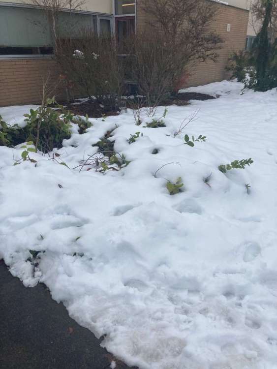 12 points
 -
Just read the last few pages. Something big is happening within the next few weeks (Christmas?). The details are murky at best but all of the ingredients are there. Alaskan ridge, SE ridge, frigid temps in BC, Tim is complaining, Jim is complaining, Rob has at least 10 c'mon's today, and Olive is still saying weird things (puberty posts?). It's gonna happen. I'm off to bed, have fun night shift.10 points
-
In short... models are struggling with the jet right now. Watch how the GFS handles the interaction between jet streak over north Alaska and the polar vortex lobe over NE Canada... Anything could happen and the cold is close!
 10 points
 -
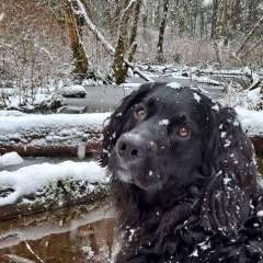
It's thawing and slushy underneath, for sure, but our lawn always holds out for a good long while. Photobombing doggo for either reference, amusement, or (perhaps) both.
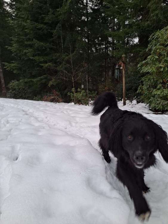 10 points
 -
LMAO Michael Snyder used his connections with KSEA ATC and NWS Seattle to ret-con the Trace of snow on the 4th into 0.1" of measurable snow. Officially. On the NWS Climate Data web page. I am not kidding, you can check. This means KSEA now has 6 straight days of measurable snow with this wintry pattern instead of just 5, and another 0.1" on the season. Dude made a couple of phone calls and weenied his way into literally adding more snow. That doesn't happen. Even when justified like in this case. Absolutely ABSURD. I have never, ever seen anything remotely like it. Absolute legend.9 points
-
Come this way sexy vortex.
 8 points
 -
One thing very cool about the last upgrades to the GFS is how it won't bend the knee to the euro on precip and snowfall maps until roughly 8 hours before the event. Keeps the hope alive.8 points
-
Overall I prefer where the eps is going as opposed to the GFS continuation of coolish purgatory.8 points
-
But eight days later!!!
 8 points
 -
Gfs is trying to be consistent.
.thumb.png.22315fe96b1ea7ded11b49c335770aae.png) 8 points
8 points -
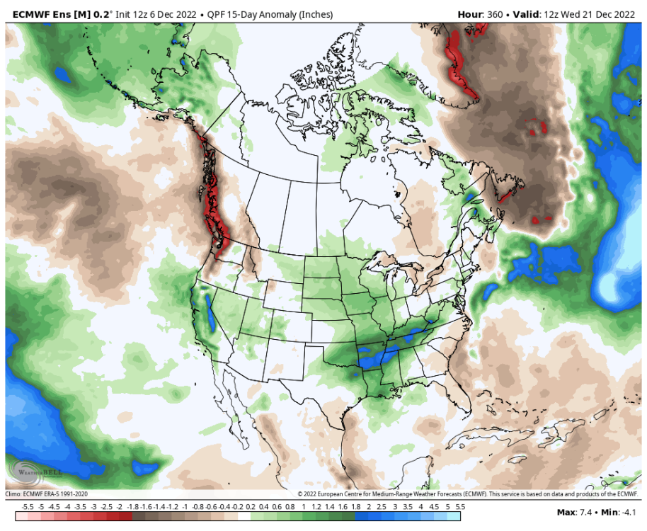
Nice to see the Sierras wetter than normal over the next 15 days per the 12Z EPS...
 8 points
 -
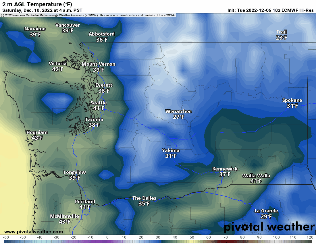
Snow for Seattle, Hood Canal Temps 29-328 points
-
Pretty clear snow line on the ridge... and down to about 6 inches on the ground.8 points
-
850mb and 925mb temps are colder7 points
-
I'm not surprised it's quiet on here tonight. Post snow blues and people just recovering after the last week of craziness. More fun is coming though.7 points
-
Big runs tonight!, followed by bigger runs tomorrow!, followed by the biggest runs the next day!, to then be followed by bigly runs two days later!, but not to be overshadowed by the then the bigliest runs a day after the next after after that day! C'MON!!!!7 points
-
18z GEFS sends the Gorge into the freezer in just 3 1/2 days.
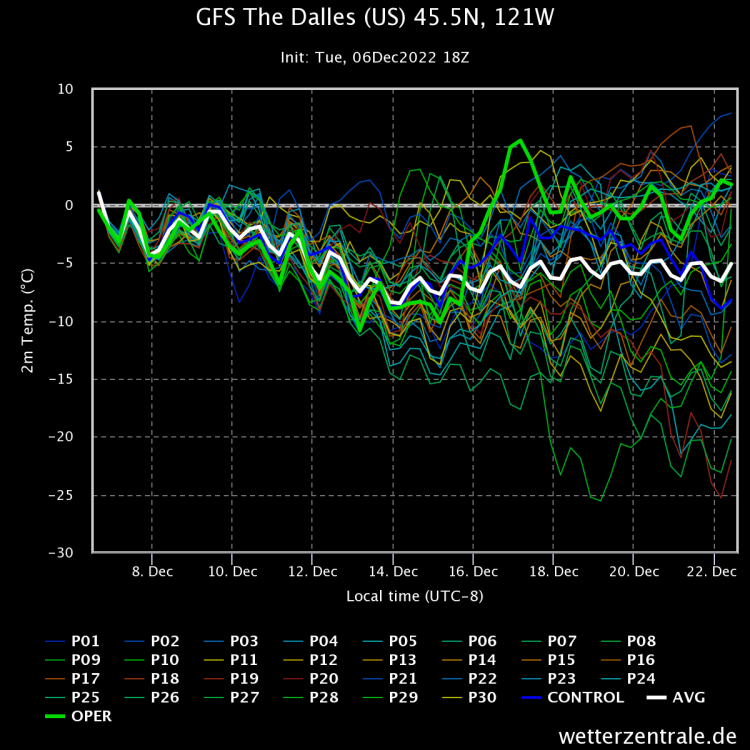 7 points
 -
12z EPS member minimums. Good 60% are solid cold throughout. I like our chances.
 7 points
 -
I’m really loving this forecast Andrew. I think all the high latitude blocking is making for clearer and colder than usual conditions there. Hope it keeps up. Would be a great setup to see the northern lights.
 7 points
 -
It’s been very cold up in central BC. Was just checking the Clinton station, which is the closest one to our Cabin at Watch Lake. So far in December they are running 6F/-18F. With an extreme min of -32F7 points
-
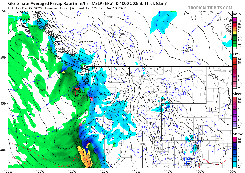
12Z GFS absolutely bures Seattle and the Hood Canal on Saturday...
 7 points
 -
Signs of block retrogression at the end of the run too. Could be a top tier cold Dec after a top tier cold Nov. That coming after a very top tier warm Jul - Oct. Wowzers.6 points
-
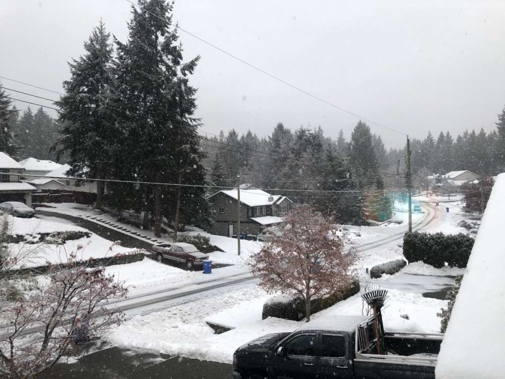
37 today after a low of 31. Still a solid 10.5 inches of snow on the ground.6 points
-
Bear in mind if we have an inversion during week two it will be coming after a shot of legit cold. Those are the best ones.6 points
-
6 points
-
What is lying ahead for us is going to be amazing and quite possibly bitterly cold first low level cold pool/inversion, then a bitter regional blast. WOW6 points
-
Not sure if posted...NWS SEA 2pm discussion. .LONG TERM /SATURDAY THROUGH TUESDAY/...A cold upper trough will move through the area Friday night and Saturday with a frontal wave bringing an enhanced period of precipitation. Snow levels will be low and heavier precipitation rates could drive them down to near sea level. Low level flow will also turn northerly with some Fraser River leakage. In other words, it looks like lowland snow is possible again. Generally speaking, ensembles show up to an inch or two for most areas as the most likely scenario but there is a good amount of uncertainty with a few members showing several inches. The best chances for heavy accumulations are over the Kitsap peninsula and Hood Canal area. The period of main concern is later Friday night and Saturday morning.6 points
-
Place your bets now!
 6 points
 -
Don't this look fun? This is what a Isuzu cab over diesel fuel pump job looks like.
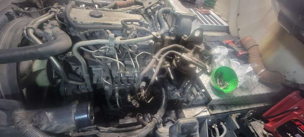 6 points
 -
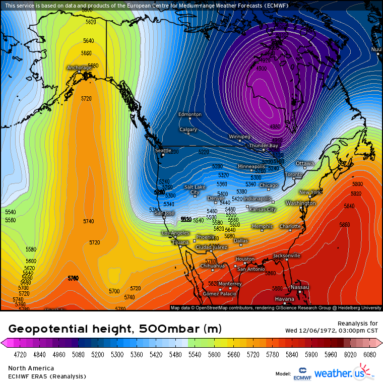
And 50 (holy ) years ago right meow…
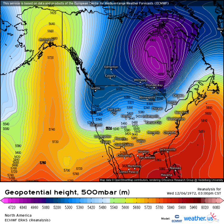 6 points
 -
18z still looking fantastic for W. Washington on Saturday.6 points
-
13 years ago right meow…
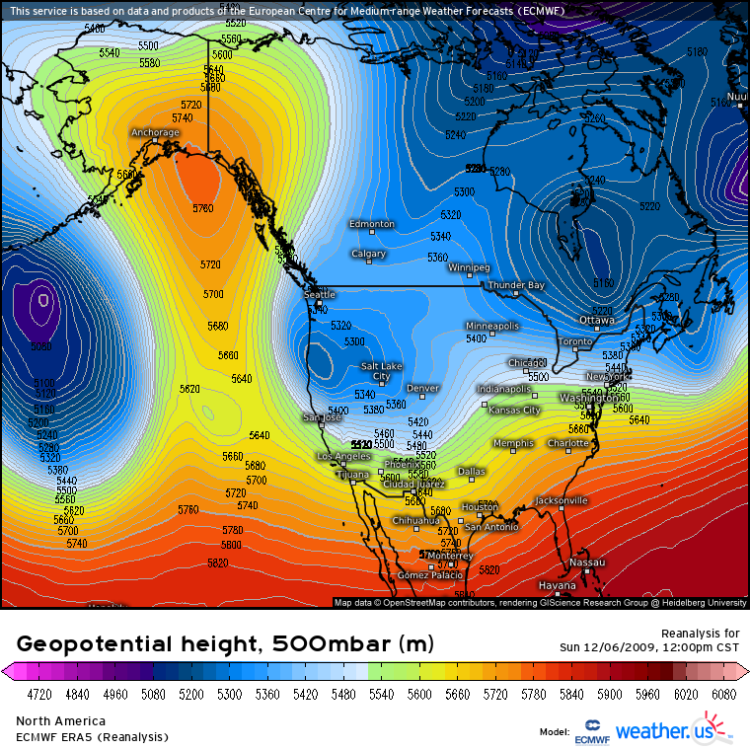 6 points
 -
I've seen many situations exactly like what appears to be coming. A prolonged low level cold pool/ridge sets up, and after 5-7 days it backs off the coast and arctic air follows soon after. BOOK IT. MBG. I'm not cautiously optimistic either, I'm rather confident. 18z GFS in 1 hour 30 minutes 00z GFS in 7 hours 30 minutes 00z ECMWF in 9 hours 40 minutes6 points
-
Beautiful return to ridge bridge stalling us in a cold pattern!6 points
-
Lol zero confidence for Saturday. Nam is almost identical to the gfs and icon for the southern track.6 points
-
Didn’t have a chance to measure the snow since I got home on Sunday night. There is 7-9” around the yard here this morning.6 points
-
Every time i stop at that McDonalds i ask if you are working but they say you are sick or cant come to the window! I miss when you worked the drive-thru.6 points
-
What finally opened my eyes was i would pick a pretty map that showed snow at 200 hrs and go back 8 model runs for the same period and it was shocking at how much every run changed. Looking at any detail past 96 hrs is silly.6 points
-
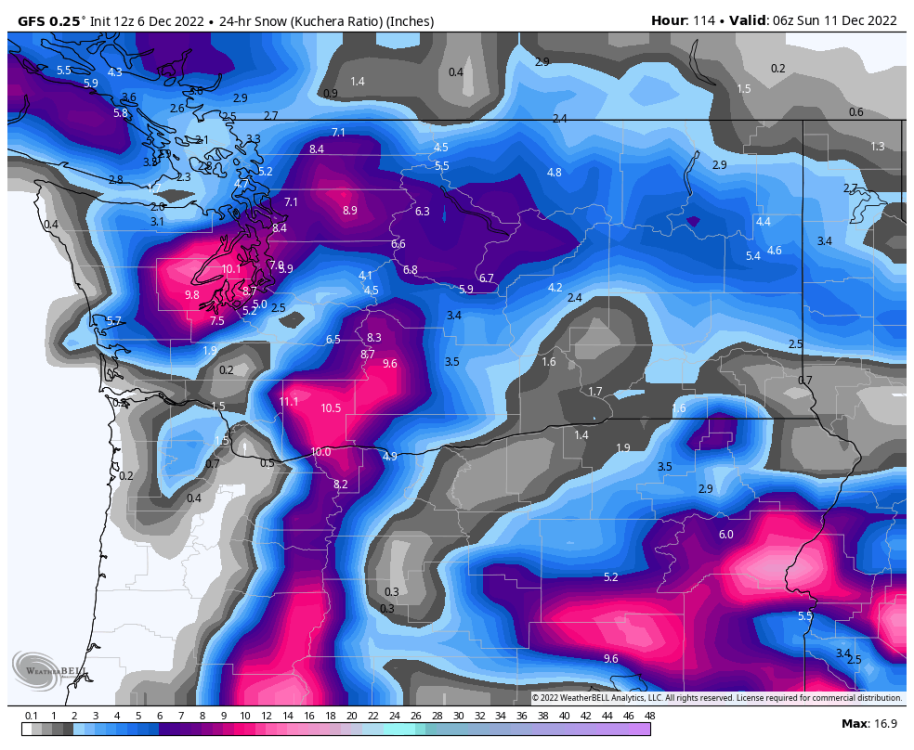
Man its been a long time since we had a low take the classic track for heavy Puget sound snow like this.
 6 points
 -
Very light flurries through the night here. Has picked up To a steady light snow this morning. Maybe about 1/3”.6 points
-
5 points
-
Meanwhile GEFS moves low father south...5 points
-
I think you mean Plumbus
 5 points
 -
5 points
-
I'm no expert on teleconnections. It seems like more teleconnections are created every day, and how they all interact seems like anyone's guess. But what I have heard repeatedly over the years is we want a negative AO and negative NAO. And with this storm coming up on roughly the 13th, we have a negative NAO forecast, and a deeply negative AO, so why is this storm cutting so far west and so far north and bringing in record heat in front of it? If someone who understands teleconnections better than me has a good explanation please let me know. GFS NAO forecast GFS AO forecast And yet we have the GFS riding this thing into far western MN. Just curious what element from the teleconnections we are either missing here, or is over riding the seemingly good deeply negative AO forecast we have. I know nothing is absolute in weather, but this one just doesn't add up to me.


 5 points


.thumb.jpeg.8bc2e9d6aa1b02cea603ad27e130f4fe.jpeg)


.png.d18383d35bc45dbcdc11ca43a1b56407.png)


This leaderboard is set to Vancouver/GMT-07:00