
Leaderboard


Popular Content
Showing content with the highest reputation on 01/17/23 in all areas
-
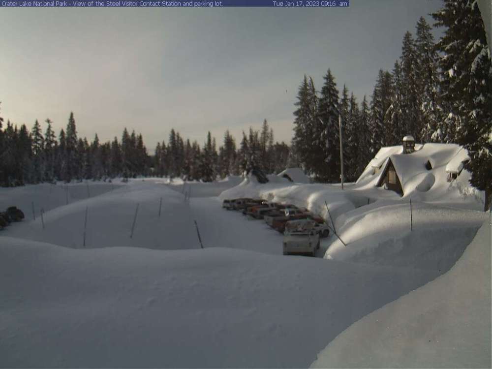
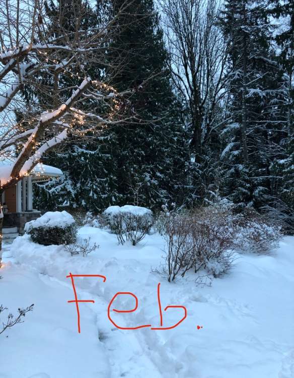
Marshmallow goodness from Crater Lake this morning!
 14 points
 -
Lock it in.
 13 points
 -
I haven’t been following all the posts here recently, but I will say the fact that Gradient Keeper is posting again is an excellent sign for cold and snow upcoming.11 points
-
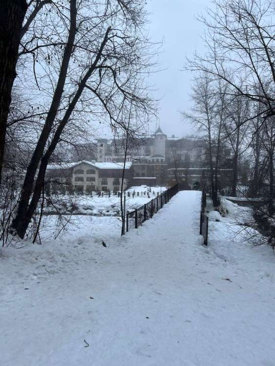
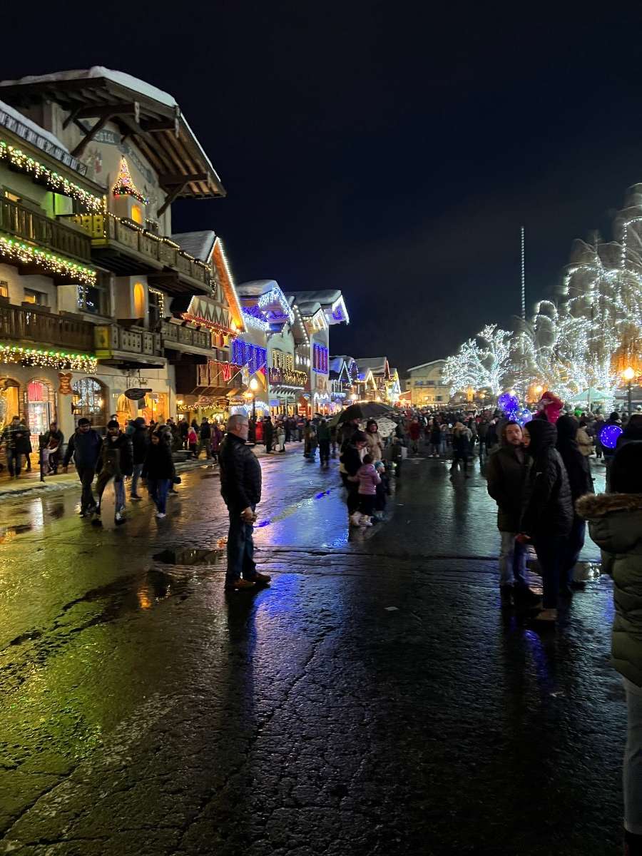
Got back from my Leavenworth trip today. Snow was really deep there and it’s a really great town with a lot to do and is on my list of places I would live. The walk around the park was slippery but gorgeous!

 10 points
 -
Could be a little 35-degree c-zone snow along the I-90 corridor out here tomorrow evening.
 9 points
 -
It’s becoming a tradition!
 9 points
 -
Got cold again in twisp down to 22. Beautiful morning
 9 points
 -
GEFS looks ok. Better than 12z anyways
 8 points
 -
It's coming
 8 points
 -
GFS needs to study up
 7 points
 -
Happy for the Nebraska peeps in here. They have earned it. My home in IA is in a Winter Storm Warning. I will be driving down in the morning in time. Calling for 5-9" but I'm thinking it will be on the lower end of that. I'll be in Chicago Friday and then back in the TC Saturday. Good luck everyone!7 points
-
Oh my gosh. I messed up. I was thinking Corvallis and typed Eugene. UGH. Sorry. I do that sometimes. I guess I was just thinking of all the great people from Eugene here on the forums. I fixed the original post. Mmmmm.... Sub sandwiches.
 7 points
 -
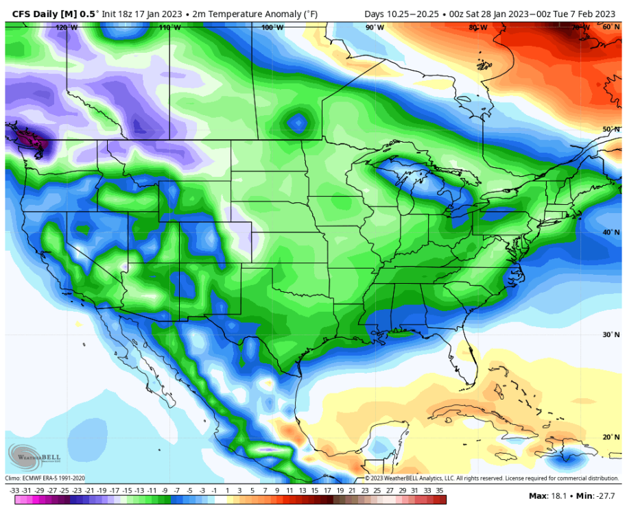
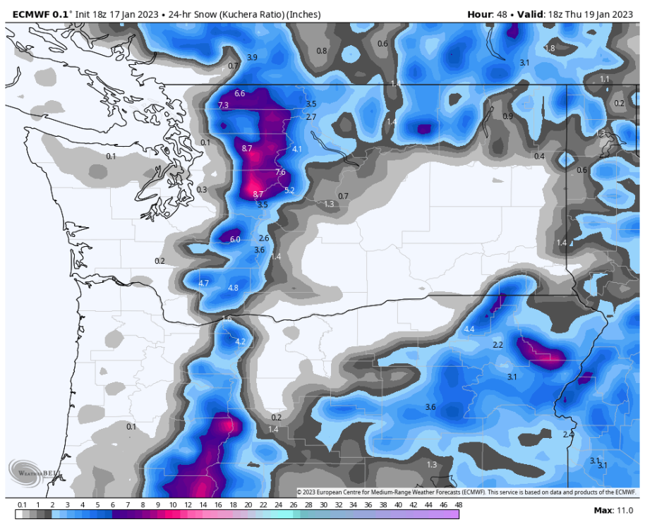
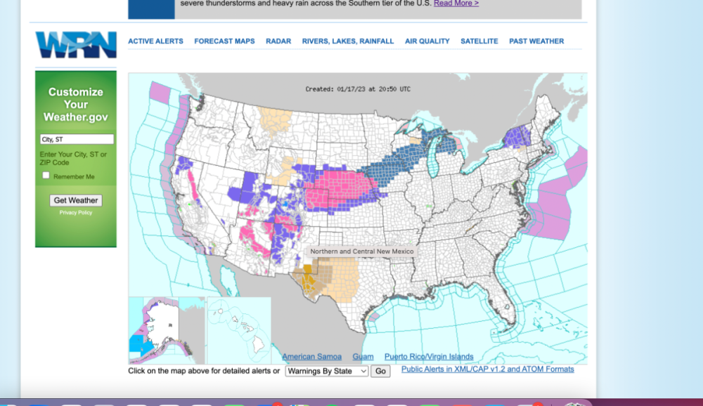
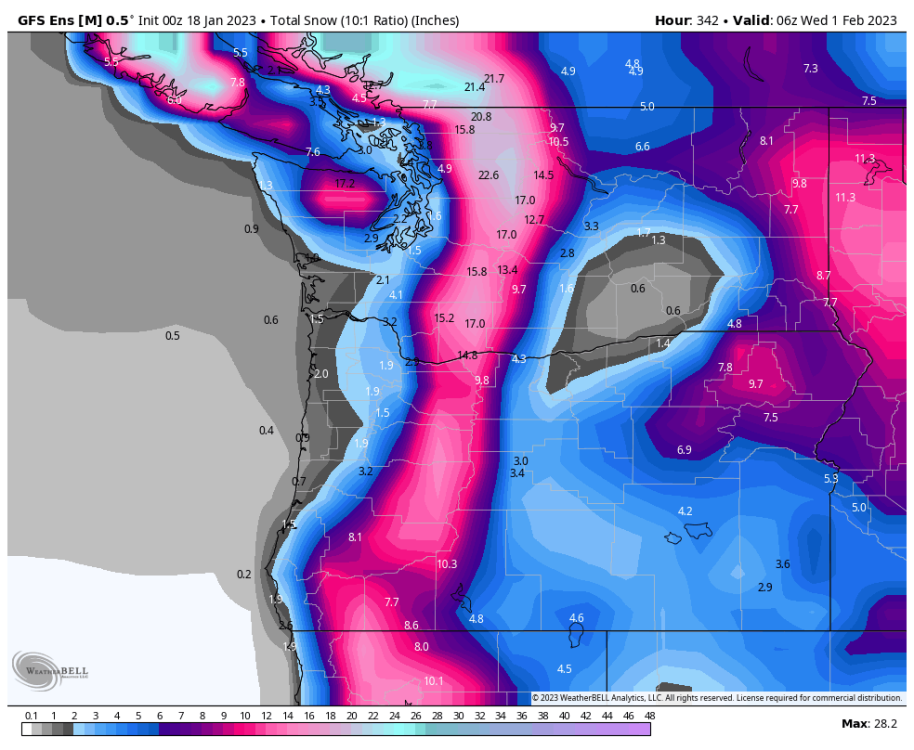
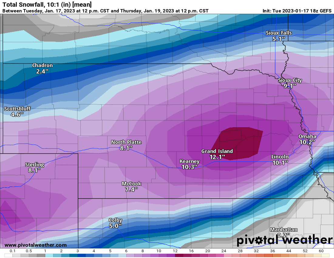
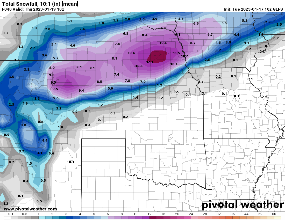
Been a very long time since I have seen a map like this. Nearly the entire state of Nebraska is under a WSW. Lastly, here is what's being forecasted in Central Nebraska at Ord. Pretty impressive stuff! Tonight Snow likely, mainly after 5am. Cloudy, with a low around 22. Northeast wind 5 to 15 mph, with gusts as high as 25 mph. Chance of precipitation is 60%. New snow accumulation of less than one inch possible. Wednesday Snow. The snow could be heavy at times. Widespread blowing snow, mainly after 5pm. High near 25. Blustery, with a north northeast wind 15 to 20 mph, with gusts as high as 30 mph. Chance of precipitation is 100%. New snow accumulation of 10 to 16 inches possible. Wednesday Night Snow, mainly before midnight. Patchy blowing snow. Low around 16. Blustery, with a north wind 20 to 25 mph, with gusts as high as 35 mph. Chance of precipitation is 90%. New snow accumulation of 1 to 3 inches possible.
 7 points
 -
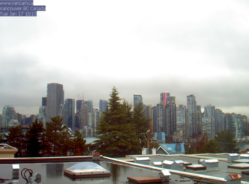
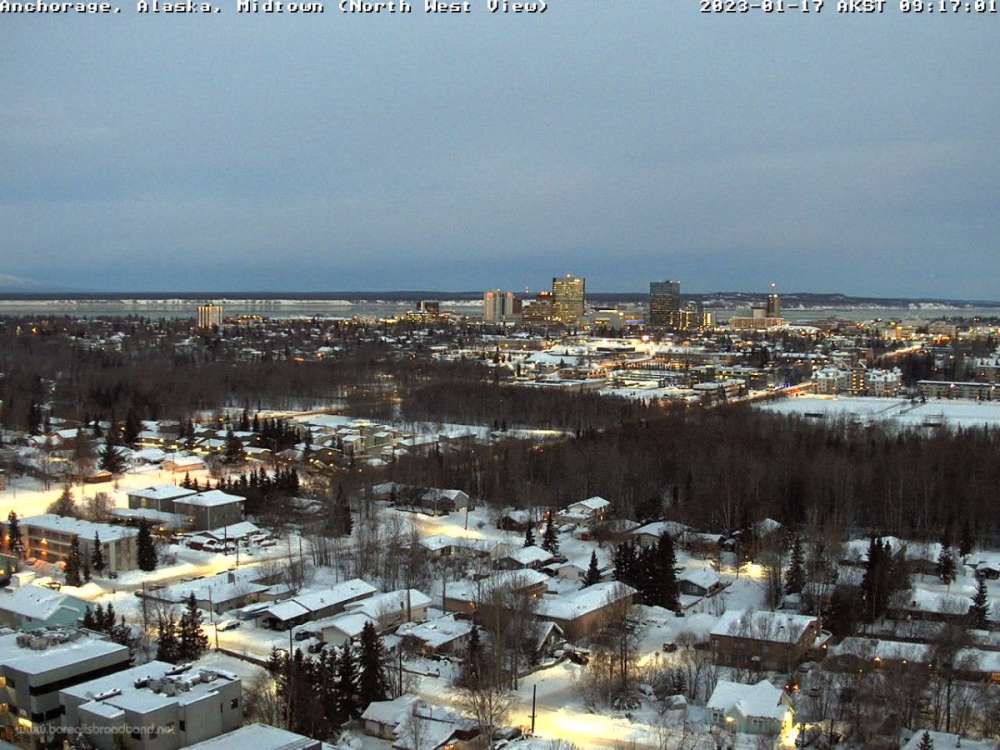
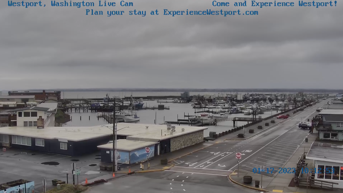
A quick look around the immediate region is pretty uniform this morning. Looking calm and gray over Westport, Washington. Currently 45F degrees there. Vancouver, BC is also cloudy this morning at a temp of 44F. They expect a high of 47F today. The sun is partially rising over Anchorage, Alaska this morning. The temperature is 22F with a high of 31F expected. Today will be mostly sunny for them and the rest of the week cloudy. No snow in their forecast. Corvallis, Oregon is under cloudy skies and at 47F today. Spokane, Washington is also cloudy this morning, but not wet like much of the region. Currently 36F degrees with a high of 41F expected.

 7 points
 -
Here we go! Nice run to run change.7 points
-
Ensembles are a hair better
 6 points
 -
Me after watching 10 minutes of fighter jet videos with my son Me after watching the 00z GFS run My son made me post this6 points
-
Great GEFS extended. 2019 redux?6 points
-
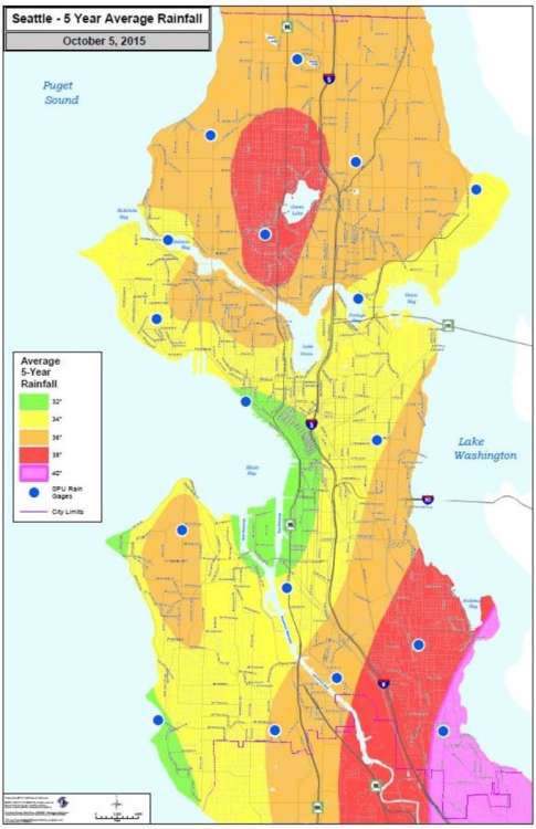
I’m pretty sure some places in city limits of Seattle average a few inches less of rain yearly due to shadowing from Queen Anne and Capitol Hill. Downtown even is shadowed from the West Seattle hill. Not enough shadowing obviously to dry them out when storms come through but just enough for the annual precip totals to be a bit less than other places. Don’t know if downsloping and shadowing are related but this just shows it doesn’t take that high of a hill to cause effects on the weather.
 6 points
 -
Our annual sales conference is in FL 2/13 - 2/17. I couldn't get out of going lol. Half a** tried, but used up my travel mulligans to stay home from biz travel for the main cold event in December. so if you want to know when it's coming, bet the house on that week6 points
-
12z EPS not bad at all.
 6 points
 -
better than nothing
 6 points
 -
Better than I was expecting quite frankly.6 points
-
I cancelled winter already. Move on smh5 points
-
Last time I can recall was in March of 2006. I got 2 feet of snow, places out by ord got 30”. I think you’re right though 2 ft might be a little high. Will see, I’ll gladly take what we can get.5 points
-
I'm guessing they are going heavily on their own model blend forecast. This shows much lower totals in Omaha. The NWS is typically highly conservative with snow totals anymore. And frankly, models do very frequently overdo moisture and snowfall, so a % less than the models show is probably not a bad idea. What that % is, is hard to say though.5 points
-
Neutral would be awesome!!5 points
-
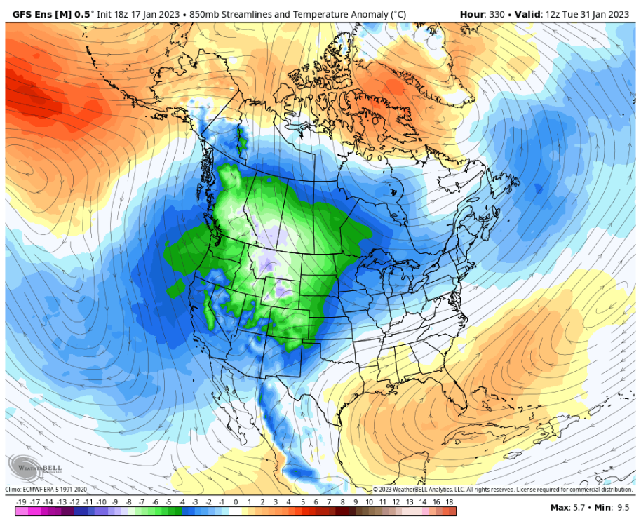
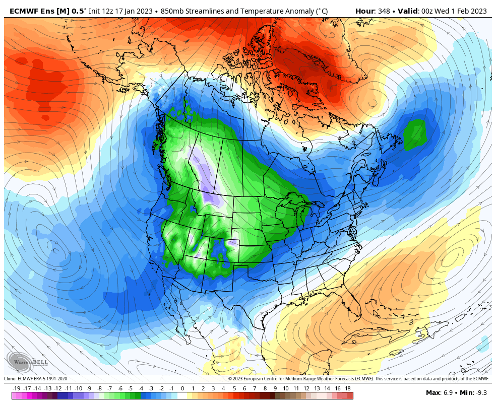
Here are the 850s.
 5 points
 -
Great zoomed in map, thanks for posting. I'm just southwest of Kearney.5 points
-
This is truly Nebraska's storm.5 points
-
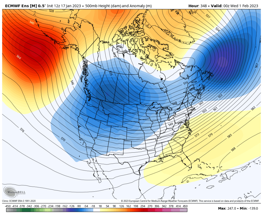
The pattern setting up to close out JAN is something I've been yearning for a very LONG time. I remember way back in SEP/OCT when I was out in AZ just thinking about Winter and how it would set up. I didn't expect such a long JAN Thaw, but this certainly has been a hellova JAN thaw. In fact, Chicago has had 20 days in a row with AN temps and will add another 8-9 days to that tally. In the end, this will end up becoming one of those Old School JAN Thaw's that will encompass a major winter storm across the Heartland of the Nation that sets the stage for the Nanook From the North to unleash its Fury. My call for snows to fall in an AN temp pattern are coming to fruition. The next big ticket item to discuss is the Major Arctic Attack that is on the calendar post 25th/26th across the majority of our SUB. Is there a JAN '19 redux lurking? Might not be quite as severe, but certainly similar as rounds of bitter cold or on the table. This time, however, we will likely see more of the U.S. covered with Snow as the bitter cold invades the lower 48. It appears that all the LR forecasting tools/methods are lining up for a Severe Arctic outbreak. We are likely to see several winter storms over the next couple weeks to lay down the blanket of white gold. Get ready down south @Andie @Iceresistance @OKwx2k4 things are about to get real interesting! The Flip coming is the real deal...glad that most of you out west will have snow OTG along with the cold that is coming. I'll be patiently waiting for our turn to come. The next system to track is showing up on the GEFS and GFS Op. Is it going to score a coupe? Then, the Big Dog potential during the 24th-26th...Buckle UP...we got ourselves some more storms to track!
 5 points
 -
And they are both sharper with the blocking tonight. Now we're getting somewhere.5 points
-
Your ability to go from ranting about how horrible our climate is and assuming the worst... to expecting (and eventually demanding) people get excited at the same time you do is infinitely entertaining to watch every winter.5 points
-
Green and gold mountain on the kitsap peninsula are only 1700ft and they work to hold the coldest air between them and the Olympics. I'm on the sw slope of those mountains and get much more rain than the bremerton airport weather station just a few miles east of me leading be to believe there is some upslope effect here from those small mountains.4 points
-
I think the entire state is closed tomorrow. The closings website just keep listing more school and business closures. I’ve heard they are going to start closing I80 in a rolling process so people aren’t stranded tomorrow4 points
-
Well look at that bullseye right over my county!!! I'm excited to see this play out tomorrow. If I get 6+ it will be my biggest storm in over two years.4 points
-
Countdowns 1/17/23 Spring 61 days Summer 154 days Fall 248 days Winter 338 days Christmas 341 days4 points
-
It snowed 2" here on the 9th. Biggest snow event of that winter for me. Wouldn't have been much colder in January/February, though. Just a very chilly onshore flow pattern.4 points
-
4 points
-
Jim, can you cancel winter again pls? That always seems to help.4 points
-
Looks about right!4 points
-
The reason why snow totals are going to be higher in C NE is really due to temps being about 5-10 degrees colder than E NE. It looks like temps are in the mid/low 20's when its pounding mid morning throughout the day tomorrow. What a beautiful day time snow storm. I expect to see many pics and vids boys!4 points
-
Interesting timing as the Chiefs play in KC at 3:30PM..the GFS has shown this for 3 runs now. The ICON just picked up on it with it's latest 12z run. Both models have the bigger storm next week right where Tom has been predicting, 24th-26th.4 points
-
It’s still coming!
 4 points
 -
Winter Storm Warning. Accuweather upped me from 6-10" last night to 10-15" today. Local forecasts say 5-10", but dependent on if sleet mixes in. If it doesn't, then the higher end is possible. I would guess that school closings will start being posted late this afternoon or this evening for tomorrow and possibly Thursday.4 points
-
DMX AFD- talks possible CI release- (thundersnow) Vigorous upper low ejects out of the central Rockies early Wednesday. Moisture is quickly pulled off the Gulf and streams northward within a belt of strong theta-e advection. Expecting a broad swath of precip to push into the state by Wednesday afternoon and evening as deep, phased kinematic and thermodynamic forcing crosses the region. Models have come into reasonably better agreement on track and precip amounts over the last 12 hours and have slowed on the northerly trend, however timing differences still remain. In addition, pinpointing the rain/snow transition Wed afternoon and evening is a challenge as temps from southwest into central Iowa will be hover near to just above freezing. Isentropic lift during this period particularly robust especially along the 290-295k surfaces which will be pumping 3-4 g/kg spec humidity to near the DGZ. Furthermore, cross-sections show some folded saturated theta-e surfaces and the potential for CI release. 00z HREF has latched on to this and advertises elevated probabilities for 1-2"/hr snow rates into west central Iowa by 21z and translating east. Current thinking is dynamic cooling + ene wind will be enough to offset low level warm air advection and set up the rain/snow line to near or south of the DSM metro for the evening commute. This will need to be closely monitored since a temp swing of just 1 or 2 degrees in either direction will have a significant impact on the southerly extent of wintry travel impacts around that time period. Higher confidence in deteriorating travel conditions closer to Hwy 30 and points north. Upper low matures into Wed night as a dry slot swings around the southern side. This dries out the DGZ over central into southern Iowa and will limit accumulating snowfall potential and may even lead to periods of light freezing drizzle. Snowfall continues in earnest over northern Iowa as a ribbon of moisture is advected back into a well defined TROWAL region. Snow winds down Thursday morning as the upper low kicks northeast. Expecting the swath of 4-9" of snowfall within the issued Winter Storm Watch, and the axis of highest amounts north of an Atlantic-Ames-Waterloo line. Some blowing snow is possible, however winds will not be overly gusty with this system due to limited cold air advection and weak surface pressure tendencies.4 points
-
Wow, after all this time and the king is the one to cave!4 points


.thumb.jpeg.e3014abf99ef08a9f9ac2c0cd31b485b.jpeg)


This leaderboard is set to Vancouver/GMT-07:00