
Leaderboard


Popular Content
Showing content with the highest reputation on 03/22/23 in all areas
-
It’s a weather forum bro post away!12 points
-
9 points
-
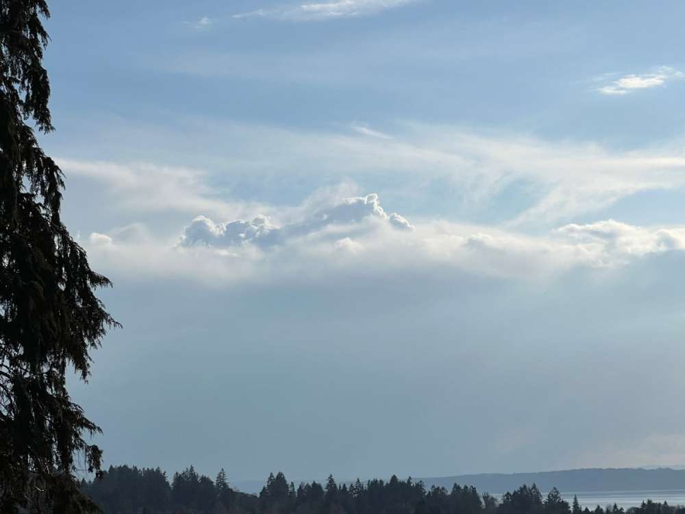
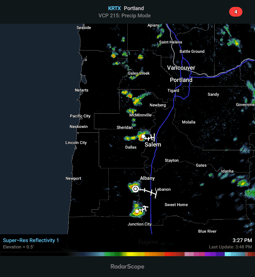
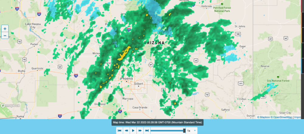
There is a lot of build up all around my location9 points
-
Wow a lot of “ignored” content being posted today!9 points
-
Didn't have a chance to chase, but did watch from my driveway. Great storm! TONS of lightning too. 328461077_5747085575420853_6806490245102182542_n.mp4
 8 points
 -
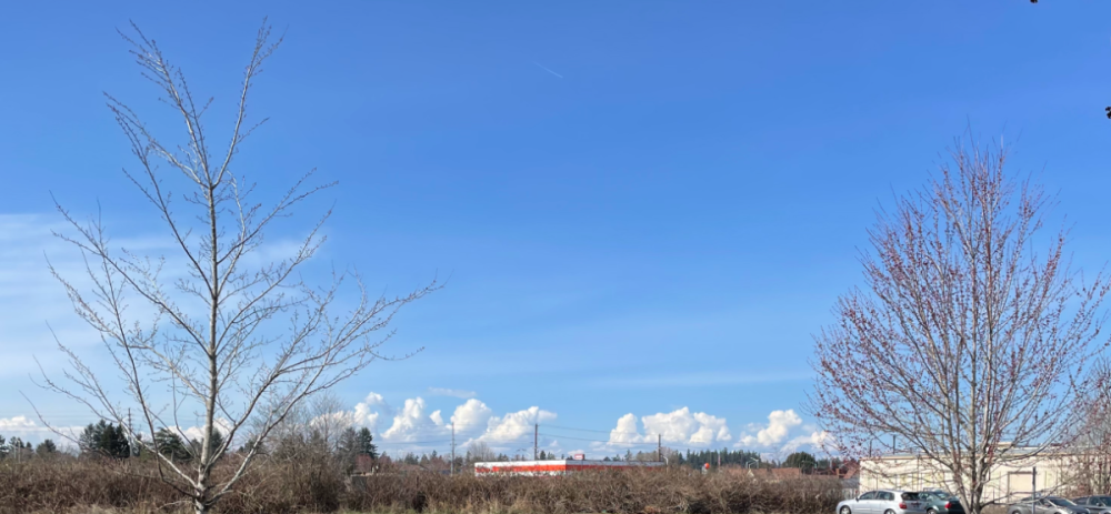
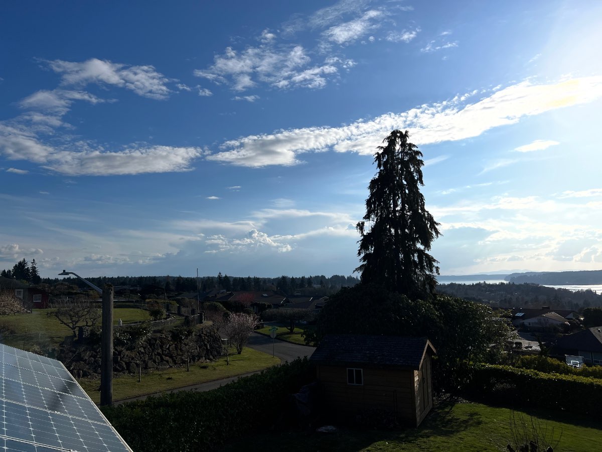
Interesting clouds to the north here
.thumb.jpg.1770064f2b20a773a74748d4511fe059.jpg) 8 points
8 points -
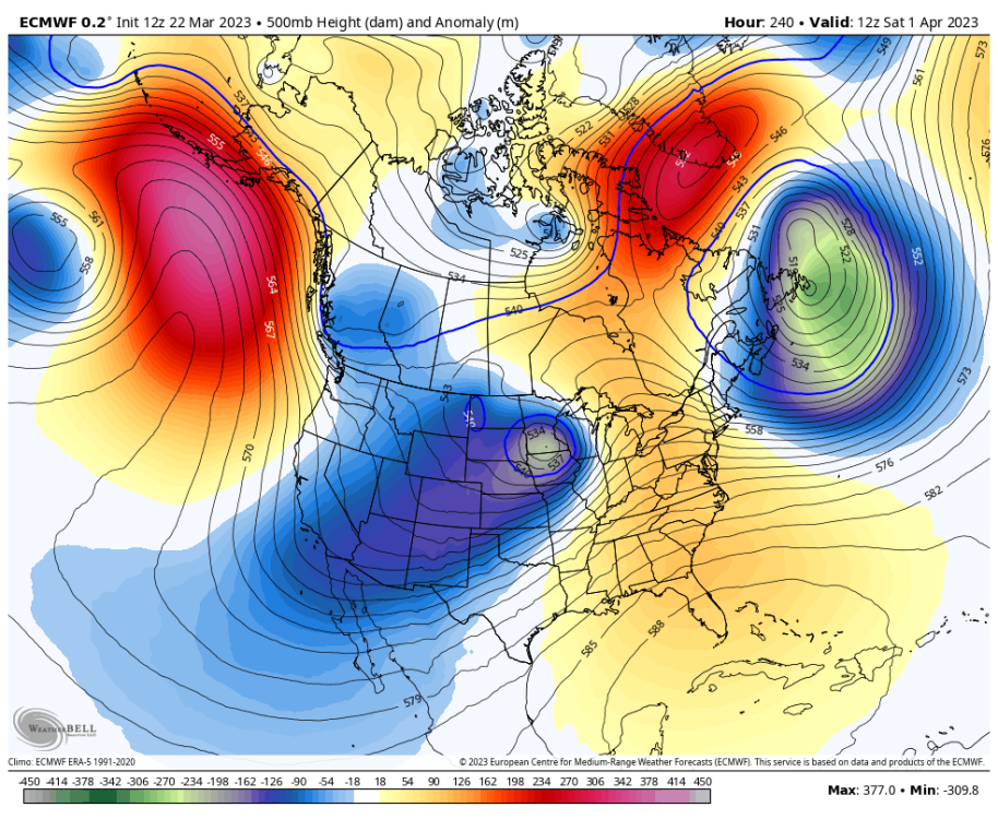
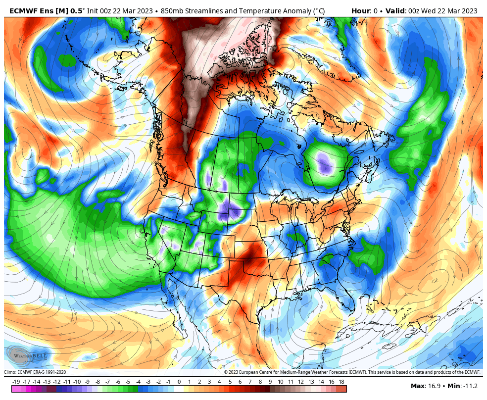
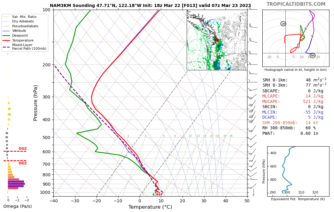
NAM goes crazy this evening in Seattle. Some moistening of the boundary layer due to dying storms drifting in off the Hood Canal, leads to decent midlevel CAPE. I've seen this before on the NAM, it's pretty aggressive, almost too aggressive, in this situation.
 7 points
 -
The commentary is amazing. Lol7 points
-
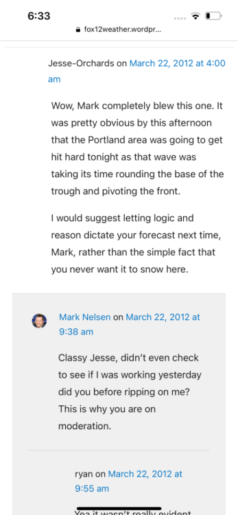
Someone posted one of Marks old blogs from this date in 2012. Some good stuff!
 6 points
 -
That was the most impressive storm I can remember for March. Summer-like lightning!6 points
-
Walter does NOT approve.6 points
-
I do see some convection popping up way SW of here in SW WA…but has a long long way to go to get here. Kind of get the feeling these storms will lose steam as they roll off the higher terrain but we will see.6 points
-
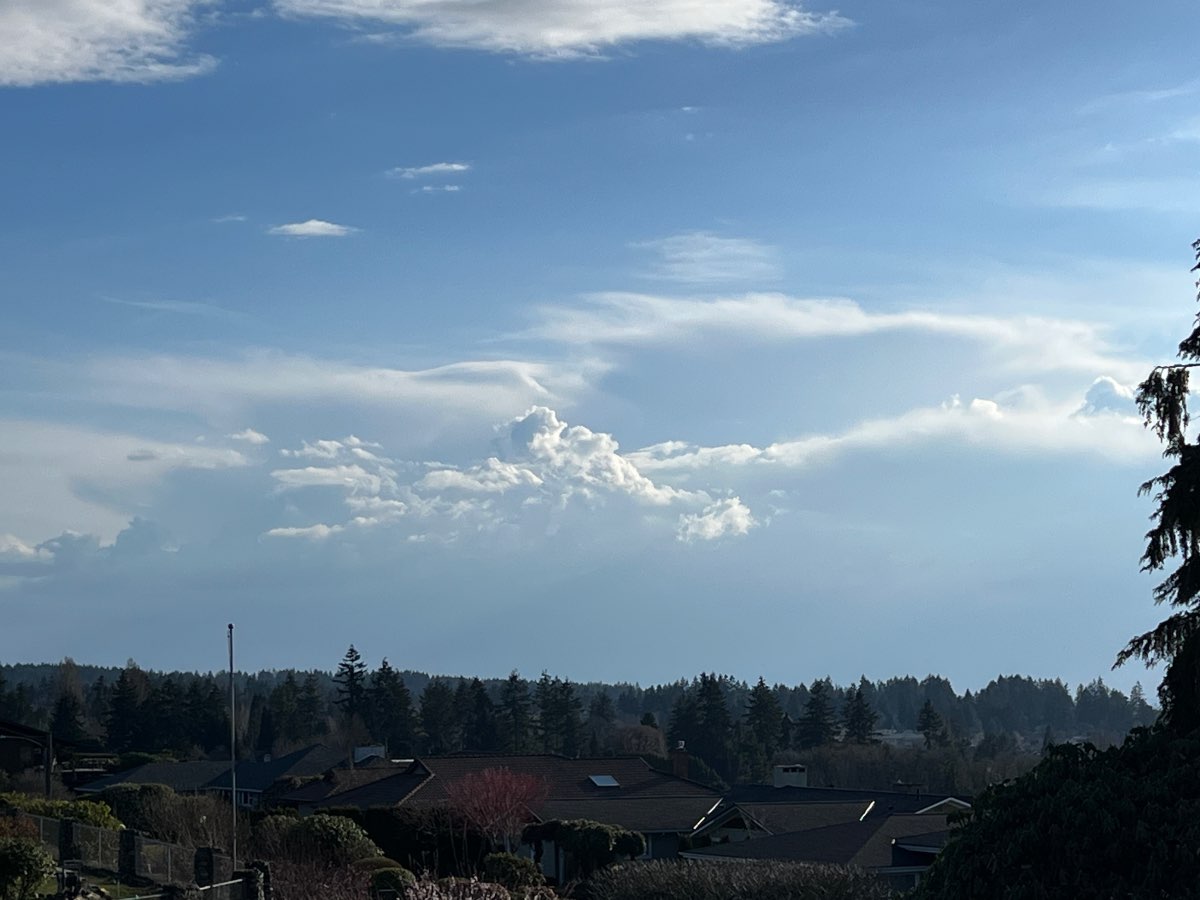
Lots of towering cumulus developing over the Cascades and to a lesser extent the coast range this afternoon. Cooler air working in aloft even though the pattern at the surface still favors low level warmth, for now. Early harbingers of a chilly and active pattern to come. Mostly sunny and 59 currently.
 6 points
 -
This is a Jim pattern if I’ve ever seen one. Reinforcing shortwave diving in right from the north.
 6 points
 -
Tornado just blew through Montebello, CA and ripped a roof off a building according the the Fire Chief I just spoke with, that is a part of my job sometimes.6 points
-
It is spring. Sometimes we get lots of cool and showery weather in the spring. There have been plenty of pleasant mild and sunny days too, like today.6 points
-
I have a storm forming right above my house. We have hail!! 20230322_213627.mp4
.thumb.gif.f791badc7cb6260d45fbd13b946802ee.gif) 5 points
5 points -
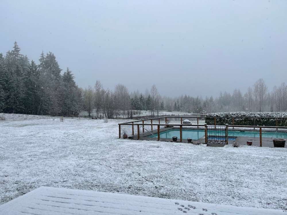
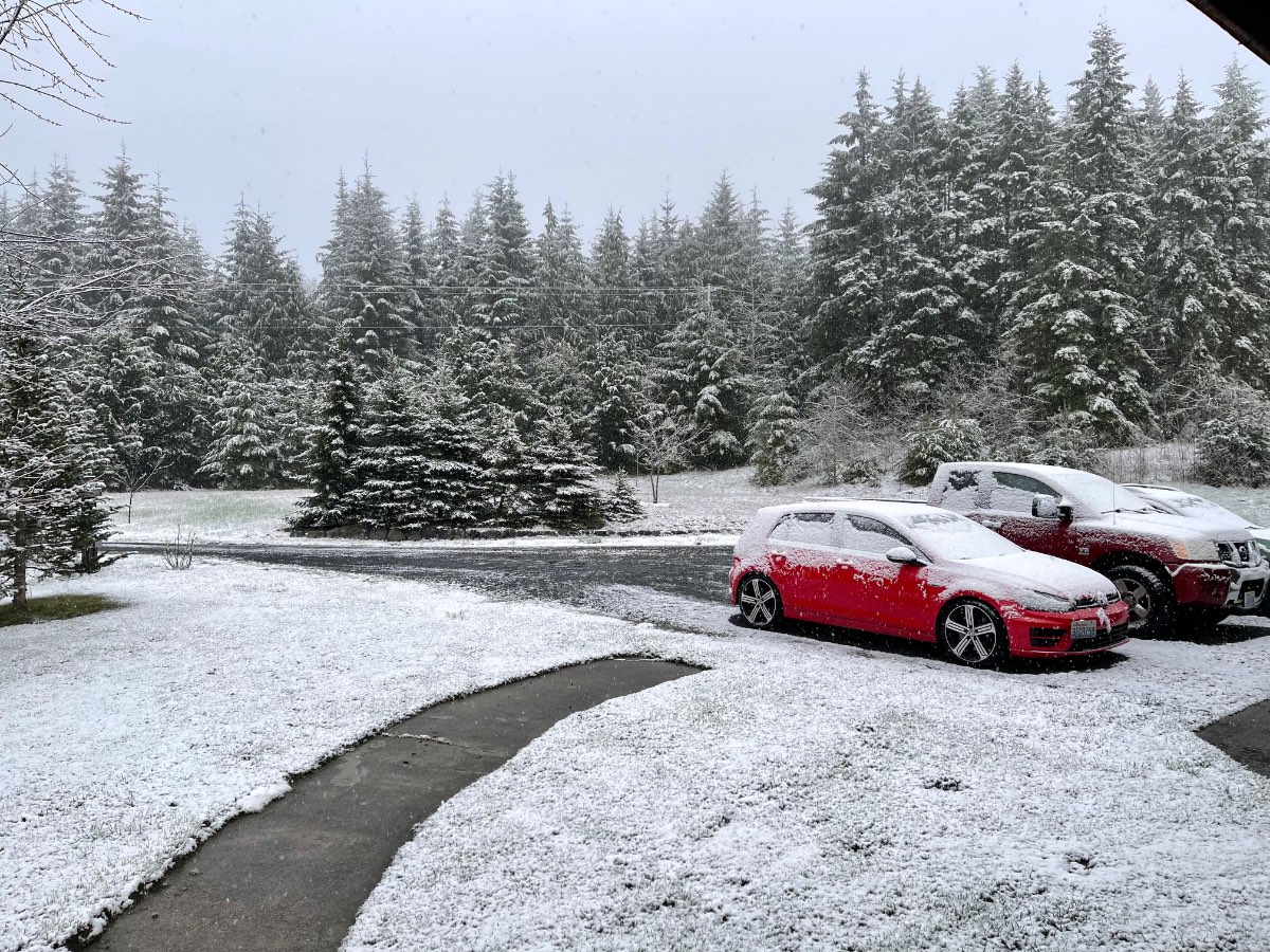
I was looking through my pictures today. This was April 10th 2022 IMBY. Forgot about this late snow.
 5 points
 -
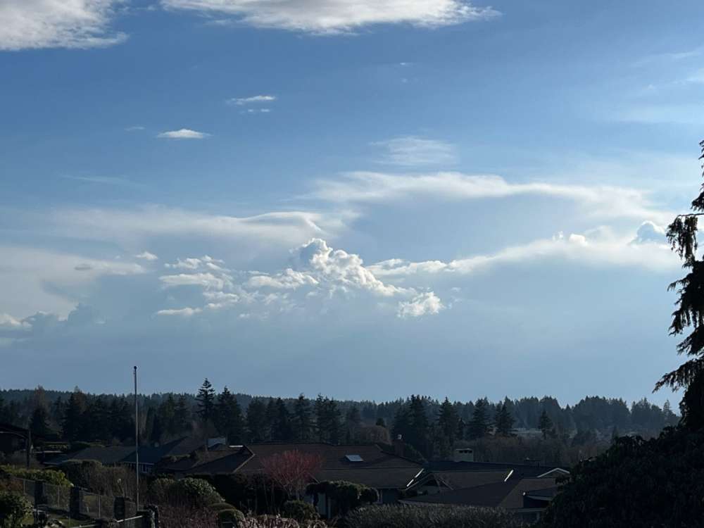
Looking bubbly to the southwest.
 5 points
 -
Dumping rain here, just had two claps of thunder5 points
-
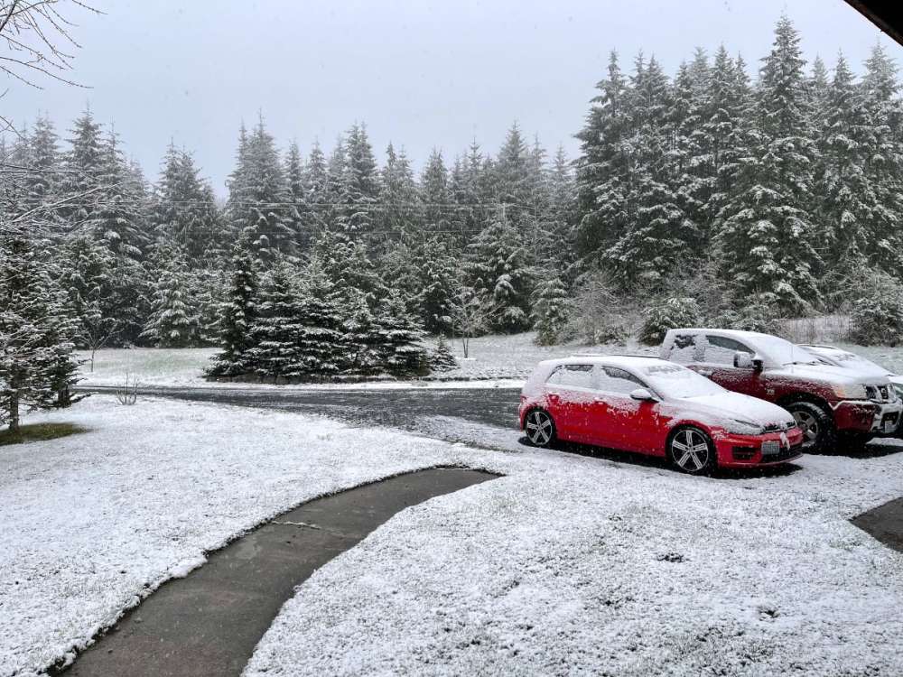
Hail coming down right now. Crazy to think it's almost April and we have this.
 5 points
 -
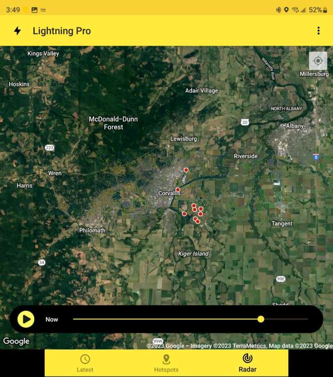
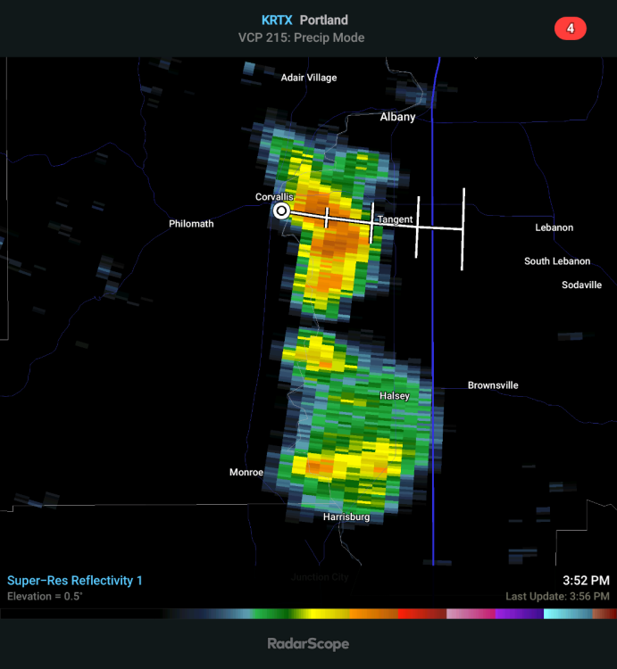
1/2" hail report out of Corvallis.5 points
-
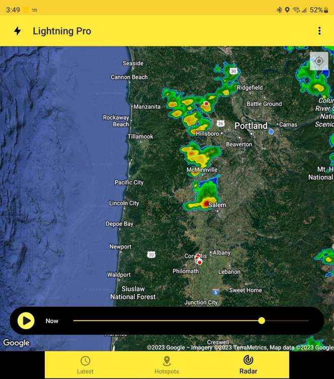
Some thunderstorm activities West of Salem 🌩
 5 points
 -
Looking pretty impressive:
 5 points
 -
We are in for some real blessings this last 7-10 days of March. The upcoming stretch sort of reminds me of late March 2008. That went on to be a fun and dynamic later spring, summer, fall. Well really just a great weather year all around.5 points
-
Coldest March in Tahoe City was 1958 with a 35.7F average high. Tahoe City is currently at 34.05F with below average temps forecast for then next 10 days. Pretty good shot of setting a new record. Also this is the first winter with 4 straight months with average Highs in the 30's since 1974-1975 and coldest since 1951-1952. Nice to see cold records can still happen.5 points
-
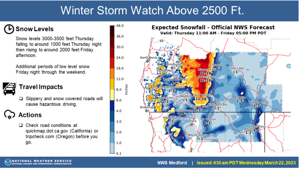
The EPSL actually has a chance of scoring on Saturday morning. Nothing unfavorable about the way the trough digs compared to the late Feb / early March event.4 points
-
HRRR also has a decent amount of snow around the Valley Friday morning. Doesn't go out to Saturday morning which is when the Euro and NAM show the snow for the Willamette Valley4 points
-
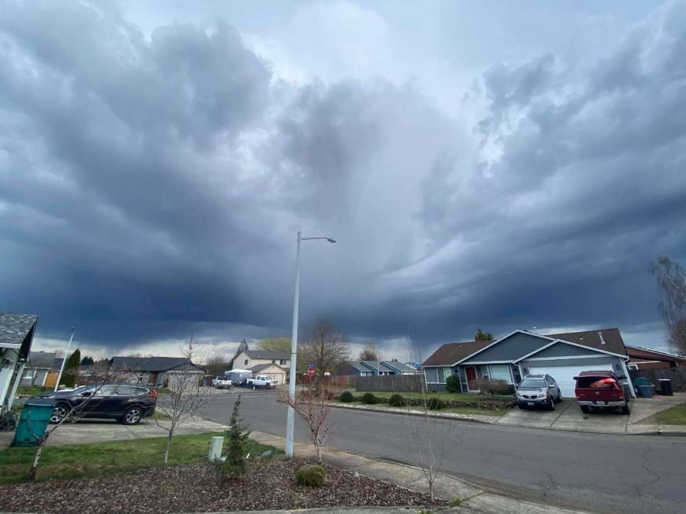
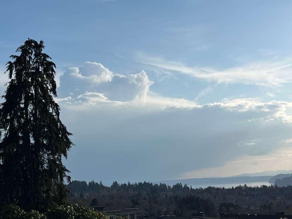
A somewhat menacing-looking sky...4 points
-
Light is fading…but you can see everything developing nicely. If you look closely enough you can see the cloud tops of that storm over battle ground.
 4 points
 -
Looking more impressive.
 4 points
 -
FWIW... the ECMWF showed this band sort of exploding again over King County around 10 p.m. and moving up the Sound all the way to Bellingham after that.
 4 points
 -
Corvallis is getting a good light show now!! 🌩
 4 points
 -
You can see the convection building up. Interesting how this is the second time we’ve had some thunderstorm threats this month. Very unusual for March from what I can remember in my lifetime but the sun angles are doing their thing.
 4 points
 -
Another big dog overachiever today temp wise. Hopefully we got some solidly cool days later this week to balance it out.4 points
-
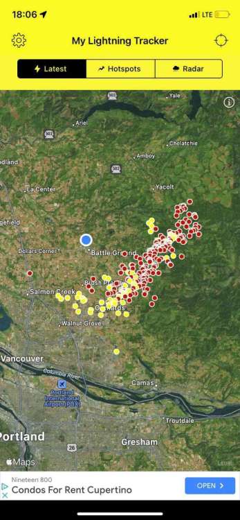
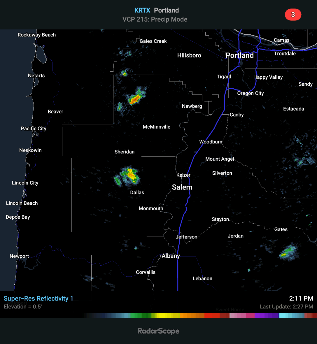
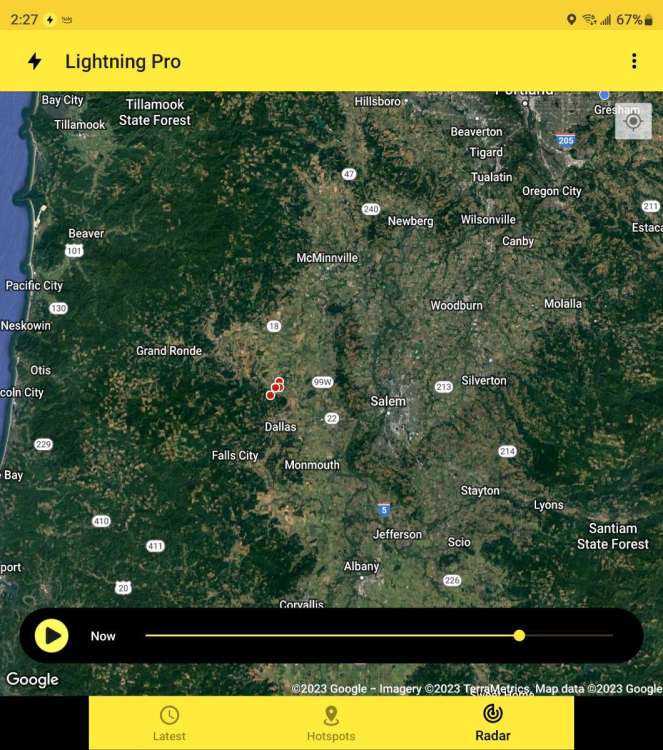
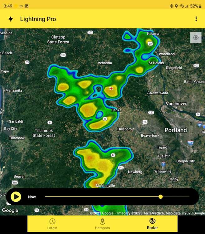
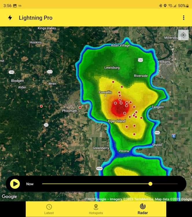
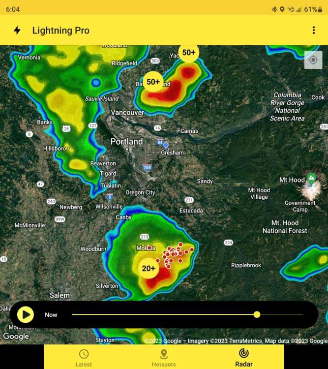
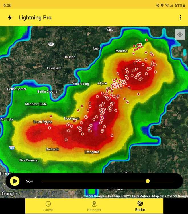
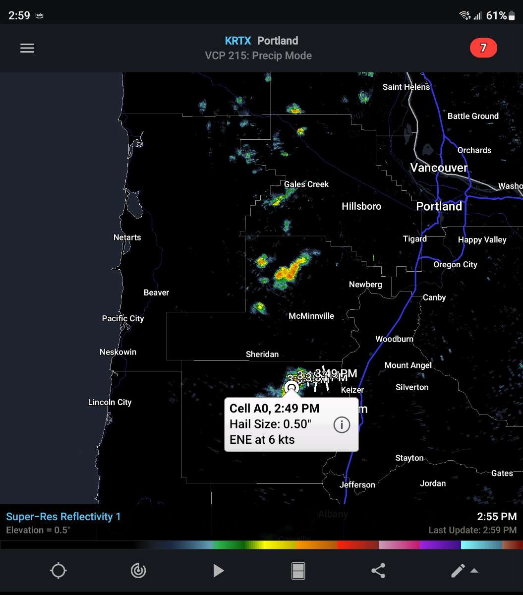
I thought I would post the radar and lightning tracker again. For some reason the lightning tracker isn't showing the moisture. You can see the other moisture East of the Portland area but not West of Portland. As you can see, there are some intense showers further up from the one producing lightning. I'm thinking those could produce lightning soon. That one cell looks like it could be having a 30% chance of half inch hail.
.thumb.gif.1b3f3b50be0afb5c018dafb1129941d3.gif)
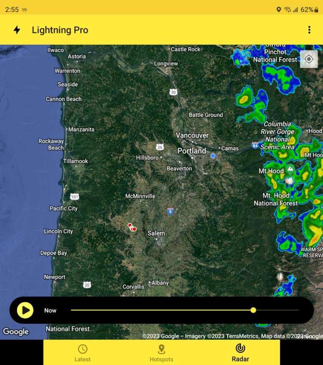 4 points
 -
Some North Bend scenes this afternoon.
 4 points
 -
WOW! Just 50 miles to the SW of KC, temperatures have soared to 80 degrees!!!! Meanwhile, kc just got out of the 40's and jump to 53 degrees. Now that's a true warm front4 points
-
I like warm water beaches in summer. grew up around it and miss it. It's way better than choking on smoke4 points
-
Aug in 2016-2017 and 1994-1995. They might be able to make it into Sept this year since they have now beat all of the previous snow and SWE records with another 2-4 feet of snow forecast next week and continued cold weather.4 points
-
Not much orange/red on the LR 00z EPS. Woohoo!
 4 points
 -
I was awakened by the sound of the gusty SW winds wailing against the south facing windows around 2:30am. CF is making its way through the valley as we speak. Snowbowl has had 10" over the past 2 days and prob another FOOT by tomorrow...the incredible ski season continues (351" to date)... Pretty cool vids showing up on social media of the "Eye of the storm" that slammed into San Fransisco yesterday and continues to spin just offshore. Notice the multiple vortices that spin up. What a powerful cyclone!
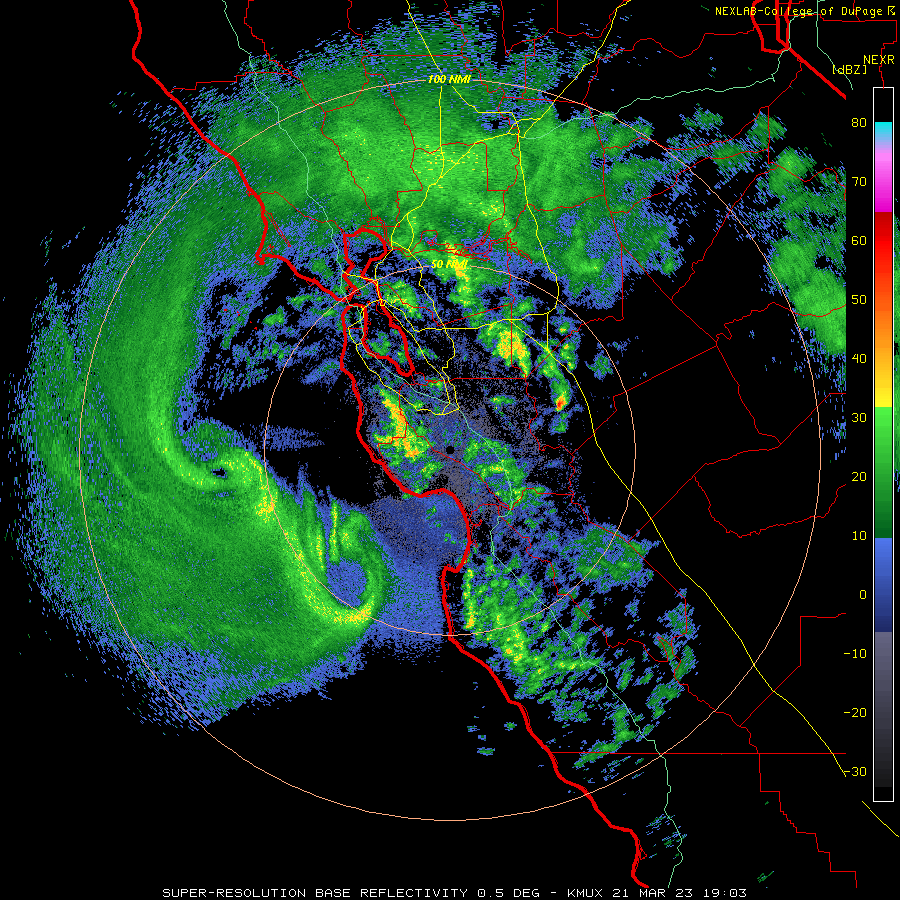 4 points
 -
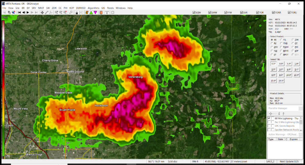
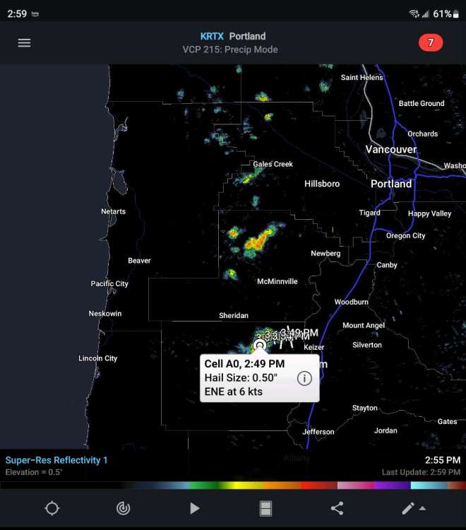
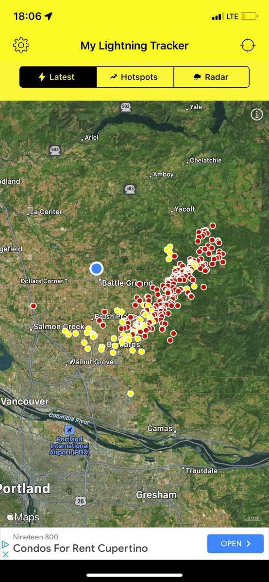
Ended up tracking that cell out to the east and intercepted it in Brush Prairie and into Hockinson. No hail but probably 1/4"+ rain under that thing in 10-15 minutes time. And a few dozen flashes visible even from the road.3 points
-
I zoomed in on Vancouver area
 3 points
 -
There is a lot of activity around me but not near me3 points
-
More thunderstorms are building up now 🌩
 3 points
 -
Euro has some snow for PDX Saturday morning while temps are at freezing3 points
-
After checking out the 12z runs I can see why there is so much panic.3 points
-
Bismarck, ND has had 8"+ of snow since Nov. 10th! Go to their monthly data starting then and work up until now it's unbelievable what kind of winter they have had!3 points
-
3 points


.jpg.5ce5c56e1296a582bfab1681a4c673e4.jpg)


.gif.6193e6b13d12873482a2c6b47ba84b3c.gif)


.gif.cb095e982aadbcd5196c8e09ac2c399f.gif)


.gif.1f0fa81c8980cc34fec8856c6b77b0ab.gif)
This leaderboard is set to Vancouver/GMT-07:00