
Leaderboard


Popular Content
Showing content with the highest reputation on 03/23/23 in all areas
-
33.9 and snowing.9 points
-
Two lightning strikes very close with heavy snow. Unbelievable.8 points
-
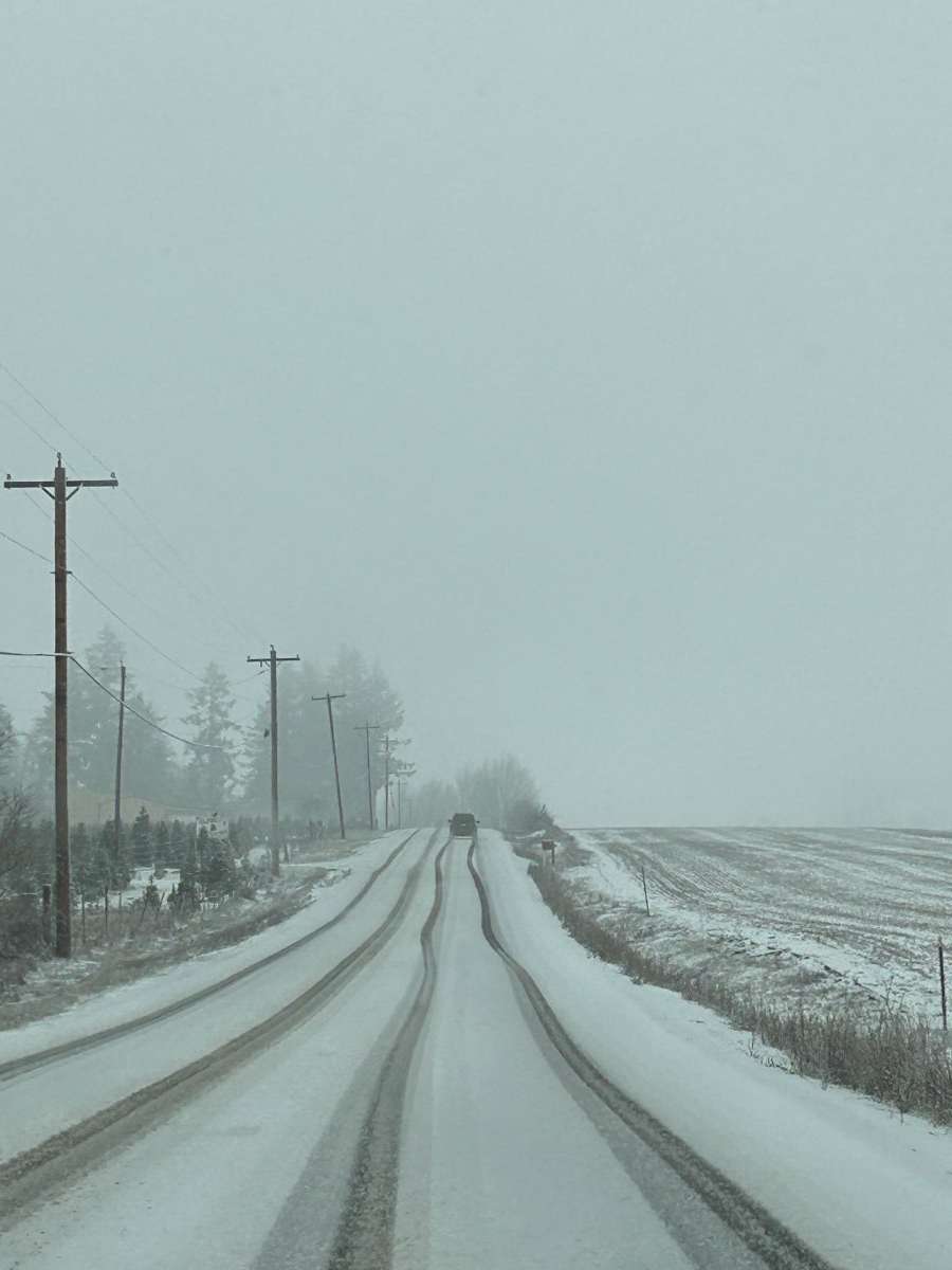
Messy commute!
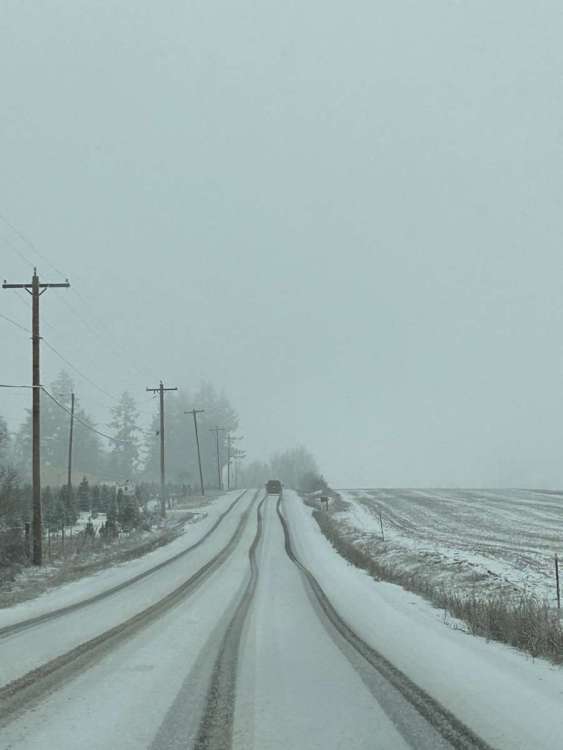 7 points
 -
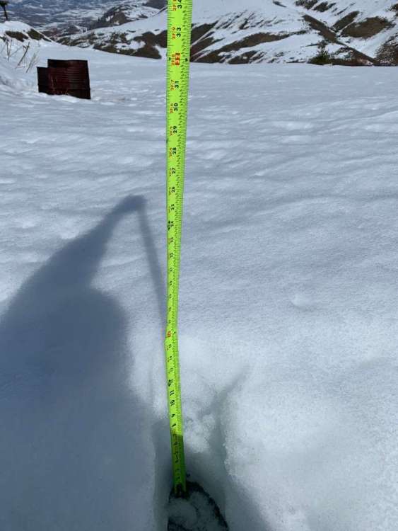
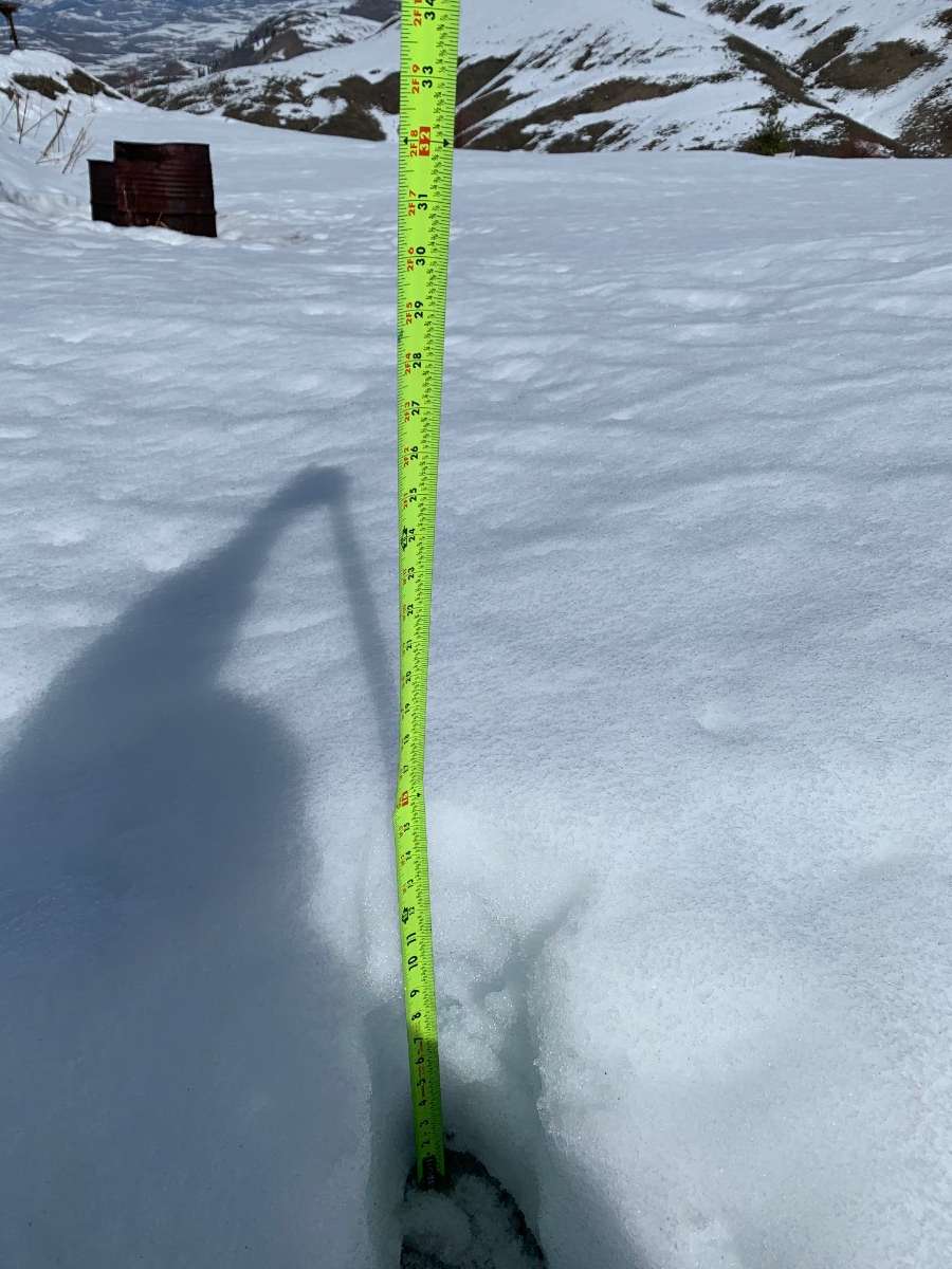
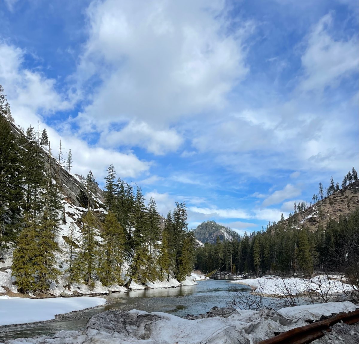
No blossoms here yet still about foot and a half on the ground in exposed areas
 6 points
 -
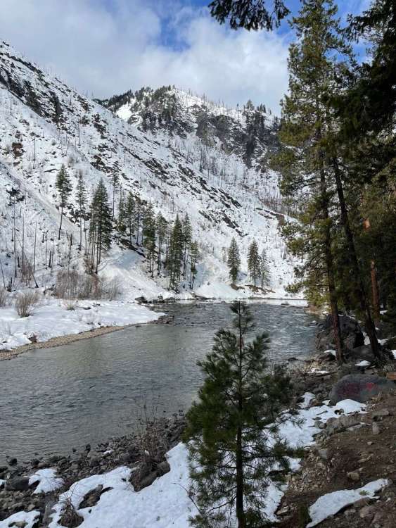
Lovely drive to Wenatchee this morning, a little light snow at the top of Stevens and 29 degrees, down here in Wenatchee it’s warm! 55 and partly cloudy currently. Stopped and took a few pics just west of Leavenworth.
 6 points
 -
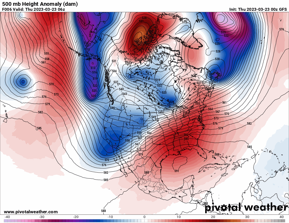
One has to wonder if our ever increasing exposure to internal weather-related information via the internet is warping our perception of just how close we are to recieving snow during many of our winter storms, even when they aren't as favorable for sticking lowland snow as modeled. Take the current iteration of the GFS, with its worsening phantom snow issues, and put it in a year like 2007-08 or or 1952-53, and this forum would probably feel cheated out of an 1861-62 redux.5 points
-
I’m ready for my foot of weekend snow!!
 5 points
 -
Heavy hail and snow mix, down to 35.6.5 points
-
NAM doing NAM things
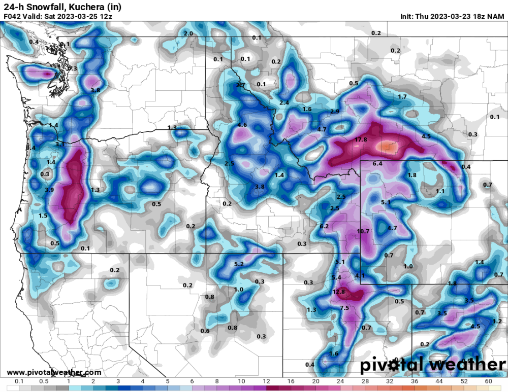 5 points
 -
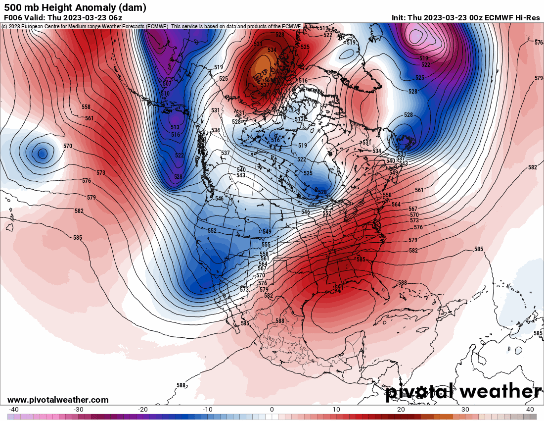
On the cold troughing front... its interesting that 925mb temps get quite cold for the next 3 days and there isn't much recovery (at least on the west side of the mountains) during the days. Its really hard to keep 925mb temps around 0C during daylight hours at this time of year.
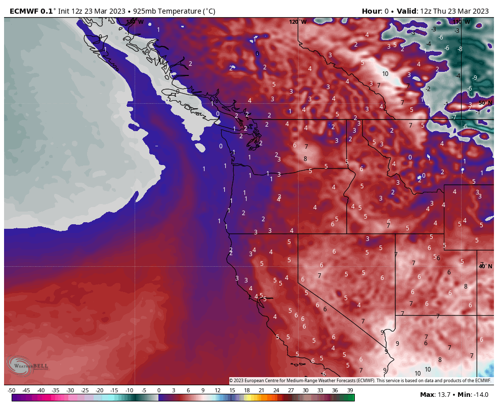 5 points
 -
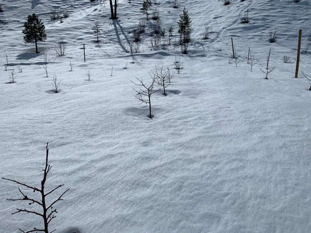
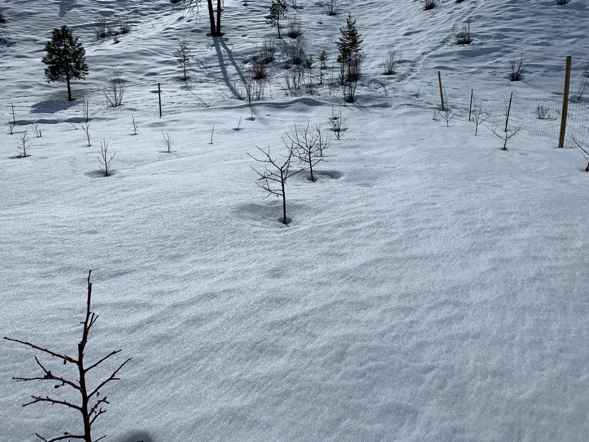
It looks like I'm 7-10 days behind last year based on pictures which is crazy because last year was a pretty late ones as well. Red flowering currant and osoberry are not even in full bloom yet but are at least partially blooming now. I have a picture of bigleaf maple in full bloom from 3/28 last year so I would guess around 4/5 this year especially if we warm up again next week. The trees are responding to growing degree days. We barely had any base-40 GDD units until the second week of March. Until your daily average temperature ((max + min) / 2)) starts going over 40 F you won't see much of anything...once you start getting base-50 GDDs as we did in the last week then everything really starts to move.5 points
-
12Z ECMWF is way south with the ULL next week continuing a trend that started on the 00Z run after the 12Z run yesterday showed it coming right through WA and OR. It might miss even southern OR now. For western WA... Sunday is fairly sunny and then mostly sunny on Monday and Tuesday on this run. Might be back close to 60 away from the water by Tuesday. A similar evolution happened this week with the storm going into CA and leaving us with a couple sunny, mild days.
 5 points
 -
00z GFS vs Euro. No agreement Day 6.5+
 5 points
 -
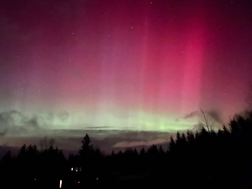
And now a lightning show has replaced the aurora as clouds move in from the NW. I’m in awe. Absolutely incredible!!! Probably the only time in my life I’ll get to see the aurora and lightning at the same time.4 points
-
Yes, it's been cold
 4 points
 -
**** yeah! We all love this weather! YESSSSSSSSSSSSSSssSSSDDDDDSSSSSSSSSSSSSSSS!!!!!!!!!!!!!!!!!!!!!!!!!!!!4 points
-
I am definitely more excited about some snowflakes potentially falling than how far along blossoms are blossoming.4 points
-
Here comes the cold front
 4 points
 -
The colder air is on the doorstep dude...4 points
-
528 thickness or lower = snow. Though after about March 1st if thickness is between 522-528 it may not stick midday. But sub 528 thickness is almost always going to be snow.4 points
-
Cell phone shot MBY
 3 points
 -
About 1.5” of snow this evening!3 points
-
Zags! What an ending. One of the craziest last minute you will ever see.3 points
-
Pics or video or it didn't happen, you know the rules for you Phil.3 points
-
Apparently my mom got some snow in sudden valley a bit ago. I said pics or it didnt happen and she said "it stopped" so who knows.3 points
-
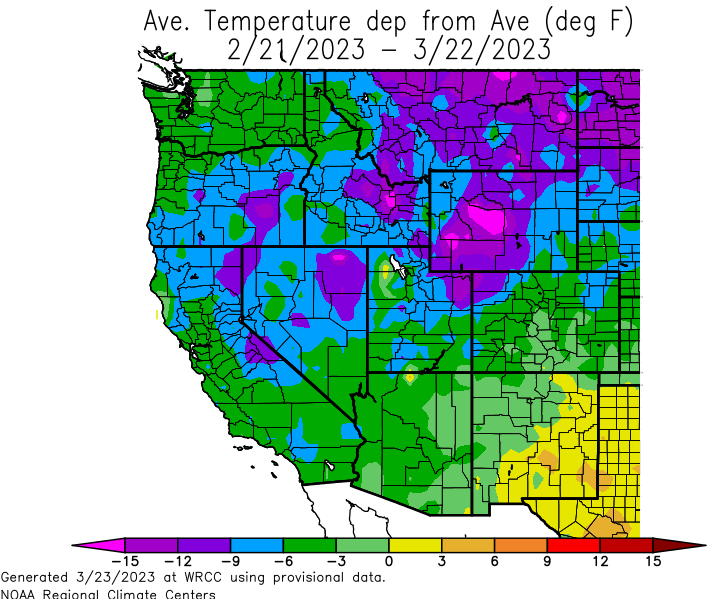
I reluctantly raised my winter grade to a D-, had 10" of snow accumulation total but it took 11 events to reach that and none ever stuck around more than a couple hours. Horrible compared to the last several winters but still well above long term average of snowfall in this area. Any snow over the next couple days will be spring snow, so it cannot help improve winter score. But all in all, it was a fun model ride winter with more potential showing than normal, things just didn't line up enough times to make it memorable.3 points
-
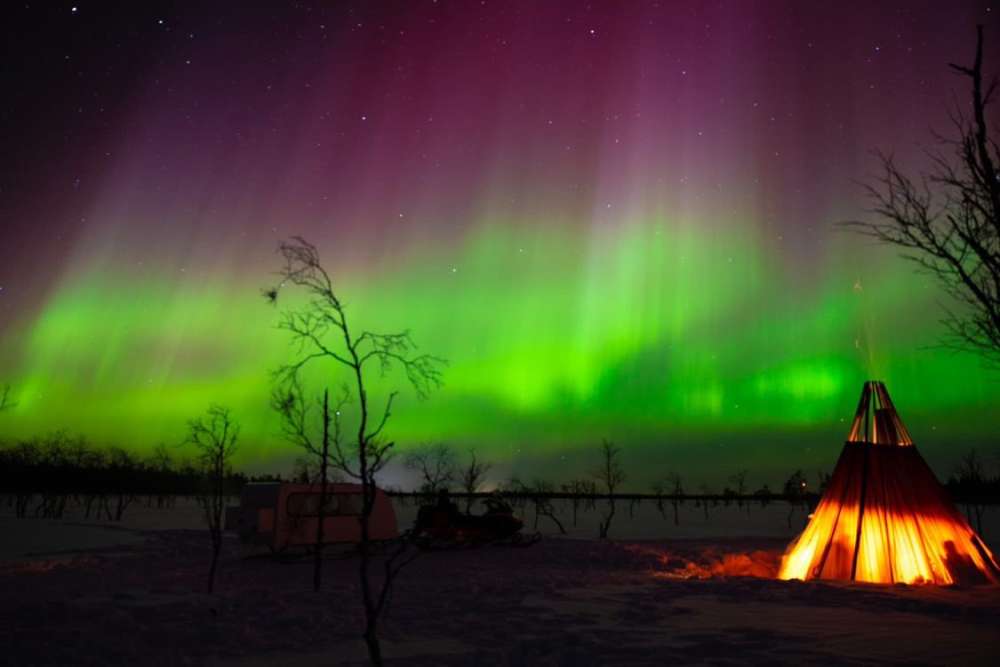
From my buddy in Finland. I’ll be out all night praying for a break in the clouds.
 3 points
 -
Here are our top single day snowfalls of the winter season so far: 1) 2/26: 11.6" 2) 2/22: 6.8" 3) 2/28: 5.5" 4) 11/6: 4.8" 5T) 11/7, 3/10: 4.5"3 points
-
And now it’s raining so hard I can’t even see across the valley.
 3 points
 -
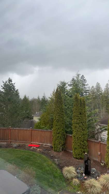
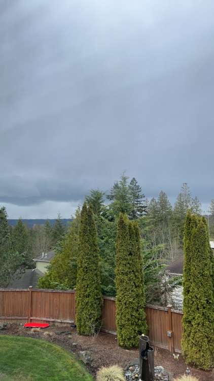
Sky looking kind of ominous.
 3 points
 -
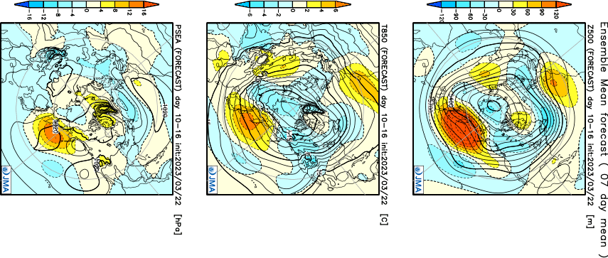
The control run also agrees in the 8-15 day period... only mentioned because it lines up well with the ECMWF and EPS which adds a little more weight to the solution. At least for now. This could change of course.
 3 points
 -
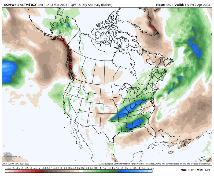
12Z EPS is still not real wet over the next 15 days... but that is because the next week is pretty dry. The last 7 days of the run flip the script and the wettest anomalies are focused over western WA.
 3 points
 -
what other topics are approved for talking about by the raccoons?3 points
-
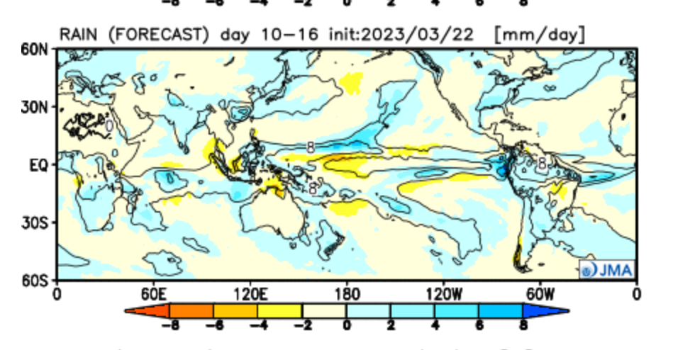
Euro shows some scattered pockets of lowland snow over the next couple of days. You can definitely tell that people’s interests have shifted to something more warm season based. This place is much busier with any potential lowland snow in December or January.3 points
-
If it is heavy snow it always sticks. Looks like maybe a good PSCZ at some point, it’s my only hope for snow really.3 points
-
Incredible!3 points
-
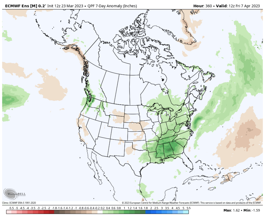
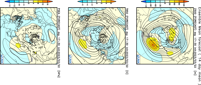
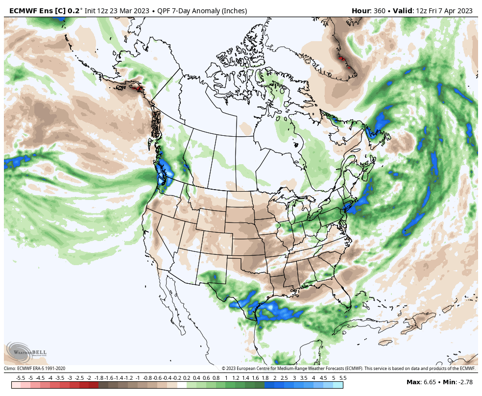
Models seem to be locking in on another significant trough around the 1st of April.3 points
-
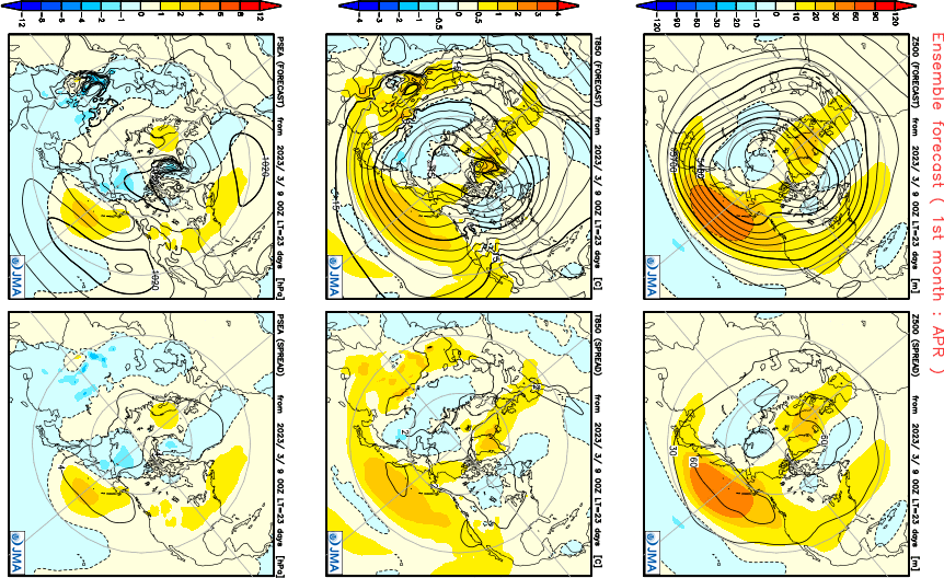
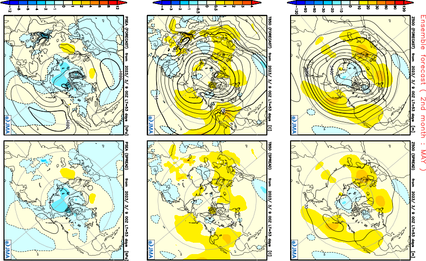
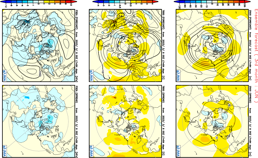
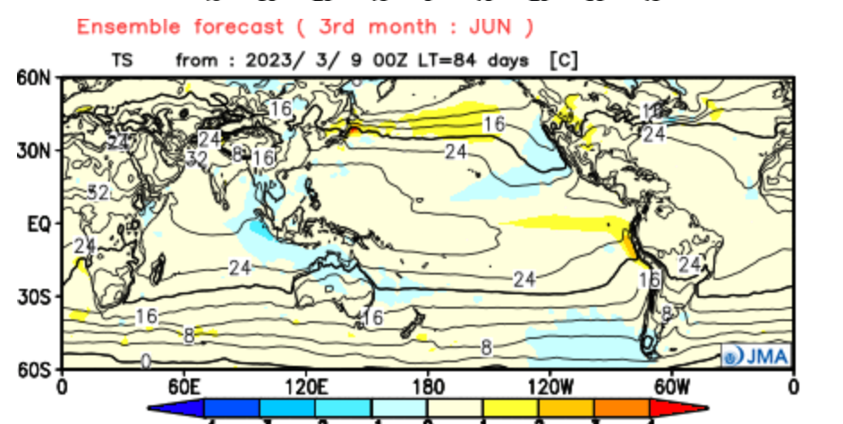
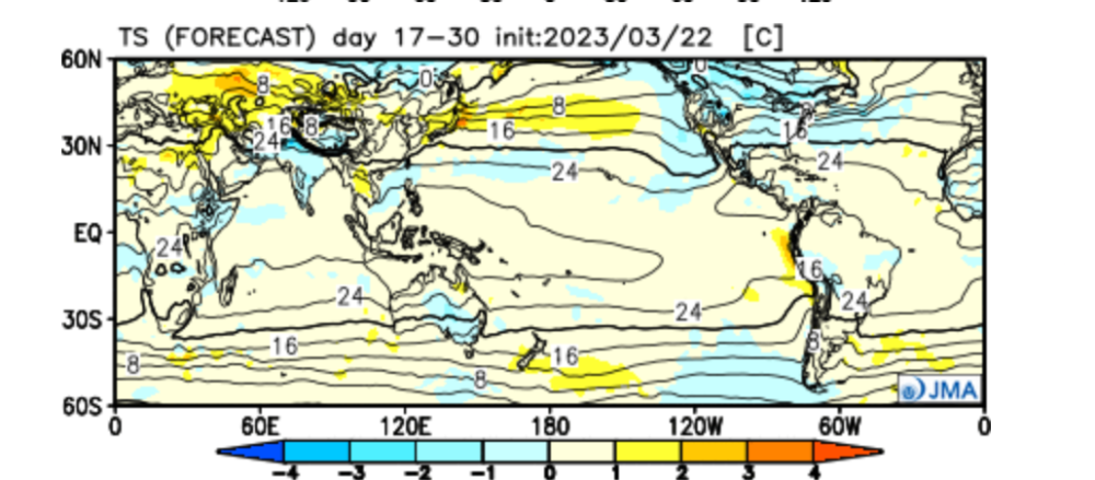
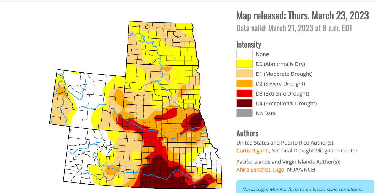
The JMA seasonal showing a slow start to Spring for many up north, but the S Plains and SW should warm up nicely. @Clinton @CentralNebWeather and NE/KC peeps should like the look of the opening 7-10 days of APR. April... May...early summer warmth for the C & S Plains?? That drought area over W TX and into W KS is a concern for our farmers. The latest drought monitor is not good. June...The Heat could really build for the western SUB..."Ring of Fire" pattern is on my mind for the MW and parts of the High Plains. If you are considering going on a trip out west to visit any of the National Parks, I think this month will be awesome as Yosemite among others will be beautiful. I can see the rivers and waterfalls flowing and raging!

 3 points
 -
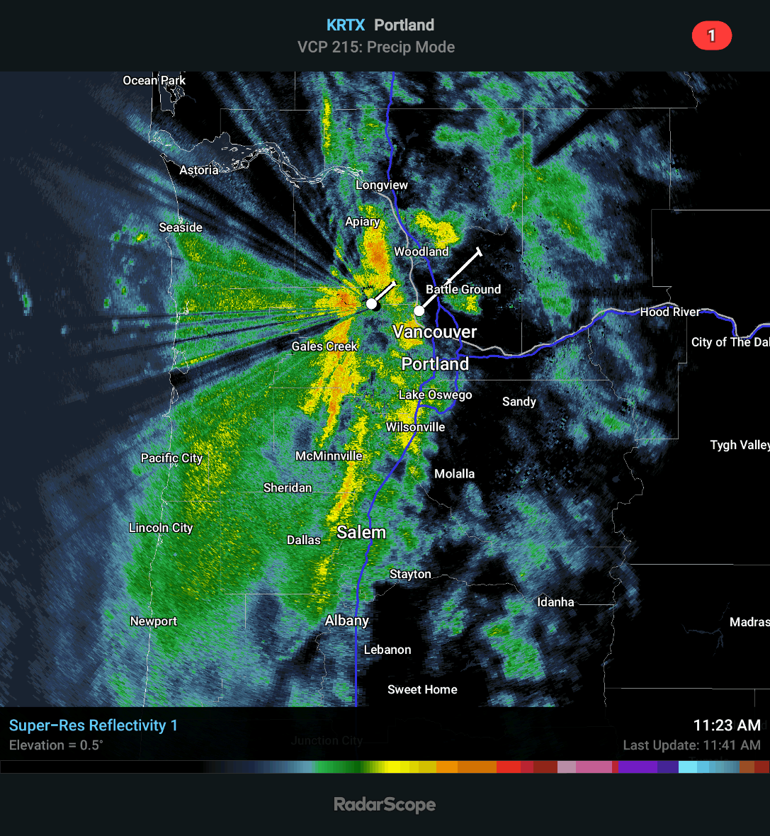
Looks like a fun night up in PDX.3 points
-
Dynamic setup so far. Not a lot of patterns where I can remember us going from warm core thunderstorms to a chance of low elevation snow within a few days.3 points
-
Spring is finally here and the seasons are certainly changing as Ol' Man Winter begins to fade away, albeit, prob to slow for those members up north and east. It's time to bring warmer weather into the picture and lighten up the mood as they say. Is there warmer weather on the horizon? What will this year's warm season bring? Some say that with a developing El Nino summers are typically wet and cool for most of the central CONUS and the bread basket of the nation. I'd love to see a banner growing season for our farmers and lack of any droughts. Thoughts? Let's discuss the various short term model data.... The latest JMA weeklies suggest as we flip the calendar into April we continue to see a similar theme that has dominated the pattern since last Fall....trough in the west and a SER....I do believe there is a window of real Spring warmth surging north as we open up APR, but how far is TBD. Does it last? Week 3-4...I see a good signal for a SW Ridge not only from the JMA, but the CFSv2 is also suggesting that by Easter week it could really begin to warm up around the SW and give Cali and the Intermountain West a chance to dry out.

 2 points
 -
With the colder air moving in, we have a couple of thunderstorms!!
.thumb.gif.33aab9e25491a5665ca64ec9b56cce5d.gif)
 2 points
 -
On another front (for lack of a better word), stronger westerlies mean a more easterly based and weaker PSCZ, and probably drier conditions for Seattle. Also stronger upsloping and colder air for the Cascades, some more snow up there. Should be some brilliant cloudscapes from time to time over the next few days.2 points
-
Strong westerlies mean less time over land and less mixing.2 points
-
West Coast at it again. Another double barrelled low, this time off BC2 points
-
18z once again pulverizes us with a cold trough to start April.2 points
-
Snow pack in the Willamette basin is 124" of normal. Pretty impressive considering water year to date total precip in the basin is only 82% of normal.2 points
-
Had a decent winter around here (nothing like the Northern Nebraska Glacier), probably will end up close to normal snow wise and a little ahead in the total precipitation. The problem is we went in so dry, that it is tough to break the extent of the drought that we have been experiencing. Also, we have missed out on many rain or snow systems in the last few weeks, so the drought hasn't improved in my area. Hopefully Enso Neutral to El Nino conditions begin to show up, those seem to be the most beneficial to our area.2 points


.gif.e5a81d2a14104f40112f08bb8eca6fa0.gif)

This leaderboard is set to Vancouver/GMT-07:00