
Leaderboard


Popular Content
Showing content with the highest reputation on 03/25/23 in all areas
-
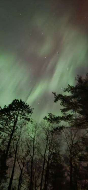
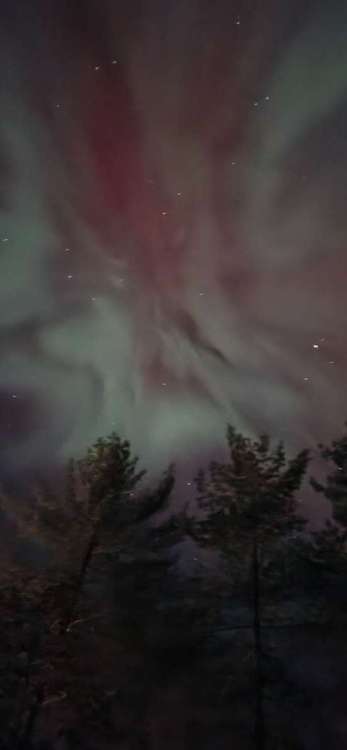
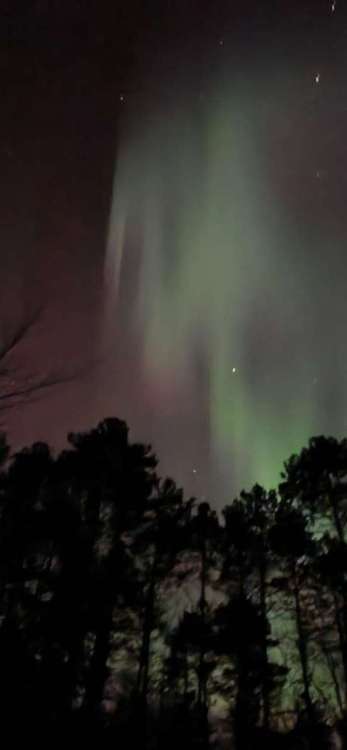
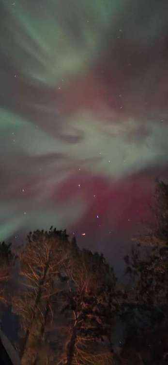
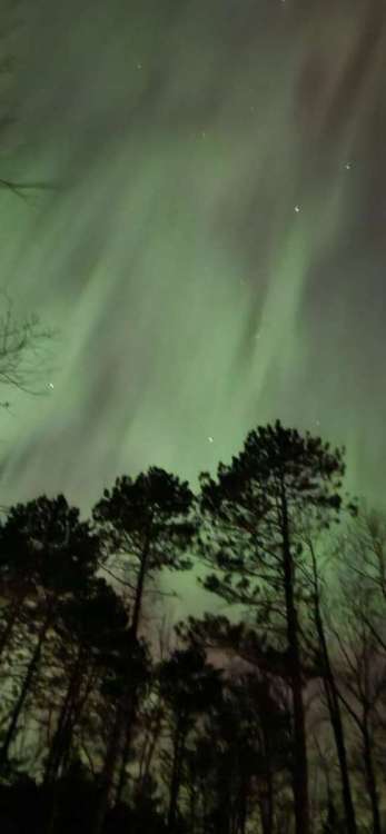
Aurora IMBY 3/23/2314 points
-
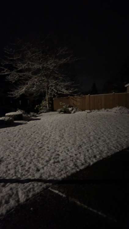
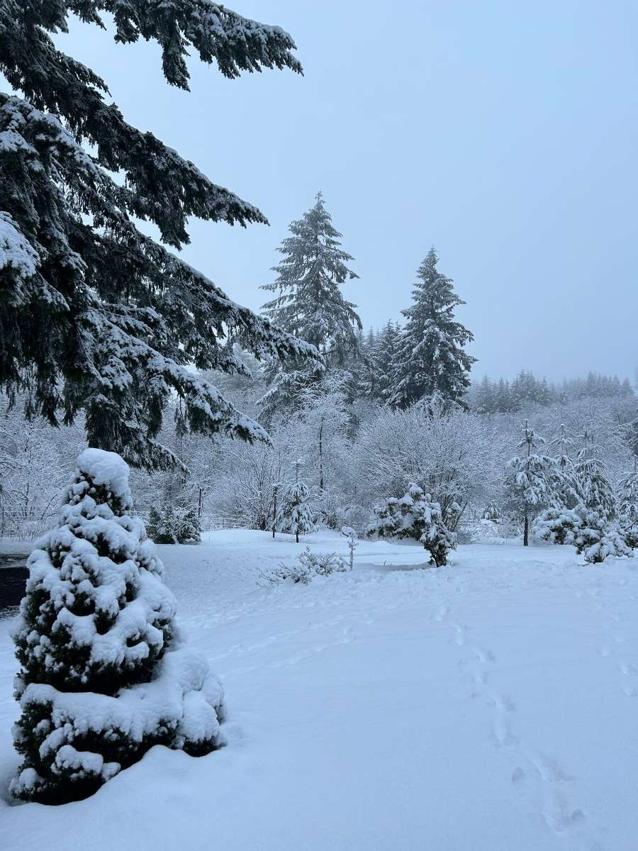
March blessings and such.
 11 points
 -
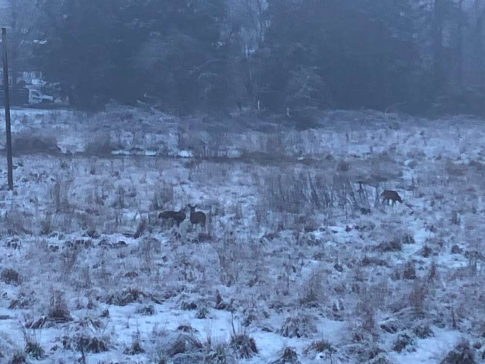
Deer family enjoying the spring snow in Tigard this morning.
 10 points
 -
Just got up and it’s snowing lightly and trying to stick too but right now it’s just grassy areas, etc. Very surprised!
 10 points
 -
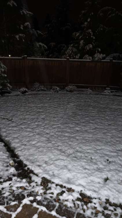
Good Saturday morning. 32 and snowing.
 10 points
 -
9 points
-
Wow, woke up and there was snow on everything outside. I didn't expect that9 points
-
Didn’t measure but probably an inch or so. Currently 33.1 and cloudy.
 9 points
 -
Snowing and sticking9 points
-
Woke up randomly around 3 AM and noticed it looked unusually bright and peeked outside. Everything was covered in snow including the roads and it was coming down at a good rate still. Had snow the previous morning too but not on the roads. I hadn't been tracking the models or even reading the forum much at all, was actually really nice to experience accumulating snow like that without any model riding, knowledge of how much would fall or how long it would last. Just watched it for a while and enjoyed it for what it was. Overall it has been a pretty darn nice season with snow visiting the low elevations often.8 points
-
From 2 nights ago. Most incredible I have seen.
 8 points
 -
I love when heavy rain turns to heavy snow. The gutters were very loud about 30 minutes ago and now everything is very silent. Starting to cover the cars and grass.8 points
-
Down to 34 and all snow. Big flakes falling on the puddles from the earlier heavy rain.8 points
-
HEAVY SNOW!7 points
-
This has already been talked about ad nauseum, but it does amaze me that with all of the upgrades to the models in recent years they seem to be spitting out more accumulating 35-36 degree snow than ever before. You’d think getting the temperature at which snow sticks right would be a pretty basic thing for an incredibly advanced weather model that can accurately predict complex 500mb patterns at great range. Maybe I’m missing something.7 points
-
Crazy that I managed measureable snow on April 11th last year and now March 25th this year. Only a quarter inch but still really nice. And that's after we had heavy non-sticking snow yesterday all morning.7 points
-
Two more: Also mixed precip here finally
 6 points
 -
My anticipation for JANUARY 2024 just skyrocketed.6 points
-
The show is over, but super sweet to get a minor dusting in late March in the middle of the day.6 points
-
Snowing so hard it is sticking. At noon.6 points
-
Heavy snow!6 points
-
2.5" overnight.6 points
-
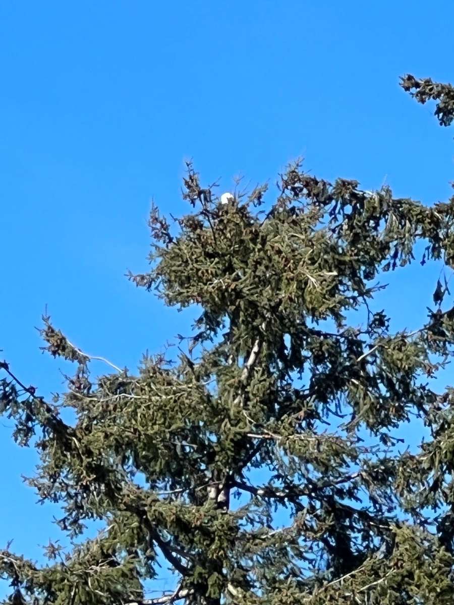
Nice sunny chilly day today. Saw an eagle on my walk earlier. Too far away to get a good pic.
 5 points
 -
These cold troughs are a pretty bad deal for your area. The colder airmasses mean less moisture throughout the column and lower PWATs, and the WNW flow associated with these systems fits the concave shape of the Cascades perfectly, maximizing lift on their westerly face. The mountains schlorp up all the rain and snow before it can even touch the Columbia, leaving you with table scraps, or nothing at all. I imagine we'll get a nice period of SW flow, where a fat juicy AR can saturate the steppes with fresh Hawaiian-imported blessings.5 points
-
We have had a lot of patterns that favor our area this year. There have been many years where Tim gets significantly more snow than us, cold onshore flow is our bread and butter, and the troughing has dug very well this year and erased any kind of N/S gradient. It really matters how cold the airmass is here, sub-528 thickness with moderate precip rates is always going to be snow. I can tell you too, there is a massive difference between even 1400' and 1600', there are many times I can have 6-10" of snow on the ground and drive 2-3 miles and there is nothing.5 points
-
Can't even describe how satisfied I am with how this winter turned out. Could have had more arctic air, could have had more snow in Dec/Jan, but no complaints. Ready for classic spring weather.5 points
-
Any reports from Kayla?5 points
-
Well it looks like I get to add 1.25” for my season total! Kind of crazy I got more snow from an event in late march than late February.5 points
-
Final round of snow has ended, about 1/2" with this band. Up to 4.7" on the day 36/30. Skies are clear now. 12.9" with this trough since Thursday afternoon.4 points
-
82.9" now. 66.8" since February 13th.4 points
-
That shower just dropped another 1.2" of snow. Only .2" of snow away from moving past January 2012.4 points
-
This was 9/8/2019. The 2.17" station is very close to my area, and 1.88" of that fell in an hour4 points
-
I really hope we can see a year for thunderstorms like that again. There was the 6/26/2019 thunderstorm, I think something on the 27th too. Then another big one on 7/1, and then in September there was a tornado less than 5 miles away and then we managed 2" of rain in an hour on the next day
 4 points
 -
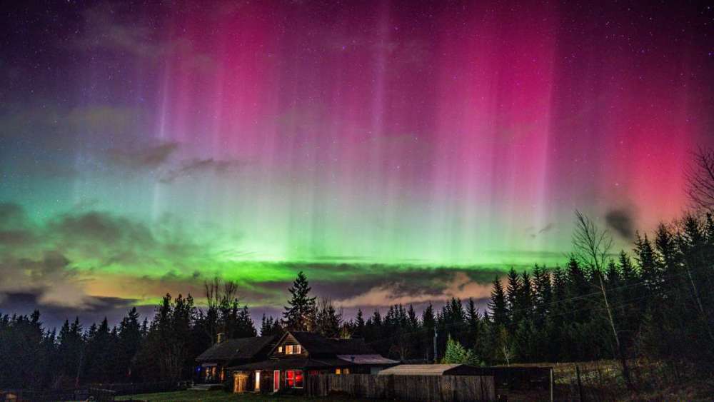
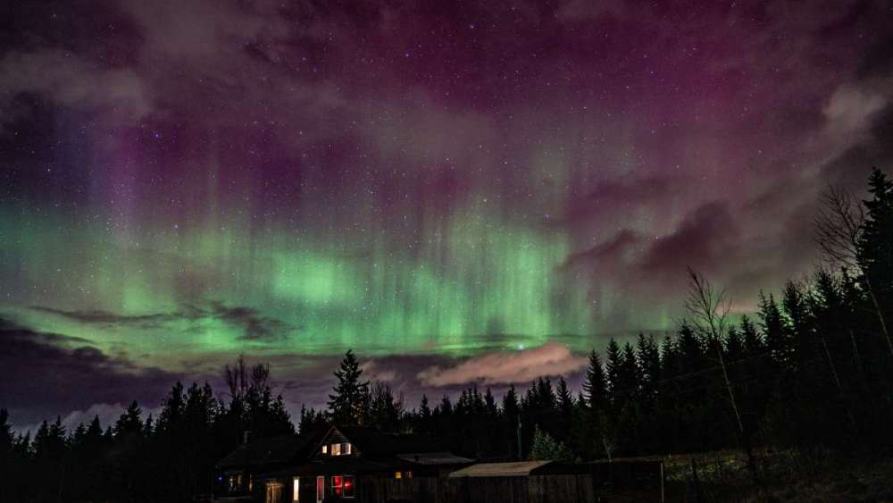
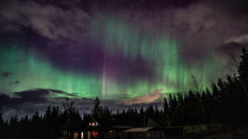
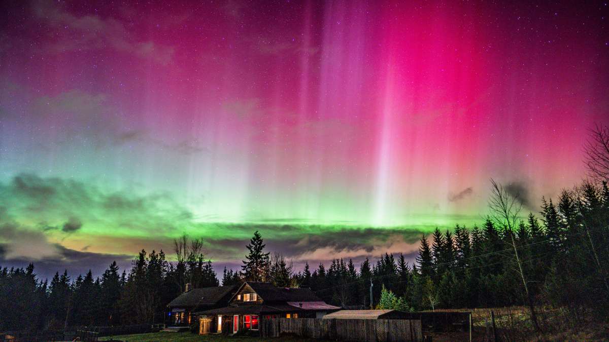
Speaking of the Northern Lights...this recent event had an even more rare aspect to it. STEVE was actually visible over WA for a time. Can't remember exactly what the acronym stands for, but it only happens with some Auroras.4 points
-
Only up to 47 here even with plenty of sun breaks this afternoon. I see convective looking clouds bubbling up around us though.4 points
-
I guess they count any rain:snow ratio as all snow with a 10:1 water equivalent. You just have to read it like that. If you are forecast 4" on the Euro, and it's just 0.4" of rain with a few snowflakes mixing in, that's technically a success for the model's architecture. It successfully predicted that 0.4" of liquid equivalent precipitation fell while frozen precip was also reaching the ground. Obviously for our observed weather that forecast is pretty ass, but that's my best guess as to what the models are thinking when they shit out half a foot of 38F suspicious rain. They're probably wearing special glasses that see either rain or snow, without any in between. Not to mention the GFS has a new Cascade gap issue, where the Snoqualmie and White River gaps allow way too much easterly influence, meaning actual phantom snow situations where airmasses are imported erroneously. That and the whole issue of airmasses verifying warmer than modeled as they advect in, as well as undermodeled friction in BC, bringing in Arctic air too early.4 points
-
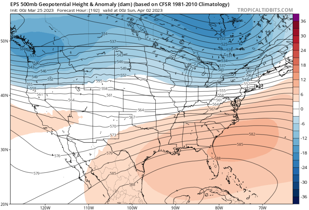
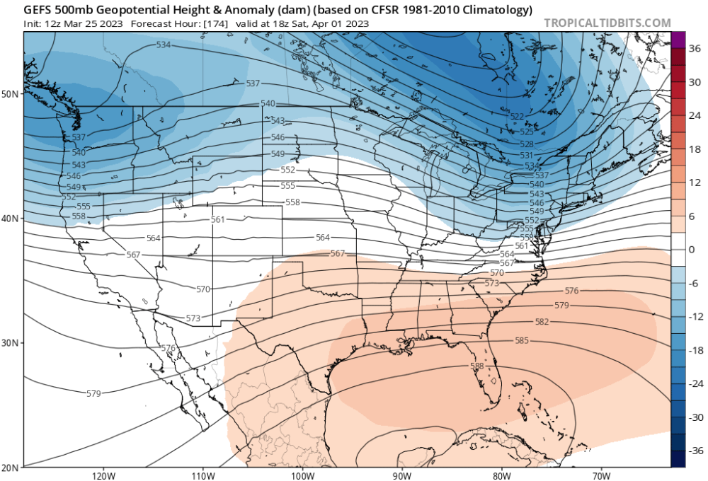
12z EPS looking good into the long range.
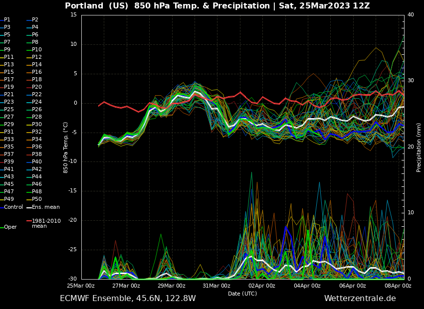 4 points
 -
Next winter has dud written all over it. Or dudderino if you’re not into the whole brevity thing. Should be a good winter to get caught up on work lost due to previous model riding.4 points
-
Got down to 35F under a snow shower a bit ago. One of the later snows I can remember.4 points
-
Pretty insane. 10 days out and still the same.4 points
-
I agree, definitely a great winter. Cool November, with some snow in the air at the end, a lot of snow in the air in early December. Then the arctic blast in December, which we had a 23/20 day with here. And I got to experience that arctic blast in Denver which was amazing, going from hiking in 50 degree weather to 4" snow falling below zero degrees F and a temp in the minus 20s in less than 24 hours. February/March has had a ton of snow falling which has been really nice. Started with about a half inch on 2/14, then the 6-8" storm on 2/22 and 2/23 which mostly fell in the mid 20s. Then snow in the air on 2/25, 2/28, 3/7, 3/9, 3/24, and today. I measured 7.5" of snow total this winter but I doubt I got a proper measurement on 2/23 so it's probably slightly more. 2016/2017 was better here since it was colder/snowier but I've really liked this winter too. Also my first winter on the forum and it feels like there's been something to track almost constantly4 points
-
I got some snow! It’s mostly melted now though.
 4 points
 -
Still out there but next trough looks a little stronger and a more direct hit.
 4 points
 -
Up to 30.5" on the month, within striking distance of March 2012, though next weekends trough doesn't really look like it has that kind of potential. At this point maybe a couple inches, but nothing like this current trough. We have done it in a very different way than 2012 though.4 points
-
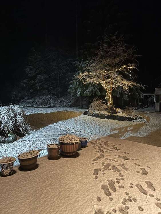
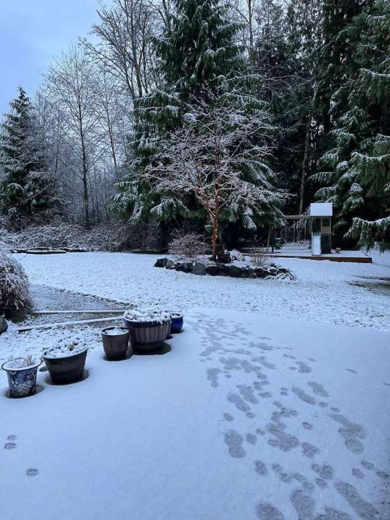
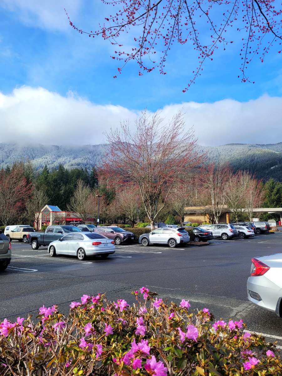
Both winter and spring from the parking lot of Safeway in North Bend.
 4 points
 -
I'd by lying to you if I wasn't to say that I'm tickled with excitement the way think things will transpire out here in the Desert SW and Intermountain West for the Spring and Summer season. Not only do I believe in shorter weather cycles like the LRC, but longer term cycles exist, and what has changed out here in the SW since really the 2021 Monsoon season till now is a longer term cycle that has begun. The moon, the sun and all celestial bodies have a direct effect on our planet and as we dig deeper into cyclical patterns, it is my personal opinion that the SW region will continue to be an important grow region. I do not see any longer term droughts developing in the near future. For this reason, many big players have been scooping up farmland. You have to wonder...why? The one who controls the food and water, controls the masses. Something to think about. For weeks the CFSv2 hasn't really changed much and shows a nation with a lot of precip.... We will most likely see a "pool of cool" establishing over the center of the Nation and most likely a BN temp regime in the 4 corners.
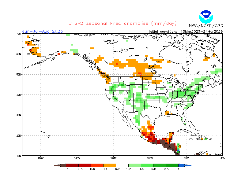
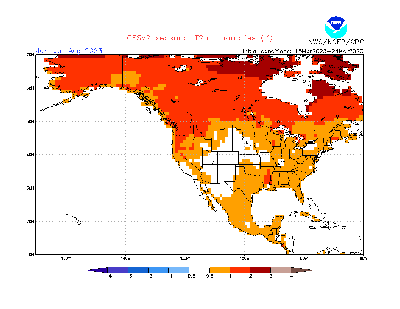
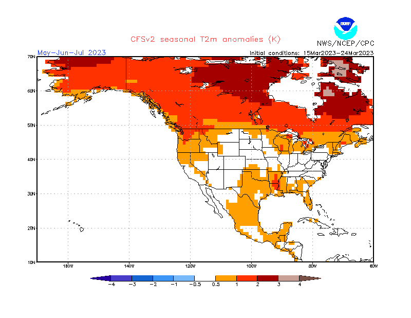
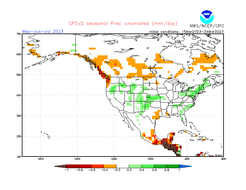 4 points
 -
Picked up 3-4 so far overnight4 points
-
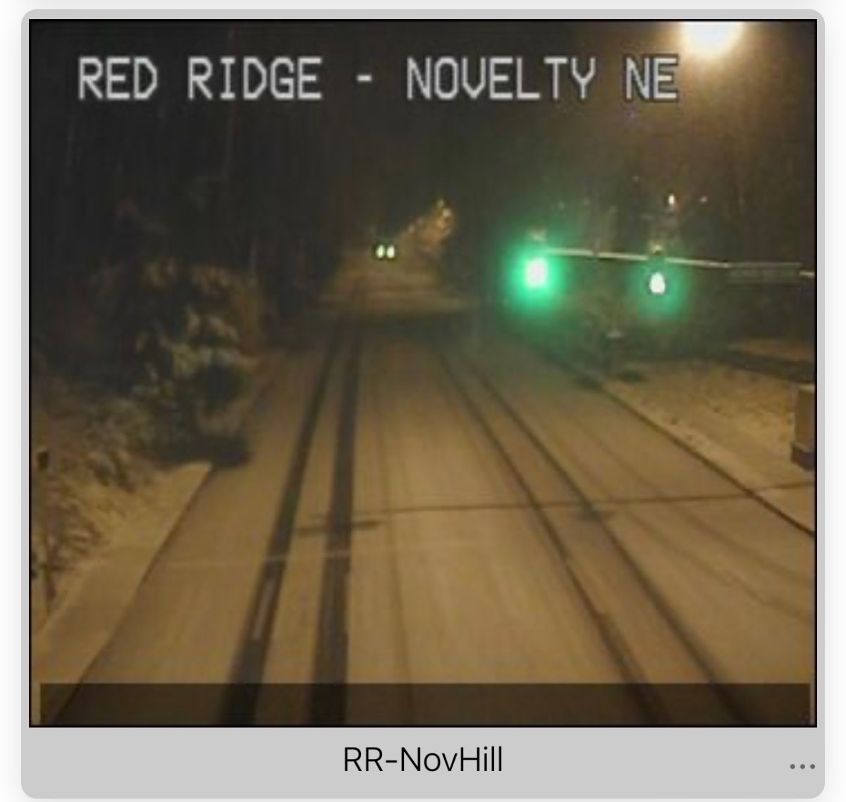
Redmond ridge cam. It’s definitely going to be a tough drive back for who’s driving me.
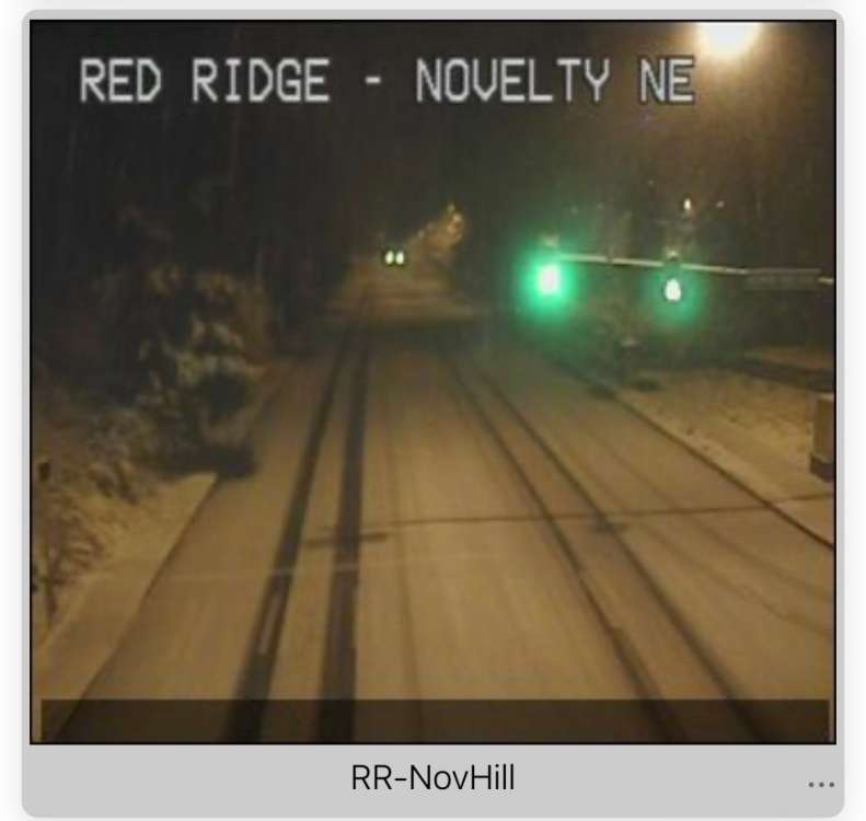 4 points
 -
Just took a closer look at this run and it would be a top tier early April trough.3 points
-
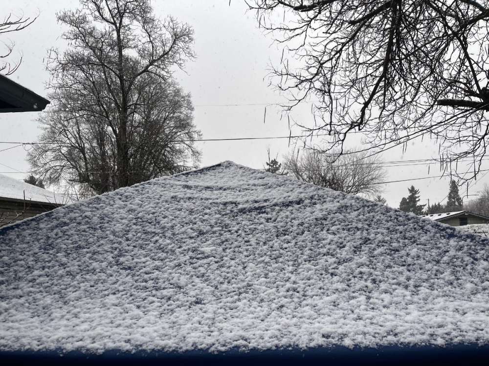
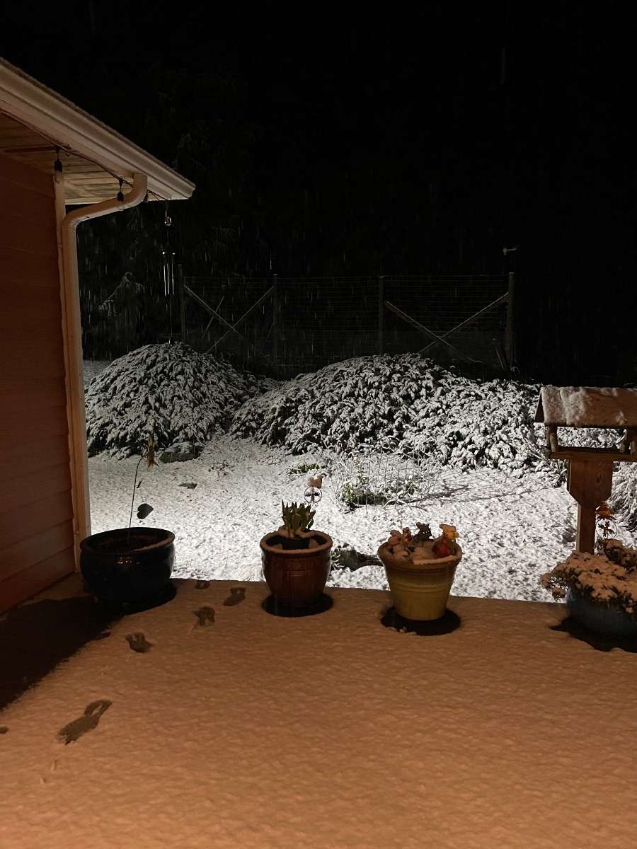
Everyone ready for the latest version of my deck snow pile update!!
 3 points


This leaderboard is set to Vancouver/GMT-07:00