
Leaderboard


Popular Content
Showing content with the highest reputation on 03/27/23 in all areas
-
Honestly speaking, I don't get the griping about this winter, even as a Seattle resident who was pretty often skunked during the countless marginal events. Going back to the beginning of November, it's been a long and fruitful season of cold and snow threats. And we might as well begin that far back, since winterlike conditions arrived on the 1st of that month, and have since refused to depart. For starters, we've seen consistent Arctic influence, including one really decent blast. Associated with this have been frequent snow chances, all spawned by nearly constant troughing aside from a couple weeks in January and November. And when we haven't been bombarded from the north, inversions have played their part in keeping temperatures down. This has culminated in one of the coldest winters of the century, or any winter going back to 1958 for that matter. Coming in with a mean of 41.6F, the 11/1-3/25 stretch is the coldest such period since the 2006-2012 -PDO party. Troughing has felt easy and reliable, almost like a certain fixture of our dominant weather pattern. Gone are the days of the middle 2010s where there was a notable anxiety for when we'd get another decent trough. La Niña has worked as it should, better than usual in fact. It's been a nice relief, especially after the nightmarish "Fall" we endured. The hydrological situation in the west is out of this world! Who could have imagined this water turnout? Records are being either approached or bested across multiple states, including regions that have been horrifically impacted by all time record drought in the last couple decades. Snowpack in the central and southern Sierras is the highest on record, with plenty more forecast over the coming days. As nice as it has been up in Seattle, this winter only gets colder and wetter the further south you look. Burns, Reno, Salt Lake City, Elko, Tahoe City, Flagstaff, and plenty more sites across the interior west have all seen their coldest, wettest, and even snowiest winter in decades. A true beast of a winter, the kind that has trapped residents in their homes, and turned deserts green. One that has annihilated a drought and returned water security to millions. Better than a best case scenario.11 points
-
I live directly under the bullseye of that hail core. Weirdly it was "soft" hail so I didn't notice what was going on at first. Best I could tell this morning they actually ended up plowing the streets, including at the roundabout in that photo. Spent my morning listening to huge sheets of hail/ice crashing off of the surrounding rooftops. Here's a couple of photos mid-event.
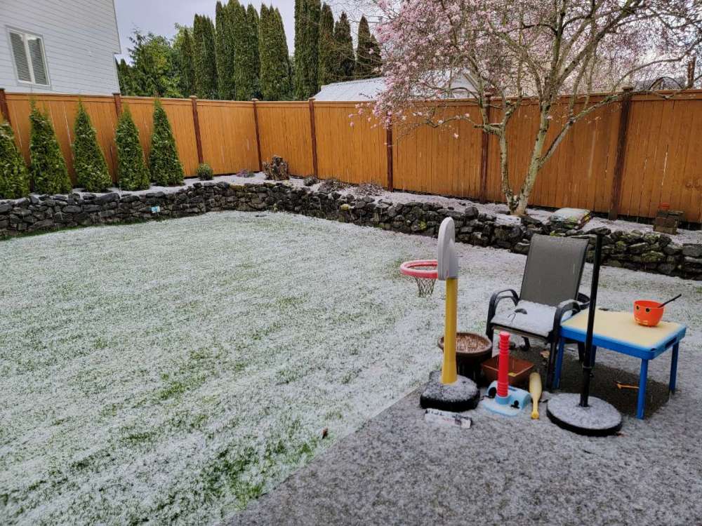
 11 points
 -
Since the beginning of November, the highest temperature recorded in downtown Los Angeles has been 84F. That's the lowest during that stretch since 1964. The lowest is just 80F from 1945, with records going back to 1878.10 points
-
About 15 minutes from the bridge (Moulton), 4 minutes from the river scene (Lewisville).
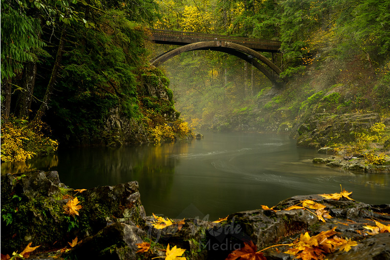
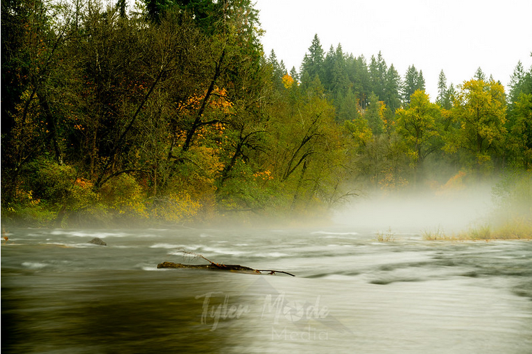 9 points
 -
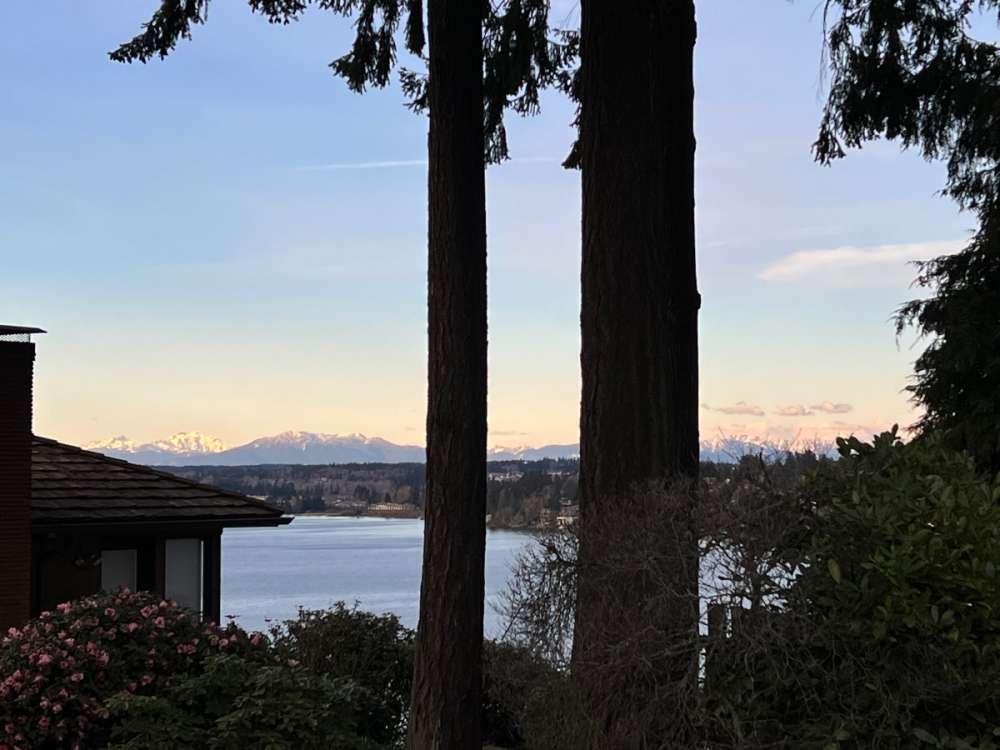
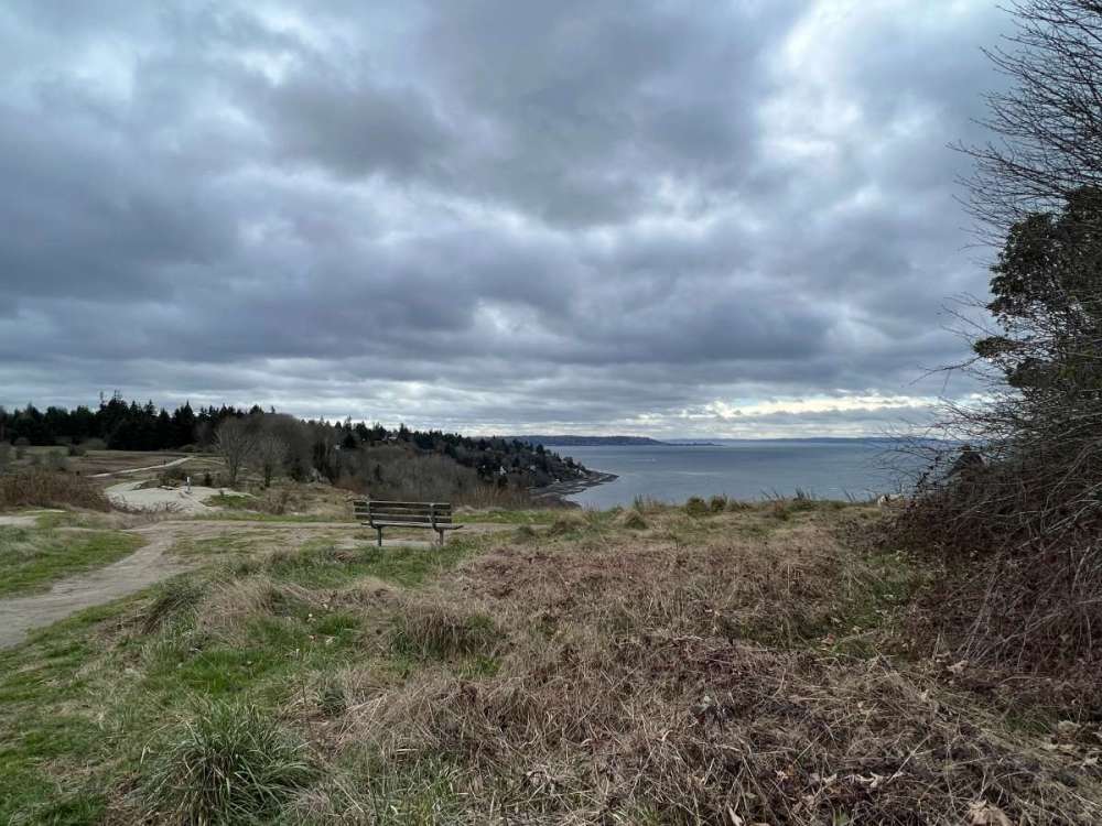
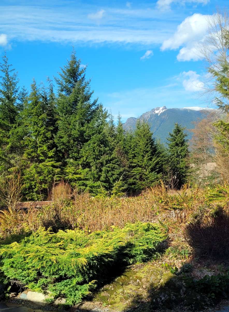
It's hard not to romanticize life with views like this.

 8 points
 -
Live view here...
 8 points
 -
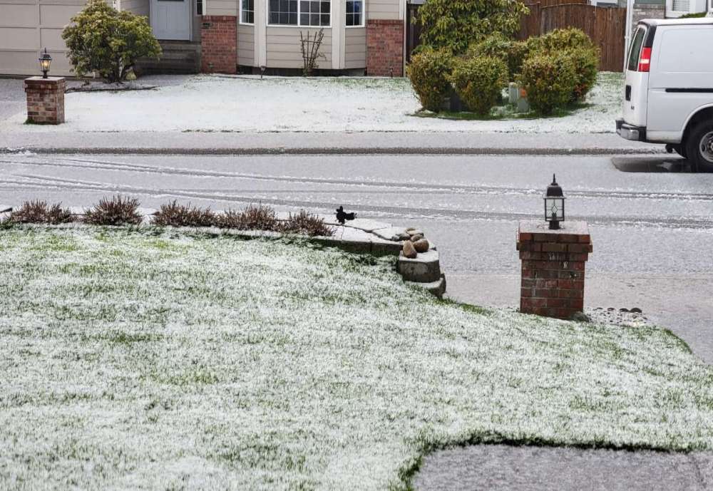
Still looks pretty white on Lea Hill this morning from yesterday's hail.
 8 points
 -
Down to 30F. 60th freeze of the season for here.8 points
-
This BC slider could bring very low snow levels.7 points
-
Personally the winter of 2022-23 will go down in my head as largely boring and forgettable. No snow accumulations above 1", no decent windstorm, just dry and cold-ish. More sunshine than last winter which was nice. Much different story at elevation but close to sea level I feel like we had a pattern that should have delivered 3 feet of snow but was thwarted by the pathetic nature of most arctic air masses these days. The one period that stands out is the pre-Christmas freeze followed by that epic ice storm and AR. The early December one that was nearly a huge snowstorm was also pretty good but it only snowed for about 15 minutes at my elevation.6 points
-
Looks like a nice sunset going on to my west.
 5 points
 -
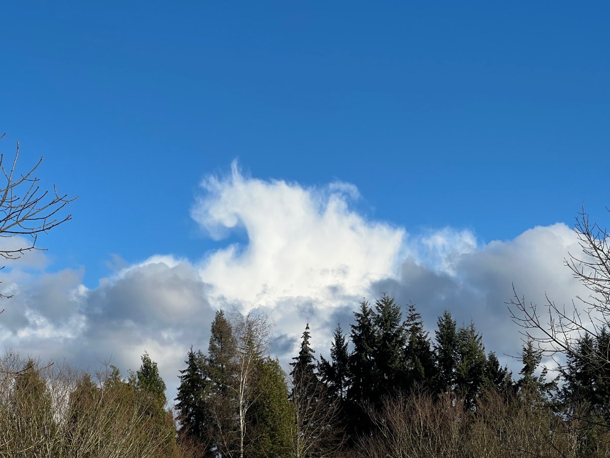
Beautiful day out here... some interesting cloud formations but sunny all day and currently 58 with a noticeable east wind. I am really enjoying these sunny, dry breaks between troughs. The same thing happened last week... but this week it will last a bit longer.5 points
-
KSEA coming in with a freeze this morning. Low of 32F.5 points
-
Not sure if it’s been pointed out, butt PDX’s overachieving 49 degree max on Saturday was their 13th below the 50 mark this month. Most in 59 years.5 points
-
Solid GFS run. The most intriguing feature is the one about a week out that slides down the coast and delivers a slug of moisture with very cold air in place. Could see some low snow levels with that one.5 points
-
5 points
-
This cold is very impressive for late March.5 points
-
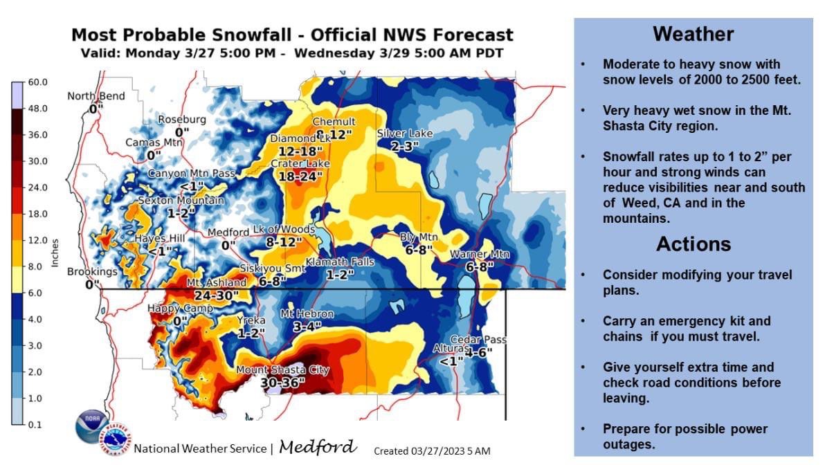
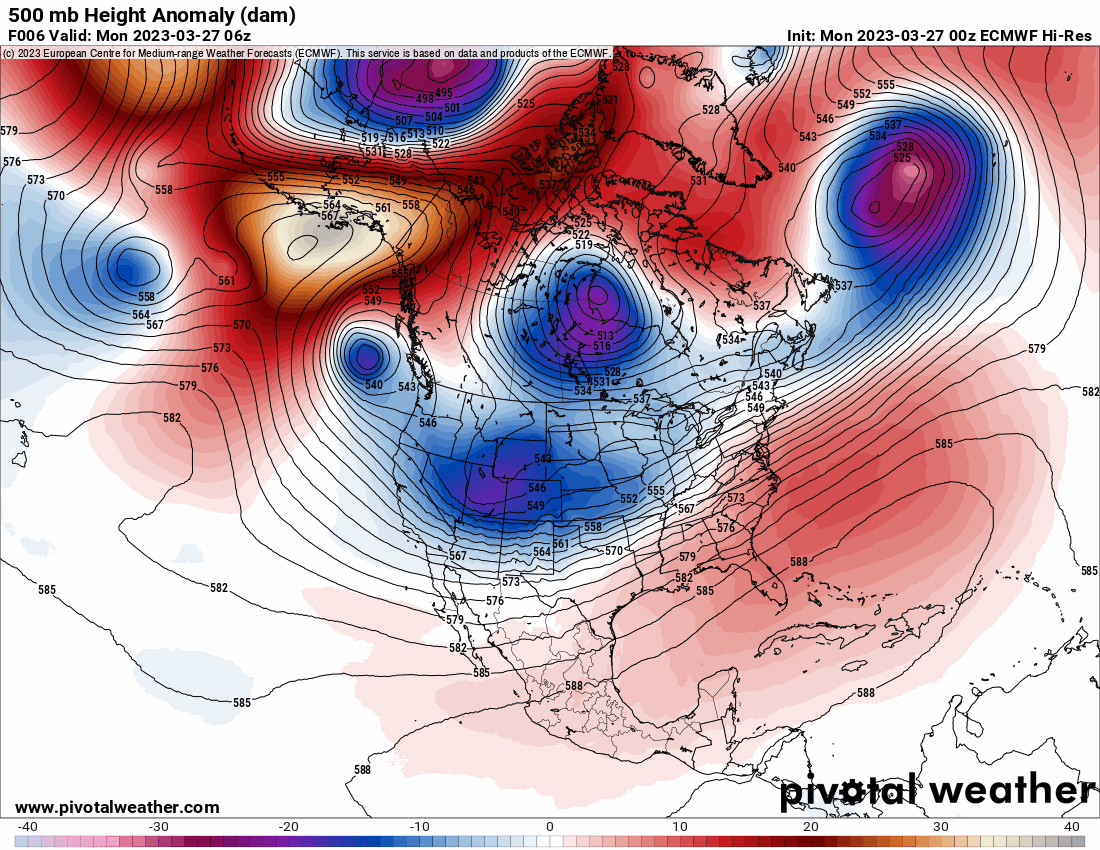
6z NWS/NCEP Pacific Surface Analysis, 6z GFS Simulated IR 3/27/23 5:50 AM Here we are in late March and a system off the southern Oregon Coast is projected to undergo Bombogenesis. What's that? It's when an area of low pressure rapidly deepens 24mb or greater within a 24 hour period. This system will definitely achieve that. This is Mother Nature's version of March Madness! In fact, the 6z NWS/NCEP Pacific Surface Analysis forecasts a surface low to develop and deepen 35mb from 1013mb(29.91 in) to 978mb(28.88 in) in 18-24 hours. That's very impressive. Bummer this won't plow into us. If it had though we would be seeing some major wind issues, so perhaps it's for the best that it won't. All models keep it well offshore sinking south the next 48 hours. It will only affect us with wrap around moisture tomorrow moving up from the south and gusty east winds due to high pressure inland over eastern Washington and the unusually strong storm offshore. Check out the 6z GFS Simulated IR Satellite imagery showing a classic mid-latitude cyclone with the low tightly wrapped up and large dry slot punching into it. Cinnamon Roll. This is going to be fun to watch on IR/WV loop by this evening into tomorrow!5 points
-
Hallelujah… Holy Shiit! Where’s the Tylenol4 points
-
Here's some fodder for us bored schmucks to toss our stubby digits at... What's your favorite park near where you live? Attach a pic, too, if you got any. I'll start first, Discovery Park:
 4 points
 -
It looks like the godliness in our weather isn’t going to be disappearing anytime soon! Praise be!4 points
-
This came up on Facebook today... sounds like it was a very well researched and important study on which cities have the worst weather. https://www.alottravel.com/article/vertical/slideshow/us-cities-with-the-worst-weather/9227/1?camp_id=213576&utm_campaign=213576&utm_content=23853851775330023&utm_medium=23853851770420023&utm_source=fb&fbclid=IwAR3Gvc4kf54UZrx8ZVLb5fHt8pNjjt_VuFBZOlj-VvkNONMKXKhaV91uIe8 They were not kind to Portland. Sounds like a horrible place. Can't grow anything! This how cities get really bad and misguided reputations. Comically stupid. Portland, Oregon Portland doesn’t get a lot of sun. On average, the city has 222 heavily clouded days out of the year. That makes it tough to grow literally anything other than roses. Roses don’t require a lot of sun and love cloudy weather, so that’s why Portland is often referred to as “the City of Roses.” Maybe that’s why food is so expensive there! While the city itself rarely sees much snow, the surrounding suburbs do sometimes have issues with snow and ice thanks to the fact that they are at a higher elevation than Portland proper is. All in all, this is the best advice we have for surviving the dreary Portland weather: invest in a good umbrella!4 points
-
Every time it appears like the weather pattern is about to change, we end up in the same position a week later, with a deep trough carving out over the west, and another one lined up upstream.4 points
-
It’s crazy to think of I lived 10-20 miles south of where I am that I would be grading this winter a C- instead of my A- grade!4 points
-
Check out the C-Zone up north on Saturday night.4 points
-
Freezes 10 and 11 of the month just before midnight and now. Sitting at 31.4 points
-
00z Euro. No end in sight the cold pattern continues.
 4 points
 -
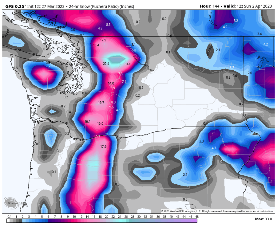
00z GFS the hits just keep on comin'. 10 Day Snowfall totals are absurd for the Cascades. C'MON!!!!
 3 points
 -
56/30 temp spread today very nice. We’re -3.1F as of today as well…average low temp has really been bringing the average down. 34.6F is the average with 9 freezes MTD.3 points
-
If a pattern change is imminent, I wouldn't mind an alternating pattern between open longwave troughing coming in from the SSW, and sharp, dynamic ridging. Would mean some days in the 70s and transitional lightning outbreaks, followed by days in the 40s and 50s and onshore cold core convective prospects. Also pretty widespread substantial precipitation. September 2013 is a perfect analog.3 points
-
I'm in that range and I gave it a B. Average snowfall but colder than average.3 points
-
Snow pile update!
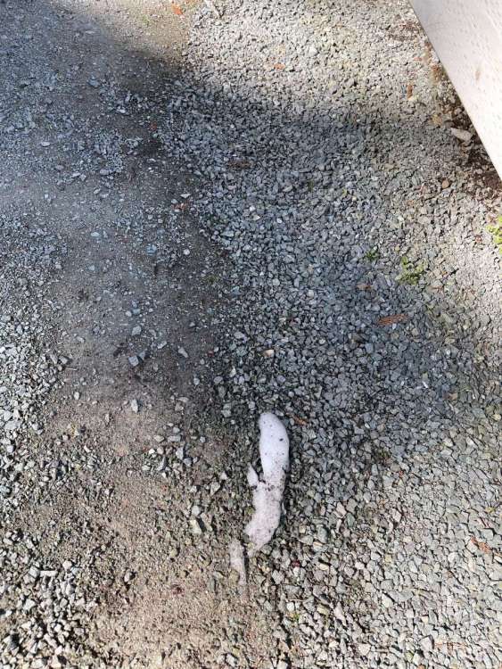 3 points
 -
Just noticed Medford is very close to their all-time coldest March on record. Currently they are at 42.2 on the month, with the record being 42.5 from 1952, extrapolating their forecast they would come in at 42.55, then March 1976 was 42.8, so they pretty much have a top 3 cold March locked up.3 points
-
12Z ECMWF is snowiest run yet for the weekend.
 3 points
 -
Nice. It shows it right over my place but you want to move it ten miles north of me so you can add to your 30 inches while I grovel at your feet with 12".3 points
-
Was very nice north of Everett, unfortunately for us south of there the southerlies pushed all the way up and it got into the low 40s before the arctic boundary pushed down. Places north of Seattle got a bit of snow before the transition but south of Seattle precip ran out right as it changed over. We did get ~1” of snow on the morning of the 21st though in the post frontal airmass IMBY but not everyone got something especially south of here.3 points
-
2021 https://fox12weather.wordpress.com/2021/04/11/cold-nights-a-sunny-april-week-ahead/ That surprised me too. Another surprising thing like that was that Eugene's record low for July was in July 2018 of all months3 points
-
Pretty sure it snowed here on April 1, 2020.3 points
-
PDX somehow managed a freeze during that warm month, 32 on 4/11. But then it torched after that3 points
-
That's impressive! SLE scored 4 straight sub-50 highs.3 points
-
We will see how April goes…but the way it’s looking could lean chilly atleast at the start. April 2020 and 2021 were pretty sunny and warm…almost as close to summer like as you could get in April. Will be interesting to see if we go with another chilly one this year.3 points
-
That has Randy's name written all over it... while there is a decent SW wind down here. The WB maps show a 925 temp of -1C or -2C at that time and its in the middle of the night so no sun angle to mitigate things. Here is the GFS snowfall map from Saturday morning through Sunday morning:
 3 points
 -
Temp continues to drop…The dry arctic front must be here! Down to 30.93 points
-
Yeah, haven’t had a wet or even average precipitation March since 2017 here. Has been wetter down south…probably going to finish with about 60-70% of normal this month. Atleast it’s been chilly.3 points
-
Wettest March in six years here. Although that really isn’t saying much since there have been nothing but fairly dry to really dry Marches in that stretch.3 points
-
Low of 30 this morning3 points
-
Yet another freezing low! 31! Currently 32 and frosty.3 points
-
Starting to feel like last spring except this is the cold and dry jimtastic version. We will see if it lasts the entirety of the spring though…at some point a more normal pattern has got to break through.3 points


This leaderboard is set to Vancouver/GMT-07:00