
Leaderboard


Popular Content
Showing content with the highest reputation on 05/09/23 in all areas
-
I remember when we used to just call them "high pressure systems." "Heat Dome" is one of those sciency-sounding terms that seem to have developed a kind of weird emotive resonance with the non-sciency pop culture crowd. Seems like it shows up in almost every weather and climate change story. "Polar Vortex" and "Atmospheric River" are a couple of others. I've seen nature shows on TV that give the term "Atmospheric River" a sort of mystical woo-woo quasi-religious significance. I remember when we just called them "Pacific storms," but that was before we knew much about them, and much of the modern technical understanding hadn't been developed yet.10 points
-
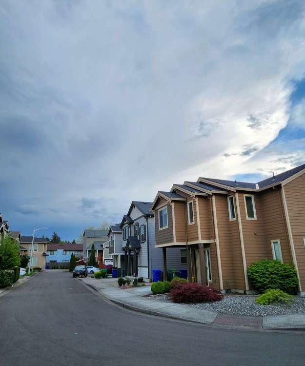
It’s not going to get that warm. The streets are still too cool because they haven’t fully warmed up from winter yet.7 points
-
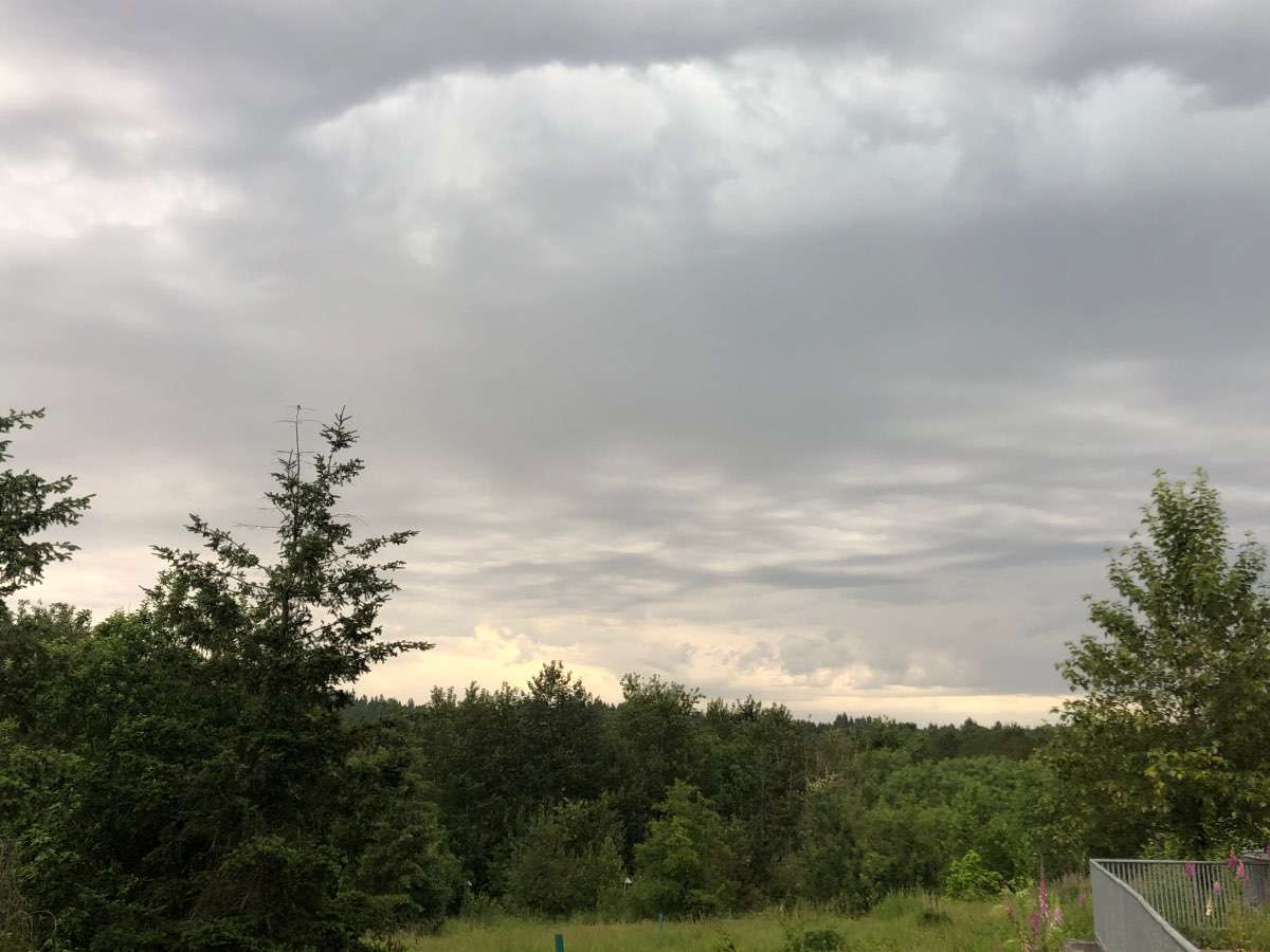
Beautiful afternoon in Lebanon.
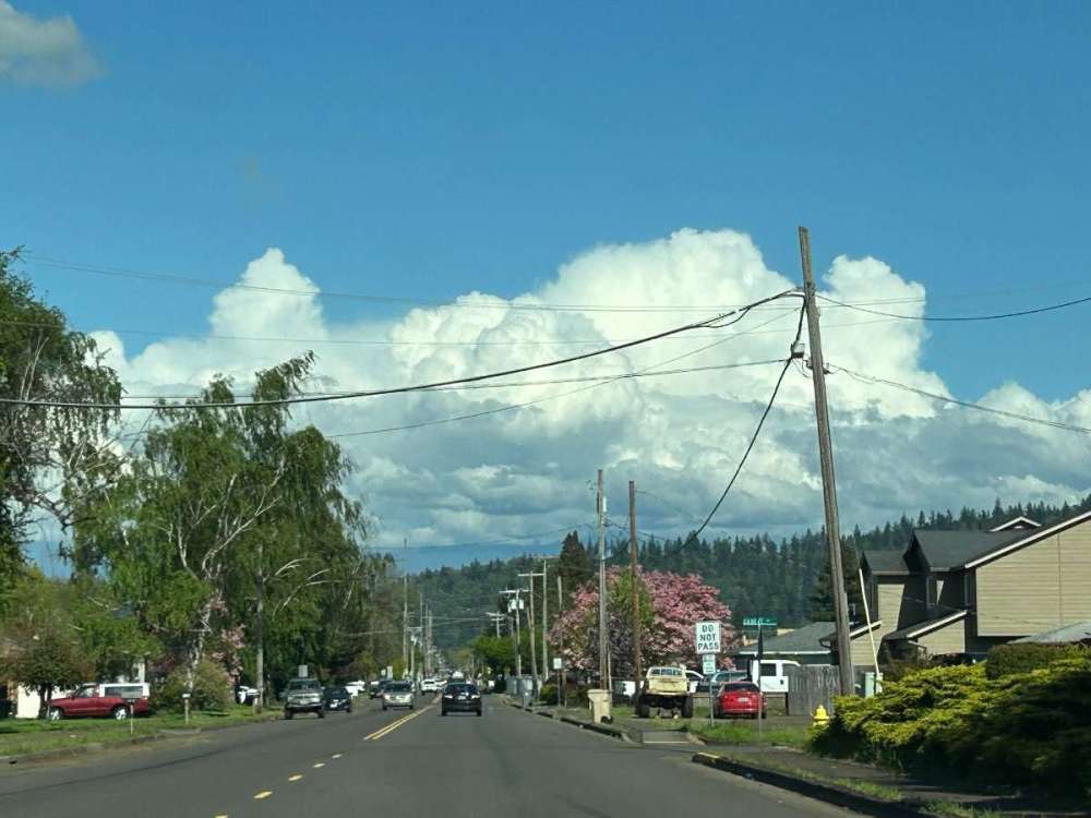 6 points
 -
That was an interesting event and prompted a severe thunderstorm watch over SW WA with it. First and only one that I'm aware of on the westside in midsummer. Portland's record is from 7/17/1941. Hit 100 and then there was a massive thunderstorm complex that night.5 points
-
PNW green on blue.
 5 points
 -
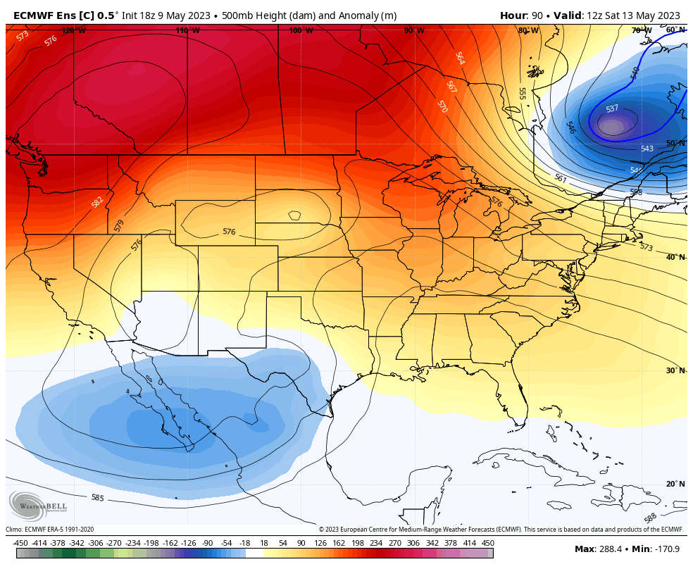
The ECMWF, EPS, and the control run all showed it. That carries more weight than the 18Z GFS. The 00Z run will probably bring it back.5 points
-
So I'm late in posting this but on Saturday my sister got quietly married on a farm about an hour south of Dallas and they had a nice canopy bought by the mother of the groom. She was going to give it to his sister for future parties on their rural acreage. But then a strong cell went through Ellis county, TX later that night and here's what it looked like the next morning. It was totally destroyed. The ground to cloud lightning that night was incredible and right after we made it to our hotel we had very heavy rain and wind for quite some time. Like nothing we have even in Eastern WA.
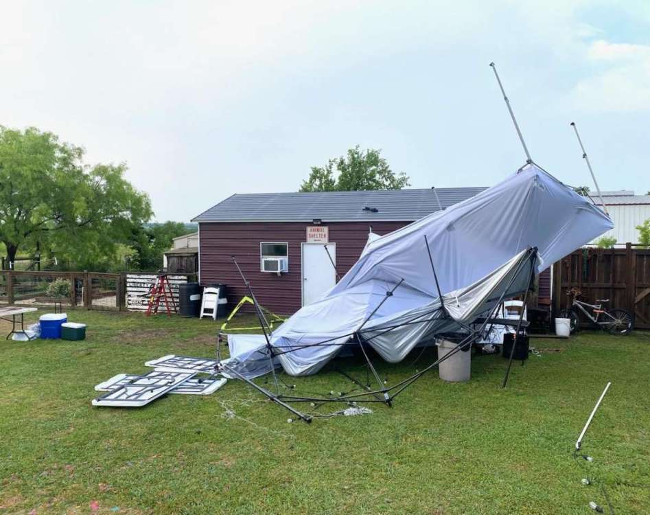 5 points
 -
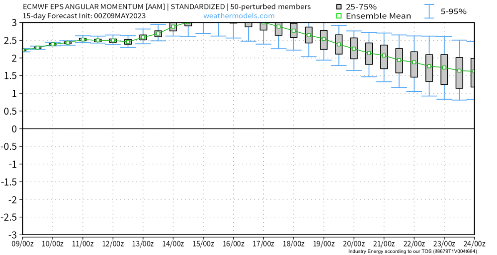
Simple/non-physicsy explanation: Earth and its atmosphere are both rotating (obviously). But sometimes, due to how the two interact, that momentum/rotary inertia may be exchanged between them. In fact it’s constantly being exchanged. But the overall angular momentum of the system (earth + atmosphere) is constant (conserved). +AAM (positive *atmospheric* angular momentum) describes a state where angular momentum has been transferred from the earth to the atmosphere (hence earth rotates a little bit slower, atmosphere rotates a little bit faster). Vice versa for the -AAM state. Depending on when these exchanges occur, where they occur (mountain torque is the reason, and there are many mountain ranges that can contribute), the rate at which it occurs, and its amplitude, the global circulation/wave dynamics can/will be affected (in a state dependent manner).5 points
-
Dewpoints in the uppers 50s and 60s and temperatures in the 80s with thunderstorms.
 5 points
 -
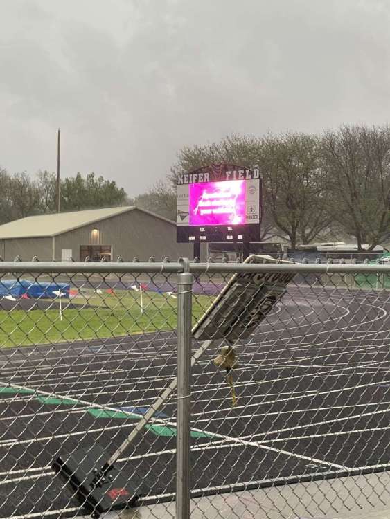
We are hosting district track today. We are obviously delayed, but a nice storm so far.
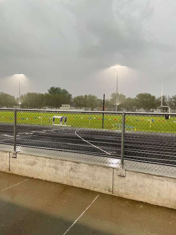
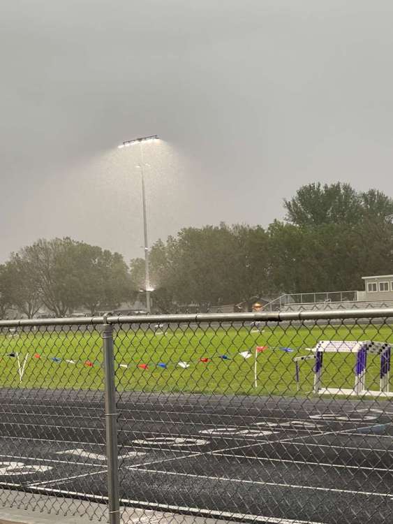
 5 points
 -
Right, and northern CA is much closer to the monsoonal tap and hasn't seen a noticeable difference either with the warmer summers, and it would stand to reason that they would probably see a more pronounced long term impact down there. The mechanisms for good moisture advection from the south in the midsummer require a little more 500mb volatility than we've seen recently as opposed to the sprawling/stagnant upper level ridges.4 points
-
This month has probably been the best for thunderstorms here since 2020. Not really saying much but we did see some decent lightning last week and I heard a good amount of thunder yesterday4 points
-
I haven't noticed much of a trend in recent years. There have been ups and downs... I'd argue the last three years have been unusually lacking outside of May 2020.4 points
-
Good. Should moderate surface temps some and provide potential boom boom fuel.4 points
-
The sun will definitely not be sticking to the roads according to Cliff…Except for maybe the side streets.4 points
-
18z GFS is delaying the low.4 points
-
In the winter (and most of the time, generally) it’s (typically) the effect of Himalayan/East Asian mountain torque (EAMT) that is most important in the PNW region, and North America/NH, more broadly. In fact, the majority of blocky, arctic-air delivering patterns in the PNW originate from dynamics in East-Asia/Eurasia, whether directly or indirectly. That’s always where I look first. Though of course, everything is connected in the system, so the amalgamation of components (the MJO/in-situ ENSO/low frequency states/RWB modes, various effects on+from the stratosphere in both the tropics and pole(s), and MT/AAM deposition/removal and meridional transfer thru eddys/z-cells + tendency + timing, etc) all work together in a slew of of intricate, state-dependent ways, on wildly varying timescales. It’s a giant mess that even our best computer models struggle to capture on timescales beyond a week, and sometimes even beyond a few days. And that will continue to be the case until we figure out a way to minimize the scale of parameterization of small scale physics. The problem is computing power more so than our knowledge of the atmosphere (though we are lacking there as well, in many areas).4 points
-
OMG yes please!4 points
-
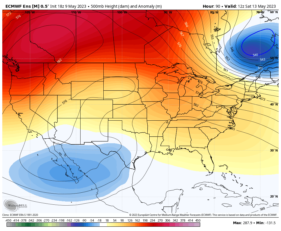
Not too often (ever) do you see a vort head due west from North Dakota to the Oregon Coast. Definitely a testament to the beefiness of the Canadian anti-cyclone.4 points
-
Here comes another chance. Hope it pans out.4 points
-
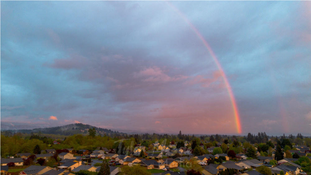
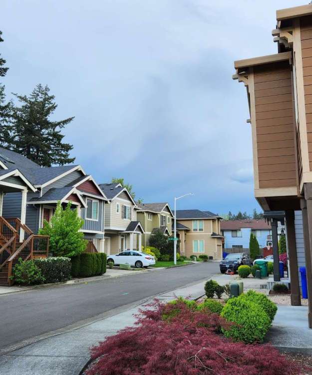
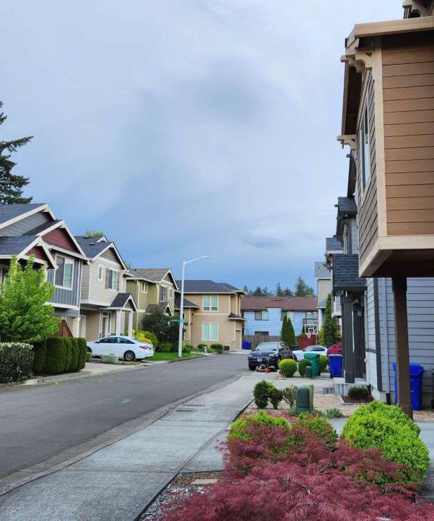
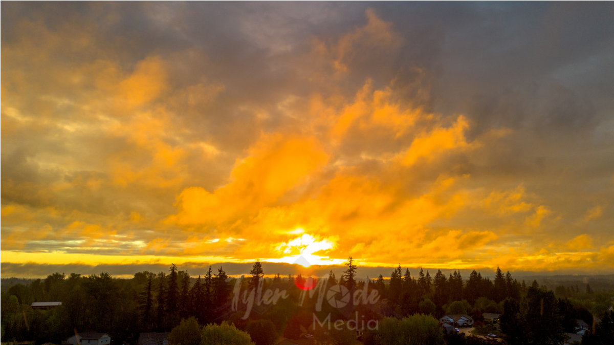
Perfectly timed sunbreaks for sunset tonight...

 4 points
 -
Gawddamn. Gonna be hard to function in that weather after such a temperate beginning to Spring. I'm not adjusted at all... 60F+ still feels warm to me3 points
-
A slushy inch.3 points
-
I wonder how many inches of sun accumulation we will get!3 points
-
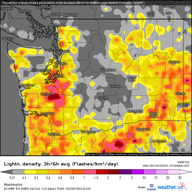
18Z EPS and control run only go through hour 144 but both clearly show westward moving disturbance.
 3 points
 -
Some moderate rain falling atm with the heavier storms moving by to my SW. I sure am glad to see water falling from the sky again.3 points
-
Make Tacoma Great Again! Bring back the old Tacoma Aroma!3 points
-
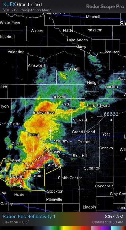
Watch this as the rain shield to the north hits my county just like hitting a wall. My county is the one between York and Columbus. Rain shield goes from yellow, green to nothing as it goes across my county. Just tough to break through; drought is the hardest thing to bust. More chances throughout the week but it's tough to get anything major to affect the large chuck of exceptional drought.3 points
-
Yeah but so is this. Models aren’t bluffing.
 3 points
 -
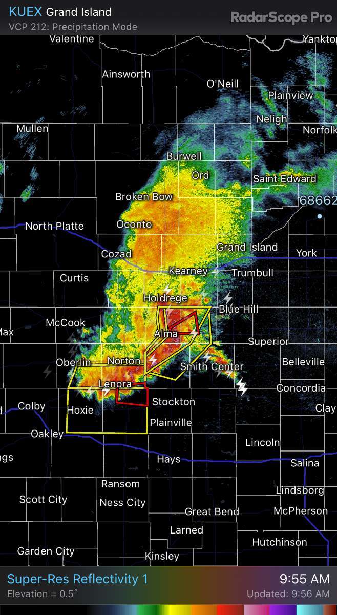
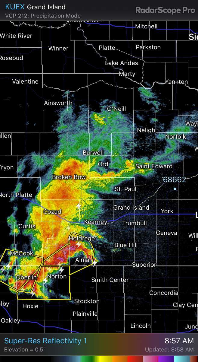
Don't think I have ever seen tornado warnings in nebraska in the morning!!!
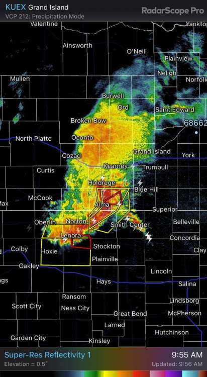 3 points
 -
Central NE. But I also have family in south central KS and various other states.3 points
-
Getting a nice rain. Worst did just go south of town. But with track today, everyone is hoping it moves through. Our high school has no school today as teachers help with district track. They will delay as long as possible with state spots on the line.3 points
-
53º for a high today. Looking like it could be 40º warmer than that by this weekend. 0.22" rain on the day, 0.70" on the month, 26.18" since October 1.3 points
-
May 2020 was awesome.
 2 points
 -
This is a forecast that we love to see.2 points
-
Yes! Things were always better in the old days!!2 points
-
See? Reminded you of the OLD Tacoma smell. Modern Tacoma smells like a fresh mountain breeze wafting gently from a forest of tall pines.2 points
-
We actually stayed at Clearwater River Resort. It was fine and relatively cheap. But when we got there on Friday night they had Larry the Cable Guy performing and there was literally no parking anywhere. One other note... they have a paper mill on the river there that reminded me of the old Tacoma smell. It was bad!2 points
-
2 points
-
Sorry guys to rant, last post. Just two days ago the circled area for 7 day qpf was 2-3". We are now down to .25-.50". Just frustrating.
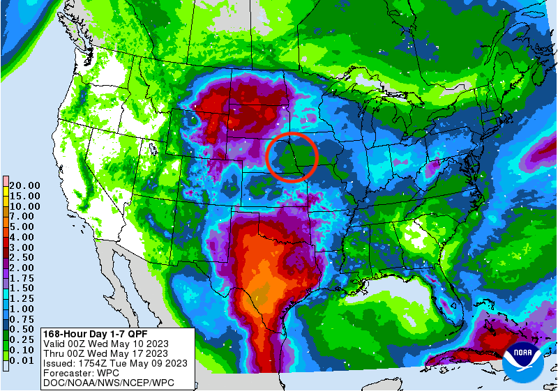 2 points
 -
Will be interesting to see what this "tropical punch" type storm out of the TX Gulf region does. I know N TX needs the rainfall still, especially western areas. Seeing this storm cycle through on models, along with the ensuing trough that ships it out of here is one of the reasons I have to agree with seasonal models indicating a cooler than average and shorter than average summer overall. When you see ridges get "attacked" by troughs like that, going to be hard to set up any large-scale heat domes like in years past. I think our northeastern cities and farthest north will struggle with most above average temperatures this summer. Mainly due to persistence but also likely still NAO/AO region influence being greater than old -enso/pdo ridging influences upstream.2 points
-
I'm diggin' what I'm seeing out here starting on Mother's Day and into the following week. A very unusual set up is going to occur that doesn't typically happen till around late June with the Monsoon. DP's are to surge into the 40's/50's (which isn't saying much for the rest of ya'll) but this will fuel up storm action across the mountain ranges and push SW into the valley. I would love to see some severe storms bc this would be a "first" for me to experience it in the month of May.2 points
-
Rain continues with lightning. Our track meet has now been delayed for 3 hours.2 points
-
Gonna be close for you @CentralNebWeather. The main line looks like it's splitting. I have seen this before, the southern part of this line will head into Kansas and the northern half is gonna die out. Hope you get some rain but not looking good down stream towards us in the eastern end.
 2 points
 -
Some first-class quality torching in the .
 2 points
 -
I keep forgetting to post my rainfall. The last round of storms from that MCS rolled in around 1:00 a.m. Lots of lightning and thunder at first with brief heavy rain. Light to moderate rain continued till ending near dawn. Got another about 0.90", or about 1.60" with last evening. Basically around or a bit over 2" total since the first rain Friday evening.2 points
-
A little thunder here. Heavy rain and hail one mile east of here.
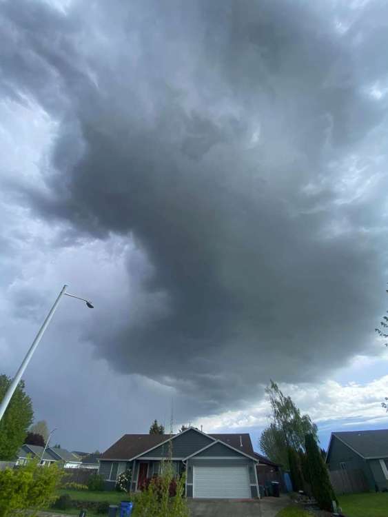 2 points
 -
I'm in between this storms! Just heard thunder
.thumb.gif.54d5340368900ef49067d9ca7c9b9d03.gif)
 2 points
 -
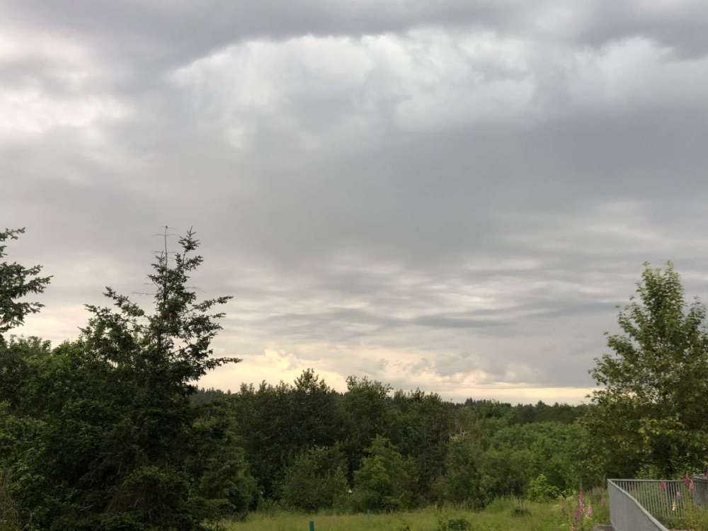
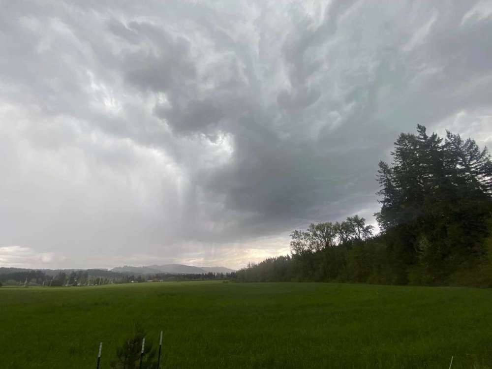
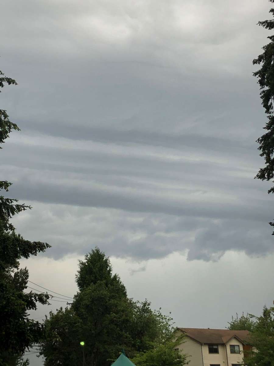
Check out the thunder head
 2 points
 -
Yes. I ski year round, which explains my desire to avoid unrelenting heat domes.2 points


.gif.16bcfc3a2286502e1e09da8051047b8d.gif)


This leaderboard is set to Vancouver/GMT-07:00