KTPmidMO
-
Posts
96 -
Joined
-
Last visited
Recent Profile Visitors


KTPmidMO's Achievements
")


-
January 2024 Observations and Discussion
KTPmidMO replied to Minny_Weather's topic in East of the Rockies
So is this saying temps may not stay warm for very long or the warmer temps will be colder than possibly forecast? -
January 14-16 Major Winter Storm and Arctic Blast
KTPmidMO replied to Black Hole's topic in East of the Rockies
Snow seems a little further south in Kansas than what short term models were predicting? RAP and HRRR saying just to the east of Salina, KS could pick up 4 inches of snow. No big models were picking up on that and RAP and HRRR seem to be reflecting that at the last minute as well. anyone close to these areas? -
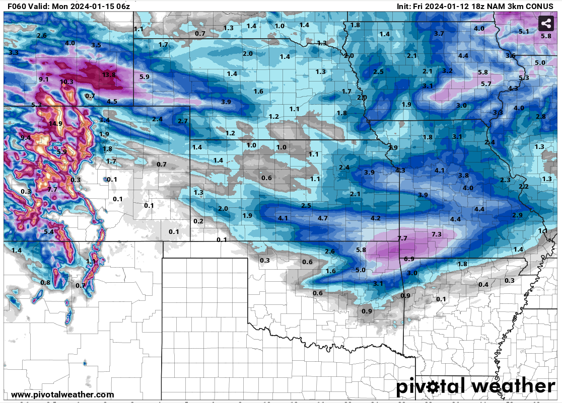
January 14-16 Major Winter Storm and Arctic Blast
KTPmidMO replied to Black Hole's topic in East of the Rockies
18z NAM 18z NAM 3km Starting to maybe find a little bit of hope for a decent snow here in mid Missouri?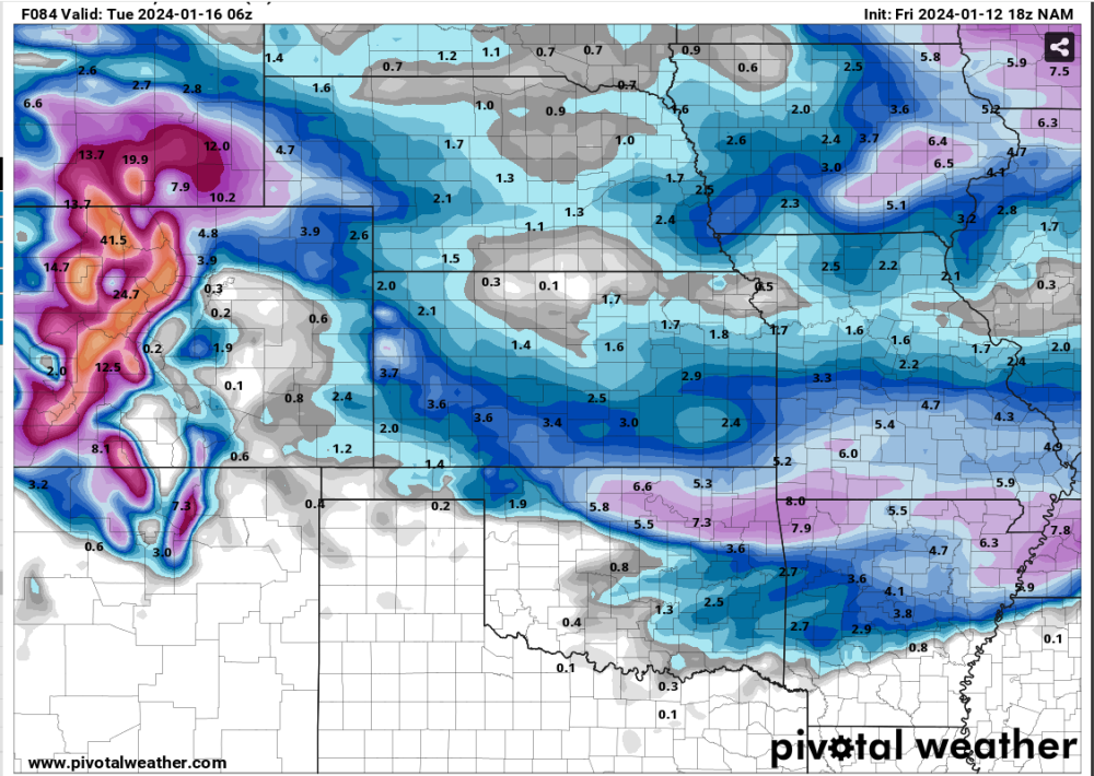

-
January 14-16 Major Winter Storm and Arctic Blast
KTPmidMO replied to Black Hole's topic in East of the Rockies
That's what I'm hoping. NAM and NAM 3km seem to be further north with it. The NAM has been spot on with these last 2 storms. It was the one that had the further north solution from the beginning and we all thought it was drunk only to prove us wrong in the end. So is the further north solution that the NAM is showing gonna happen and all other models will play catch up again? I don't know but that's my hope right now. lol -
January 14-16 Major Winter Storm and Arctic Blast
KTPmidMO replied to Black Hole's topic in East of the Rockies
What's the chance of this coming back north a bit? I know models this year have trended north 3-4 days prior to the storms so wonder if this will do the same? I just really want to cash in on one of these storms. Not getting in on the first 2 so hoping for a north trend at this point. -
January 11-13 Major Winter Storm/Blizzard
KTPmidMO replied to Hoosier's topic in East of the Rockies
Do you have the Central US one for this through the whole storm? Thanks in advance -
January 14-16 Major Winter Storm and Arctic Blast
KTPmidMO replied to Black Hole's topic in East of the Rockies
Boy I swear, got missed by the storm last week, gonna get missed by the storm this week. Was hoping to cash in on this one but the trend for it looks like it may miss me to the south. What do I have to do?! Is there an Indian dance for snow? lol -
January 11-13 Major Winter Storm/Blizzard
KTPmidMO replied to Hoosier's topic in East of the Rockies
Yeah I haven't had a good feeling about this storm for central Missouri for a couple days now. Maybe I'll get proved wrong but I don't know. I'm more interested in the Monday system. Most models are putting a WIDE area of snow down on Monday and ratios look to be 20:1 or better. -
January 11-13 Major Winter Storm/Blizzard
KTPmidMO replied to Hoosier's topic in East of the Rockies
Right now, it seems like most models have it bombing out just after getting through Missouri. I hope that's not the case. -
January 11-13 Major Winter Storm/Blizzard
KTPmidMO replied to Hoosier's topic in East of the Rockies
So being here in mid Missouri, I need to try to bank in on that second low? -
January 11-13 Major Winter Storm/Blizzard
KTPmidMO replied to Hoosier's topic in East of the Rockies
All the numbers around the L is the possible Low location and strength from different members correct? If I am correct in that, are you telling me that some members have the low down in Texas while some members have it in Iowa? Thats crazy. -
January 11-13 Major Winter Storm/Blizzard
KTPmidMO replied to Hoosier's topic in East of the Rockies
And you say that, why? -
How is everyone's actual temps comparing to hourly forecast temps? Mine appears to be a few degrees colder at 36 compared to the forecast 39 at 10 AM.
-
Does anyone have a good radar that they use? Want something that reflects good. What does everyone use?
-
Much further south here in missouri. Have to watch temp profiles and radar as its happening to see if this will verify or not.