Beltrami Island
-
Posts
368 -
Joined
-
Last visited
Everything posted by Beltrami Island
-
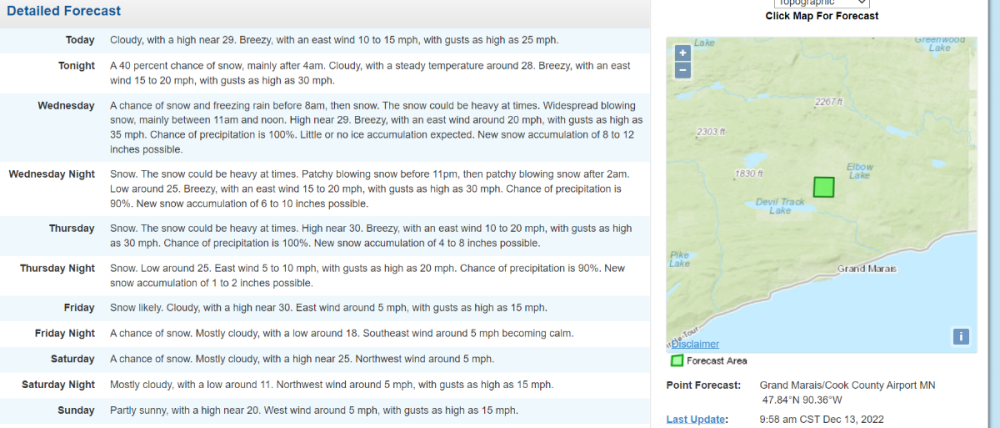
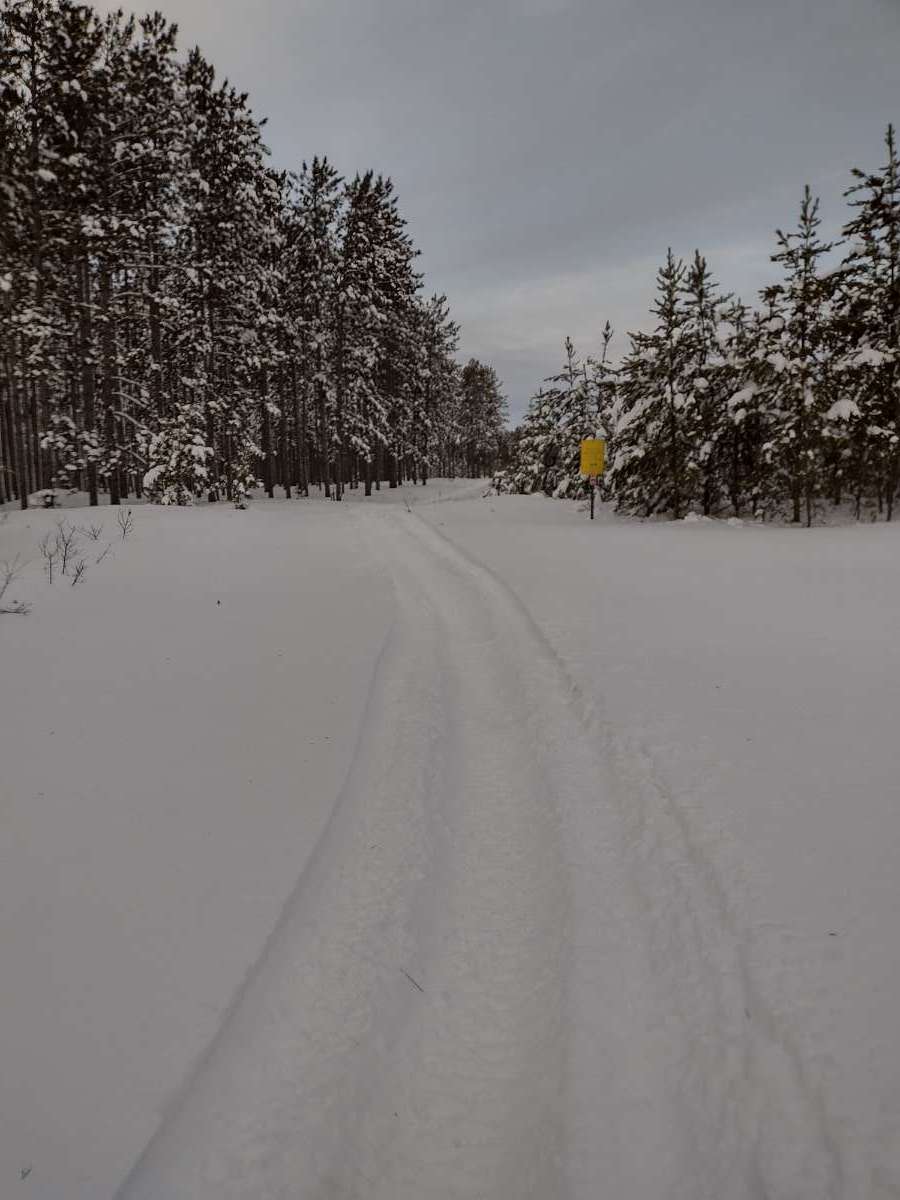
Been snowing good here since noon, which was a little later than forecasted. Supposed to get 5-8" by tomorrow afternoon. Snow is dry and winter like, and wind is blowing it around good. Funny thinking back to the March like slushy snow we got back in December, things are flipped around.
-
March 2023 Observations and Discussion
Beltrami Island replied to Tom's topic in East of the Rockies
Zilch. The only measurable snowfall Ive had since Dec 23 was 5" of super fluff over two days mid jan and a fluffy 2" on presidents day. Pretty frustrating watching southern and central mn getting hammered while I am looking at old crusty sun baked snow from the week of 40s in early Feb. -
February 2023 Observations and Discussions
Beltrami Island replied to Iceresistance's topic in East of the Rockies
If you were able to extend the map into Saskatchewan and Manitoba it wouldn't look so anomalous. That whole prairie prairie area has had pretty paltry qpf all winter even compared to their typically low averages. I would fully expect a spring snowstorm for the area at some point, if not, then an early fall snowstorm is not unusual. Most of that areas BIG storms are outside the normal cold season. If neither of those two happen, its conceivable with a quiet Nov-Dec 2023 they could go 365 days without a WSW. West Virginia also is a glaring gap, not sure what is going on there. I would think the higher terrain in that area could eek out some heavy snow in warm/wet pattern for the eastern US. -
February 2023 Observations and Discussions
Beltrami Island replied to Iceresistance's topic in East of the Rockies
This has been the most boring winter since Christmas in NW MN and ND. Bismarck CWA up to 70 days without a winter storm warning issue. Grand Forks was up to 57 days prior to earlier this week, the string ended only because a couple of the far SE counties in their CWA were issued a WSW. There have been a few Blizzard warnings but there was not much if any snowfall associated with those. 33 days for the UP seems odd, I guess Lake Effect warnings and advisories may have been issued in their case. -
February 2023 Observations and Discussions
Beltrami Island replied to Iceresistance's topic in East of the Rockies
I know its not talked about much here but that 0.4"+ band over nw ontario would equal or surpass snowfall and QPF those areas have received all cold season. Dryden, ON only has 3-4" of snow on the ground. Its hard to believe how much of a dividing line has developed this year in the storm tracks. Everyone talks of cutters here but those cutters really hit a brick wall once the get to the great lakes the this year.
-
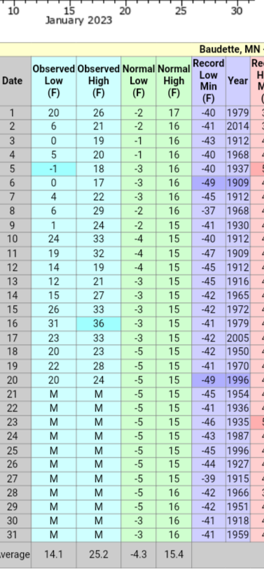
January 2023 Observations and Discussions
Beltrami Island replied to Clinton's topic in East of the Rockies
It's not exactly been a classic January here either. No measurable snow since Christmas either.
-
January 2023 Observations and Discussions
Beltrami Island replied to Clinton's topic in East of the Rockies
We have had the longest stretch of freezing fog/freezing mist over the last 5 days I have ever experienced. Nearly everything outside is flocked in thick frost. Pictures don't do it justice. -
This is the chicken or the egg problem because if cold air was in place, the gulf moisture in that amount wouldn't be making it that far up north most of the time.
-
December 2022 Observations and Discussion
Beltrami Island replied to Iceresistance's topic in East of the Rockies
These guys should have some interesting observations and videos over the next few days. https://www.youtube.com/@utahavalanchecenter/videos -
December 2022 Observations and Discussion
Beltrami Island replied to Iceresistance's topic in East of the Rockies
Yesterday Last March same spot with 24+". Didn't think I'd ever see a comparable picture to last march, let alone before new years.
-
Pre-Christmas Storm Plains/MW/GL 12/21-12/22
Beltrami Island replied to bud2380's topic in East of the Rockies
My wife's relatives in central IL aren't taking to kindly to single digits below 0 and -30 wind chill. Meanwhile we have the same conditions here and the reaction is, meh, its gonna be 30 in a week so what's the fuss. -
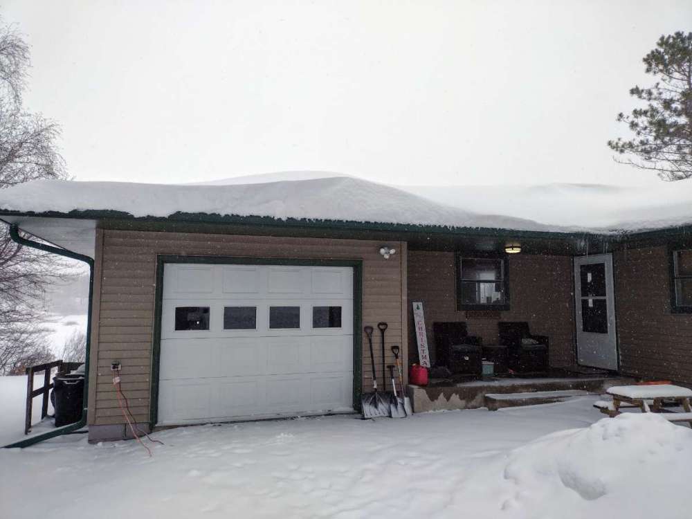
Adding it all up I think I have accumulated 7-8" of some of the wettest snow I have seen. Up here it is a bizarre feeling clearing snow in December with a light jacket and no gloves. This sticky wind blown snow has really made a pile on my roof.
-
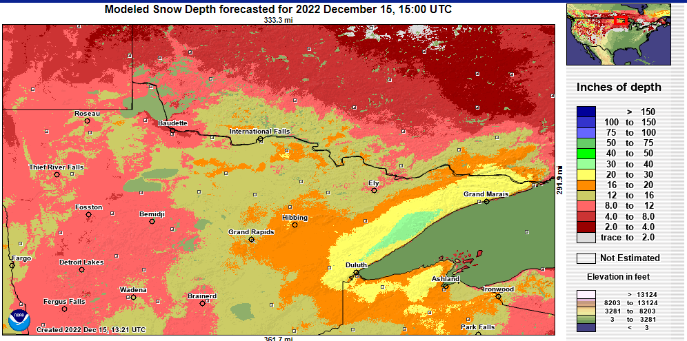
A good stretch of 30"+ showing up on here...
-
So what is the best mesoscale model for snowfall out to 24-48 hours? I see a bunch on tropical tidbits and pivotal weather but usually winter snow system move so fast by me they are not very accurate or worth looking at.
-
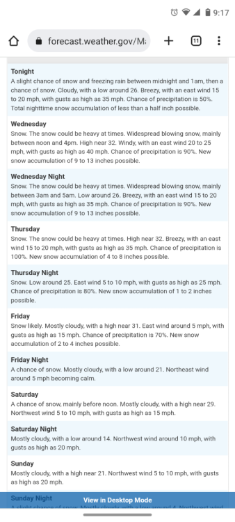
Point forecast for the same spot I posted before ups the total to 23-36" plus 2-4" more on Friday. If I were reading this blind I would be crazy to guess it is anywhere in Minnesota. Pacific Northwest, or someplace just above Valdez AK would be reasonable guesses.
-
I think this is the most snow I have seen for a point forecast in Minnesota, 19-32" through Thursday night. I am skeptical of the high end, but if there is an area in minnesota that can do this, this is it. 1100 feet of orographic lift with flow coming straight off the lake...
-
December 2022 Observations and Discussion
Beltrami Island replied to Iceresistance's topic in East of the Rockies
50f temp swing to near or above freezing starting this morning to Friday. Not the point of your post, but those record highs for DVL just highlight some terrible years for winter weather enthusiasts in the north central US: 97-98, 98-99, 99-00, 02-03, 11-12, 15-16, -
Election Day - Veteran's Day Major Winter Storm
Beltrami Island replied to Tom's topic in East of the Rockies
RGENT - WINTER WEATHER MESSAGE National Weather Service Grand Forks ND 1210 PM CST Wed Nov 9 2022 MNZ006-009-120000- /O.UPG.KFGF.WS.A.0010.221110T1200Z-221112T0000Z/ /O.NEW.KFGF.WS.W.0008.221110T1000Z-221111T1600Z/ Lake Of The Woods-North Beltrami- Including the cities of Baudette, Red Lake, Redby, and Ponemah 1210 PM CST Wed Nov 9 2022 ...WINTER STORM WARNING IN EFFECT FROM 4 AM THURSDAY TO 10 AM CST FRIDAY... * WHAT...Heavy mixed precipitation expected. Total snow accumulations of 6 to 16 inches and ice accumulations of around one tenth of an inch. Winds gusting as high as 50 mph. * WHERE...Lake Of The Woods and North Beltrami Counties. * WHEN...From 4 AM Thursday to 10 AM CST Friday. * IMPACTS...Travel will be very difficult. The hazardous conditions will impact the morning or evening commute. Gusty winds could bring down tree branches. * ADDITIONAL DETAILS...Snowfall rates of over an inch an hour are possible. PRECAUTIONARY/PREPAREDNESS ACTIONS... If you must travel, keep an extra flashlight, food, and water in your vehicle in case of an emergency. The latest road conditions for North Dakota can be found at dot.nd.gov/travel and for Minnesota at 511mn.org, or by calling 5 1 1 in either state. -
Election Day - Veteran's Day Major Winter Storm
Beltrami Island replied to Tom's topic in East of the Rockies
I am not sure where these NWS percentages come from, they feel like throwing darts to some degree. I am at 91% for 6 inches and 58% for 12". I am guessing what ever falls, in a week it will compact down to 4" or less with no frost in the ground. If this snow holds through to the heart of the cold season that would be a great base. -
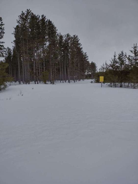
October 2022 Observations and Discussion
Beltrami Island replied to Tom's topic in East of the Rockies
-
October 2022 Observations and Discussion
Beltrami Island replied to Tom's topic in East of the Rockies
First non-rain of the cold season falling this morning here. Considering it was near 70 yesterday that's a pretty big change in about 18 hours. -
August 2022 Observation & Discussion
Beltrami Island replied to Timmy Supercell's topic in East of the Rockies
This is from last week but still thought it was cool enough to share.
-
I happen to visiting inlaws in the northern suburbs, just north of the lake/cook county line. Had sirens going, even though I don't think we were technically in the tornado warning areas. No real damage on the north side of the storm except for a close lightning strike took out cable tv/internet.
-
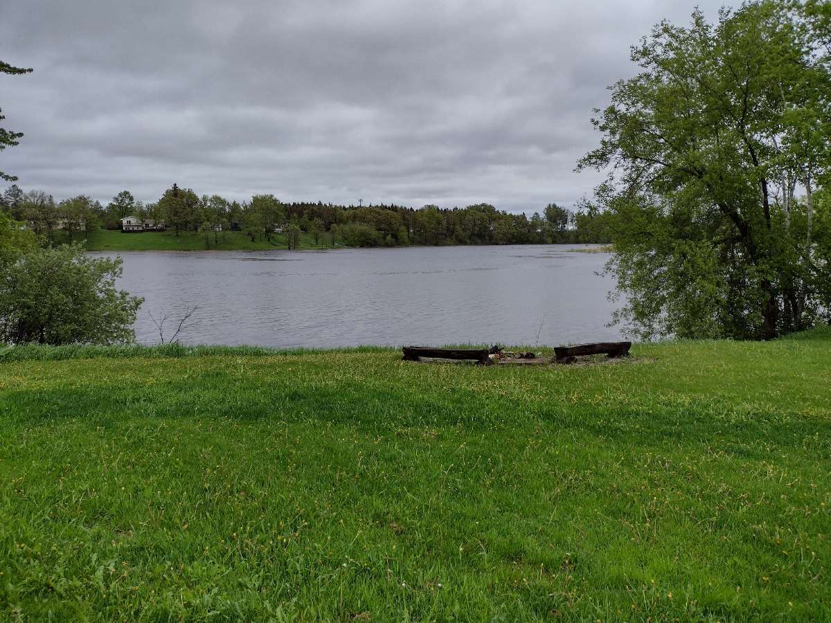
Very dramatic difference from 10 months ago. Record low water levels to approaching all time record highs in some spots in the lake of the woods watershed beating out 2014.
.thumb.jpg.4ccc02738e9097598247598a0d0c6f4d.jpg)

-
May 2022 Observations & Discussions
Beltrami Island replied to Iceresistance's topic in East of the Rockies
A few snow showers here this am. Only lasted a few minutes, but still it's may 21, a bit ridiculous even for my location


.jpg.accd0c350e0e4110b7e6b09a7d0a6797.jpg)