Beltrami Island
-
Posts
368 -
Joined
-
Last visited
Everything posted by Beltrami Island
-
May 2022 Observations & Discussions
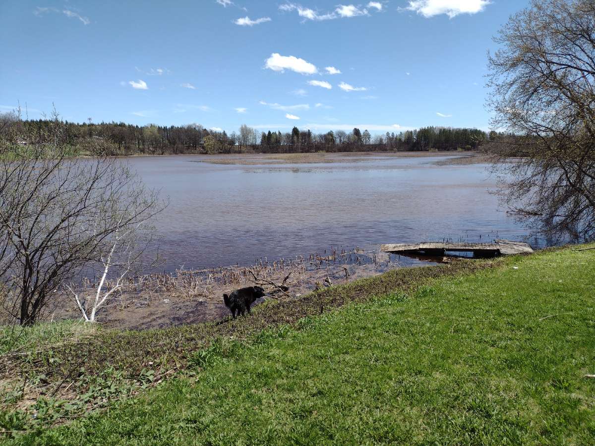
Beltrami Island replied to Iceresistance's topic in East of the Rockies
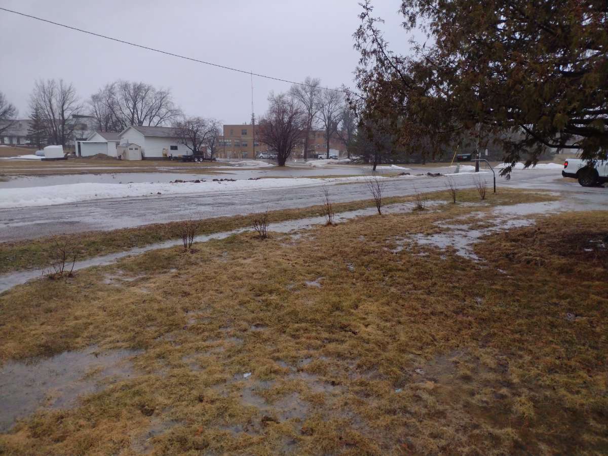
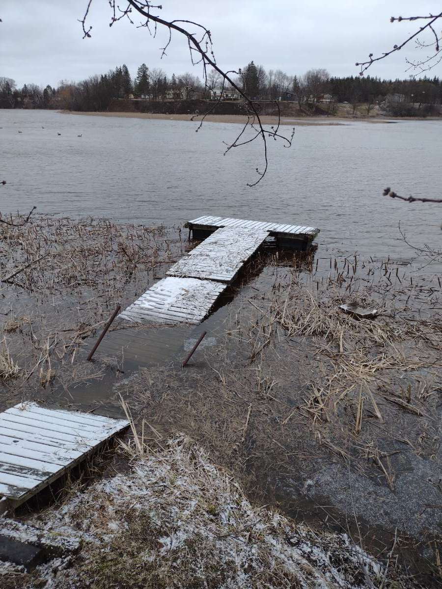
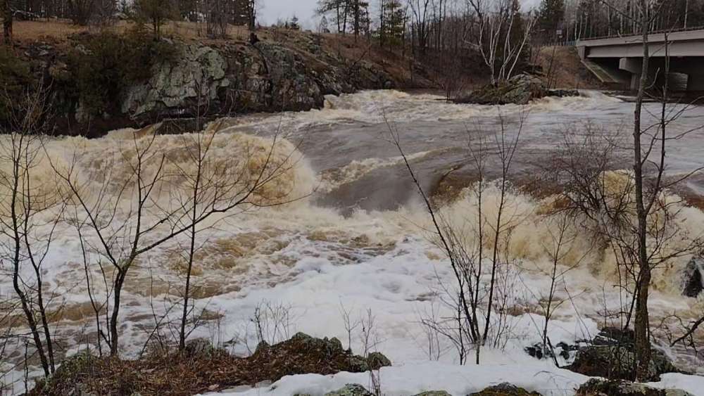
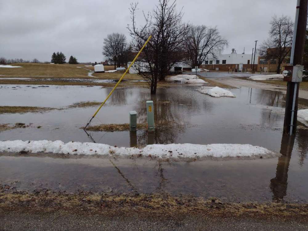
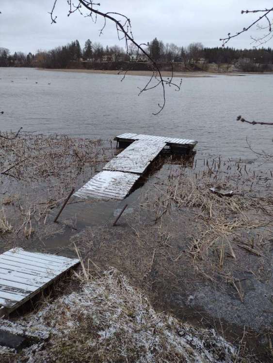
Crazy difference 9 months makes. This picture would have looked like a hay field more than water front last August. Cattails getting flooded out... Water still coming up from rains last night.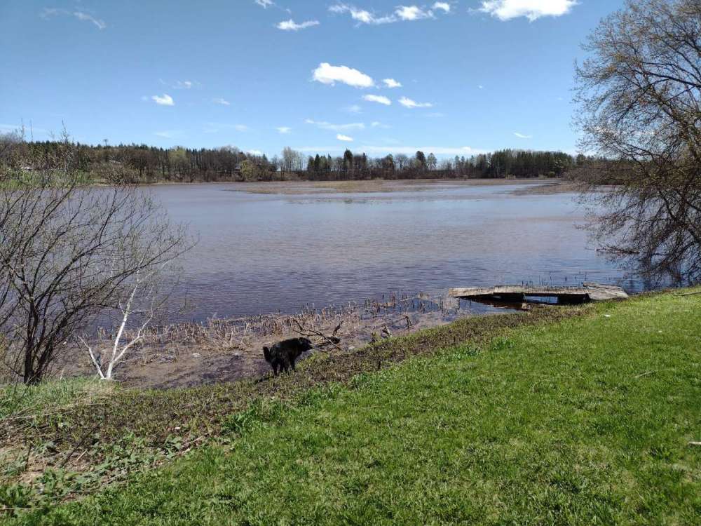
-
May 2022 Observations & Discussions
Beltrami Island replied to Iceresistance's topic in East of the Rockies
May snowmobiling in..... Minnesota https://www.hardcoresledder.com/threads/riding-in-may.1886445/ -
April 2022 Observations & Discussions
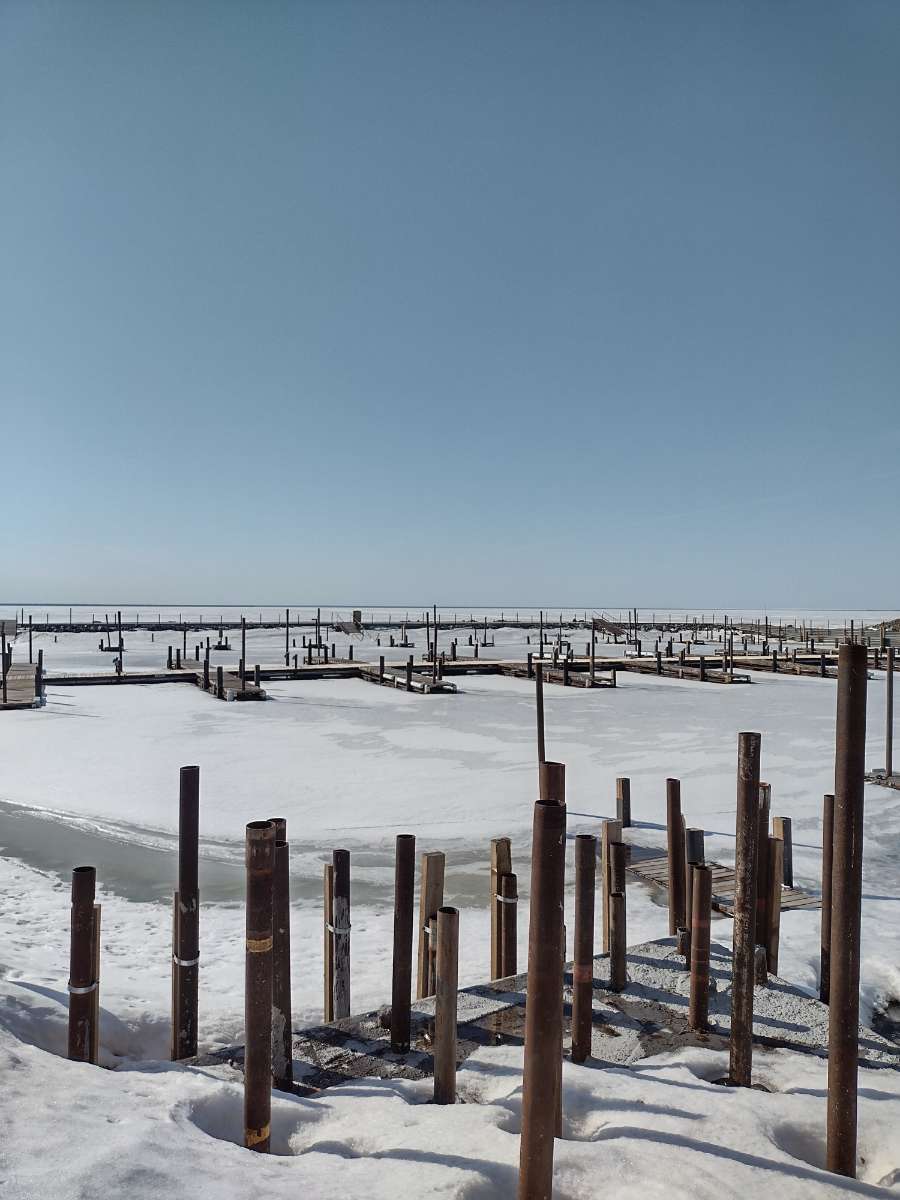
Beltrami Island replied to Iceresistance's topic in East of the Rockies
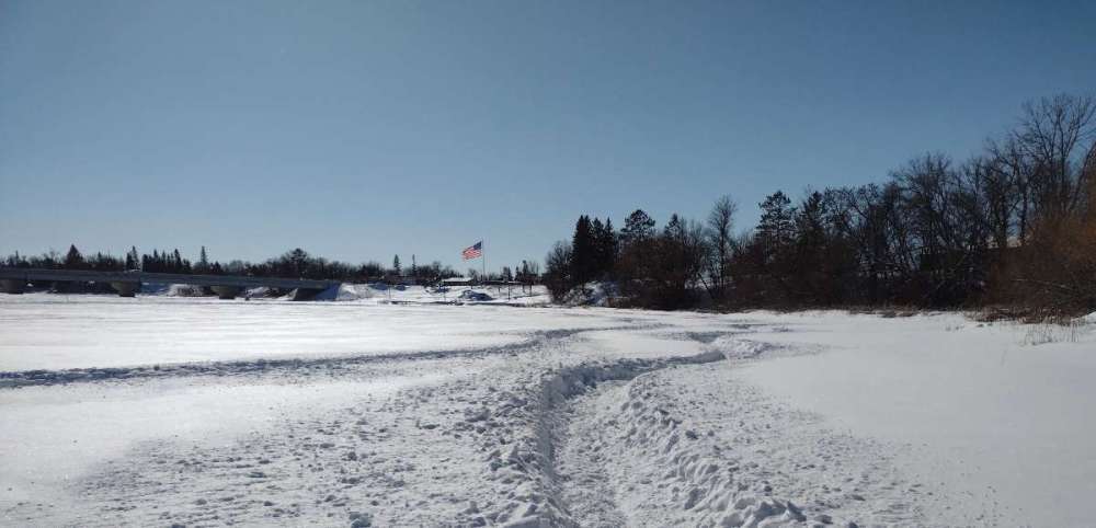
You are not alone. I have heard of quite a few people the last few days come to the realization that many lakes up here are still going to have ice well into May. 2014 and 1996 ice outs are going to be about the only other years comparable to this year. Photo of lake of the woods (rocky point) from yesterday, no open water even hinting at showing yet.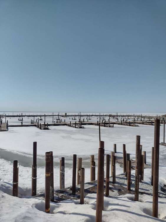
-
April 2022 Observations & Discussions
Beltrami Island replied to Iceresistance's topic in East of the Rockies
Some pics from the last few days. snowmelt plus rain plus frozen ground is a poor combo. Can I send some water to you guys in Nebraska? Just gotta come and get it before it gets to Hudson Bay.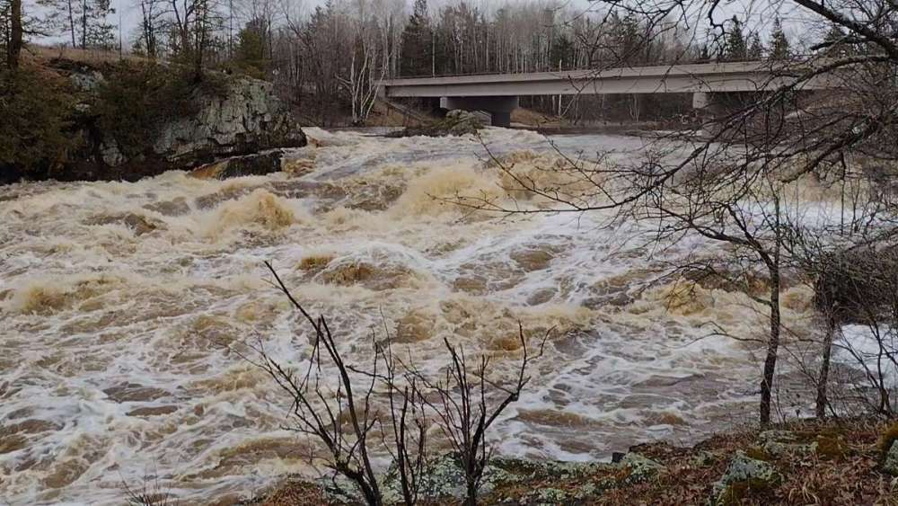

-
April 2022 Observations & Discussions
Beltrami Island replied to Iceresistance's topic in East of the Rockies
Just another 6-10" snowfall in the Minnesota arrowhead/north shore. I would not be surprised if the spine of the ridge along the north shore near grand marais mn has seen spots with 200" accumulation this season. Localized locations within a few miles of Superior in that area have 1000' of elevation rise to enhance the snow with the right fetch. There aren't really any reliable weather stations in that area though.
-
April 2022 Observations & Discussions
Beltrami Island replied to Iceresistance's topic in East of the Rockies
I don't know the specifics of spring 1996 other than it was cold in general. April 2008 had some significant snowstorms, but these were disconnected from the "winter", where the winter snowpack had all melted. 2013-14 was an epic winter but kinda flipped to spring after the first week of April. April 2013 is the only thing comparable to this April I can think of. I remember hearing guys getting stuck snowmobiling the MN north shore trail on May 1. -
3-29 to 3-31 No Joke About It Big Dog
Beltrami Island replied to Madtown's topic in East of the Rockies
Heck, I am 50 miles further north latitude than Ely, and I can see Canada. Yes 2013 was one of the latest springs I can remember, 2014 was right on its heals. For that Ely cam to truly look like a good midwinter scene, the snow would need to be nearly up to the thermometer. -
March 2022 Observations and Discussions
Beltrami Island replied to Hawkeye's topic in East of the Rockies
Let the meltdown commence, I guess, well it had to happen eventually. I wish it could have waited until after this coming weekend. 40 at noon already. Seeing blacktop on some city streets I haven't seen since mid December. -
March 2022 Observations and Discussions
Beltrami Island replied to Hawkeye's topic in East of the Rockies
Thanks. I love it so far. Coming off a 14 year old sled it's night and day to my old one -
March 2022 Observations and Discussions
Beltrami Island replied to Hawkeye's topic in East of the Rockies
Looks like last day of "winter" is tomorrow. Endless forecast if 30s and 40s beyond. Finally got my new toy just in time for this last weekend.... Not sure why the side ways pics?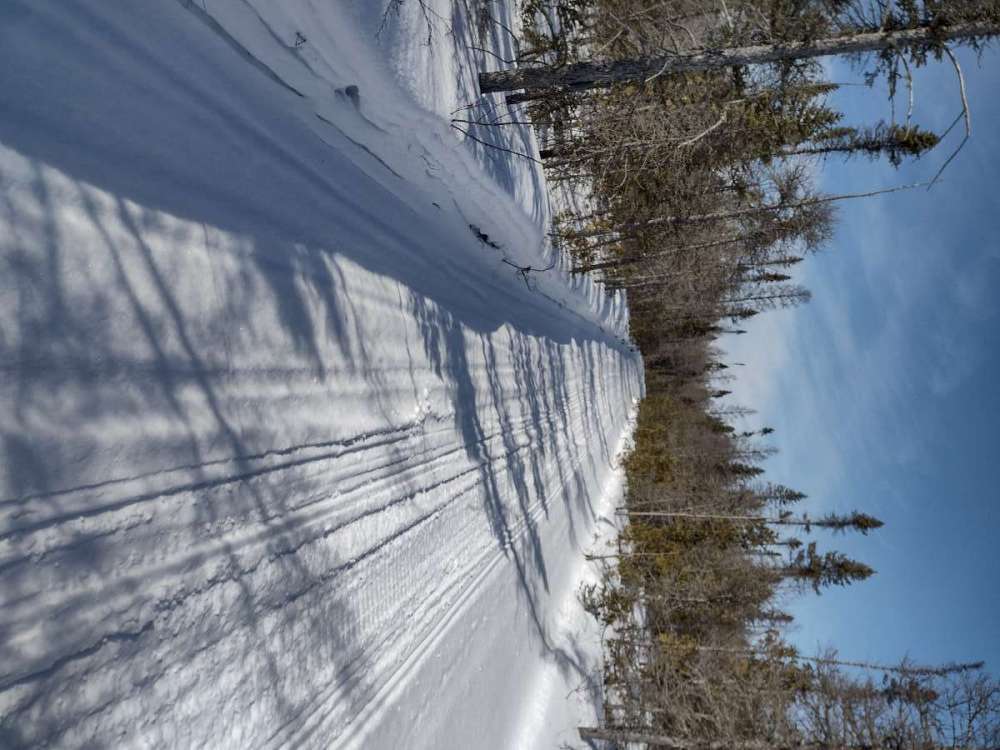

-
March 2022 Observations and Discussions
Beltrami Island replied to Hawkeye's topic in East of the Rockies
Yeah 3' of ice is nothing on LOW this late in the year, the only reason its not close to 5'+ is because of the thick snowcover insulating the ice. My snow on the ground is still close to 18" I'd guess and that's with no significant snow for 2 weeks. -
March 2022 Observations and Discussions
Beltrami Island replied to Hawkeye's topic in East of the Rockies
Looks like I am going to register 6 or 7 of the first 12 days of March with below 0f lows. Saturday am looks like the last likely below 0 low for this cold season. Of course I have had a few years with below 0f days in April as well. -
Sadly, the storm tracks would have to shift way nw for me to realistically hope for significant snow over the next 10 days....Duluth would have to be in the warm sector entirely. This storm track is classic minnesota precip climo, which leaves me in a position oh so close but out of the snow/precip shield. I can think of many instances where Ifalls 60 miles to my east gets 6"+ snow and I am left high and dry. I have 24" snow depth on March 2nd, and a week+ of solidly below freezing days ahead, so I can't really complain if I get missed over the next 10 days.
-
Those Pivotal weather map pink scaling always look shocking to the eye. Compare it to tropical tidbits and it looks wet and stormy but nothing crazy for early march.
-
February 2022 Observations and Discussions
Beltrami Island replied to Grizzcoat's topic in East of the Rockies
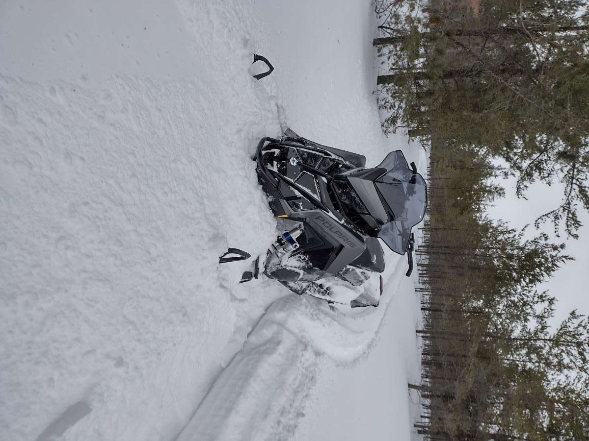
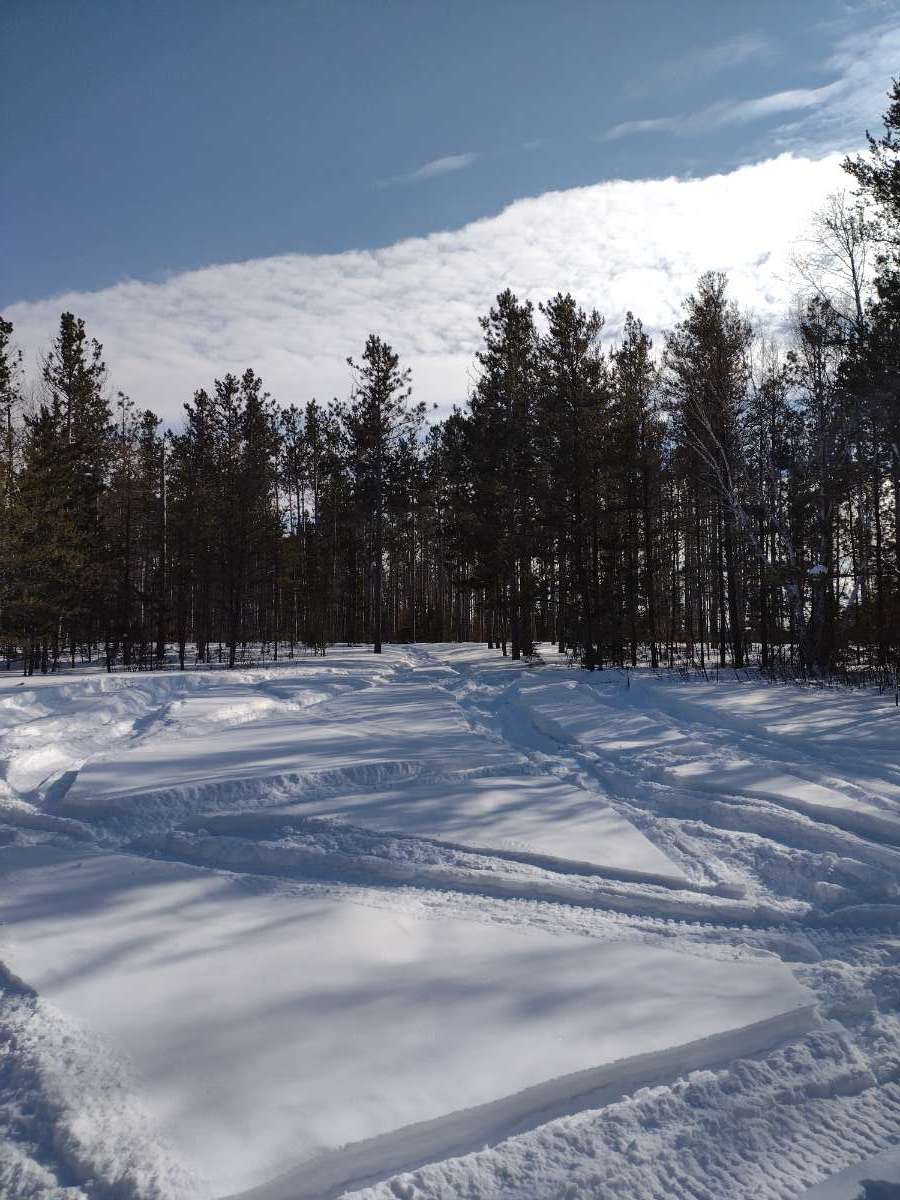
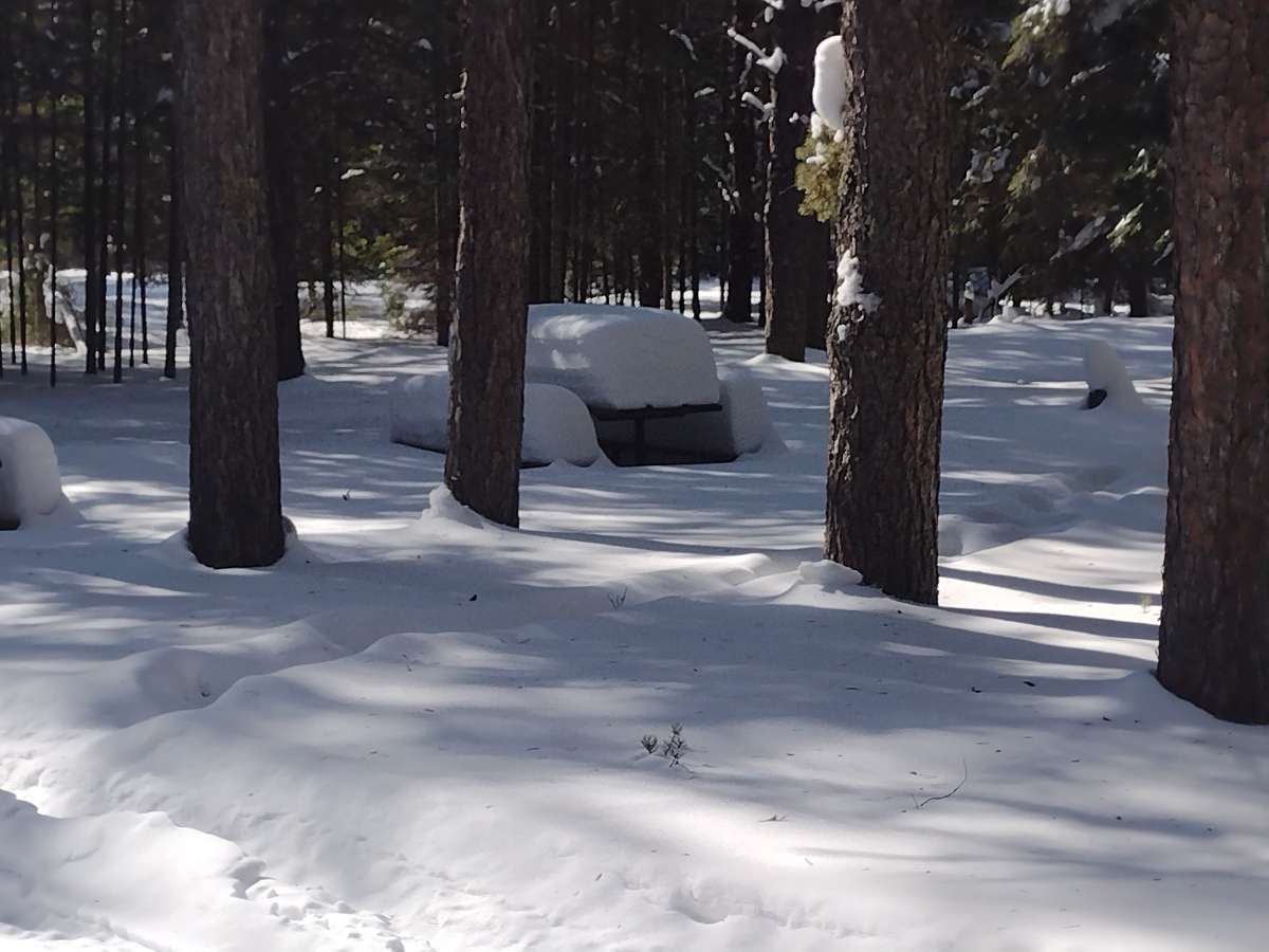
Went for another snowmobile ride today. Gotta say I underestimated how much snow we have. 24-30" snow depth pretty much everywhere in my area. If it wasn't so flat around here I could probably post a pic and get away with tagging it as somewhere in a primary les belt. Funny thing is all the snow is bottomless powder, haven't had a thaw since mid December when it all started piling up. This caused going down untouched forest roads difficult, some spots I was going full throttle and struggling to keep momentum. First pic is a spot where I had to help my dad get unstuck. Pretty much had to do circles around him to give his tank of a sled some packed down snow to have a shot of getting turned around. Second pic is a picnic table covered in the seasons snowfall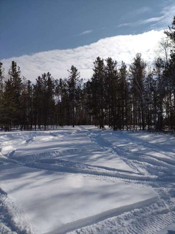

-
February 2022 Observations and Discussions
Beltrami Island replied to Grizzcoat's topic in East of the Rockies
Pretty cool analysis comparing this winter to 1996-97 blizzards for Fargo/Grand Forks https://www.weather.gov/fgf/BlizzardClimatology -
February 2022 Observations and Discussions
Beltrami Island replied to Grizzcoat's topic in East of the Rockies
A few degrees warmer than yesterday morning... If it wasn't for December relative warmth, this year would be very comparable to 2013-14. 13-14 cold pattern set up in early December up here. By the time the "POLAR VORTEX" drifted down south after Jan 1 that winter, all of us up north had been experiencing similar cold departures from averages for 3-4 weeks.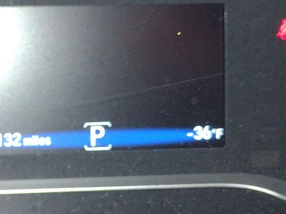
-
February 2022 Observations and Discussions
Beltrami Island replied to Grizzcoat's topic in East of the Rockies
Just another day in paradise....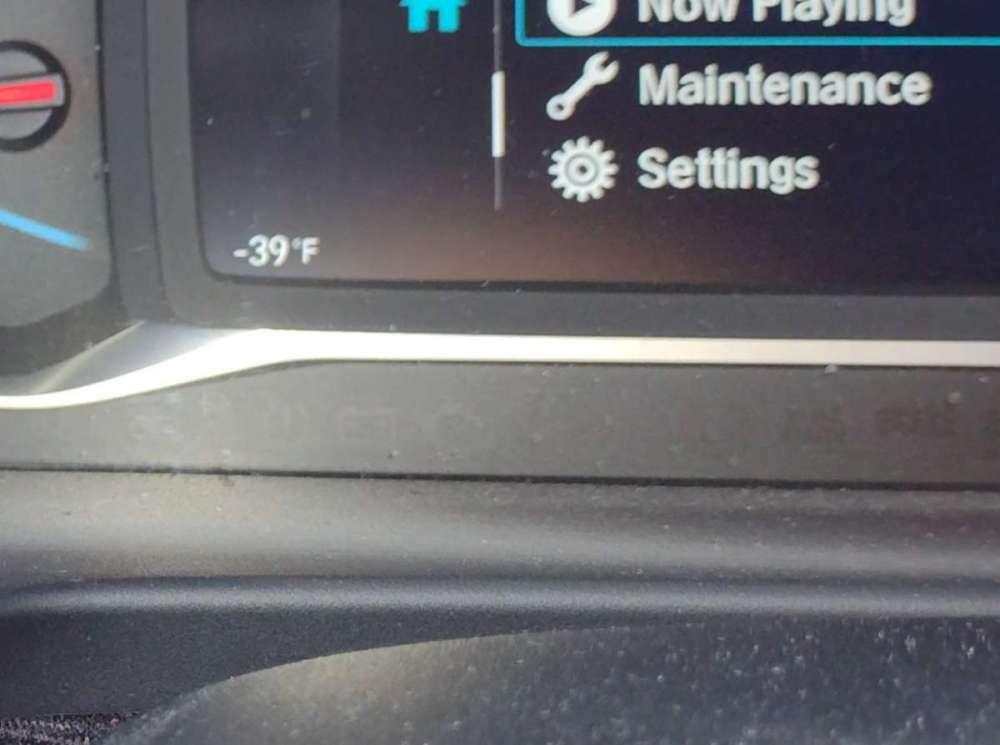
-
February 2022 Observations and Discussions
Beltrami Island replied to Grizzcoat's topic in East of the Rockies
I guess I don't fully understand what your asking. If your asking when sun starts affecting the snow surface despite below freezing temps? March 10-15 I'd say. When it affects roadways and rooftops despite below freezing temps? I'd say around now. -
February 2022 Observations and Discussions
Beltrami Island replied to Grizzcoat's topic in East of the Rockies
I was concerned going into last winter based on developing drought conditions going through fall and the fact that my back yard was coming off of two well above average snow years... We were due for a down year and got just that, not as bad as 11-12, but not much better. I don't think I posted much thoughts going into this winter. If I had, I would have said the slight improvement in drought over late summer and fall here along with weak to moderate strength la Nina conditions were promising...but anything is possible and really didn't have a strong feeling in any direction. Do you wish for ten 2" snowfalls or one 20" snowfall? This winter has definitely been the ten 2" snowfall type winter here. Since the mid December thaw it has been consistently cold with light snowfalls every 5-7 days. If this winter can have legs deep into March without any thaws it may out due 18-19 in my mind. That year had an incredible 8 weeks of snow and cold but lost it's oomph the second week of March. -
February 2022 Observations and Discussions
Beltrami Island replied to Grizzcoat's topic in East of the Rockies
I don't know if this is pouring salt in the wounds for Iowa and Nebraska folks or not but couldn't resist sharing these from today.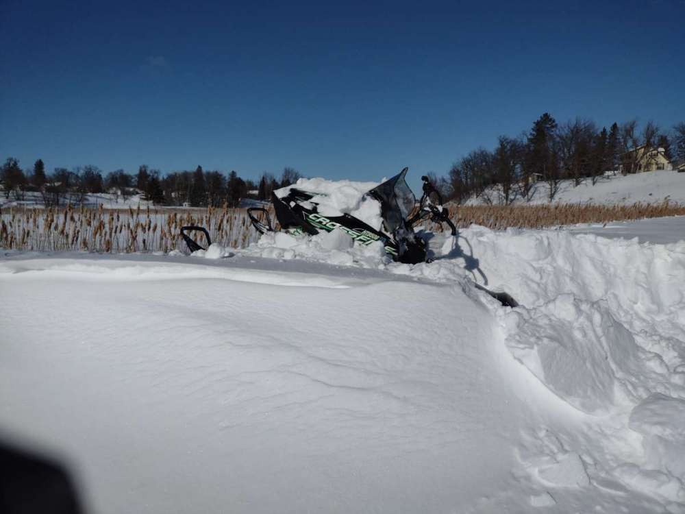
-
February 2022 Observations and Discussions
Beltrami Island replied to Grizzcoat's topic in East of the Rockies
This kind of statistic is as useless as when, for a brief period some years, there is snow on the ground in all 50 states. As a snapshot, this probably map I would predict with a dominant ridge in the west and a NW flow over the northeastern 2/3 of the CONUS. If it were an el nino I would expect the STJ to undercut the western ridge and possibly lead to a storm or two to lay down some wet snow over the south central/southeast states. -
February 2022 Observations and Discussions
Beltrami Island replied to Grizzcoat's topic in East of the Rockies
This clipper is ripping here right now. Half mile visibility at best right now. Hardest I've seen it snow in years. To bad this is only going to last a couple hours. Of course pics don't do it justice.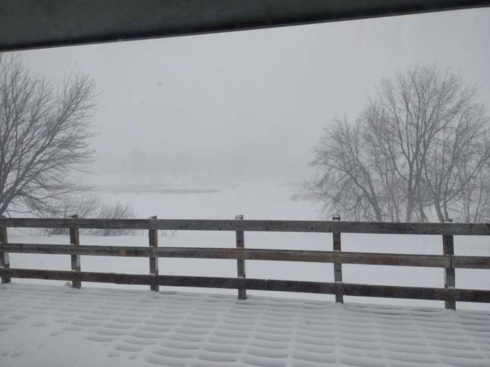
-
February 2022 Observations and Discussions
Beltrami Island replied to Grizzcoat's topic in East of the Rockies
I am glad its not just me noticing this. The GFS has always been bonkers past day 7, but even past day 4-5 the Euro seems to be worthless this winter. -
February 2022 Observations and Discussions
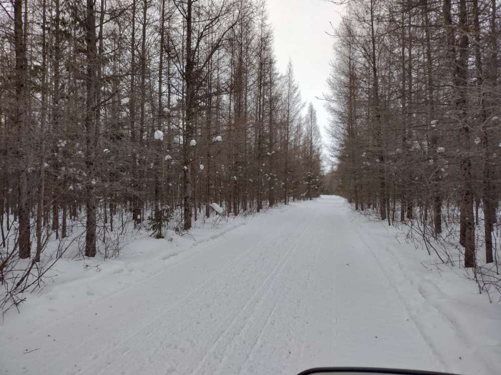
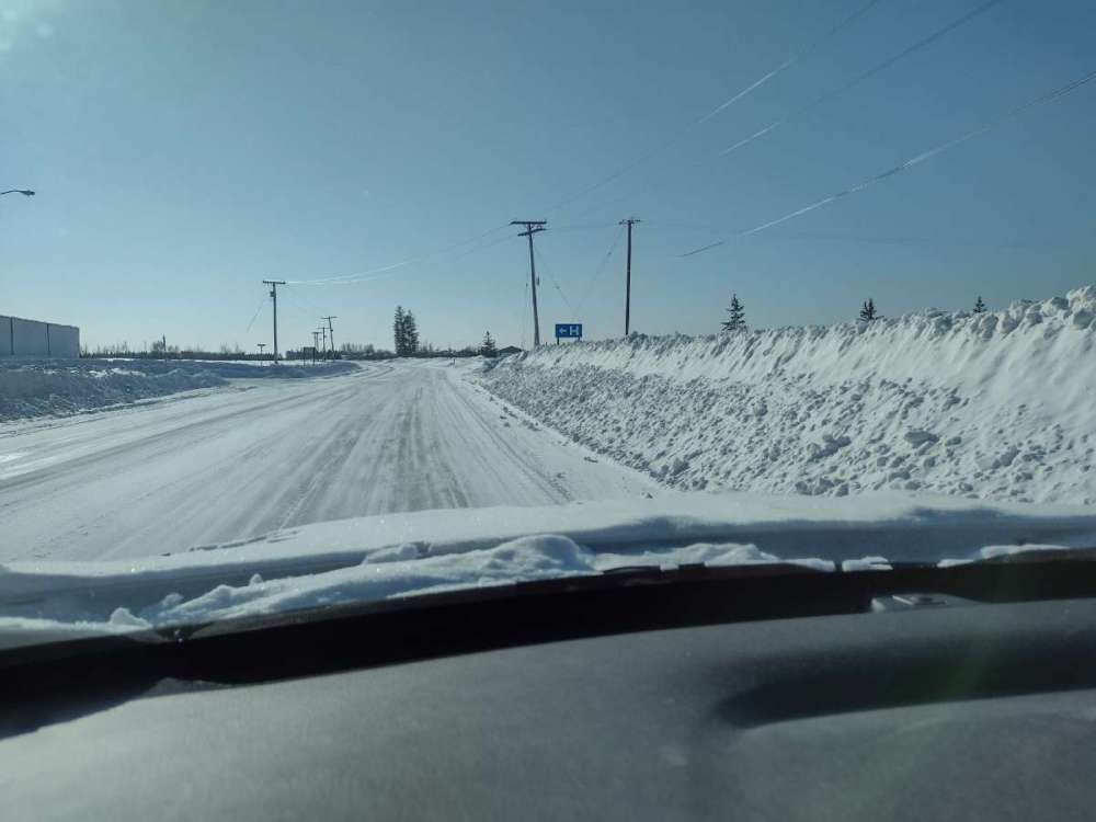
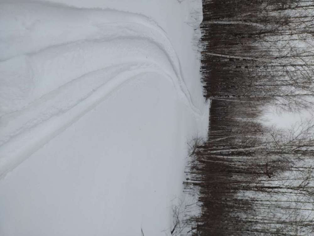
Beltrami Island replied to Grizzcoat's topic in East of the Rockies
A pic of trail from last weekend. Those golden tamaracks look like dead pines if you didn't know better. Had to add a pic the growing plow drift near me. It's wind drift aided in growth but is starting to rival some good winters