Meatyorologist
-
Posts
8895 -
Joined
-
Last visited
-
Days Won
13
Everything posted by Meatyorologist
-

March 2024 Weather in the PNW
Meatyorologist replied to TigerWoodsLibido's topic in West of the Rockies
There's a nugget of truth in there, but the reality is that the good majority of us are weather lifer's whether we like it that way or not, and our temperate climate is pretty unforgiving for even the most patient of diehard cloud fanboys. It's hard *not* to be disappointed unless you live in one of the rare, specialized microclimates that try their hardest to be a little more "fair" to us nerds. That all being said, you need more than one reason to live. -
March 2024 Weather in the PNW
Meatyorologist replied to TigerWoodsLibido's topic in West of the Rockies
That wasn't a downvote. It simply means... -
March 2024 Weather in the PNW
Meatyorologist replied to TigerWoodsLibido's topic in West of the Rockies
Not a single weather model has the current low under handle. Some are too strong, some too weak. Most are behind in timing by a few hours. Nowcast kind of night ahead (though I don't think there is any alternative during marginal setups.)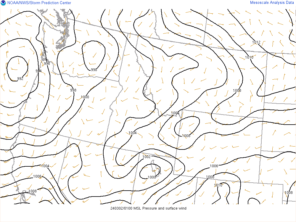
-
March 2024 Weather in the PNW
Meatyorologist replied to TigerWoodsLibido's topic in West of the Rockies
Subzero 925's are gonna track almost directly with where it's precipitating, especially with all of the sinking/warming in the low levels over the Sound. A general precip map ought to be just as useful. -
March 2024 Weather in the PNW
Meatyorologist replied to TigerWoodsLibido's topic in West of the Rockies
Hiking Mt. Si on a day like today would be a weather nerd's playbox. I kind of regret not showing up today with a cup of coffee and my Kestrel 5500FW -
March 2024 Weather in the PNW
Meatyorologist replied to TigerWoodsLibido's topic in West of the Rockies
Chunky rain -
March 2024 Weather in the PNW
Meatyorologist replied to TigerWoodsLibido's topic in West of the Rockies
Inversiony November. Snappy January. SLUSHY February and March! Not bad considering back in October the attendees working at northeast Seattle's winter cash-out fob tried their best to inform me that the Pacific was NOT going to cooperate! -
February 2024 Weather in the PNW
Meatyorologist replied to TigerWoodsLibido's topic in West of the Rockies
Near the ground, yes. But on a macro scale, the storm systems powering our cold fronts are the size of continents and some of the largest heat transfer machines on Earth.- 8823 replies
-
- 11
-

-
February 2024 Weather in the PNW
Meatyorologist replied to TigerWoodsLibido's topic in West of the Rockies
If I had to wager a guess as to what the issue stems from, I'd argue that the models have recently been toyed with as to allow for higher snowfall accumulations through moist-saturated near-sfc columns. This error seems to show up almost exclusively in the immediate vicinity of the coast, exactly where you'd find enhanced lift via the sudden onset of terrain, and the most saturated lower troposphere, right from Pacific onshore winds in a lightly unstable environment. Wouldn't doubt it would be a useful tweak given recent marginal snowfall busts in the Northeast, but since the greater Northwest sits in a gradual transition between a subarctic and subtropical maritime climate zone, where snow can fringe on the hair of dewpoints and Chris' 925mb temp maps and how badly you pray at night, subtle tweaks can wreak havoc on our beloved #snowmaps, as pretty as the colors may be nowadays.... -
February 2024 Weather in the PNW
Meatyorologist replied to TigerWoodsLibido's topic in West of the Rockies
Really hard not to get excited looking at weather models tonight. Lots of small mesoscale oportunities with very high jackpot potential. This next trough will be in rarified territory due to its cold nature alongside its negative tilt, allowing for moisture as well. Fun times ahead. -
February 2024 Weather in the PNW
Meatyorologist replied to TigerWoodsLibido's topic in West of the Rockies
Can't bring you anywhere! -
February 2024 Weather in the PNW
Meatyorologist replied to TigerWoodsLibido's topic in West of the Rockies
NAM is biased to overdo evaporative cooling... Likely stems from the same internal flaw which causes an underestimation of stratoform precip. Hopefully it's right though and I eat crow! -
February 2024 Weather in the PNW
Meatyorologist replied to TigerWoodsLibido's topic in West of the Rockies
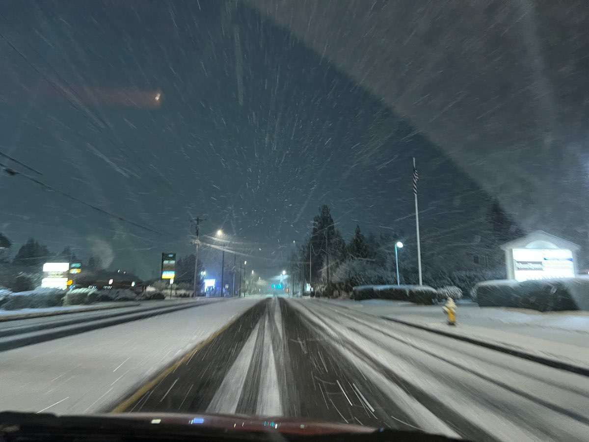
Took a drive up to South Everett! About 2-3" here.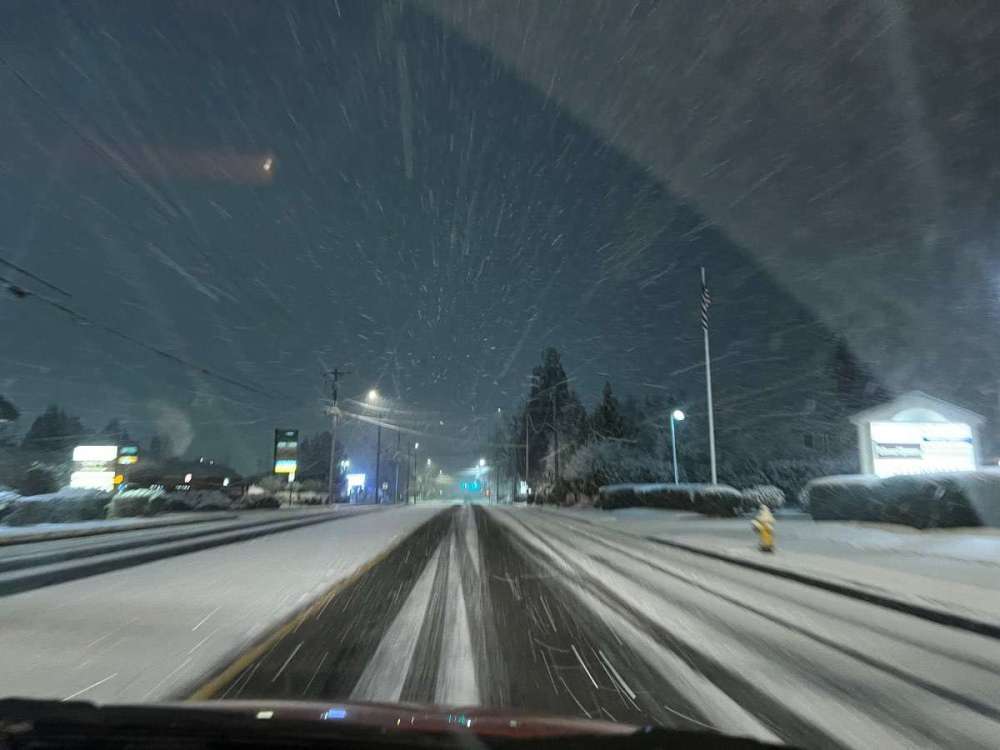
-
February 2024 Weather in the PNW
Meatyorologist replied to TigerWoodsLibido's topic in West of the Rockies
That is a webcam for the ages, Skykomish.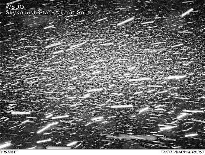
-
February 2024 Weather in the PNW
Meatyorologist replied to TigerWoodsLibido's topic in West of the Rockies
That is a beautiful convergence zone... -
February 2024 Weather in the PNW
Meatyorologist replied to TigerWoodsLibido's topic in West of the Rockies
KSEA coming in with a 5pm low of 35F. -
February 2024 Weather in the PNW
Meatyorologist replied to TigerWoodsLibido's topic in West of the Rockies
Snow back at home! Grauple transitioned to plain snowflakes.- 8823 replies
-
- 10
-
-

-
February 2024 Weather in the PNW
Meatyorologist replied to TigerWoodsLibido's topic in West of the Rockies
Yeesh! That blows. What happened? -
February 2024 Weather in the PNW
Meatyorologist replied to TigerWoodsLibido's topic in West of the Rockies
I'm so, so sorry, Tim. If only I could take all this pain from you... -
February 2024 Weather in the PNW
Meatyorologist replied to TigerWoodsLibido's topic in West of the Rockies
Rain/snow mix here, 38F -
February 2024 Weather in the PNW
Meatyorologist replied to TigerWoodsLibido's topic in West of the Rockies
Oh that block support is strong, alright. It's just a bit too far to the west to incorporate any Canadian air. Off-the-chart positive height anomalies over the North Pacific; record breaking actually. Inarguably during our recent cold snaps the truly big story has lied with the heatwave on the other side. -
February 2024 Weather in the PNW
Meatyorologist replied to TigerWoodsLibido's topic in West of the Rockies
This is pretty raw for the Pacific Ocean, at a latitude matching California, with outflow coming from the Aleutians instead of the continent.
-
February 2024 Weather in the PNW
Meatyorologist replied to TigerWoodsLibido's topic in West of the Rockies
The 3km NAM is the driest mesoscale model by far. It doesn't believe in stratoform precipitation at all, which makes it useless during the winter and pretty bad for stalled convection/latent heat machines such as PSCZ's. -
February 2024 Weather in the PNW
Meatyorologist replied to TigerWoodsLibido's topic in West of the Rockies
Looking west, this wall of doom is showing up as nothing from KATX, not even on the higher bands. If it's gonna storm it's about to do so without warning.
-
February 2024 Weather in the PNW
Meatyorologist replied to TigerWoodsLibido's topic in West of the Rockies
Snow in King county will probably have to wait until after 10pm when 925's drop below freezing. 51F and partly sunny here. Big frontal passage just to the NNW.