Meatyorologist
-
Posts
8883 -
Joined
-
Last visited
-
Days Won
13
Everything posted by Meatyorologist
-
Love the beard bro
-
Hate how shadowing is becoming an increasing concern for Tuesday. Weaker system means weaker lift and more meridionally oriented precip direction, and downsloping off Olympics.
-
Lytton down to 3F.
-
I am fully aware of that..
-
There will probably be a fairly sharp E-W snowfall gradient tonight. All this snowfall is occurring due to very low level moisture... Low level terrain is playing a pretty substantial role in precip intensity.
-
HRRR has precip picking up in the central Sound again late this evening into early tomorrow morning. Not sure what it sees, but given the nebulous nature of this Arctic frontal boundary's precip shield, I would not discount such a development.
-
The Lynnwood snow magnet... Lived in spite of it for over a decade now. You learn to get used to it.
-
Beastly airmass
-
Down to 32F now.
-
You just repeated what I said, but with a map. lmao
-
Just watched the clip that came out! WTAF?!?!?! Laughing my ass off with a cloud of white outside. Good evening.
-
I was getting that feeling based on Tuesday temp outputs. Super aggressive with the southerly flow despite offshore gradients.
-
This is a difficult pattern for any model to nail. But there is a good sentiment here in that no model, not even the vaunted Euro, is a godsend.
-
Been a very long while since North Seattle was 'zoned in an Arctic frontal event. Last December we got hit pretty good but it never stalled... It was two hours of extreme upper end snowfall dumping 5" or so. It's probably been since Jan 2012 that we were selectively nailed. Since then it's been Snohomish Co., West Seattle, SeaTac, Marysville, ect. But not here! Statistically we're pretty due given our location in the central Sound.
-
Update... Looks like this is very shallow stuff since KATX is missing a bit of it. Filling in from the west regardless, similar to what the GFS and RGEM depicted. Could last into the early morning.
-
Tell that to her..
-
33F here now. Just on the southern periphery of the cold sector.
-
It definitely looks like it's trying to fill in though!
-
PSCZ hung up just to the north. Hopefully it sags south!
-
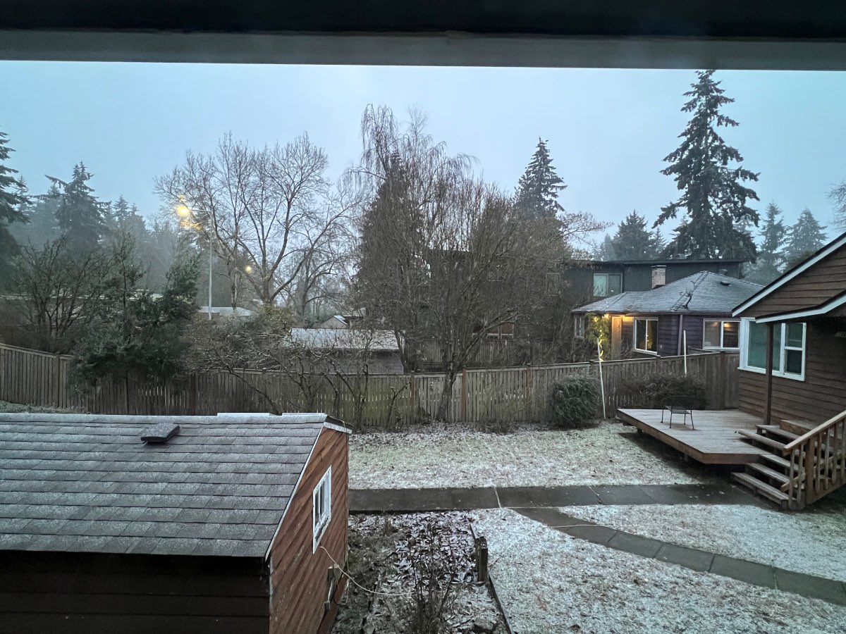
Nice little flurry going on here
-
That would be very snowy from about Seattle northward.
-
Cloudcover rapidly increasing over the city as radar begins to fill in.
-
I could envision a worst case scenario where a 2022-esque fall leads into a cold snap/ice storm combo in early-mid Nov. Tons of leaves on deciduous trees and the beginning of cold pool/inversion season to support ZR. Would be some east coast style ice storm destruction.
-
My guess is temporary mixing, but if there is a pressure spike it could be adiabatic?
-
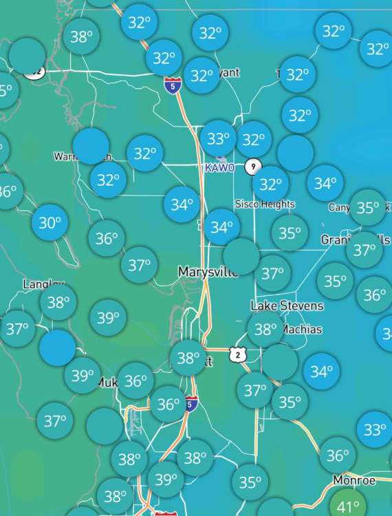
Arctic front reaching Marysville now. Might stall towards the Cascade foothills as strong convergence develops.