OmahaSnowFan
-
Posts
2693 -
Joined
-
Last visited
-
Days Won
1
Everything posted by OmahaSnowFan
-
January 2020 Observations & Discussion
OmahaSnowFan replied to Hawkeye's topic in East of the Rockies
-
Looks like the Omaha airport reported 2.9" of snow, but had .51" liquid equivalent. That's a 5.7:1 ratio. No wonder the snow felt like a lead weight scooping it this morning!
-
Another WWA issued for tonight into tomorrow for up to 2 more inches of snow. Just enough to replace the stuff from last night/this morning that will melt/compact. Oh well, at least it's snowing. I'll be honest, minus the melting snow right away, this is the type of winter weather I enjoy. Not bitterly cold and snowy. If it was about 5-8 degrees colder (24-28 degrees) this would be perfect for me
-
Measured 2.5" of snow about 11am. Also some of the heaviest, wettest snow I've shoveled in a long time. Just a sloppy mess everywhere. On the bright side, the ice rink that was my driveway is in much better condition with all the ice still having melted despite being under the snow that I had to scoop.
-
WWA for 1-3" tonight into tomorrow morning, and then maybe another 1-3" Thursday. Sounds about right.
-
I'm at 8.9" after last weekend's system.
-
There's no way anyone gets 8-12" of snow out of this like the Euro, Canadian, and NAM are showing. Not a strong system at all. All of the models are showing the low staying above 1010 MB. Only thing that it has going for it is it's slow movement. Otherwise marginal temps, rates etc will hurt amounts.
-
January 2020 Observations & Discussion
OmahaSnowFan replied to Hawkeye's topic in East of the Rockies
Definitely not showing any kind of extreme winter weather pattern -
January 2020 Observations & Discussion
OmahaSnowFan replied to Hawkeye's topic in East of the Rockies
-
January 2020 Observations & Discussion
OmahaSnowFan replied to Hawkeye's topic in East of the Rockies
How old is this map? Hour 384 isn’t Jan 31st. This has to be from a run from 3-4 days ago... -
Jan 17th-19th Rain/Snow/Mix/LES System
OmahaSnowFan replied to jaster220's topic in East of the Rockies
-
Jan 17th-19th Rain/Snow/Mix/LES System
OmahaSnowFan replied to jaster220's topic in East of the Rockies
Measured 2.5” in my backyard. Most models were 4”+ -
Jan 17th-19th Rain/Snow/Mix/LES System
OmahaSnowFan replied to jaster220's topic in East of the Rockies
High wind warning issued here now for tonight from 2a-8a for winds up to 60 mph. -
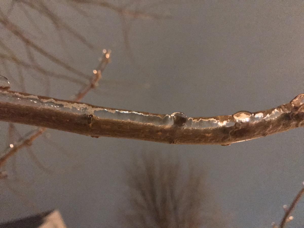
Jan 17th-19th Rain/Snow/Mix/LES System
OmahaSnowFan replied to jaster220's topic in East of the Rockies
It’s done here except for freezing drizzle this pm and maybe some flurries and wind tonight. -
Jan 17th-19th Rain/Snow/Mix/LES System
OmahaSnowFan replied to jaster220's topic in East of the Rockies
I crossed the mythical 1” barrier for the first time this winter but don’t think I crossed 2”. At work so can’t measure. Either way another letdown here. -
Jan 17th-19th Rain/Snow/Mix/LES System
OmahaSnowFan replied to jaster220's topic in East of the Rockies
Man 0Z HRRR coming in hot for eastern Nebraska. Large area of 6”+ totals -
January 2020 Observations & Discussion
OmahaSnowFan replied to Hawkeye's topic in East of the Rockies
12Z Euro looks warm in the extended after this weekend/beginning of next week. -
January 2020 Observations & Discussion
OmahaSnowFan replied to Hawkeye's topic in East of the Rockies
I'm under a WWA for tonight for freezing drizzle. What's weird though is it's only a 40% chance in the grids. Normally watches, warnings, advisories are for much more higher percentages of precip. -
January 2020 Observations & Discussion
OmahaSnowFan replied to Hawkeye's topic in East of the Rockies
GFS is cold and dry after this next system in a couple of days. If it was supposed to be so active, you'd think it would flash a system every once in a while. Looks pretty boring after this weekend... -
January 2020 Observations & Discussion
OmahaSnowFan replied to Hawkeye's topic in East of the Rockies
I know it’s long term and the GFS, but after next Friday/Saturday’s system it looks pretty quiet. Also not seeing any signs of significant locked in cold. -
January 2020 Observations & Discussion
OmahaSnowFan replied to Hawkeye's topic in East of the Rockies
Today’s 1-3” event turned into nothing but flurries for my backyard. Again. -
January 2020 Observations & Discussion
OmahaSnowFan replied to Hawkeye's topic in East of the Rockies
HRRR w 1/2” and NAM with 1” for me tomorrow. Looks like the one inch or less run continues for me. -
January 2020 Observations & Discussion
OmahaSnowFan replied to Hawkeye's topic in East of the Rockies
Nice. NWS forecast has 100% chance snow with 1-3” forecast for tomorrow -
January 2020 Observations & Discussion
OmahaSnowFan replied to Hawkeye's topic in East of the Rockies
I'm not trying to be rude or anything, but this is the hyperbole that I see on this forum that kind of makes me roll my eyes and chuckle a bit. This statement of "not seen in years or even DECADES", it seems has been said so many times that it seems like every potential active pattern is a pattern that's never been seen before. It's this kind of statement when said all the time that, at least for me, leads to pessimism bc usually it seems to rarely pan out. Just my .02 cents when I see this. That being said, I know your statement doesn't seem to refer to Nebraska so I'll hold my expectations down on what to expect here too. -
January 2020 Observations & Discussion
OmahaSnowFan replied to Hawkeye's topic in East of the Rockies
Down to 4.3 this morning in my backyard. Wasn't supposed to be quite that cold this morning. It's our coldest low since November 12th as well when we dropped to exactly zero degrees.