Tibster13
-
Posts
8 -
Joined
-
Last visited
Everything posted by Tibster13
-
PNW January 2022, Contact Info for Phil
Tibster13 replied to The Blob's topic in West of the Rockies
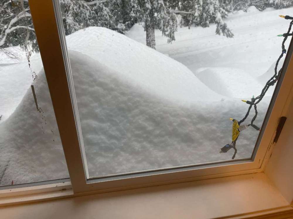
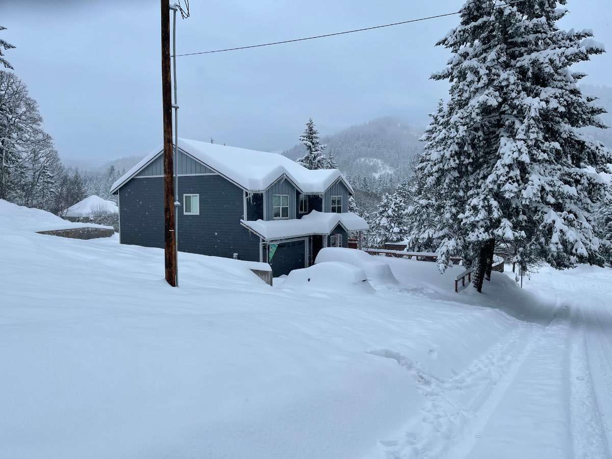
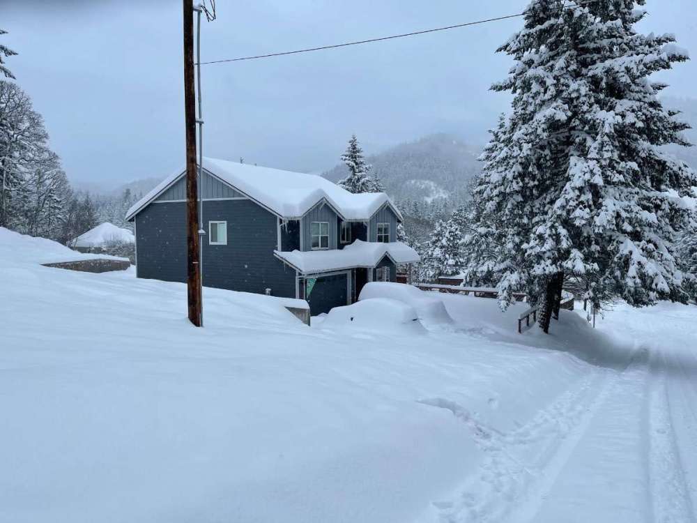
For science, I did my best to measure the newest snowfall (started here about midnight). Roughly 23” and climbing. -
PNW January 2022, Contact Info for Phil
Tibster13 replied to The Blob's topic in West of the Rockies
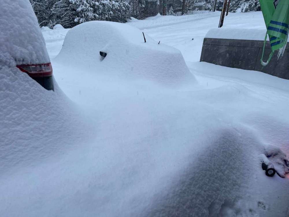
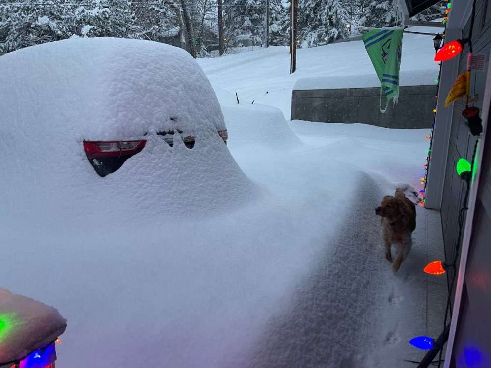
Here’s a couple more from the gorge (White Salmon). Still continuing to dump snow.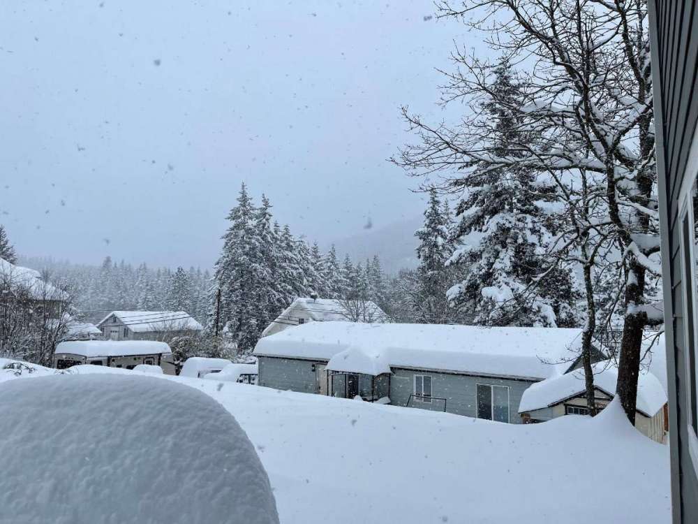
-
PNW January 2022, Contact Info for Phil
Tibster13 replied to The Blob's topic in West of the Rockies
Yeah I get that a lot. Haha. I’m originally from the Kirkland/Bothell area so I grew up with mostly wet, sad snow. No idea on yearly average. I follow weather with childlike enthusiasm and tend to black out from excitement when it snows. -
PNW January 2022, Contact Info for Phil
Tibster13 replied to The Blob's topic in West of the Rockies
Yeah she definitely gave me some wtf looks. Hah -
PNW January 2022, Contact Info for Phil
Tibster13 replied to The Blob's topic in West of the Rockies
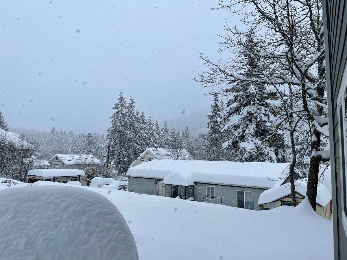
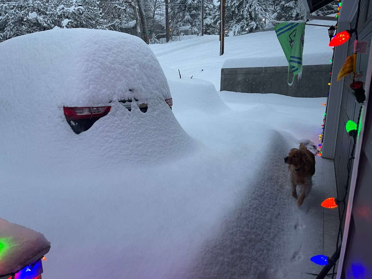
Ok here’s my once a year post! Reporting from White Salmon, WA. Always found the weather forecasting here to be really tough to pin down, as the NWS out of Portland tends to focus on Hood River and the western gorge, and the NWS out of Pendleton is always a blanket ‘East slopes of the cascades.’ I’m basically right across the Columbia River from Hood River, but higher up. I think I technically fall under the Pendleton office, but we’re right on the border of their forecasting areas. For just a quick example, we had no WWA or WSW leading up to this, and they only recently added a WWA for an additional 2” at 9am. Id guess what makes the area tough to forecast is White Salmon essentially sits on top of a cliff side along the gorge. I’m at about 900’ but the elevation quickly increases the more towards Adams you go. Most model maps really struggle to show the difference between what’s going on along the river and what’s happening a quarter mile off of it up the hill. I don’t have any temps or semi-official measurements to give you all so I’ll just let the pictures speak for themselves. Been a wild 9 hours and doesn’t seem to be ending anytime soon. yay snow!