
OttumwaSnomow
-
Posts
562 -
Joined
-
Last visited
Recent Profile Visitors



OttumwaSnomow's Achievements






-
April 2024 Observations and Discussion
OttumwaSnomow replied to westMJim's topic in East of the Rockies
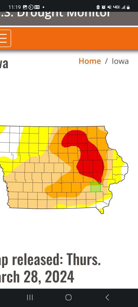
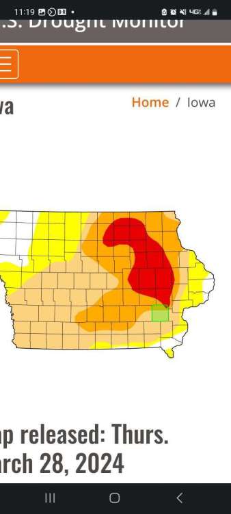
It will be so nice to see my area off the dreaded drought monitor soon! I have a incredible 7 plus inches since March 1st. My ponds are almost full! Going back to Dec 1st 2023 I am steadily running surpluses. Except for the pultry .14 in Feb. -
April 2024 Observations and Discussion
OttumwaSnomow replied to westMJim's topic in East of the Rockies
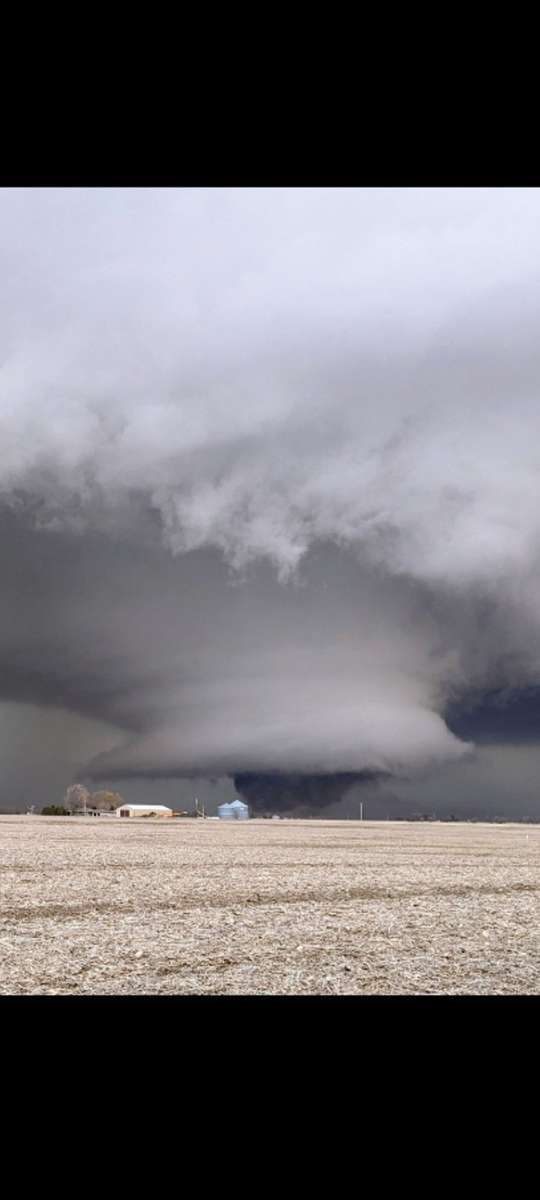
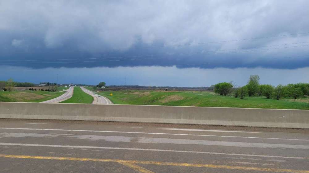
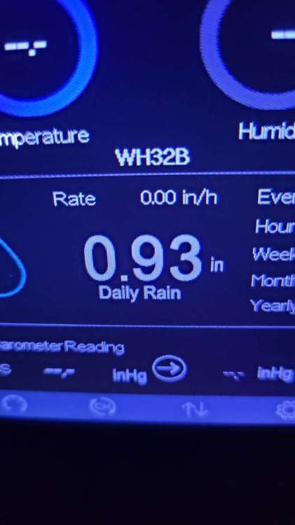
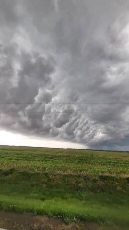
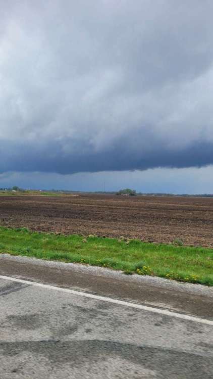
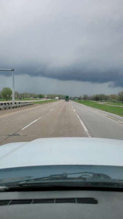
Well this system over preformed here for sure!! 3 rounds of thunder. Still thunder tonight. I have about .88 so far. 2 bouts of light hail. The 2nd round was squall line in my pics below did finally get some spin on it in eastern Wapello county. There was a eery sound that Ive only hear twice iny life... freight train.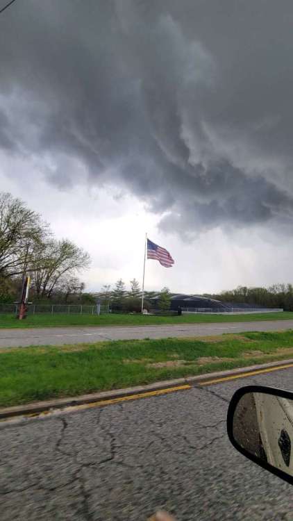
-
April 2024 Observations and Discussion
OttumwaSnomow replied to westMJim's topic in East of the Rockies
Just not a good setup for my area for good rain in more than a couple spots. Maybe a strip or stripe under a super cell. Today i tilled the garden. Craziest hard crust i ever saw from the days of sun and wind. But still mud underneath!! Deep soil wetter here than further west. Bone dry over along hwy 35. -
Will Chicago receive more snow than Minneapolis this winter?
OttumwaSnomow replied to Hoosier's topic in East of the Rockies
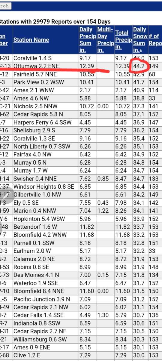
Looks like i will finish with 44.2" 38 of which fell in 11 days. A Crazy winter.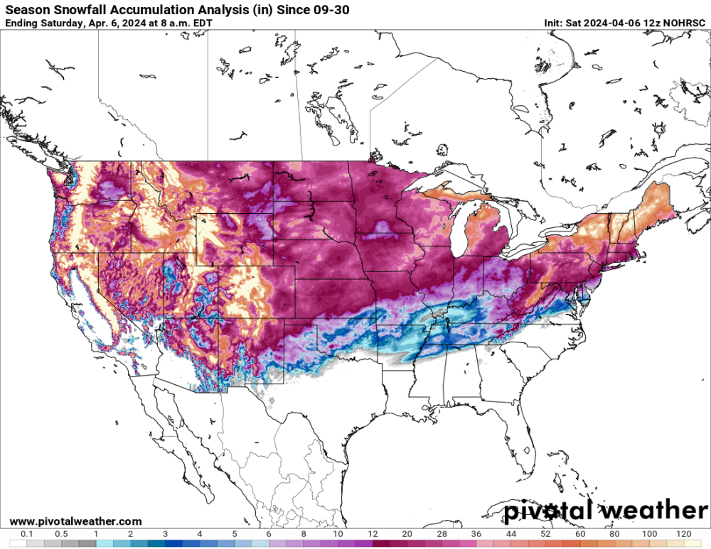
-
March 31st - April 2nd Potent Plains Storm
OttumwaSnomow replied to Clinton's topic in East of the Rockies
3.16" day total precip since Sunday afternoon. And a snow rain mix is still falling so will add to this. What a over performer! Very thankful!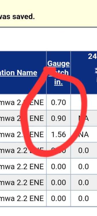
-
April 2024 Observations and Discussion
OttumwaSnomow replied to westMJim's topic in East of the Rockies
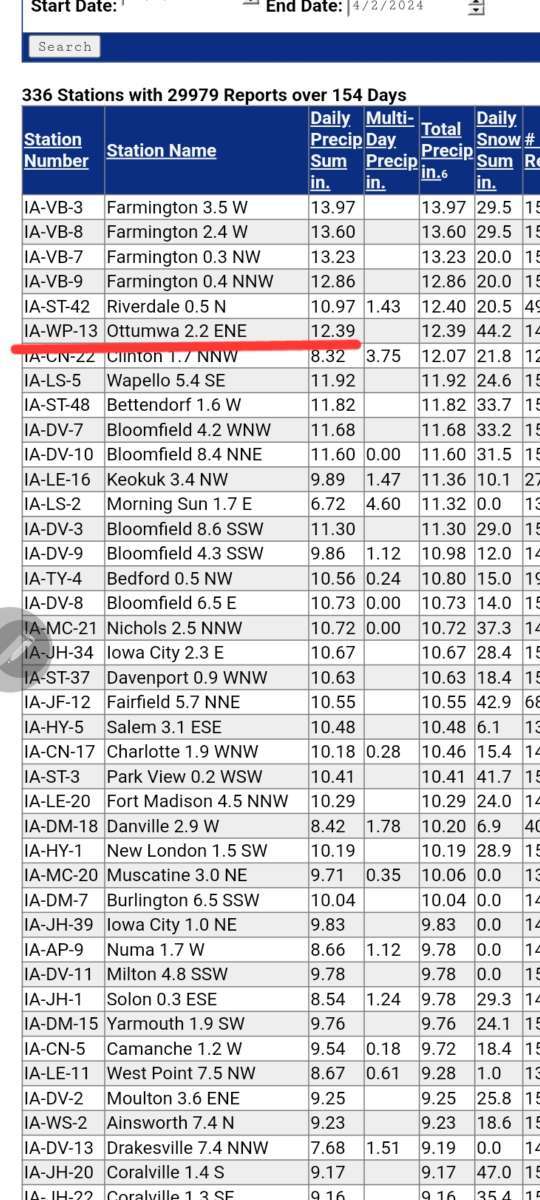
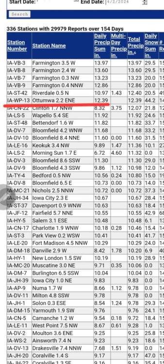
I'm probably thought of as a complainer on these forums. And my company has lost millions from years of drought. But I must say this since Nov 1st mby is near the top of a Iowa locations. #2 snowfall 44.2" #6 precip 12.39" We should be falling off the drought monitor soon.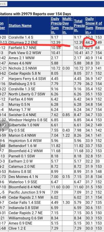
-
March 31st - April 2nd Potent Plains Storm
OttumwaSnomow replied to Clinton's topic in East of the Rockies
1.56" My heaviest rain only day since September 2022. Was pea sized hail twice. My pond jumped up 2 feet!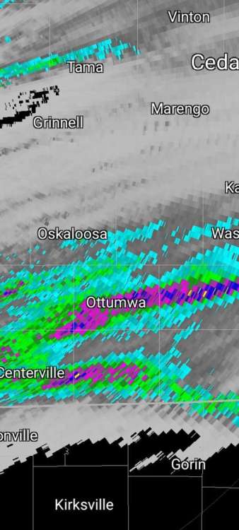
-
March 31st - April 2nd Potent Plains Storm
OttumwaSnomow replied to Clinton's topic in East of the Rockies
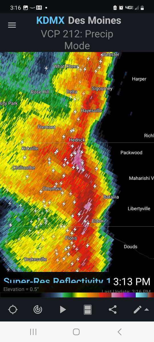
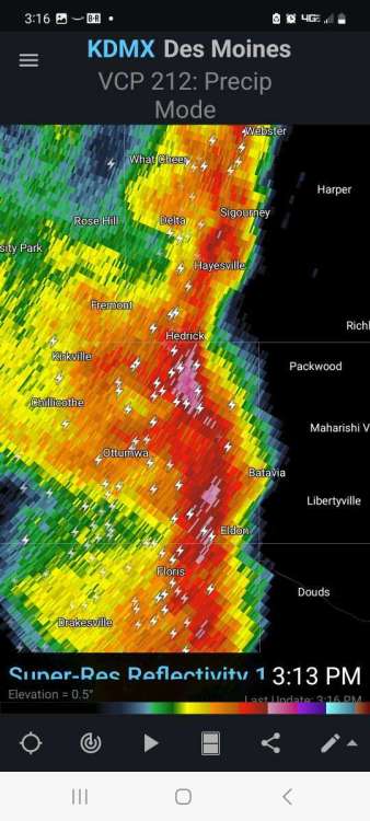
Great call @Tom! Nothing like a wobbling warm front here!!! I just got raked best gully washer since June or longer! 1.32" and still not over! 2 rounds of pea size hail! FINALLY SOME RUN OFF FOR PONDS! KDMX - Super-Res Reflectivity 1, 10_52 PM.mp4 -
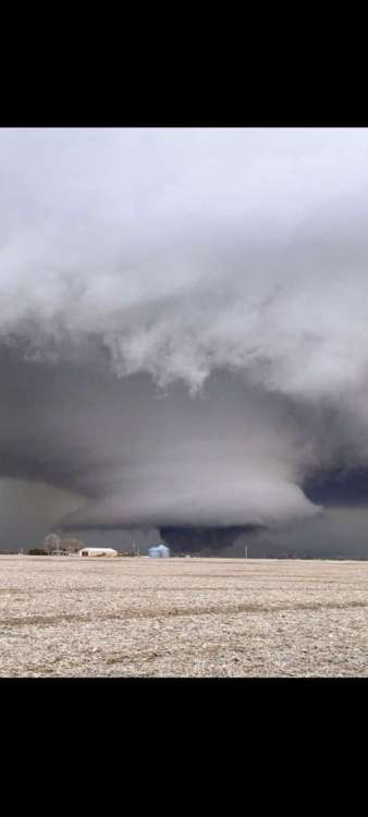
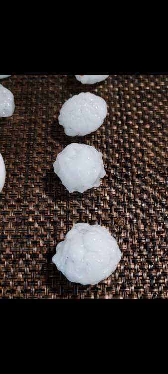
Whats a thunderstorm? Im seeing just 2 to 4 per year in recent years!!!! That said today is the 1 year anniversary of one of strongest supercells of my life! It actually passed right over my 24 acres! Touched ground not even 2 miles away. The Hedrick Keota Iowa tornado and hail.
-
Go Os! Man is this team good!
-
Yes.. just this massive weird dry slot. But as soon as the cold front approaches the Mississippi river BOOM! line of solid precip. I have witnessed this so many times in recent years its uncanny. Thus much of Illinois has not been in the severe drought as SE iowa just 60 to 80 miles away! And looking at historical averages Illinois east of Mississippi river doesnt not receive more precip than SE Iowa. But in recent years they have!!!!
-
3/24-3/27 Midwest/Plains Colorado Low(s)
OttumwaSnomow replied to Minny_Weather's topic in East of the Rockies
I have exactly a trace and a trace the past 3 days!!! ZERO.. after days of model data with a very good rain Friday thru tues. Pathetic. Never seen a dry slot like this in march that last 4 days!!! While rain repeatedly formed west and north and now east this pm. -
3/24-3/27 Midwest/Plains Colorado Low(s)
OttumwaSnomow replied to Minny_Weather's topic in East of the Rockies
I just reported a trace 2 days. What a bummer. I had watched this setup for 15 days. Seems like it takes some kinda freak event to get a big rain here. A wobbling front along the mo/ia border usually works. Oddest place, front after front system after system. Maybe 1 of 20 gives a precip even over .50! So many months pass here with 1 or none significant precip events. Its shocking to me that even being on the east side of a trough doesn't create lift and precip here. -
Its complete opposite of climo in Iowa. SE Iowa by far wettest part of Iowa. Not this system. If fact ZERO precip wont surprise me.
-
3/24-3/27 Midwest/Plains Colorado Low(s)
OttumwaSnomow replied to Minny_Weather's topic in East of the Rockies
I watch Eric daily. The AI EURO certainly saw the overall pattern development. But all the long range models stunk it up for my area into Missouri. Huge dryslot now clear on all models. Snodgrass explained that the east coast system cutting off the gulf flow because of nw flow behind the east coast sys.