NWbyNW
-
Posts
1499 -
Joined
-
Last visited
-
Days Won
2
Everything posted by NWbyNW
-
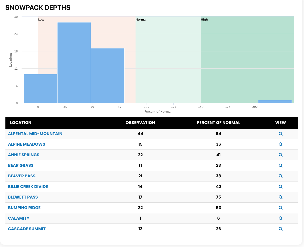
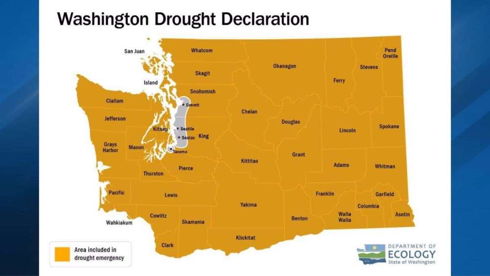
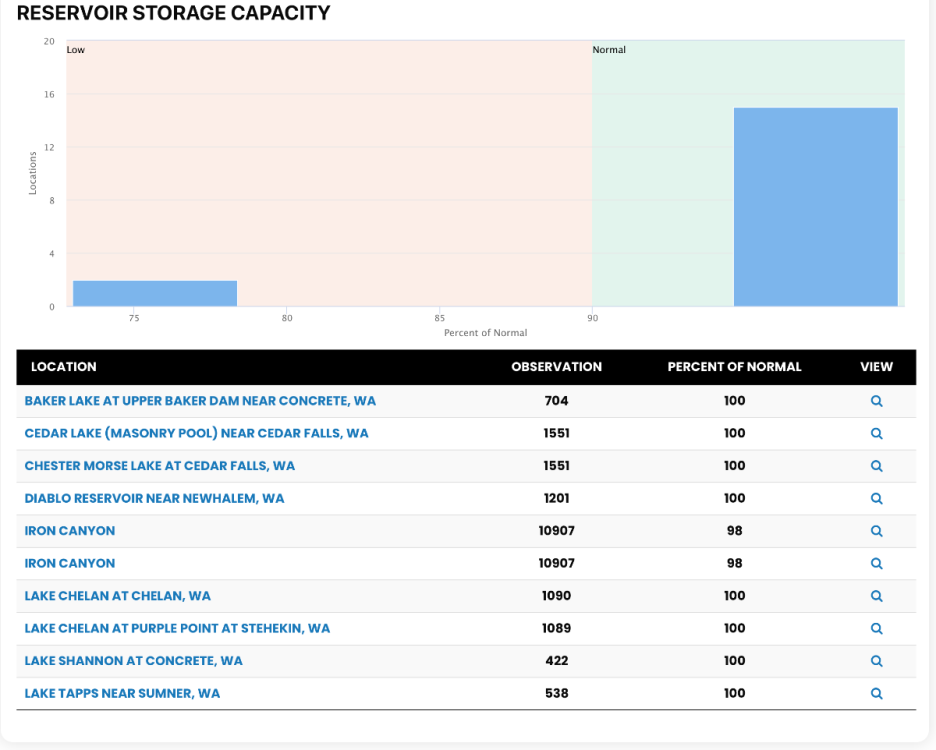
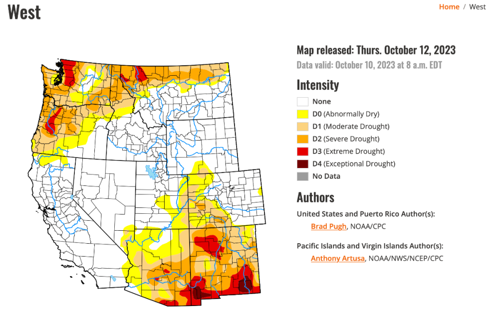
Our state is jumping right into things. The Washington Department of Ecology declared a drought emergency for nearly the entire state. They say we had a very dry winter, which we did. They say we have low snow pack and it's diminishing fast. “There is simply not enough water contained in mountain snow and reservoirs to prevent serious impacts for water users in the months ahead.” According to WA Ecology, statewide snowpack stands at 68% as of Tuesday, with some areas — including the Olympic Mountains, Lower Yakima and the north Sound — registering “significantly lower.” “Streamflows in many basins are already below 75% of normal,” Ecology wrote. “Forecasts for April through September have Chelan River streamflows at 52% of normal, while the Stehekin, Methow and Okanagan rivers are forecasted to have 59% of normal streamflows.”
-
This is no April Fools. It is a balmy 67F degrees and partly sunny outside here in Everett / Mukilteo.
-
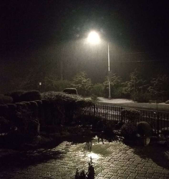
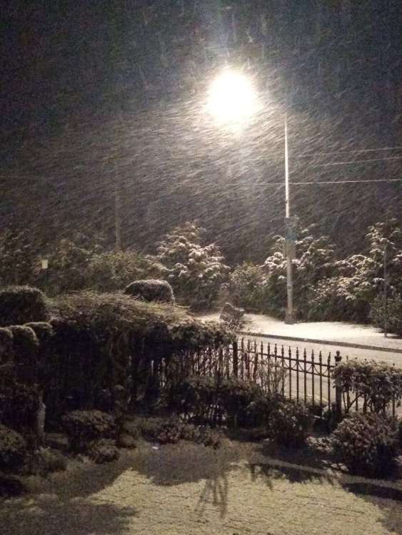
Report from right here from convergence zone central; Snohomish County! Hail and on and off snow showers all day. Hailed so hard this afternoon it left several inches on everything. Photos below show the conditional differences within only about thirty to forty minutes. One was taken around 11:40pm and the other at around 12:10am. Pretty significant. The snow is getting thicker on the ground. All surfaces outside are covered including roads. Current temp is 33F though.
-
That was a wild storm that came in today over the North Puget Sound. It was overcast, then within a matter of minutes, strong wings, white cap waves, and heavy rain. It came on so fast, but lasted throughout the evening and is still windy and now. Fantastic storm for storm watchers! Just another fine example of how fast weather can turn for the worse.
-

January Weather In The PNW 2024 (Part III) - The Warming Shot
NWbyNW replied to iFred's topic in West of the Rockies
We have had our last 4pm sunset of the year. -
January 2024 Weather in the PNW (Part II)
NWbyNW replied to Meatyorologist's topic in West of the Rockies
A balmy 18F here in Everett. -
January 2024 Weather in the PNW (Part II)
NWbyNW replied to Meatyorologist's topic in West of the Rockies
The mountains were out in full force today and gorgeous. The snow is amazing. I love how they seem hidden until they have snow on them, then they just POP! It's so amazing! Have a great weekend everyone!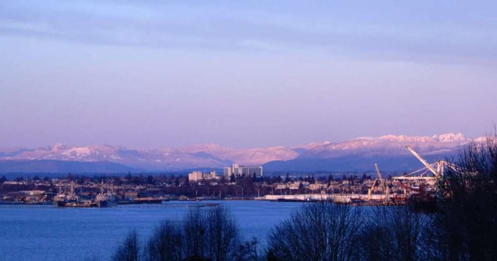
-
January 2024 Weather in the PNW (Part I)
NWbyNW replied to Sunriver Snow Zone's topic in West of the Rockies
Happy 2024 everyone! Been monitoring our strong El Nino season which has led to warmer and less-snowy conditions in the Cascade's. Earlier last year I had half-jokingly said that with California getting all the cold and rain, we would switch places with them and become the drought stricken area for several years to come. It's too early to say that of course, but I still always worry. Heheh.... Anyways, let's check the snowpack to normal real quick. We really need to pick it up if we don't want to worsen drought conditions next summer and spring. Our drinking water is all in the good, as to be expected.
-
Set up exterior Christmas lights (not the super Christmassy ones, just white lights to brighten up the dark nights) last weekend and set up more this weekend. Only light showers so far tonight, but over wise it has been beautifully and sunny most of the past week.
-
We had temps in the 30s but nothing below freezing yet. This occurring during that stretch of dry weather maybe two weeks ago. Otherwise it has been overcast or showers. Yesterday it was overcast with some rain and 66. So very mild to warm temps. Currently 54 and light showers.
-
Loving the rain recently. The garden is so confused. I got white and yellow roses still blooming as if it summer! There are even still new buds to bloom!! Other flowers are still blooming but on their last rung I am sure. My indoor cacti for some reason and blooming to! No idea what's going on, lol! Hope all had a nice weekend!
-
The PNW flipped with California. Good for California though. It's been twenty plus years since they've been mostly drought free.
-
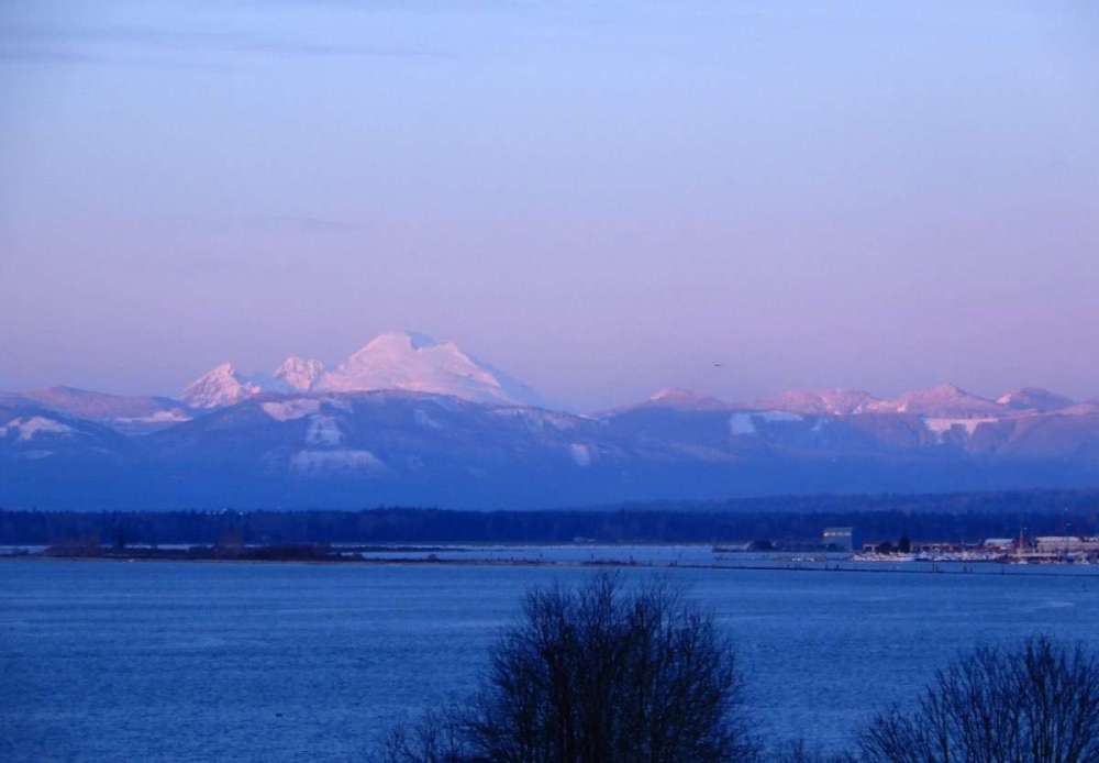
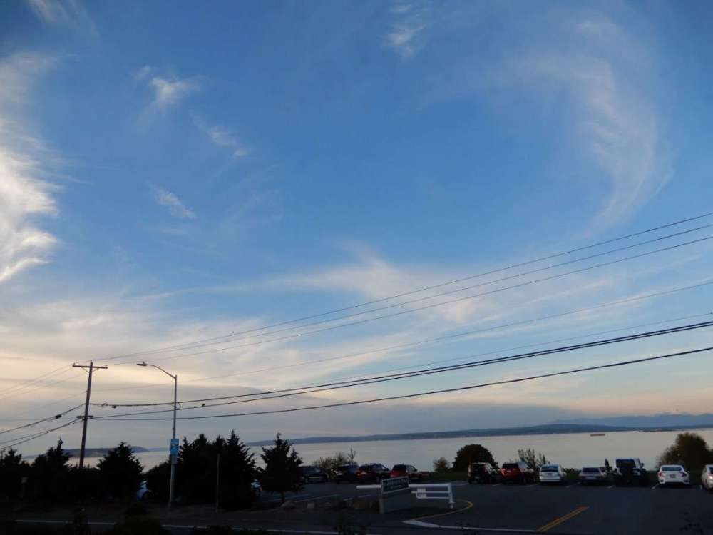
Beautiful day. It hit 63F after much of the morning hovering around 50F. Found these clouds neat as well as the bigger front to the north.
-
Oh rain, how we have missed thee. (Love the autumn colors on the forum by the way) Had been raining since about noon, then stopped about 40 mins ago.
-
Lol! Forecast for Sunday was 85F, then down to 83F. We tipped the scales at 73F in Everett. Nice. Currently 64F. The smoke really kept the sun and heat at bay.
-
Smoke is clearing out here and we has some light sprinkles!!! Currently 67F.
-
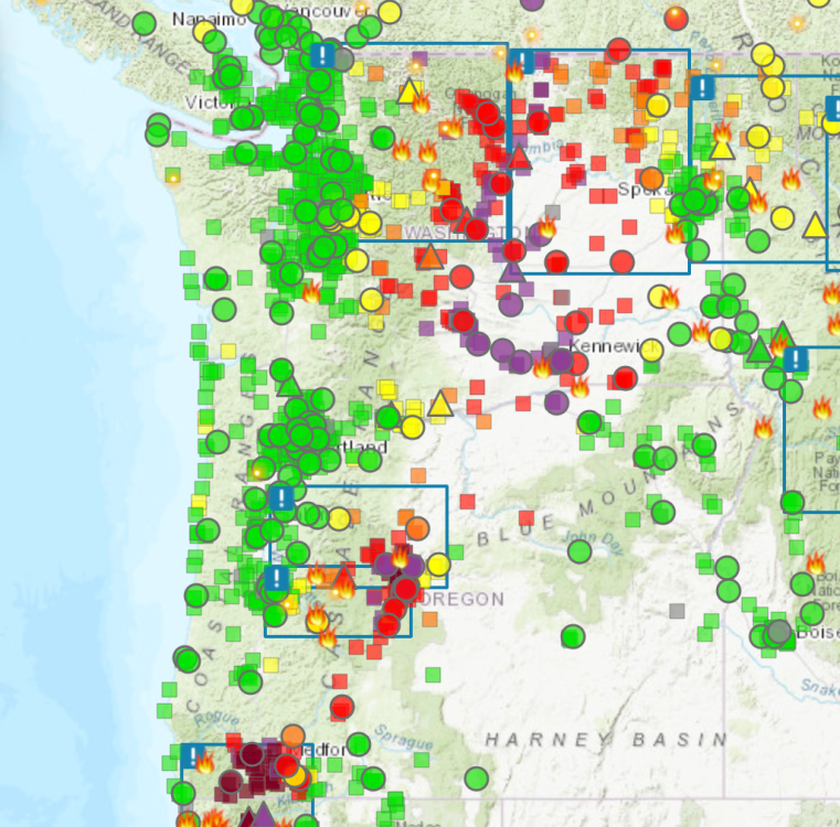
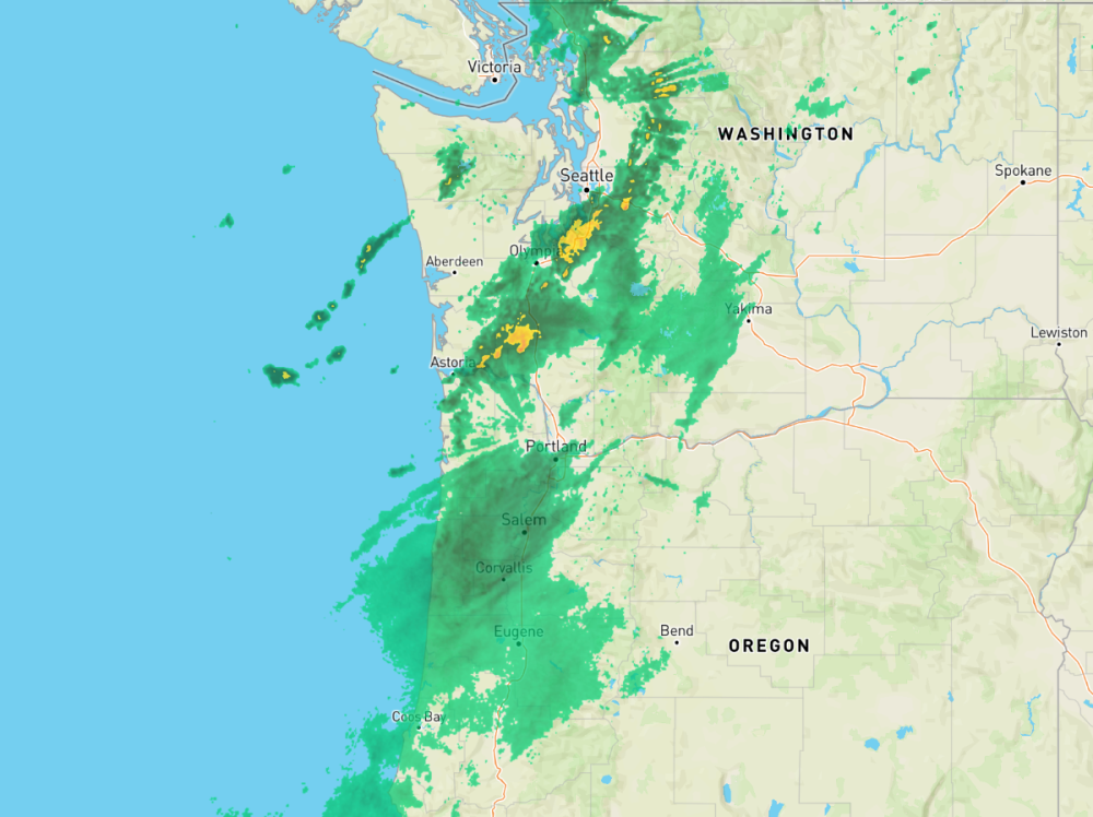
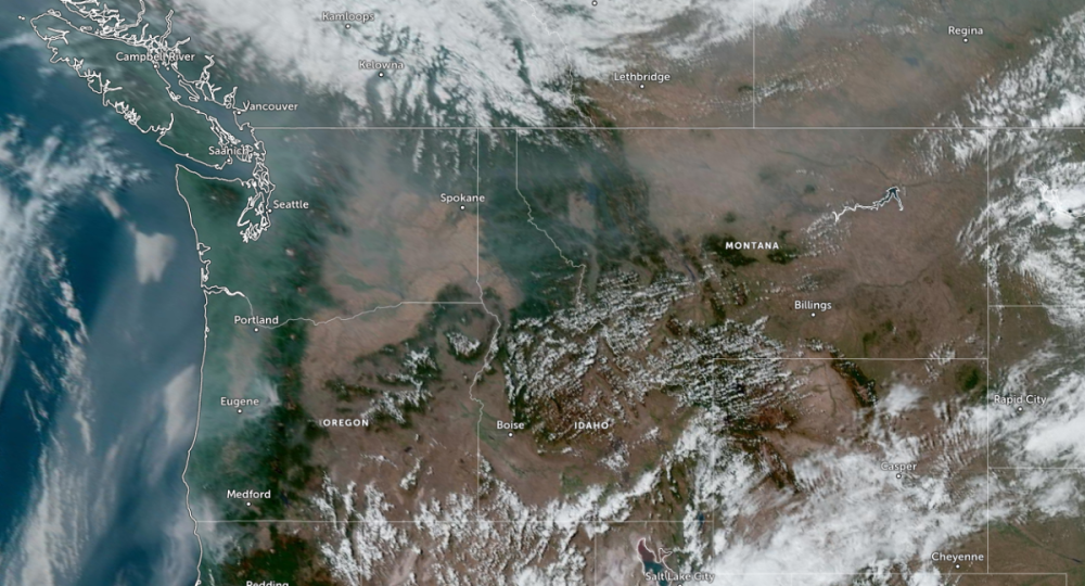
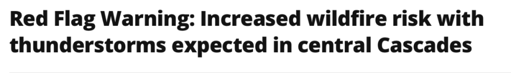
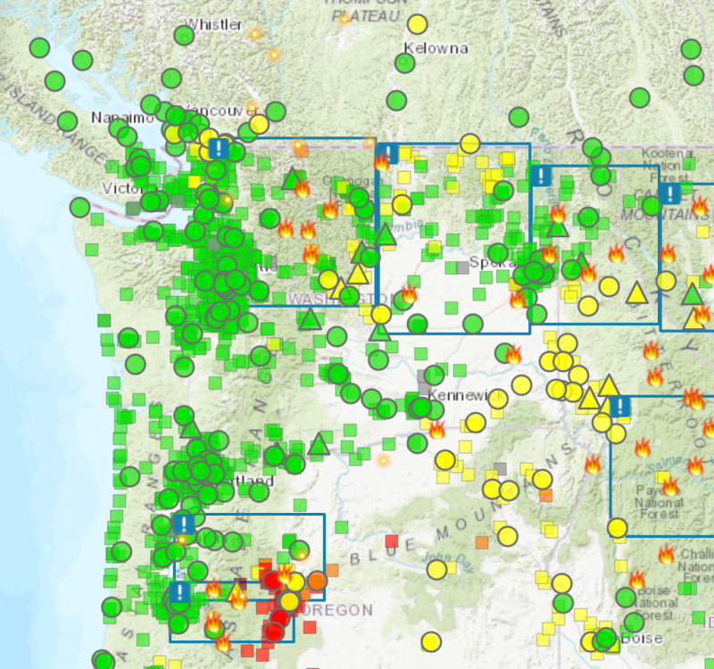
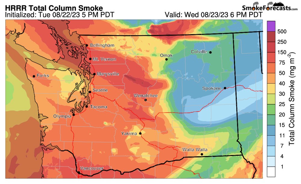
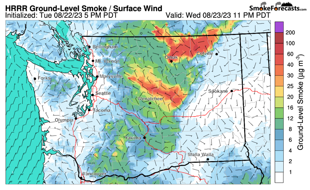
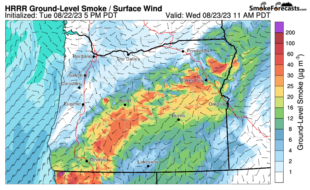
Not good with the lightning tonight across Oregon. This is prime time for wildfires. But let's check out our smoke. As of 1:10am, everyone is pretty much moderate right now, but things will quickly clean out tomorrow, opposite of what a lot of forecasters had been bemoaning for days. Ground level smoke should remain moderate (but a lot less then our last round) and start to clear out by 4pm Pretty much all of Western Washington will clean up and Eastern Washington will greatly clear up too. The story is less so for Western Oregon, especially SW Oregon which will be getting heavy smoke from California. The reason for this quick cleaning of ground level smoke will be due to winds coming from the south, moving north, and pushing a lot of it away. We may see some smoke aloft still but at least it's out of our breathing zone. Let's hope the lightning doesn't cause more fires during this super dry time of year.
-
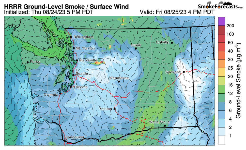
MUCH lighter levels of smoke in the air at higher altitudes for the Western portions of WA and Oregon. The Puget Sound is still seeing clouds too. Should burn off throughout the day.
-
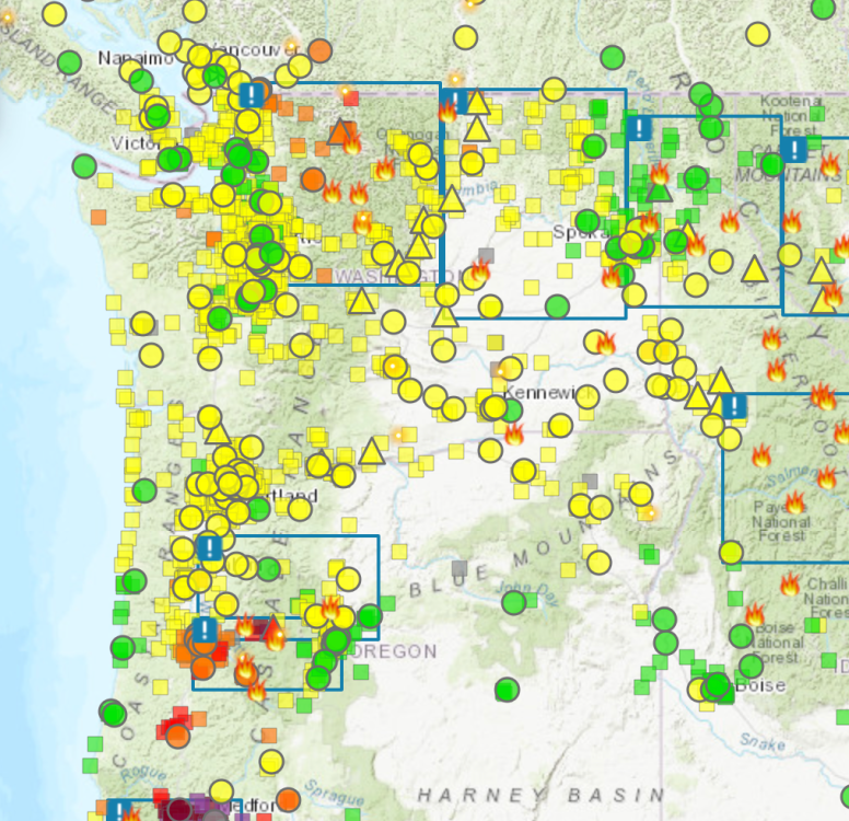
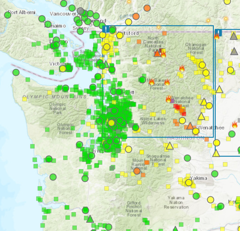
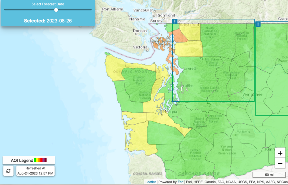
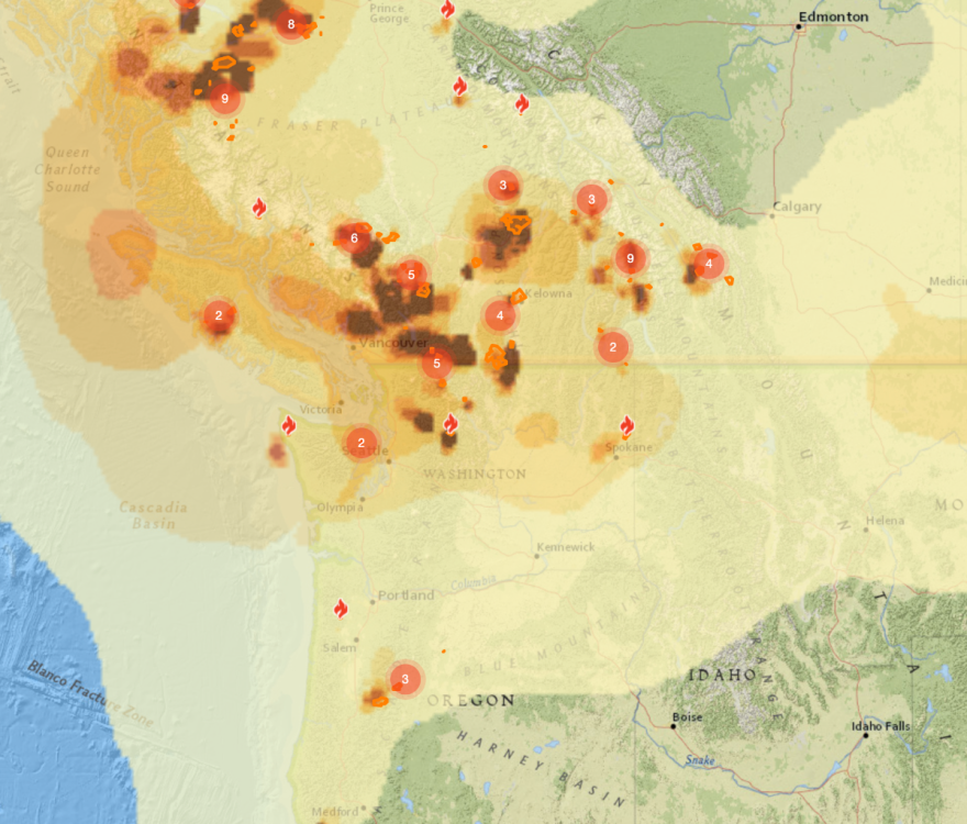
Current AQI is still green except for NW Washington and BC. The worst runs show August 26th being the worst day for smoke, and even then, the experts still predict we will have clean air to breath and it will mostly be aloft. So who is going to be right? The local tv media who is ramping up hype of dangerous smoke returning, or the State of Washington forecasters? Remind others to be mindful as well...
-
Here is the current AQI. We will check in on this later through the week. Smoke is returning, but at lower levels for much of Western Washington... I'm not too sure yet.
-
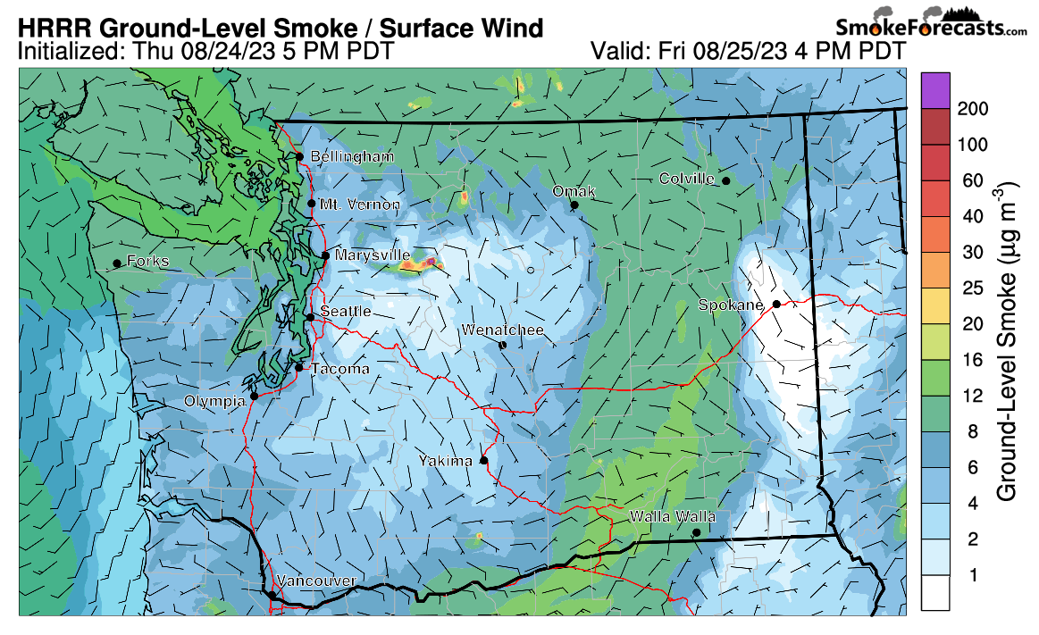
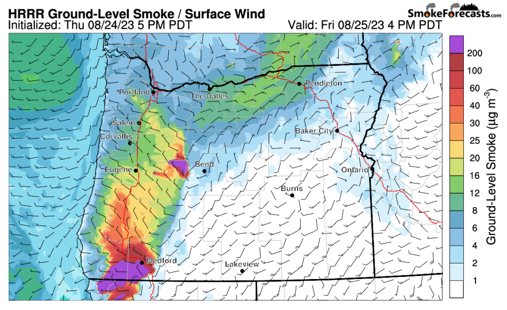
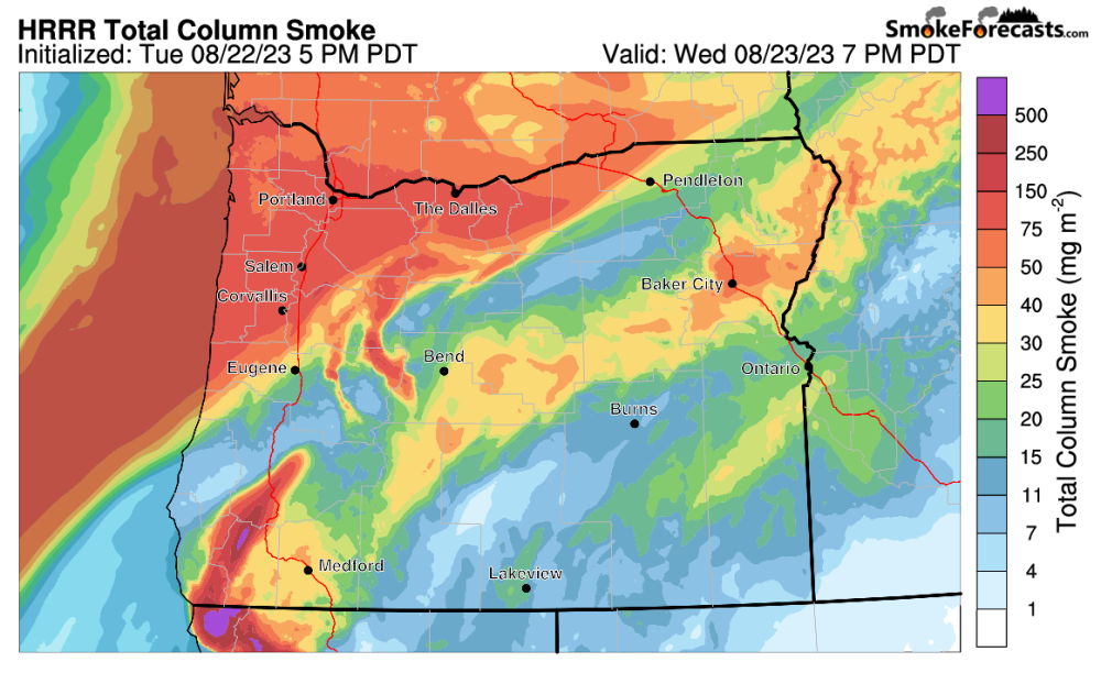
Unfortunately Thursday, especially evening, the smoke appears to be coming back. Heaviest concentrations will be in BC and NW Washington. Most of the smoke is coming from BC wildfires which continue to torch the province rent free. This time the smoke will be coming from out in the Pacific and moving over us that way, well a lot of it will be. Some of it will be localized for the Lower Mainland of BC and Whatcom County. This model is showing smoke at higher levels in the atmosphere, so not at ground level. Ground level smoke might be okay as there doesn't appear to be a lot yet on the modeling forecasts... unless you live in Central Washington. For Oregon, a lot of your upper level smoke will be from BC while the lower stuff will come from California wildfires and some localized stuff. This is at higher altitudes and should not be ground level. The NW portions is coming in from the Pacific from Canada wile the souther/central band is coming up from California.
-
The rain flipping missed me! What gives? The high temp yesterday was 68F and it is currently 57F. The longterm forecast for Everett looks manageable. It makes me sad to keep seeing rain pop up, only for it to disappear as we get closer to that day. This has happened a lot this year as a whole. I guess what really depends is on where the smoke is going to go.
-
I love the little bongo blob reaction!! They're back!!!
-
A 10 degree difference at about the same time. Big change. Your current temp then was our projected high. We only reached 65F today.
-
Glorious.