SpaceRace22
-
Posts
541 -
Joined
-
Last visited
Everything posted by SpaceRace22
-
February 2024 Weather in the PNW
SpaceRace22 replied to TigerWoodsLibido's topic in West of the Rockies
Can confirm. I go in to work at 5pm, so normally right at the peak of evening rush hour. Normally takes me an 1hr 15min to make it in, and today it took me 35 minutes. I honestly cannot believe how well this city has handled this event. The fact that UCLA just posted 12" of rain in 24 hours, yet so many rubes on twitter are screeching about how this was a nothingburger and they remember way worse 30 years ago is a testament to modern flood control and engineering. -
February 2024 Weather in the PNW
SpaceRace22 replied to TigerWoodsLibido's topic in West of the Rockies
I've officially seen more inches of rain with this storm in LA than I saw inches of snow in Vancouver last month. And I was ******* thrilled with how much snow we got. -
2024-2025 California and Southwest Weather Thread
SpaceRace22 replied to Anti Marine Layer's topic in West of the Rockies
Amazing how shitty the flatlands have done with this event. Really shows how orographically driven it all was. I'm in the hills in south OC only like 10 miles from SNA, and we have had literally double SNA's total and are over 4" now.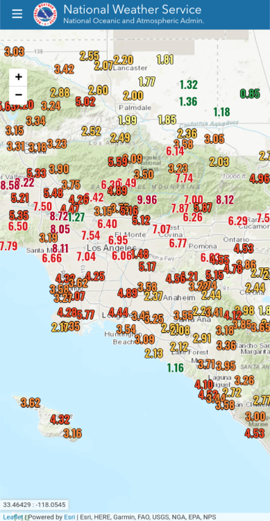
-
2024-2025 California and Southwest Weather Thread
SpaceRace22 replied to Anti Marine Layer's topic in West of the Rockies
A little wet today. -
2024-2025 California and Southwest Weather Thread
SpaceRace22 replied to Anti Marine Layer's topic in West of the Rockies
We are all doing to die -
2024-2025 California and Southwest Weather Thread
SpaceRace22 replied to Anti Marine Layer's topic in West of the Rockies
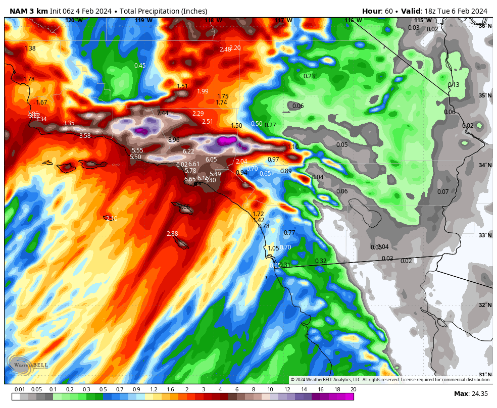
The 6z NAM just came in borderline catastrophic. Both the NAM and the HRRR are showing the atmospheric river stalling out exactly over LA County until literally the end of their runs. If that actually happens, the totals shown in this map will almost certainly be underdone. Even still, this has a minimum 5-7" over the entire LA Basin, with 10-15" in the San Gabriel foothills, and nearly 25 freaking inches of QPF over Mt Baldy. Buckle up everyone. This might be a storm that we remember for many, many years.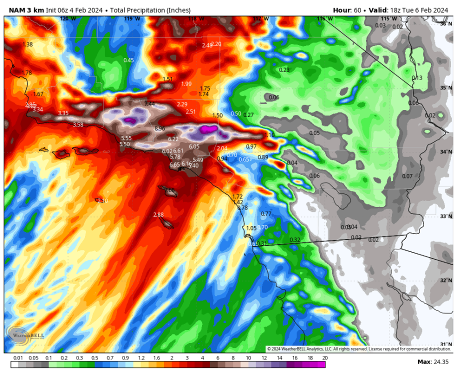
-
2024-2025 California and Southwest Weather Thread
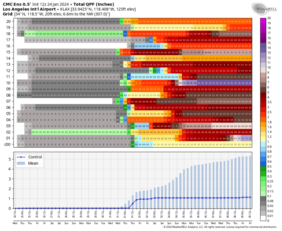
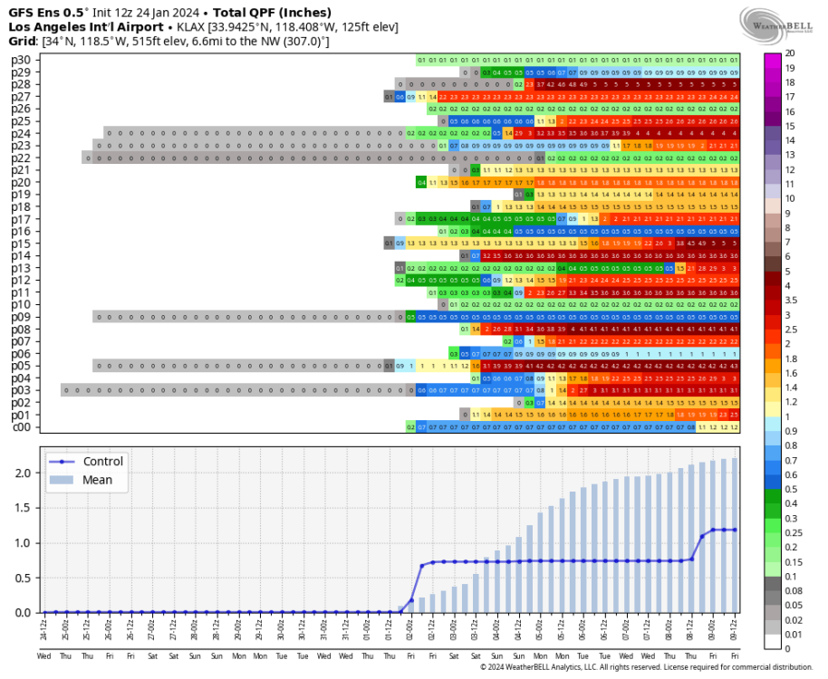
SpaceRace22 replied to Anti Marine Layer's topic in West of the Rockies
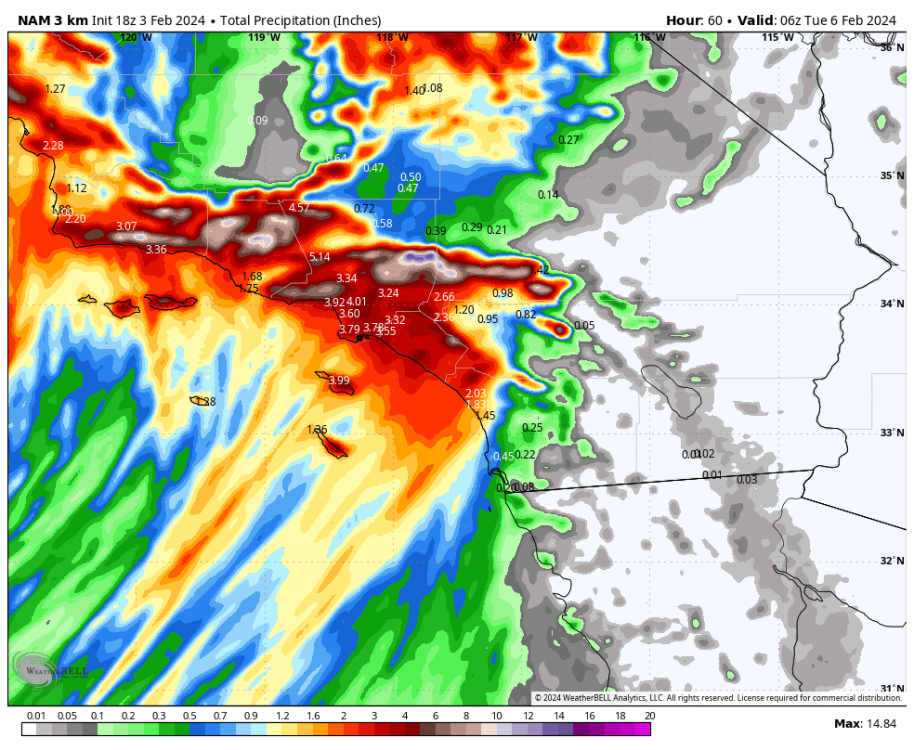
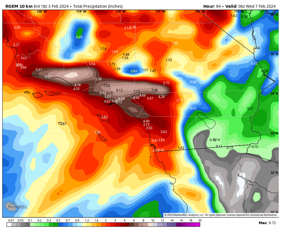
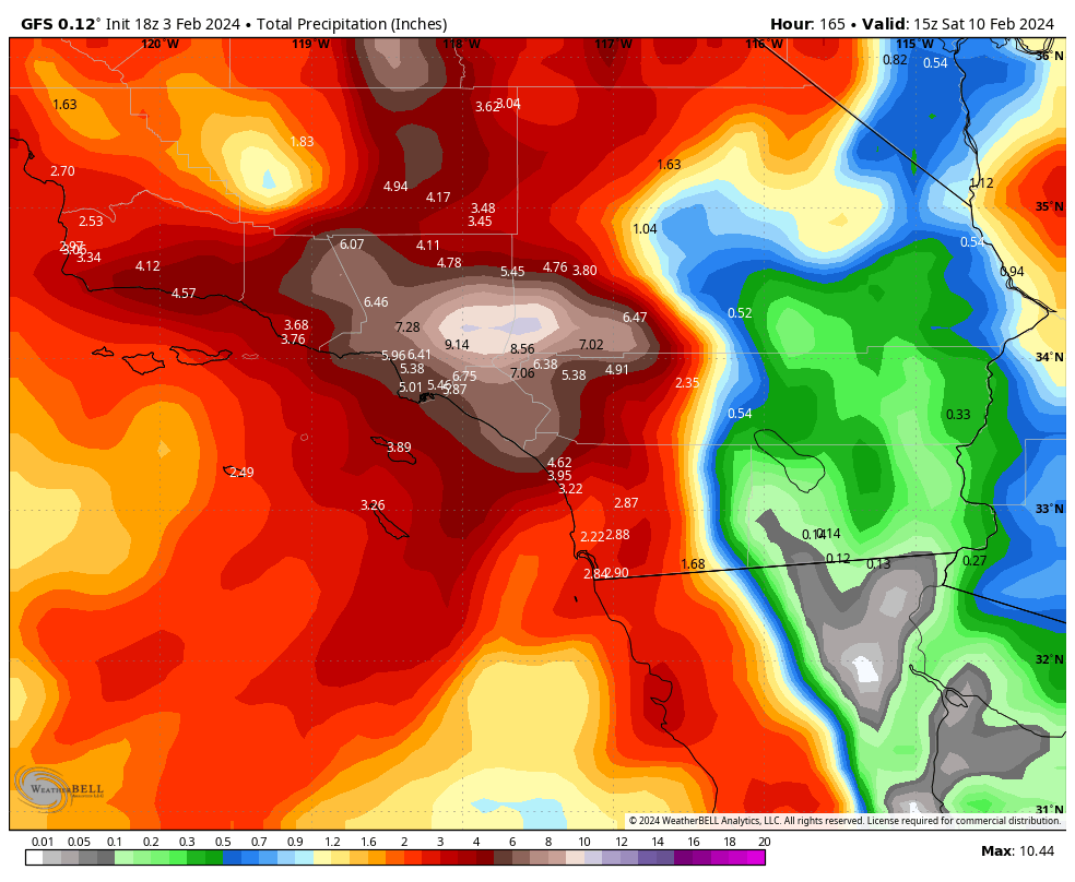
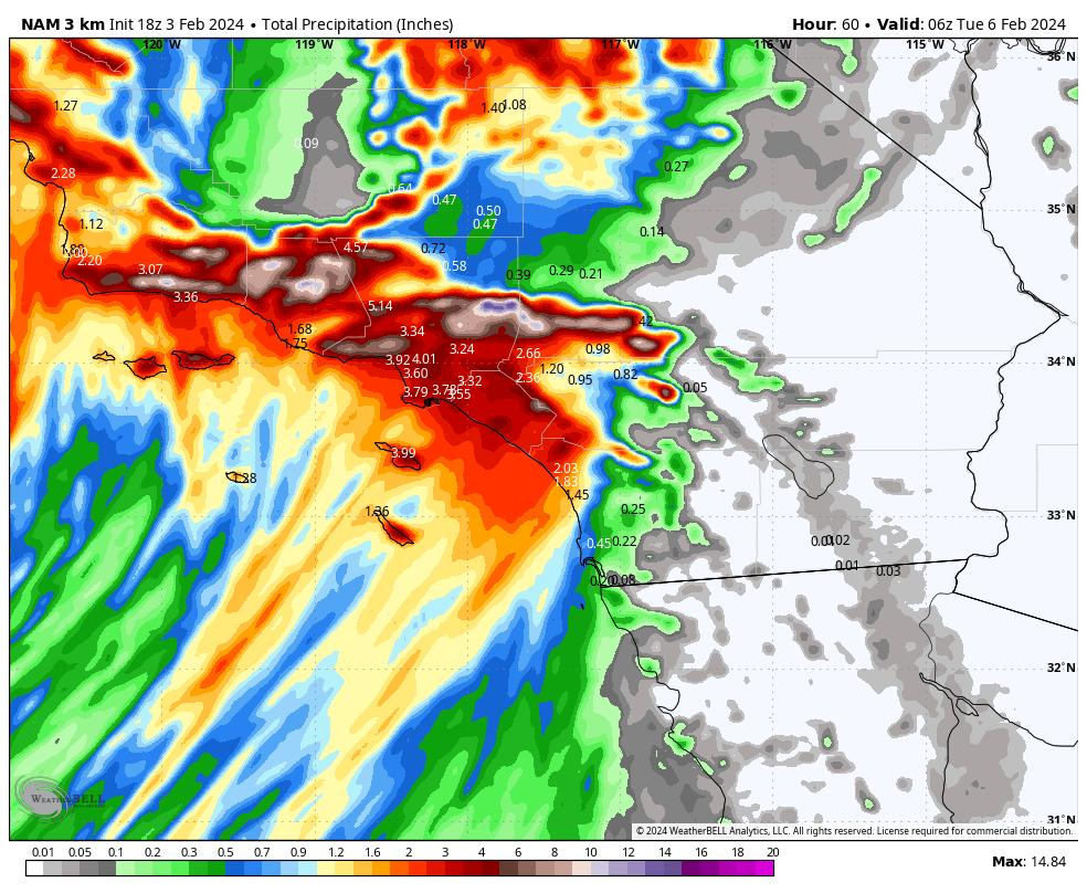
In the interest of making this thread more like the PNW one, here's some model riding for you. The last 2-3 sets of runs have definitely shifted the primary axis of this thing a little bit to the east. Looking like the bullseye might be the San Gabriel Mountains instead of SB/VTU counties. Still going to be a soaker there too though. 18z GFS: 18z RGEM: 18z 3km NAM (the main axis of precip is still dead center over LA county on this final frame, so these totals are significantly underdone as there will be much more to come here):

-
January Weather In The PNW 2024 (Part III) - The Warming Shot
SpaceRace22 replied to iFred's topic in West of the Rockies
GraphCast is looking pretty nice at hr 240, so this is as good as LOCKED IN. (1v1 me, h8rs)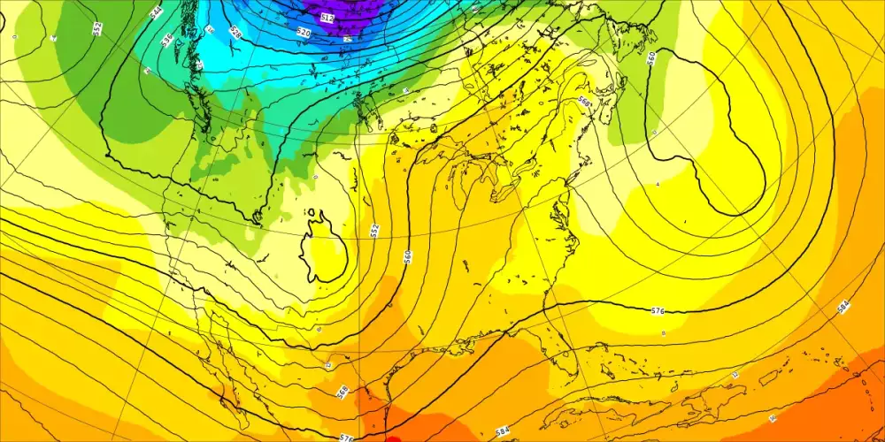
-
2024-2025 California and Southwest Weather Thread
SpaceRace22 replied to Anti Marine Layer's topic in West of the Rockies
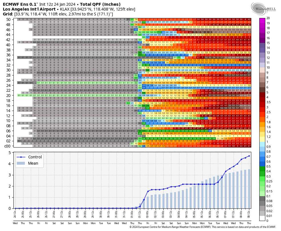
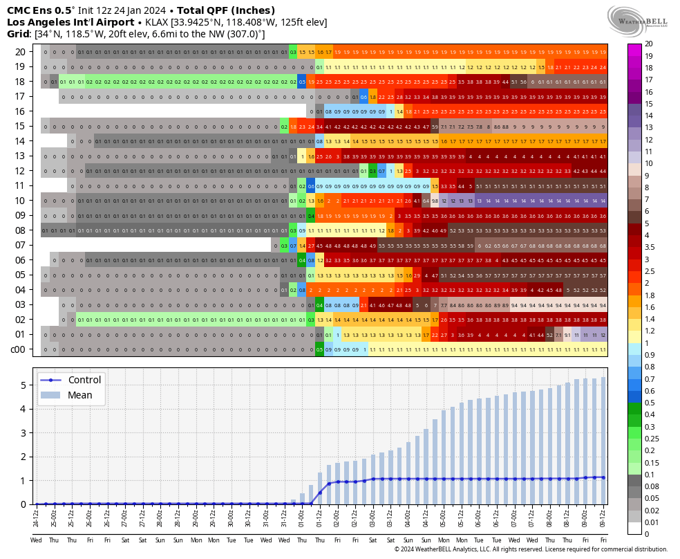
Pretty much a lock now that SoCal is getting soaked next week. All 3 major Ensemble suites got significantly wetter on today's 12z runs, too. The 12z Canadian Ensembles are particularly interesting. Some members show a full year's worth of rain in 3 days at LAX. 9.3" of QPF in 24 hours, lol.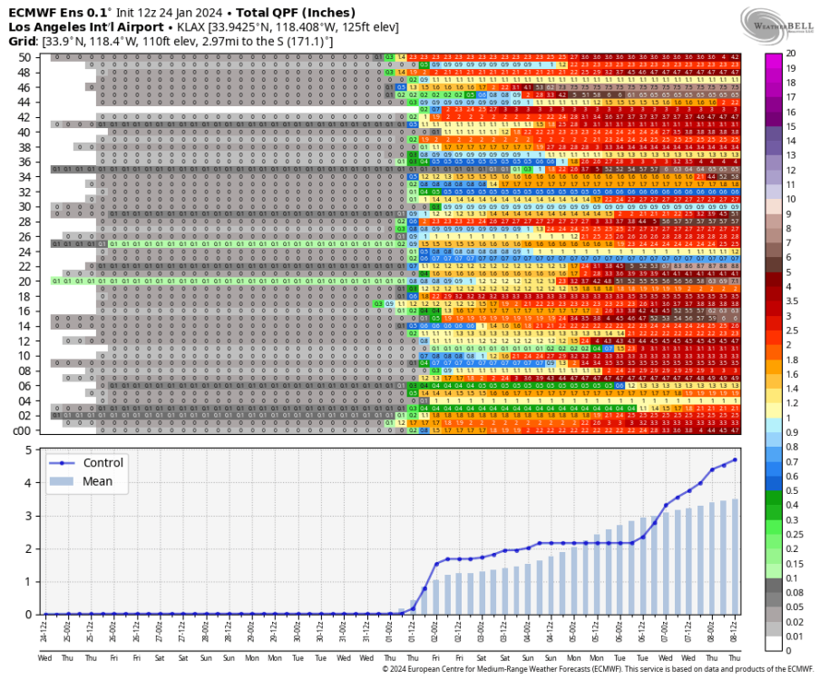
-
January Weather In The PNW 2024 (Part III) - The Warming Shot
SpaceRace22 replied to iFred's topic in West of the Rockies
Ahh, nice to see the Euro Ensembles finally showing some snow potential in Februa- HEY WAIT A MINUTE
.thumb.png.f8ee075e003f506fb150d0a4202b11da.png)
-
January Weather In The PNW 2024 (Part III) - The Warming Shot
SpaceRace22 replied to iFred's topic in West of the Rockies
Yeah, I know the absolute amount falling over the 10 day period isn't all that unusual, but the time period it falls in is. If 20-30" fell within a 2-3 day period, that would be pretty gnarly and would definitely cause some major flooding regardless. The bigger risk would probably actually be for more inland parts of the BC mainland though, which tends to get railed pretty good by atmospheric rivers like this since it's the one setup where they don't get rain shadowed super heavily as the precip blasts in from the SW. The threshold for what causes flooding there is way lower. Anyway, didn't mean to make it seem like I thought this is going to be a thousand year flood that wipes BC off the map. Just that right now the models are a bit concerning is all. There's *potential* for something significant, but it's far from world ending and far from a certainty. -
January Weather In The PNW 2024 (Part III) - The Warming Shot
SpaceRace22 replied to iFred's topic in West of the Rockies
Yeah but maybe not 3 month's worth in 3 days, lol. -
January Weather In The PNW 2024 (Part III) - The Warming Shot
SpaceRace22 replied to iFred's topic in West of the Rockies
Some of today's model runs are getting downright scary for much of BC with all this rain. Every recent run of the GFS is showing 15-30" of rain in ~3 days for most of Vancouver Island. The 00z Canadian's solution is even worse, with a legitimately catastrophic 43" of QPF shown for the maximum in the mountains. Hopefully one of these atmospheric rivers ends up orienting itself a little further south or north, because if they just keep blasting the same part of BC literally nonstop for days, it could get super ugly.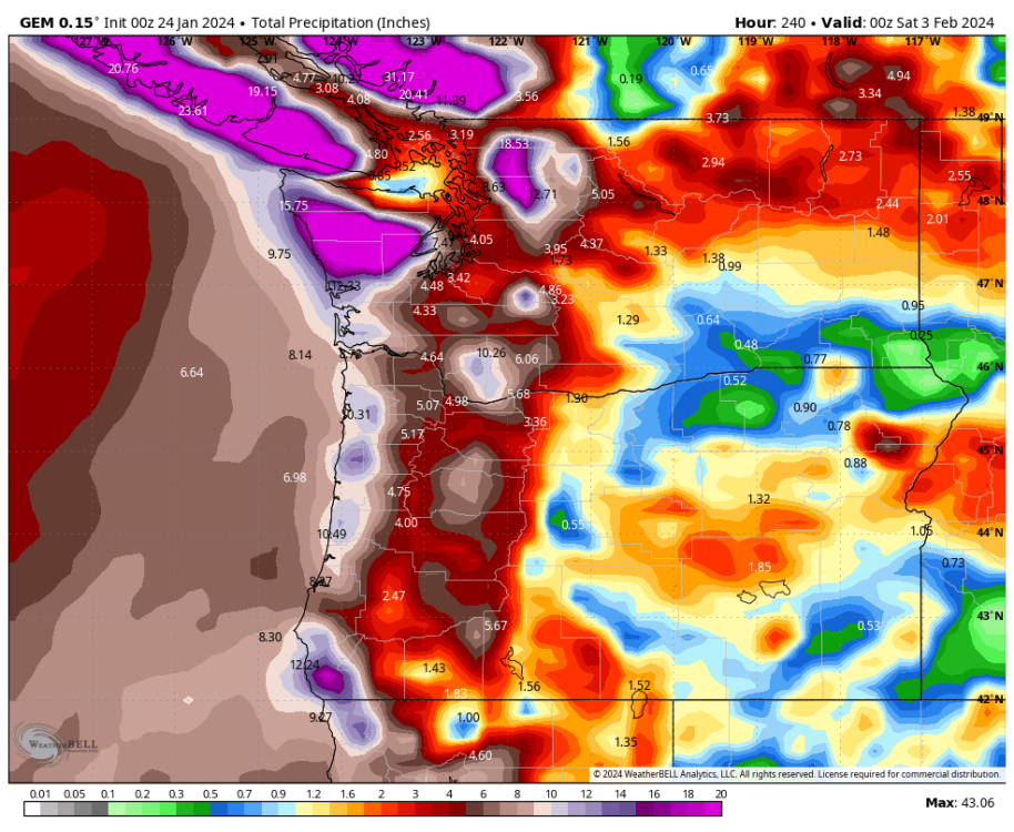
-
January Weather In The PNW 2024 (Part III) - The Warming Shot
SpaceRace22 replied to iFred's topic in West of the Rockies
Amazing how many areas in the SW metro that were up near 45 yesterday are now back at or below freezing.
-
January Weather In The PNW 2024 (Part III) - The Warming Shot
SpaceRace22 replied to iFred's topic in West of the Rockies
This will probably shock a lot of people in light of recent news reporting, but my Tesla has been hands down the best vehicle in the ice and snow I have ever driven. Took it out at the height of the ice storm yesterday morning with 0 issue (well technically my mom's car, but she has the exact same model as me). Drove it all over Seattle and up some shockingly steep hills at the height of Dec 2021 with no trouble at all as well. I remember passing countless cars that couldn't make it up the same hill I was driving up with ease. I've also taken it up Hwy 2 and I-90 during countless snowstorms without any issues whatsoever. Can't say enough good things about that car as far as how it drives in slippery conditions. The extra weight of the battery combined with the AWD and smart traction control capabilities the car has are an absolute godsend in the snow. There's never been anywhere I haven't been able to go in any type of weather so far. -
January Weather In The PNW 2024 (Part III) - The Warming Shot
SpaceRace22 replied to iFred's topic in West of the Rockies
I am a complete and total moron when it comes to 500mb charts, so this could be false hope and not a pattern where a GoA ridge has a chance of building out of, but the GraphCast looks like it's loading one hell of a gun at hour 240. Tons of cold air building up in Canada. The Pacific looks very zonal and blah at that time, but this seems like something that could be very spicy with a few more days of run time.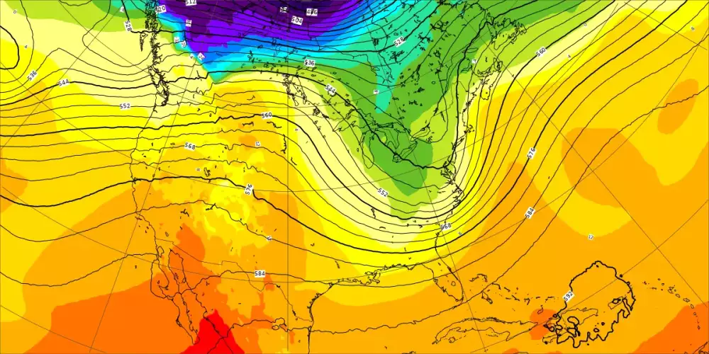
-
January Weather In The PNW 2024 (Part III) - The Warming Shot
SpaceRace22 replied to iFred's topic in West of the Rockies
Still only 32.5 here. We tried to thaw briefly yesterday around 1pm, but very quickly went back below freezing for the whole evening and overnight. It was interesting to see everything go from wet and drippy to suddenly looking much more "white" s the temp inched down a half a degree or so. Finally getting some serious melting here now today, but still an impressive amount of ice over everything. Ground remains completely covered in snow (if you can even call it that at this point, lol). Would not be shocked to dip back below freezing tonight, given how precarious our temp is right now. Looks like several stations within a couple miles of here are still right at or just under the 32 degree mark. -
January Weather In The PNW 2024 (Part III) - The Warming Shot
SpaceRace22 replied to iFred's topic in West of the Rockies
That's very intriguing. Something tells me this winter is far from over. -
January Weather In The PNW 2024 (Part III) - The Warming Shot
SpaceRace22 replied to iFred's topic in West of the Rockies
It's seriously impressive how much better Vancouver can do compared to every other lowland location south of the border. I would move there in a heartbeat if work and geopolitical boundaries allowed it. Know any Canadians who will sell me their marriage so I can have citizenship? -
January Weather In The PNW 2024 (Part III) - The Warming Shot
SpaceRace22 replied to iFred's topic in West of the Rockies
Spring is just around the corner!!

- 6999 replies
-
- 15
-

-

-

-
January Weather In The PNW 2024 (Part III) - The Warming Shot
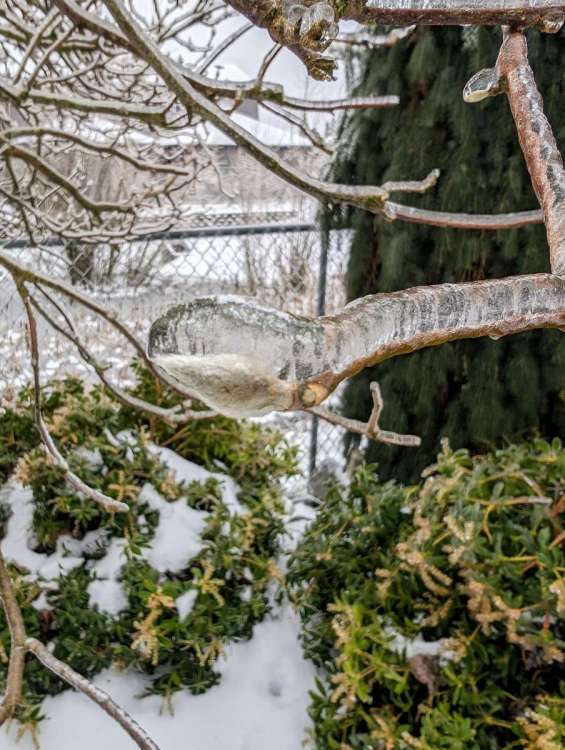
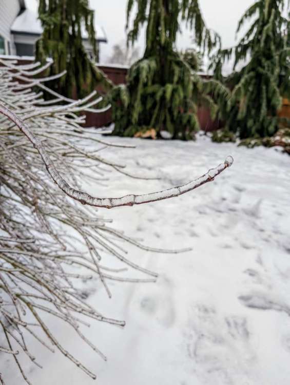
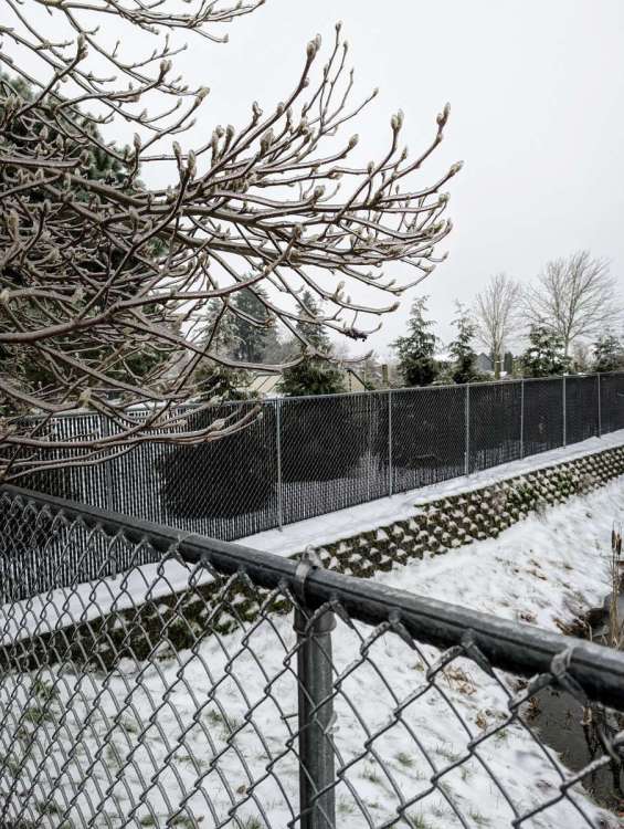
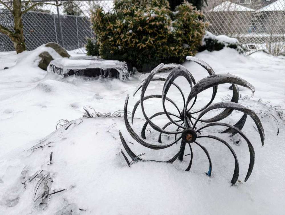
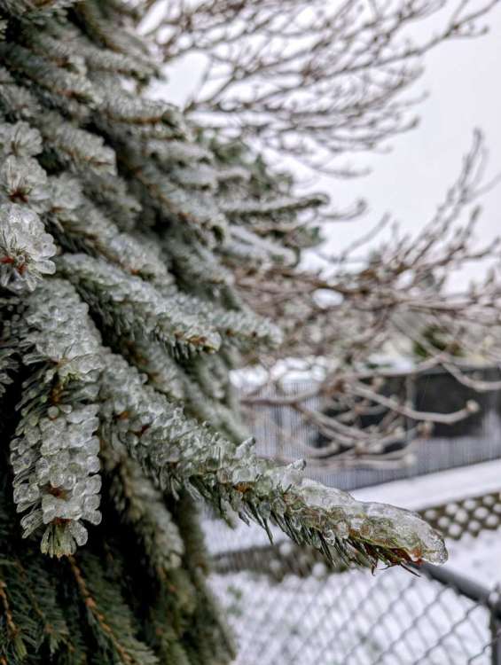
SpaceRace22 replied to iFred's topic in West of the Rockies
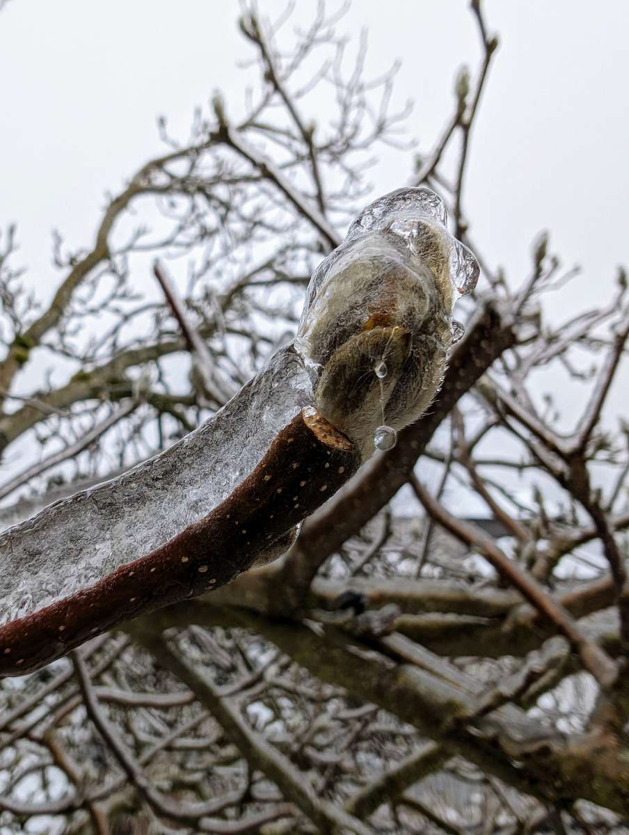
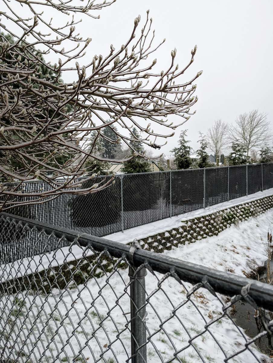
More dog poo free ice pics. Also, the pond near the house is completely frozen solid now. Some kids were jumping on the ice trying to break it yesterday and they physically could not. Pretty impressive week this has been!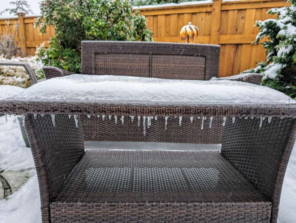
-
January Weather In The PNW 2024 (Part III) - The Warming Shot
SpaceRace22 replied to iFred's topic in West of the Rockies
I do not understand that the hell that man's deal is. There's no doubt he's an incredibly intelligent and experienced professional, but his stubbornness and ability to occasionally disregard incredibly compelling evidence is odd. -
January Weather In The PNW 2024 (Part III) - The Warming Shot
SpaceRace22 replied to iFred's topic in West of the Rockies
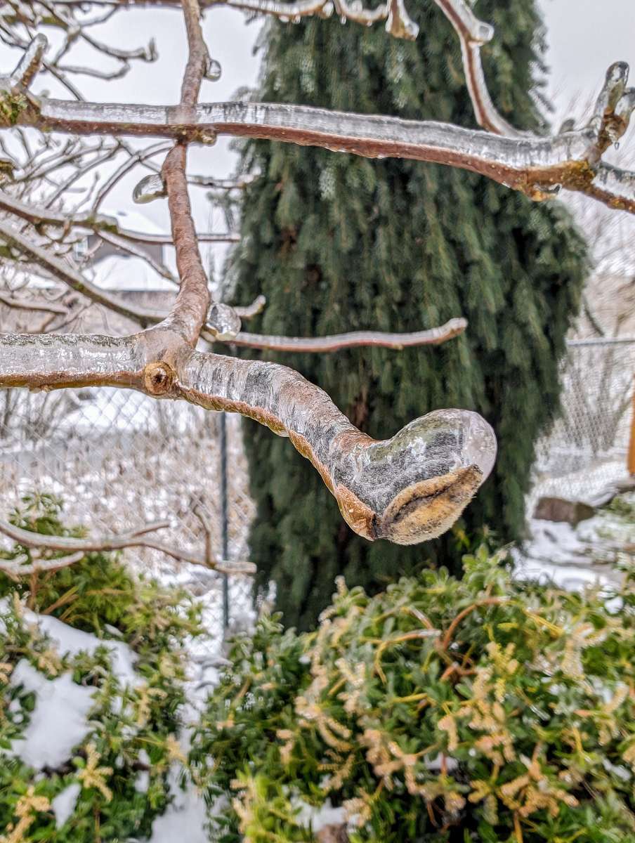
28 degrees with a solid half inch of ice coating everything now. Looks like some pretty heavy rain is about to move in, and I don't think we are going to thaw before then. Reeeeally happy we have underground power lines here.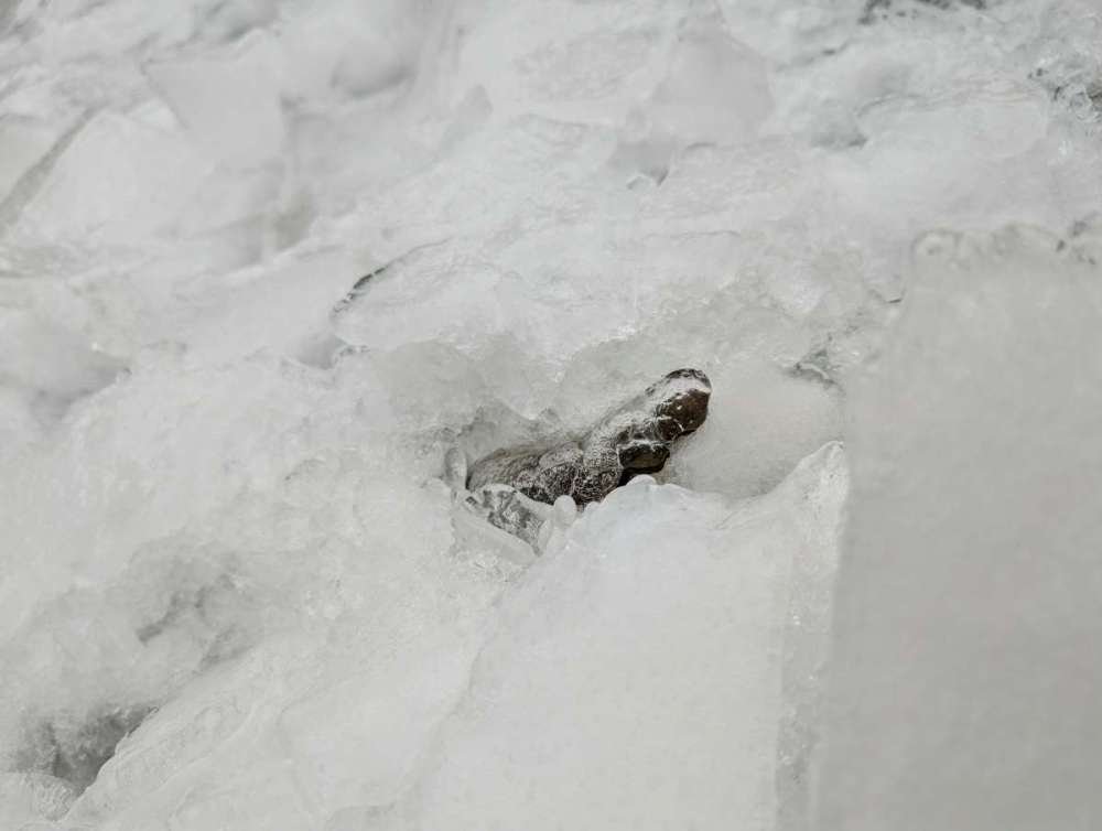
-
January Weather In The PNW 2024 (Part III) - The Warming Shot
SpaceRace22 replied to iFred's topic in West of the Rockies
Yeah, the AIFS. It's available here: https://charts.ecmwf.int/?facets={"Product type"%3A["Experimental%3A AIFS"]} -
January Weather In The PNW 2024 (Part III) - The Warming Shot
SpaceRace22 replied to iFred's topic in West of the Rockies
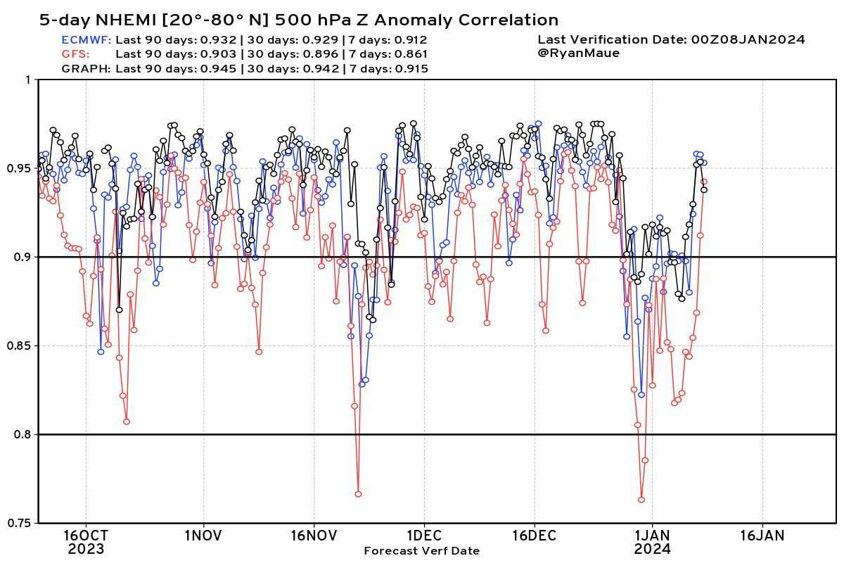
Also, I know that meatyorologist and Mr Nyberg think I am a literal child for liking the GraphCast (xoxo h8rs) and gave me a good scolding last week for having the audacity to mention it, but I just found this actual skill data comparison for it and it blows even the Euro out of the water. I've also seen some literature claiming that GraphCast especially tends to handle extreme events better than the other models, so I think this is very likely the primary model we are going to be using on here in the future. In particular, I found it interesting how there were a couple times recently where the GFS or Euro (or both) fell off a cliff, but the GraphCast didn't. Look at the periods around Oct 17th, Nov 20th, Dec 30th, and Jan 4th on this chart for some examples of GraphCast completely outperforming the others. Anecdotally, GraphCast did seem to have this whole event over the weekend down better than any other model, so there is very likely a new king in town that I will be there for trusting above all the others in future events. At least around the mid range/5 day-ish period. Still a lot of use for the traditional models in the long and short range periods imo.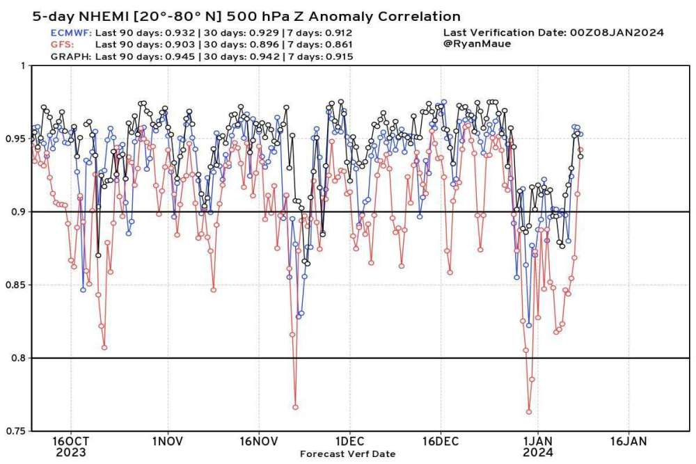


.png.a5895cc919c6ee92e8d0578daded9ad1.png)