Eugene-5SW
-
Posts
137 -
Joined
-
Last visited
Eugene-5SW's Achievements
")


-
Is he showing you a bunch of stats he cherry-picked to prove it really isn't all that hot there?
-
Definitely not just media hype. Took me 2.5 hours to get back to Eugene from my eclipse viewing site 60 miles away, and that was on back roads. Main roads were completely jammed.
-
29º crash from 78º yesterday to a midnight high of 49º today. Could have been even more dramatic if the front had arrived a bit sooner, as it didn't get above 46º during the day. Rare rain over-performance too with 0.33" in the gauge and more coming down.
-
It all depends on where you're putting your axis of rotation. That has not been defined. If it's the middle of the map, then we need more like a 45º clockwise rotation.
-
Like Phil said. Most of Arizona is on permanent standard time, and yet life goes on. The exception is the Navajo Nation, which observes the typical DST schedule.
-
You probably know about it already, but this site seems to work OK for me: https://nwcc-apps.sc.egov.usda.gov/imap/ I like how configurable it is. It can show SWE by basin, or individual snow amounts by station, among much else.
-
34º too up here at 850' with rain only. Porch light test negative. Wonder how @Eugene Snow is doing at 975'?
-
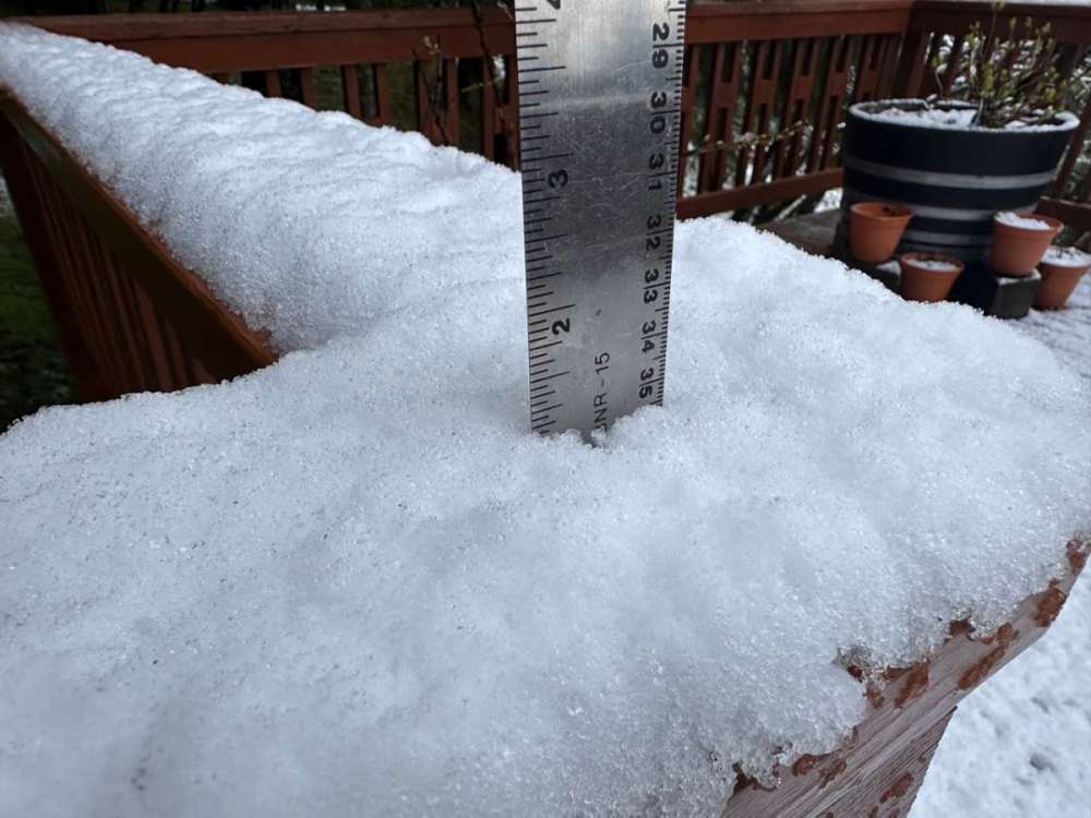
A Slushy Inch!
- 6147 replies
-
- 12
-

-

-

-
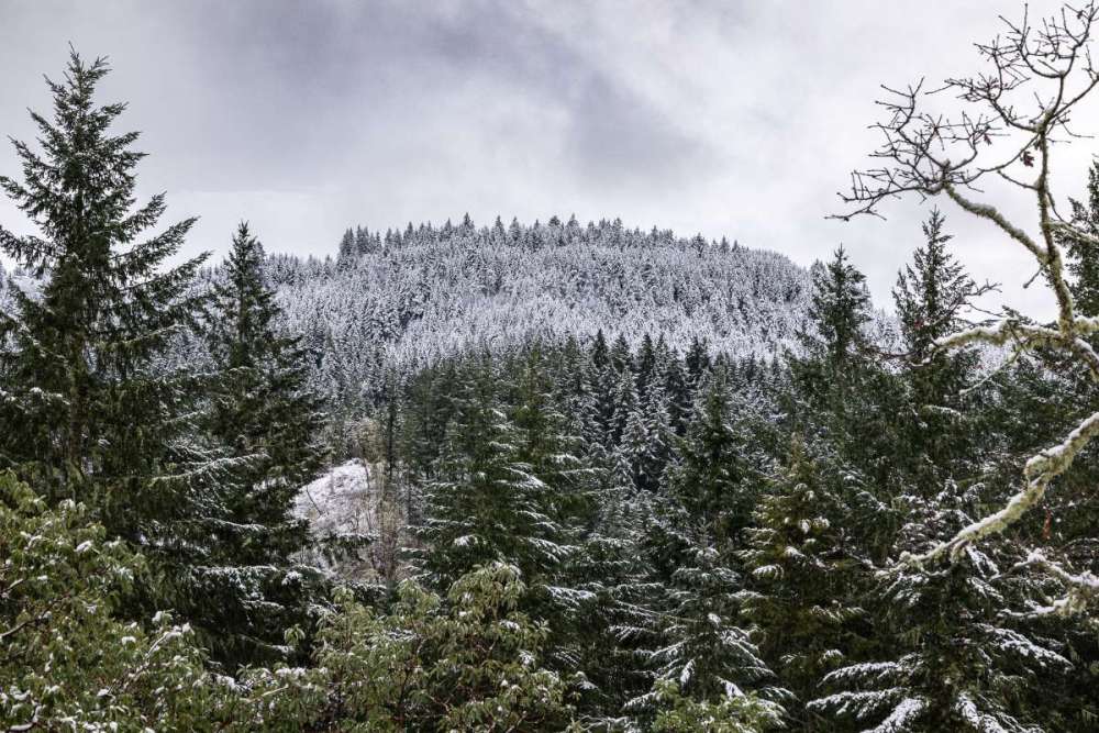
What a difference 120 feet makes! You can see it on the ridge across from me with a sharp cutoff above which the snow is much heavier.
-
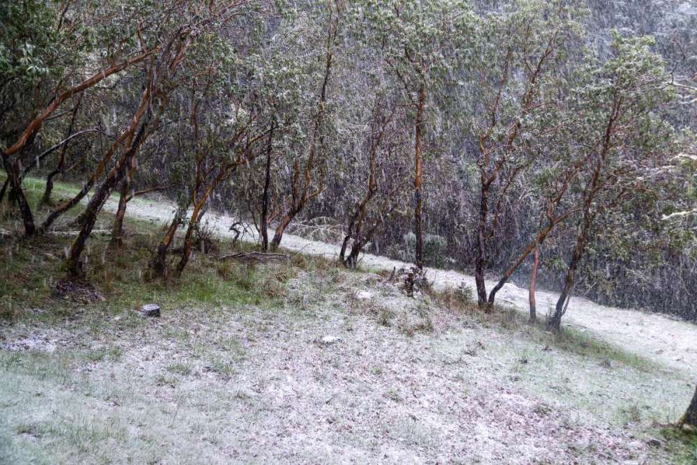
Nice to see that the valley folks scored! About 3/4" on the ground here with more coming down. So pretty!
-
I was pretty happy about it, actually.
-
33º with some sticking snow here
-

February 2024 Weather in the PNW
Eugene-5SW replied to TigerWoodsLibido's topic in West of the Rockies
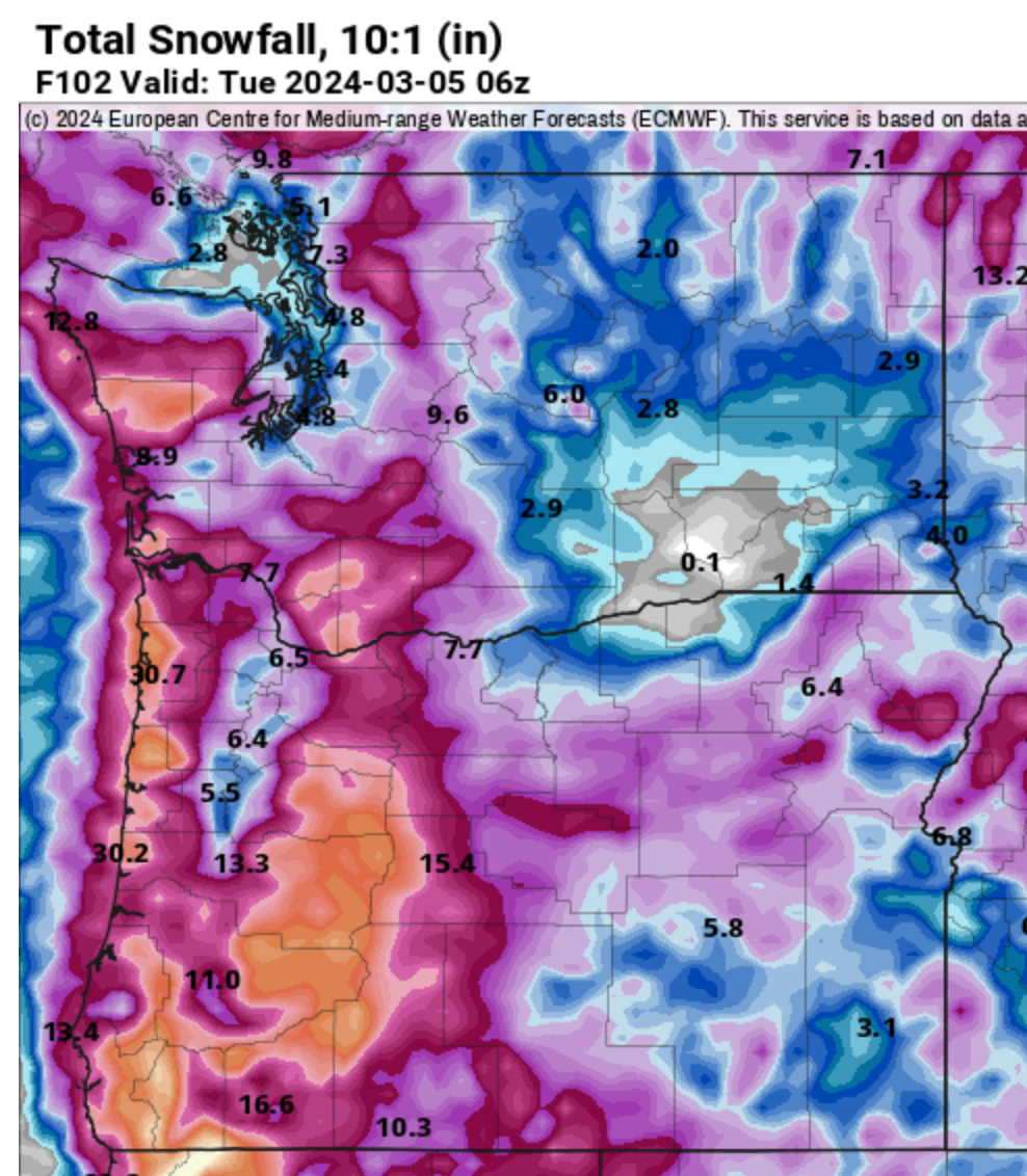
Florence the big winner for coastal snow on tonight's Euro with 30"!
-
February 2024 Weather in the PNW
Eugene-5SW replied to TigerWoodsLibido's topic in West of the Rockies
1.03" on the day, 1.27" storm total, 4.51" on the month, 24.06" on the water year. Snowflakes mixed in with the heavier showers. Looks like a sunbreak is on the way. All good stuff! -
February 2024 Weather in the PNW
Eugene-5SW replied to TigerWoodsLibido's topic in West of the Rockies
34º with light rain and some flakes mixing in. About what I expected. 1.04" storm total so far a bit better than I expected!