


hlcater
-
Posts
2123 -
Joined
-
Last visited
-
Days Won
2
Posts posted by hlcater
-
-
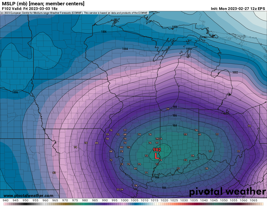
2 hours ago, Hawkeye said:
12z EPS

Big cluster of members near Hannibal likely bring the goods here.
-
 1
1
-
-
This is likely to be the best storm of the season here despite the 3-4 hr dry period. The defo zone quickly made up for that and with 1-2 hours of snow left, will likely finish with 6-7". About in line with the model consensus. Nice to break the trend of events falling short of expectations this winter.
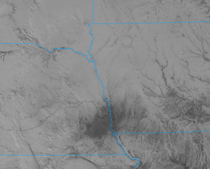
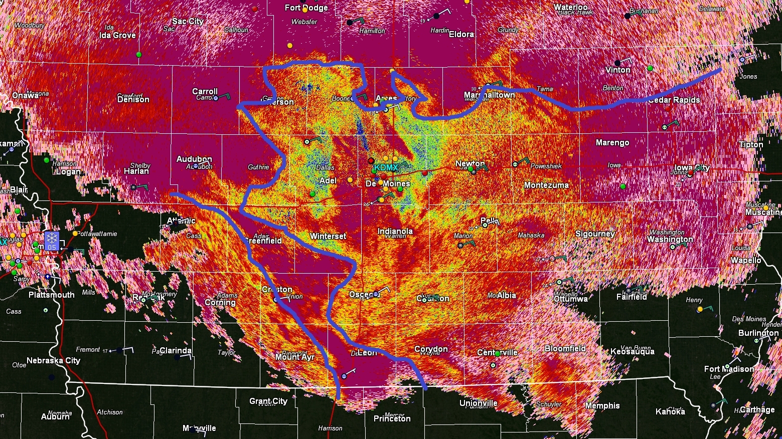
IC area is closing in on 9-10" and Waterloo is reporting 2-2.5"; hell of a gradient and CR looks to have wound up just barely on the right side
-
8
-
-
Eyeballing close to 6”. This band that’s been over me for the past 2 hours or so is really delivering the goods
-
2
-
-
Expecting to end right near 6" with a measurement of about 4.5" right now and probably another 1.5-2" on the way.
-
1
-
-
18z so far looking better than 12z
-
I see we are doing the T24 trend into the toilet
-
This is looking like a nice one.
-
2
-
-
Maybe just maybe we can crack 6" on this one.
-
2
-
-
Cant dislike the 00z suite for E IA tonight. 60 hours to go.

-
4
-
-
The airport is likely higher because they do hourly measurements negating compaction/melting.
I’ve got maybe 1.5”
-
WSW issued
* WHAT...Heavy mixed precipitation expected. Total snow
  accumulations of 3 to 5 inches and ice accumulations up to a
  tenth of an inch. Up to a tenth of an inch of sleet is also
  possible.

* WHERE...Portions of east central and northeast Iowa.

* WHEN...From 3 AM to 6 PM CST Thursday.

* IMPACTS...Plan on slippery road conditions. The hazardous
  conditions will impact the morning.

* ADDITIONAL DETAILS...A band of heavier snowfall is possible but
  the location of the band is uncertain at this time.
-
2
-
-
21 hours ago, Bryan1117 said:
Don’t complain too much my friend (things could be much worse like here in East Central NE)… you currently stand a good chance to get some decent precipitation. I would take 33 and rain all day long right now.
I'm not. Things could always be worse, but it is kind of a pet peeve. Though now the snow band is so narrow that you're riding the edge regardless.
-
1
-
-
I swear CR rides the edge in every. single. event.
-
3
-
 1
1
-
-
Have exactly zero confidence in this storm due to the incredibly marginal thermos.
-
3
-
-
Fast asleep rn
-
All the NAM derivatives are crazy north. Just don’t think this pans out well here but we’ll see I guess
-
2 minutes ago, Hawkeye said:
Assuming we get a bit Friday and again Saturday, I may end up with six consecutive 0.5-1.3" snows. Unfortunately, the fact is our snow climate sucks. It's a nickel/dimer climate and it always will be. Ten variables have to align perfectly just to get 6".
I've got exactly 1 event down over 3" so far this year. Pathetic.
-
2
-
1
-
-
Getting close on being time to punt for those south of 20. With the trends tonight its looking like this might be ANOTHER 1" snow.... yay.
-
1
-
-
Initial call for CR: 2”.
-
1
-
-
NAM going north
Way north
-
HRRR way up in N IA.
-
Now this is a special kind of pain
-
1
-
 2
2
-
 1
1
-
 1
1
-
 1
1
-
2
-
-
Lol what a p-type nightmare. Though W/S IA are switching over fast.
-
1
-
-
1 minute ago, bud2380 said:
Rain/snow mix down by my house. Radar is so impressive too. If only it were a degree or two colder.
Bright banding due to the melting layer. If it were colder the returns would be much more typical.
March 1st-4th...Major Winterstorm Potential
in East of the Rockies
Posted
Need the GFS to come on board. Still warm and SE relative to the ensembles, NAM, euro etc.