

SnowHawks
-
Posts
91 -
Joined
-
Last visited
Posts posted by SnowHawks
-
-
BC Slider baby! Everybody scores!
-
 3
3
-
 5
5
-
-
I am pretty disappointed with this event. Yes, it was nice to get the cold temps. But for me a would rather have a good BC slider that doesn't seem to pick and choose where it will snow and leave others with nothing. Arctic or modified Arctic air in place and your moisture or low pressure moving down the BC coast that only slightly modifies the air is the only way the Central Pugent Sound can get a Vancouver type experience. Yea I know low pressure arriving at the Columbia River is ideal, but how often does that happen?
-
8
-
-
Downtown Everett at 16 degrees, hope all this cold air is not wasted for lack of moisture.
-
1
-
-
Wishing everyone a Happy New Year and think snow from the Canadian border to the California State line.
-
1
-
1
-
-
What was remarkable about the December 1968 airmass was the length of the event. As I recall it began several days after Christmas and lasted until the 3rd week of January 1969. It was so cold that the windows of our older home in North Everett, froze from the inside!
-
4
-
-
I was reading KOMO news brief description for our upcoming EL NINO winter and looked back to see if there were any significant snows during an EL NINO in the PNW. 1968-69 stands out as one and I was wondering other than the EL NINO state at that time, what would have been the other factors that would have enabled such a rare occurrence?
-
 1
1
-
-
It seems as if we have resigned ourselves to a El Nino lack of snow winter. While the odds do not favor us for significant snowfalls, there have been exceptions in the past where we have had major snowfalls in the Seattle area. 1968-69 was a moderate El-Nino yet we had a month long Arctic outbreak with greater than 9 inches on the ground. So hope springs eternal.
-
 1
1
-
-
WSW 90 miles to the north of Seattle and WSW 150 miles to the South. Seattle trace to one inch-Classic!!!
-
 3
3
-
-
Deterministic and ensemble members remain in lockstep with each other regarding the Saturday system, starting to nudge onto the coast mid to late Saturday afternoon but not becoming a widespread concern until Saturday evening. The timing of the entrance of this front, given that cold air will remain in place, looks to be conducive to another round of lowland snowfall. Projected amounts look to be a little higher than the previous round. That being said, it does spread this snowfall out over a 36 hour period that extends into the long term, making for a complicated forecast thanks to daytime heating. Since this would start at the very earliest in the fourth period, no headline decisions need to be made at this time. I used to write blue book essays for exams in college. Where If I didn't study or know the material, I would try to BS my way through Sometimes I succeeded-most times not. But this write up takes the cake. How to write a forecast without saying anything. Thanks Seattle NWS!
-
3
-
1
-
-
You mean Eugene to Bellingham?
-
4
-
 1
1
-
 1
1
-
-
I was living temporarily in Fair Oaks, Ca and remembering how bummed out I was for missing a great snow event. The best I could do is watch You Tube videos of the event. Not quite the same as experiencing it in person.
-
20th works for me I will be flying back from Vegas.
-
Yea Nicholslegate- I was living on Capitol Hill in Seattle and we had a good 10 inches to a foot and the roads were not plowed. I had an Audi TT(fast car) with all wheel drive. It could go anywhere in the snow. I remember being pissed because my car kept bottoming out because the roads weren't plowed.
-
Just observing a flag pole hoisted upon a Downtown Everett building, shows a brisk northerly wind which coincides with the temp drop.
-
3
-
-
So what does King Euro say for today?
On 12/18/2022 at 9:48 AM, Seattle said: -
40 minutes ago, Doinko said:
9:45 around I think
Thanks
41 minutes ago, Doinko said:9:45 around I think
-
1
-
-
What time does the EC run?
-
1
-
-
Yes a repeat of Jan 1969 but with more systems interfacing with that extreme Arctic air. We could have had 1950 all over again.
-
2
-
-
I wish I could tell you but my world existed in Everett only as I was 7.
-
4
-
-
I hate to date myself but looking at the CPC analogs I remember significant snows either Seattle area or region wide (1) 1968 arctic blast with a foot of snow on the ground in Everett(2) 1983 Snow from Everett to Pullman with freezing rain in Othello (3) 1987 snow just after Christmas that lasted until New Years. (4) 1989 Valentines Day arctic outbreak with daytime high of 14 degrees. So there you go this area is capable of heavy snow and frigid temps. Would love to see that this year.
-
7
-
 1
1
-
-
1968 had a huge block that sent Arctic air into the Pacific Northwest. A huge regionwide snow followed by almost a month of sub freezing highs. I remember Harry Wampler explaining how unusual this was. I may be wrong but it was an El Nino year.
-
3
-
-
I'll be Cliff Mass if you want me to be

-
More importantly what would it take for a region wide snowstorm. I know over running events will do it, but that would mean an end to the snow and cold air. I have seen the recent Kuchera maps and well, they are a joke. This hit or miss BS gets a little tiring. We have only so many bites at the Apple.
-
4
-
-
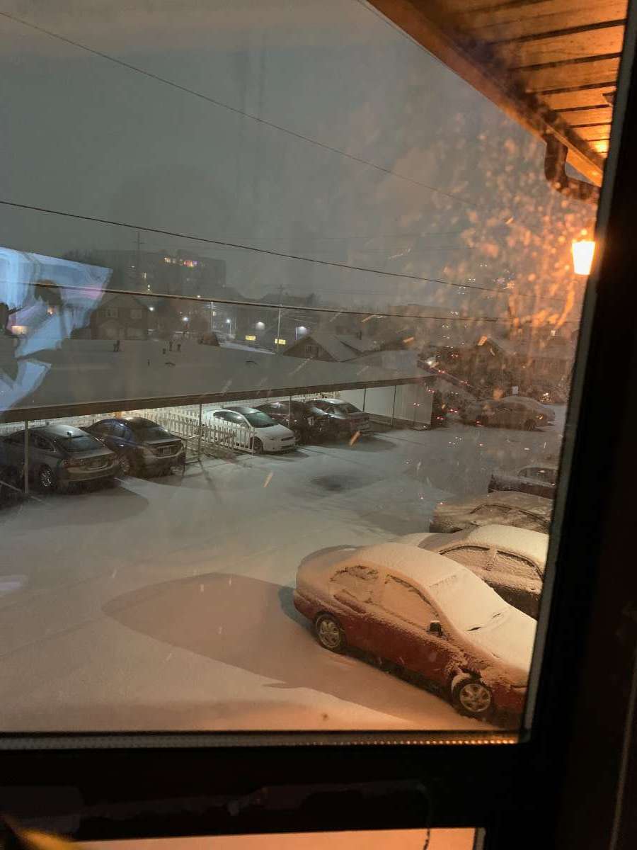
This was an hour ago. It is snowing harder now in Downtown Everett!

-
8
-
 1
1
-
February 2024 Weather in the PNW
in West of the Rockies
Posted
CZ's can be quite dynamic in terms of snowfall. I was living in Seattle in 1996 on Capitol Hill and the forecast called rain snow mix possibly. Well a CZ developed and it appeared to be a King/Snohomish County line special. As the CZ began to slide south, it strengthened and stalled over Seattle. We had a howling northerly wind and ended up with over 10 inches of snow!