dairyd
-
Posts
215 -
Joined
-
Last visited
Everything posted by dairyd
-
February 2019 Weather in the Pacific Northwest - Part 1
dairyd replied to a topic in West of the Rockies
It's true and they don't. thus it is proven time again. taxpayers should replace the mets with a bot imo. maybe a letter to a congresscritter cc to seattle office -
February 2019 Weather in the Pacific Northwest - Part 1
dairyd replied to a topic in West of the Rockies
temps and wind gusts
-
February 2019 Weather in the Pacific Northwest - Part 1
dairyd replied to a topic in West of the Rockies
I LOVE the new satt. if you line up the beg/end circulation I come up with almost due south on 6 hour timeframe but it is a guess, it might be jogging at the last few frames. one interesting thing is the convection n/s along the olympic coast pulling from the low level moisture vs. the upper level moisture that's generating the squalls inland at the moment. could be the overnight snowmaker that overperforms? -
February 2019 Weather in the Pacific Northwest - Part 1
dairyd replied to a topic in West of the Rockies
just run this stuff from Goes-17 -
February 2019 Weather in the Pacific Northwest - Part 1
dairyd replied to a topic in West of the Rockies
They use chip-seal size gravel. bigger than what you are talking about. -
February 2019 Weather in the Pacific Northwest - Part 1
dairyd replied to a topic in West of the Rockies
In Pullman they actually put out road gravel on the roads when it snows/ices up along with the salt. That is so you can stop at the bottom of the hill. -
February 2019 Weather in the Pacific Northwest - Part 1
dairyd replied to a topic in West of the Rockies
That's because anything north of Everett doesn't count for NWS seattle. Trust me, had many of discussion with them about this. -
February 2019 Weather in the Pacific Northwest - Part 1
dairyd replied to a topic in West of the Rockies
they could use this thing called salt.... -
February 2019 Weather in the Pacific Northwest - Part 1
dairyd replied to a topic in West of the Rockies
The thing is, if you just take 10 min. to take your nose out of your precious model and look at the sattelite you can see the advection and frontogenesis in real time. At that point you know what the model doesn't. That means you aren't a met anymore but a model rider like the rest of the internet kids. -
February 2019 Weather in the Pacific Northwest - Part 1
dairyd replied to a topic in West of the Rockies
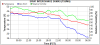
almost 0 deg. windchill now in Whatcom Co.
-
February 2019 Weather in the Pacific Northwest - Part 1
dairyd replied to a topic in West of the Rockies
that's the beauty of these cold-core sliders -
February 2019 Weather in the Pacific Northwest - Part 1
dairyd replied to a topic in West of the Rockies
not the first nw met to be burned by an upper level trough, won't be the last -
February 2019 Weather in the Pacific Northwest - Part 1
dairyd replied to a topic in West of the Rockies
the 700mb trough is quite pronounced. quite magnificent in this view imo.
-
February 2019 Weather in the Pacific Northwest - Part 1
dairyd replied to a topic in West of the Rockies
and the roadworks in the area don't use salt anyways so its not like they use NWS as a resource to get ahead of the storm. Unlike in other parts of the country where they care about motorists' safety. -
February 2019 Weather in the Pacific Northwest - Part 1
dairyd replied to a topic in West of the Rockies
this is a weather discussion board? or isn't it? can we discuss a published weather model or not? what are the rules here, asking for a friend. -
February 2019 Weather in the Pacific Northwest - Part 1
dairyd replied to a topic in West of the Rockies
euro has 1050 high forecast for 8-9 Feb to traverse alberta/BC. IDK if I've seen it that high (usually 1040's). GEM is above that. This may be a generational storm for outflow if that verifies with its accompanying slider. :o -
February 2019 Weather in the Pacific Northwest - Part 1
dairyd replied to a topic in West of the Rockies
fb video from Lynden, WA https://www.facebook.com/WhatcomCountyWeather/videos/372742856609201/ -
February 2019 Weather in the Pacific Northwest - Part 1
dairyd replied to a topic in West of the Rockies
here comes the upper air trough!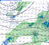
-
February 2019 Weather in the Pacific Northwest - Part 1
dairyd replied to a topic in West of the Rockies
it's popping now
-
February 2019 Weather in the Pacific Northwest - Part 1
dairyd replied to a topic in West of the Rockies
getting chilly in the outflow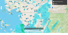
-
February 2019 Weather in the Pacific Northwest - Part 1
dairyd replied to a topic in West of the Rockies
href
-
February 2019 Weather in the Pacific Northwest - Part 1
dairyd replied to a topic in West of the Rockies
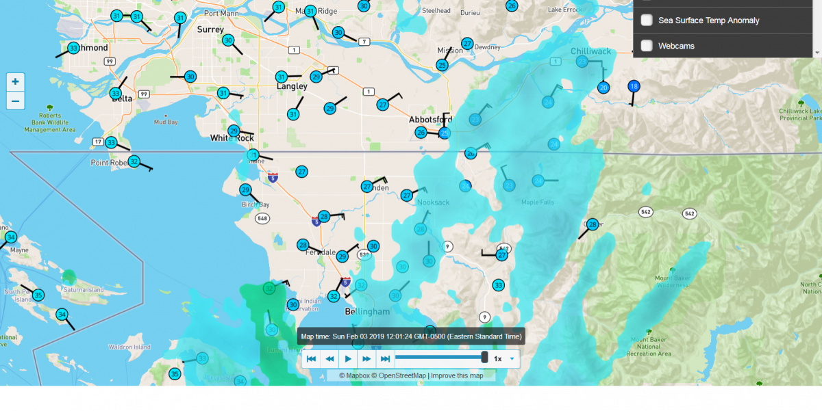
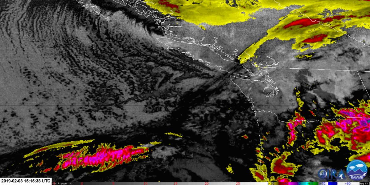
mostly low-mid level moisture, current flare up in lower mainland which is interesting.
-
February 2019 Weather in the Pacific Northwest - Part 1
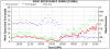
dairyd replied to a topic in West of the Rockies
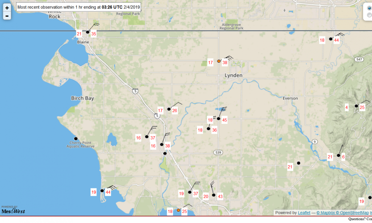
sumas winds finally kicking up to decent speeds. temps dropped to 28 too. going to be a fun morning up there with that band moving north...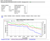
-
February 2019 Weather in the Pacific Northwest - Part 1
dairyd replied to a topic in West of the Rockies
5:27 AM PST Sunday 03 February 2019 Snowfall warning in effect for: Fraser Valley - central including ChilliwackFraser Valley - west including AbbotsfordSnowfall with total amounts of 5 to 10 cm is expected. Snowfall totals of 5-10 cm are expected in portions of the Fraser Valley. A band of moisture over the eastern Pacific will interact with an arctic front now over the south coast to produce an area of snowfall centred over the Fraser Valley beginning this morning. 5 to 10 cm of snow can be expected through this afternoon mainly between Abbotsford and Chilliwack before dry arctic outflow winds move in tonight. Be prepared to adjust your driving with changing road conditions. Rapidly accumulating snow will make travel difficult. Visibility may be suddenly reduced at times in heavy snow. -
February 2019 Weather in the Pacific Northwest - Part 1
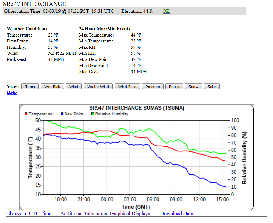
dairyd replied to a topic in West of the Rockies
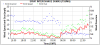
the outflow building, temps, dewpoint dropping at the border. still not at epic levels for this point. Mean wind has to pick up to the mid 20's. we'll see how the day travels.