Perturbed Member
-
Posts
5085 -
Joined
-
Last visited
-
Days Won
2
Everything posted by Perturbed Member
-

March 2024 Weather in the PNW
Perturbed Member replied to TigerWoodsLibido's topic in West of the Rockies
Really close to the coast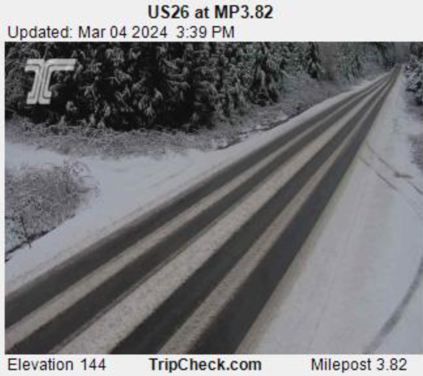
-
March 2024 Weather in the PNW
Perturbed Member replied to TigerWoodsLibido's topic in West of the Rockies
It looks to stay pretty far south. This is about as far north as the precip gets.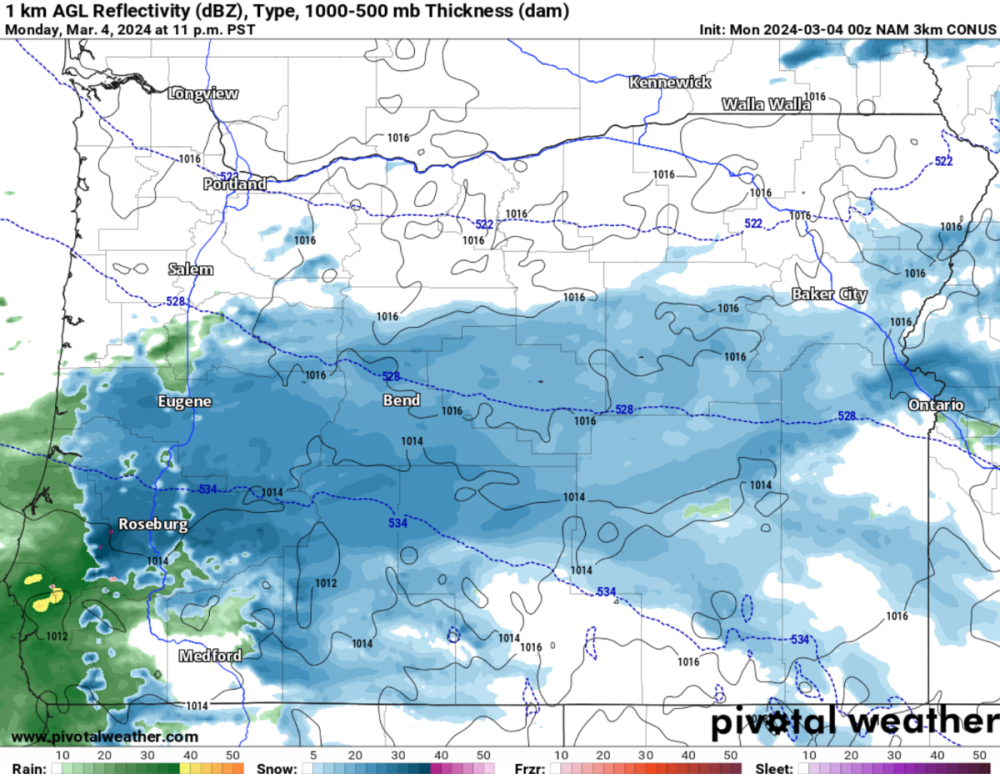
-
March 2024 Weather in the PNW
Perturbed Member replied to TigerWoodsLibido's topic in West of the Rockies
Cold air damming (and upsloping) for sure helps that spot in offshore flow but with these kind of setups its more about how those low elevation areas are protected from the S/SW winds by the higher elevation parts of the coast range that extend east in areas south of there. Of course there is the usual effect of colder air near mountain peaks sinking and collecting in the valleys directly below. Places like Vernonia and even Staley's punch well above their weight due to that microclimate. -
March 2024 Weather in the PNW
Perturbed Member replied to TigerWoodsLibido's topic in West of the Rockies
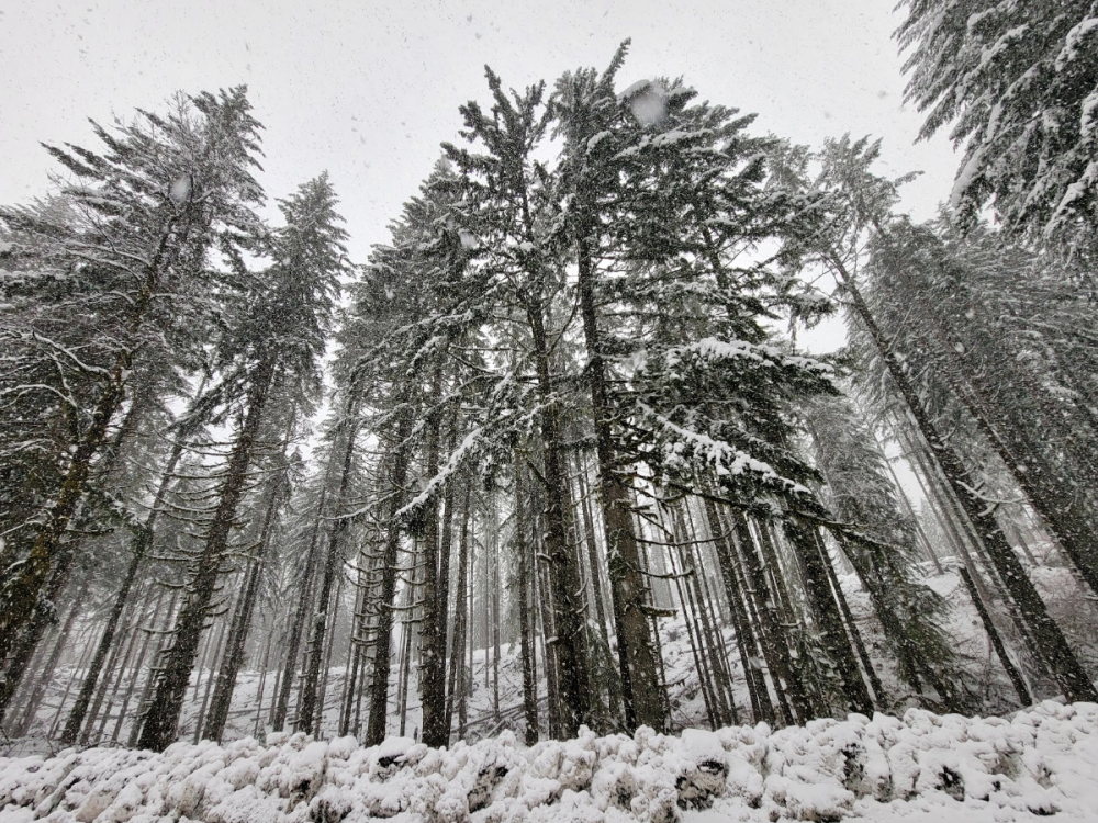
Great shots. I was there earlier too. Pretty nice spot. I do like going there to catch some nice winter weather. Kind of fun to walk around some of the trails in the snow. If you keep driving up that road I think the main road tops out around 1200 or 1300 ft. Obviously the surrounding terrain has quite a bit higher elevation but I don't think you can drive to it. -
March 2024 Weather in the PNW
Perturbed Member replied to TigerWoodsLibido's topic in West of the Rockies
Yeah was just looking at those. Radar continues to look great. Too bad this band didn't come in overnight for us. -
March 2024 Weather in the PNW
Perturbed Member replied to TigerWoodsLibido's topic in West of the Rockies
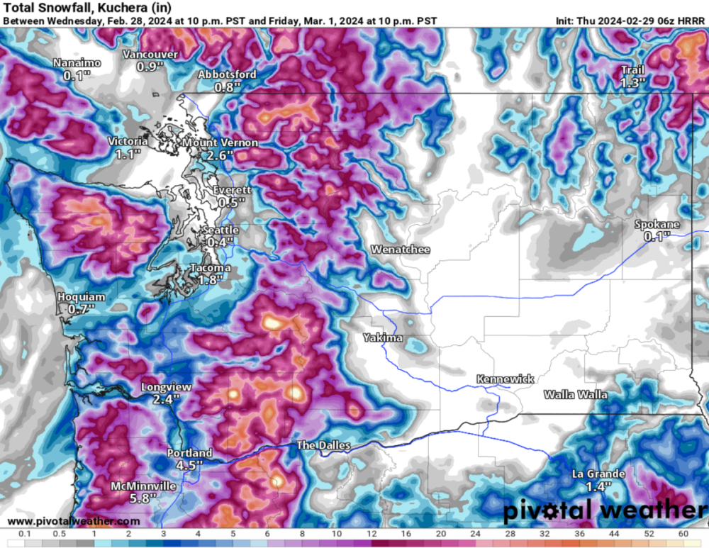
3rd day in a row of waking up to a light coating of snow. Still snowing here and the radar has been juicy but it is just a hair too warm to stick well. Probably doing well if you're above 500ft here. Of course the Coast Range microclimate is delivering even at the lowest elevations: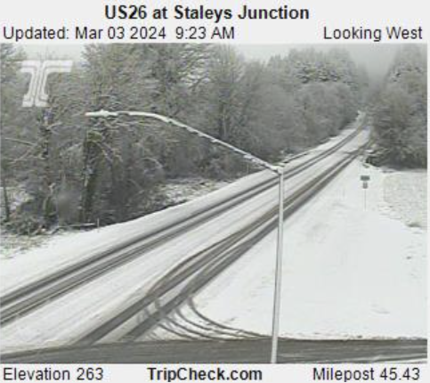
-
March 2024 Weather in the PNW
Perturbed Member replied to TigerWoodsLibido's topic in West of the Rockies
It shows basically zero snow in the OR Coast Range. It is currently vomiting snow there and piling up really quick, I was just there a moment ago. The ICON snow maps really are absurd in the opposite direction of the GFS. -
March 2024 Weather in the PNW
Perturbed Member replied to TigerWoodsLibido's topic in West of the Rockies
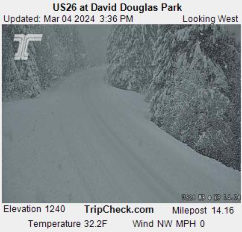
Spent most of the day in the Coast Range between 1000-1500 ft. I never quite get used to how drastically different the microclimates in our region can be. Completely different world today once you get to even about 700 ft there. Absolute winter wonderland with on and off snow all day and awesome orographic enhancement of these showers. I've grown pretty tired of the ultra marginal climate down at the lowest elevations and now days I just drive up a bit in elevation to find more interesting weather. Next time I move I'm really going to try to get up to at least 500 ft if not 1000 ft+. The Coast Range or SW WA Cascade foothills still at the top of my list I think.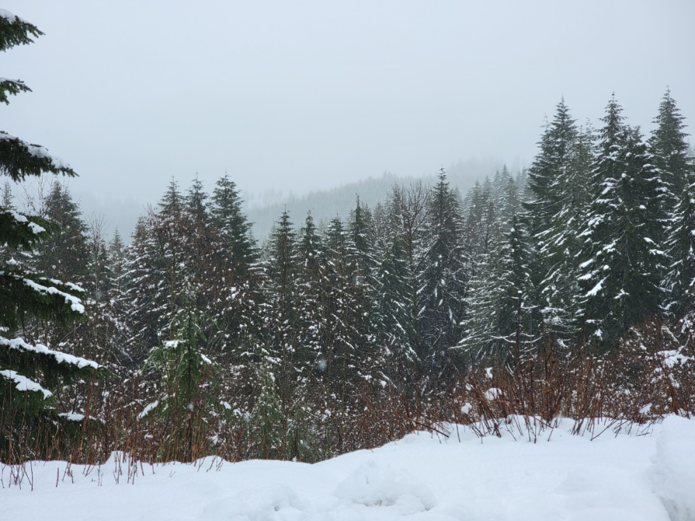
- 6147 replies
-
- 17
-

-
March 2024 Weather in the PNW
Perturbed Member replied to TigerWoodsLibido's topic in West of the Rockies
Got just enough snow to turn most things white. Precip rates brought the temp down to about 32.8F. -
February 2024 Weather in the PNW
Perturbed Member replied to TigerWoodsLibido's topic in West of the Rockies
How are your temps? Looks like another round is about to hit. -
February 2024 Weather in the PNW
Perturbed Member replied to TigerWoodsLibido's topic in West of the Rockies
That last shower was pretty fun here. Absolute bonkers snowfall rate. I drove up to 600 ft when I saw the radar and camped up on the side of the road like a creep and it was pretty much whiteout conditions with huge numbers of massive cotton balls falling. Was sticking to the roads down to 400 ft. Just slushy accumulations down at 26. Barely too warm at the lowest elevations under that shower. A similar shower overnight or early AM would do the trick for the lowest elevations. Radar is looking promising. -
February 2024 Weather in the PNW
Perturbed Member replied to TigerWoodsLibido's topic in West of the Rockies
I don't really care for the HRRR outside 12-24 hours but FWIW: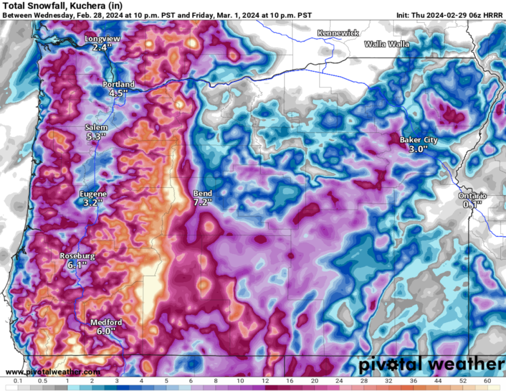
-
February 2024 Weather in the PNW
Perturbed Member replied to TigerWoodsLibido's topic in West of the Rockies
Changed over to snow pretty low in the eastern Coast Range.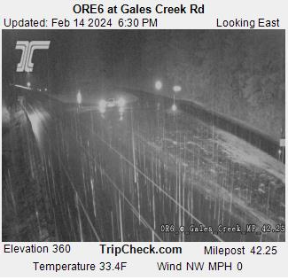
-
February 2024 Weather in the PNW
Perturbed Member replied to TigerWoodsLibido's topic in West of the Rockies
Might be time to drive west into the Coast Range.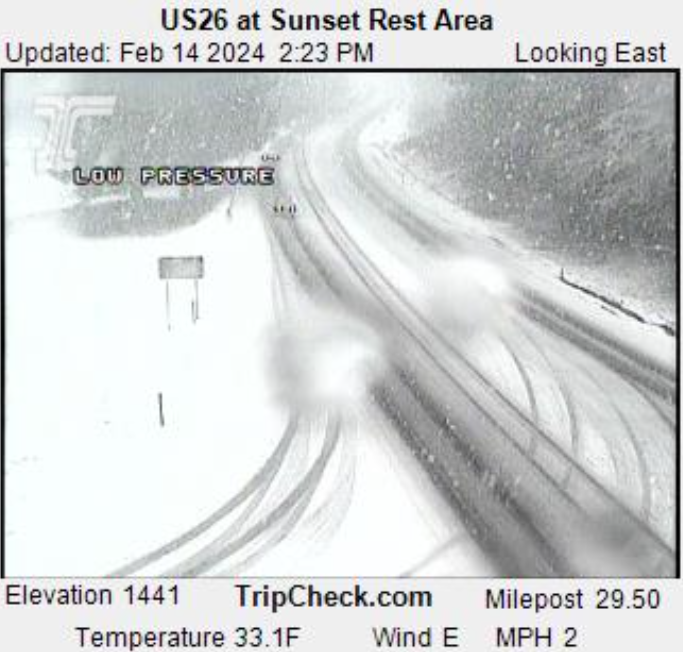
-
My current location did get some light accumulation with that but back then I lived further east in WA county and it was just cold rain. I ended up driving west into the coast range and it was a winter wonderland there. As you said, it was ridiculously frustrating how close that rain/snow line was to us and we were just barely on the wrong side of it.
-
Yeah 32F here and moderate rain. I can see the drops of water on the trees have re-frozen. Both the cold and snowcover have had impressive longevity with this event.
-
Still 33F here and the snow/ice has barely melted. Mark has adjusted his forecast, still in the 30s for the next 2 days. The past week has been an incredible stretch around here. The snow, sleet and ZR made for an interesting event, but this was really all about the strength and persistence of the low level cold. The way in which the cold rapidly converged on PDX from the north and east at the same time was pretty epic too.
- 6999 replies
-
- 10
-
-
Sleet here
-
Your area must have done incredibly well. How much snow did you end up getting in total? I ended up around 2.5-3 inches of snow/sleet mix.
-
January 2024 Weather in the PNW (Part II)
Perturbed Member replied to Meatyorologist's topic in West of the Rockies
Really thought we'd do a lot better this time in terms of getting more snow than sleet but overall the models did very well with this when you consider just how marginal this setup was at the mid levels. Kind of a bummer because we were so close to being able to pull off a big snowstorm with incredible low level cold. Certainly a lot to be happy about though, I've got maybe 3 inches of snow/sleet mix, the temp is 14.7F and it looks beautiful outside during a winter that most of us were not too optimistic about to begin with. Now we get to enjoy several days of serious cold and this wintery landscape is going to look incredible the next few days, especially on Monday. -
January 2024 Weather in the PNW (Part II)
Perturbed Member replied to Meatyorologist's topic in West of the Rockies
Yep, the low is weakening and running off to the SE. The deformation to the north will linger for a while but is unlikely to drift much further south. Used up a lot of our juice on sleet, and then ran short of precip once the entire column was cold enough for snow. A problem that isn't too uncommon for us. -
January 2024 Weather in the PNW (Part II)
Perturbed Member replied to Meatyorologist's topic in West of the Rockies
Yeah, that's gap in the precip right over the center of the metro area is ridiculous lol. Cruel. -
January 2024 Weather in the PNW (Part II)
Perturbed Member replied to Meatyorologist's topic in West of the Rockies
Precip been very light for a bit now. Just a bit too far south to get in on that deformation. Latest HRRR says this might be it for here besides some less steady lighter precip. Radar not looking terribly impressive to the south. -
January 2024 Weather in the PNW (Part II)
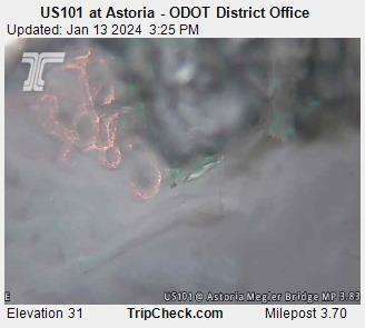
Perturbed Member replied to Meatyorologist's topic in West of the Rockies
The icing in Astoria...