wxmet
-
Posts
1522 -
Joined
-
Last visited
Everything posted by wxmet
-
Tim lives in a big house out in NoRth BeNd. Surely you can add a few more zeros.
-
Layer of ice with snow on top is going to make for some nasty conditions in PDX.
-
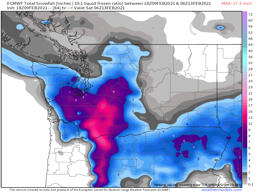
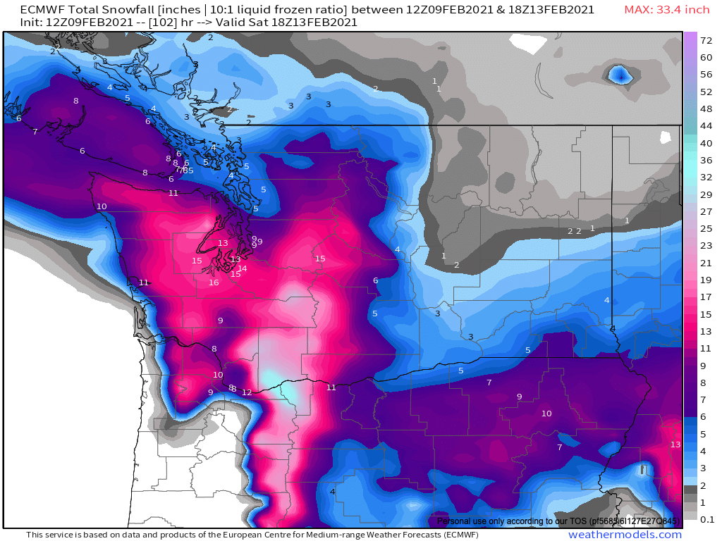
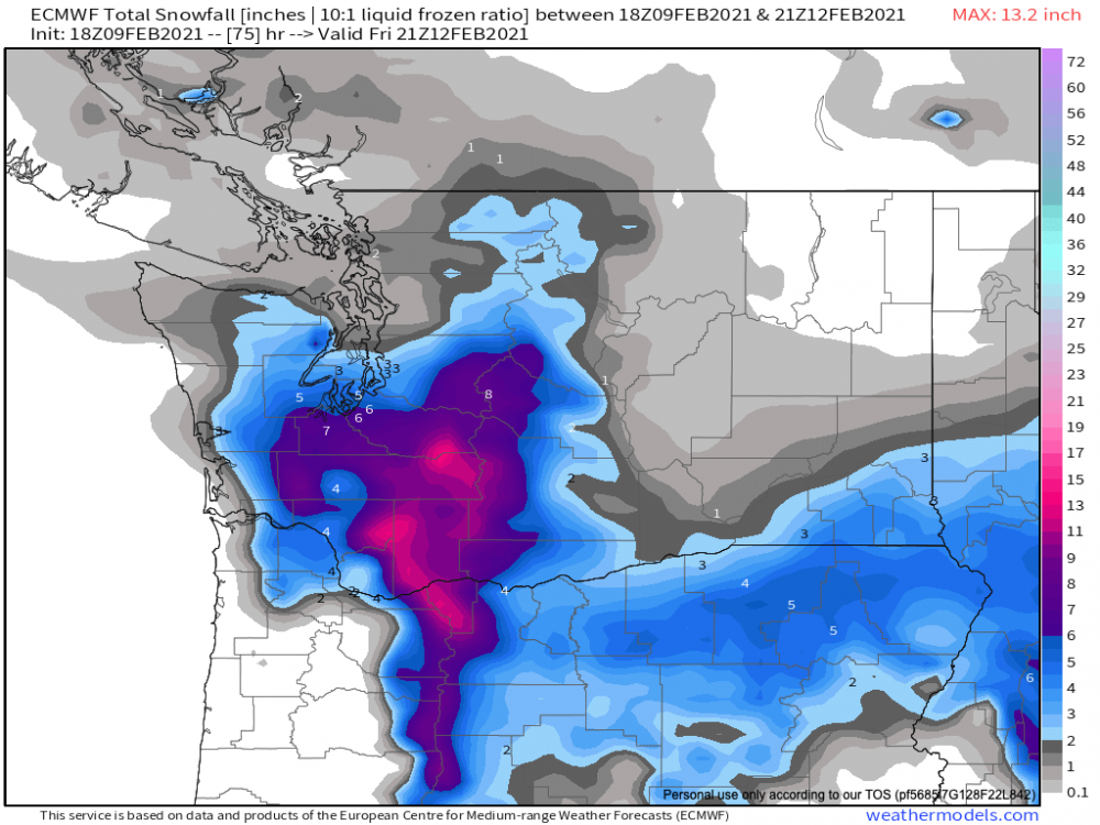
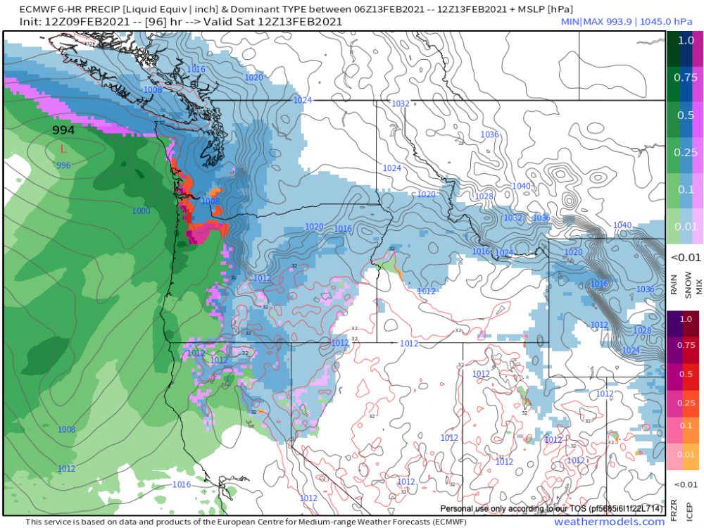
Final totals by very early Saturday morning

-
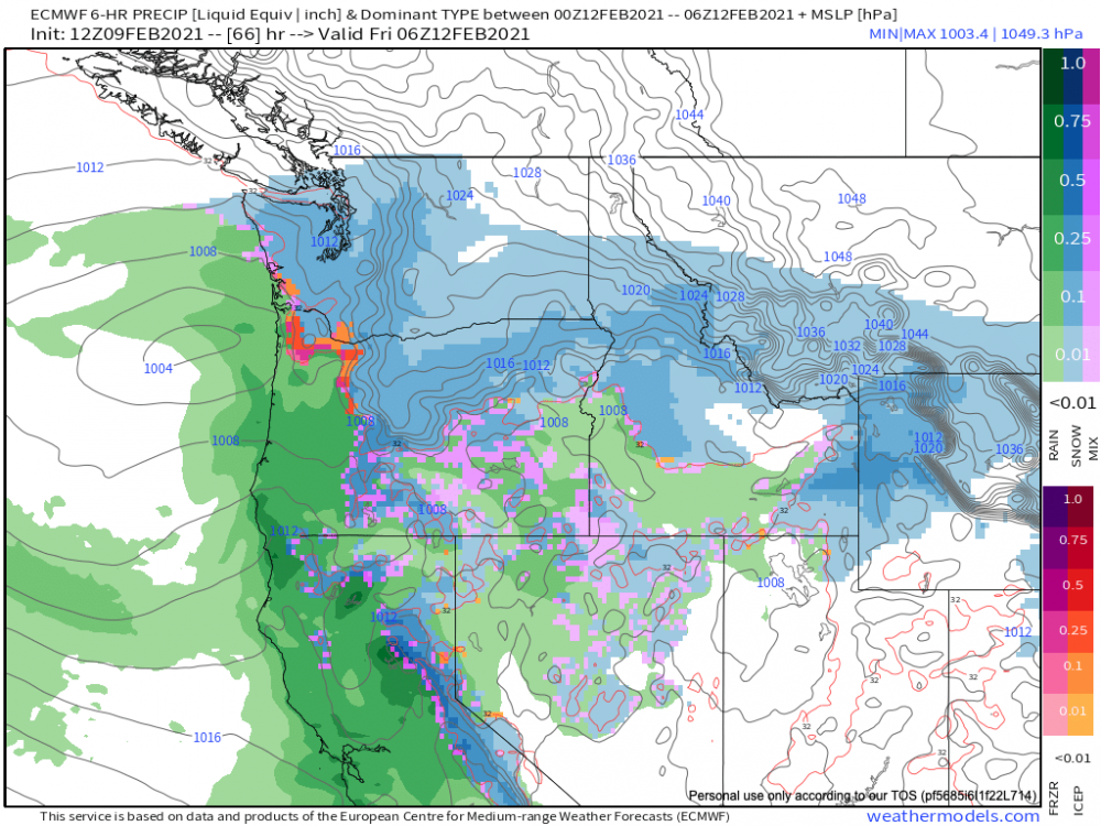
Totals by late Friday evening. Snow increasing north as the next system comes in.

-
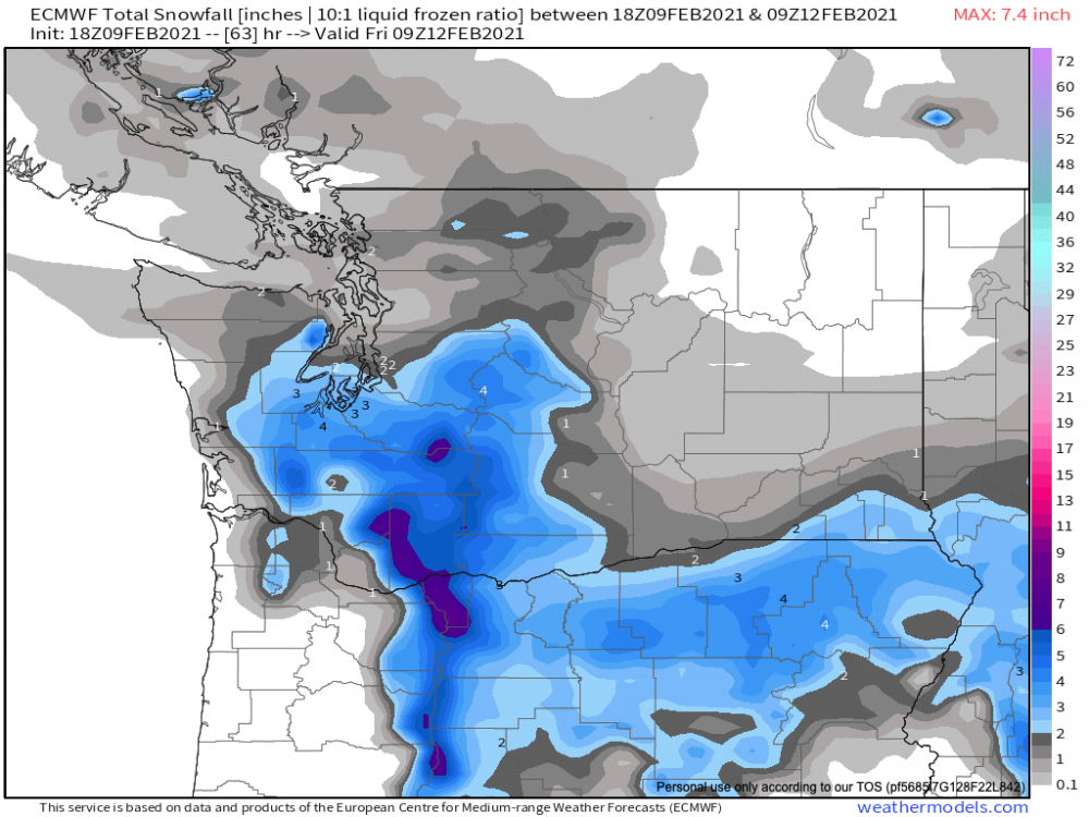
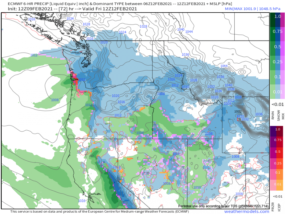
Totals early Friday afternoon
-
Yes. That would be more of a problem for PDX and areas south.
-
Totals lower across the board 2 in. in Seattle by very early Friday morning
-
By 48hrs the upper low is a little further south but the B.C. trough is hanging back a bit compared to 12z.
-
No. I use the comparator on weathermodels.com to compare the two runs at the same time interval.
-
Out to 24 hrs on the ECMWF 18z, The upper level low in the Pacific is slightly north of 12z and the B.C. trough is hanging back just a little.
-
That's what the RGEM is
-
NWS point forecast has 3.5in here in West Seattle before Friday evening but no WSW.
-
They definitely could have extended those WSW through the Seattle metro
-
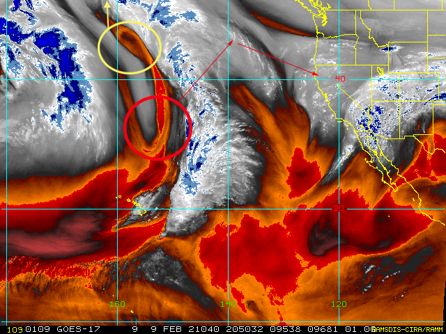
Here's a quick annotated WV image that illustrates what's happening. The area in yellow is an upper level low that represents the northern portion of the trough. It will move northward into Alaska. The area red is the southern end of the trough that will head northward and close off into an upper level low. It will then head WSW into California or northern Oregon. An upper level low with this track favors a low pressure system in the region of maximum divergence which is the upper right sector of the upper level low. A baroclinic leaf will extend north from the center of this upper level low bringing with it moisture and precipitation. Snow will be favored in the cold conveyor belt where air is being isentropically-forced over the cold air mass coming down from the B.C.
- 8730 replies
-
- 10
-

-

-
This looks fairly amplified to me


-
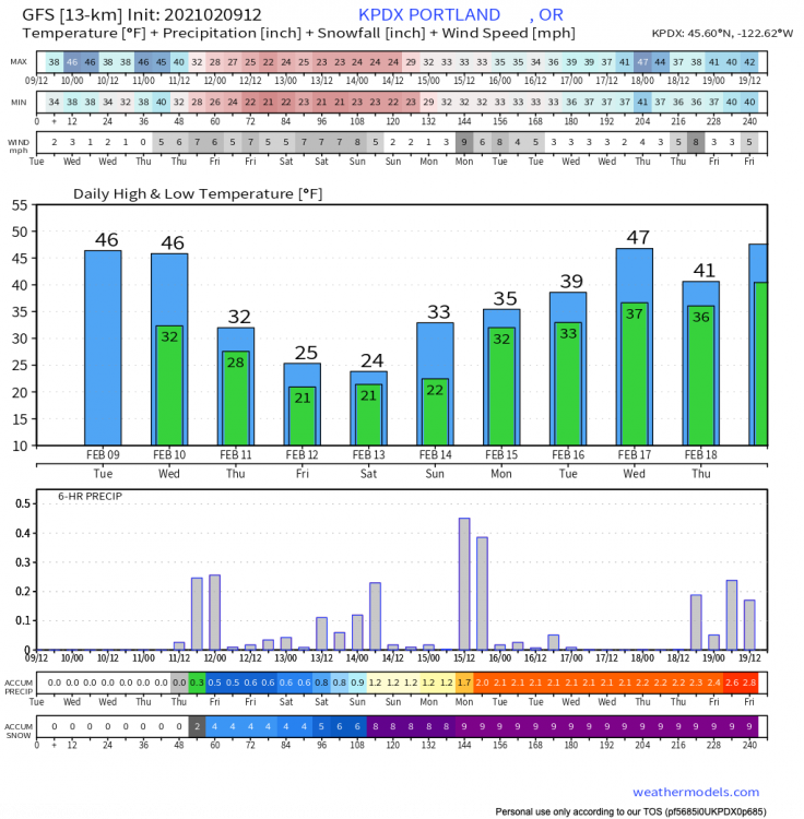
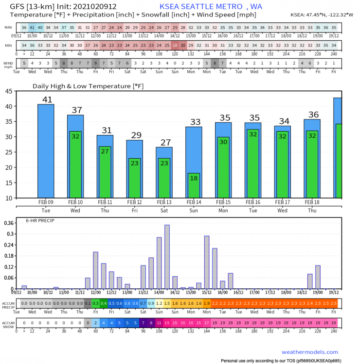
GFS 12z City Charts
-
You would have to do the calculation yourself if the model parameter isn't already there.
-
Snow falls in Seattle with temperatures in the 20s. Snow to liquid ratios will likely be higher than 10:1 probably around 12:1.
-
Totals by Saturday morning

-
Saturday system incoming
-
ECMWF and GFS low track is very similar just that the GFS is colder.
-
Things eventually cool down for PDX
-
ECMWF 12z
-
Compared to the ECMWF 00z, the upper level low in the Pacific is further north on the 12z run through 30 hr.
-
I’m going out later after the 12z Euro to stock up. Do not want to be in the grocery stores when they finally issue that Winter Storm Watch.