Hawkeye
-
Posts
7153 -
Joined
-
Last visited
-
Days Won
17
Everything posted by Hawkeye
-
 For days I've been excited about storms and heavy rain this weekend. However, as is the case all too often, models are backing off as we approach the start. Some models are drying out my area big time. Instead of 2+ inches, there are now models showing less than a half inch Friday and less than an inch total all weekend. Regarding the first wave on Friday, it has slowed and it doesn't arrive here until midday Friday when the storms are crapping out. The second wave is still very up in the air. A few models insist there will be a plume of heavy rain from Missouri up through southeast Iowa. Other models (Euro) say the heavy rain will be in northern Iowa into Minnesota, with no heavy band from Missouri into southeast Iowa. Once again, I am having to greatly lower my expectation and just hope we can get an inch out of this entire weekend. On top of the BS this weekend, there is suddenly a trend on some models toward early May being much less warm and active compared to what they've been advertising in recent days.
 -
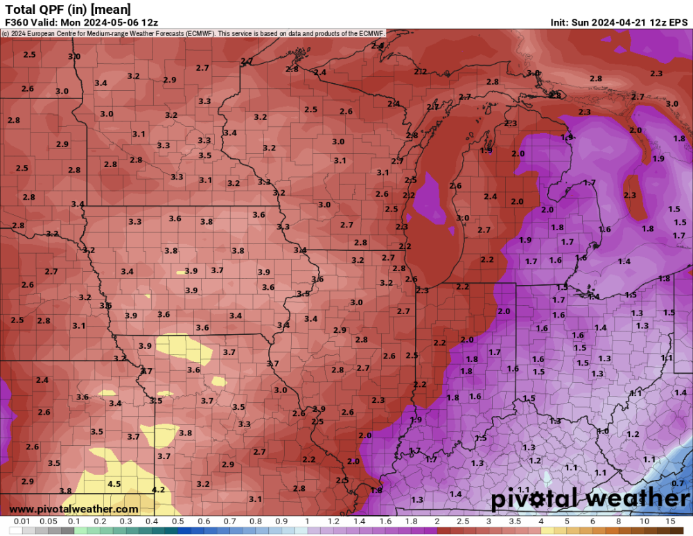
Euro ensemble avg next 15 days. That is what I want.... warm, stormy, wet.
-
I covered several budding plants with multiple layers of protection. The NWS lowered our low to 26º, but, fortunately, here in town we only dropped to about 30º, similar to the previous night. Yesterday sucked, barely making it over 40º. I'm ready for this stuff to be over.
-
I got 0.36" of rain today, pretty close to the middle of the model range. The grass is very lush and green. Cedar Rapids has been downgraded from "extreme" drought to "severe".
-
The second line looked promising for a while, but it was very thin and raced through in only a couple minutes. My event rain total is 0.67". I'll take it, but it's much less than what models were spitting out a few days ago.
-
I got lucky. A heavy cell passed just west of Cedar Rapids and another heavy cell moved up through the middle of Cedar Rapids. I just barely got caught inside the western edge of the eastern cell. There was barely any thunder, but it was gusty and the rain was very heavy. I finished with 0.57". Only one mile to my west only 0.12" fell. I wasn't expecting much from the secondary line, but it is actually really beefing up. There is a nasty cell near Ottumwa.
-
Radar shows a hole in the line moving into Cedar Rapids. It'll probably be June before we get a decent thunderstorm.
-
The dewpoint has risen nearly 30º since sunrise, but thick clouds have prevented any insolation across Iowa.
-
Radar sure doesn't look like a severe event. It's just a wide band of showers with embedded brief downpours.
-
As expected, overnight was a total bust. Strong east wind is pumping very dry air into eastern Iowa. On top of that, the entire area is covered in thick clouds. At this point I'm hoping we can get a half inch of rain.
-
I am becoming increasingly concerned about my rain total. A couple days ago, the GFS and Euro were suggesting up to four rounds of storms and a rain total possibly 2+". Tonight's storms are gone and the Tuesday night rain is mostly gone. Models are down to only one main round Tuesday afternoon, with maybe a thin second line. There may be spots around here that get missed by the stronger cells and end up with only a half inch of rain.
-
It's looking good for storms and heavy rain across Iowa Monday night/Tuesday. I'm very much looking forward to this because I really haven't had a thunderstorm yet this year.
-
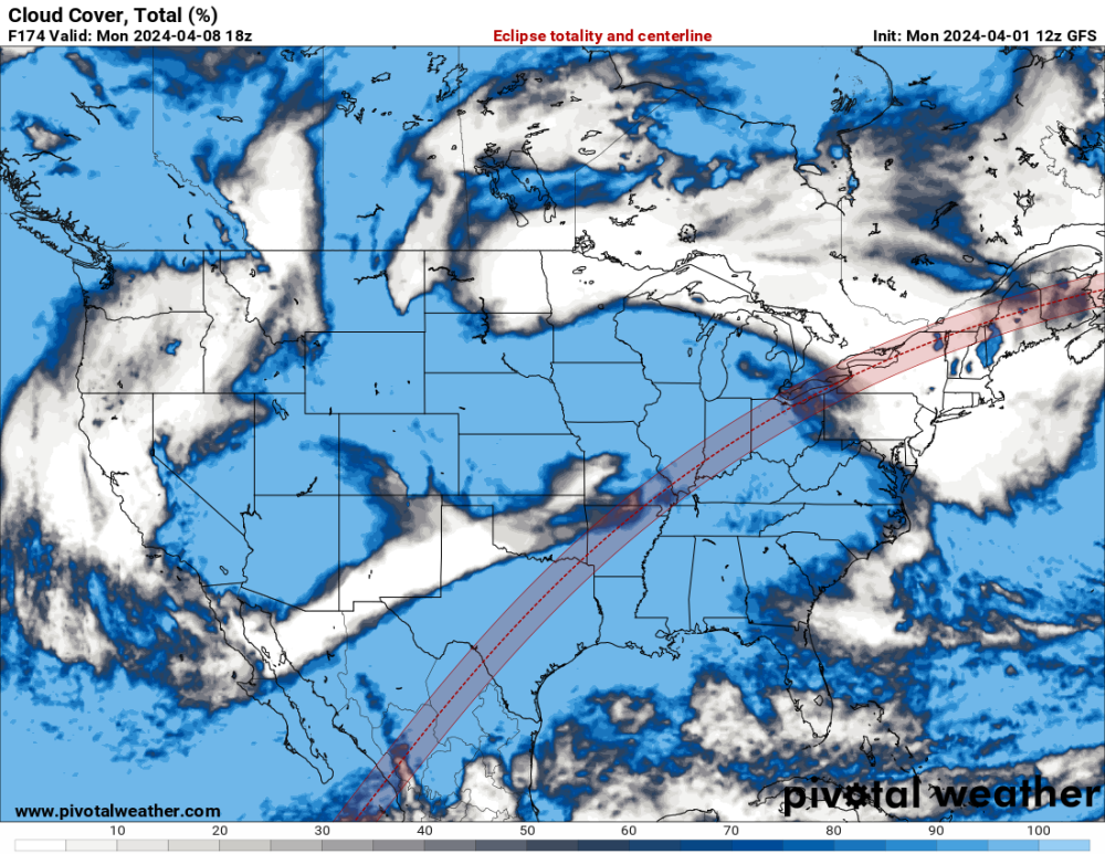
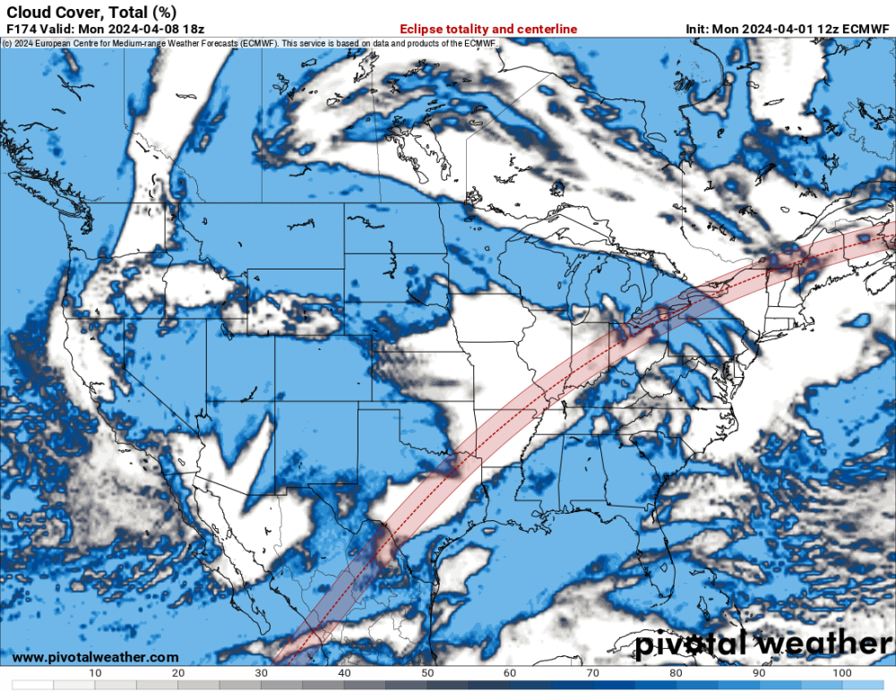
A significant portion of the totality path through the US got to see the eclipse. At this time of year there could easily have been thick clouds from Texas to New England.
-
Unfortunately, there have been no total solar eclipses near my area in my lifetime, and there won't be any through the rest of this century. I just found a set of maps for total solar eclipses next century. In October of 2153, downtown Cedar Rapids will be exactly in the center of totality.
-
It appears solid spring has arrived, with nothing but 60s, or even 70s, for the next week+. I only got 0.17" of rain yesterday.
-
It's too bad the totality path isn't farther nw, through Kansas and southeast Iowa. It's clear and sunny here today. It appears the Texas part of the eclipse is covered in clouds, so tough luck for them.
-
March 31st - April 2nd Potent Plains Storm
Hawkeye replied to Clinton's topic in East of the Rockies
My three day precip total is 1.37". I'm happy with that. We've been doing ok, precip-wise, recently. However, nearly all precip this year has been either snow or light to moderate rain showers. I am ready to move on to thunderstorm season. -
March 31st - April 2nd Potent Plains Storm
Hawkeye replied to Clinton's topic in East of the Rockies
I got a couple tenths of an inch of snow, but the heavier precip moved out before the cold air moved in. The midday timing didn't help. -
March 31st - April 2nd Potent Plains Storm
Hawkeye replied to Clinton's topic in East of the Rockies
The rain is beginning to mix. Radar shows the switch to snow on my door step. I've received 0.76" since midnight. Iowa City got a 1" head start on CR. -
March 31st - April 2nd Potent Plains Storm
Hawkeye replied to Clinton's topic in East of the Rockies
Timmy Supercell had a nasty line move through his town a couple hours ago. An automated station not too far away recorded a 90 mph wind gust. -
March 31st - April 2nd Potent Plains Storm
Hawkeye replied to Clinton's topic in East of the Rockies
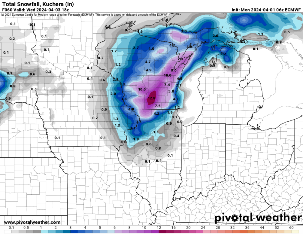
It appears there could be a swath of 2" of precip from Iowa City northeastward, with a sharp edge to the heavier precip near Cedar Rapids. 1" would be nice. -
March 31st - April 2nd Potent Plains Storm
Hawkeye replied to Clinton's topic in East of the Rockies
The HRRR has shifted the heavier rain back southeast, out of my yard again. I'm not surprised. All the big convection from Missouri through Illinois will probably pull the whole thing e/se.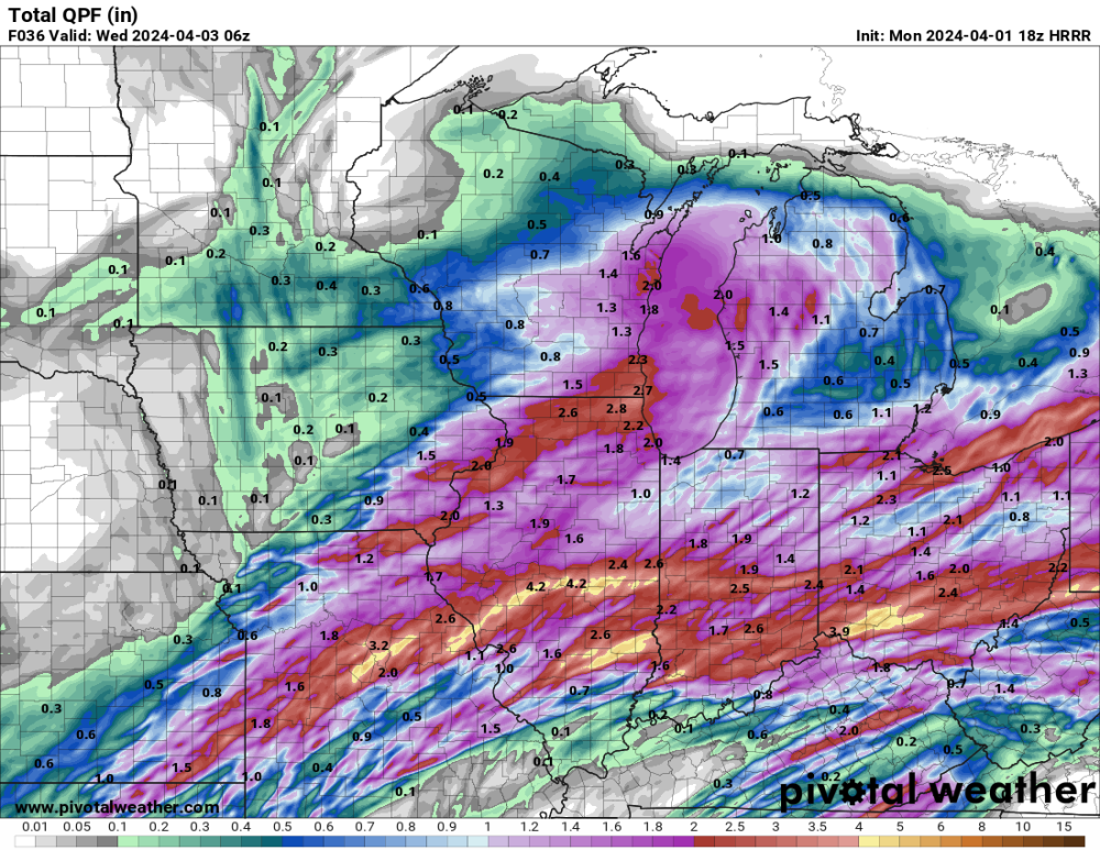
-
Today's op runs of the GFS and Euro are very different.
-
March 31st - April 2nd Potent Plains Storm
Hawkeye replied to Clinton's topic in East of the Rockies
Models had been showing some good rain moving across my area today, but that appears to have crapped out. I have to hope the main low can throw precip far enough nw to give me something. -
March 31st - April 2nd Potent Plains Storm
Hawkeye replied to Clinton's topic in East of the Rockies
06z Euro.... a bit more nw