


gabel23
-
Posts
2291 -
Joined
-
Last visited
-
Days Won
5
Posts posted by gabel23
-
-
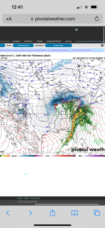
Monster over Chicago.
-
 1
1
-
-
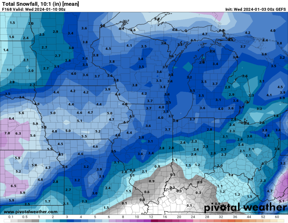
Euro is going nuts for the central plains wow.
-
1
-
-
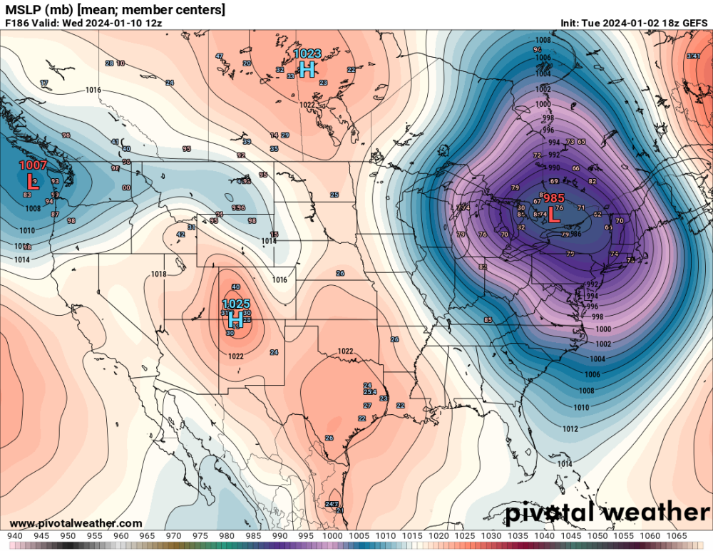
32 minutes ago, Grizzcoat said:
Not only N - but increased totals by about 25% compared to 12 and 18Z runs-- Go figure-
Been in the bullseye from the GEFS for the past two days; It has for sure increased. What could go wrong......
-
2
-
-
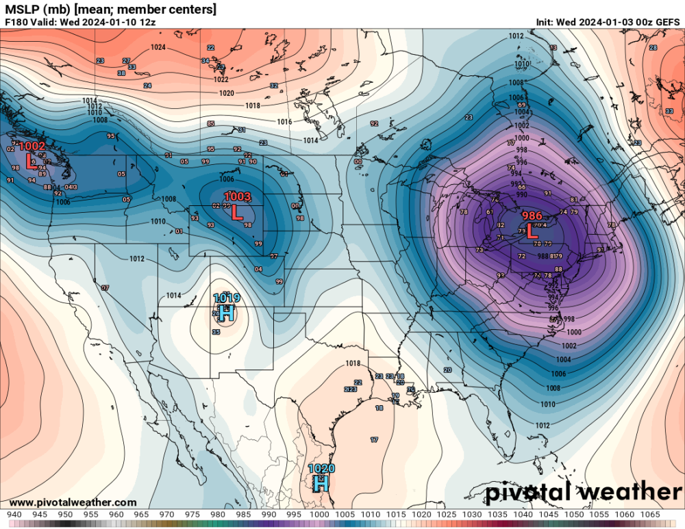
7 minutes ago, Grizzcoat said:
Variables that still need to be worked out are obviously numerous at this range. One that is clearly an issue is if true Arctic air will get pulled down right behind this system ? or - will the low pressure parade coming in from the NW USA limit it's intrusion? If the Arctic air is allowed down it will only make this system more dynamic but then likely shut down the low pressure parade for a time. You can see the GEFS struggling with this tonight--- 18Z and 00z
Fun times ahead.
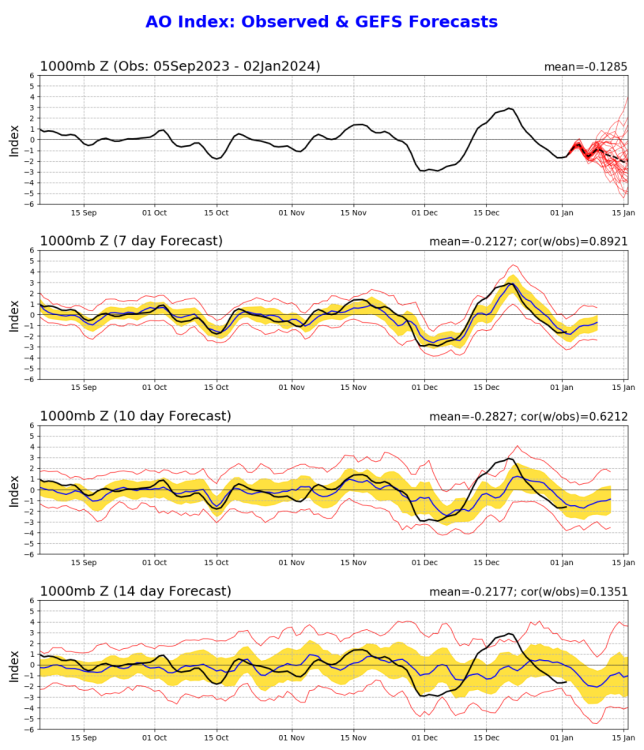
Both AO and NAO should help the cause! Bring on a monster; I just hate to see that snow hole showing up on both models tonight. Let's see what the EURO has to say.
-
3
-
-
9 minutes ago, hawkstwelve said:
18z GFS with a parade of storms over the next two weeks that just continue to dump snow on a large section of the central US.
Man that would do wonders for a lot of us on here!! Come on!
-
6
-
-
35 minutes ago, Clinton said:
EPS for the 1st storm (6th and 7th)

Big dog (8th-11th)


Control 10:1

I would take that and run. Too bad we are a long ways out! I’m thinking a big storm is a good bet though.
-
2
-
-
It would be great if we can get a straight west to east track, spread the wealth to everyone. I’m tired of riding the line with cutters! Good to see all major models picking up on a biggy!
-
6
-
-
9 hours ago, Timmy Supercell said:
There was a cold blast now in 1983. Current lows to highs are relatively average.
That 1983 winter was a beast I think for most of the lower 48. My area was below zero for a week straight. I was born on the 21st and my parents had to drive 20 miles in a blizzard with temps well below zero to get to the hospital. I swear to this day is the reason I love the snow and cold so much!
-
2
-
 1
1
-
 1
1
-
-
2 hours ago, Madtown said:
 Come on snow
That’s insane. Things never bode well for all of us if you don’t have at least a little snow on the ground. Is this comparable to 2016 El Niño? How did you do then? We had one major blizzard at the end of January that year.
-
1
-
-
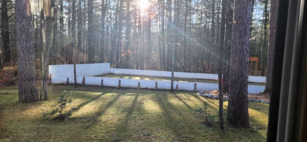
Just got home and measured 4.5" of snow. Not as much as I thought we would have but I'll take it. I'm just hoping we can keep it around for a while.
-
5
-
-
21 minutes ago, CentralNebWeather said:
We are getting 1” an hour snow rates the last 2 hours. It is insane. Roads are a complete mess with blowing continuing. Will be interesting to see our final totals by Wednesday.
You guys are racking it up again congrats! I seen an amount of 11” around the Kearney area! You guys might make a run at a foot!
1 minute ago, Clinton said:0z GFS and bumping up totals in central Missouri.
CMC please
I’m rooting for you guys hope you score a special Christmas present!!
-
6
-
-
-
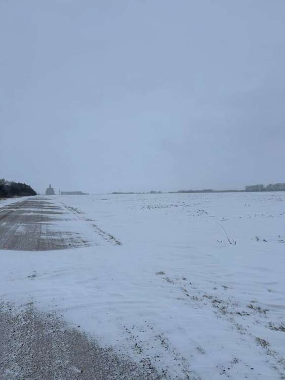
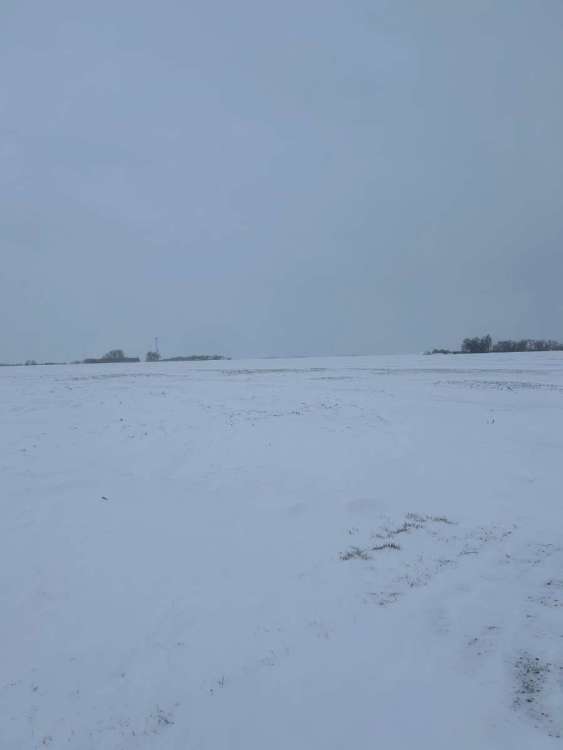
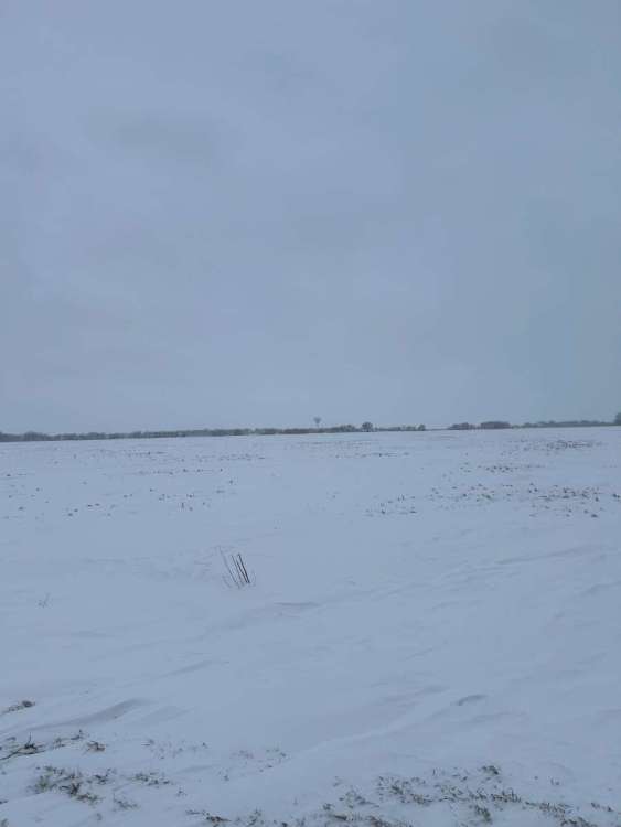
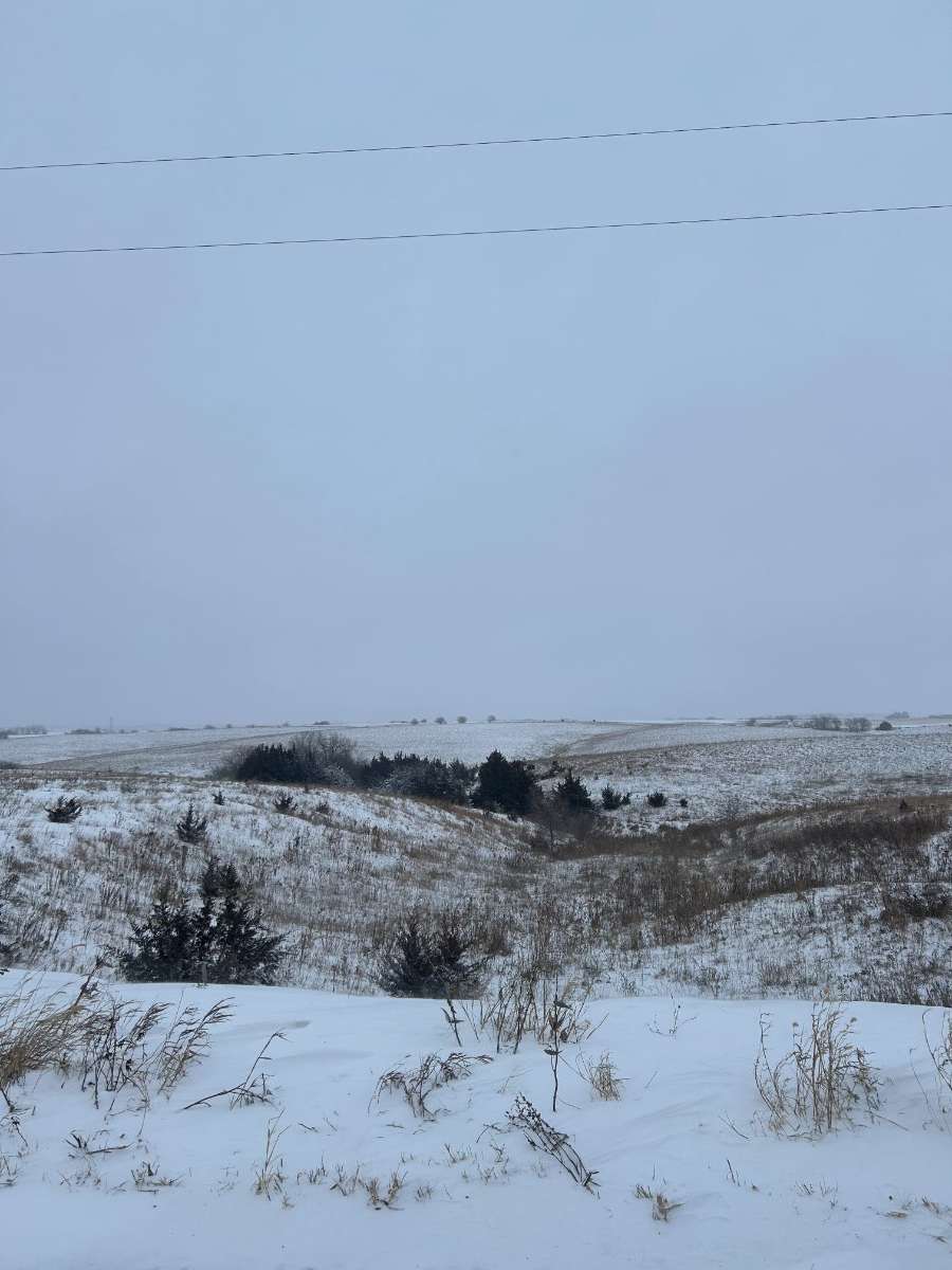
Few picks from David city, snuck out before supper and snapped some pics out in the country. I’m interested in seeing how much we got back in Shelby, 20 miles west of here. We got about 5” here but the way it sounds we got more back home! Overall I’ll take what we got!

-
7
-
-
1 hour ago, Tom said:
Congrats! It's wild to see that on the radar the rain/snow line is right on the IA/NE state border..you ain't kidding when you say that OMA is always riding the fine line. Enjoy the snow on this Christmas morning...it's a memory your kiddos will have for a long time.
@gabel23 is it ripping out by you? I think your a bit farther west... @jcwxguy how about you? Looks like some heavy snowfall rates right about now...
@CentralNebWeather, how much do you have OTG?
It was an interesting ride to my in laws this morning! Snow coming down hard and got quite a bit of drifting. If I had to guess I’m sitting between 1-2” of snow. Will see how today goes, looks like banding is setting up north and south of me.
-
4
-
-
I'm surprised I''ve been upgraded to a blizzard warning. The Low looks to go right over me darn near. Typically winds and precip aren't as much. I'm gonna be riding a fine line. I feel bad for those of you to the east; just missing out is horrible. I did pick up .50" of rain; this month will end up well above normal so that's huge!
I'm trying to figure out what's best for my family. We have christmas in David City tomorrow and we are trying to figure out whether to leave after mass tonight or risk driving through it tomorrow morning.
-
6
-
1
-
-
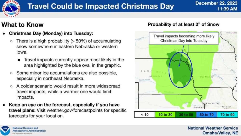
11 minutes ago, CentralNebWeather said:
NWS Hastings afternoon disco:
The NWS in Hastings encourages everyone with travel plains in
south central Nebraska and north central Kansas too look hard
at their plans and adjust accordingly for maximum safety. That
should include altering the timing of your trip away from most
of the day Monday and Tuesday.
Here’s what I take away from that disco and all I have to say is wow!! 15-20 hours of snow?!?
Bottom line is a moisture laden, large upper low will be
energized by some backside cold air (baroclinicity) late Sunday
night and Monday night. All the moisture will set up a trowel-
like structure and ride around the top of the low and down the
backside, potentially setting most of south central Nebraska up
for an 15-20 hour period of deformation axis snowfall, with
rates at times 1" per or more. The heaviest snow would fall from
midday Monday until early Tuesday. Add into the forecast, the
deepening nature of the low scaling up backside north winds. We
are forecasting wind gusts of 25-45 mph with some gusts to 50
mph possible both Monday and Tuesday. Needless to say, the combo
of wind and snow has major winter storm potential, over a major
holiday, and could induce blizzard-like conditions at times.
-
5
-
2
-
-
2 minutes ago, Bryan1117 said:
Gabel, my thoughts exactly… dense fog seems to correlate with winter storms arriving 48 to 72 hours later. Fingers crossed that this idea stays true… not counting on anything until the snow is actually flying.
Pulling for you guys! Typically when Omaha does well so does my area!! I’m holding off the cheering until we actually see something flying too!
-
2
-
-
I’m not freaking out. I’m not freaking out…..
on another note, it just has the feel something major is about to happen. We have had the dense fog the past couple days and now fog rolling back in. I’m hoping for a Christmas miracle!
-
7
-
-
37 minutes ago, Hawkeye said:
Ugh... days of models showing 2" of rain here, now it's crapping out.

00z UK
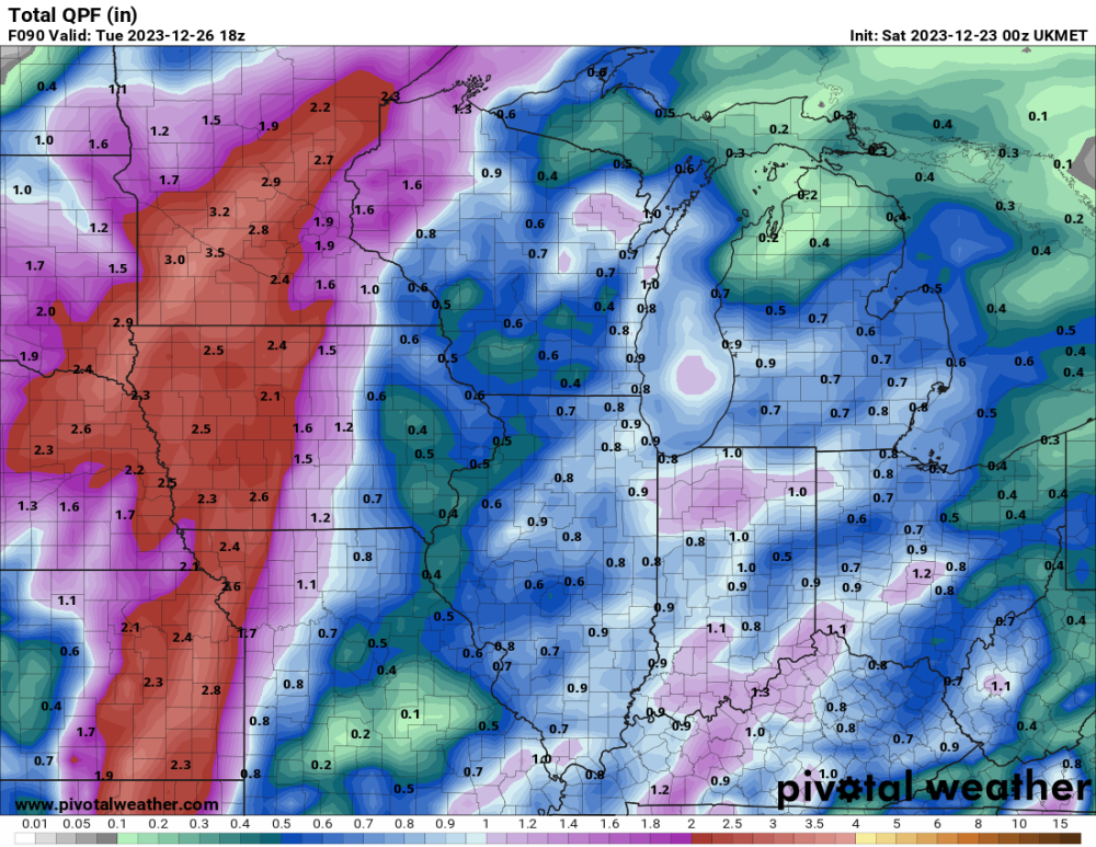
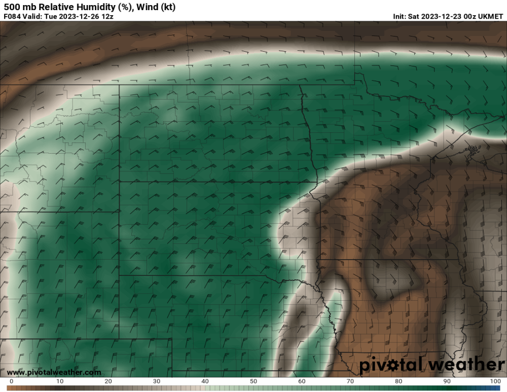
D**n dry air that we are always battling showing its ugly face over you guys out east. Might actually be the wrench in everyone's side I hate to say it....could see the models not picking up on that thus why it's showing the high snowfall forecast over us. Could see QPF fall as we get closer for everyone; otherwise the NWS offices will have to start throwing out watches tomorrow evening.
-
3
-
-
25 minutes ago, clintbeed1993 said:
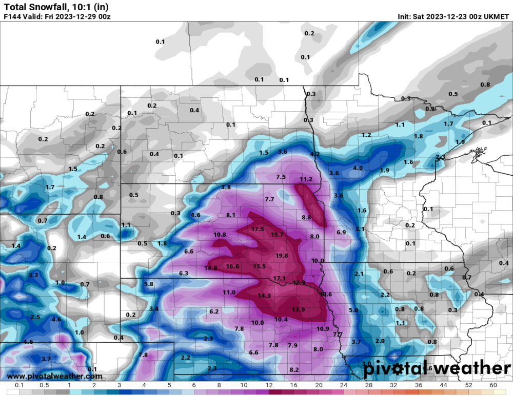
00z GFS is literally a dream run for central NE, and it looks almost identical to the Christmas 2009 blizzard that stalled and wrapped snow into the area all day. Wow, LOCK THAT IN
It’s pretty crazy what the gfs is showing tonight….almost identical to that barrel low that came thru in 2009. Jim flowers mentioned it back a couple weeks ago when models were picking up on this storm; it’s called the Fujiwara effect. Retrograde that low inside the main area of low pressure….if far enough west of that low and it could dump some snow. Lots of runs to go but would love to lock this one in.
-
4
-
-
I’ll tell you one thing… Moisture should not be a problem. Been a while since I have seen fog hang around our area for such a long period of time. I was in a dense fog advisory for 24 hours and far eastern Nebraska is in it again tonight. Top off that the sun was out and it got up to 55 degrees today…..hoping for a Christmas surprise!
-
5
-
-
Hoping models just had a glitch today and shift back southeast about 50 miles. Always have to ride the line!
-
Well this has gone up at least!
-
3
-
 1
1
-
-
Gfs and euro almost exact same spot. CMC on its own now…wouldn’t surprise me if this is what will happen. I’m cursed!
-
1
-


1/8-1/10 Panhandle Hook
in East of the Rockies
Posted
Ok just want to get everything straight with today's runs. 12z GFS goes south and crushes Kansas. The GEFS mean is wider and a more north. CMC goes south much like the 12z GFS and the EURO stays pretty much where it was last night. Ok then I think we got this handled! LOL. One thing that was mentioned earlier; if the LRC is 45 days this would fall right in line with the storm back on Nov. 25th that crushed Central Kansas.