


gabel23
-
Posts
2289 -
Joined
-
Last visited
-
Days Won
5
Posts posted by gabel23
-
-
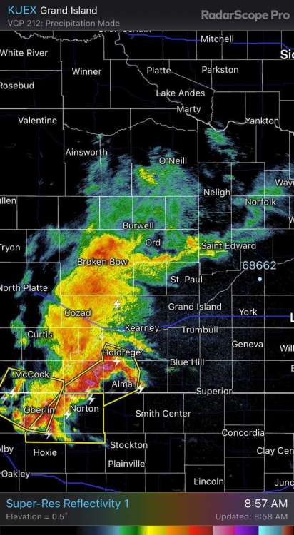
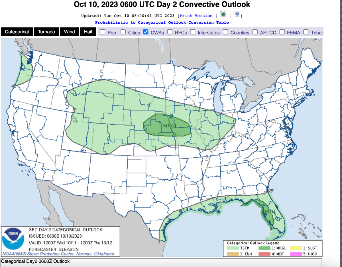
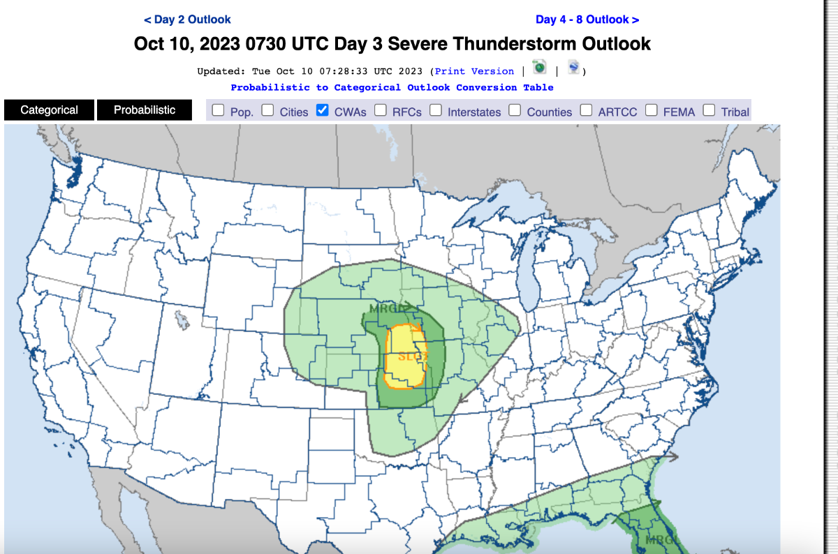
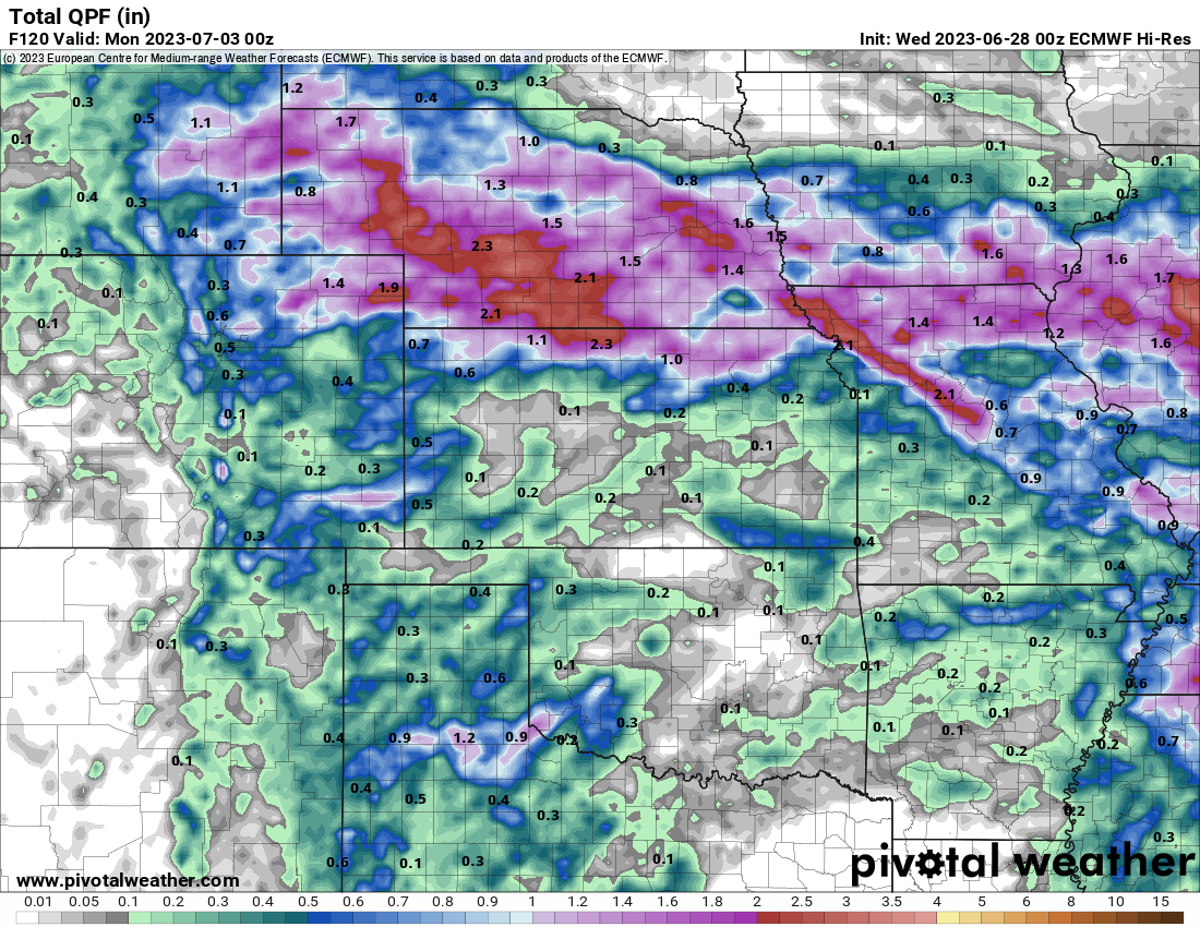
Looks like will have a pretty stout low pressure system coming out into the midwest that will produce all kinds of weather! I'm guessing might be one of the signature storms for this years LRC?! Discuss! (My area looks to get dry slotted.......something we had way too much of last year....)
URGENT - WINTER WEATHER MESSAGE
National Weather Service Rapid City SD
250 AM MDT Tue Oct 10 2023

...STRONG FALL STORM MAY BRING HEAVY SNOWFALL TO PORTIONS OF THE
BLACK HILLS THURSDAY INTO FRIDAY...

.A strong fall storm will develop over the Plains late Wednesday
into Thursday, bringing heavy precipitation and strong winds to
our area through early Friday. Precipitation will begin as rain,
with some thunderstorms expected Wednesday into Wednesday night.
As colder air wraps into the system late Wednesday night into
Thursday morning, precipitation will change over to snow across
higher elevations of the Black Hills, where accumulating snow is
likely Thursday morning through Friday morning. Rain may mix with
or change over to snow across the foothills and portions of the
northeastern Wyoming and western South Dakota plains later
Thursday into Friday, but confidence in precipitation types is
relatively low outside of the Black Hills. Precipitation will
taper off from west to east on Friday.

SDZ024-028-WYZ057-110000-
/O.NEW.KUNR.WS.A.0009.231012T1200Z-231013T1200Z/
Northern Black Hills-Central Black Hills-Wyoming Black Hills-
Including Lead, Deadwood, Cheyenne Crossing, Brownsville,
Terry Peak, Rochford, Nemo, Hill City, Rockerville, Hisega,
Pactola Reservoir, Custer, Jewel Cave, Sundance, and Four Corners
250 AM MDT Tue Oct 10 2023

...WINTER STORM WATCH IN EFFECT FROM THURSDAY MORNING THROUGH
LATE THURSDAY NIGHT...

* WHAT...Heavy snow possible. Total snow accumulations of 7
  inches or more possible. Winds could gust as high as 40 mph.

* WHERE...In South Dakota, the Northern Black Hills and the
  Central Black Hills. In Wyoming, the Wyoming Black Hills.

* WHEN...From Thursday morning through late Thursday night.

* IMPACTS...Travel could be very difficult.

PRECAUTIONARY/PREPAREDNESS ACTIONS...

A Winter Storm Watch means heavy snow, strong winds, freezing
precipitation, and cold temperatures are possible. Monitor NOAA
weather radio, local radio or television, or the Internet for
updates on this potentially dangerous storm. Take time to prepare
for severe winter conditions before the storm develops.

&&


-
 5
5
-
-
1 hour ago, Tom said:
When is the avg first freeze?
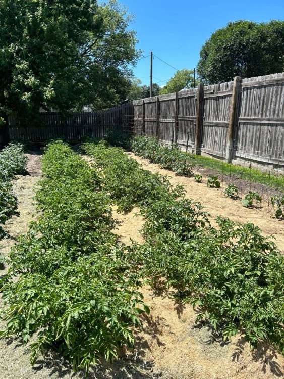
Typically around the 15th for my area, probably a week earlier for central Nebraska. I’m hoping I don’t see a hard freeze because my tomato plants are still going strong! Looks like right now a low right around freezing, they might survive that….
-
4
-
-
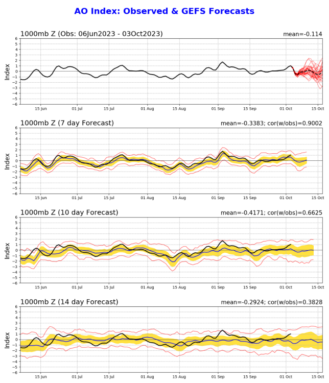
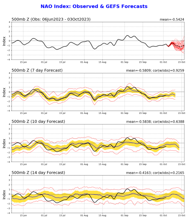
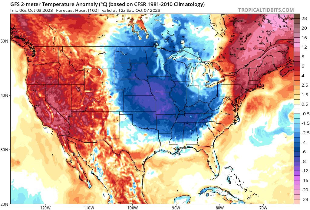
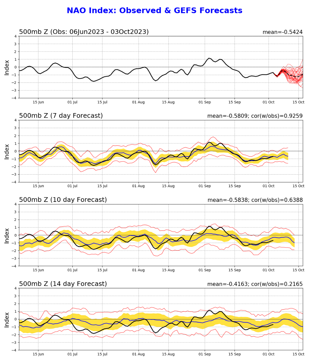
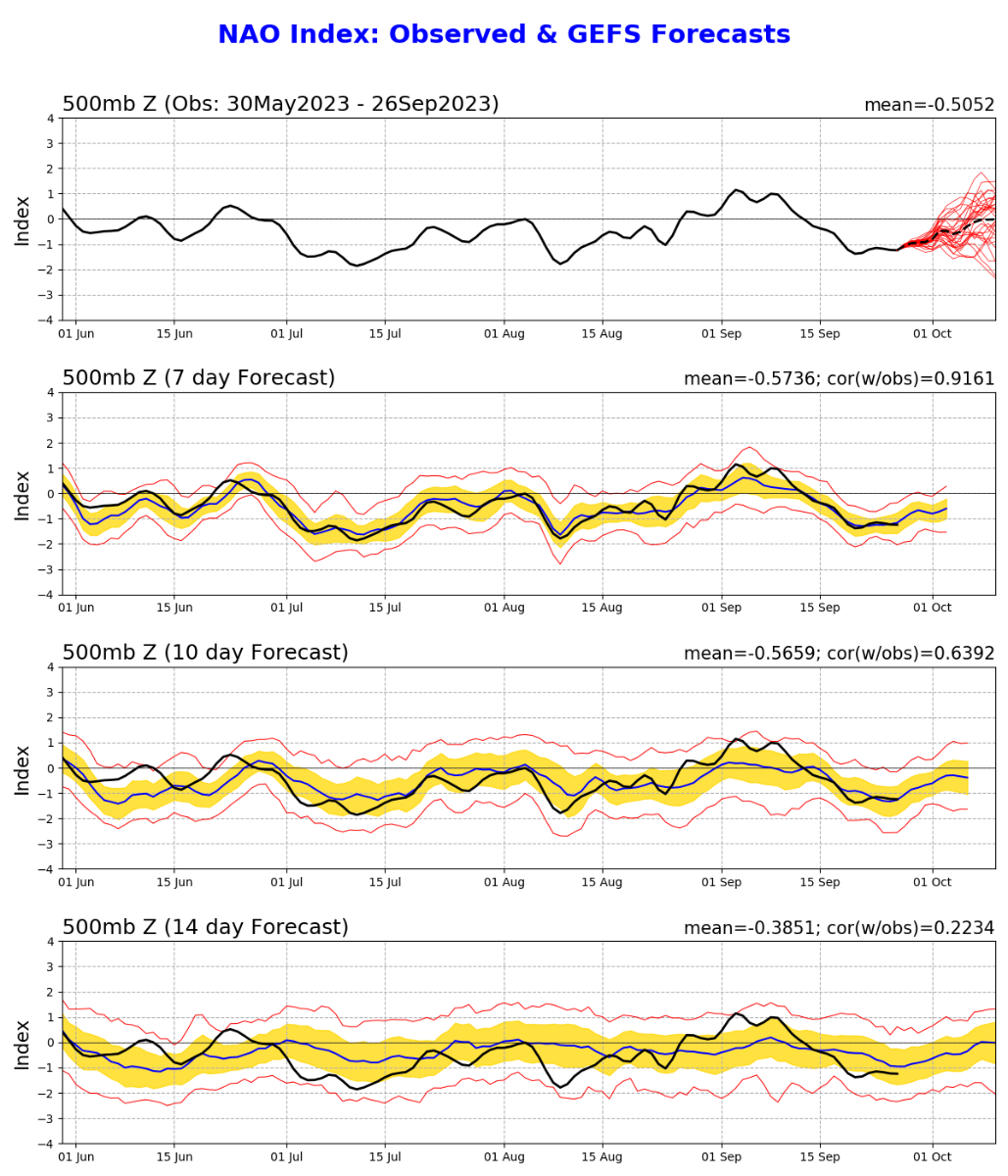
The opening to the new LRC season??????? Nice cold dump into the central parts of the US. Good to see the NAO in the negative side. Corresponds pretty well with the long range showing lots of blocking.

-
7
-
 1
1
-
 1
1
-
-
Well you crazy weather fanatics it's time to start the biggest month of the year!! (If you follow the LRC at least) . Been seeing a lot of winter forecasts being released and it sounds like at the very minimum will have a weak/moderate El Nino(hoping not a strong!). The things I'll be watching is the NAO and AO. if we can keep those neutral or negative that would do wonders. Analog years I have seen that have matched up with the long range forecasters, or at least the ones I follow, leads to a fast start to winter. October and November cold and possibly snowy for the upper midwest?? 02-03 and 09-10 are winters that I remember; 09-10 by far being one of the best in my memory (NAO and AO negative pretty much the whole winter). 57-58, 72-73, 77-78 was also fast starts to winters, at least around my area. Let the discussions and new cycle begin!
https://www.facebook.com/JimFlowersForecaster/videos/294496906601118
-
7
-
-
2 hours ago, hawkstwelve said:
Front has moved through with a pretty stiff NW wind and a chilly feel to the air, especially when compared to the past couple weeks. Temp has quickly fallen to 66 after topping out at 87.
Loving the turn the models have taken to begin the cool/wet period quicker than previously anticipated. I'm beyond ready for some sweatshirt weather!
Had our first junior high football game today and it went from summer to fall by half! The front feels amazing and currently have my north windows open. Wife and I watching tv in living room with blankets because of the cool fall feel!
-
5
-
-
Jim flowers part 1 winter forecast! Interesting hearing him talk about cyclical patterns with the SOI.
-
2
-
-
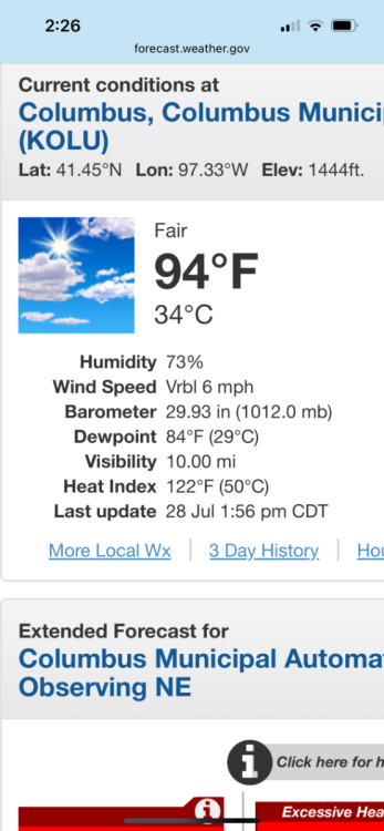
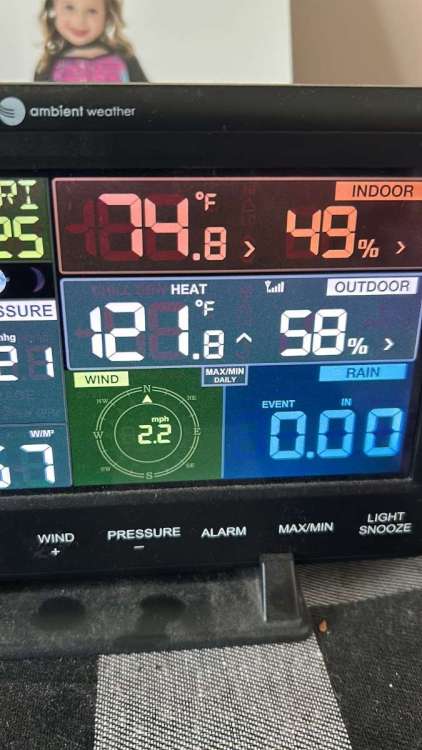
3 hours ago, CentralNebWeather said:
I’ll add my 2 cents on the heat wave. We have these every summer. This one has felt worse in that we had 2 months of above normal rainfall preceding it. Also, corn is putting off a lot of water which is only adding to the dews. Finally, we’ve had little to no wind so there hasn’t been a breeze for any relief.
Agreed! Normally we have wind with our heat waves in the past but not this year! Just so brutal out there…..I have never seen a dew point this high in my area, at least I can’t remember it this high. Columbus has a feel like of 120+ surprisingly my station says pretty much the same. 98 air temp and 80 dew point.
-
2
-
-
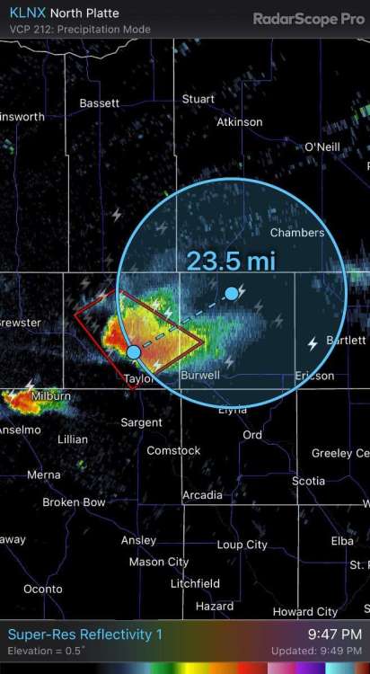
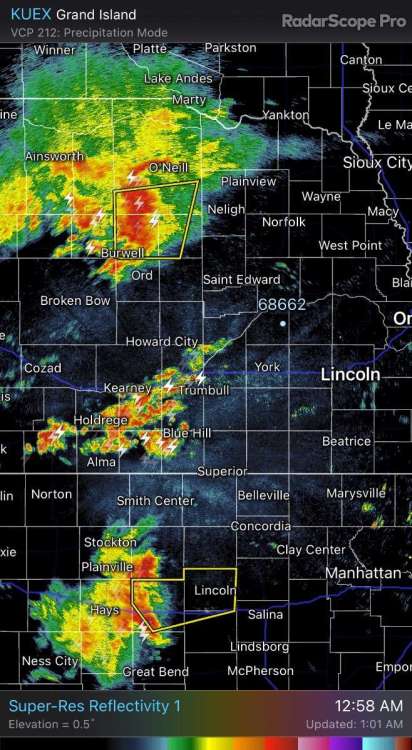
Lightning showing up 20+ miles away from the anvil on this supercell out in north central Nebraska.
-
2
-
1
-
-
1 hour ago, Clinton said:
Severe storms moving through the KC metro with 75mph winds. If they keep their current trajectory they will reach mby in about an hour and a half.

Wife and I came down to kc today for a concert at the power and light. I thought I was going to get lucky and have the storm pass before I came into town. Not so much……. That was the hardest scariest drive I have ever had! We just got to our hotel and lightning must have hit somewhere because their lights went in and out but elevators are out. I had to carry our stuff to the 8th floor! Never want to drive thru that stuff ever again. Thought we would run into flash flooding but thank goodness nothing major.
-
4
-
 1
1
-
-
21 hours ago, Tom said:
Terribly dry all the way from La Crosse to the dells. Horrible how bad this drought has been for all of us! Hoping they get more they need it.
-
2
-
 1
1
-
-
Lightning strike caught on camera in my hometown this morning.
https://twitter.com/1011_news/status/1677367131409637379?s=46&t=svZB1-WQ2Q4cwBSQmskK9A
-
7
-
-
6 hours ago, Tom said:
@gabel23 @Bryan1117...the radar this morning looks interesting for your area to get clipped...the bowing line on the southern extent might do the trick.

Still in Wisconsin but sounds like another inch or two fell in my area!! Loving the pattern switch and long ways to go to get out of this drought but it’s a start! Some sad news though coming out of my hometown; they were getting ready to pour some concrete on our new elevator and lightning struck. Sounds like up to 6 were affected. Hoping they turn out to be ok.
-
3
-
1
-
-
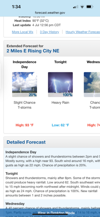
Greetings from wisky dells and happy 4th! Was pretty cool driving here on I-90 first time I have ever been in that area. Meanwhile back home I don’t think I have ever seen a forecast like this before! Sucks I won’t get to see it but happy to see more rain in the forecast.
-
3
-
 1
1
-
-
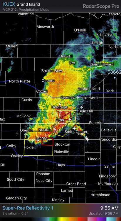
Watch what a drought does to this radar. Three areas of storms I’m gonna go out on the limb and say middle area becomes a dud. Got .34” past two days but glad for those east of me finally scored today. #Ihatedrought.
-
3
-
-
7 hours ago, Tom said:
I don't ever recall seeing and smelling this much smoke in the air. I think the last time we had anything close to comparable was in the summer of 2014 or '15 and I went up to Wiso for the long 4th of July weekend. I vividly remember how beautiful the sunsets were that year. This smoke is next level stuff!
Well, now let's see nature fire up some storms late tonight and again on Thu-Fri period....some of the CAM's show a NW/SE line of potential training storms for N IL late tonight...
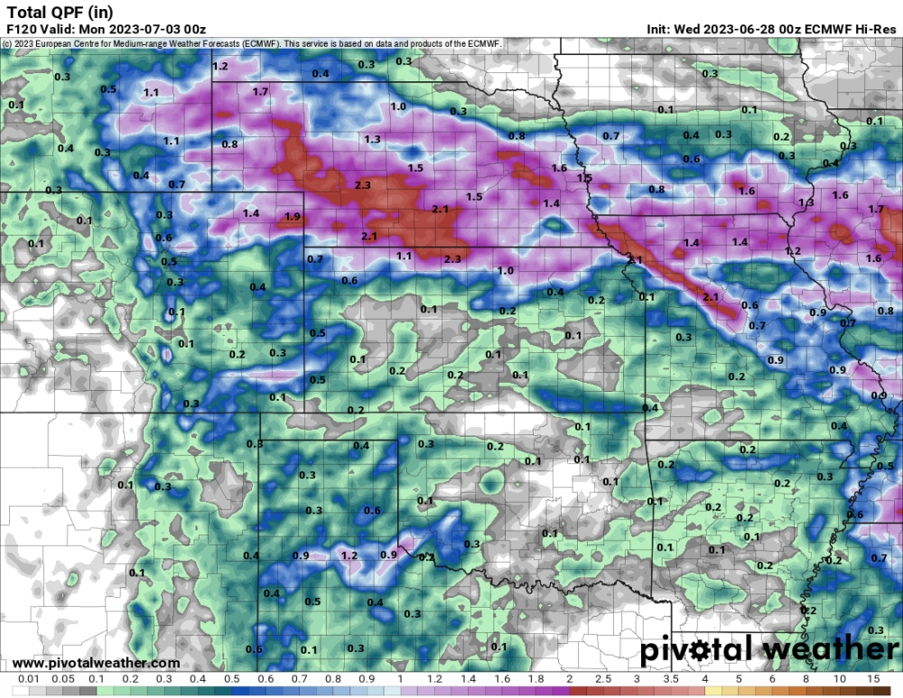
The battle between the GFS & EURO for the next 5 days...Good luck NE peeps!
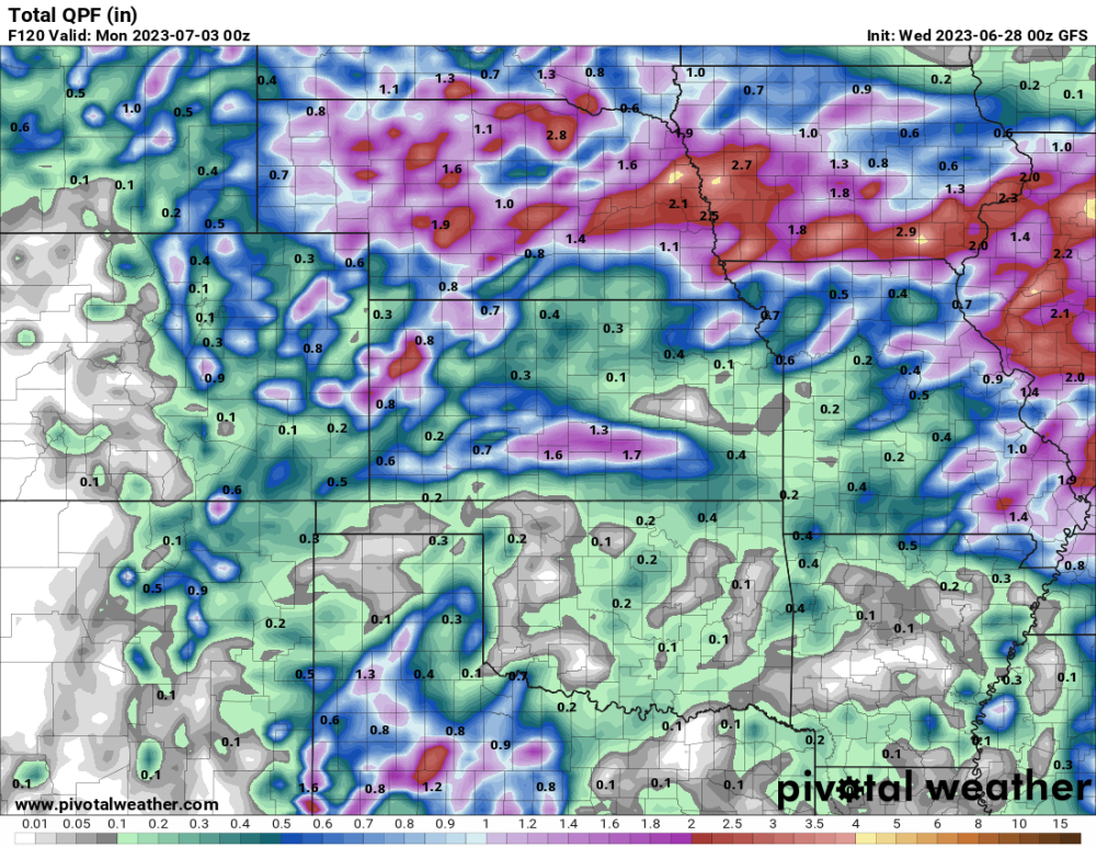
We leave for Wisconsin dells Monday for my daughter’s national dance competition! Will be my first time ever in the state looking forward to it! What’s your prediction for smoke then?! We had to deal with it in may it was the worst I have ever seen. Planning on golfing at trappers run looks like an amazing golf course.
-
1
-
-
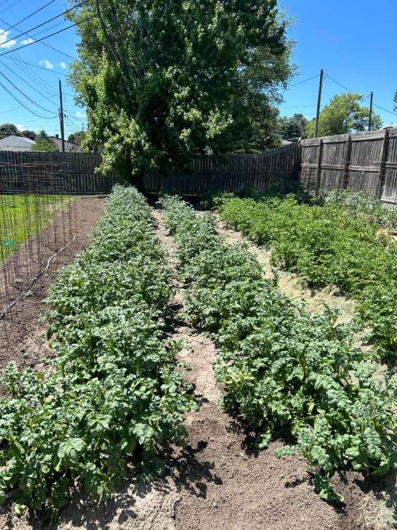
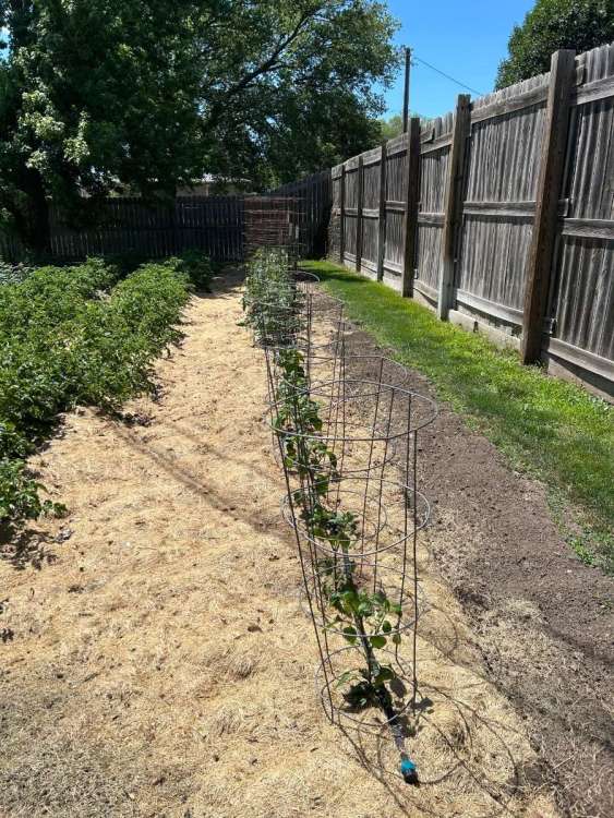
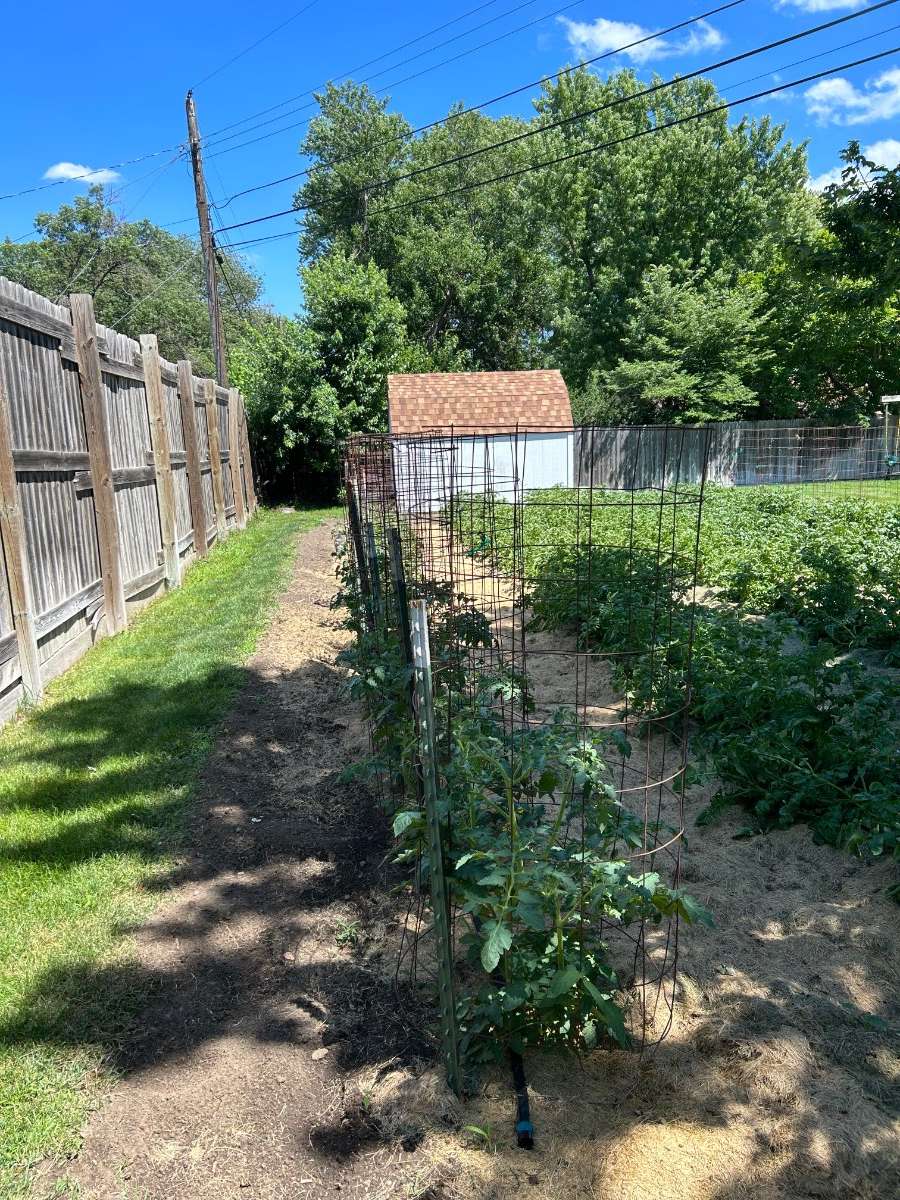
My garden sure has been liking this month so far!

-
7
-
-
8 hours ago, Tom said:
@gabel23, did you do alright in the rain dept?
Ended up with .30”. The lightning was intense, me and my family was staying in our camper at our families lake and a lightning bolt struck nearby. It was crazy. Surprisingly I’m doing much better than areas all around me for the month of June! Been crazy spotty, hoping we get into a ring of fire set up to help spread rain for all areas that need it.
-
4
-
-
8 hours ago, CentralNebWeather said:
Not sure about the rest of the areas, but is anyone else noticing how little wind we have for weeks now? Our area usually has a lot of wind just based on our geography.
Thought the same thing! I’ll take it, normally I have to wrap my tomato cages to help protect from the wind but didn’t this year! Calm for sure
-
3
-
-
We are approaching dangerous levels around these parts. Dry land crops might be screwed before mid June and farmers are selling cattle because pastures are dead. My mowing business is gonna take a big hit this year also if things don’t change. It looks like mid July or august on yards not watered.
-
1
-
 3
3
-
-
6 hours ago, Tom said:
@gabel23 did you get lucky from that line?
Had 3 tornado warnings in my county but luckily no official tornado on the ground. As far as the rain goes ended up with a total of .30” for the week. Mondays forecast was looking like 1-3 was a good bet. Drought goes on….
-
4
-
1
-
-
Sorry guys to rant, last post. Just two days ago the circled area for 7 day qpf was 2-3". We are now down to .25-.50". Just frustrating.
-
1
-
2
-
-
Watch this as the rain shield to the north hits my county just like hitting a wall. My county is the one between York and Columbus. Rain shield goes from yellow, green to nothing as it goes across my county. Just tough to break through; drought is the hardest thing to bust. More chances throughout the week but it's tough to get anything major to affect the large chuck of exceptional drought.
-
1
-
3
-
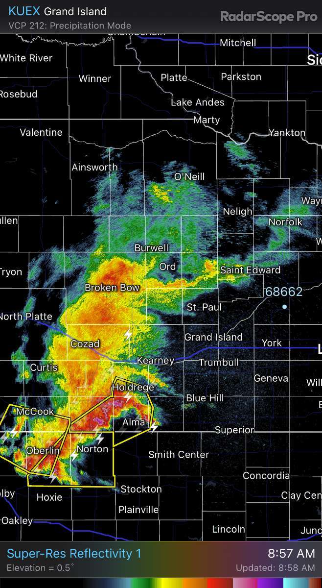
-
Don't think I have ever seen tornado warnings in nebraska in the morning!!!
-
1
-
3
-
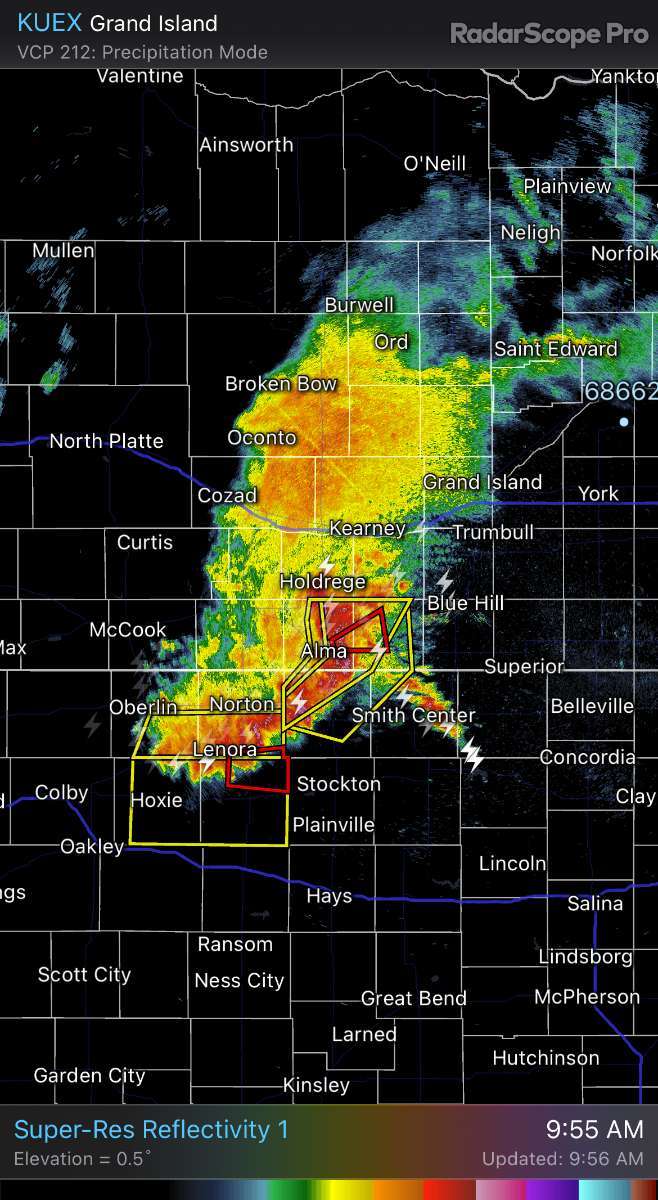
-
Gonna be close for you @CentralNebWeather. The main line looks like it's splitting. I have seen this before, the southern part of this line will head into Kansas and the northern half is gonna die out. Hope you get some rain but not looking good down stream towards us in the eastern end.
-
2
-


October 2023 Observations and Discussion
in East of the Rockies
Posted
Started a thread.