

snowstorm83
-
Posts
1817 -
Joined
-
Last visited
-
Days Won
1
Posts posted by snowstorm83
-
-
89 (and blowing dust) in the grids for Sunday. If it hits 90, that will break the latest 90 degree day on record by 3 days. Beginning Sunday I'll also begin living in Grand Island permanently.
-
 7
7
-
-
52 minutes ago, gabel23 said:
85-86 was a dreadful winter for us, at least at Columbus and Lincoln reporting areas. Well below snowfall and lots of temp swings. Columbus didn't record a single inch of snow in the month of Jan which is very hard to do.
Lincoln had 18.9" that year, though only a trace in January. Late November and most of December were cold with snow on the ground, and also a stretch in February. Not a great year, but it sounds like it wasn't physically impossible for more than an inch of snow to fall, so I'll take it over last year

-
1
-
-
Yesterday had a low of 16 at LNK before hitting 65 by the afternoon. Avg high/low for the month is 72/38 so far (normal is 66/41). Needing to find all my scattered chapsticks a bit early this year

-
2
-
-
The Tuesday night storm was exciting despite only 0.50" of rain. I guess that was probably our once a month rainfall lol.
-
3
-
 1
1
-
-
10 hours ago, Dan the Weatherman said:
Does anyone here in the Midwest / Plains think we are currently in a pattern that is reminiscent of the 1930's Dust Bowl era in terms of the current drought? I know this drought hasn't been going on out here as long it has been in the Southwest and California, but I am just curious what people on this forum from this area think about the current pattern.
Dust Bowl drought was much longer and more severe. 1934 and 1936 were worse than 2012, and 2012 was worse than this year. But if next year doesn't change, then things will be in realllly bad shape. Looking at Lincoln during the 1930s decade, the average annual precip was only 23.26" (compared to a usual around 29") and 4 years were under 20".
-
 1
1
-
-
Late October through 12/31 isn't a particularly wet time of the year either, so that number probably won't be moving significantly. Norfolk also only received 4.1" of snow last winter (still can't get over that lol). Before last year, 7-10" seemed to be the floor in eastern Nebraska.
-
3
-
-
Wouldn't be surprised to see LNK make a run for 90 on Tuesday despite the current forecast being only 84. Seems like the type of day to overperform.
-
1
-
-
October snow normally wouldn't surprise me, but I'm not super confident in our ability to receive any type of precipitation right now

-
2
-
 1
1
-
-
Looking forward to highs in the 50s and potentially the first frost. Unfortunately still looking very dry for the foreseeable future.
-
3
-
-
3 minutes ago, OmahaSnowFan said:
Crazy to see the sharp gradient of September temperature anomalies across the area.
Omaha Eppley: +2.2
Valley NWS: +3.6
Lincoln: +4.5
Norfolk: +5.3
Lincoln's been even drier than Omaha, which probably further boosts afternoon temps. There's been a lot of overperforming days this month.
-
1
-
-
Looks like were going for 90s today, it's already 89 at LNK. Forecast was only 84.
-
1
-
-
With no rain in the forecast September will likely finish with only 0.96" at LNK, after only 0.55" in August. Currently at 18.4" for the year, so I doubt we will remain below the 19.14" in 2012, but I wouldn't be surprised if we barely make it above 20".
-
2
-
 1
1
-
-
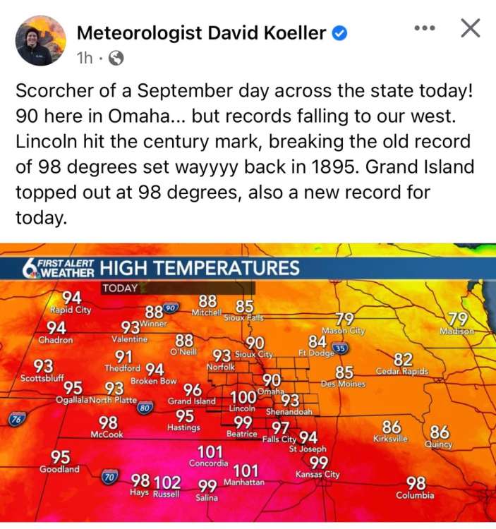
Hopefully yesterday was both the final 90+ and 100+ degree day. 103 was crazy for September 20th. Though even if we don't for the rest of the month, 2022 definitely seems like a 90s in October type of year.
-
2
-
-
1 hour ago, OmahaSnowFan said:
Lincoln should hit 100 on back to back days after outperforming today.
I “only” reached 90.5 IMBY, but the dew was over 70 most of the day so pretty brutal.
Forecast for tomorrow is 97 and then 75 Wednesday!
I also only received .29” of rain over the weekend.
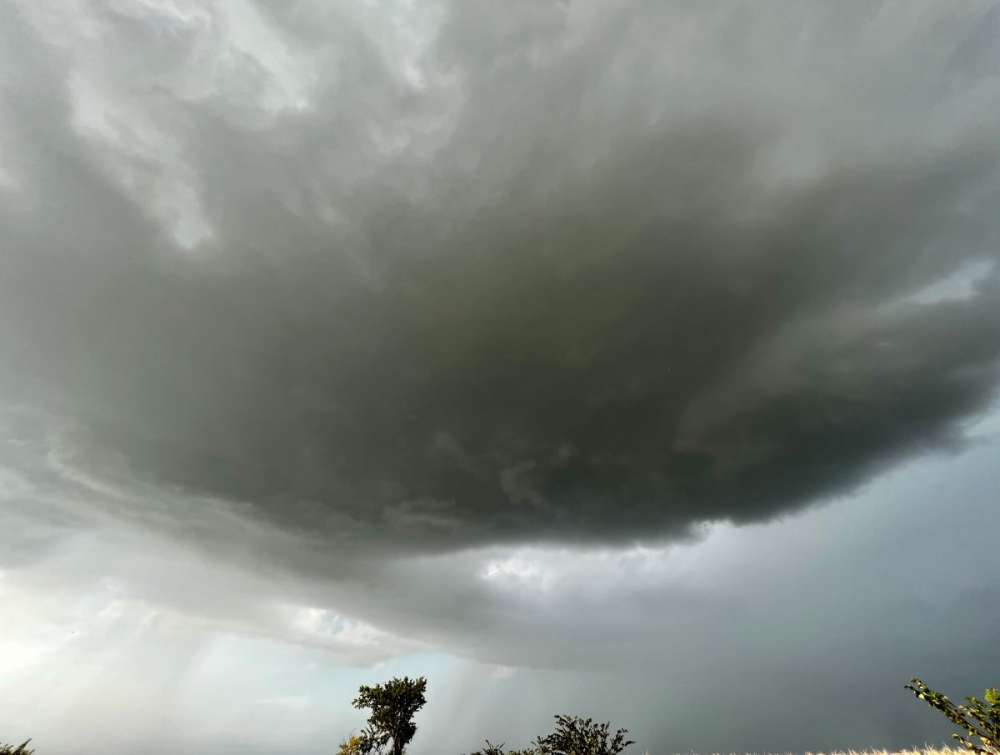
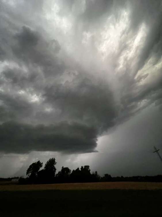
Went chasing yesterday and was left pretty disappointed. One line cell popped about 630-700 and moved right along the highway so was east to follow. It went tornado warned for a while but was never close to dropping one, and then died a pretty rapid death about sunset.
5 degrees below average will feel quite cool after breaking record highs
-
5
-
-
19 hours ago, OmahaSnowFan said:
The lows this weekend are near are normal highs
TonightClear, with a low around 62. East southeast wind 6 to 9 mph.WednesdaySunny, with a high near 90. South wind 6 to 16 mph, with gusts as high as 23 mph.Wednesday NightPartly cloudy, with a low around 68. South southeast wind 10 to 14 mph, with gusts as high as 23 mph.ThursdayPartly sunny, with a high near 88. South wind 10 to 17 mph, with gusts as high as 26 mph.Thursday NightA chance of showers, with thunderstorms also possible after 1am. Partly cloudy, with a low around 66. South wind 10 to 14 mph, with gusts as high as 23 mph. Chance of precipitation is 40%.FridayA slight chance of showers and thunderstorms before 1pm, then a slight chance of showers between 1pm and 4pm, then a slight chance of showers and thunderstorms after 4pm. Partly sunny, with a high near 85. Chance of precipitation is 20%.Friday NightA 40 percent chance of showers and thunderstorms. Partly cloudy, with a low around 64.SaturdayA slight chance of showers and thunderstorms before 1pm. Mostly sunny, with a high near 87.Saturday NightA chance of showers and thunderstorms, mainly before 1am. Mostly clear, with a low around 67.SundaySunny, with a high near 90.Sunday NightClear, with a low around 73.MondaySunny, with a high near 92.Monday NightA slight chance of showers and thunderstorms. Mostly clear, with a low around 69.TuesdayA chance of showers and thunderstorms. Mostly sunny, with a high near 85.Mid 90s in September just seem normal to me, I always forget that avg highs are in the 70s by this point
-
3
-
-
Received around 0.75” so far, probably not much more to come. Far from a drought buster, but easily the best rain in 2 months.
-
3
-
-
I'll be moving to Grand Island for a job next month. GI doesn't exactly have the best reputation
, but it probably won't be for more than a couple years. I'm excited for the change and still only 1.5 hours from Lincoln when I'm bored. The climate is basically identical to Lincoln, just a little drier and slightly snowier on average. GRI averages 27.7" compared to 26" at LNK. Kind of thought it would be a greater difference since large storms have the tendency to sharply cut north before hitting Lincoln.
-
6
-
-
Hopefully this forecast doesn't get any more serious. We don't want to receive more than 0.10" at once and put us at risk for a flash flood!
-
2
-
 1
1
-
 1
1
-
-
Unless we get a surprise before midnight (20% POPs lol), LNK will end August tying as the 5th driest on record with only 0.55". Even worse, only there's only been 0.89" since July 7th. I don't know how Lancaster is still only in D0 drought, wouldn't be surprised to see that change tomorrow. I guess one positive thing is it seemed like we only had a handful of humid days this month.
-
4
-
-
2 hours ago, CentralNebWeather said:
I was just thinking this morning, I don't remember the last time I've seen a cloud in the sky. Probably at least 10 days ago when we had some fog. Every day is the same weather, 85-90 degrees, little to no wind, with a dew of 60. Just such a frustrating pattern we are in. Still sitting at .06" in the last 28 days.
Most of the past 10 days have had some passing clouds, but almost no rain to speak of. Farms surrounding Lincoln are mostly dryland and don't look good at all, outside of random localized spots that have gotten multiple storms.
-
2
-
-
After the past year, I think we've already built our weather karma back up since 2018-19 and 2020-21. It's time for some rain and actual snow next winter. I know weather doesn't actually work like that but at this point it's like cmon do something
-
2
-
-
Currently 100/72 at LNK creating a heat index of 110. Yikes.
-
4
-
1
-
-
On 8/4/2022 at 12:50 AM, OmahaSnowFan said:
Lock it in (again)! All you have to do is come here or to places like the Facebook page image I shared to see we’re all getting buried this winter and this is the year (finally) when the next massive global cooling/ice age is coming!
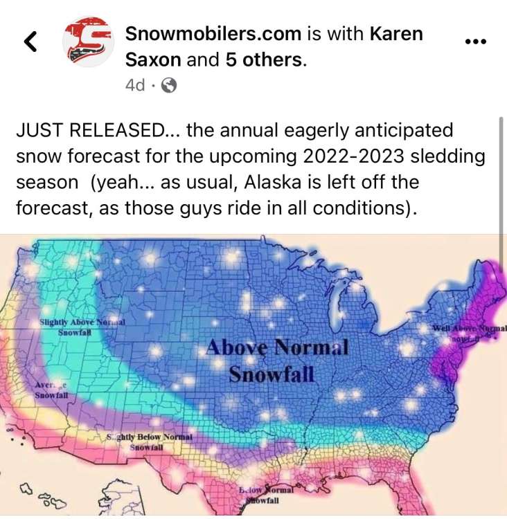
I think I saw that exact same map as far back as 2012-13

-
 2
2
-
-
7 minutes ago, Hawkeye said:
DVN has 105º in the forecast for Cedar Rapids next Wednesday. I'm not sure why they would even put that in because there is very little chance it'll verify. It hasn't been that hot since the 1930s dust bowl. Cedar Rapids hasn't even hit 100º since 2012.
I've noticed that OAX follows closely with the national model blend (which is still usually a few degrees too warm during the summer). The NMB only has up to 99 for Cedar Rapids and even the GFS is only getting up to around 110, so yeah not sure where that 105 is coming from
-
2
-


June 2023 Observations & Discussions
in East of the Rockies
Posted
I guess I've been gone a couple minutes. I'm very baffled by this dry streak. Extremely bizarre to have a situation where western Nebraska is getting dumped on with precip while the rest of the state is drooling. I got a new puppy a couple months ago that I have to take outside constantly, so in that regard, the warm and dry weather has been very nice.