Clinton
-
Posts
6469 -
Joined
-
Last visited
-
Days Won
28
Everything posted by Clinton
-
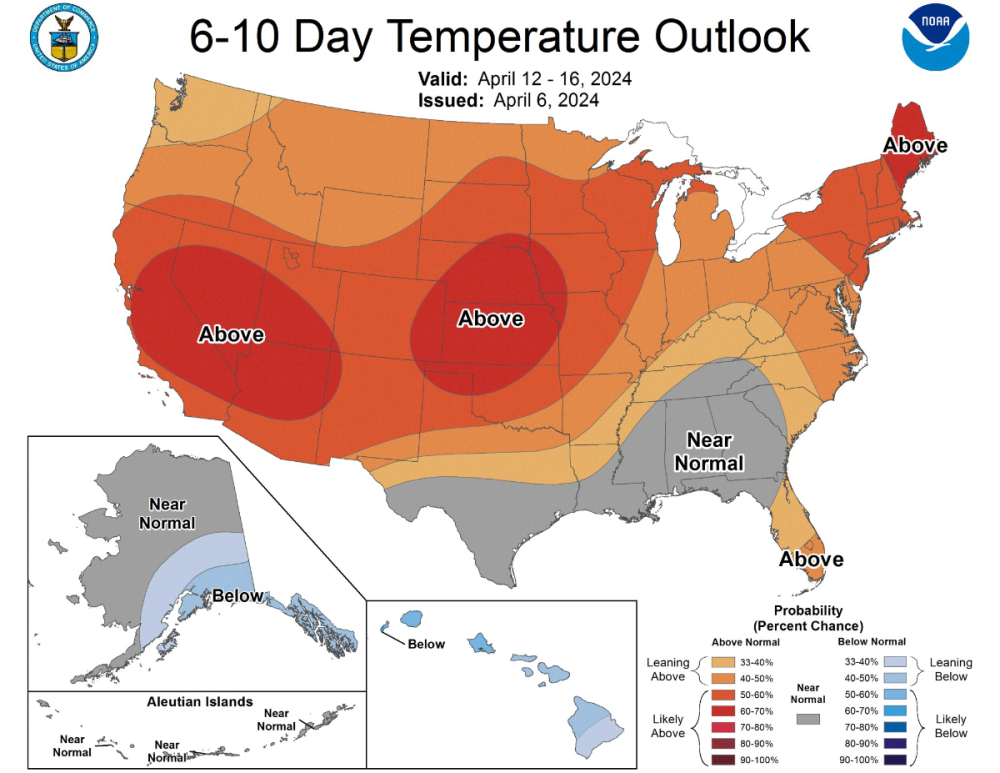
It's looking like the wetter pattern that will close out April will carry into the first week of May along the I-35 corridor. I'm ready to get the pool ready and the CPC favors above average temps to open May.
-
 0z models all bullish on rainfall totals for just about everyone. WPC forecast
 -
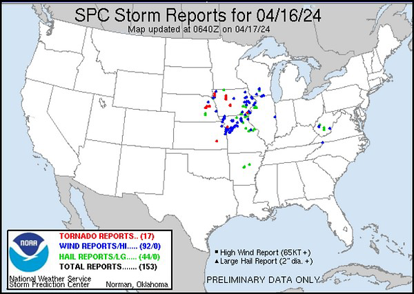
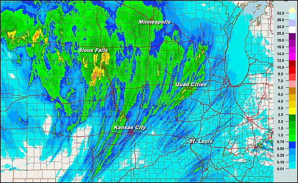
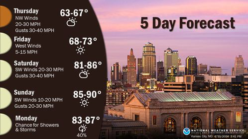
Heavy rain and severe weather looking more likely for mby Thursday- Sunday. Friday and Saturday looking like the best bet for severe weather in my area. Sunday will likely be the biggest day of this event for severe weather but the action will likely be to my east. EAX showing more rain in that time span than I've had this year to date.
-
This is the part of the pattern that can put a dent in the ongoing drought and will likely produce alot of damaging storms. Here's some thought from Gary Lezak as this is by far the most exciting stretch of weather in this years pattern and he thinks 3-5 inches of rain over the next 10 day is certainly possible for the KC area. Weather 2020 Well, here we are almost 45-days after the strongest and most deadly severe weather outbreak in this year's LRC, March 12-14, and around 135 days after the other big winter outbreak in this part of the LRC, December 9th. Gary Lezak @glezak Do you remember this day in the previous cycle? 3 people were killed in western Ohio. This part of the pattern is cycling back through, one of our signature long-range predictions, in the next six days! If you know the LRC, then you know it is due around 4/28
-
That day 5 looks intense for mby. Hope the timing works out so the storms don't fall apart as they get here and redevelop to my east.
-
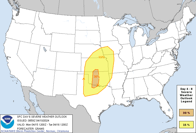
I hope it brings the rainfall as there should be 2 big troughs digging down before the end of the month. The SPC showing the severe risk later in the week. Another trough should dig down on the 28th and 29th, both will have lots of Gulf moisture.
-
No frost here this morning as temps only dropped to around 40. Lots of sun and a high in the low 60s today.
-
Somehow my cherry trees survived a frost when they were blooming and are loaded with cherries, not sure how my apple trees will turn out though.
-
Cool temperatures this weekend hopefully I can avoid any frost Sunday morning as temps may dip into the mid 30s. Later next week one of the stronger storms in this year's LRC will likely ignite a major sever weather outbreak across the middle of the country. Models are already showing significant amounts of rain in my area but it's gonna have to show me it can actually happen here in the show me state before I get to excited.
-
Another disappointment with rain here only .22 inches. The rain just seems to find away to miss me.
-
A good amount of severe weather and rainfall from this system.
-
As expected not a drop of rain fell here yesterday however things are looking good for some beneficial rainfall tonight and tomorrow. The Euro and 3km NAM showing 1in plus for mby and the GFS just a little bit less. I could really use the rainfall, the strong winds yesterday picked up a bunch of dust and blew down trees including a apple tree in my yard.
-
Not expecting much rain here overnight or tomorrow. It's looking like Thursday may be my best shot. I'm so tired of drought!
-
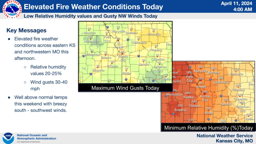
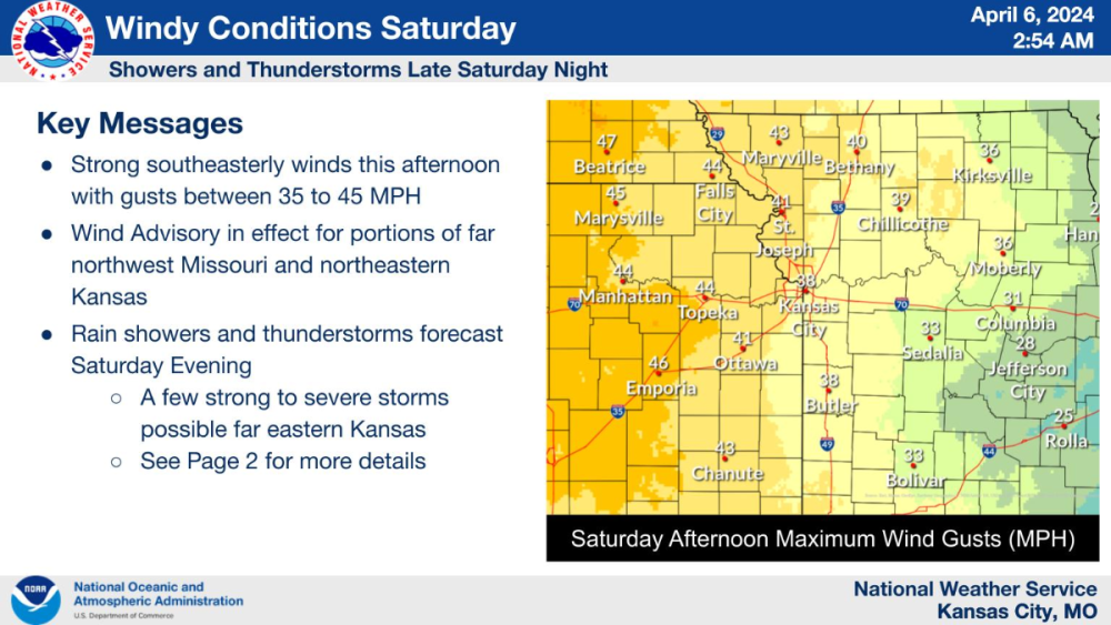
Warm and windy conditions have drought conditions worsening quickly over western MO and other parts of the Midwest. Hopefully some rain is coming this week with a rather robust closed low that should crank out some big storms. http://www.cpc.ncep.noaa.gov/soilmst/img/curr.w.anom.daily.gif
-
Cool, windy and dry as a bone here today. Some summer like temps and humidity will have me turning the AC on this weekend.
-
The heat starts to build into the central plains this weekend which will lead to big storms early next week.
-
Severe weather and big time rains across the south the next few days. For mby only the Euro is showing significant rainfall with totals near an inch. All other models have the rainfall to my SE, though the GFS has crept very close.
-
Big jump NW on the 12z Euro for the storm this week. This would give me over an inch of rain on Wednesday. Hopefully other models follow suit.
-
Nice and somewhat boring weather ahead this week around here with all the thunderstorm action in the south. However great viewing for the eclipse this afternoon, I get about 93% coverage.
-
A graduale warm up over the next week for most of the country. The next chance for widespread significant weather should be around the 19th as this part of the pattern produced in early March.
-
I received .22 inches of rain with a line of showers overnight. Nice weather today with temps around 70.
-
Beautiful weather today but windy. Maybe pull in a thunderstorm tonight.
-
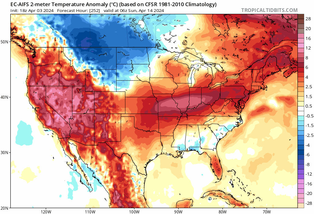
The Euro AI for April 14th 18th Some of you may not be done with snow yet.

-
Light freeze expected here tonight with lows around 30. Going forward into next week, the blocked up pattern has the operational models struggling. The EPS and GEFS ensemble means are more generous with precipitation and further north than the operational models are currently are.
-
March 31st - April 2nd Potent Plains Storm
Clinton replied to Clinton's topic in East of the Rockies
This beast is still spinning