Clinton
-
Posts
6459 -
Joined
-
Last visited
-
Days Won
28
Everything posted by Clinton
-
Heavy thunderstorm atm with some cloud to ground lighting has managed to wake up the entire house lol. I'm going to put the coffee pot to work today lol.
-
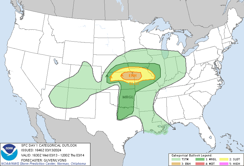
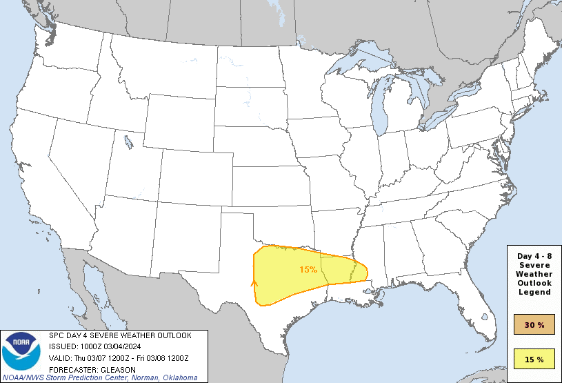
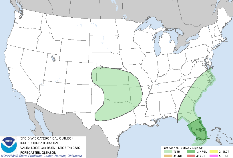
Myself and the KC are upgraded to an enhanced risk.
-
Warned cell getting ready to move overhead, quarter sized hail is possible.
-
The ski resorts in Colorado are going to love this. This storm has produced in every cycle but the amounts this time look to be much larger.
-
Just missing out on some big storms producing torrential rains and large hail along the I-70 corridor in Missouri. More widespread storms possible tomorrow along with some severe storms.
-
Major changes in the long range showing up on both the 0z runs of the GFS and the Euro Control starting on the 22nd. This is looking more like an early Spring artic outbreak that has legs to last through the end of the month at least. Cooler than average temps may return as early as St. Patrick's Day as the ridge builds in the west and the EPO complete tanks. Snow for some
-
Another nice warm up gets started today. Models don't agree much on rain chances later in the week.
-
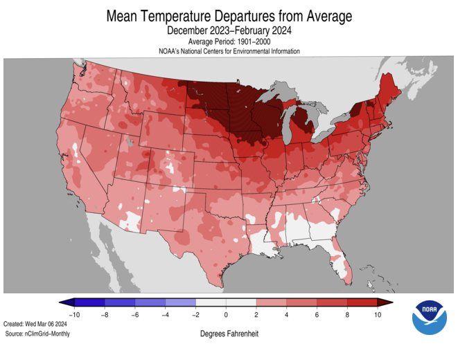
Not a winter to remember. @NWSKansasCity Follow It didn't matter if you were in Kansas City or anywhere else in the lower 48 states...Winter was hard to find. This meteorological Winter (Dec-Feb) was the warmest on record for the contiguous U.S. of the 130-years on record and was 5.4 degrees above normal
-
This mornings run of the Euro Control is trending wetter for next weeks storm system in the areas that need it. Also the 0z run of the Euro Control brings the return of Winter at least for awhile.
-
The Euro weeklies got my attention and we have delayed putting fertilizer on our hay and pasture ground. I would hate to see the grass and fruit trees get burnt by a frost.
-
The pattern setting up could deliver several more of these types of systems. Enjoy the scenery!
-
Looks like it's just sitting over ya this morning!
-
The latest Euro Weeklies showing a lot of high latitude blocking and a slow start to Spring. This may not be good for many of the southern members as trees are budding out like it's early April in my area. After next weeks big warm up the pattern looks to cool dramatically as a big ridge develops over the west. 500mb flow from March 17th through April 16th. Mid April looks especially cool especially given the models bias toward warmth. Much needed rainfall in the south while the drought looks to really intensify in the north. This LRC has had a strong El Nino flavor and that looks to continue even as El Nino fades.
-
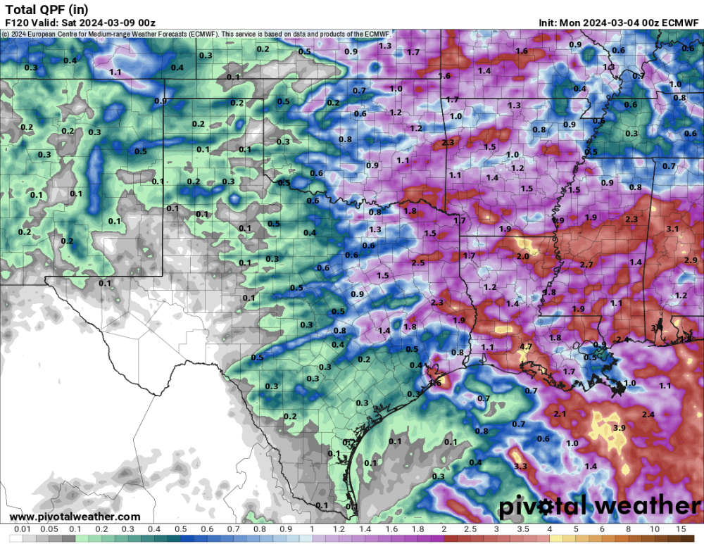
I got a nice rain yesterday of .70 inches but it was about half of what was forecasted. Here's some estimated rainfall totals from around the are and the latest drought monitor that shows how the drought has intensified again in many areas.
-
Nice steady rain falling with a nearly stationary band over my place. I'm worried for those north of I-70 in Missouri, the rain just seems to refuse to push into northern Missouri.
-
Just hope its wet. Everyone around here could use a nice hay and corn crop after last year.
-
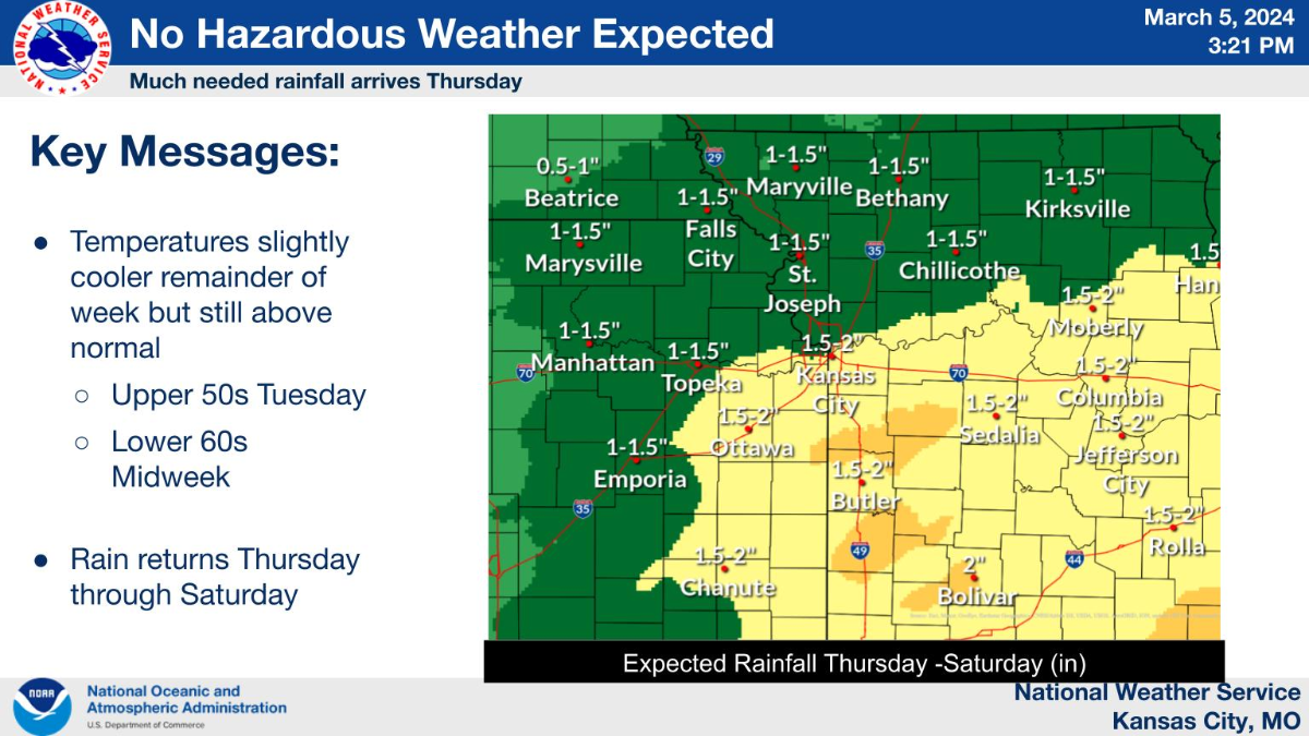
Significant rainfall expected here today and tomorrow. 1-2 inches with some higher amounts possible and we really need it.
-
I'm not sure winter is done with you, models have been pretty consistent dropping a trough over the lakes and points east around the 18th. Negative AO and NAO with a big dip in the EPO has the pattern looks ripe for some late season clippers, despite the MJO moving through the warm phases.
-
I hope this forecast verifies, looks like a good soaker.

-
Cooler weather for my area today with temps in the upper 50s. Warm and windy conditions over the past month have really dries things out. Hopefully the 1-2 inches of rain the models show for Thursday and Friday pan out.
-
Looks like ya have some rain coming mid week along with a risk of severe weather.
-
More record heat in western MO today, it's currently 79 at my place. St Joseph current temp 81 record was 80 (1983) -Kirksville current temp 78 record was 70 (1955) -Sedalia current temp 80 record was 70 (2021) -Olathe current temp 77 record was 69 (2021) - P-Hill current temp 78 record was 73 (2008) @NWSKansasCity Kansas City just hit 80 degrees! It's the 5th earliest 80 degree day in KC's 136-year period of record.
-
Warm and very windy in conditions here today, slight chance of rain tomorrow and a better one later in the week. I hope we get it because the drought conditions are beginning to intensify again.
-
Here's the February rundown for KC. NWS Kansas City @NWSKansasCity Follow Here's the February 2024 climate rundown: -Feb 2024 was 10.5 degrees above normal and the 3rd warmest on the 136-year record for KC. -Precip was 0.15" which was 1.33" below normal and the 5th driest on record. -Snow came in at 1.3" which was 4.6" below normal (35th least)
-
Warm weekend ahead and hopefully I can get some rain soon as things have dried back out again.