Jump to content

Recommended Posts

Posted

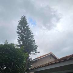
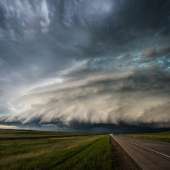
68F and sunny in Pullman. Feeling a little envious of Cougs fans since it's a bit warm for dark shirts. Patchy clouds to the north but mostly sunny and bright. Light breeze.

IMG_20221001_132712988.jpg

IMG_20221001_132249825_BURST000_COVER_TOP.jpg

  • Like 6

Garfield County/Pomeroy, WA:

2026-2027 Snowfall totals: 

Highest snow total (per event): 

Most recent accumulation (non trace): 

Days with trace or more snowfall: 

First Freeze:  

Lowest Temperature:

Last White Christmas: 2022 at my location (on ground)

Subfreezing Highs: 


Posted
4 minutes ago, Phishy Wx said:

🤢


Screen Shot 2022-10-01 at 1.27.21 PM.png

I would’ve killed for that weather on a consistent basis in July and august…the current 10 day forecast here seems so unnatural for the first 1/3rd of October. 

  • Like 1

2026 warm season stats

Max temp-93

+80s-14

+85s-8

+90s-3


Posted

72 here…smoke seems to have increased a bit. I’ll have to look at the wx records when I get home but I’m pretty sure we haven’t been in the 70s in October in a few years. Some upper 70s are even showing up across the region. 

2026 warm season stats

Max temp-93

+80s-14

+85s-8

+90s-3


Posted
1 hour ago, snow_wizard said:

I have a pic of the waterfront starting to freeze in Seattle in Jan 1950.  Pretty unreal.  The Columbia was frozen 30 inches thick at Portland in 1862.  Those were the days!

Boundary Bay froze in the December/January cold snap last winter.

  • Like 1
It's called clown range for a reason.

Posted
Just now, TacomaWx said:

Jeez 84 at PDX. Don’t think they hit 90 but that’s pretty warm. 74 here. 

Decently windy here as well

Posted
4 hours ago, snow_wizard said:

This composite of October 1942 and 1988 is pretty amazing.  Both strong La Ninas with profound +PNA signature.  Both winters featured historic blocking during the heart of the winter and extreme cold in the NW.

This plot is not dissimilar to the PNA

I was only 6 but I remember it snowing on Christmas Eve here in 1988.  Can’t remember where we were going but I remember being in the front seat of my dads truck and being pretty D**n excited about the snow. 

Posted

Brian O'Keefe just hit his first base hit! But before you celebrate...

  • Angry 1

Weather stats for MBY

Snowfall:

-Total snowfall since joining: 56.25"

-- Lake City, Seattle (LC) --

-2018-19: 21"

-2019-20: 2.5"

-2020-21: 13"

-2021-22: 8.75"

-2022-23: 5.75"

-2023-24: 0.25"

-2024-25: 4.75"

-- Ballard, Seattle (B) --

-2025-26: 0.25"

-Most recent snowfall: 0.25”; March 13th, 2026 (B)

-Largest snowfall (single storm): 8.5"; February 12-13, 2021 (LC)

-Largest snow depth: 14"; 1:30am February 12th, 2019 (LC)

Temperatures:

-Warmest: 109F; June 28th, 2021 (LC)

-Coldest: 13F; December 27th, 2021 (LC)

Posted
1 hour ago, Deweydog said:

Breezy!

In October!

Columbus Day is approaching! 

Elevation 580’ Location a few miles east of I-5 on the Snohomish Co side of the Snohomish/Skagit border. I love snow/cold AND sun/warmth! 

Posted
13 minutes ago, TT-SEA said:

Gorgeous October day in Pullman.    Go Cougs!

20221001_143525.jpg

Not far from me. In the corner section in the shade (not the visitors section) Probably just over 70F and clouds now coming in from the East. I'm in the shade. Perfect weather for football.

16646642292204343532547379725688.jpg

Garfield County/Pomeroy, WA:

2026-2027 Snowfall totals: 

Highest snow total (per event): 

Most recent accumulation (non trace): 

Days with trace or more snowfall: 

First Freeze:  

Lowest Temperature:

Last White Christmas: 2022 at my location (on ground)

Subfreezing Highs: 


Posted

Hard to complain about this. 

7ED57104-2DBE-48DF-88D7-BA5C35C7ACFA.jpeg

  • Like 1

Snowfall                                  Precip

2023-24: 39.5"                   2023-24: 76.88

2022-23: 95.0"                      2022-23: 73.43"

2021-22: 52.6"                    2021-22: 91.46" 

2020-21: 12.0"                    2020-21: 71.59"

2019-20: 23.5"                   2019-20: 58.54"

2018-19: 63.5"                   2018-19: 66.33"

2017-18: 30.3"                   2017-18: 59.83"

2016-17: 49.2"                   2016-17: 97.58"

2015-16: 11.75"                 2015-16: 68.67"

2014-15: 3.5"
2013-14: 11.75"                  2013-14: 62.30
2012-13: 16.75"                 2012-13: 78.45  

2011-12: 98.5"                   2011-12: 92.67"

It's always sunny at Winters Hill! 
Fighting the good fight against weather evil.


Posted

I clearly see three fires around HWY 2 now.  Looks like they are picking up since this morning.  One might even be new.

Death To Warm Anomalies!


Winter 2024-25 stats


Total Snowfall = 4.3"

Day with 1" or more snow depth = 6

Total Hail = 0.0

Total Ice = 0.0

Coldest Low = 22

Lows 32 or below = 47

Highs 32 or below = 0

Lows 20 or below = 0

Highs 40 or below = 17


Posted
1 minute ago, SilverFallsAndrew said:

Hard to complain about this. 

7ED57104-2DBE-48DF-88D7-BA5C35C7ACFA.jpeg

Yeah...A pattern that would bring uncomfortable heat in the summer is now quite enjoyable.

Death To Warm Anomalies!


Winter 2024-25 stats


Total Snowfall = 4.3"

Day with 1" or more snow depth = 6

Total Hail = 0.0

Total Ice = 0.0

Coldest Low = 22

Lows 32 or below = 47

Highs 32 or below = 0

Lows 20 or below = 0

Highs 40 or below = 17


Posted

The 18z GFS shows another Thursday type system moving through early in week two instead of a big pattern change.

Death To Warm Anomalies!


Winter 2024-25 stats


Total Snowfall = 4.3"

Day with 1" or more snow depth = 6

Total Hail = 0.0

Total Ice = 0.0

Coldest Low = 22

Lows 32 or below = 47

Highs 32 or below = 0

Lows 20 or below = 0

Highs 40 or below = 17


Posted
16 minutes ago, snow_wizard said:

The 18z GFS shows another Thursday type system moving through early in week two instead of a big pattern change.

Just unbelievable how bad it’s getting. I think it’s time for some good ol’ rain dancing and repenting. The webs in my feet are about gone now and that’s saying a lot considering I live in the desert anyways. 
 

Maybe I should get in on those conference calls up at Stampede Pass to find out the scoop behind all this. 

  • Like 1
  • Excited 1
  • lol 1
Posted

Topped out at 65.8F today.  Smoke is quite thick.  It has a wispy quality to it today and occasionally you can smell it. 


DSCN1516.JPG

DSCN1518.JPG

DSCN1523.JPG

DSCN1524.JPG

Screen Shot 2022-10-01 at 4.52.02 PM.png

  • Like 1
Posted
18 minutes ago, RentonHillTC said:

Ash falling in carnation. Cool

Fires in the north cascades and cedar creek looked like they picked up intensity today. Continued offshore flow in the coming days won’t help. 

G17_sector_pnw_GEOCOLOR_24fr_20221001-2027.gif

2026 warm season stats

Max temp-93

+80s-14

+85s-8

+90s-3


Posted

The smoke here is worse than it looks on the satellite imagery. This year might’ve not had the major thick nasty smoke 2020 did…but this has been an on and off issue for over a month now. 

  • Sad 1

2026 warm season stats

Max temp-93

+80s-14

+85s-8

+90s-3


Posted

Too smoky and warm for me today. At this point the only '70's or '80's I want to see in the weather forecast is snowfall accumulations.

  • Like 4
  • Excited 1
  • Snow 1

Weather stats for MBY

Snowfall:

-Total snowfall since joining: 56.25"

-- Lake City, Seattle (LC) --

-2018-19: 21"

-2019-20: 2.5"

-2020-21: 13"

-2021-22: 8.75"

-2022-23: 5.75"

-2023-24: 0.25"

-2024-25: 4.75"

-- Ballard, Seattle (B) --

-2025-26: 0.25"

-Most recent snowfall: 0.25”; March 13th, 2026 (B)

-Largest snowfall (single storm): 8.5"; February 12-13, 2021 (LC)

-Largest snow depth: 14"; 1:30am February 12th, 2019 (LC)

Temperatures:

-Warmest: 109F; June 28th, 2021 (LC)

-Coldest: 13F; December 27th, 2021 (LC)

Posted

Pretty evening light. Feeling a bit of a chill but still comfortable. Saving the game talk for Tacoma in the banter thread for obvious reasons. But the bright side of a warmer fall is you can enjoy the activities of the season.

IMG_20221001_174553669.jpg

IMG_20221001_174552349.jpg

  • Excited 1

Garfield County/Pomeroy, WA:

2026-2027 Snowfall totals: 

Highest snow total (per event): 

Most recent accumulation (non trace): 

Days with trace or more snowfall: 

First Freeze:  

Lowest Temperature:

Last White Christmas: 2022 at my location (on ground)

Subfreezing Highs: 


Posted
33 minutes ago, LowerGarfield said:

Pretty evening light. Feeling a bit of a chill but still comfortable. Saving the game talk for Tacoma in the banter thread for obvious reasons. But the bright side of a warmer fall is you can enjoy the activities of the season.

IMG_20221001_174553669.jpg

IMG_20221001_174552349.jpg

Technically I am in that pic!   We moved down to student section.   Here was our view in 4th quarter.  You are also in my pic.  😀

20221001_174332.jpg

  • Like 1
  • Excited 1

*

Posted

Some incredibly interesting stuff happened in the late 1920s through early 1940s that offers a lot of hope going forward.  1929 and 1936 both featured a ridiculously dry October / November with 1929 reaching 80 in Landsburg on October 23.  Both years featured abnormally cold mins in November followed by a very wet December and then epic cold Januarys.  1942 featured a very dry September / October (up until Oct 29th). Followed by very wet weather from the very end of Oct through November, a typical December, and then extreme blocking and deep cold in January.  We'll see if this year takes a similar path.  The theme of these kinds of seasons seems to be cold holding off until the heart of the winter.

  • Like 2
  • Weenie 1

Death To Warm Anomalies!


Winter 2024-25 stats


Total Snowfall = 4.3"

Day with 1" or more snow depth = 6

Total Hail = 0.0

Total Ice = 0.0

Coldest Low = 22

Lows 32 or below = 47

Highs 32 or below = 0

Lows 20 or below = 0

Highs 40 or below = 17


Posted

74/50 today was the warmest October day since 10/6/14 when we pulled off a 75/53. That’s also the warmest day I’ve recorded 2005 to present. Pretty good chance we break that record coming up. 

2026 warm season stats

Max temp-93

+80s-14

+85s-8

+90s-3


Posted

F453C240-E201-4D96-BF4B-33E4A8367B0D.thumb.jpeg.4dd424e7e1dafa581368671dead38509.jpeg

Gorge tents are setup and pregame has been going for a while now. Concert should be starting (fairly) soon, here’s the sunset going on over Ryegrass Summit. Have a great night TWF!

Also it’s 73 here and dropping fast!

  • Like 2
  • Weenie 1
Posted
16 minutes ago, RentonHillTC said:

Feels like June out there 

Besides that it’s almost totally dark by 7:45 yeah it’s pretty warm out. 

2026 warm season stats

Max temp-93

+80s-14

+85s-8

+90s-3


Posted
4 minutes ago, kokaneekidz said:

What did they break the record by? +10 or more!?

I'm not sure where to find their records but I see Astoria broke the previous record of 78 with 82 today.

  • scream 1
  • Thanks 1

Join the conversation

You can post now and register later. If you have an account, sign in now to post with your account.

Guest
Unfortunately, your content contains terms that we do not allow. Please edit your content to remove the highlighted words below.
Reply to this topic...

×   Pasted as rich text.   Paste as plain text instead

  Only 75 emoji are allowed.

×   Your link has been automatically embedded.   Display as a link instead

×   Your previous content has been restored.   Clear editor

×   You cannot paste images directly. Upload or insert images from URL.

×
×
  • Create New...