


VMB443
-
Posts
200 -
Joined
-
Last visited
Posts posted by VMB443
-
-
Exactly! Not the hype like the other storms, but I think this one has more potential.
I wanna see how this dry slot that MKE NWS has been advertising pans out in the morning. I guess that was the reason for the Advisory over Warning
I agree - my gut says this has more potential, but maybe my gut is just wishcasting!
-
Four miles west of Mitchell Airport.
I'm going to be intrigued to see what we get, this storm seems to be passing through without the hype or conversation of the last couple of storms - I don't know if it's the difference in being under and Advisory versus a Warning, but I wonder if this is going to catch a few people off guard.
-
Started snowing in MKE!
Just started for me too, what part of Milwaukee are you in? I'm just west of the Milwaukee County line in Waukesha County.
-
 1
1
-
-
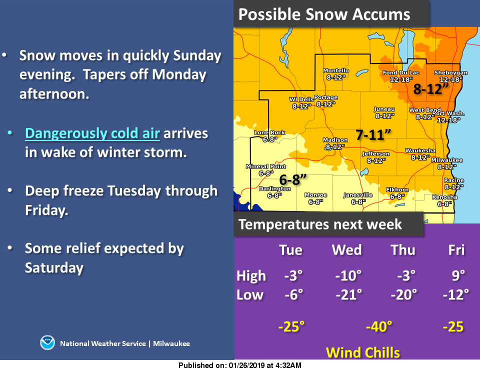
MKX going on the lower side of qpf- expecting a dry slot tomorrow morning which will keep our totals lower - so sticking with an Advisory rather than a Warning - it’ll be interesting to see, I was expecting to see a move to a Warning.
-
You see, unlike all of you evil people who wish extremes on folks just for your silly hobby — I am just fine with a normal winter day or a normal summer day.
A few inches of snow to pretty things up? No problem for me.
78 degrees and sunny? Can’t wait to take a lap around the lake and drink a few beers.
What I don’t need? Ice, record-low temps, feet of snow, humidity and tornadoes wiping out entire towns. You know - the things ya’ll hope for and cherry pick, post and root home any/every model that suggests it might happen.
I bet you’re a lot of fun at parties...
-
3
-
-
Funny how now that it’s only -8 people are venturing out again. I guess temps like many things are relative!
-
1
-
-
-23 I actually find that more impressive than the windchill numbers - it’s very, very cold.
-
-23 with a -52 windchill.
-
1
-
-
MKX said you can get frostbite in five minutes in this kind of cold - that’s incredible.
-
Pileups everywhere on the highways here is Western Michigan - dangerous conditions all around.
Sad that most of you root for this type of weather where people have to put their lives on the line just to go to work to make money to feed their families. You should all be ashamed of yourselves for wishing this through.
That’s not fair - don’t go there - this is a good forum, don’t start down the road of ripping on people just because they happen to like winter weather.
-
5
-
-
Started snowing again - this thing just won't go away. Get something plowed or shoveled and then it starts again.
-
1
-
-
MKX says another round on the way - we will see. As of an hour ago they were saying up to three more inches - if we get that then we’ll end up at the bottom end of their pre-storm predictions, but still in their range.
-
Radar loop looked like you had some very heavy returns all throughout the night. How much do you have OTG? There is somewhat of a bust on the models which suggested there would be more Lehs and I'm not really seeing it on radar at the moment. Could change as winds veer more easterly later today.
I just went out to measure, kind of hard with the drifting involved, but I chose a good spot and that had me at 6" - MKX saying we're in for a lull and then this afternoon should bring some more snow - actually a lull might be nice, things are a mess, and it would be good to have a little break to get things cleaned up before anything comes this afternoon. I haven't seen any snow that resembles lake effect snow at this point, the flakes have all been fairly small, just a lot of them!
-
2
-
-
Continues to pour snow, heaviest I have seen all morning right now, they are saying a dry slot may be moving in which would limit totals, we'll see what happens - even if it does this has been the most impressive storm I've seen in a long time. It's hard to tell how much snow we've gotten right now, it's really blowing all over the place, my guess would be a good six inches or so.
-
1
-
-
Visibility poor - looks blizzard like out there.
-
1
-
-
Pouring snow- strong wind - this is great!
-
2
-
-
HRRR is eye candy right now, I’m thinking I’m getting up early to watch this thing start to pile up snow.
-
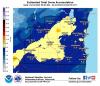
WSW 7-12” - three warnings in a week and a half - very nice!
-
1
-
-
Seems like they are holding more weight into the GEFS and not so much the EPS....
Here’s their full thinking:
“A major winter storm is on track to hit southern Wisconsin. The
guidance remains in very good agreement with a slight shift north
(compared to previous days) with the surface low. The EC has a
more southern sfc low track, but focusing on the surface low
track can be misleading when dealing with an arctic airmass in
place. Models usually struggle with arctic airmasses. More
importantly, is the solid agreement with the h7/h5 low tracks.
This is where much of the meaningful forcing will be.
The warm air advection ahead of the low for Monday night is off
the charts. We`ll see sfc temps rise through the night, with
temps getting up around 30 in the far southeast on Monday. This
WAA and associated frontogenesis will be a productive snow maker.
The column is deeply saturated with a large portion of that high
RH in or very close to the favorable dendrite growth zone.
As the WAA pushes east by sunrise Monday, we`ll then get into the
forcing associated with potent mid level wave and upper
divergence for the morning hours. Things should begin to wind down
quickly from west to east Monday afternoon.
In general, this will be a dry snow. The exception may be across
the far southeast where temps rise to around 30F. Ratios in the
north on average will be about 18:1, while the southeast will be
about 13:1.”
-
1
-
-
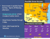
THIS is what I call winter! MKX hoists Wimter Storm Watch.
-
2
-
-
MKX forecast has 3-5” Sunday night and 3-5” Monday for me - they’ve been on a roll lately so hopefully it continues that way.
-
1
-
-
Latest storm reports from MKX
-
Storm pretty much done here - I would say about six inches or a hair more. Really nice storm!
-
Pouring snow - looks good for this to last a while.
-
1
-

2/11 - 2/13 Major Winter Storm
in East of the Rockies
Posted
I was really wondering why they hadn’t already - glad to see that.