


ajreich
-
Posts
87 -
Joined
-
Last visited
Posts posted by ajreich
-
-
3 hours ago, iFred said:
I think this is an artifact of dynamic ip addresses used by various ISPs. When someone gets banned, the IP address they posted from are added to a pool to ban as well. Ten years of this place and a couple hundred bans across the Pacific Northwest has yielded just around under a thousand IPs being marked.
I am working on that this week. I figure at this point if your account gets banned, but you find ways to get back on and harass people or pull a Link and threaten to murder me, then I'll just add your IP address to a table to drop.It happens consistently to me when I’m on my Verizon data plan (but not AT&T), so that makes sense.
-
- Popular Post
- Popular Post
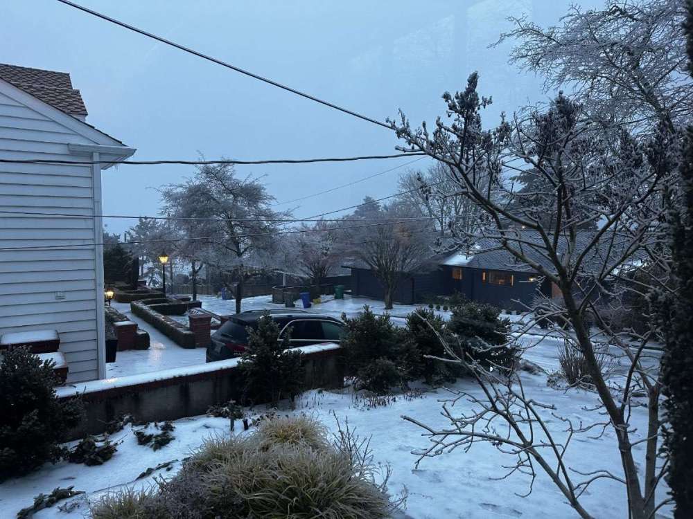
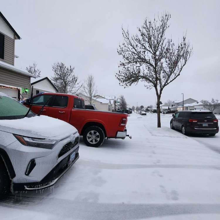
Ugh, well after 6 days we finally lost power last night too. The west hills are a disaster - it was hovering around 28 all night and looked like a thick glazing on everything again. So now no water and no power and no ETA on either. Luckily we escaped yesterday morning before the ice started again and are holed up in a 600 sq/ft apartment with two kids and two dogs. Fun times! But we have power and water, and maybe school will actually happen today though

What a storm! I’m still amazed at the persistences of the cold and big busts from the models (Aside from the GFS I think?) Wishing everyone else a speedy warm up and recovery.
-
 12
12
-
Ugh this blows. Back below freezing and everything is starting to ice up again. We’re hoping to get a plumber out to fix the pipe, but it’s an ice rink right now.
-
4
-
-
This is cool, we are right on the edge of the warm and cold air masses, keep ping ponging between fog and 30 degrees and clear(er) and 37. Change happens almost instantaneously.

Bad news is we had a pipe burst with the thaw. No water for us

-
7
-
 2
2
-
-
Gross. Shocked again we haven’t lost power.

-
5
-
1
-
 1
1
-
 1
1
-
 1
1
-
-
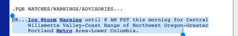
I’m guessing they extend this for at least east metro and west hills.
-
1
-
-
Just now, RaleighHillsRunner said:
Looks to be the inner SW side is warming more quickly than your location. Bridlemile/Raleigh Hills/Sylvan stations all near or slightly above freezing while Arlington Heights/Forest Park to North still much colder along with entire east side.
Yeah, you’re right. I noticed the south facing hills are about 4-5 degrees warmer than us on the north side. Interesting dynamics!
-
3
-
-
43 minutes ago, Andstorm said:
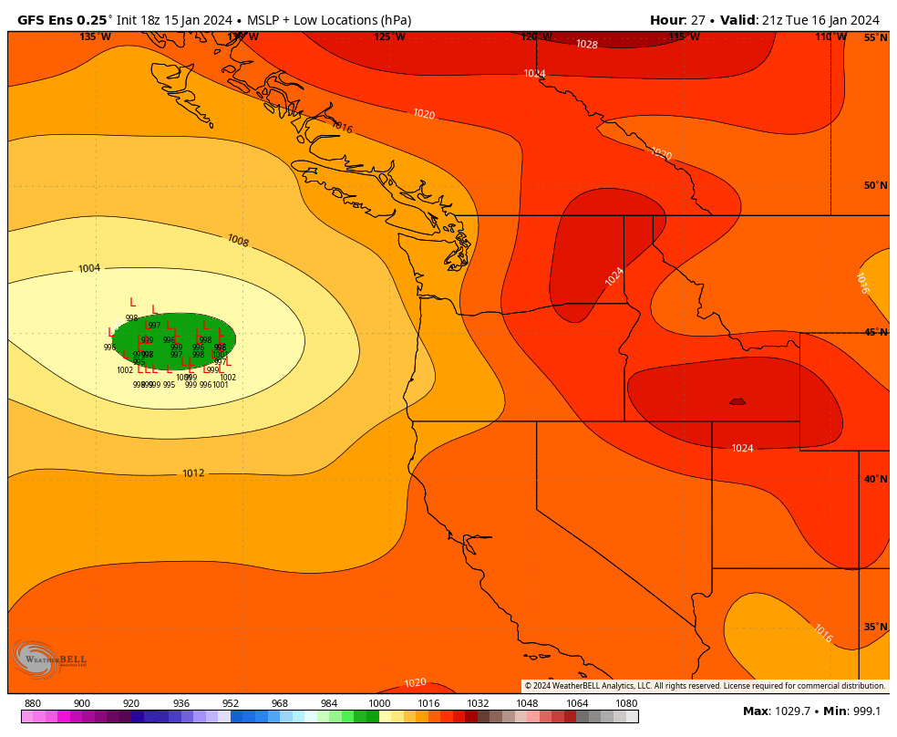
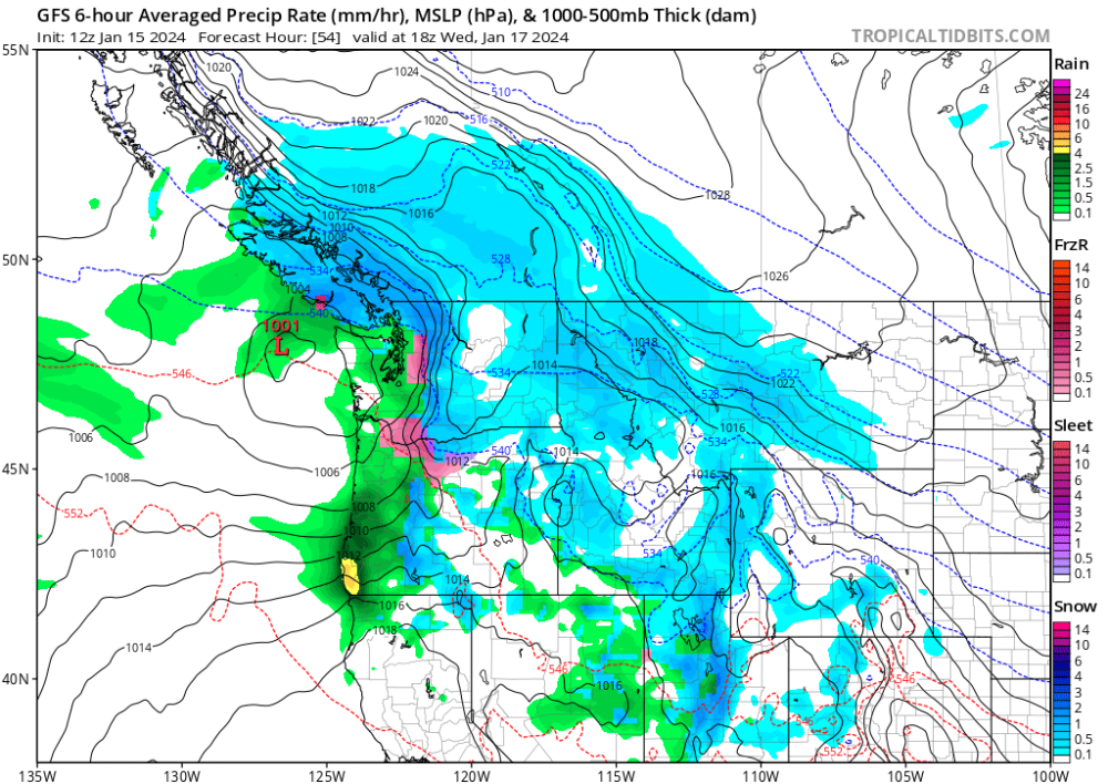
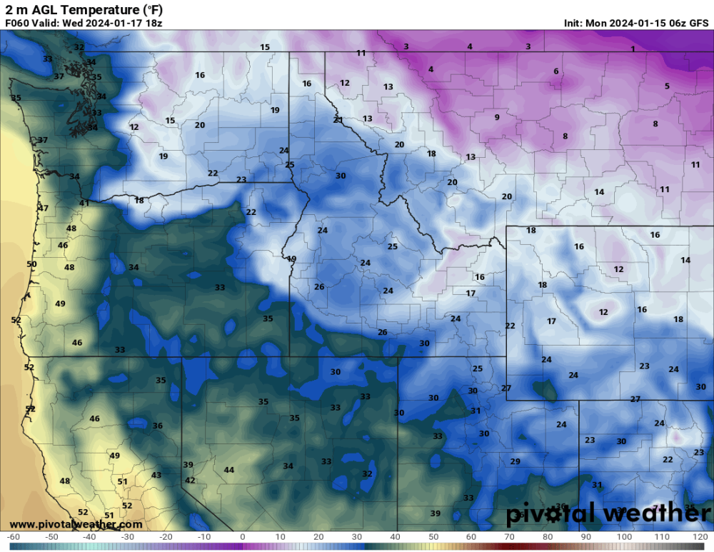
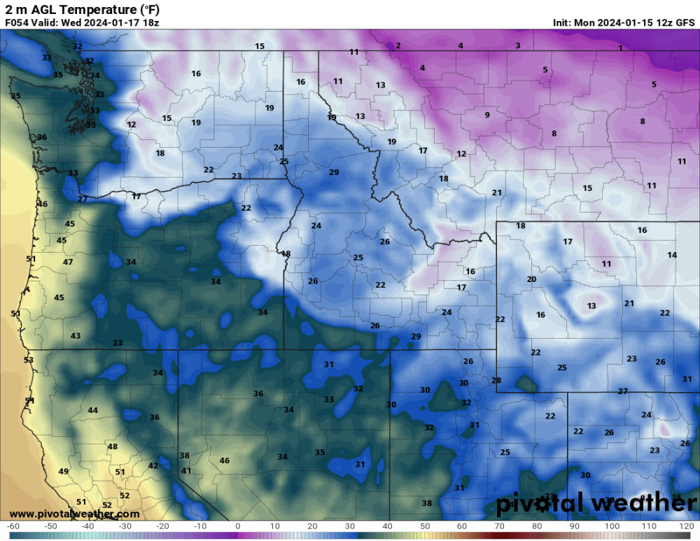
I know this is a washington-heavy forum but does anyone have thoughts on situation in Portland and the return of offshore Thursday. Most forecasts are calling for a cold rain with temps in the mid to high 30s. GFS continues to show temps below freezing and more ice accumulation thursday afternoon/night. It looks reasonably borderline. Temps have been slower to warm this morning. my concern is that if we only make it to the mid 30s today, it’s not going to take very much additional cold air to create problems. But forecasters still seem confident portland makes it into 40s today. Would love any input. Sitting at 28 right now.
I think a lot of the Oregon members are without power! Once the warm air makes it, temps will definitely rise rapidly. The CRB is supposed to moderate today/tomorrow, so even with east winds it probably won’t be enough to freeze PDX again. That said, GFS has us pretty borderline through the weekend, so it could go on a lot longer than people expect

-
1
-
-
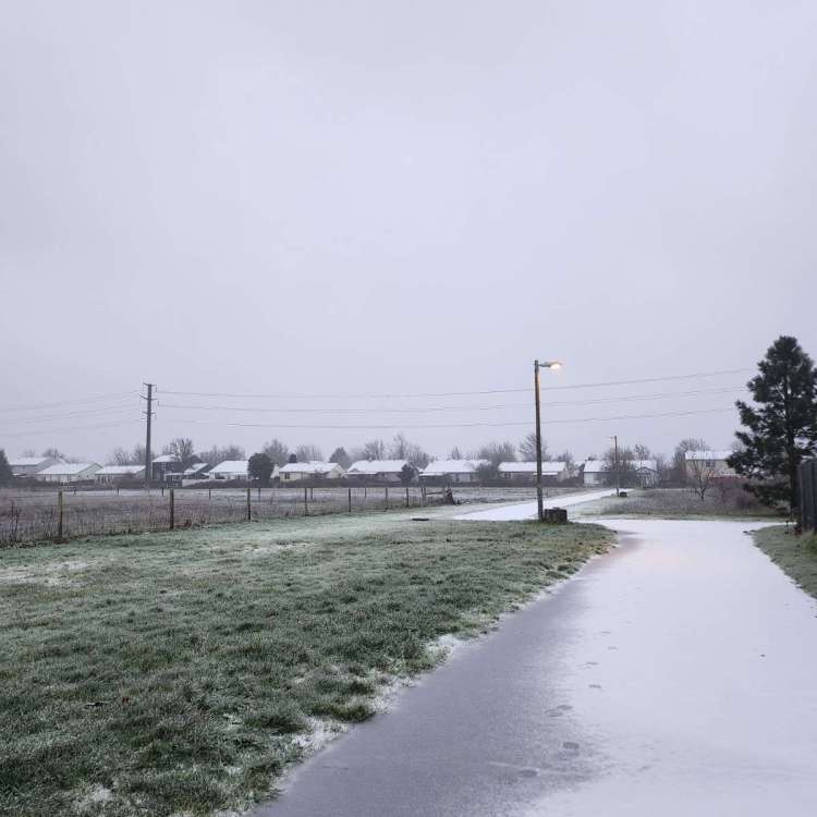
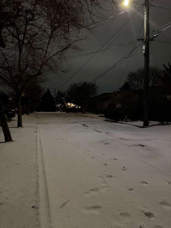
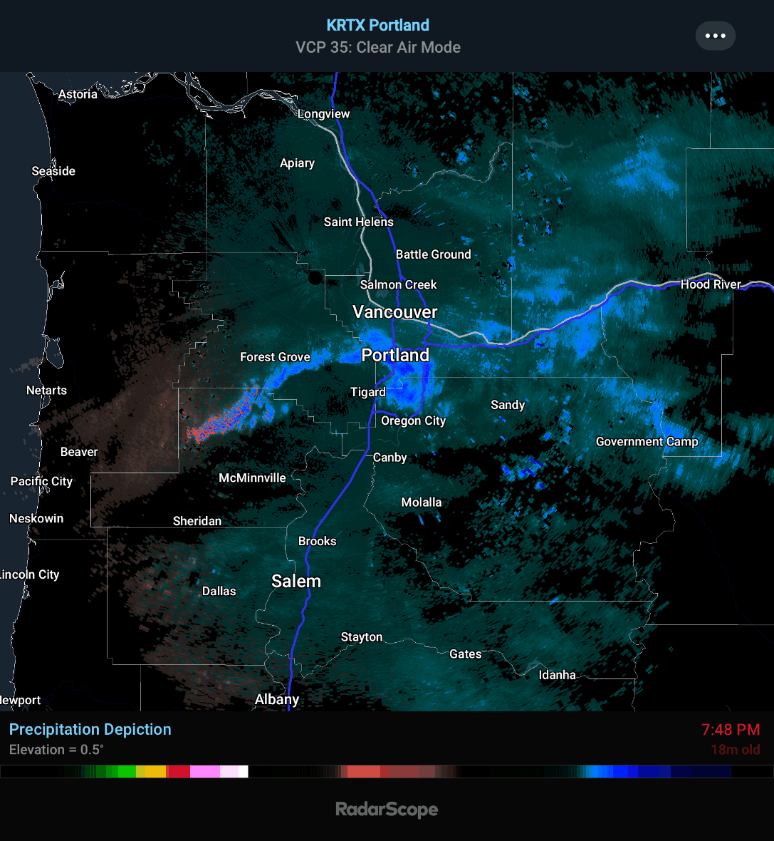
Still at 26 and now up to half inch of ice
 Really not sure how all this gonna melt off today as the NWS thinks. The warm air just isn’t coming north as modeled at all. At 600’ we should be mixing out before the valley and yet we’re still 3-4 degrees colder.
-
3
-
-
10 minutes ago, TigerWoodsLibido said:
Yes and all the ice is falling off the trees and buildings at a fast rate. Most of the city doesn’t have power. Even downtown has lost power like 10 times. This one is a lengthy outage.
Ugh so sorry for what you’ve been through - sounds like a nightmare
-
Just now, ajreich said:
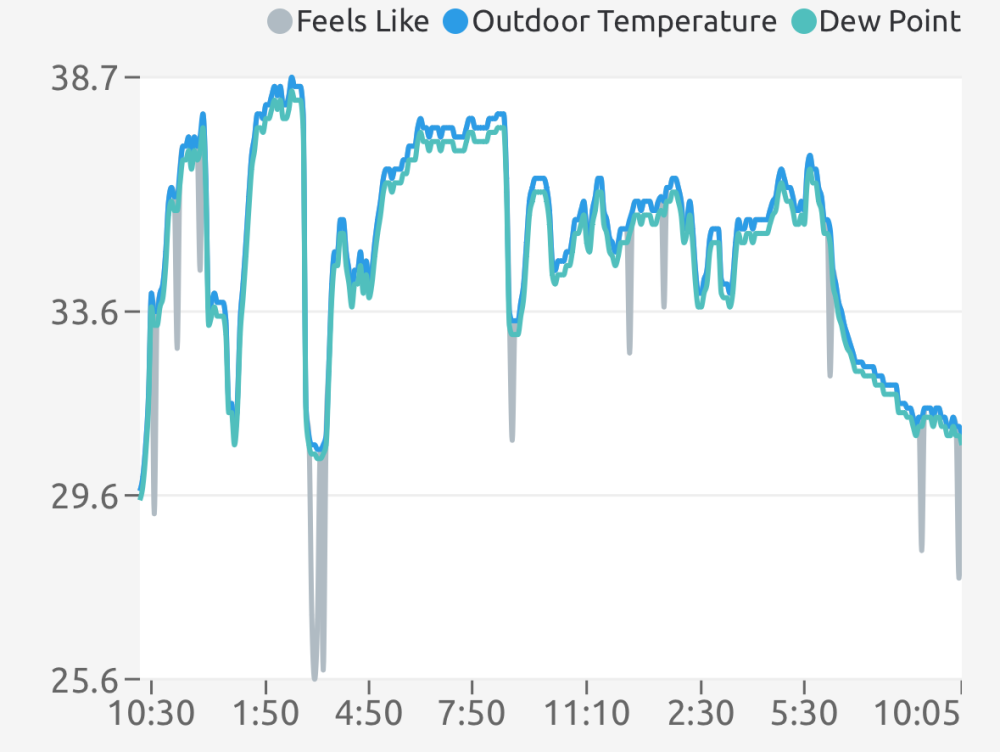
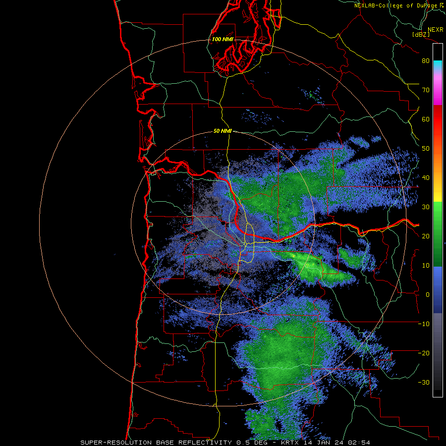
We’re hovering around 24/25 degrees with a solid .3” of ice. Given temp is well behind models, looks like a mess of a morning at least. South winds just never really materialized - winds continue out of the east predominantly. No AFD yet, so looks like PQR are scratching their heads about what to do.
BTW it’s now 5+ days with highs below freezing. I can’t recall that happening ever, but I’m sure someone here knows better than me

-
 1
1
-
1
-
-
We’re hovering around 24/25 degrees with a solid .3” of ice. Given temp is well behind models, looks like a mess of a morning at least. South winds just never really materialized - winds continue out of the east predominantly. No AFD yet, so looks like PQR are scratching their heads about what to do.
-
2
-
-
22.3 and raining steadily. Probably .25 of ice on everything? Forecast now says we don’t get above freezing until 7 am
-
1
-
2
-
1
-
-
2 minutes ago, snow_wizard said:
The fact of the matter is we landed a top tier cold wave in January. That is a huge deal. We haven't been able to do that in forever.

-
1
-
-
We’re stuck at 22.5 for the last 2 hours. Gonna get dicey.
-
1
-
-
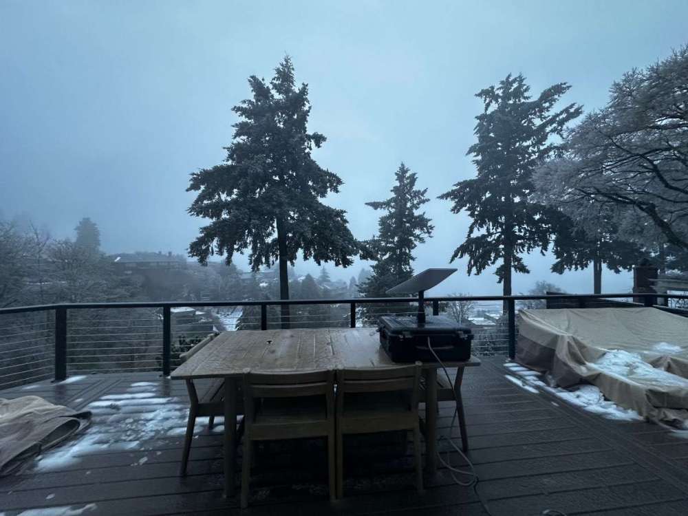
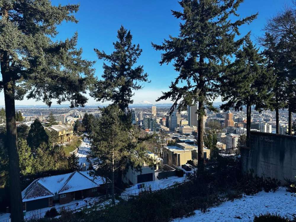
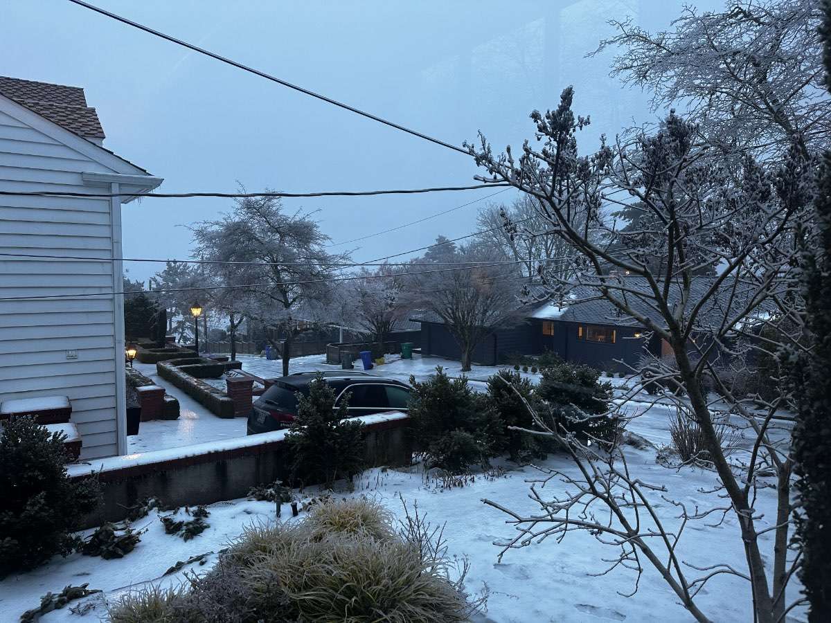
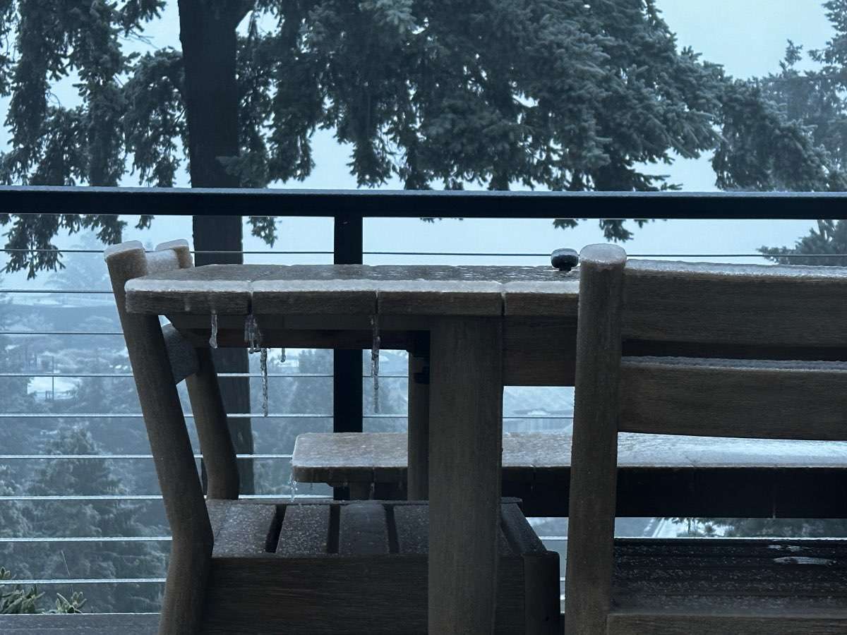
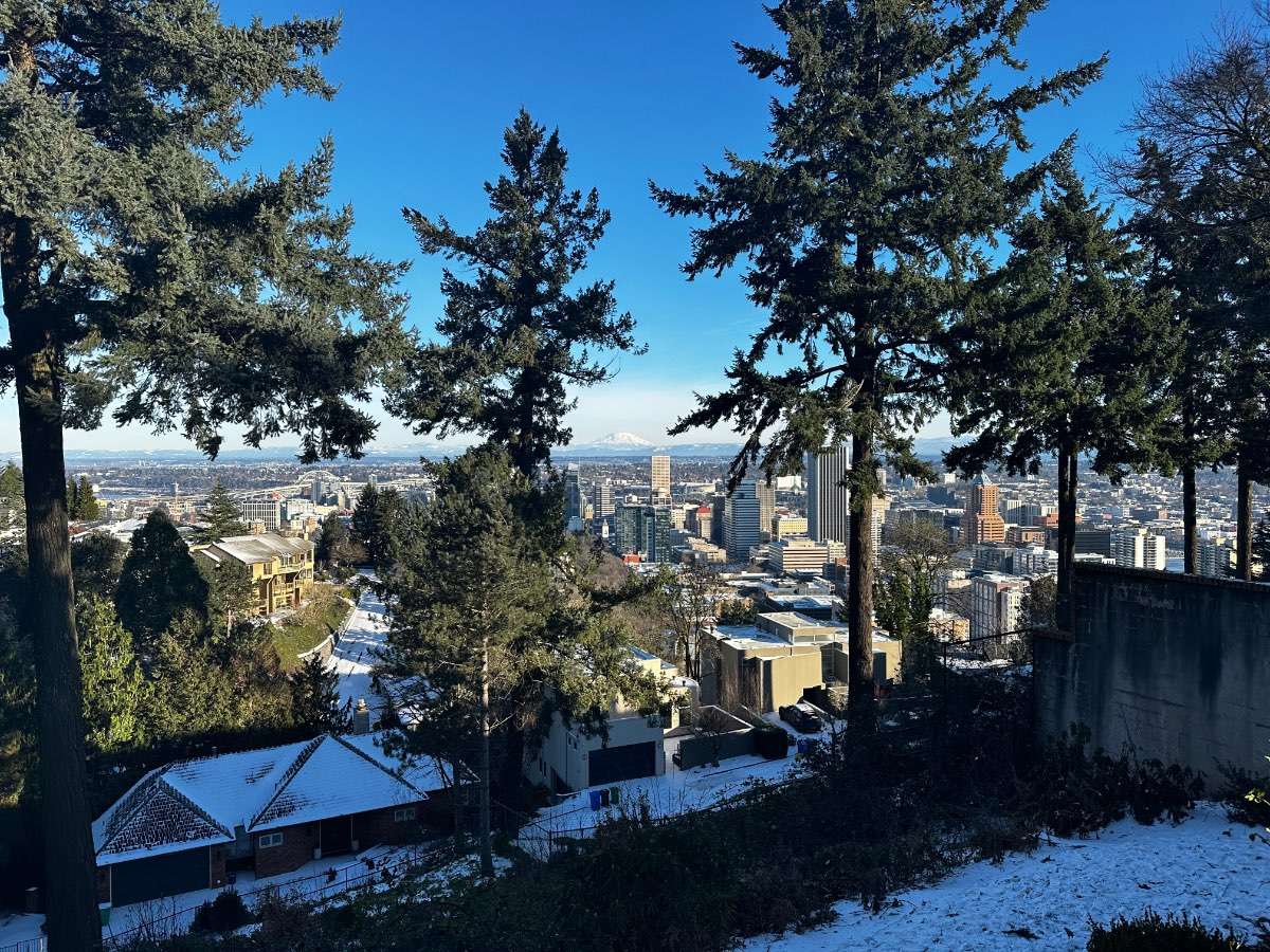
4 hours ago, Cascadia_Wx said:
You have a gorgeous view
Thanks! We’re actually moving in a couple of weeks up to a place off Skyline. The view here is nice, but the winds and traffic noise from 405 mean we can’t enjoy the deck as much as you’d think, even when the weather is nice. Plus our new place is up around 1000ft, so better weather

-
2
-
-
17 minutes ago, TT-SEA said:
18Z GEFS... some decent members in there and some are north as well. None of them show 4-5 feet of snow in Arlington like the RGEM though.

That low position tho. Gorge winds will be howling for Portland.
-
1
-
-
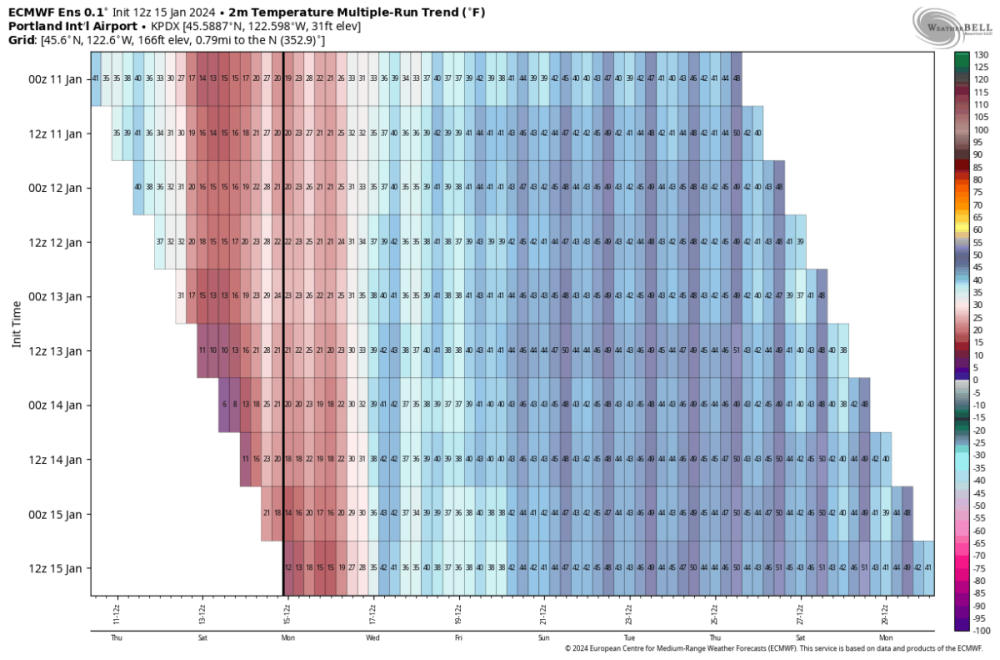
Interesting, Euro ensembles have been trending colder longer the last 6 runs. Be curious as observation data keeps coming in on the cold side how that impacts 0z tonight. The air might be warming, but the ground is a frozen rock.
I dont think we’ll hit 25 today, stalled at 23 and the sun is sinking.
-
3
-
-
- Popular Post
- Popular Post
Up to 18 today and so pretty! 11/19 yesterday, so we’ve been below 20 since Friday at 5pm; I can’t remember a cold event like this. East wind picked up again today, so plenty of incoming cold air. Maybe a high of 25 today if we’re lucky?
-
12
-
1
-
37 minutes ago, Frontal Snowsquall said:
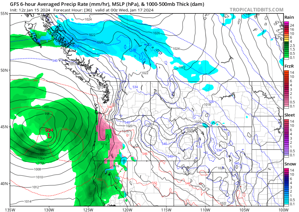
The 12z GFS trended way colder for down here. Ice arrives just before sunset tomorrow and continues through the morning. The 06z GFS had PDX at 41 Wed 10am, now the 12z shows 27 with ice still. The models always are too aggressive with scouring out the cold air down here and it looks like they are getting a better handle of the low level cold air. If there is an east wind, PDX will not thaw out.
-
1
-
-
7 minutes ago, skywatcher said:
Jackson Prairie went down completely earlier today. Big natural gas facility, supplies a lot of power to the west coast.
https://www.huffpost.com/entry/pacific-northwest-gas-supply_n_65a329a7e4b06444b2230d94?03p
Oh crud. That can’t be good.
-
1
-
-
4 minutes ago, ArcticAirmassLover said:
Hey everybody! New Member here, been lurking around since the 2019-20 season (I think) and decided to give this a go if we ever get a regional arctic event. I considered this as close as we can get and made the decision lol.
In all honesty, I had very low expectations for this airmass to make it to my region (South Valley - West Eugene), but actually turned out to be a massive over performer! I was thinking that freezing rain would be the "best case scenario". Was pleasantly surprised to not only awaken this morning to sleet and upper 20's, it STAYED below 30F with sleet accumulation throughout the day! Totaled 1.5", truly wasn't expecting this.
Conditions right now 20F with freezing drizzle
P.S. How did Phil get into Pacific Northwest climatology?
Welcome!
-
2
-
-
Just now, Ken in Wood Village said:
The two masses are creating showers

 🌨
🌨

We’re under that and a good little burst of snow
-
2
-
1
-
-
- Popular Post
- Popular Post
Well! That was quite the event
") Though we didn't end up with the snow amounts I would've hoped, this was still one of the most memorable winter weather events I've had. The combination of wind and cold is really exceptional in my experience; the type of stuff you'd expect in the NE, not here! The duration of cold and wind is also impressive - both have been sustained throughout the day. We're in the SW hills at 600 feet.
Though we didn't end up with the snow amounts I would've hoped, this was still one of the most memorable winter weather events I've had. The combination of wind and cold is really exceptional in my experience; the type of stuff you'd expect in the NE, not here! The duration of cold and wind is also impressive - both have been sustained throughout the day. We're in the SW hills at 600 feet.
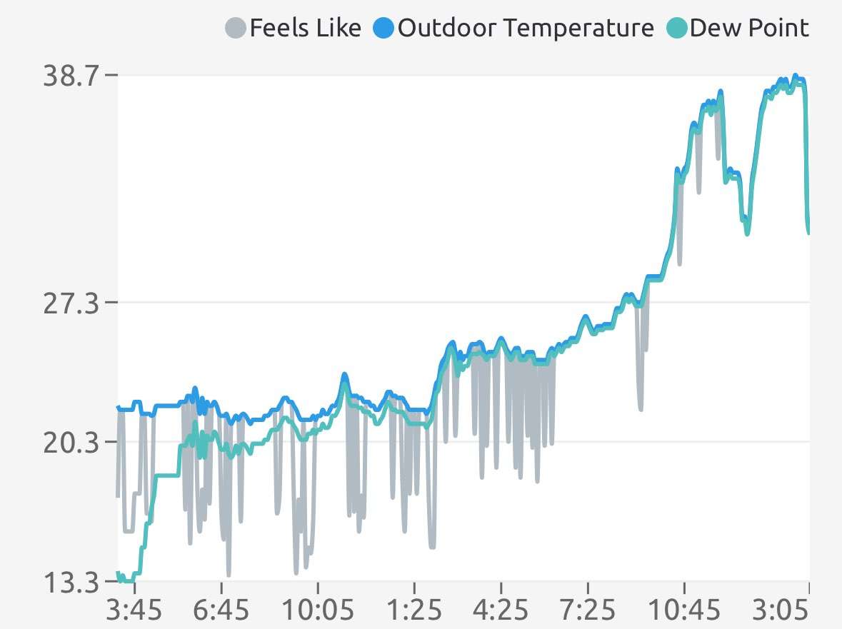
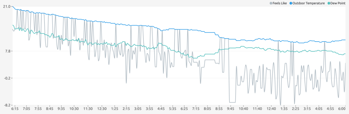
Our high for the day was 16.5 at midnight, low of 10.2 degrees around 2:45 pm. Currently it is 11.1 degrees, so we've had 9 hours below 12 degrees. That is just exceptional back to 1990 (which I don't remember details of too well since I was only 6!) I'd assume we stay at roughly this temp through tomorrow AM, and a lot of stuff is going to freeze. I want to check out the pond and Laurelhurst park on Monday to see if its frozen over - I don't think its done that since 1990 or 1992.

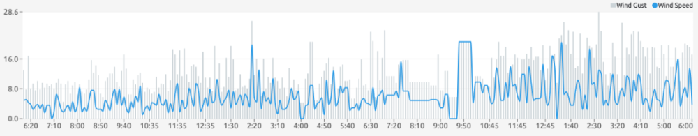
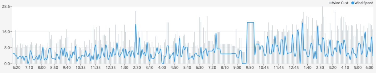
Peak wind gust was 36.7 mph - wind gauge is about 6ft off the ground, so gusts higher up in the trees were even greater. Since about 10pm last night, we've had consistent wind gusts above 15 mph, with regular gusts consistently above 20 mph since 12pm today. Windchill has been consistently below zero since 9 am. Winds are still going strong!
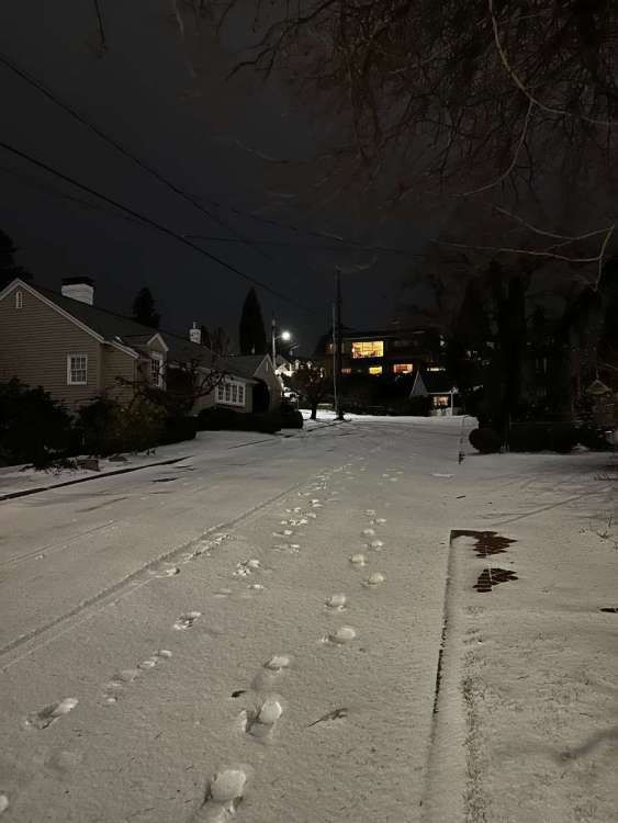
Currently, looks like about 2-3 inches of mixed precipitation, though the snow is so dry it's hard to tell what's snow and what's sleet. Enough to make the grass and streets white up here
Though in wind-exposed areas, it's all dry ground. Some of the larger drifts are 6-8 inches deep.
HRRR shows maybe a lucky inch or two between now and midnight, but even if we don't seen any more snow, today was a great weather day and one of my top 5 storms. My favorite video of the day below.
-
12


February 2024 Weather in the PNW
in West of the Rockies
Posted
At our new spot about 850’ in the west hills and it’s all snow for the last 30 min. No idea what will happen, but this was much earlier than forecast.
Kids coming home early after school. Not risking getting stuck on the roads.
Maybe Mark busts again? Giving me the 2017 vibes.