


Abbotsford_wx
-
Posts
363 -
Joined
-
Last visited
Posts posted by Abbotsford_wx
-
-
Still managed a +0.8F up here. Seems like the only way to get a negative departure is to have a front or ULL right overhead.
-
Pretty much solid overcast here this morning. Might even pull of a negative departure today. Yesterday was +2.5F
-
Yea, sunny and 76F up here.
Kinda surprised how warm it ended up this afternoon. Upper 70's out here, pushing 80 in some spots.
-
Nice morning. Clear skies and 72F at 11am. Much cooler than yesterday when we were pushing 80 at this time.
Yeah, much cooler today. Just 71F here coming up on noon... down about 10 degrees from yesterday. Humidity much lower also.
-
It is pretty humid up here. My dew point briefly touched 20C (68F). It's generally been in the mid 60's during the afternoon for the past three days.
-
 1
1
-
-
Gotta love urban contamination. Looks like a small section of the eastern sound averaging above normal. Everyone else below:
IMO, it looks more like areas adjacent to bodies of water are generally running above normal. What are current SST's like in the sound and coast areas?
Could just be coincidence, though.
-
1
-
-
SEA is not the only place that's running warm. It's been above normal here seven out of the last 10 days. Today looks to add to that.
-
So far I've received .60 inches of rain since midnight. I know others have received closer to if not surpassing 1" since midnight in surrounding cities.
So far this July I've received 2 inches of rain. 3.2 inches is average for me for July.
I had .75" in a half an hour and probably over 100 lightning strikes.
-
2
-
-
We rarely get sharp fronts here, especially this time of year.
You'll notice a dramatic difference if you're talking about Denver or Billings.
On a daily basis, yeah. I meant more over the course of a month... it tends to smooth out to within a few decimal places. Last July for example, I get identical values calculating both ways. Most months I've checked are within 0.4F.
-
FWIW, my weather software calculates the average both ways, and I find there's very little difference in the end.
Averaging the minutely data, my average for July so far is 61.3F
Averaging just highs and lows, it's 61.7F
-
Looks like Shawnigan Lake will come in close to +2.5F for June. Maybe there is something wrong with the OLM sensor.
Abbotsford is only +1.2, same as OLM.
My personal station is +2.1, which seems more in line with the others.
-
I must have been very close on yesterday's numbers. It was a pretty tight race before.
-
We don't have A/C at home, but I'd probably set it around 75. I like to wear short sleeves indoors.
It's usually set between 73 and 75 where I work.
I could tolerate lower temperatures, but I find the air from the vents is too cold. I could not work in an office that was 69 with A/C blasting down all day... I'd be wearing a jacket.
-
What was 2008 like up in your neck of the woods?
I had over 20" on the ground Christmas morning.
-
1
-
-
Warm start. Gonna be some busts on this morning's lows.
-
1
-
-
PDX:
97/62
99/64
90/62
85/61
74/58
SEA:
90/60
95/62
87/61
82/60
72/57
Max temp for BLI: 89
Max temp for YXX: 91
Max temp for YVR: 78 -
That map is helpful. It would be even more helpful if it extended into Canada to show that the northern boundary of above-normal precipitation occurred about where this map ends.
I stand corrected on the width of the band of above-normal precipitation, and I see that Eugene was in a relatively dry zone compared to the U.S. PNW at large.
I still say the big December storms skewed the overall numbers way upward, and one of the comments on the linked blog supports this notion.
Up here we were basically near normal.. 96% of normal at Abbotsford for October-March. Having said that, there were some areas that were wetter relative to normal, particularly near the mountains to our north.
-
I've picked up .45" since yesterday. It was definitely needed. Lawns were starting to turn brown on the edges.
-
Dry as a bone up here. I haven't had a trace of rain in almost a week. It's been the same story for about 8 months now... when you guys were breaking records down there, I was barely getting normal rainfall.
12z GFS shows about an inch of rain here over the next 16 days.
-
Lots of convective clouds popping up out here. Nothing is forecast this far north, so it will be interesting to see if something develops.
-
Warm start here with the east wind blowing... already 70. Should translate to highs in the upper 80's, maybe the odd 90.
-
Looking like a spectacular weekend ahead.
Someone needs to inform Environment Canada. Here's their latest forecast for Abbotsford:
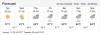
No doubt this is going to be completely wrong... lol.
-
Abbotsford was officially 83.3 at their last hourly so they smash their previous record of 77.
The all-time April record is 85.6, so it could end up close, if not today then possibly tomorrow or Wednesday.
-
Overcast and a chilly 51 here today. The forecast was 61... whoops.
Doesn't look very sunny until Saturday afternoon.


August 2016 Observations and Model Discussion for the Pacific Northwest
in West of the Rockies
Posted
Very localized rainfall around here today. I had less than a hundredth, but less than 5 miles to my west they had .29".
It's been very dry here over the last few weeks. Today's rainfall was the first measurable since July 16th, and I've only received .12" since July 9th.
I won't use the "D" word, but we could really use a good soaking as everything is looking pretty parched. It's nothing like last summer, but we're running a pretty large deficit for the year.