


Money
-
Posts
9329 -
Joined
-
Last visited
-
Days Won
11
Posts posted by Money
-
-
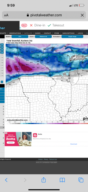
GFS ensembles look south of 6z
-
Icon at 120 has the low south of Chicago. GFS has it right over eastern WI
-
 1
1
-
 1
1
-
-
-
Tuesday wave
-
1
-
-
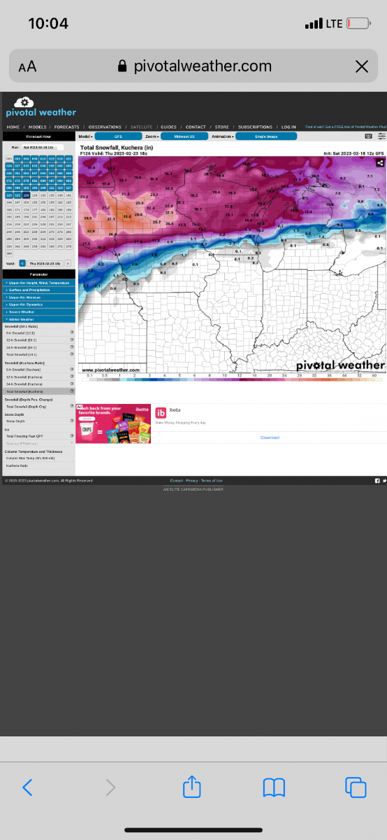
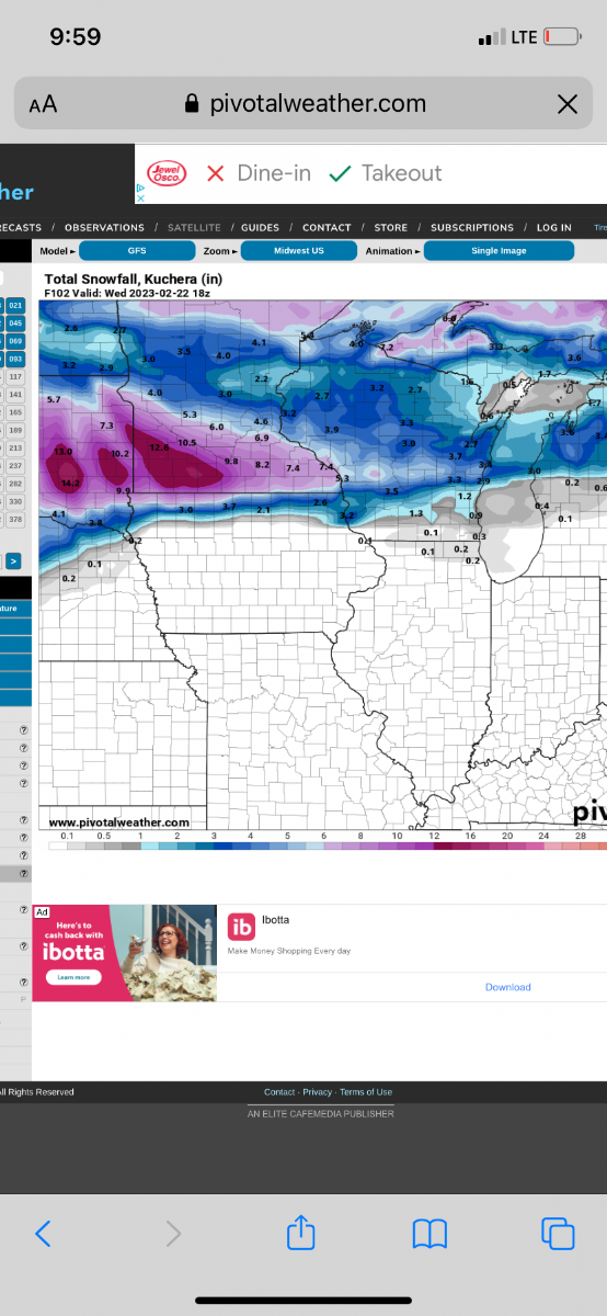
GFS is a bit stronger and south with the first wave. Drops 6-10 in minny and 3-5 across WI
-
2
-
-
Not much change in the icon. Crushes msp again although low eventually looks a bit farther south
-
Honestly wouldn’t surprise me to see this trend more north than what models are showing. Snow cover should be disappearing across IL and WI as well throughout the upcoming few days which should help things warm up more than what models are forecasting IMO
-
MSP is looking golden
S. WI will probably depend on how far north the low gets and how strong. Looks like euro is showing mainly snow but gfs is warmer aloft and more sleet
-
-
-
-
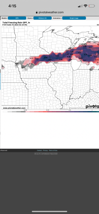
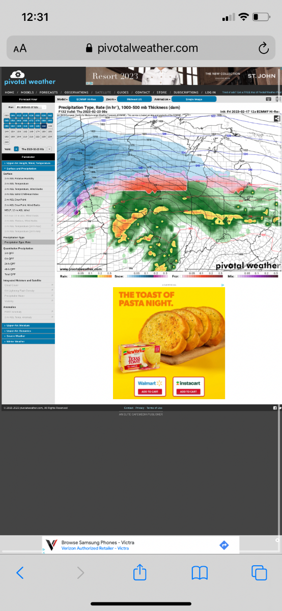
0z icon with a big shift south
-
2
-
-
Bigger area of fzr this run
-
Amazing how consistent the models have been yet with a big storm somewhere. They have been showing it since at least 240 hours out
-
How does the ice map look? Has to be some hefty totals
-
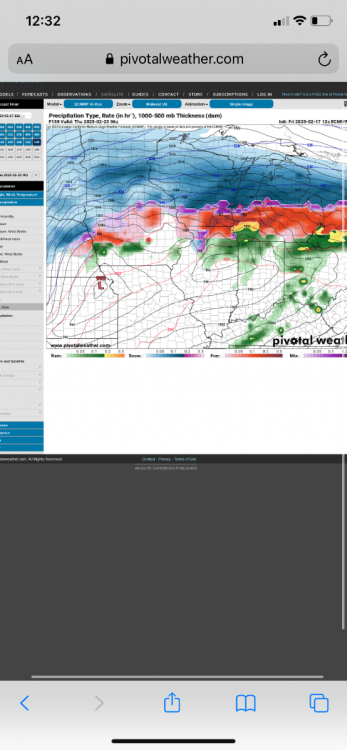
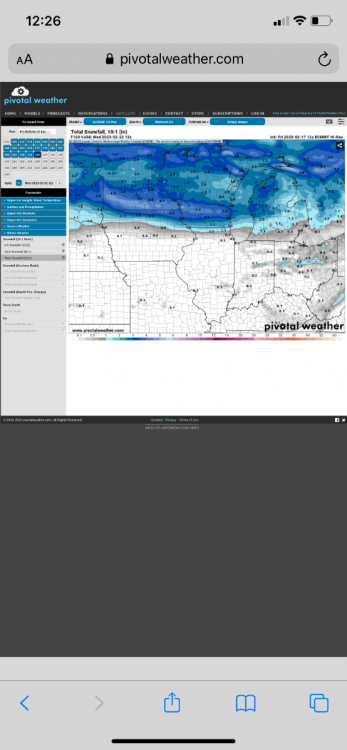
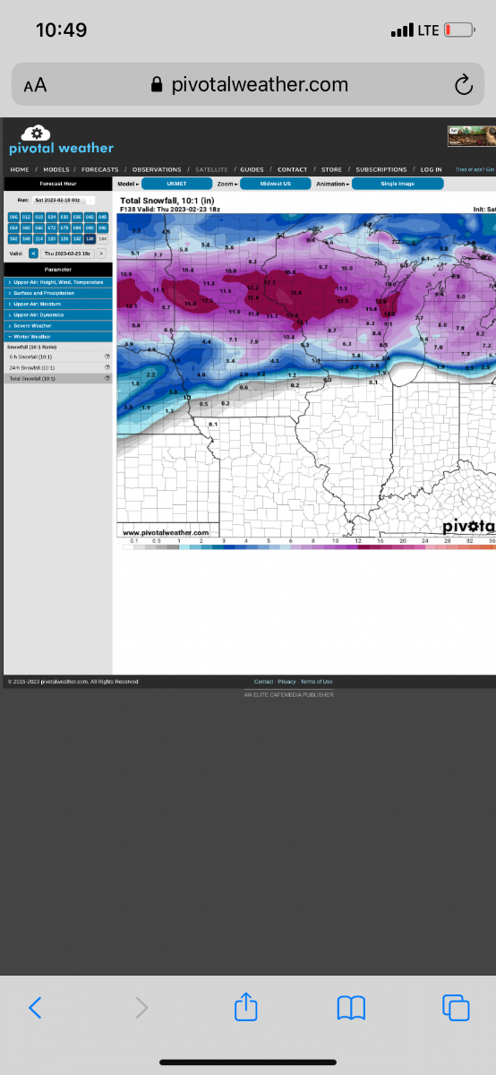
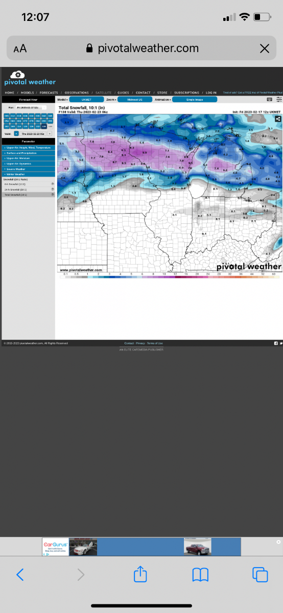
Euro QPF and snow map

-
This looks nasty
-
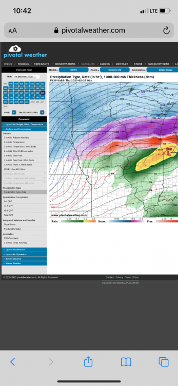
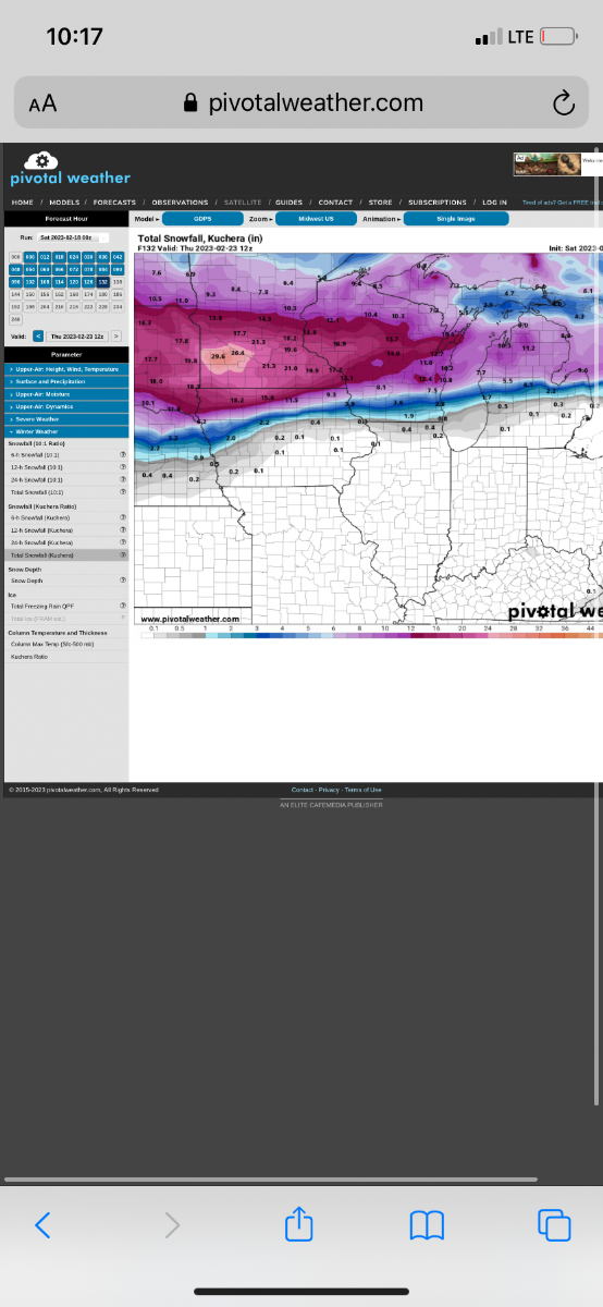
Euro showing that band of ice at hr 132

-
First band on Euro
-
-
Temps are in the 20-24 range in the sleet area
-
1
-
-
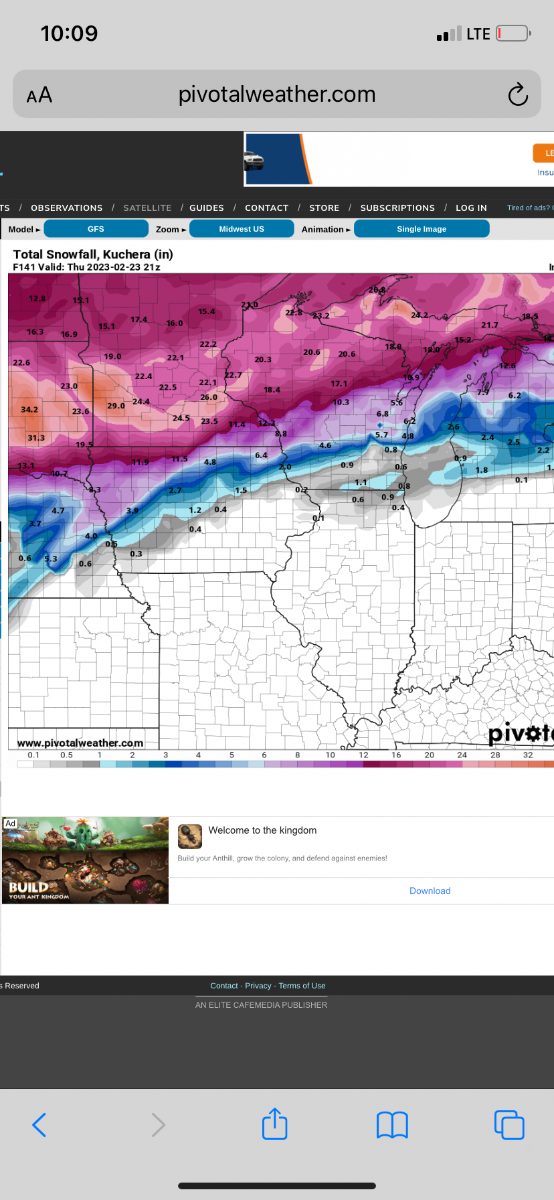
GGEM has 1 inch QPF of all sleet or freezing rain here
yikes
-
It’s amazing how remarkably consistent the models have been on this for the last 72 hours. We are within 120 hours now (of first band developing) and only two more days until we start getting into NAM range for it.
-
2
-
-


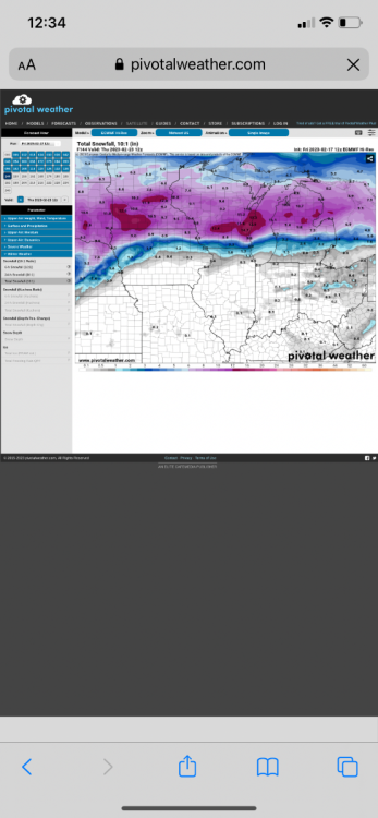
2/21 - 2/24 Powerhouse Upper Midwest/GL's Winter Storm
in East of the Rockies
Posted
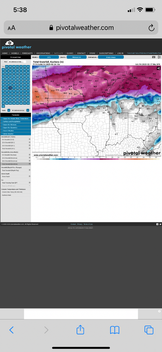
Euro is pretty much identical to 0z except maybe a tad lighter on the QPF