

El_Nina
-
Posts
2496 -
Joined
-
Last visited
Posts posted by El_Nina
-
-
20 minutes ago, FroYoBro said:
Already colder this evening than it was this morning for my spot. 35 degrees right now.
Same here, currently 35 after 37 this morning.
-
 1
1
-
-
17 minutes ago, jakerepp said:
Wanted to go through the Feb 2019 threads but there are literally so many pages I can't figure out where to look.
Another late winter that turned things around. 1-2" night of the 4th that stuck around without even melting off the trees for 5 days. Followed by about an inch the morning of March 7 and 1-2" on the 9th.
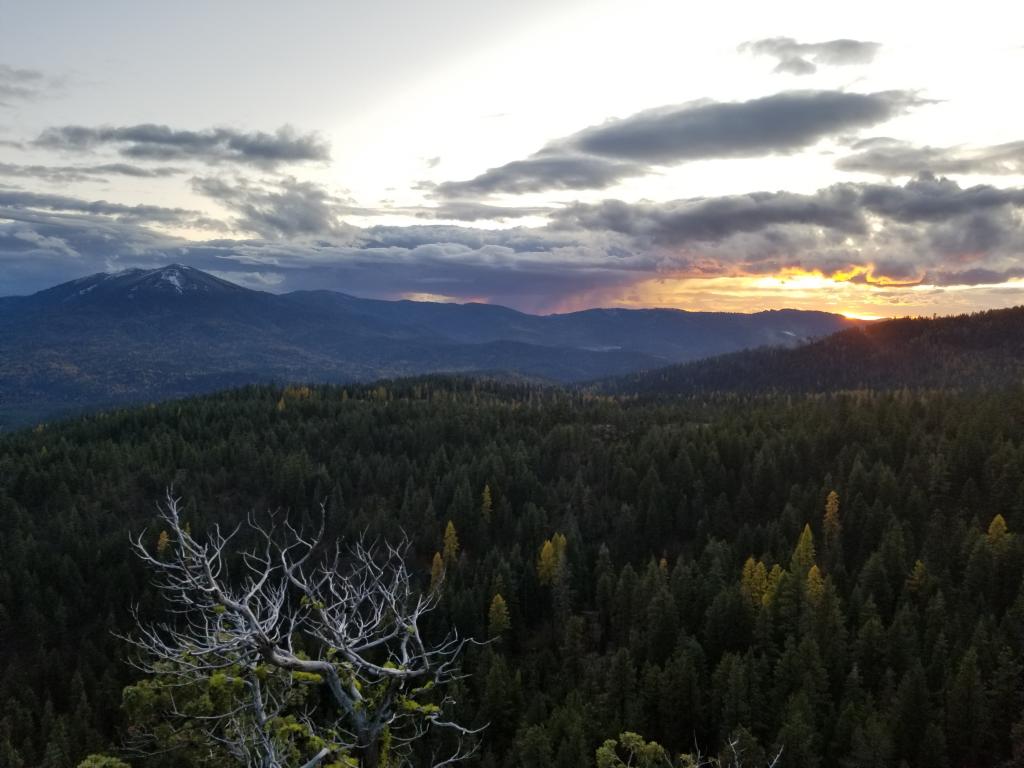
Morning of February 5th.

-
 1
1
-
-
2 minutes ago, TheNewCulverJosh said:
Sweet, let me talk to some of those people up there. Seriously though, I know SSW is a great initial player but being up there is only a part of the equation. I don't see any retrogression imminent, I just see the cold air deepening in central Canada.
With the UFO videos released by the navy earlier this year and monoliths popping up in the desert sw, maybe we can make a deal with them.
-
6 minutes ago, Phil said:
Depends on the time of year, ENSO, and cycle+maturity of QBO.
Yeah.
-
Wind has died down and it's down to 39.
-
 1
1
-
-
4 minutes ago, iFred said:
Hmm.
In all seriousness, not really picking on Tim this time. I get that people see a shake up mid month, based on a ticking clock and a pending SSW, but I don't see it. We were due for an outright dud and with the poor ice setup leading into the season, the warm Pacific, and just the general trend of our climate, I just don't see anything happening this month. Maybe something in Feb ala 2011, but at that point its just a couple days of cold weather, one day near freezing, and on to spring we go.I also know that this is partially a weenie cop out, but there is a touch of bias as I really want to rescue my lawn and get some gardening done.
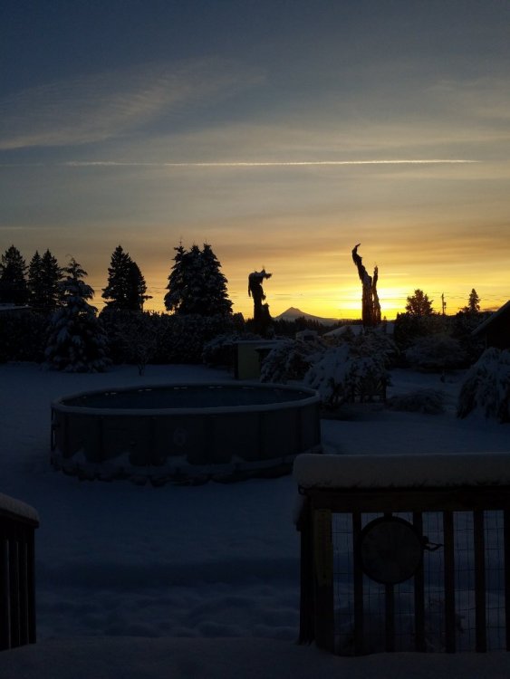
Deal me in for another epic February, would really like to go through another February 2018. Several snows working their way up to an 8" total the 21st. Started with a dusting the 14th, 4-5" paste the night of the 18th then it snowed again the evening of the 20th and brought us up to 8".
This was the morning of the 21st.
-
5
-
-
Windy, sunny and up to 45.
-
15 minutes ago, FroYoBro said:
Already up to 45 here. Nice day, but I’m definitely ready for a real cold snap for the valley at this point.
Even when we get snow with those they end up pretty dry, though. December 2008 was
-
4 minutes ago, Deweydog said:
Actually, I’m not sure you could draw up an eastern Pacifc pattern at the moment that would be more hostile toward block development. Just a hotbed of progressive vorticity to start 2021.
Lots of much needed precip for Oregon being shown at least. Many areas down south and east are still in extreme drought. The only areas that have experienced any improvement are up north and west at the coast, in the coast range and northern cascades. I've been watching that area just to my east where the drought has been eliminated slowly get closer the past couple months.
-
1
-
-
3 minutes ago, snow_wizard said:
Weird....the same time we had our intense cold here.
The high pressure must've pushed the cold arctic air into the middle latitudes.
-
2 minutes ago, snow_wizard said:
When in 1968 did that happen?
December 31.
-
2 minutes ago, BLI snowman said:
29 here with thick freezing fog. Some patchy ice on the road.
Even some frost in the grass and ice on the driveway here from the low dewpoint.
-
1
-
-
5 minutes ago, Jesse said:
Frosty and 32 degrees this morning.
Yesterday was mostly sunny and 49/39, with an east wind picking up in the late afternoon and evening. Must have decoupled quickly overnight because it was blowing strong around bedtime.
5 degrees warmer over here at 37.
-
Back in Boring. It's currently 43 with overcast and we're 0.01" away from Novembers rainfall total of 9.21". Lots of dense fog in spots of the coast range and valley on the way back this morning.
-
1
-
-
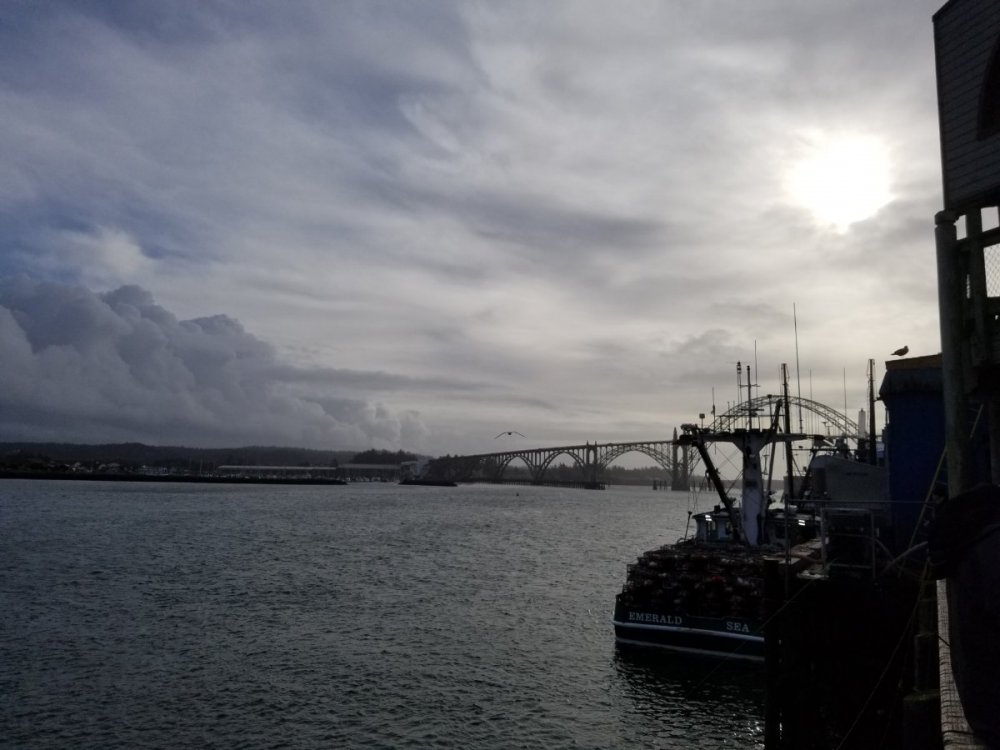
Periods of clouds and sun down in Newport, about 50 degrees.
-
4
-
-
45 and raining, 0.15" past 4 hours. Up and over 9" for December at 9.16." Glad we had proper weather for Christmas this year, was getting a little worried seeing the big ridge parked over us about a week ago.
-
1
-
1
-
-
36 degrees and rain, 0.09" so far.
-
1
-
-
26 minutes ago, Timmy_Supercell said:
Merry Christmas to everyone, and its looking like Christmas on doppler radar this morning!

Currently 37 as the moisture bubbles up from the south. Gonna be some cold rain this Christmas morning. Sitting at 8.77" for the month so should easily surpass 9" today as well. Second month with near-normal precipitation in a row.
21.48" on the water year so far.
-
1
-
 1
1
-
-
Mostly sunny and 47 here.
-
Some high clouds moving in and filtering the sun.
-
Second freeze in a row here this morning with a low of 29. No fog this time.
-
25 minutes ago, paulb/eugene said:
FYI there’s no gas in Brothers in case you plan to escape to Burns for a therapeutic drive through the middle of nowhere
They don't have any rattlesnakes either due to all the pumice in the soil.
-
 1
1
-
-
14 minutes ago, Jesse said:
Bleep blop blorp.
First you mentioned yesterday the snowpack was surprisingly unaffected by the AR and would actually probabaly go up again last night. Then now you seem to have forgotten it was 60 just yesterday even though you were talking about it all afternoon.
-
 1
1
-
-
Just now, Jesse said:
At least PDX barely avoided another 50+ degree disaster today.
You mean 60.


May 2021 Pacific Northwest Weather Obs
in West of the Rockies
Posted
Surprised to see crabapple growing in your area, I would've thought it was too arid. It's great having those around to thoroughly pollinate any type of tree.