joaqweri
-
Posts
199 -
Joined
-
Last visited
Everything posted by joaqweri
-

February 2019 Weather in the Pacific Northwest - Part 1
joaqweri replied to a topic in West of the Rockies
pressure gradient doesn't look very intense, can't make out a high -
February 2019 Weather in the Pacific Northwest - Part 1
joaqweri replied to a topic in West of the Rockies
low is farther from the coast with the icon so far
-
February 2019 Weather in the Pacific Northwest - Part 1
joaqweri replied to a topic in West of the Rockies
00z ICON goes out 60hrs so far, but at hr60 which is 4am friday it has snow already arriving in seattle. -
February 2019 Weather in the Pacific Northwest - Part 1
joaqweri replied to a topic in West of the Rockies
GFS in half an hour -
February 2019 Weather in the Pacific Northwest - Part 1
joaqweri replied to a topic in West of the Rockies
cooled back down to 27F, melted snow from the sunshine and 35F high today should be refreezing -
February 2019 Weather in the Pacific Northwest - Part 1
joaqweri replied to a topic in West of the Rockies
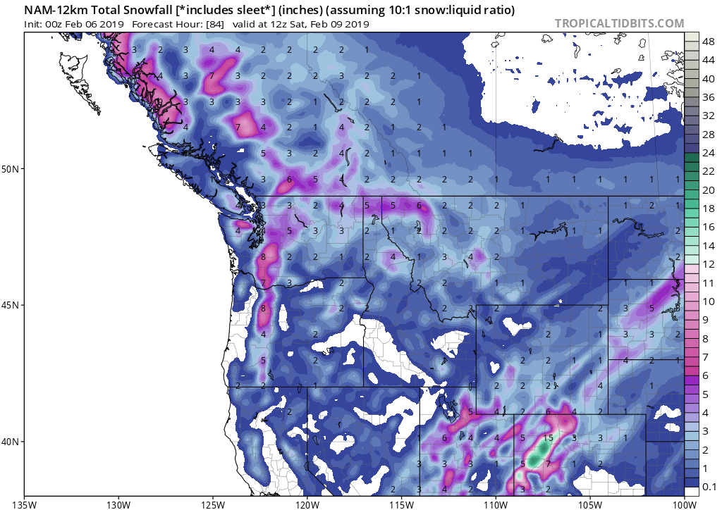
only goes out to 12Z (4am) saturday which has it still snowing steadily by then, but already 4" in seattle
-
February 2019 Weather in the Pacific Northwest - Part 1
joaqweri replied to a topic in West of the Rockies
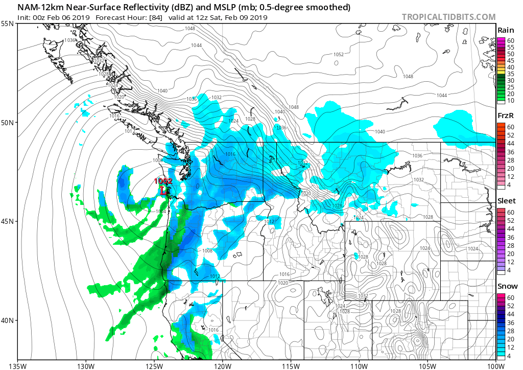
tonight's NAM has the low hugging the WA coast after sliding off van island, snow beginning in seattle around midday friday
-
February 2019 Weather in the Pacific Northwest - Part 1
joaqweri replied to a topic in West of the Rockies
still quite a few clouds here in seattle. -
February 2019 Weather in the Pacific Northwest - Part 1
joaqweri replied to a topic in West of the Rockies
back down to freezing after topping out with a high of 35°F. low this morning was 22°F. -
February 2019 Weather in the Pacific Northwest - Part 1
joaqweri replied to a topic in West of the Rockies
go up in the forums, some greasy stuff to sift through -
February 2019 Weather in the Pacific Northwest - Part 1
joaqweri replied to a topic in West of the Rockies
this dude really is wild
-
February 2019 Weather in the Pacific Northwest - Part 1
joaqweri replied to a topic in West of the Rockies
FV3 out to 72hrs so far, has snow starting early friday with already half an inch of new snow in seattle by 10am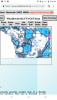
-
February 2019 Weather in the Pacific Northwest - Part 1
joaqweri replied to a topic in West of the Rockies
FV3 is starting to roll out. Thinking it's gonna be in line with this morning's euro. -
February 2019 Weather in the Pacific Northwest - Part 1
joaqweri replied to a topic in West of the Rockies
if this happens alongside the reinforcing fraser outflow shot, we could see blizzard conditions -
February 2019 Weather in the Pacific Northwest - Part 1
joaqweri replied to a topic in West of the Rockies
fellas, this could be huge. -
February 2019 Weather in the Pacific Northwest - Part 1
joaqweri replied to a topic in West of the Rockies
FV3 going full snowmageddon with mainly 6-12" by sunday morn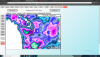
-
February 2019 Weather in the Pacific Northwest - Part 1
joaqweri replied to a topic in West of the Rockies
from which model? -
February 2019 Weather in the Pacific Northwest - Part 1
joaqweri replied to a topic in West of the Rockies
ICON doesn't look as significant, but obviously change will happen in future runs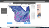
-
February 2019 Weather in the Pacific Northwest - Part 1
joaqweri replied to a topic in West of the Rockies
weathermodels.com is taking FOREVER to bring out the 12Z euro. out to hr96 now -
February 2019 Weather in the Pacific Northwest - Part 1
joaqweri replied to a topic in West of the Rockies
morning GFS is pretty wild for western WA. 10" for seattle.