


joelgombiner
-
Posts
892 -
Joined
-
Last visited
Posts posted by joelgombiner
-
-
Nice overall structure
-
 5
5
-
-
1 minute ago, bainbridgekid said:
Probably going to be too much cloudcover (and hopefully a little snow) to get that cold tonight there IMO.
The forecast shows it staying breezy and mostly cloudy overnight so I think a lot of that cooling is just cold air advection, but we'll see.
-
16 minutes ago, TacomaWx said:
The trends our friend it appears.
Looks like the low just pushed inland and jogged to the NE. Looks good to me.
-
NWS going with 22 tonight and 21 tomorrow night for KSEA. Both would be record lows for the dates.
At Sea-Tac, the record low for 2/23 is 23 set in 2022 but if the forecast verifies it will be 22 set in 2023. Conspiracy?
-
3
-
-
Dry flurries, light north breeze, and diffuse sunshine. This is some of my favorite weather.
-
6
-
-
3 minutes ago, Deweydog said:
My snow is falling off the trees. Any thoughts on how to prevent this?
Cut down your trees.
-
1
-
 3
3
-
-
The low seems to be pretty stationary near the mouth of Columbia.
-
1
-
-
1 minute ago, TonyP said:
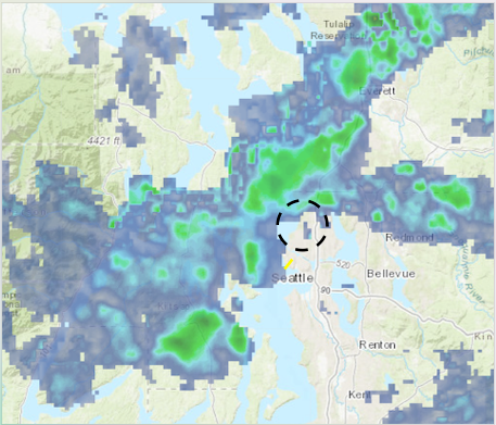
That moisture plume around Olympia does seem to be heading north. Hopefully we can see some flakes in the Central Sound!
Flurries in Seattle.
-
2
-
-
Exciting morning with up to an inch in spots around the city! But it melted pretty quickly in most places. Might be something developing again over the central Sound on IR/radar.
-
A tenth of an inch! I'll take it.
-
1
-
 2
2
-
 1
1
-
-
Outflow gradient steepening!

-
6
-
1
-
-
Positive splat test with this heavy shower. Temp dropped from 42 to 35 in the last hour or so.
-
5
-
-
One plus of having this come through in late February is the improved convection potential.
-
2
-
 1
1
-
-
2 minutes ago, Phishy Wx said:
I think the Arctic front/squall line is get hung up/split on Mt Spokane, now two/three cells. Also see some possible convection forming south of me.
Thunder Snow?

Looks amazing.
-
1
-
-
Hope has changed over to snow in the last 20 minutes. It's coming.
-
2
-
 1
1
-
-
The sun is shining and it's crystal-clear above me, with dark clouds to the north and south.
-
Getting some ice pellets or graupel on the southern edge of this band.
-
5
-
-
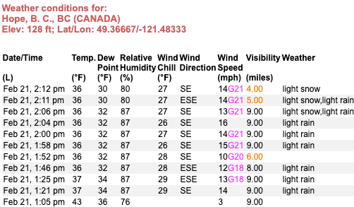
12 minutes ago, TacomaWx said:
Looks like it’s passing through Lytton BC. DPs dropping there and down to 36 with a N wind of 25.
Yep! Moving through.
-
4
-
-
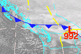
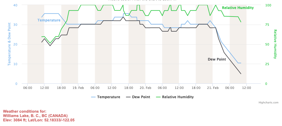
You can spot the moment the Arctic front passed through Williams Lake this morning. The boundary is now moving south in southern B.C.
-
5
-
2
-
-
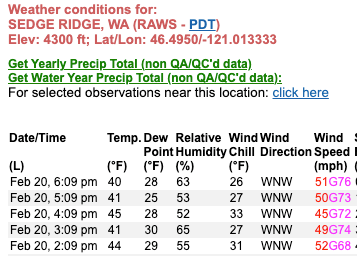
Looks like those 70+ mph gusts are verifying on the east slopes of the Cascades.
-
1
-
-
5 minutes ago, SouthHillFrosty said:
Can we pin this?
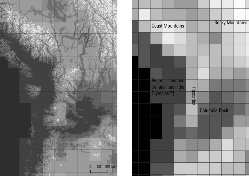
Caveat that I do not really understand how the GFS model works, but I interpret "44-mile" grid spacing as meaning something similar to the topography shown above.
-
- Popular Post
- Popular Post
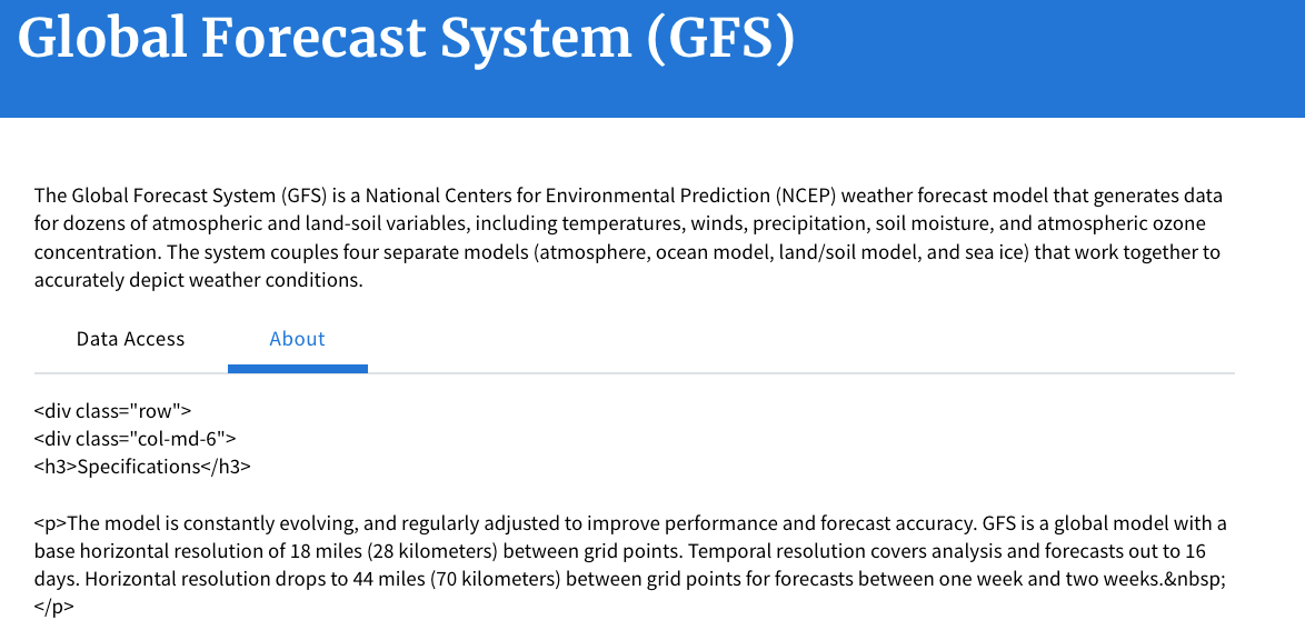
56 minutes ago, Cold Snap said:44 mile resolution on the GFS in the long range lol no wonder it performs so bad in the long range here.
Some quick mapping in QGIS shows what 44-mile resolution looks like. The image on the left shows the topography of western North America, overlayed with a 44x44 mile grid. The image on the right shows the same view, with down-sampled topography created by taking the median elevation value in each grid cell. This is close to what that the long-range GFS apparently sees. Note the total absence of the Olympics, and the overall crudeness of the topography.
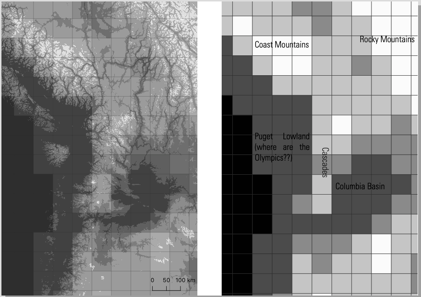
Due to interest in this, I went ahead and made a second version with 15 greyscale color classes to better depict the coarse 44-mile topography on the right. This makes it a bit harder for my eye to pick out the terrain patterns, but is more accurate for what the GFS actually sees.
Another thought is that the placement of the grid relative to the topographic features makes a big difference for the final output. Are the Olympics centered in one grid-cell or split between four?
-
11
-
38 minutes ago, Phishy Wx said:
GFS GFS'n
Are we really trusting a forecast system that doesn't even know how to use HTML on their website?

-
8
-
 1
1
-
-
Cold air moving into place... (from a few days ago). Yakutsk up to -16.
-
 1
1
-

PNW February 2023 Weather Discussion - Meteorological winter finale
in West of the Rockies
Posted
I swear the low looks like it's moving to the NE on the IR imagery...