

Thunder98
-
Posts
3521 -
Joined
Posts posted by Thunder98
-
-
A Sign of autumn coming? CDA will go from upper 80's to mid 60's by Thursdays with a rain showers.
-
When do you think you will see the 1st 40F or lower morning lows?
-
Think of it as a forecaster asset. Go somewhere, you can guarantee your forecast for that area.
However, don't drag out the hair shirt just yet oh weather Swami ! Ye Old Farmers has something to add.
Throw your computer models away Phil, this little chart has ya covered !!
It better be wet here this winter in California!
-
 1
1
-
-
A sign of autumn coming? Temperatures in the 60's today in Eau Claire and Duluth.
-
Eau Claire, WI got 2.56" on Thursday.
-
The stuffed white cat says prepare for late fall and winter, it could be very cold!

-
2
-
-
I have a big deal, I guess, about just picking a spot and standing on it so I'm going to go with -.5 to -.8 for our Niña and stay there. If August roasts all the way to the end down around my area and we get a good trades burst soon, I will have felt pretty good about my decision by September 1st and will make my winter thoughts from there. :-)
I think La Niña will be around -.8 to -1.0 this winter and next year I think a super La Niña might occur.
-
Sitting here looking at the PDO setup of 2014-15 vs now and knowing what happened that year. One could have lots of arguments for a repeat only with the core of the main trough anchored in the central US instead of the eastern 3rd/half. Winter 2003 had a similar matching PDO structure as what we could be looking at as well but there was a Niño in play that year. I've got to get my maps from the 60s and late 70s out and analyze them over the next few weeks also and see what really 'drove the bus' in those years as well.
It's really stunning to me to see the torch CFS loving the cold this year. Precip wise is showing a Niña ridge type precip pattern (ridge over the SE with troughing and storms slamming in behind to the NW) in the south and that would imply, again, persistent troughing over the central states. Maybe a snowy south Central and great Lakes is in store this year. That's what the maps+PDO/ENSO combo are really implying as early as late november for most of us except for maybe myself. That's about all the analysis I have at the moment but taken at face value, I really like what I see right now.
Let's take a look and see what the SST's are forecast to look like by Oct/Nov when the new LRC develops in Autumn and then later in the Winter. First, let's start by paying attention to the central Pacific. Overall, the model continues to back off on the idea of a moderate La Nina. I do believe we will see conditions that favor a weak La Nina, but the question is...does it hold??? Lets dive in.
In October, it seems to favor almost a La Nada look, but conditions Nov-Dec favor a weak La Nina...
http://www.tropicaltidbits.com/analysis/models/cfs-mon/2016073018/cfs-mon_01_ssta_global_3.png
http://www.tropicaltidbits.com/analysis/models/cfs-mon/2016073018/cfs-mon_01_ssta_global_4.png
http://www.tropicaltidbits.com/analysis/models/cfs-mon/2016073018/cfs-mon_01_ssta_global_5.png
If we turn our attention to the N PAC, this is prob going to be the main driving force to the N.A Winter, IMO. We have a classic +PDO with a cold pocket of water N/NW of Hawaii, indicative of the late 70's winters. We haven't seen a SST look like this that had a mature cold pocket in the autumn months which I think should correlate into a stormy pattern for the west coast as well as the central CONUS. If you have a trough develop N of Hawaii, storms systems will "hand off" under a ridge in NW NAMER. I think this is where the CFSv2 model is heading. Check out the precip maps below.
In October, a hint of above normal precip near the desert SW and especially in the Midwest/southern plains
http://www.tropicaltidbits.com/analysis/models/cfs-mon/2016073018/cfs-mon_01_apcpna_month_global_3.png
November turns dry...but in December, the west gets pounded...
http://www.tropicaltidbits.com/analysis/models/cfs-mon/2016073018/cfs-mon_01_apcpna_month_global_4.png
http://www.tropicaltidbits.com/analysis/models/cfs-mon/2016073018/cfs-mon_01_apcpna_month_global_5.png
Continues into January...
http://www.tropicaltidbits.com/analysis/models/cfs-mon/2016073018/cfs-mon_01_apcpna_month_global_6.png
This type of pattern certainly won't be a boring one. Should be fun watching the models come in with new info as we get closer to Autumn.
In terms of precip in the Autumn months, when you see the JAMSTEC model somewhat agree with the CFSv2, you gotta take this into consideration. Especially when you see the model's Dec-Feb forecast...that is like heaven for those in the drought stricken Cali region.
http://www.jamstec.go.jp/frcgc/research/d1/iod/2007/forecast/tprep.glob.SON2016.1jul2016.gif
http://www.jamstec.go.jp/frcgc/research/d1/iod/2007/forecast/tprep.glob.DJF2017.1jul2016.gif
The NASA/CanSIPS model updates later this week and I'll post the maps when they are available.
I think the Midwest and plains will see a very cold winter and late fall this year, I think it will be like 2013/2014 season.
-
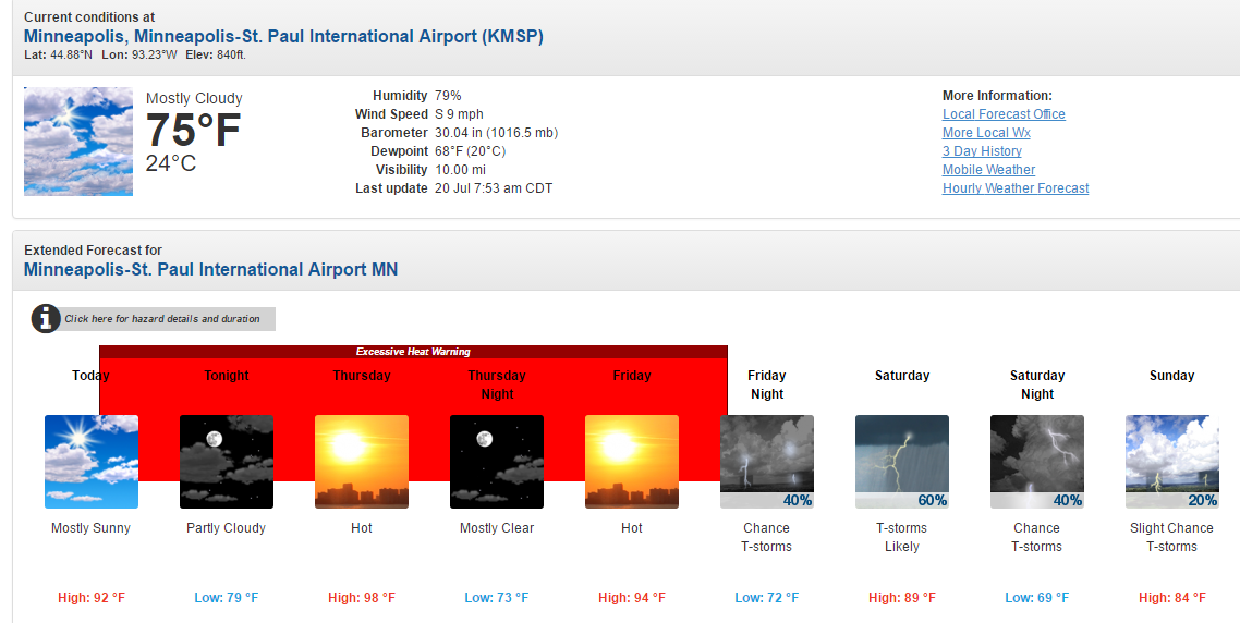
Very hot and humid weather forecast for Minneapolis.

-
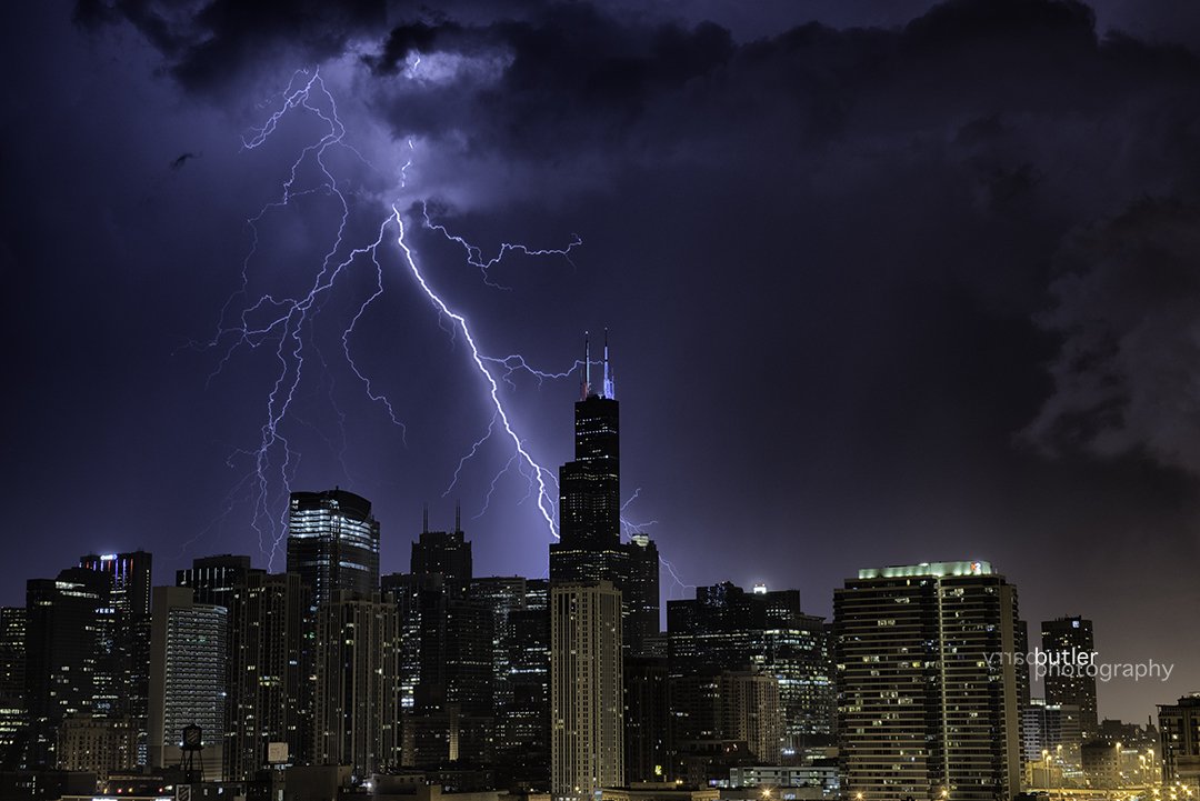
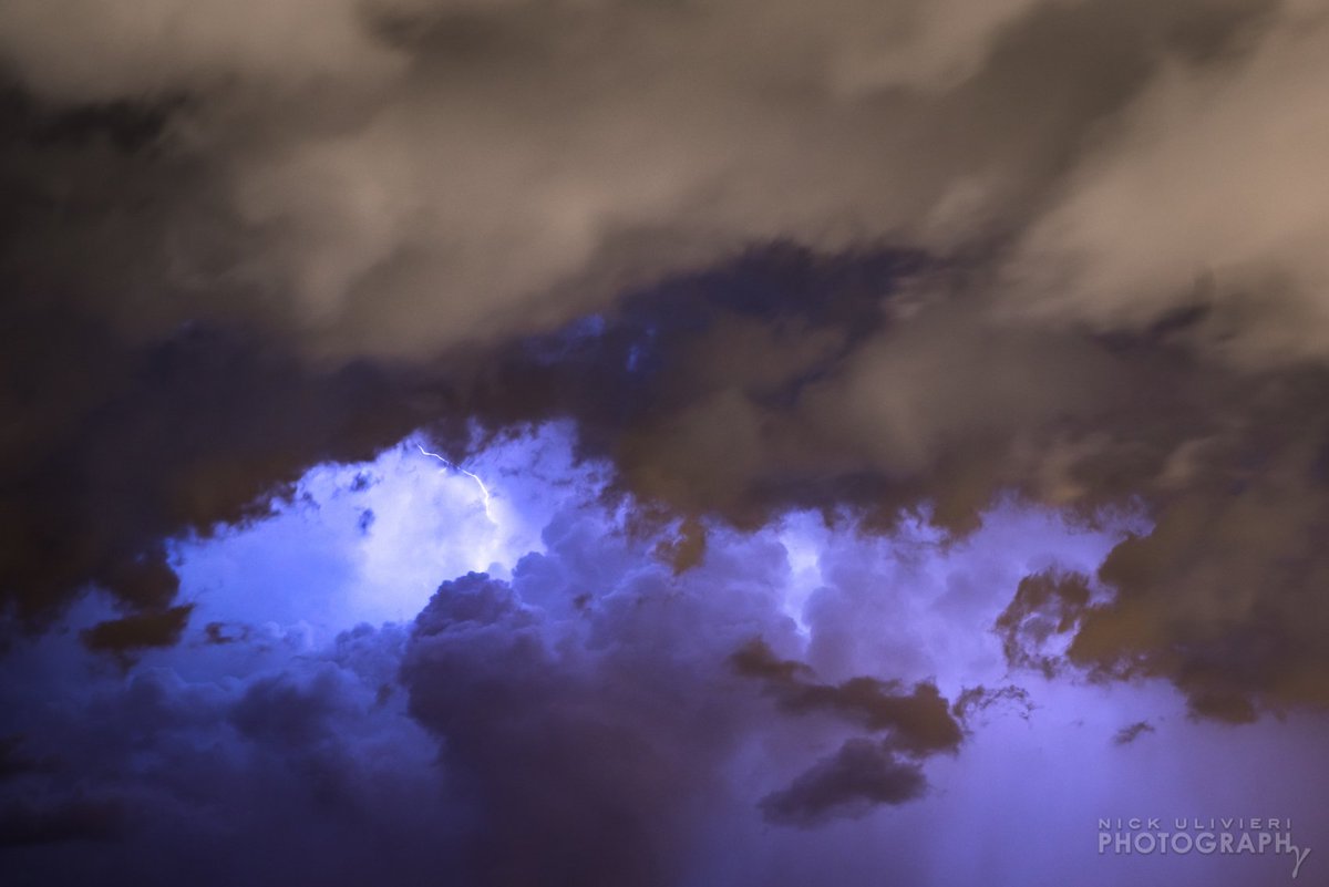
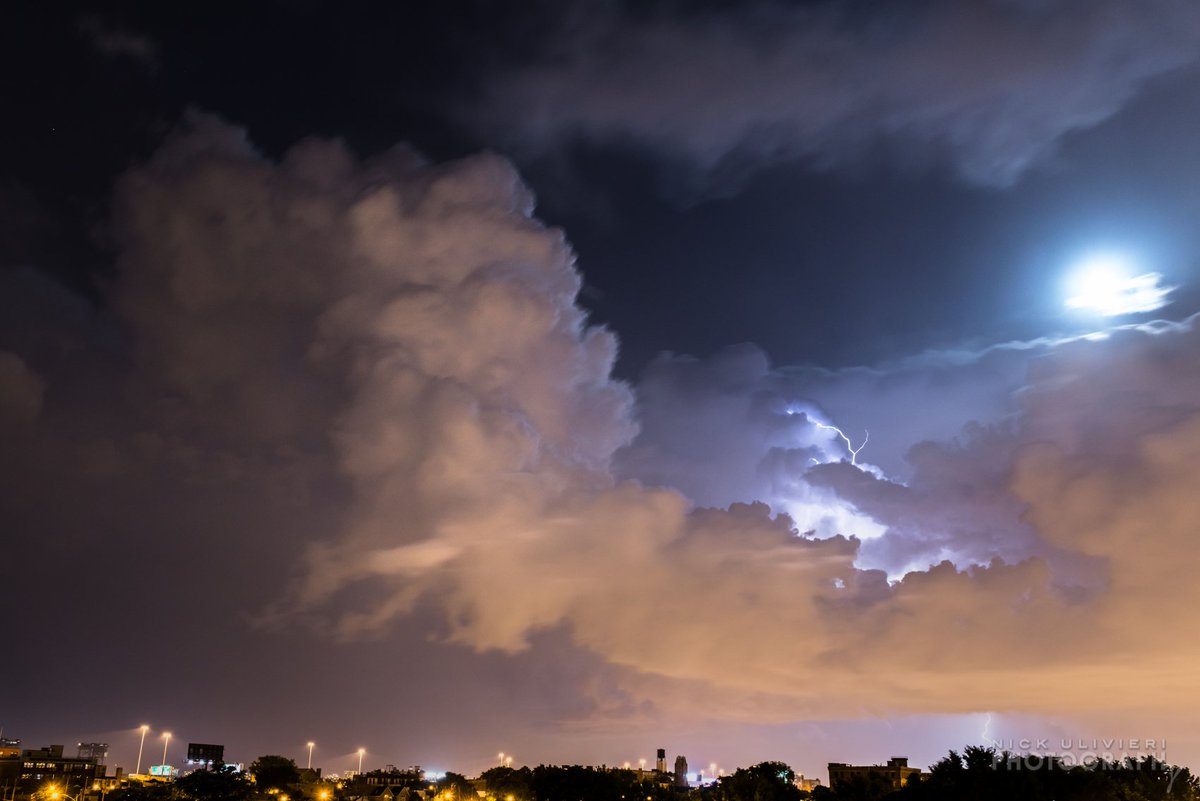
When I left Muvico last night in Rosemont, the skies were lighting up to the south. We had some powerful electric storms that blossomed just to my south. It was one of those warm, breezy and humid summer nights that I enjoy, esp when there is an active storm in the area.
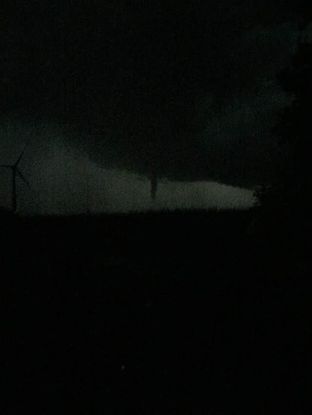
A report of a Tornado hit the SW burbs near Kankakee county...nigh time funnel clouds were captured.

Here are some lightning shots...
3-6" of rainfall fell causing flash flooding...

Fantastic pictures Tom!

-
1
-
-
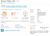
Could Sioux Falls, SD reach 100F on Thursday? http://pics3.city-data.com/forum/images/smilies/eek.gif
http://www.city-data.com/forum/attachments/weather/172524d1468847438-summer-2016-northern-hemisphere-siouxfalswxfrcast2.png
Very hot temperatures in Eau Claire, WI with highs in the mid 90's on Wednesday and Thursday. Lows are in the mid 70"s very warm! And don't forget it will be humid!
http://www.city-data.com/forum/attachments/weather/172525d1468847476-summer-2016-northern-hemisphere-eauclairewiwxforcast8.png -
Tom, thanks for posting this, it is absolutely fascinating. I have always been highly skeptical of global warming/climate change/insert liberal buzz word being a man made phenomenon. The fact of the matter is the Earth's climate has changed dramatically over it's several billion year existence. Even the most recent ice age was only about 12,000 years ago, which is not that long ago considering how old this planet is. You see these handful of places experiencing some slightly different climate than we see historically and everyone jumps on that the world is coming to an end, and it's all our fault. This is some fascinating stuff here based on real science. I'd love to see this on 60 minutes or some other major news outlet and see what people think.
Climate always changes
-
Very high Dew points in Sioux Falls, South Dakota!
-
meanwhile here in drought island Michigan....
http://i.imgur.com/5Kf4tEQ.gif
http://i.imgur.com/zLBOJ2F.png
Blame Lake Michigan!
-
Severe thunderstorms and heavy rain are in this MCS.
Eau Claire, WI so far has gotten 1.32" of rain in just 1 hour!
-
Chippewa Falls, WI has the perfect summer weather forecast!
-
Somebody should start the July 2016 Obs and discuss thread.
-
Eau Claire, Wisconsin has been getting very wet Junes since 2010! June 2016 so far has experienced 6.05" of rain this year. The only month below average was in June 2012 with 3.73" of rain.
June 2010: 4.84" Avg: 4.27"
June 2011: 7.23" Avg: 4.27"
June 2012: 3.73" Avg: 4.13"
June 2013: 5.86" Avg: 4.13"
June 2014: 9.84" Avg: 4.13"
June 2015: 4.83" Avg: 4.13"
-
1
-
-
Duluth area just got pounded by intense thunderstorms. Severe wx alerts in Minnesota and Western Wisconsin.
-
All of the storms (and the rain) were to the SW of West Michigan last night. At this time there looks to be a better chance of seeing a shower yet this morning. So far this month Grand Rapids is still under one inch of rain (0.93” at the airport, 0.66” here at my house) BTW the last time Grand Rapids received less than one inch of rain in June was in June of 1988 (0.25”) one good thing about Michigan is that we are not drought prone,
Do you ever get droughts?
-
Eau Claire could get some good storms on Monday and Tuesday.
-
Senaca Oregon could get frost all year long.
-
Not here in Orcutt/Santa Maria area. Fortunately there was no damage reported.
-
It's forecast to fizzle out as it heads down this way. I really don't need the extra rain. We had plenty already over the past few days.
We need it here in Socal! Your welcome to bring the rain and t'storms to California.


August 2016 Observations and Model Discussion for the Pacific Northwest
in West of the Rockies
Posted
Can we stop this stupid argument?