


HoodCanalBridge
-
Posts
103 -
Joined
-
Last visited
Posts posted by HoodCanalBridge
-
-
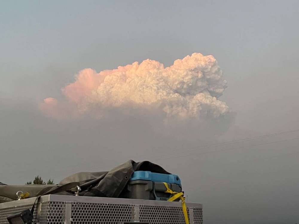
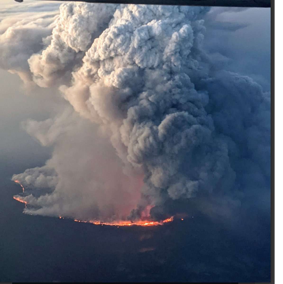
Taken from Bly at 8:55pm. Reported column collapsed happened at the Log fire, caused quite a bit of fire intensity (more than what was already intense) on the bootleg.
-
-
The 3 WA Wildland taskforces are being reassigned from the Grandview fire near Sisters to the Bootleg fire. I’ve been seeing hints of lightning in the forecasts, any thoughts on that?
-
- Popular Post
- Popular Post
I’m headed down to the Sisters, OR area as part of one of three WA state task forces being sent today
-
 11
11
-
21 minutes ago, TacomaWaWx said:
Yeah it really blew up last night in the evening hours.

-
 2
2
-
-
3 minutes ago, TT-SEA said:
I think this is a lightning projection... this is the loop through Wednesday.

Yikes. Hopefully they get some moisture. Had a lot of consecutive dry days over 100 in the north central part of the state.
-
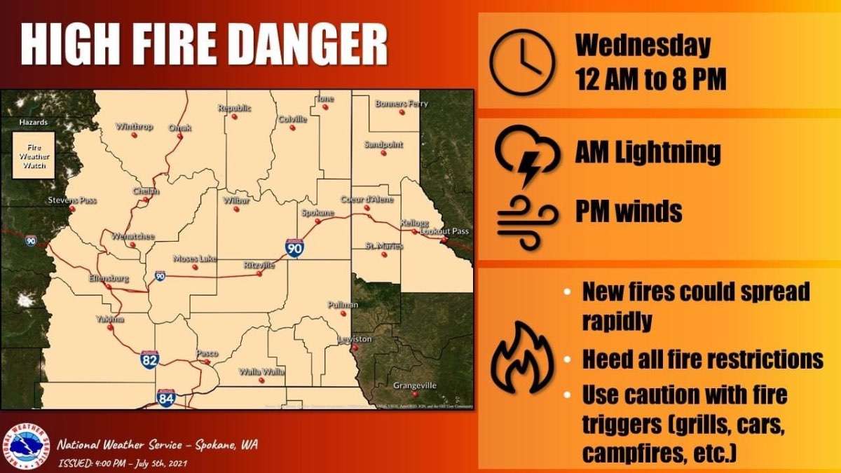
Weather service posted a fire weather watch for most of eastern WA…. And Oregon as well…. For lightning and wind on Wednesday.
Do any of you have lightning forecast maps? If those even exist?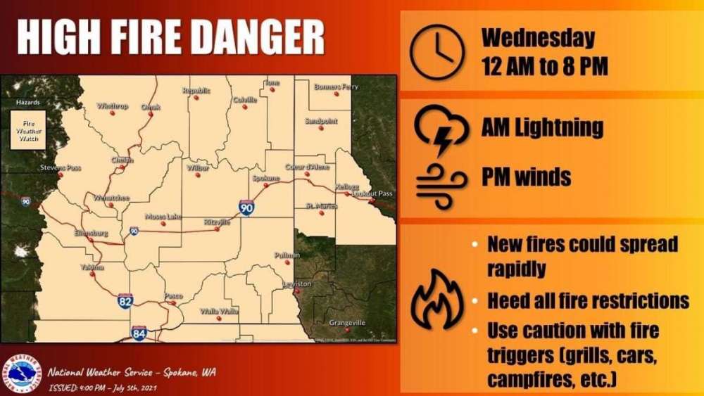
-
 1
1
-
-
From the Spokane office forecast discussion.
Lightning east of the cascades followed by winds. This set up carries a high potential for many fire starts as well as large fire growth.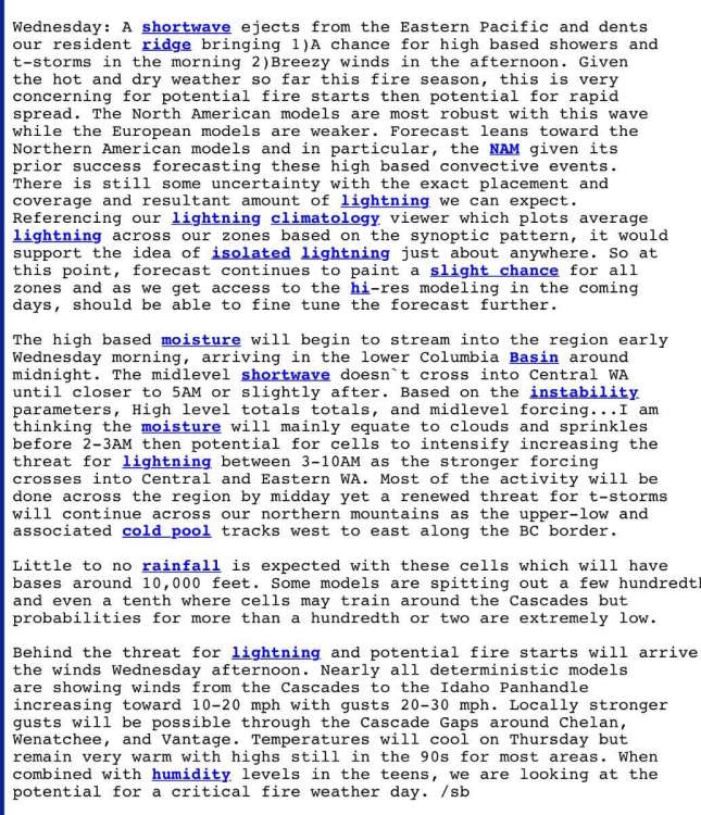
-
1
-
-
Starting to break up near the north end of the canal!

-
Going to be a long 2-3 months in the PNW!

-
-
Snowmizer- What do you see for Bainbridge?
I see different solutions, some not reaching eastern side of the peninsula, but the 12K Nam pretty much destroys it starting around 2.
What are your thoughts for today on the eastern side of Kitsap?
The island mostly missed out last night. I have snow, but not a lot. Much more farther North.
Nothing to 2" depending on the surface. Temp holding at 33 dp 28.
Edit- am at 31 deg. Forgot about the 2 degree bias my weather station has. No joke.
Thanks
Curious about this as well. Working at the suquamish fire station today and wonder what impacts snow/wind wise will be to our side of the peninsula.
-
Snow starting to come down rather heavily near the bridge!
-
It usually does.
Unless an East or North wind eats it up. Its calm here.
Makes sense. Calm here as well.
I go to work in the morning in suquamish and wonder if it will be a repeat of the other day. Apparently it got hit hard, almost 8”.
-
 2
2
-
-
She'll be comin' round the mountain....
Look South, young man.... South of the mountains that is. Its peeking.
Sorry Pierce County. It usually makes a sharp left up the Peninsula after it does this.
Snowmizer. Incoming your way soon it looks like.
Up the kitsap peninsula?
-
Snow coming down and sticking to roads in NW Kitsap peninsula!
-
1
-
-
These maps yesterday even leading up to the snow seemed to show North Kitsap areas in a shadow. Turns out we were hit with 3-7”.
Maps are again showing a shadow. Is this due to different set up? Do the maps struggle predicting CZ?
Signed, the amateur’s amateur
-
Poulsbo definitely benefits from cold air damming. Just not nearly as much as areas further South and right along the Hood Canal, partially because it usually takes longer for the snow to reach as far North as Poulsbo and they get shadowed a bit more and partially because the SE winds don't pile up as much against the North part of the Olympics near Poulsbo as in Snowmizer's area West of Bremerton.
Bainbridge benefits too, and Poulsbo definitely gets more than Bainbridge in most cold air damming events.
I moved from Kingston to across the street from the canal waterfront just south of the bridge a few years ago and thought I’d see very little snow because of the canal. Boy was I wrong! We ended up with about 6” here.
-
1
-
-
2-3 inches across the street from the water here. CZ still doin it’s thing!
-
Floodgates opened. Dumping big flakes near the bridge now!
-
1
-
-
Rain/snow mix! Wunderground was pretty much spot on!
-
Still shadowed in my neck of the woods
-
Pretty cool video from Skunk Bay Weather (Camera in North Kitsap looking across at South Whidbey) showing the convergence zone:
Looking North toward the mouth of the Hood Canal it looks like blue skies at the moment.
-
1
-
-
Bridge closed again, power going off and on in the area!


Fire Season 2021
in West of the Rockies
Posted
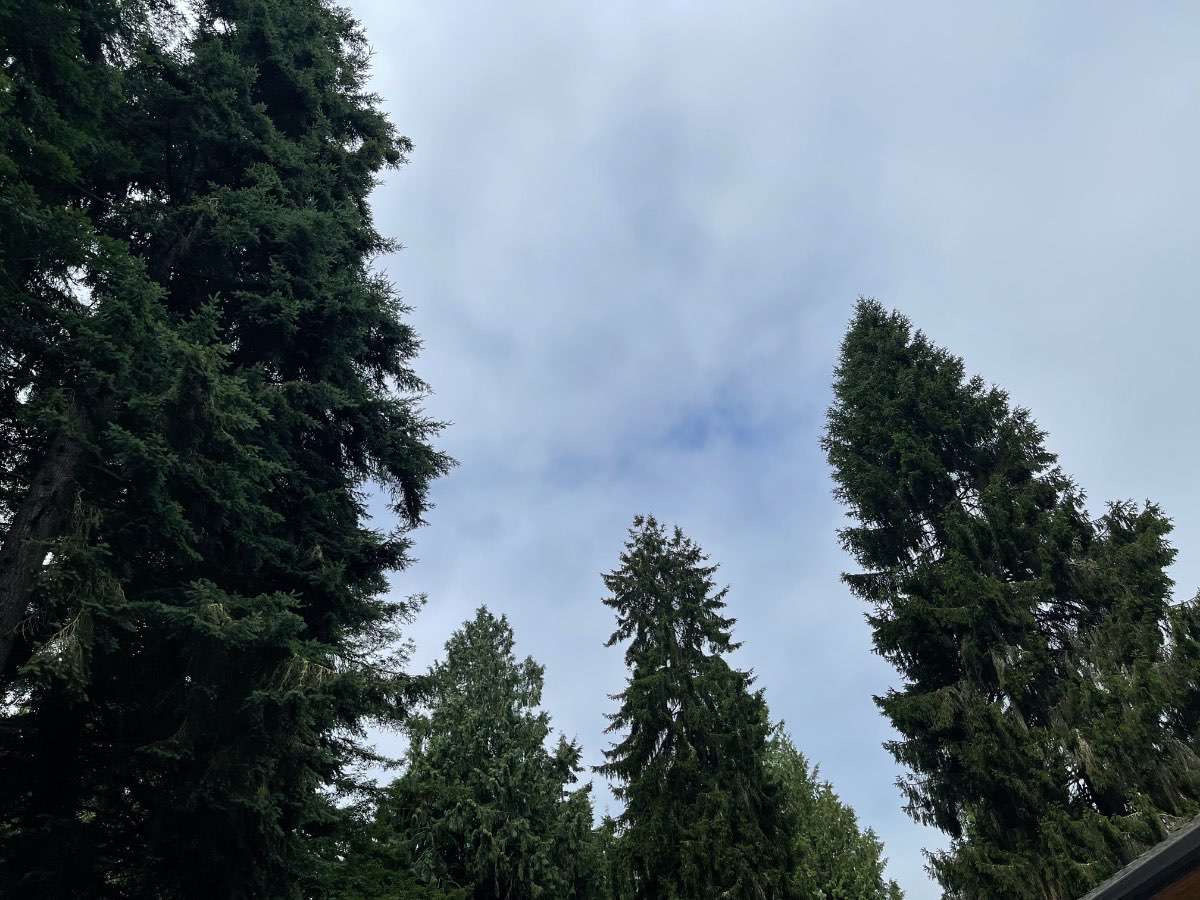
Taken just now on the return to camp