

bainbridgekid
-
Posts
6896 -
Joined
-
Last visited
-
Days Won
24
Posts posted by bainbridgekid
-
-
Arlington pulled off a string of lows of 26, 22, and 23 the last three days. Pretty impressive for March.
-
 9
9
-
 1
1
-
-
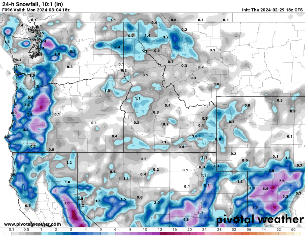
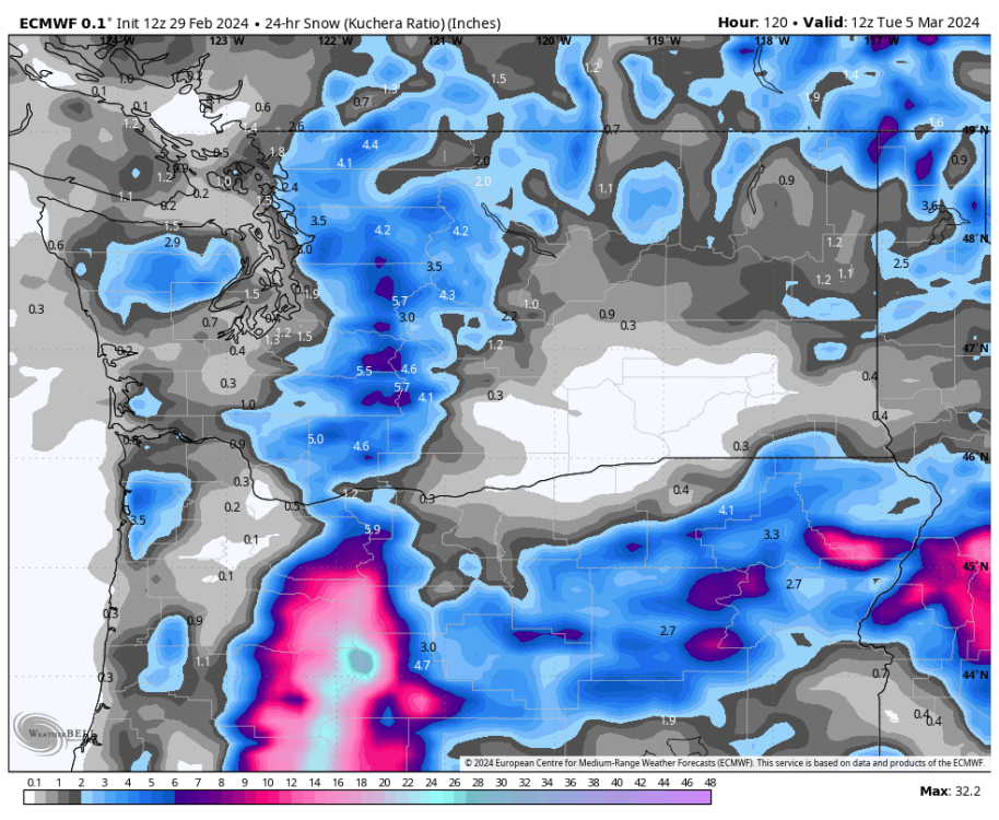
The 12z GFS gives a large portion of the Olympics 5 feet of snow this weekend. Great to see them catching up. Their snowpack was absolutely abysmal till a few weeks ago.
-
8
-
-
4 hours ago, BLI snowman said:
Even in the gorge a few hundred feet makes a big difference. White Salmon and the main part of Hood River above the river tend to do quite a bit better than Bingen and the waterfront portion of Hood River. They see a lot more continental influence out that way but there's still a handful of borderline snow events each winter that come around 32-33 degrees.
Yeah for sure. It can make a big difference anywhere in certain situations. My point was just that on this side of the mountains a few hundred feet make a noticable difference like 75% of the time (arctic fronts and overrunning events coming out of arctic events are the only real exceptions) while in the Gorge and Fraser it's probably less than 50% of the time.
-
1
-
 1
1
-
-
31 minutes ago, icyasf said:
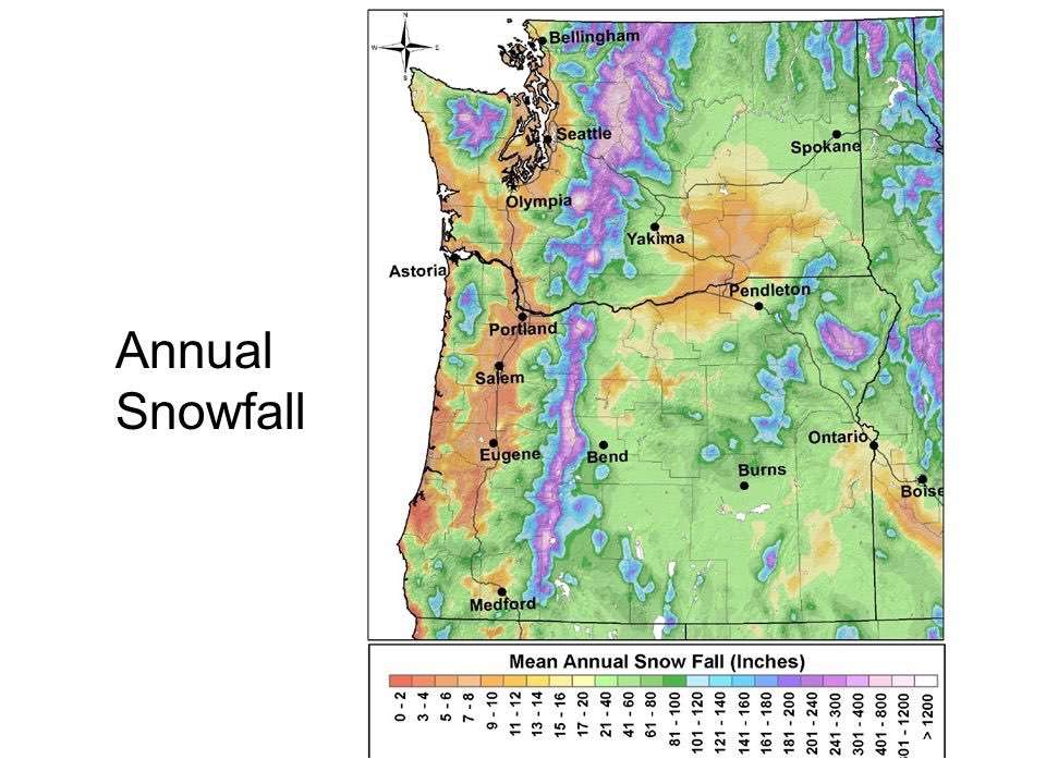
Question? I know in the Puget Sound since it has elevations near sea level areas higher up by even 100 ft get more snow. How prevalent is that say in the Willamette Valley? My parents house consistently gets more snow than the rest of Corvallis because they are a hundred feet above most of town. Obviously I know more elevation means more snow but I didn’t really realize that even 100 ft makes quite the difference. Is that common in other parts of the valley as well?
It makes a big difference everywhere in the Pacific Northwest. I've always figured that each 100 feet in elevation gain makes about a 15% increase in average snowfall. That means each 500 feet pretty much exactly doubles expected snow in a given year.
The reason it makes such a huge differnece here compared to most of the rest of the country is the temperature is almost always right around freezing for our potential snow events. That's just as true in the Willammete Valley as around Puget Sound. Only exception really is up the Fraser River Valley North of Bellingham and well East of Portland deeper into the Gorge where there is more contintental influence during snow events and elevation often doesn't matter.
-
3
-
-
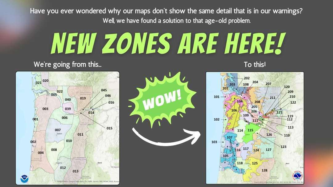
44 minutes ago, Tanis Leach said:
So as of today, the Portland NWS has new watches and warnings zones.
I apologize if this was already posted.

Nice to see so much detail, but wow locating a city on there is going to be very difficult for the general public.
-
1
-
-
Did SEA record snow last night? Sure hope so. Was clear from webcams the ground was white there.
-
5
-
-
6 minutes ago, BlvuSumit said:
Cool map, but the color scheme kills me. Why would they make 0-14" all represented by seven different shades of orange?
-
 1
1
-
-
24 minutes ago, the_convergence_zone said:
The snow level is about 250 ft with this band. I’m at 150’ in West Seattle so I’ve been mostly rain with occasional snow when the precip rate picks up a bit.
0.30” in the bucket now which is crazy over-performance.
I'll be very surprised if the top of West Seattle didn't get about 2". It goes up over 500 feet there.
-
2
-
-
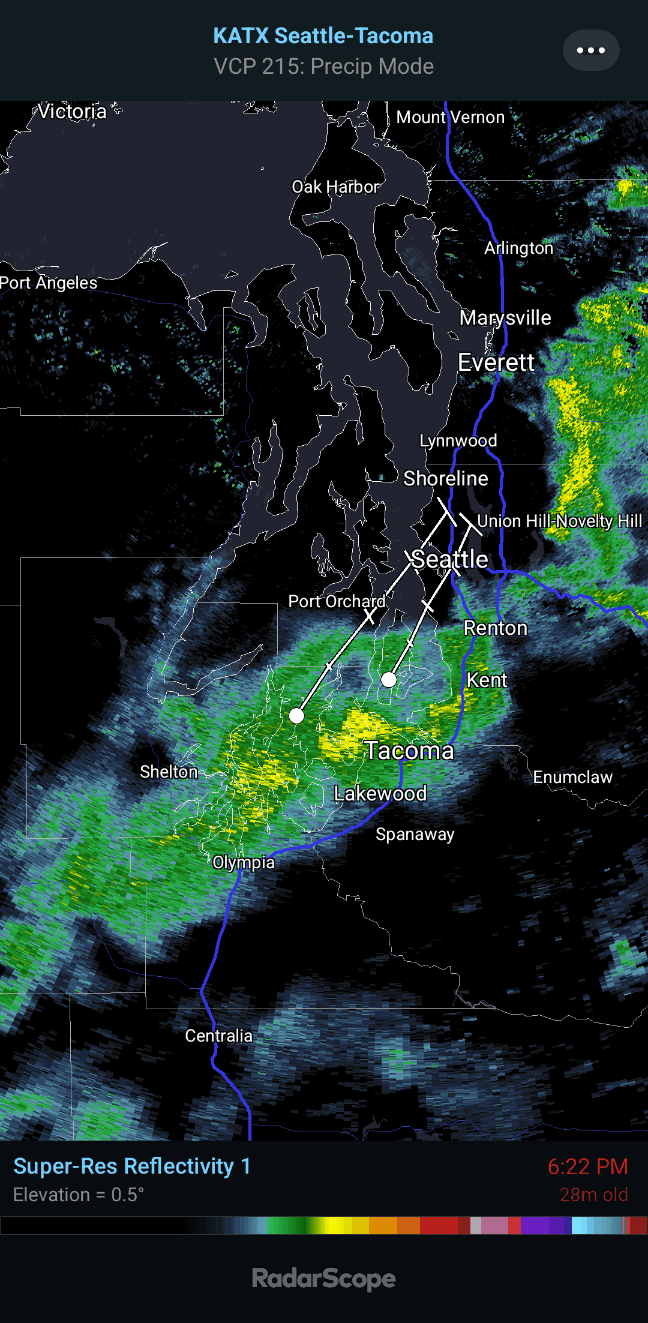
Still hammering the South half of Seattle but it's progress North has slowed to a crawl. Good news for those getting hit but I doubt it moves North past Shoreline at all.
-
1
-
-
Ground quite white at SEA. Hopefully they got out and recorded some snow officially.

-
6
-
-
These cams are 9 blocks apart in Everett.
-
3
-
 1
1
-
 2
2
-
 1
1
-
-
36 with big wet flakes coming down here at school in Mountlake Terrace.
-
2
-
1
-
-
5 minutes ago, SilverFallsAndrew said:
Possible, it would be a slushy foot.
The only way most of us will experience a slushy foot is by stepping barefoot into the slush.
-
 4
4
-
 1
1
-
-
12 minutes ago, snow_wizard said:
One thing for sure is they have to fix the model snow maps. It should be easy to ax the 36 to 40 degree snow they show right off the bat.
It's completely inexcusable how bad they are. Zero reason for a weather model in 2024 to predict sticking snow while the temperature is in the upper 30's and they do it all the time.
Models are never going to be perfect. Sometimes they are going to predict 32 degree snow and a low goes North or South or downslope winds end up stronger than predicted and it turns to 35 degree rain. We can live with that kind of error.
But they need to at least be internally consistent and predict things that are physically possible given the other parameters the model is predicting. I just don't understand how they've gotten so much worse at that.
-
2
-
-
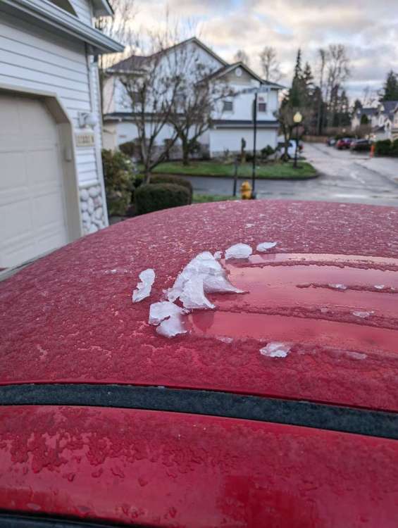
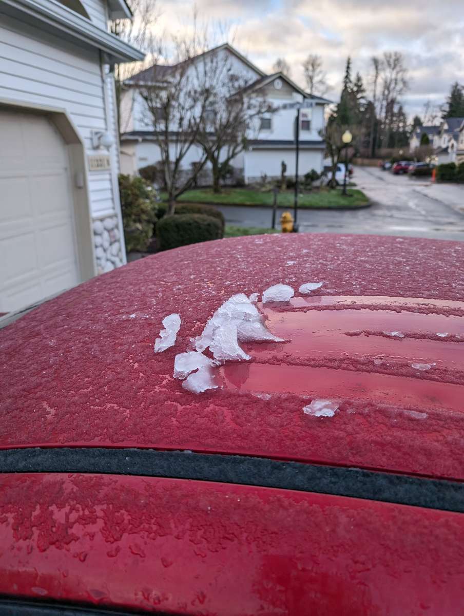
Got the lightest coating of snow possible last night. Actually had an abundance of showers temps were just barely too warm.
-
2
-
-
Just now, lowlandsnow said:
This pattern unfortunately came too late. As much as I hope otherwise I don't think there will be any widespread accumulation below 500 ft.
Cold onshore flow is just as cold in late February as it is in mid Winter. And Sun angle makes no difference at night. Tonight's snow chances are unaffected by the time of year IMO.
-
8
-
-
SEA was 34 with rain/snow mix at 6pm.
-
4
-
-
Radar does look promising for hills around Puget Sound. Probably a mix below 300 feet with stickage staying above about 500 feet though. 36 here now.
-
2
-
-
Strong CZ signature Sunday night on the 18z though.
-
3
-
1
-
 1
1
-
-
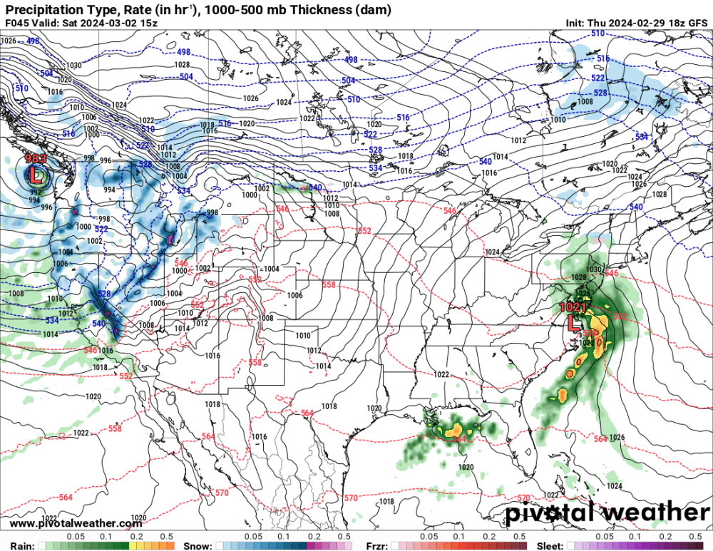
18z is pretty lame around Puget Sound for the next 48 hours. Not much organized precip during the night tonight and tomorrow night's storm stays well offshore keeping things pretty dry then too. Would have loved to see this guy push inland because a 983mb meandering low like that could bring fun surprises in the right spot, but not looking likely. Bummer.
-
 2
2
-
-
33 minutes ago, TT-SEA said:
Monday night into Tuesday morning seems to be the best shot... upper level temps are not an issue.
Looks great on the snow map, but tracking these individual impulses of energy at this range is a fool's errand. When you look at the actual map for that time, you see how finicky and disorganized that feature is and why it's just as likely to disappear on the next run.
-
2
-
 1
1
-
1
-
1
-
-
3 minutes ago, TT-SEA said:
Precip with main frontal band ending now... came close.
I always forget. What is your exact elevation? I feel like I remember you realizing years after you bought your house that your elevation was lower than you originally thought.
-
23 minutes ago, SilverFallsAndrew said:
It's theoretically possible, but very unlikely. It's pretty hard to see significant accumulation during the day up here this time of year.
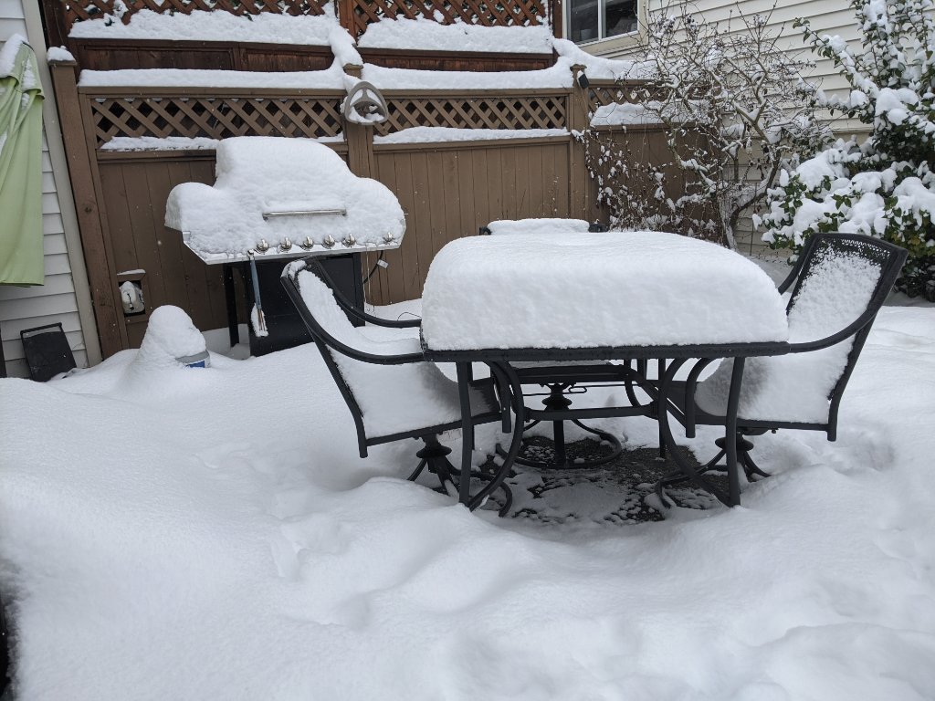
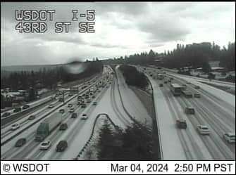
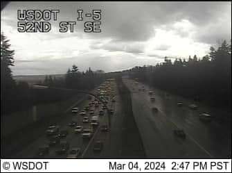
I-5 was completely snow covered with cars spun out at 3 PM in Everett this Monday. Took a very heavy shower in the CZ but that can definitely overcome the late Winter sun angles.
-
2
-
-
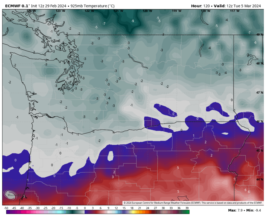
30 minutes ago, TT-SEA said:
ECMWF doesn't show the 925mb temps changing much over the weekend. Generally colder in the morning.
Next 3 afternoons below... going to be tough to have any accumulations during the day obviously.
.thumb.png.c8106b839168fa385826cbcbffb4c0d4.png)
.thumb.png.56ebb2f199665b69d8a7e8f9dc09a1f0.png)
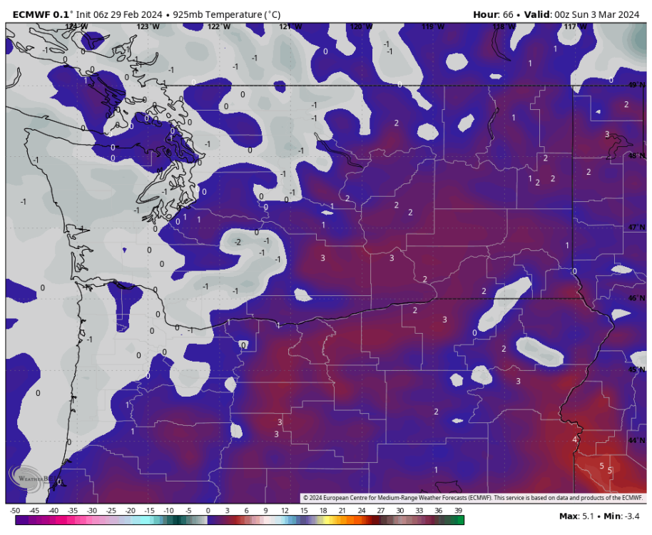
Since you know 925mb temps will be lower at night and that's the time everybody is watching for snow, why post the maps for 4 PM?
-
5
-
1
-
1
-


.png.703759efe7d4766199ff641578fe6016.png)
.png.1e4d65ac691aae218f4823ea0a95d8b0.png)

March 2024 Weather in the PNW
in West of the Rockies
Posted
My girlfriend lives in Olympia close to OLM and I've been shocked by how mild it's been when I've visited this Fall and Winter. I expected way more frosty cold nights but there's been a lot of cloudy, foggy mornings in the mid-upper 30's even when much of the rest of Western WA was fairly clear and frosty.