


OttumwaSnomow
-
Posts
574 -
Joined
-
Last visited
Posts posted by OttumwaSnomow
-
-
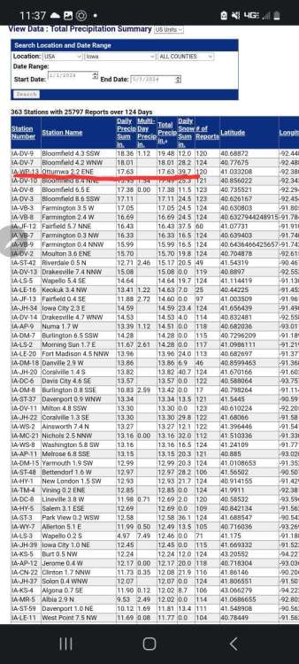
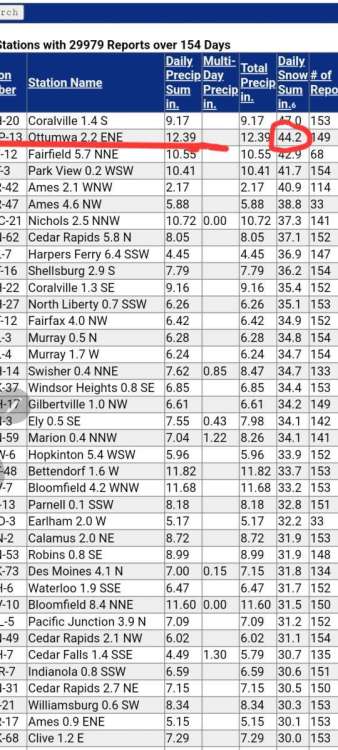
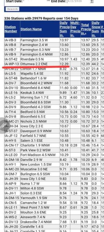
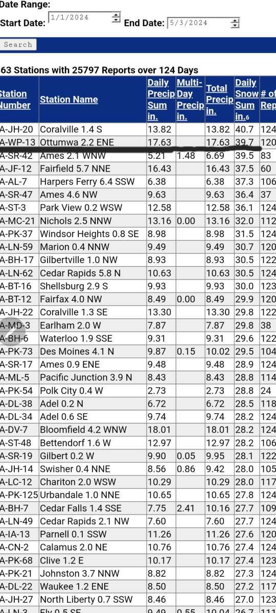
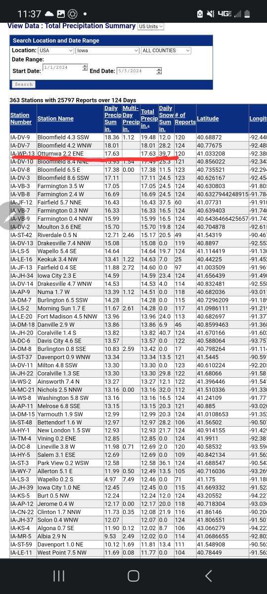
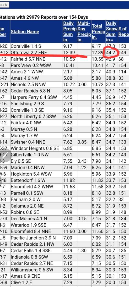
Looking over the over 300 cocorahs locations across Iowa mby has 3rd most precip in 2024! And even more shocking given how far SE I am, I recorded the 2nd most snowfall in Iowa! Only Coralville eeked out a inch more snow. No doubt about after December 2023 this area a magnet for precip! Doesn't really surprise me though. In 2017 I spent a couple days researching and Ottumwa Iowa Kirksville Mo have the wildest swings and deviations from averages in the midwest! Bermuda triangle here of crazy ups and downs in precip. The past 13 months totally bear this out. Yes all location flucuate but the swings here historically are mind blowing!

-
 4
4
-
-
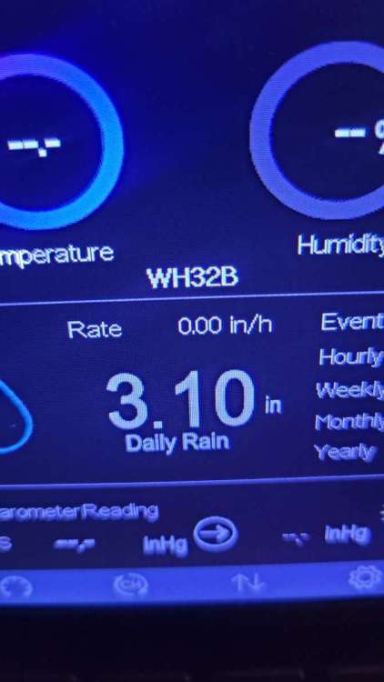
What a day! What a past 33 days!
Today 3.10" (ambient)
Since March 31st over 11 inches!
Since Dec 1st over 20 inches.
Pond now inches from overflowing, first time since late 2020!
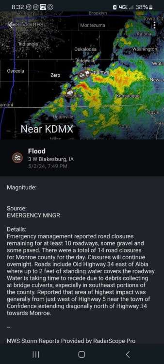
Some minor flooding today first time in years! SW wapello county had a report of 6.5" just today!
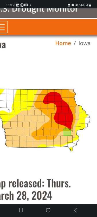
Todays drought monitor still had mby in "abnormally dry" which will be gone next week. Its honestly as wet now as I have seen since maybe sept 2020. Looking at May forecast a 2010 deluge isnt out of the question. Snodgrass referred to 2010 as a analog year? Seeing so many unusual things not seen for years! Like my basement leaking!

-
3
-
 2
2
-
-
6 hours ago, Stormy said:
Yeah I was checking the monthly COCORAHS reports yesterday and noticed the Bloomfield area had even higher April rainfall totals, like up to 9"+! My sister in south central KS says they're drying up and I noticed they again missed the recent rains.
 They're not farmers, but already the other week she said the wheat may be toast er long.
I'm glad to hear that the COCORAHS gauge is nearly identical to the official one because I have two of those and like them. I'm guessing the COOP gauge is more accurate beings it has a larger diameter. I actually have 5 gauges out. Two other small ones always show less unless it rains a lot, like over 1" as they tend to catch up. I like my digital Davis gauge, but it's not consistent and I never fully trust digital gauges. I have a spare older Davis station/gauge and both rain guages had to be adjusted up a bit (calibrated) to match my other gauges. The new Vantage Pro2 has a redesigned gauge so the wind affects the rain less that's entering it. I don't know if the new design helps much. Davis finally came out with a touch screen console last year but it needs to be plugged in an outlet as battery backup won't last long. I'd get one if they'd make it totally wireless like what I have.
I had a davis pro for years. Gave it to my son when I sold him that property. The solar charger quit and I was constantly putting batteries in. I love the ambient console and easy access of the data. Its been out since nov 2012 with zero issues. And its quite far from the house
-
1
-
-
2 hours ago, Stormy said:
My April total rainfall is 5.50". Not sure if I'll add anything to that amount before midnight tomorrow night or not, but probably not as it appears less likely.
Im at 7.93" here for April. I have 3 gages: coop observer large metal gage, a cocorahs gage and my Ambient electronic one. The coop observer and cocorahs are usually identical.. The coop observer maybe a tic higher less, maybe 0.5% than the cocorahs at times. The ambient is steadily 4 to 6% higher, so i dont document it. But its midnight to midnight and saves me a trip out in the rain! The ambient is very reliable, except for dead of winter ice or snow. But perhaps most confusing is OTM 7 miles nw of me is measured at midnight and i measure 7 am. On March 31st just before midnight we had a torrential downpour, which went into my April data. Had that went on March data March would've been closer to normal precip. But I continue to see this oddity that My 2 locations in Wapello county steadily see much more precip than OTM, and 2 other friends not far from OTM. I've come to strongly believe that info isn't accurate! When I have 3 rain gages over years? Why is OTM constantly 10 to 20% less? Possibly even more in winter when precip needs melted.?????? Oh and fyi my ambient says 6.98" since April 1st at midnight.
-
3
-
-
Well what a event! The 4 day, 2 system total is 2.62" nothing extreme. But I had my wettest 24 hr period in 3 yrs. And most amazing I have 7.93" in April and still another chance Tuesday evening. My wettest month in Iowa since Sept 2020.. Kiss goodbye to darn drought monitor!
-
4
-
 1
1
-
-
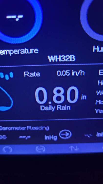
Another wet day! Love it! .80" this pm and still raining. Weekend total now 1.7" and incredibly now at 7 inches in April! And there hasnt been a extreme amount of run off or gully washers. Soaking in and saturated!
-
5
-
-
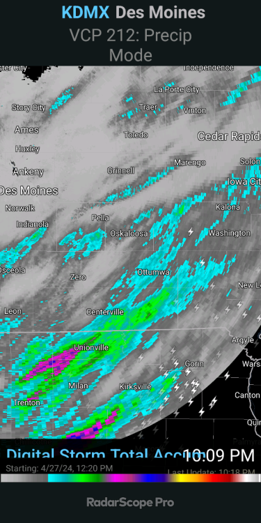
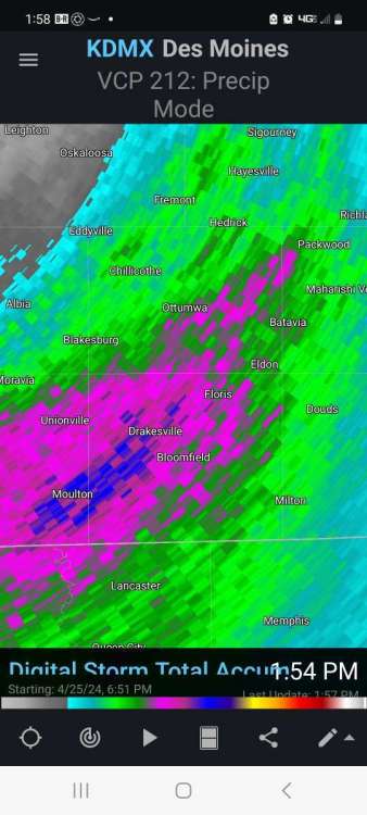
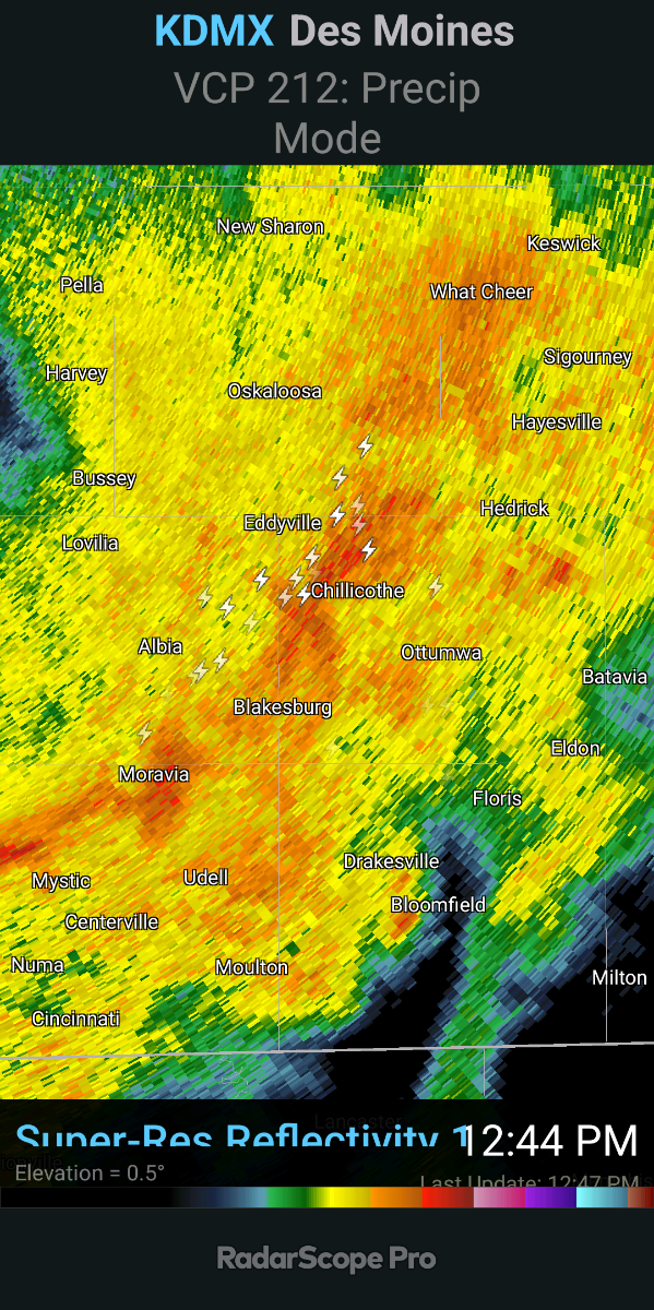
Is east edge of Desmoines getting raked? Hope not.
-
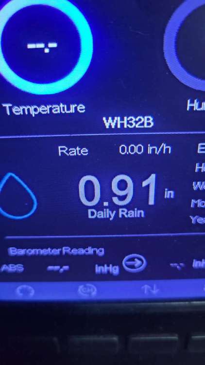
.91" wow and just the first round!
-
4
-
-
4 minutes ago, Hawkeye said:
Unfortunately, it appears the dry models are going to be correct for us this morning. An area of rain is trying to lift up into my area, but it is really drying out. You just can't expect any heavy rain when the freakin dewpoint is in the 30s. I'm tired of this crap. To get heavy rain, we need the dewpoint to be in the 60s and 70s.
My dewpoint is 43 and nice moderate rain. And Im up to .43 rain this am. Unreal how Ive been the bullseye for months now.
-
2
-
1
-
-
We drove to the Royals Orioles game on Sunday (go O's!). And there was quite few dry areas between here and kc.. much wetter here thankfully. But looks like we all get in on it soon!
-
4
-
 1
1
-
1
-
-
6 hours ago, Clinton said:
Cool temperatures this weekend hopefully I can avoid any frost Sunday morning as temps may dip into the mid 30s. Later next week one of the stronger storms in this year's LRC will likely ignite a major sever weather outbreak across the middle of the country. Models are already showing significant amounts of rain in my area but it's gonna have to show me it can actually happen here in the show me state before I get to excited.
Most of my 30 fruit trees in full bloom. Currently its 41F at 1 pm. Dewpoint is 27F and both will plummet down tonight i think my fruit is gone!
-
 1
1
-
-
3 hours ago, Stormy said:
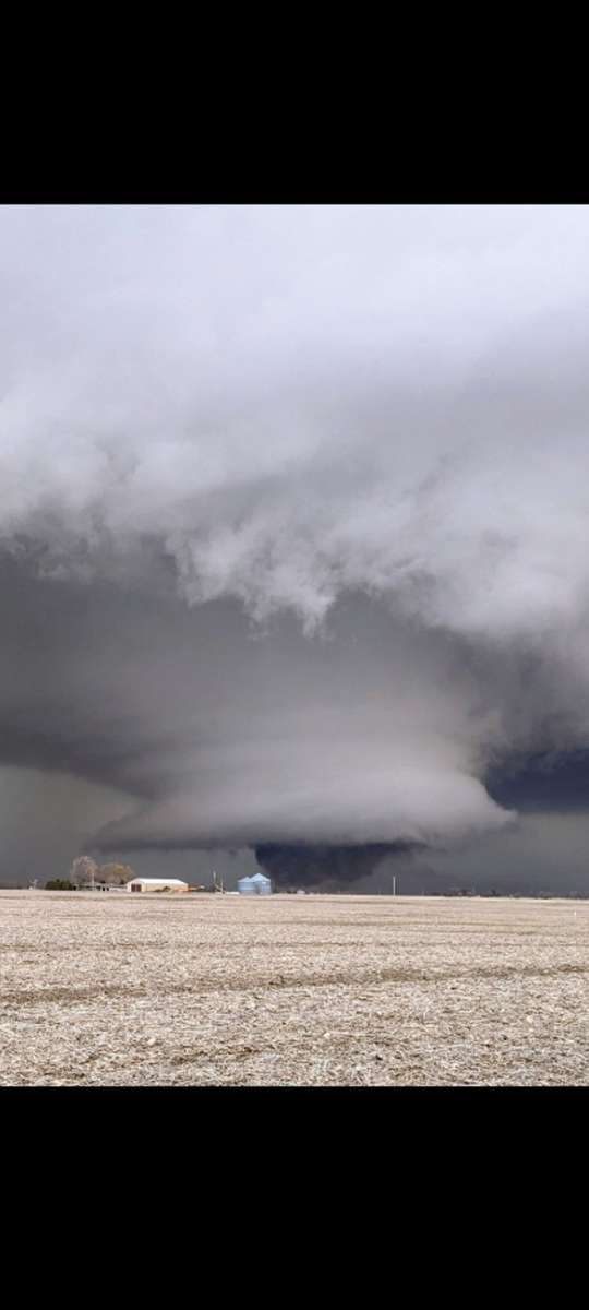
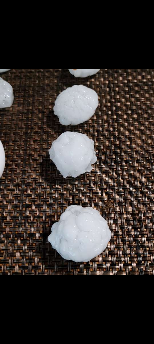
I wanted to comment about the weather on Tuesday, but I always get sidetracked in doing and looking at other things. Plus I was helping with storm cleanup for people from my church that evening. The first batch of showers Tuesday afternoon was heavier then it appeared on radar as PWATS were quite high, but I was in a gap between heavier cells of course. Still ended the first round with exactly 0.40". Then a short period of sunshine preceded an ominous shelf cloud from the last brief intense line of storms. The sky looked greenish, and I was out shooting video (with iPhone 15 Pro Max) and photos till the last second! But only 0.24" rain from that line with wind gust only around 43 mph and not as windy at my location as early in the afternoon. But had some decent hail with a few of the largest stones at 1" diameter. But 2 farms approximately 3-4 miles se. of me had buildings destroyed from a possible little spin up tornado or microburst? One building was totally flattened and the other farm had half of the roof gone among other damage. Total rainfall on Tuesday was only 0.64".
The drought maps may be off for my location since we've had very good rains in March, and especially this month. Field tile lines are running since the heavy rains of early April and water is standing in roadside ditches after each rainfall. With today's rainfall I'm approaching 4" for the month.
 And it looks active again by late April.
Just checked my weather station and I'm just over 4" for the month now, with over a third of an inch so far today.
It will be so nice to see my area off the dreaded drought monitor soon! I have a incredible 7 plus inches since March 1st. My ponds are almost full! Going back to Dec 1st 2023 I am steadily running surpluses. Except for the pultry .14 in Feb.
-
4
-
 1
1
-
-
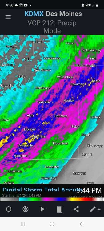
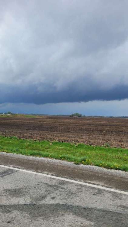
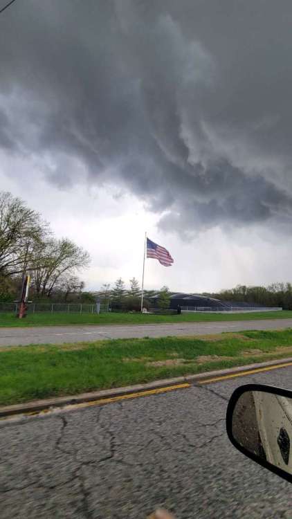
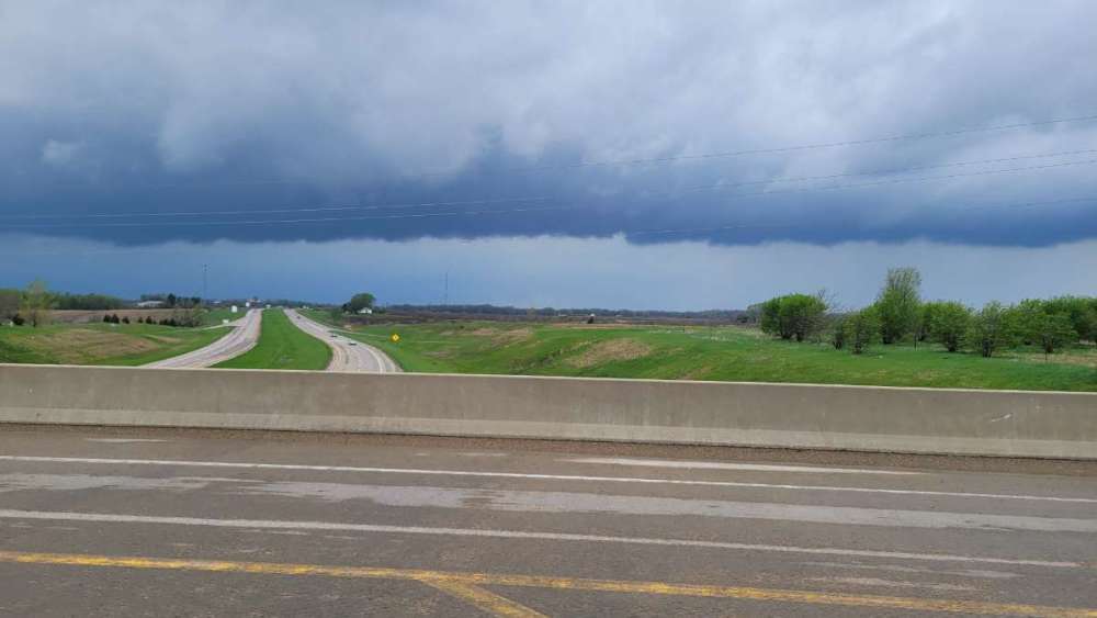
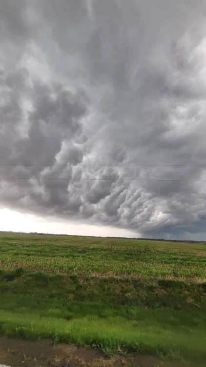
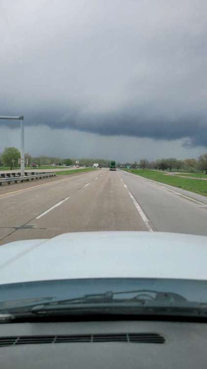
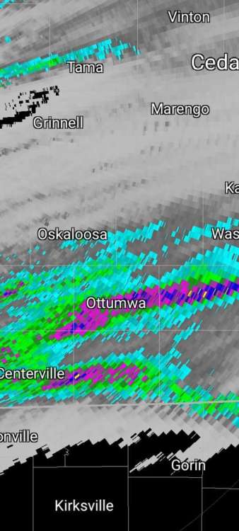
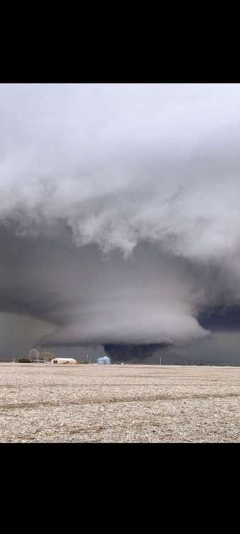
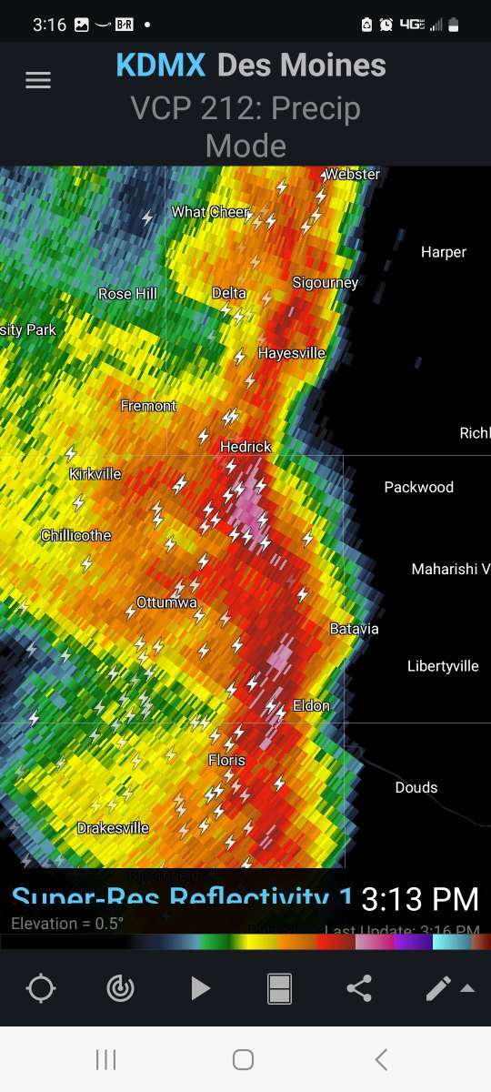
Well this system over preformed here for sure!! 3 rounds of thunder. Still thunder tonight. I have about .88 so far. 2 bouts of light hail. The 2nd round was squall line in my pics below did finally get some spin on it in eastern Wapello county. There was a eery sound that Ive only hear twice iny life... freight train.

-
8
-
-
Just now, Hawkeye said:
I am becoming increasingly concerned about my rain total. A couple days ago, the GFS and Euro were suggesting up to four rounds of storms and a rain total possibly 2+". Tonight's storms are gone and the Tuesday night rain is mostly gone. Models are down to only one main round Tuesday afternoon, with maybe a thin second line. There may be spots around here that get missed by the stronger cells and end up with only a half inch of rain.
Just not a good setup for my area for good rain in more than a couple spots. Maybe a strip or stripe under a super cell. Today i tilled the garden. Craziest hard crust i ever saw from the days of sun and wind. But still mud underneath!! Deep soil wetter here than further west. Bone dry over along hwy 35.
-
Looks like i will finish with 44.2" 38 of which fell in 11 days. A Crazy winter.
-
4
-
-
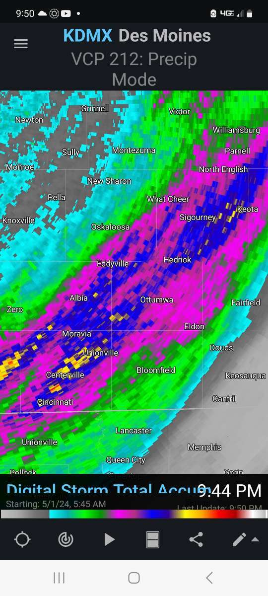
3.16" day total precip since Sunday afternoon. And a snow rain mix is still falling so will add to this. What a over performer! Very thankful!
-
2
-
 1
1
-
-
I'm probably thought of as a complainer on these forums. And my company has lost millions from years of drought. But I must say this since Nov 1st mby is near the top of a Iowa locations.
#2 snowfall 44.2"
#6 precip 12.39"
We should be falling off the drought monitor soon.
-
4
-
-
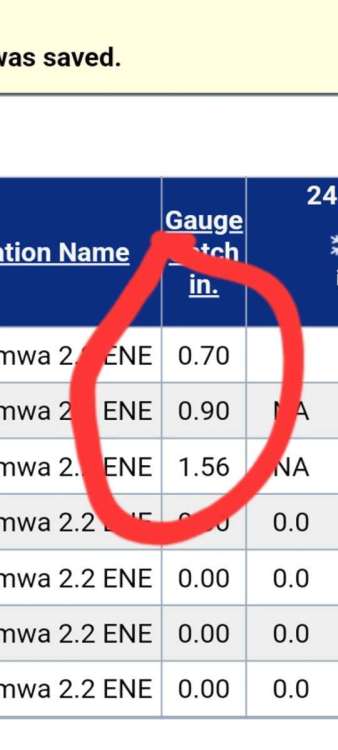
1.56"
My heaviest rain only day since September 2022. Was pea sized hail twice. My pond jumped up 2 feet!
-
4
-
-
On 3/30/2024 at 9:06 AM, Tom said:
This setup looks to be golden for your area and most of the MW/OHV.... @OttumwaSnomow should do real good...this is the epitome of the IA/MO warm front scenario at play which he discusses on here. Good luck bud!
Great call @Tom! Nothing like a wobbling warm front here!!! I just got raked best gully washer since June or longer! 1.32" and still not over! 2 rounds of pea size hail! FINALLY SOME RUN OFF FOR PONDS!
-
2
-
1
-
-
2 hours ago, Timmy Supercell said:
55, moderate rain and t'storm! There's gonna be a lot of them over the next couple days.

Whats a thunderstorm? Im seeing just 2 to 4 per year in recent years!!!! That said today is the 1 year anniversary of one of strongest supercells of my life! It actually passed right over my 24 acres! Touched ground not even 2 miles away. The Hedrick Keota Iowa tornado and hail.

-
3
-
1
-
 3
3
-
-
8 hours ago, PhiEaglesfan712 said:
The rain wrecking havoc on MLB opening day in the East Coast. The Atlanta Braves vs. Philadelphia Phillies and Milwaukee Brewers vs. New York Mets opening games have been pushed back to tomorrow. The Los Angeles Angels vs. Baltimore Orioles game looks like it will go on as scheduled at 3:05 pm ET.
Go Os! Man is this team good!
-
3 hours ago, Beltrami Island said:
In this case that is the dry slot of this storm, no? Iowa still has the nw to se gradient on average. Minnesota's gradient is particularly contrasting between gulf moisture feeding into storms of upper Mississippi vs the arid plains of ND/MT, etc.
Yes.. just this massive weird dry slot. But as soon as the cold front approaches the Mississippi river BOOM! line of solid precip. I have witnessed this so many times in recent years its uncanny. Thus much of Illinois has not been in the severe drought as SE iowa just 60 to 80 miles away! And looking at historical averages Illinois east of Mississippi river doesnt not receive more precip than SE Iowa. But in recent years they have!!!!
-
3 hours ago, bud2380 said:
Both Cedar Rapids and Iowa City airports have reported 0.00" of rain so far. A far cry from the 2-3" modeled for days here. Latest HRRR shows about a .25-.35". And that will pretty much be all that we get from this system. A huge disappointment around here. Although with models trending this way in the couple of days leading up to the storm, it was no longer a surprise.

I have exactly a trace and a trace the past 3 days!!! ZERO.. after days of model data with a very good rain Friday thru tues. Pathetic. Never seen a dry slot like this in march that last 4 days!!! While rain repeatedly formed west and north and now east this pm.
-
3
-
-
34 minutes ago, Hawkeye said:
0.01" of rain here so far. Maybe we can squeeze out a few tenths later..
I just reported a trace 2 days. What a bummer. I had watched this setup for 15 days. Seems like it takes some kinda freak event to get a big rain here. A wobbling front along the mo/ia border usually works. Oddest place, front after front system after system. Maybe 1 of 20 gives a precip even over .50! So many months pass here with 1 or none significant precip events. Its shocking to me that even being on the east side of a trough doesn't create lift and precip here.
-
2
-
2
-


May 6-9 Multi Day Severe Weather Outbreak
in East of the Rockies
Posted
.55 overnight. Just a absurd wet pattern. Not complaining