Tom
-
Posts
27343 -
Joined
-
Last visited
-
Days Won
413
4 Followers


Recent Profile Visitors
8957 profile views


Tom's Achievements
")


-
Eventually, I’ll prob get a cabin up there close to a rancher/farmer and have good clean food. Somewhere to experience the snow in the winter and cooler summer days. I like the Payson and Pinetop/Lakeside area but Flagstaff has more or less of a busier city vibe mixed in with the forests.
-
It's the Rim Country along with the rest of the high country that gets to see the storms blossom in the daytime. I would love to go up there and experience it during this year's Monsoon.
-
Ya, I've been coming here for years and remember always seeing nighttime storms and the gorgeous lighting shows.
-
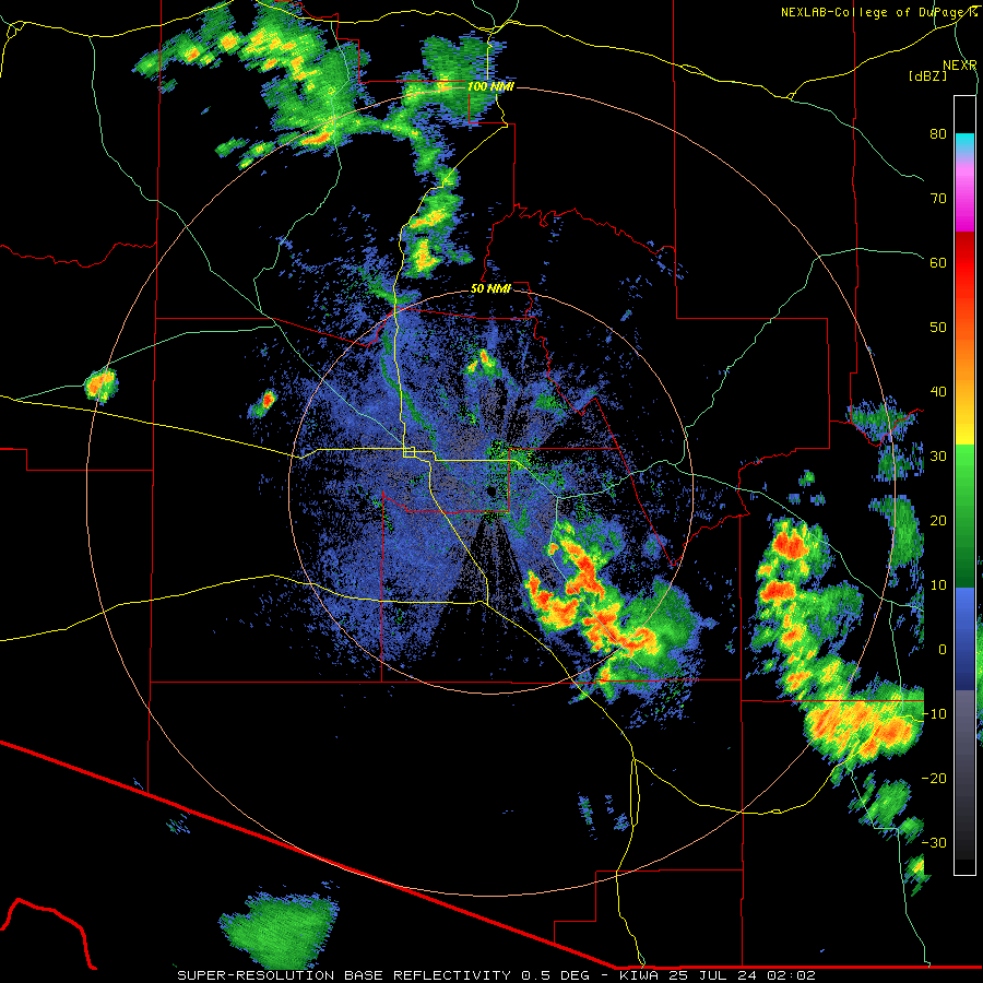
The west valley had some wild weather with a major microburst that caused a lot of damage (80mph winds). My family from Poland flew into town just before the skies erupted after sunset. Check out the radar loop and you'll see the outflows created the storms. I wish I stayed up to watch it but I was in bed by 8:30pm! It's humid out there this morning...may we see a repeat tonight???

-
Looks like your reeling it in this morning, huh?
-
 I just noticed this was posted...sorry for the delay, but I have pinned it so members can chime in. I Agree, the CFSv2 most noteably has been the mildest while the ECMWF a bit warmer with the potential reversal across the equatorial PAC. Is it going to be a La Nada? I doubt it. The CFSv2 has been lock steady on the oceanic waters to cool quickly in the 1.2 region during MAY/JUN, which they have to some extent, but to what level does it migrate west across the ENSO 3.4 region? My gut says we end up with a moderate La Nina and it will be central-based during the heart of the Autumn/Winter. If you take a look at the UKIE ( a formidable LR Global Climate Model) it is suggesting pretty much the same scenario as the CFSv2.

-
Here is some footage of the dust storm... https://www.facebook.com/FOX10Phoenix/videos/dust-storm-hits-the-303/1853845207997351/
-
It was an eventful evening yesterday across the west valley. A large wall of dust tracked south from the very strong outflows. It is a delightful 78F this morning and the smells of the desert aroma are evident from the rains yesterday. We have entered a legit Monsoon period for the rest of this week as daily storm chances exist. It peaks right around Wed-Thu so we'll see more storms I'm sure of it. I'm shocked that sky harbor only recorded 0.02" of rain yesterday even though that cell popped up right over the airport. I wonder where they have their weather instruments located at the airport. It could have very well rained on the west side and not the east side of the airport. Anyway, looking forward to this weeks of weather around here.
-
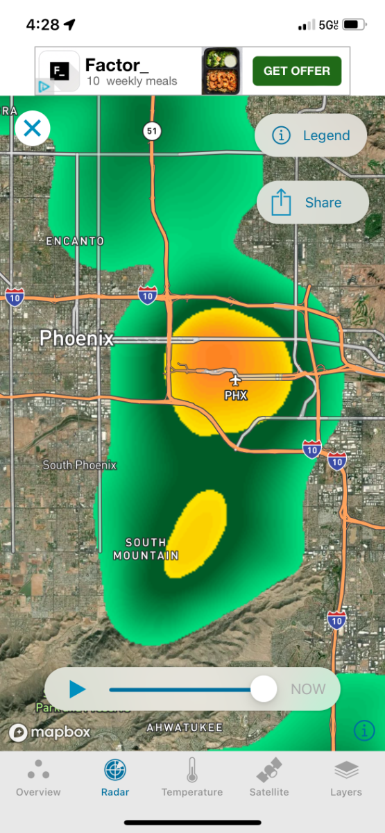
Outflow boundaries have popped up cells on the west side of valley and right over Sky Harbor…thankfully it’ll beef up the stats for the season!

-
Should get interesting here in a couple hours or so… F941F325-8AF6-416D-A2D0-4ADE0E2271ED.mp4
-
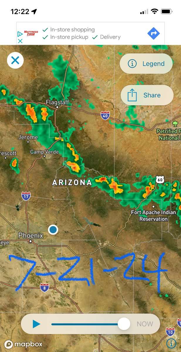
Already some severe warnings with that line coming down Rim Country…

-
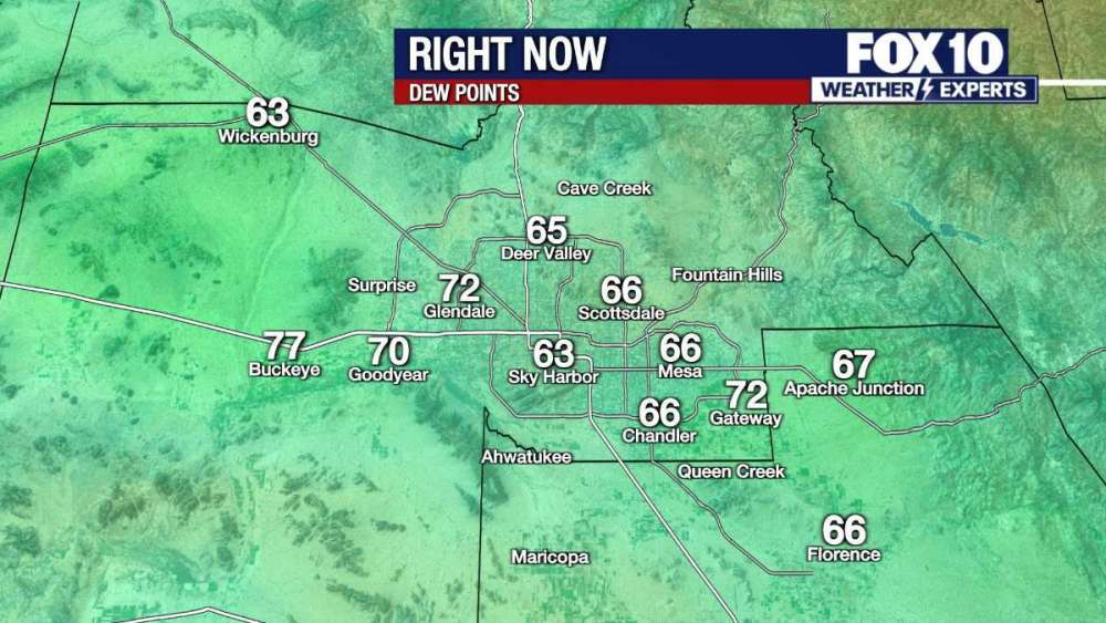
Alright, alright, alright...it looks like today will be the Valley's highest risk of severe weather from the Monsoon this season. It's soupy out there, DP's are well into the mid 60's and storms should really fire up early on today across the Rim country and push southwest into the valley. I should have a very good vantage point from my front deck looking northeast and see the Thunderheads forming as skies darken. Let's see how this shakes out. PHX take...

-
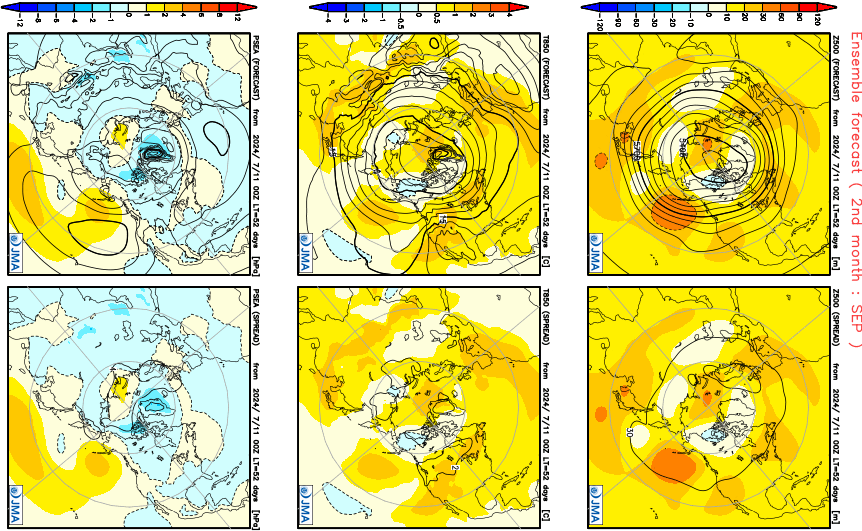
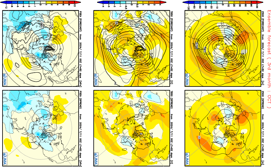
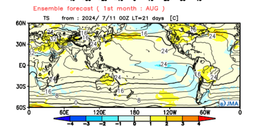
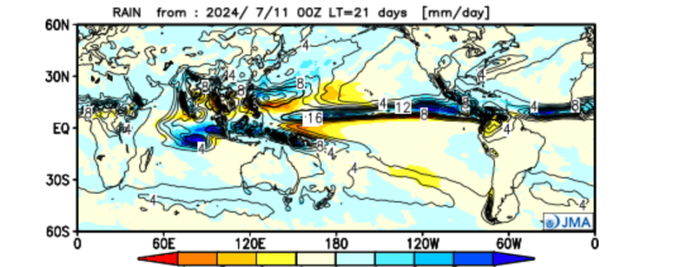
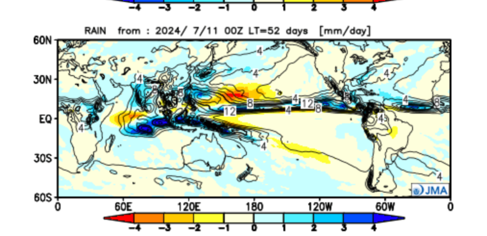
The latest JMA seasonal.... August.... September... October...


-
Here you go... https://ds.data.jma.go.jp/tcc/tcc/products/model/
-
You will like the JMA weeklies…pretty much a golden pattern to close out summer for the Plains…cool and wet! Speaking on the topic of a little wet weather…current situation… filtered-0681CB9F-A568-424A-B3FD-9769B7825730.mp4