-
Posts
4394 -
Joined
-
Last visited
Profile Information
-
Gender
Not Telling
-
Location
Grand Rapids, mi
-
Interests
some of my main weather interest are record events. and long range weather guessing (forecasting)
Recent Profile Visitors
3274 profile views
westMJim's Achievements
-
The official H/L yesterday at Grand Rapids was 81/57 there was no rainfall. The sun was out 87% of the possible time. The highest wind was 14MPH out of the SE. For today the average H/L is 83/63 the record high of 101 was set in 1916 the coldest high of 68 was set in 1915. The record low of 47 was set in 1977 the warmest low of 77 was set in 1916. The wettest was 3.49” in 2011. The July 2024 mean so far at Grand Rapids is 70.8 that is a departure from average of -2.0° The highest so far has been just 86 if that holds to the end of the month it will be the coldest maximum for any July since 2000 and the 3rd coldest maximum for any July at Grand Rapids. The low for the month is 47 there has been 5.56” of rainfall that is a departure of +2.32”.
-
The official H/L yesterday at Grand Rapids was 83/58 there was 0.23” of rainfall. The highest wind gust was 34 MPH out of the W. The sun was out 65% of the time. For today the average H/L is 83/63 the record high of 103 was set in 1934 the coldest high of 67 was set in 1911. The record low of 47 was set in 1953 the warmest low of 75 was set in 1940 and 1934. The most rainfall of 1.53” fell in 2016. The rainfall yesterday was kind of hit and miss. The official total at the airport was 0.23” while here in MBY there was only 0.02” I work out at the ballpark and I am not sure how much rain fell there but there was a brief heavy shower with some gusty winds. The overnight low here in MBY was 65 and that is the current reading with cloudy skies.
-
We are now just over 2/3rd through July 2024 it has been cooler and wetter than average July at Grand Rapids. The mean so far for July is 71.0 that is -1.8. it is the coolest mean since 2014. The highest so far has been just 86 the is the coolest high for any July since 2009 and the low of 47 is the coolest low for any July since 2001. There has been 5.33” of rainfall so far this month.
-
The official H/L yesterday was 83/63 there was 73% of possible sunshine. Yesterday H/L was right at average for the date and that is also today average. The record high for today is 101 set in 1934 the coldest high was 60 in 1992. The record low of 45 was set in 1947 and 1985 the warmest low of 74 was in 4 years the last one was 2012. The most rainfall of 2.65” fell in 2021. There was no rainfall overnight here in MBY and the overnight low was 58 at this time it is clear and 59.
-
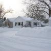
Wow, that almost looks like a lake effect snow squall
-
The official H/L yesterday at Grand Rapids was 83/59 there was no rainfall the sun was out 63% of the time. For today the average H/L is 83/63 the record high of 97 was set in 1934 the coldest high of 66 was set in 1974 and 1927. The record low of 43 was set in 1947 the warmest low of 74 was in 1940 and 1935. The record rainfall of 2.36” was in 1991. Currently was no rainfall overnight the overnight low was 64 and at the current time it is 69 with some clouds.
-
Earlier this week there were two events that could be classified as a derecho. Both were just west and south of the Grand Rapids area. We did get a good Thunderstorm and a lot of rain from the 1st one and less lightning are less rain from the 2nd one. Here is some information on derechos in general. Derechos can cause extensive damage, with wind speeds rivaling some tornadoes In the Midwest summer is full of all sorts of weather events, but few pack as much destructive power. A derecho can cause wind speeds of over 100MPH. Damage can be almost as severe as a tornado. And they cover a much larger area than a tornado. According to NWS data, derechos are most common between May and July, when nearly two-thirds of the events have historically occurred. Derechos develop with a “bow echo.” Thunderstorms experience a phenomenon called “updrafts” early in their formation, when warm surface air rises until condensation begins forming, ultimately transitioning to rain. This forces cool air toward the ground on the back end of a storm, which has the effect of generating strong winds near the ground. As the line of storms strengthens, updrafts continue on the edge of the storm and the mass of rain-cooled air at the surface expands the storm horizontally, pushing it forward more quickly and generating higher wind speeds. In certain instances, those winds sustain for hundreds of miles. Derechos can and have happened Michigan here are 3 of the bigger ones in Michigan. July 16, 1980: This derecho moved through extreme Southern Michigan. July 13, 1995: This derecho moved across Upper Michigan and Lower Michigan, causing millions of dollars in damage, three deaths, and several injuries. In Roscommon County alone, 100,000 trees and 100 miles of power lines were blown down. May 31, 1998: This derecho hit West Michigan, causing an average speed of 70 mph and winds of up to 130 mph. The storm killed four people, injured 146, and caused an estimated $172 million in damage. The Federal Emergency Managers Association declared 13 counties a Federal Disaster Area.
-
The official H/L yesterday at Grand Rapids was 76/55 there was no rainfall the sun was out 68% of the time. For today the average H/L is 83/63 the record high of 96 was in 1935 and 2013 the coldest high of 68 was set in 1941,1950 and 1969. The record low of 47 was set in 1979 the warmest low of 78 was set in 2013. The record rainfall of 1.80” fell in 1902. The overnight low here in MBY was a cool 53 and the current temperature is 54 with clear skies.
-
We are now past the halfway point of meteorological summer. The mean temperature at Grand Rapids so far this summer is 70.9. the highest so far is 94 on June 17th the low so far is 45 on June 11th there have been just 3 days of 90 or above. 8 days of 87 or above 12 days of 85 or above, one of them was in May. There have been 4 nights with low of 50 or below. It has been a wet summer so far with a total of 10.26” of rainfall. Average the 1st half of summer is 6.17” So it has been a wet summer with near average temperatures so far.
-
July 18, 1942, the overnight temperature dropped to only 80 degrees. This is the highest record maximum low temperature ever recorded in Detroit and ties the records set on July 1, 1931, and July 5, 1921.
-
The official H/L yesterday at Grand Rapids was 81/61 there was a trace of rainfall. The sun was out 77% of the time. The highest wind gust was 31MPH out of the N. For today the average H/L is 83/63 the record high of 101 was set in 1894 the coldest high was 68 in 1914 the record low was 47 in 1924 the record warmest low of 79 was in 1947. The most rainfall of 2.15” fell in 1969. The overnight low here in MBY was a cool 55 at the current time it is clear and 58.
-
The official H/L yesterday at Grand Rapids was 80/67 there was 0.23” of rainfall for the month GR is now at 5.32” that is +3.36” above average. There was 33% of possible sunshine yesterday. For today the average H/L is 83/63 the record high of 99 was set in 2012 and 1931 the coldest high of 67 was in 2009 the record low of 48 was set in 1958 the warmest low of 78 like the record high was set in 2012 and 1931. The record rainfall of 1.86” was in 1950. The overnight low here in MBY was 64 there was no rainfall overnight. At the current time it is clear and 68 here.
-
We are now about half was through July 2024. The mean at Grand Rapids so far is 71.6 the highest reading so far is just 86 there has been 5.10” of rainfall. At Lansing the mean so far is 71.7 they have official reported 3.96” of rainfall. The highest reading there so far is 88 and the lowest is 46. At Muskegon the mean there so far in71.6 there has been 1.71” of rain. The highest so far is 85 and the lowest so far in 46. So far this has been a rather typical July in our area.
-
We were lucky last night as the severe storms were to our west and south. Here in Grand Rapids the official H/L yesterday was 85/66 there was 1.90” of rainfall the peak wind gust was 39 MPH that came in the storms late Sunday into early Monday. For today the average H/L is 83/63 the record high of 97 was in 2012 the coldest high was 71 in 2014. The record low of 42 was in 1945, the warmest low of 76 was in 1931. The record rainfall of 1.47” was in 1988. A moderate thunderstorm rolled thur here last night, I had 0.30” of rainfall. The overnight low here was 67 the current temperature is 69 with mostly clear skies.
-
In looking at current radar trends it looks like most if not all of the severe weather will be to the south of the Grand Rapids metro area. At the current time it is sunny here in MBY with a temperature of 84 and a DP of 72 that DP is down from the 75 that is was a while ago.


