Phil
-
Posts
45781 -
Joined
-
Last visited
-
Days Won
275
2 Followers

Recent Profile Visitors
40729 profile views


Phil's Achievements
")


-
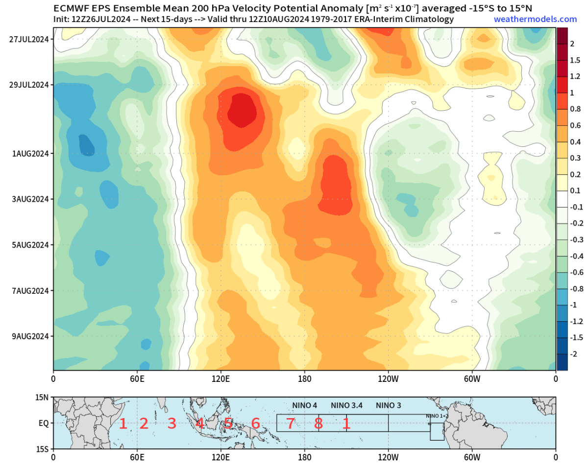
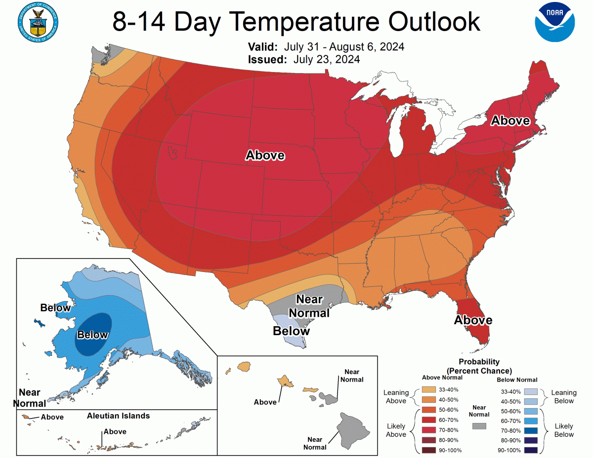
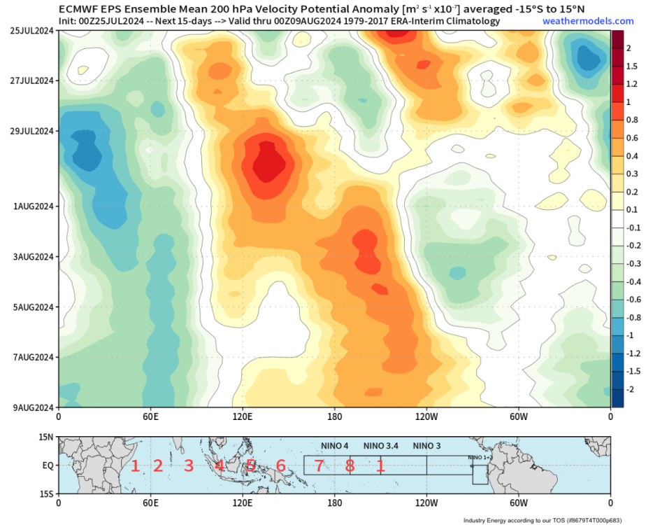
Not only will this period of constructive interference crank up the CONUS heat ridge, but it’ll also augment the +AMM and ignite the Atlantic hurricane season mid-August. Lots of westerly momentum transported to off-equator NH latitudes is an old school boreal midsummer post-niño response.

-
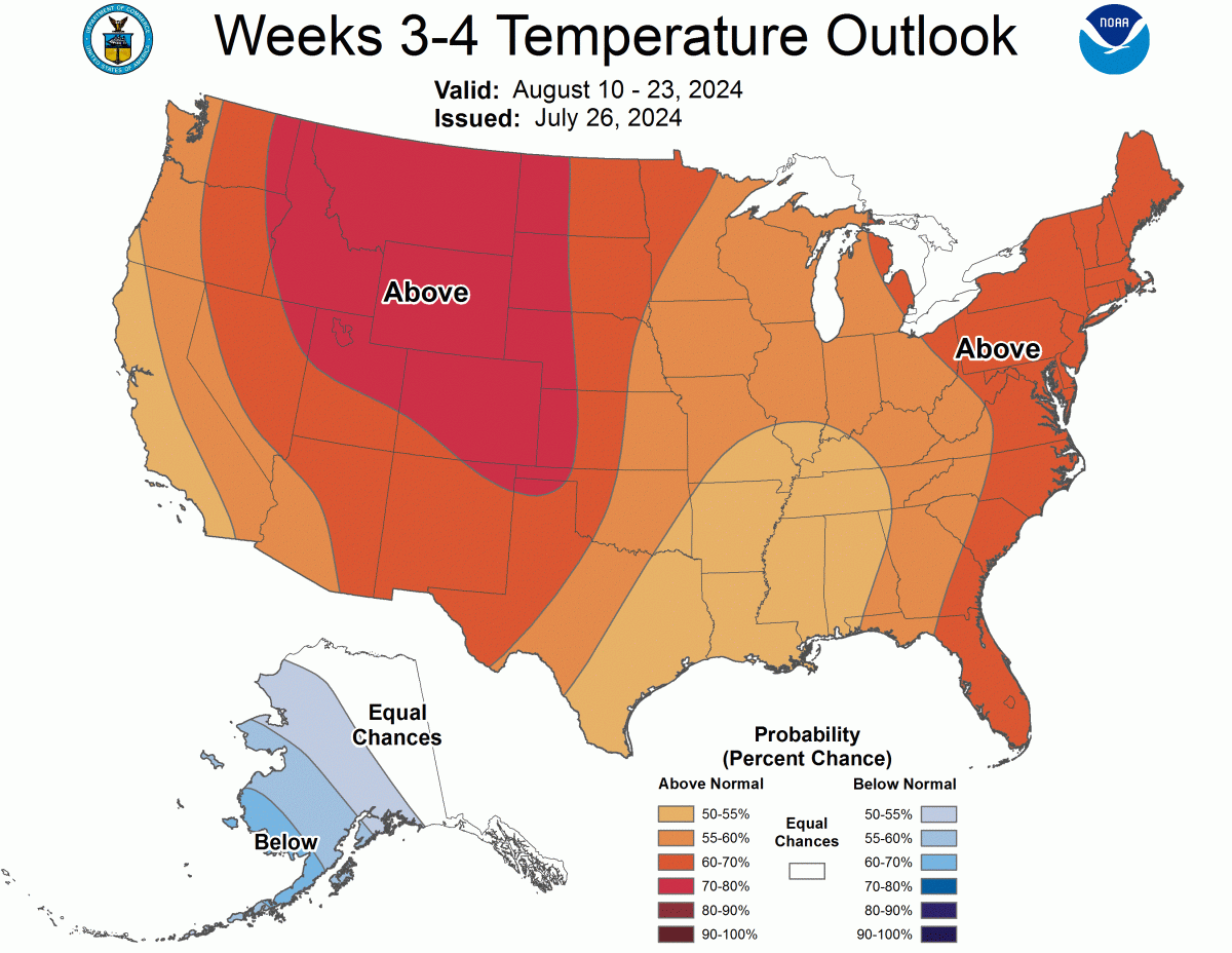
And weeks 3-4.

-
Here comes round-2.
-
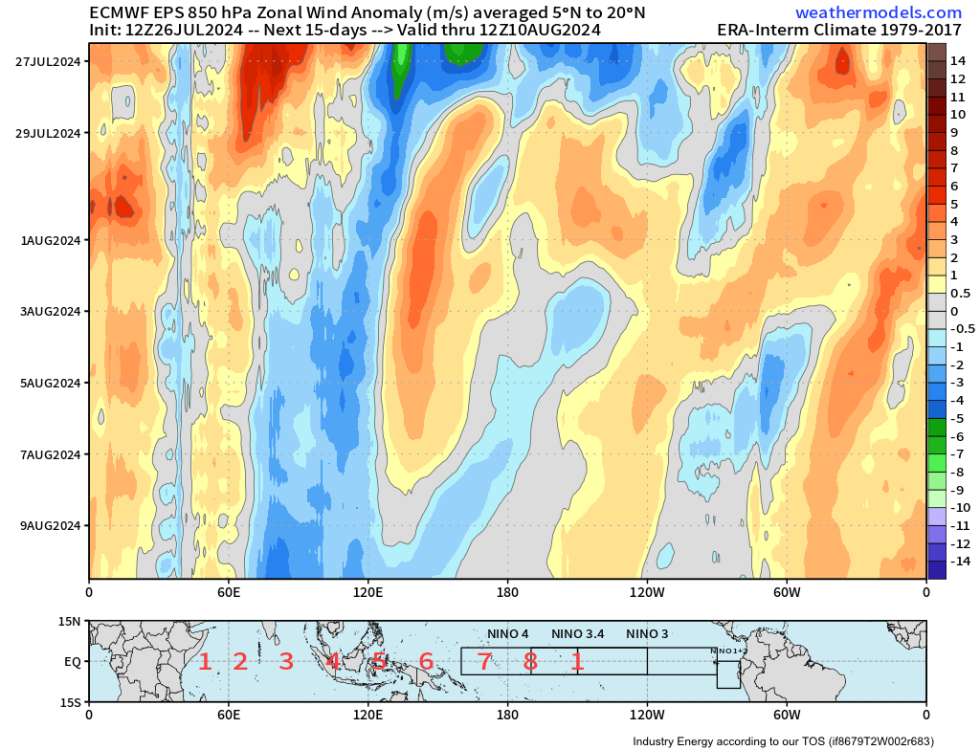
Interesting the EPS tropical forcing projection is misaligned with its middle latitude wavetrain(s). Last time this happened was back in late May. Will probably see a significant swing in its projected middle latitude pattern for week-2, similar to what happened last time.
-
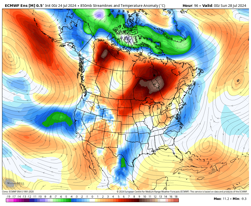
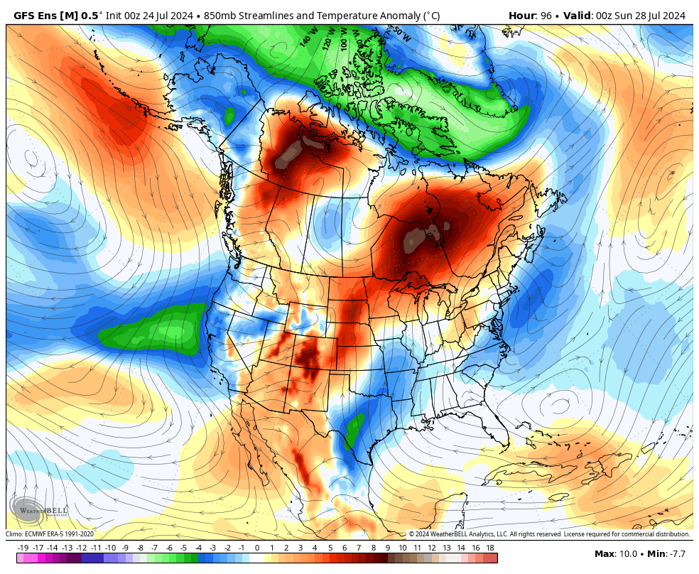
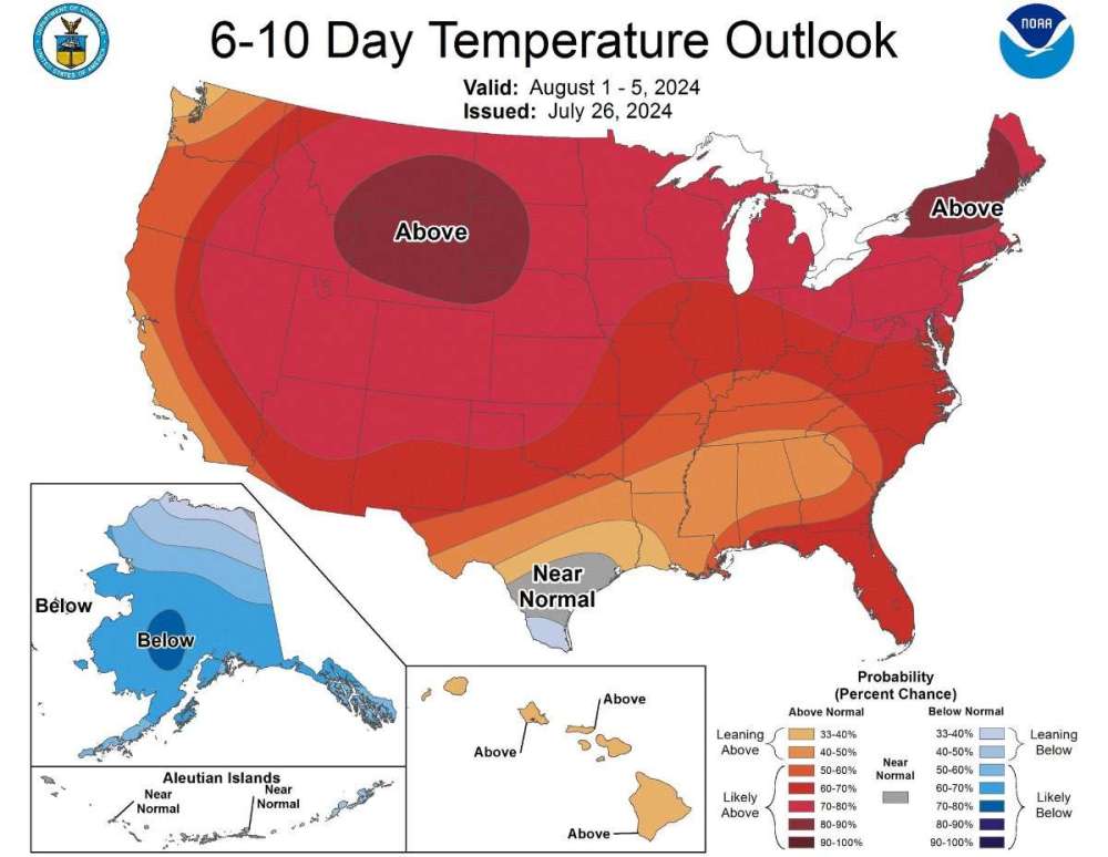
Man the next 6+ weeks are gonna be rough across the CONUS. Tropical forcing resetting with deep+slow 8/1/2 MJO/BSO (E-Hem) and -dAAMt. Much like June/July, I don’t think anyone will escape death ridge round-2. Everyone will get a turn in the oven.
-
First time since 2018 we’ve had a 100% cloudy day in late July! Loving it, high temp has been held to 85°F. But the anti-precip dome holds firm. 1.28” of rain at DCA, not a drop here. Recurring theme this summer.
-
Weird. I didn’t realize temps were calculated that way.
-
Starting to notice some haze on the horizon now. Milky white sky has replaced those deep blues. Thanks for the pollution, guys. Y’all never fail.
-
I think we’re talking about different things. My point was both the daily climatology and measured values averaged out to exactly 81.5°, but they were rounded in opposite directions.
-
Alaska is the place to be come week-2.

-
This doesn’t even address what I’m talking about. The individual high & low temp are rounded to the nearest whole number before the daily average is calculated, so that part is irrelevant. If the 24hr climate average is 81.5, that should be rounded to 82, as the observed 24hr average was.
-
Yes, but my point was they rounded the daily normal down but the measured daily average was rounded up. They should either round both up or both down.
-
90/73 averages to 81.5. Which should be rounded to 82. But the normals were rounded down to 81 while the daily temps were rounded up to 82. Don’t understand the logic behind that.
-
That’s what I thought, except the climate normals and measured temps are already rounded before they’re averaged. I’m sure there’s some logistical reason, but it’s moronic.
-
This is why we need a Yellowstone eruption.