


Eugene-5SW
-
Posts
146 -
Joined
-
Last visited
Posts posted by Eugene-5SW
-
-
34 minutes ago, Cascadia_Wx said:
Gorgeous photos. We’re actually planning a trip up that way mid month.
Perfect time of year. Pleasant temps and still some green on the hills.
-
 3
3
-
-
- Popular Post
- Popular Post
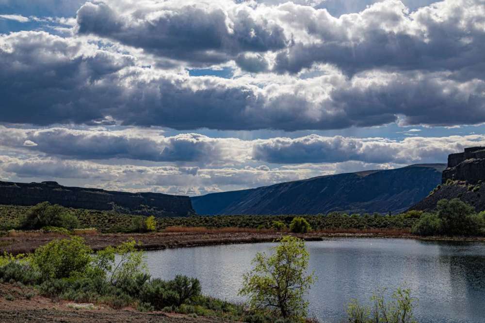
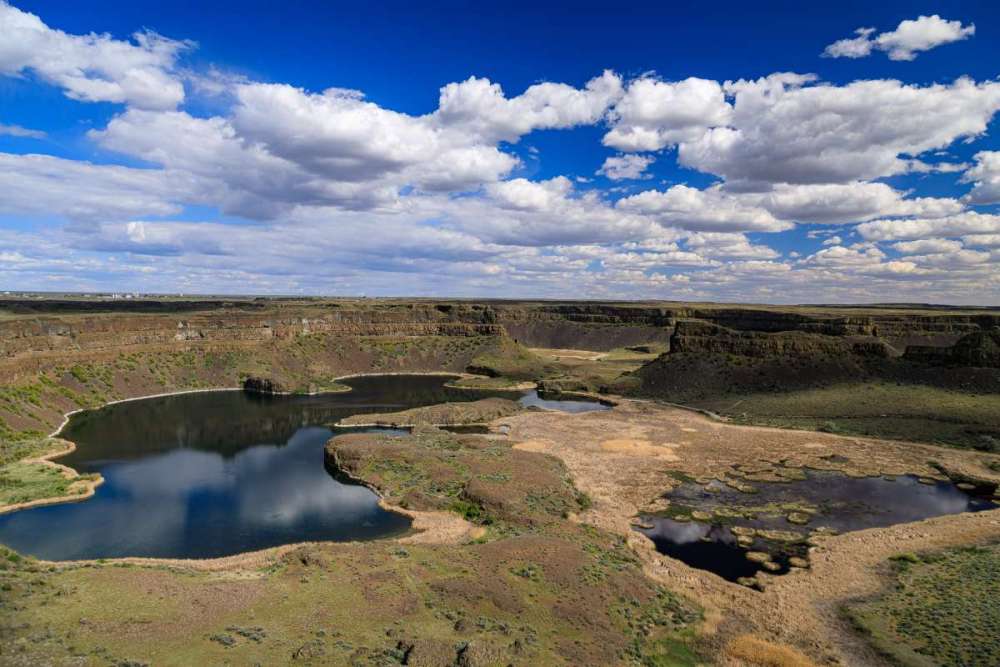
Cool clouds at Dry Falls State Park on Thursday:
-
9
-
 1
1
-
22 minutes ago, ShawniganLake said:
Figured the Oregon people would be checking in with some overnight rain totals.
1.55" here. Drought anxiety quelled at least until the next perma-ridge.
Sorry for the folks up north who are getting skunked on this one.
-
1
-
 2
2
-
 1
1
-
-
9 hours ago, Cascadia_Wx said:
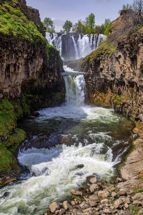
Is Celestial Falls another name for White River Falls?
Google tells me the whole complex is called White River Falls, but the lowest portion of it is called Celestial Falls. I should probably have used White River Falls as the caption.
-
1
-
-
- Popular Post
- Popular Post
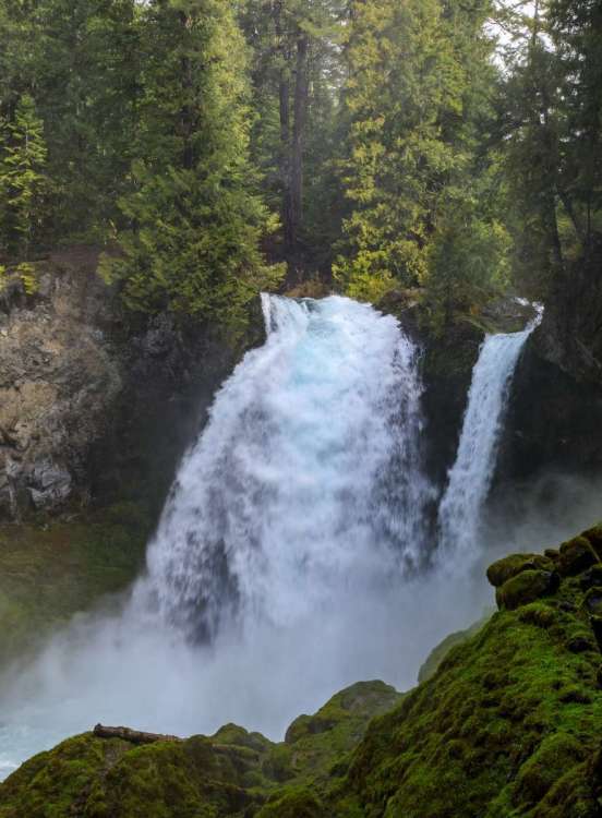
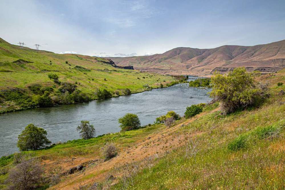
Day 1 of road trip. Perfect time of year with pleasant weather and green hills!
Sahalie Falls, Celestial Falls, Deschutes River at Columbia River, Riverfront Trail in beautiful Richland, WA.
Ran into some slushy snow over Santiam Pass but no issues.
-
11
-
1
-
Santiam Pass looks snowy enough for tomorrow morning that I moved everything around and delayed my 3-day Central WA road trip by a day.
Stops include the Hanford Manhattan B reactor tour, Dry Falls, Grand Coulee Dam, Ginkgo Petrified Forest.
Anything important I should add?
-
1
-
 1
1
-
-
I have as much drought anxiety as anyone, but this story was a bit over the top even for me:
-
1
-
-
15 minutes ago, Meatyorologist said:
how do you screw up mac and cheese that badly. mac and cheese. lord.
I once watched in disbelief as my sister boiled the macaroni and then dumped in the cheese packet without draining the water off first.
A measly underwhelming 0.13" of rain here. Getting the smoke masks and wildfire "go" box ready for this summer.
-
1
-
2
-
 1
1
-
 2
2
-
-
6 minutes ago, Phishy Wx said:
Rapture complete. I ended up in Hell though with Front Ranger
Is he showing you a bunch of stats he cherry-picked to prove it really isn't all that hot there?
-
1
-
4
-
-
11 minutes ago, SilverFallsAndrew said:
We were in the path of totality, but like you said it was August, school hadn’t started yet. The traffic was supposed to be terrible, but that was just media hype.
Definitely not just media hype. Took me 2.5 hours to get back to Eugene from my eclipse viewing site 60 miles away, and that was on back roads. Main roads were completely jammed.
-
2
-
-
29º crash from 78º yesterday to a midnight high of 49º today. Could have been even more dramatic if the front had arrived a bit sooner, as it didn't get above 46º during the day.
Rare rain over-performance too with 0.33" in the gauge and more coming down.
-
3
-
-
1 minute ago, Cascadia_Wx said:
I’m sort of surprised I’m having this discussion, but clockwise means the stuff on top goes to the right/downward, and the stuff on the bottom moves to the left/upward.
It all depends on where you're putting your axis of rotation. That has not been defined.
If it's the middle of the map, then we need more like a 45º clockwise rotation.
-
1
-
 1
1
-
-
27 minutes ago, Sunriver Snow Zone said:
?!?!?!??!?
They're on permanent standard time, not DST.
Like Phil said. Most of Arizona is on permanent standard time, and yet life goes on.
The exception is the Navajo Nation, which observes the typical DST schedule.
-
1
-
 2
2
-
-
20 minutes ago, Cascadia_Wx said:
Shame, it seems like they got rid of those nice easy to read snowpack maps that were divided up by basin. That or they changed their location and my old link doesn’t work anymore.
You probably know about it already, but this site seems to work OK for me: https://nwcc-apps.sc.egov.usda.gov/imap/
I like how configurable it is. It can show SWE by basin, or individual snow amounts by station, among much else.
-
1
-
-
4 minutes ago, Dave said:
It snowed for about 20 minutes at around 8:30 tonight. The amount of stickage was nope. EUG didn't report any though on the 5 minute obs. Currently 34 degrees which is 2 degrees colder than EUG. The airport is usually colder, but not always. Some other nice person added a personal station to the wunderground network that is only a block a way. Now I got one that is two blocks away and one that is one block away. I don't even need to look at my thermometer any more.
https://www.wunderground.com/dashboard/pws/KOREUGEN393
https://www.wunderground.com/dashboard/pws/KOREUGEN497
I'm pretty much sandwiched in between them.
34º too up here at 850' with rain only. Porch light test negative.
Wonder how @Eugene Snow is doing at 975'?
-
2
-
-
- Popular Post
- Popular Post
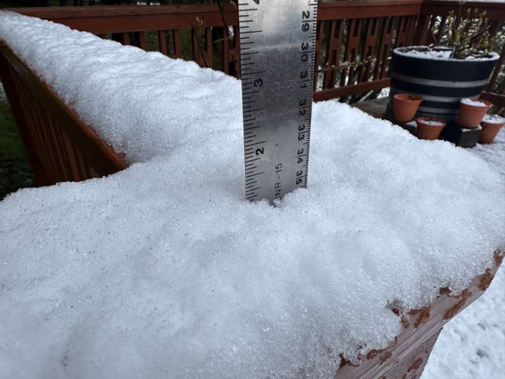
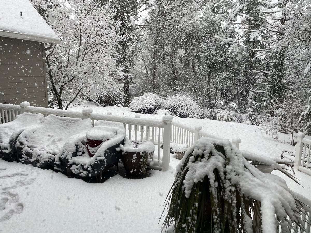
9 minutes ago, LowerGarfield said:What did you measure?
A Slushy Inch!
-
8
-
2
-
 2
2
-
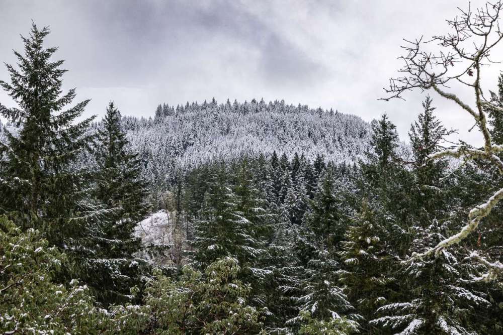
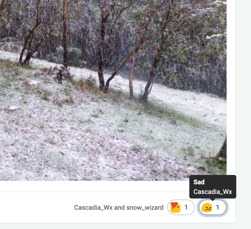
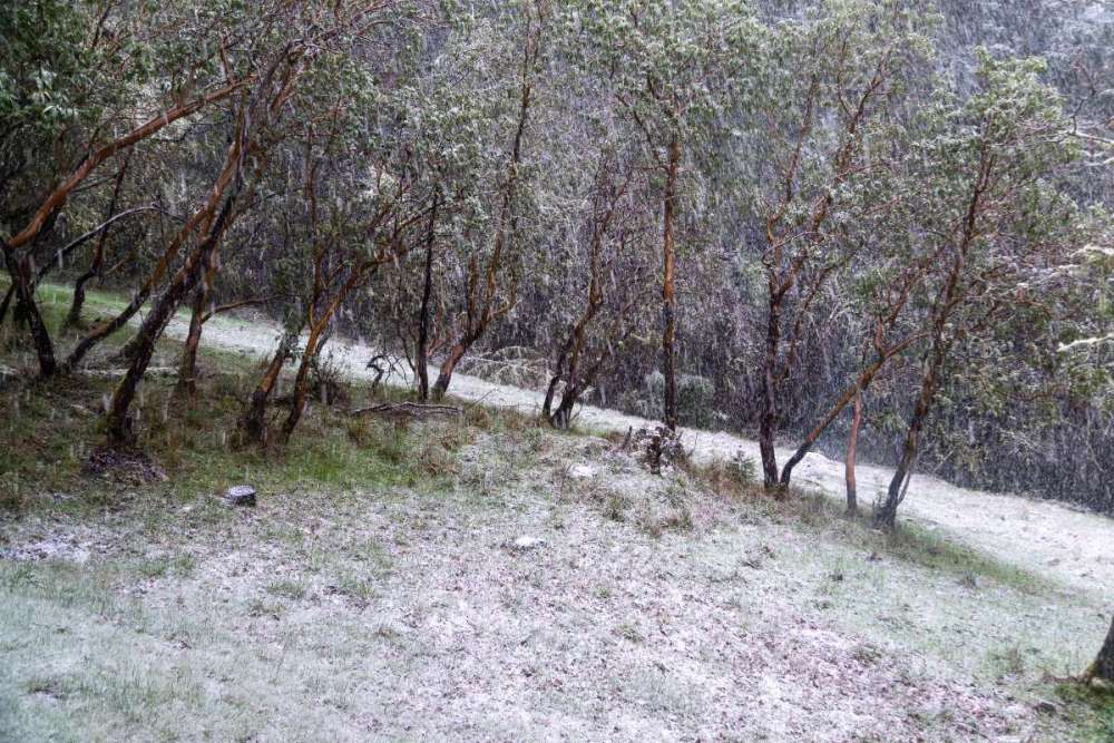
57 minutes ago, Eugene Snow said:
Woke up to 2-3” on the ground, decent shower right now.
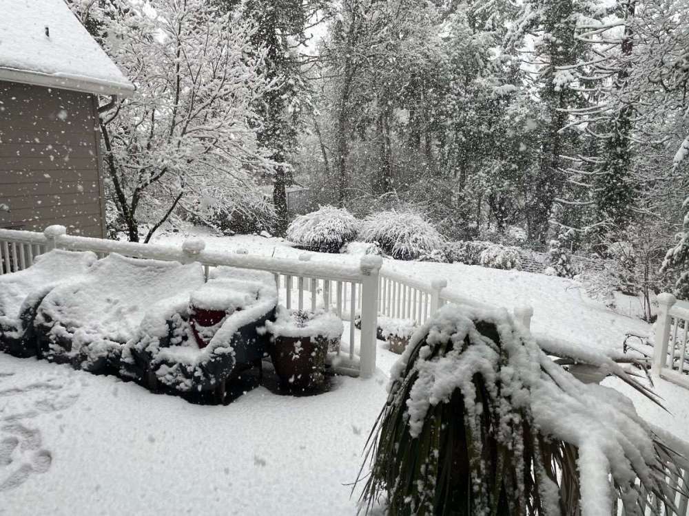
What a difference 120 feet makes!
You can see it on the ridge across from me with a sharp cutoff above which the snow is much heavier.
-
8
-
 1
1
-
-
Nice to see that the valley folks scored!
About 3/4" on the ground here with more coming down. So pretty!
-
4
-
1
-
-
I was pretty happy about it, actually.
-
1
-
1
-
1
-
 1
1
-
1
-
 1
1
-
-
33º with some sticking snow here
-
8
-
1
-
-
Florence the big winner for coastal snow on tonight's Euro with 30"!

-
2
-
-
1.03" on the day, 1.27" storm total, 4.51" on the month, 24.06" on the water year.
Snowflakes mixed in with the heavier showers. Looks like a sunbreak is on the way. All good stuff!
-
2
-
1
-
-
34º with light rain and some flakes mixing in. About what I expected.
1.04" storm total so far a bit better than I expected!
-
1
-
1
-
-
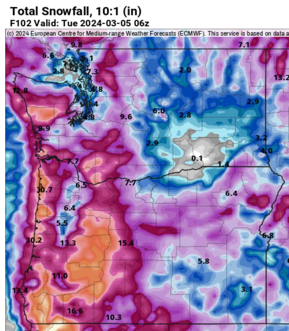
As long as ECMWF is fixing snow maps, I wouldn't mind if they'd fix QPF amounts while they're at it.
All the global models are usually too bullish on QPF for my location, but the Euro is by far the worst. It routinely shows 2x-3x the actual amount right up to the event. I know some of it is terrain bleed, but it seems like actual QPF amounts rarely verify even at favored locations.


May 2024 Pacific Northwest Weather
in West of the Rockies
Posted
Just squeaked out 1.01" on the day to go with 1.03" yesterday for rare consecutive 1"+ days. I've never seen that in May before, and could find only 2 instances in the EUG historical record (looks like they didn't make it to an inch today).
Up to 32.5" on the water year (Oct. 1 to date), which is close to normal and a big improvement on last year's ~26" at this point.