
Winterdog
-
Posts
2667 -
Joined
-
Last visited
-
Days Won
2
Posts posted by Winterdog
-
-
I never thought it would come to this but please verify 0Z GFS. The GFS kicked butt for the past several days while the EURO, the ICON, the GEM and several other AI models got embarrassed and will all be moving towards the lowlife GFS. Go GFS, go Huskies!
-
 2
2
-
-
6 minutes ago, MossMan said:
We are European and Canadian fans along with those new fancy models like the Sphere or whatever it is.
So nothing changed from last night. Thanks. Something is going to change before this day ends and I hope it’s the Goofus
-
2
-
-
3 minutes ago, Phishy Wx said:
one more run in the morning and ill be pretty convinced
I won't be convinced until I see snow accumulating on my eyebrows and uncut nose hairs as I stare into the floodlights from our deck
-
2
-
 1
1
-
-
35 minutes ago, SpaceRace22 said:
No
No biggy. Thanks for the honest reply.

-
2 minutes ago, SpaceRace22 said:
The Euro and GEM are definitively more accurate at this range, and it's not unheard of for the GFS to get a pattern just straight up completely wrong in this timeframe. I think it's quite clear which models to trust and which to discount in this scenario.

Please post one of those for a winter month.. thanks
-
13 minutes ago, TT-SEA said:
EPS control run is faster... quite a bit of a SE shift at 144 hours compared to 12Z run at 150 hours.
And plenty of arctic front snow for Randy!
Why do we get so excited over a control run? I really am curious.
-
My App is in good form again!
-
3
-
-
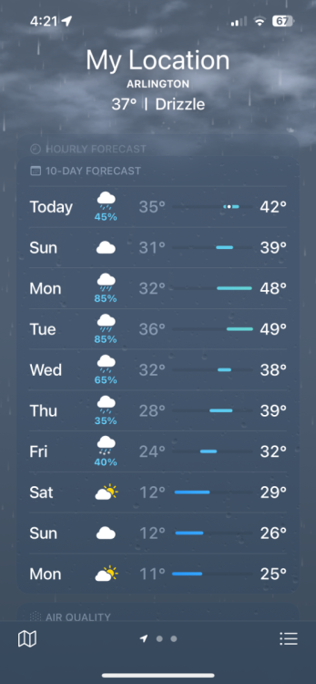
High of 41 at midnight and a low of 36. .22" of precip, .63 for the month and year. Currently 37 with partly cloudy skies and a nw breeze
-
1
-
-
15 minutes ago, Christensen87 said:
Yeah, I’ll be surprised if Euro doesn’t cave tonight. Bummer.
Nope, it has to be a day or two later to maximize the misery of the second rug pull.
-
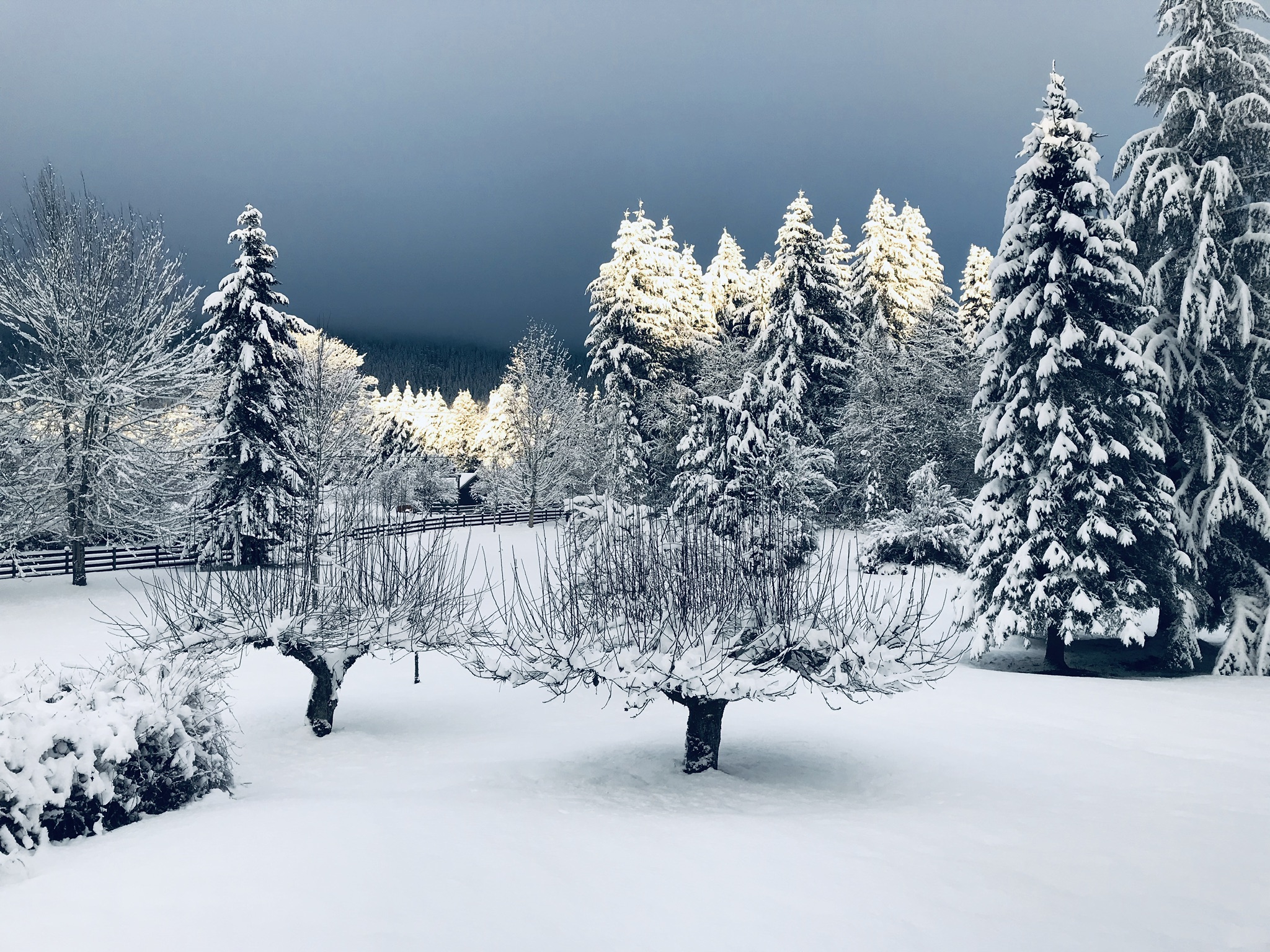
Just had a graupel shower and sitting at 39 degrees.
-
2
-
-
Had a midnight high so far of 41 and a low of 36. Did have a shower of mixed rain and snow earlier, currently 39 and partly cloudy.
-
1
-
-
33 below in Trail BC. This is as cold a run as any we've seen.
-
1
-
-
This is looking so good I think we might have a chance at another meltdown!
-
2
-
1
-
 4
4
-
 2
2
-
-
Rob will be pleased with that cold pool in eastern Washington. It looks like a slow but dry warmup for most of us in Western Washington.
-
1 minute ago, TT-SEA said:
00Z ECMWF was really a good run... arctic front and entrenched cold air and then an overrunning event that didn't even scour the cold out and was snow from start to finish from Salem northward.
But as you said last night the run is really a moving target. It will likely trend to the warmer solutions. I'm not trying to be negative but it comes so naturally for me.
-
There is snow mixed in with the rain here! Very evident. 36 degrees.
-
1
-
-
After the carnage of last night's runs, this morning feels like we are returning to a burned out home looking for surviving remnants. 36 with snow on the top of Jordan Ridge at 2000 feet.
-
 1
1
-
-
10 minutes ago, TT-SEA said:
Bellingham? Vancouver?

Anywhere north of Seattle?
-
It would sure be cool to have the GFS rebound back on the 6Z
-
3
-
-
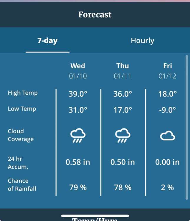
Shows me at 23 degrees at 4pm on Thursday with 2" of snow. I'll take that. I don't need single digits, just a couple inches of snow and freezing temps.
-
2
-
 1
1
-
-
Just now, Cloud said:
The GFS got its inevitable yet expected bad run in. That was a complete crash and burn. Crap like this makes it extremely hard to defend this model.
That is the worst “bad run” I’ve ever seen
-
1
-
-
My Davis App just updated. It must be based off the UKMET.
-
1
-
-
7 minutes ago, Mid Valley Duck said:
Here are the most recent verification scores at day 6
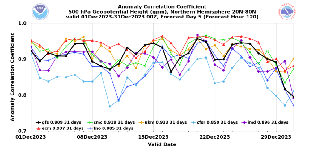
Wow, I remember the UKMET being an absolute joke a couple years back during one of our big arctic flops. It was showing -22 850's with blizzard conditions over the entire NW while the other models were cozied up under their sunlamps. I thought it was a joke before that and more so ever since.
-
9 minutes ago, Frontal Snowsquall said:
It usually scores 2nd right behind the EURO. GEM is 3rd and the GooFuS is 4th.
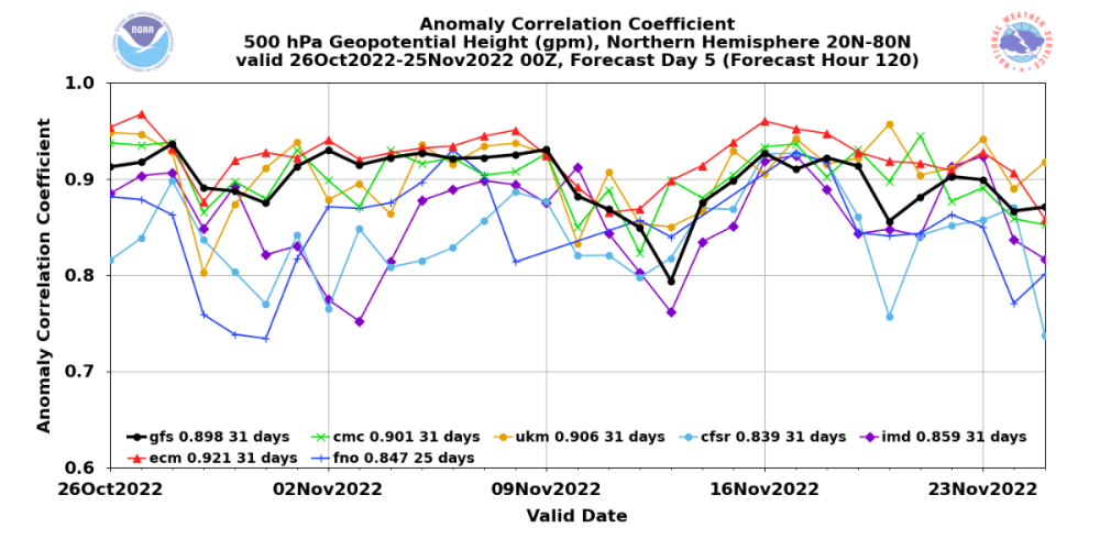
That is for only one month, October to November 2022. All the other models probably had Covid and didn't perform up to standards.
-
1
-
1
-
 1
1
-


January 2024 Weather in the PNW (Part II)
in West of the Rockies
Posted
It looks like I'm likely not getting any snow out of this. Gets chilly for a couple days. I'm pleased that I spent many hours each day for the past 8 days surveying every little wiggle in all the models to end up with essentially a zero result. Speaking of wiggles. Pretty cool how the Euro wiggled it's way eastward over the past several runs. Those little wiggles add up!