
- Popular Post


VancouverIslandSouth
-
Posts
3512 -
Joined
-
Last visited
-
Days Won
7
Posts posted by VancouverIslandSouth
-
-
25 minutes ago, ShawniganLake said:
Sticking snow is still being driven by precip rates though. It’s 35 and raining lightly here just to the north of this webcam.
Only 33F down here now. Most of our precip came in the form of hail with just a brief bit of snow at the end of it. Still enough to make everything turn white.
-
 2
2
-
-
6 minutes ago, Rubus Leucodermis said:
Small hail now.
Just one step away from thundersnow.
-
1
-
 1
1
-
-
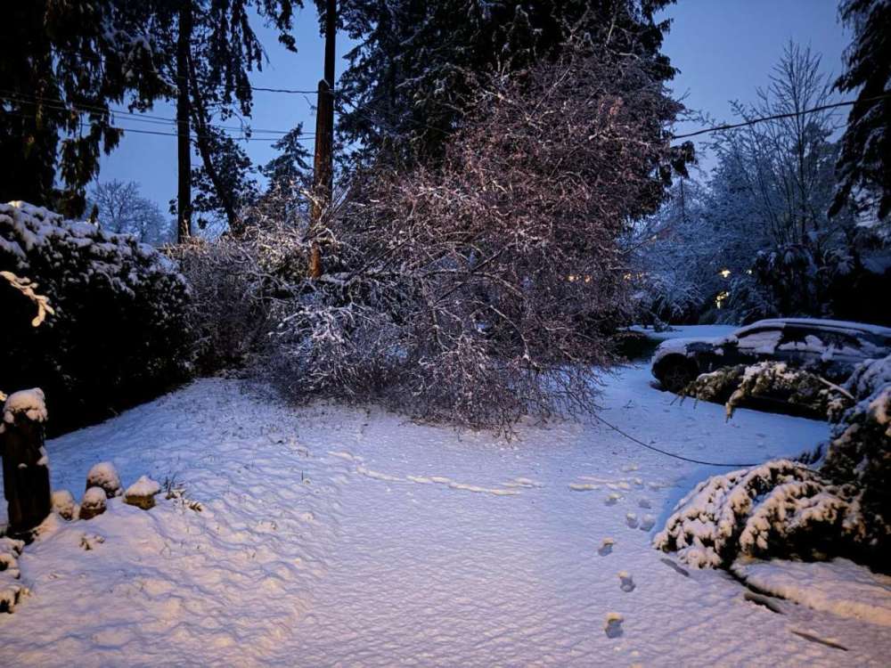
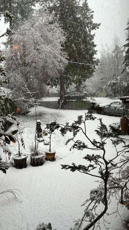
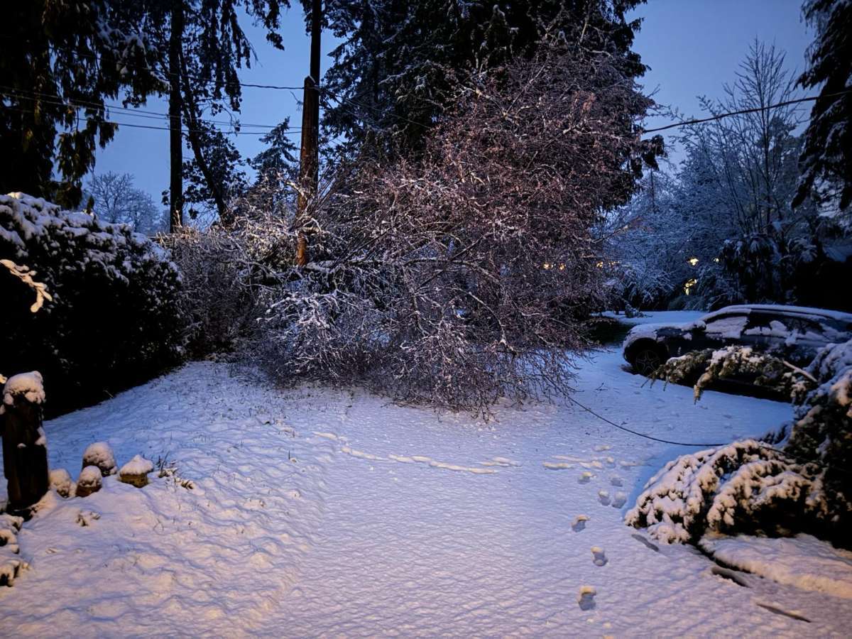
Yikes, sounds like trees are starting to come down in Nanoose. That heavy band has just been hanging over there. Some parts must be approaching 6". This is from a few hours ago, seems like a very wet snow
-
3
-
-
Wow, snowing up near Shawnigan. Seems like the band is stalling out just north of here. Still have yet to see a drop of rain in this part of Victoria. I miss those surprise snowfalls, Victoria seems utterly incapable of getting in on this type of event.

-
6
-
-
Been watching the web cams up near Parksville, the Tigh-na-mara one at Rathtrevor Beach looks pretty cool:
Absolutely dumping snow in Nanoose now -

-
4
-
-
1 minute ago, TT-SEA said:
Updated through 9 a.m. so far... total snow.
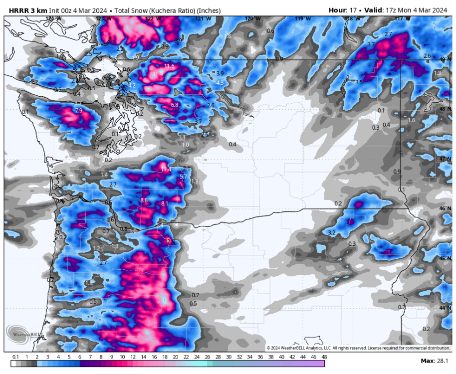
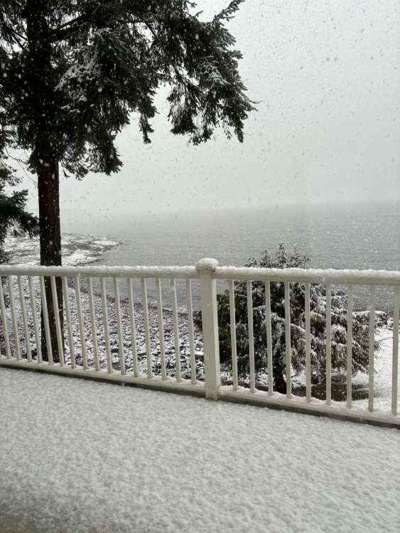
Seems a little too far south with the placement. My parents sent these pictures, there's heavy snow over the Strait of Georgia now. There's probably several inches in that area by now, particular further from the water.
-
3
-
 1
1
-
-
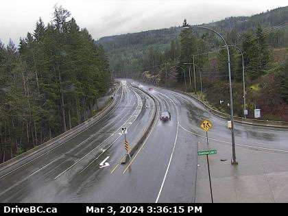
41 minutes ago, ShawniganLake said:
Yea there is nothing on the ground here even up above 1000ft.
This webcam is 1100ft elevation. Interesting to note, there is a subdivision at the top of the ridge in the background. I’m guessing it’s probably around 1500ft. Maybe a bit more. I think it’s the highest elevation area on Vancouver island with a housing development.
Just 100 miles north there's heavy sticking snow right beside the ocean. I'd never guess it looking at the conditions around here. Feels like spring with sun breaking through the clouds.
-
2
-
-
Heavy snow is working its way back into Nanaimo now. There was nothing there an hour ago.
-
7
-
-
4 minutes ago, ShawniganLake said:
Looks like there might be some deformation setting up just to the NW of Duncan, with that small Low spinning towards southern Vancouver island right now. Some flakes are mixing in around 1000ft towards Lake Cowichan but it isn’t sticking yet.
This would have been an ideal low placement if we had any Fraser Outflow. We would likely be getting absolutely crushed right now if that had happened
Yeah, probably comparable to Feb 2017 if that were the case. There's legitimate cold air in the BC interior and even outflow coming out of the north coast. This pattern is just kind of stuck with nothing to drive it through the Fraser.
Looks like the snow's starting to stick at sea level in Nanoose now:
-
2
-
-
12 minutes ago, ShawniganLake said:
42F with some occasionally rain showers.
My parents said it's snowing up in Nanoose now. Not even getting rain showers in Victoria, but it looks convective around Langford.
-
4 minutes ago, ShawniganLake said:
43F and sunny with a gusty SW wind this afternoon.
Looks quite snowy up around Comox. March has been such a dud month in Victoria. In the 8 years I've been at my current location I've only recorded about an inch of total accumulation. Definitely my least favorite month of the year weatherwise. I've got to start prioritizing vacations for this month rather than Nov - Feb.
Seems like the main band is north of Campbell River now:
-
4
-
-
3 minutes ago, ShawniganLake said:
Still in the Vancouver island rain shadow right now but the showers just south of here are falling as snow.
36F and snowing here in Victoria now.
-
5
-
-
- Popular Post
- Popular Post
Dumping snow in Port McNeill near sea level in Northern Vancouver Island:
-
9
-
1
-
 1
1
-
 1
1
-
1
-
4 hours ago, ShawniganLake said:
28/18 that day. Perfectly tolerable temperatures for palm trees. Also snow is a great insulator and there was plenty of it on the ground.

Trachycarpus fortunei (windmill palm) can handle more extreme cold than a lot of the typical landscaping here. There are some growing in Bulgaria that have survived temperatures down to -17F. My palms breezed through the coldest day in decades this past January (average temperature 14F with brutal winds). In contrast several of our rhododendrons were freeze-dried to a crisp and might not survive. The remaining cordylines in the area were wiped out to the ground, but most were wiped out in previous years as they have hard 18F tolerance range. I've also noticed some very large eucalyptus trees that look completely dead, some in various precarious spots near the road.
-
3
-
-
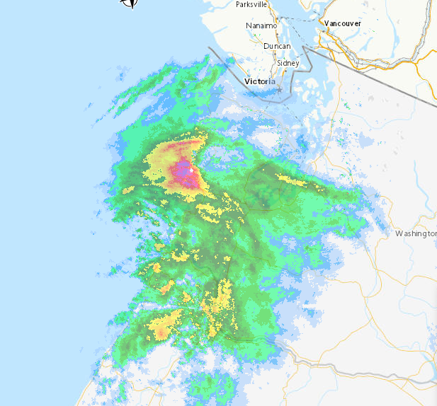
The low is looking surprisingly well defined:
-
4
-
-
5 minutes ago, ShawniganLake said:
Could happen if the deformation bumped much further north than modeled. Seems pretty unlikely right now.
The angular momentum is the thing to watch for. It seems like this thing is set to get squashed through the Puget Sound. If the rotating band can't move further east it will get squeezed to the north while the low collapses into it. I think that's what some of the mesoscale models have been catching.
-
1
-
-
3 minutes ago, ShawniganLake said:
6-8” as far north as southern Vancouver island.
 Okay!
Okay!
We need more northerly momentum or a faster rotation. It could happen with a well-placed deformation zone. The dynamics are favorable with a slight nudge to the north.
-
8 minutes ago, snow_wizard said:
The ICON is just so dry for the east side of Puget Sound. The ECMWF has been the wettest model by far that area.
Getting into radar over model watching hour now.
-
8 minutes ago, TT-SEA said:
00Z NAM has updated.
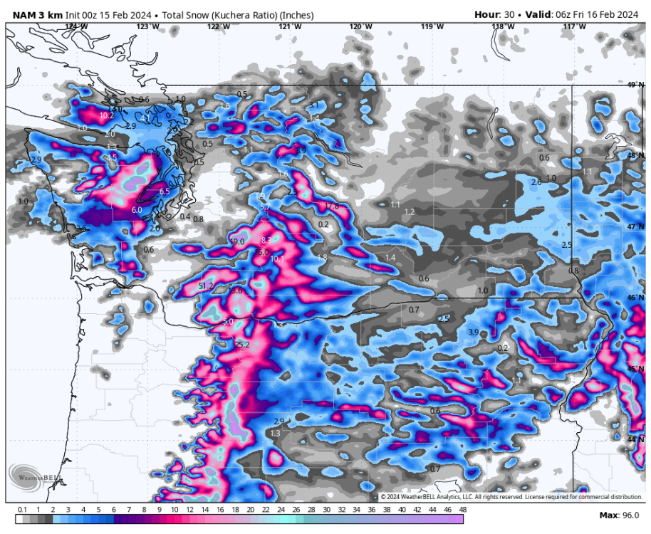
That's wild, like 4~5" here if that verified. Seems like some of the recent models have upped the amount of moisture jumping north of the Olympics. There was light snow in Victoria this morning at 41F. It evaporated almost instantly when it hit the ground. Pretty amazing to see snow at such warm temperatures.
-
1
-
-
48 minutes ago, TT-SEA said:
One interesting aspect of this system is that the ECMWF has been consistently showing temps a little warmer towards the foothills in the middle of the night tomorrow during the precip. This is the opposite of the last event with cold air coming through the pass.
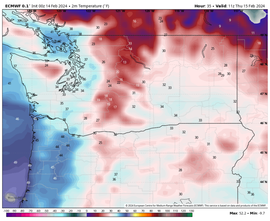
Almost like a reverse of the typical Fraser Valley outflow there, yet the precip still gets wiped out at the border.
-
22 minutes ago, Sunriver Snow Zone said:
00z gfs trended south! Snow totals are low though
Feels more like it trended west, heaviest precip totals remain well offshore.
-
2
-
 1
1
-
-
- Popular Post
- Popular Post
4 minutes ago, MossMan said:Tim does not want any more snow until December 24th 2024!
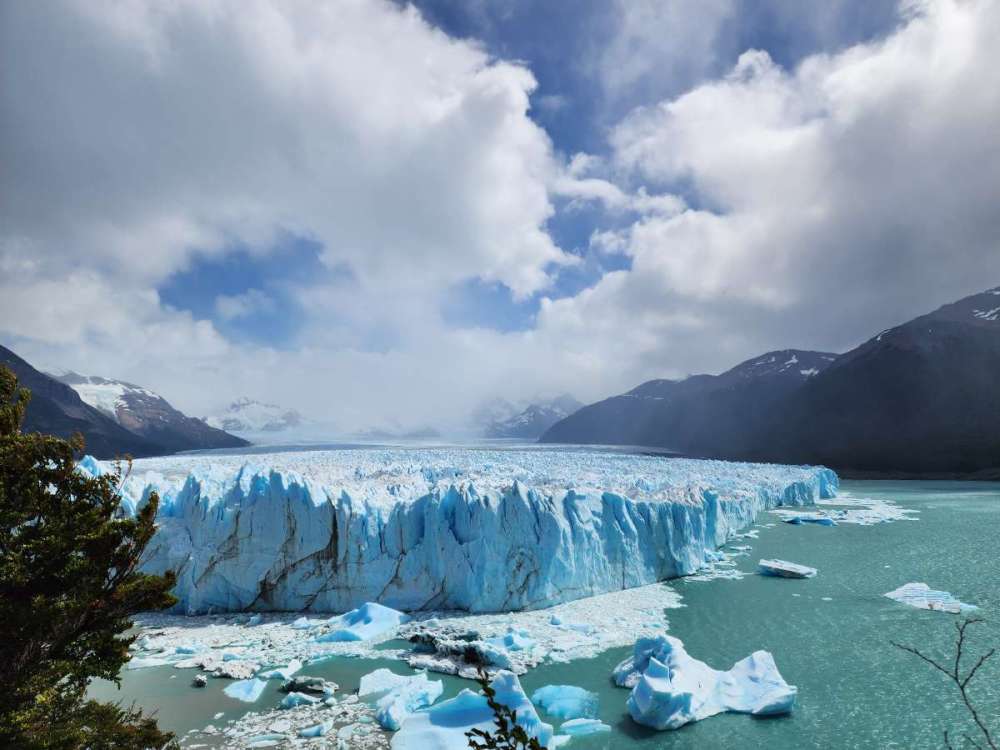
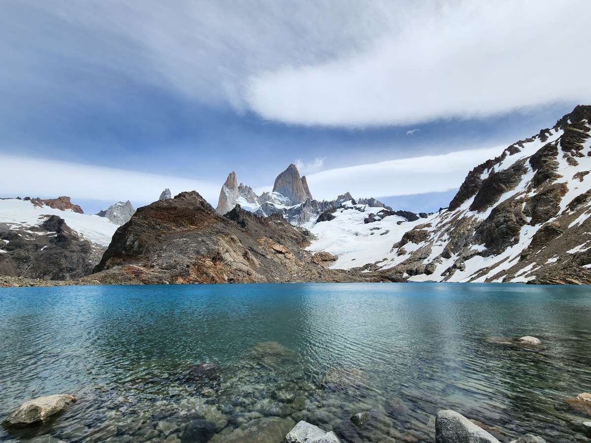
Don't worry, I'm going to be in SE Asia end of next December/early January. We got a Feb 1989 redux while I was in Argentina this January. Expect a full on Dec 1996 redux next year.
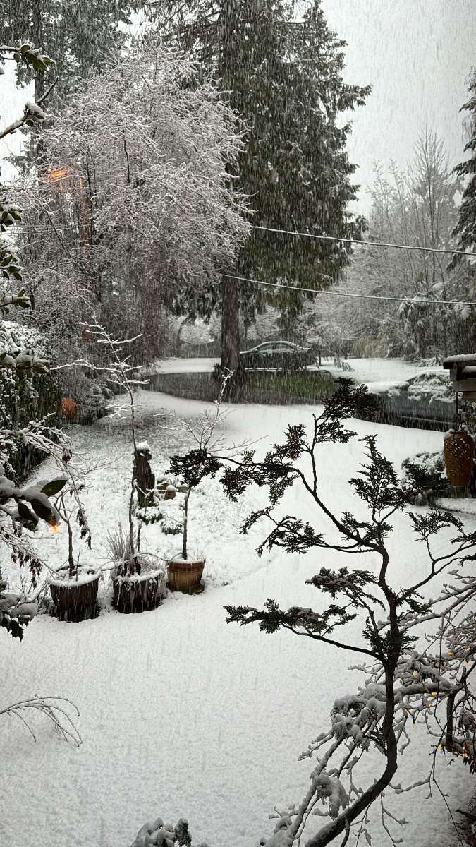
Something like 12" of snow in Victoria last month while I was out, but this is the only thing resembling snow I've seen this winter:

-
11
-
12 minutes ago, Mid Valley Duck said:
UKMET landfall is Coos Bay but the precip shield is shunted far to the south. My house doesnt even get a half an inch of precip.

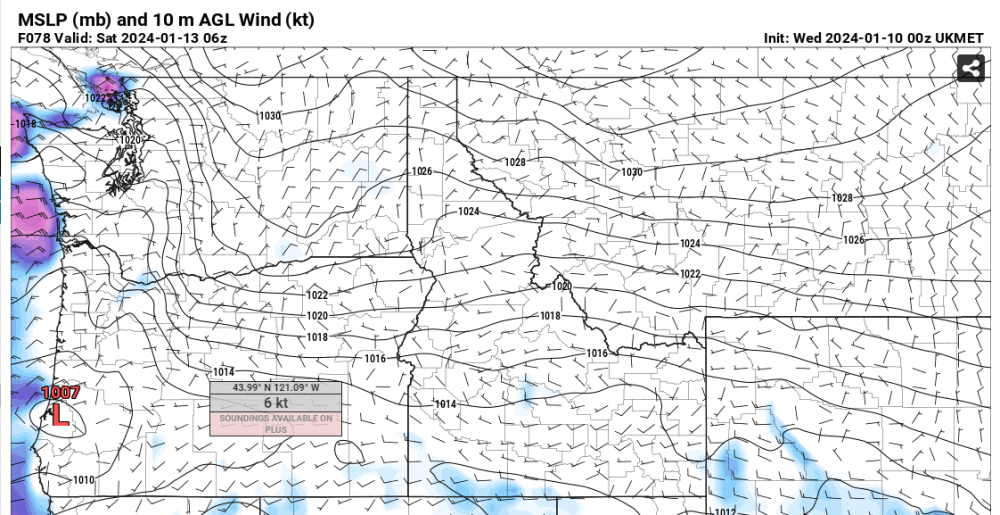
That small area on the East Side of the Vancouver Island around Nanaimo is gold. Even if the event misses the area by hundred of miles as long as there's Arctic air flowing over the Strait of Georgia there will be at least something there going into a blast. They got a bunch last night too.
-
2
-
-
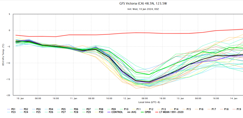
The 0z GFS operation is still considerably warmer than the majority of its ensembles from Friday onward.
-
3
-


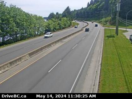
March 2024 Weather in the PNW
in West of the Rockies
Posted
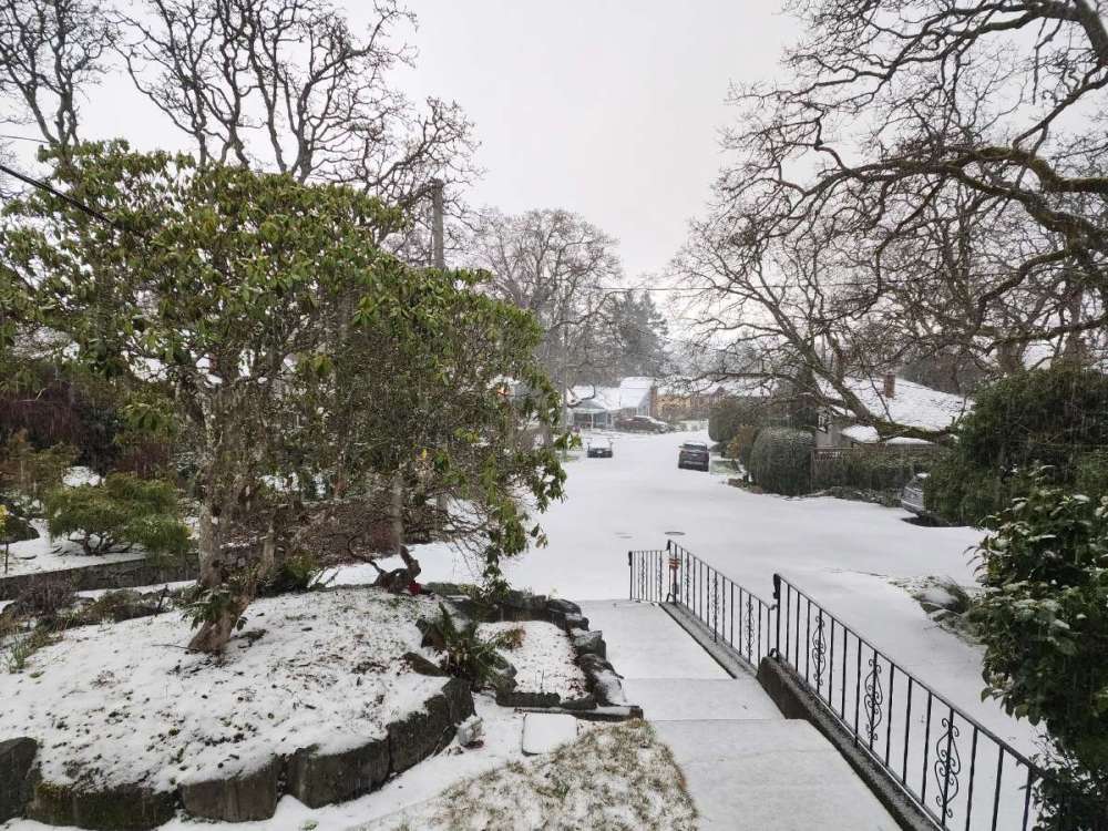
Had a surprise dump of snow around mid-day in Victoria. It only amounted to about 1/2" but still the best daytime March snowfall I've seen in this location. It also kept the daily temperature spread quite low at 38F/34F, not what I'd expect for this airmass.