


Hawkeye
-
Posts
7173 -
Joined
-
Last visited
-
Days Won
17
Posts posted by Hawkeye
-
-
It is looking very boring across the northern US for quite a while after this system leaves.
-
 1
1
-
 1
1
-
-
Ugh... days of models showing 2" of rain here, now it's crapping out.

00z UK
-
2
-
1
-
 1
1
-
 1
1
-
-
Every run of the GFS just gets drier for eastern Iowa and points east.
-
1
-
-
The rain was pretty light today, but it really lingered. I finished with a decent 0.32". That's at the high end of the model range.
-
5
-
 1
1
-
-
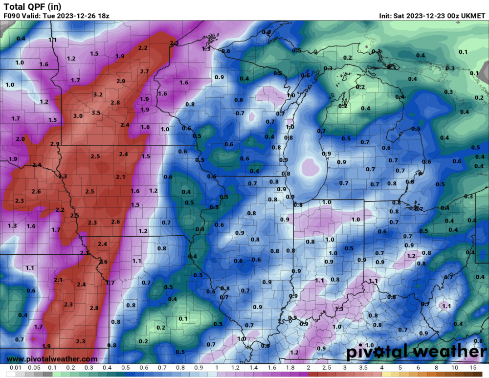
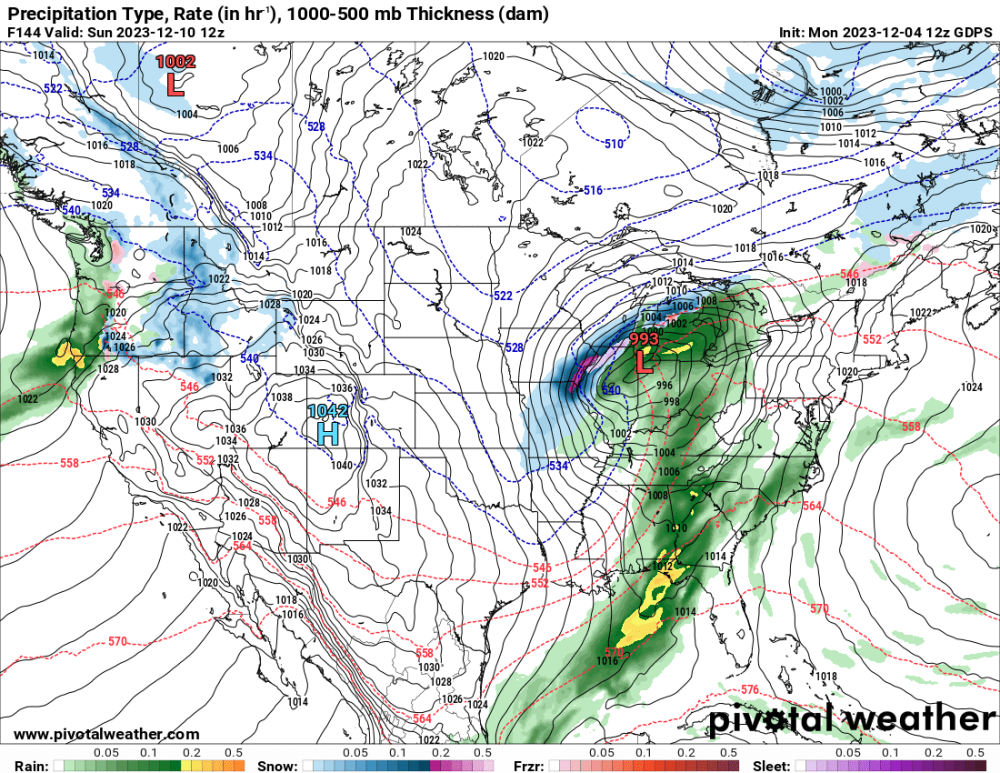
There is a terrible model trend for eastern Iowa. For days, models showed the north-south band of rain training up through the area. However, the upper low is now being shifted west, which leads to the training rain shifting west and dry air being pulled into eastern Iowa from the east. Also, the surface low now stalls farther west and north, so we now get dry-slotted with no wrap-around precip. At this point I think 2" of rain is gone and we have to hope we can get 1".
Look at this ridiculous change on the GFS in only 24 hours.

-
2
-
 1
1
-
-
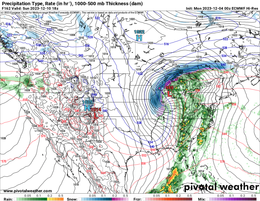
The 00z UK moved the heavy rain into western Iowa and eastern Nebraska, and Cedar Rapids gets stuck in a dry hole. This run doesn't even drop any rain in CR until Monday night. Every model is still a little different. There are a lot of pieces of energy spinning around, making it difficult to pin down the details.
-
2
-
-
Models still can't agree about the initial wave of rain Friday. The trend is back south, possibly missing Cedar Rapids completely. The GFS and a few other models still get a couple tenths up here.
-
2
-
1
-
-
The 500 mb pattern gets pretty messy this weekend into early next week, but it's looking good for some good rain around here. The Friday light rain event has come back as well. Much of the area is still in extreme drought, so this is much needed. We don't want to be very dry going into spring.
-
4
-
-
The northwest wind hit us at 2am. It's going to be a rare cold day, but models show the wind will be gone by this evening. We warm back up well into the 30s tomorrow, so it's a very quick cold shot.
-
2
-
 1
1
-
-
I got 0.33" of rain today.
-
3
-
2
-
-
The Euro has gone much stronger and nw with the eastern storm. We get a quick shot of cold and wind.

-
1
-
 2
2
-
-
The wettest models are down to only a couple tenths of an inch of rain here Friday night. Some models show only sprinkles. This system sure crapped the bed.
-
1
-
-
Today and tomorrow I can finally get all my winter prep completed as we rise to the 50s. My garage is currently full of bags of leaves, flower pots, rabbit fencing, etc. It all has to be mulched, put away, etc.
-
4
-
-
Yep, this has turned into just a quick rain system here Friday night into Saturday morning. Oh, well.
-
00z GFS, GDPS (Canadian), ICON...... all blah.
-
4 minutes ago, bud2380 said:
Wow, Euro caving to the GFS. Wonders never cease.

On this run the energy comes out in two pieces. The first moves through Iowa while a backside jet streak keeps digging into the south.
-
1
-
 1
1
-
-
1 hour ago, tStacsh said:
Just can't get hyped or excited at this point because there is no sign of any real cold air anytime soon even if we get a storm.
The GFS is most bullish with the weekend storm for my area, but even that would only be a couple sloppy inches. It's more likely we get nothing. We might have to wait til after Christmas for something better.
-
1
-
-
On the 12z Euro, the lead wave is slower. That causes the second wave to travel much farther south and east before it can turn northeast. That subtle difference is all it takes.
-
3
-
-
The Canadian is now getting on board a more westerly solution.
-
4
-
1
-
-
Well, the op Euro has made a big jump back northwest tonight. This is probably as far northwest it can possibly go, with at least a bit farther south and east being more likely.
-
2
-
1
-
1
-
-
All of the new 1" of snow is already gone.
-
I got about an inch of snow last night and this morning. The measurement this morning is a bit less than that, but I made the mistake of not measuring last night and it very slowly melted overnight, so I just added a couple tenths. There are some scattered heavier bursts moving across the area this morning, one of which dumped here for a few minutes.
-
3
-
 1
1
-
-
This evening's GFS and GDPS (Canadian) have removed the big storm for Iowa and areas north and west.
-
5
-
-
It has been snowing steadily for a couple hours. I'm guessing we might have a half inch.
-
1
-
2
-


Christmas Blizzard 12/20 - 12/28
in East of the Rockies
Posted
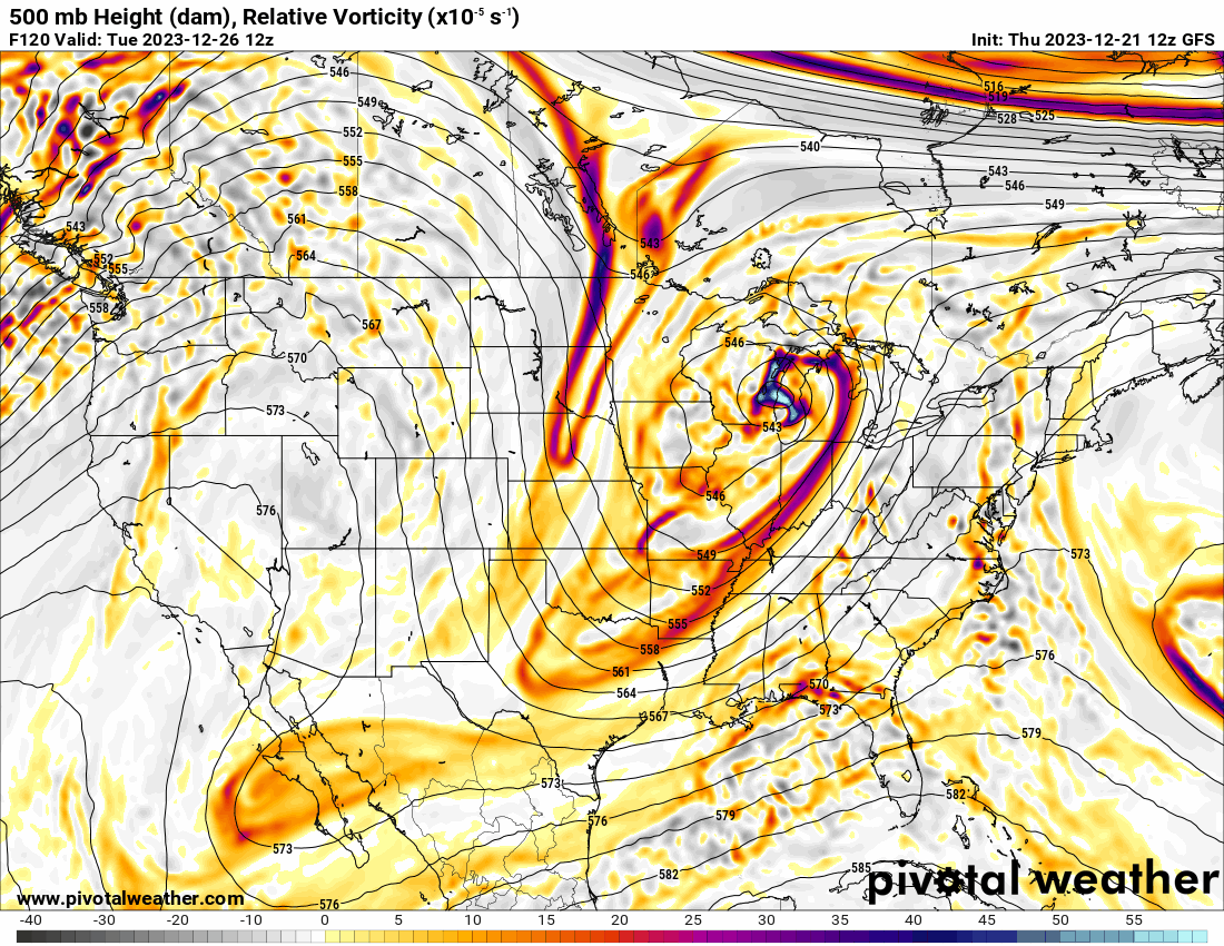
It's not often systems get as wrapped-up as this one is going to get. The Euro has the surface low beginning to develop in northern Missouri and ending up almost in central Nebraska.
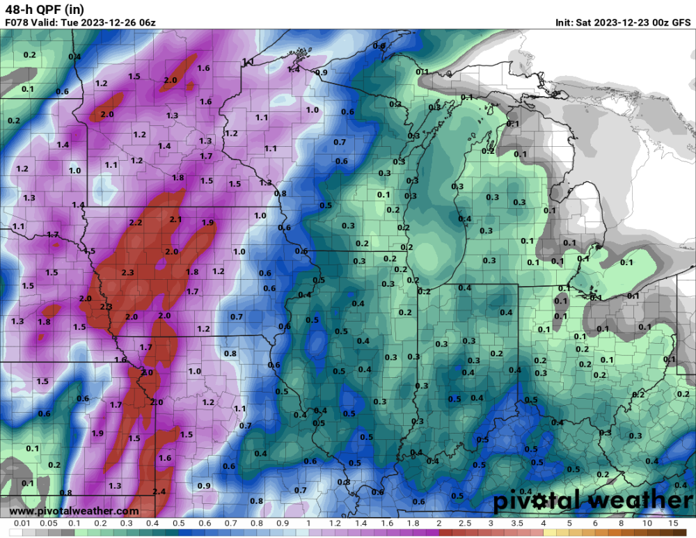
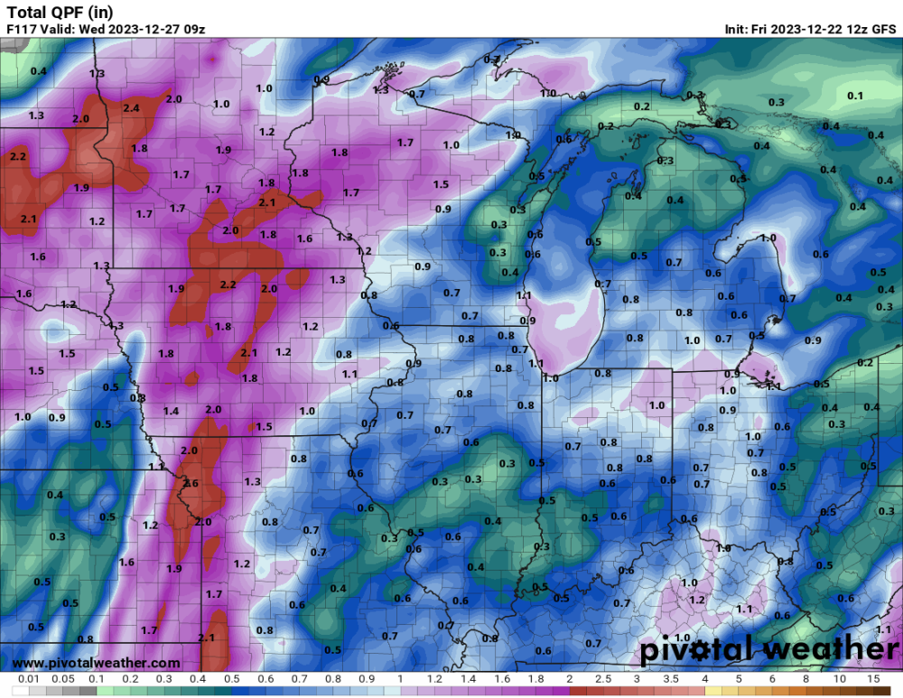
Models have settled into a 0.50-0.80" range for my area.