


Hawkeye
-
Posts
7161 -
Joined
-
Last visited
-
Days Won
17
Posts posted by Hawkeye
-
-
4 minutes ago, bud2380 said:
from midnight to 6am the RAP just hammers Eastern Iowa. 9.2" in Iowa City in a 6 hour period.

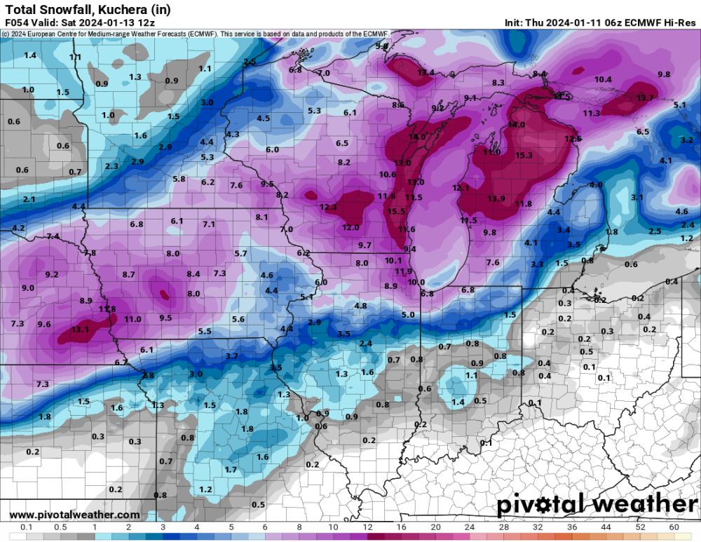
See, this is very different from some other models that show the heaviest band through Waterloo, with only a few inches over southeast Iowa where the RAP is heaviest. I really want to see some model convergence.
-
-
I'm concerned a bit about southeast/east-central Iowa. There is definitely a hint in the models that wave #1 will drop its heaviest snow northwest of us and then wave #2 will mostly miss northeast, leaving a relative dry pocket across this area. The 06z Euro is showing exactly this. I'm not buying the GFS, which is very aggressive for southeast Iowa and a southeast outlier.
-
Thursday morning's models won't be contaminated by this evening's snow burst.
-
My total is 2.6". It's too bad that super heavy snow was so brief. For about five minutes, it may have been snowing at 5"/hr.
-
 7
7
-
-
- Popular Post
- Popular Post
I just received 1" of snow in 15 minutes. This was an incredible burst.
-
10
-
 2
2
-
This is the heaviest snow of the season. Not large flakes, but extremely dense. Even the house across the street is foggy.
-
5
-
 3
3
-
-
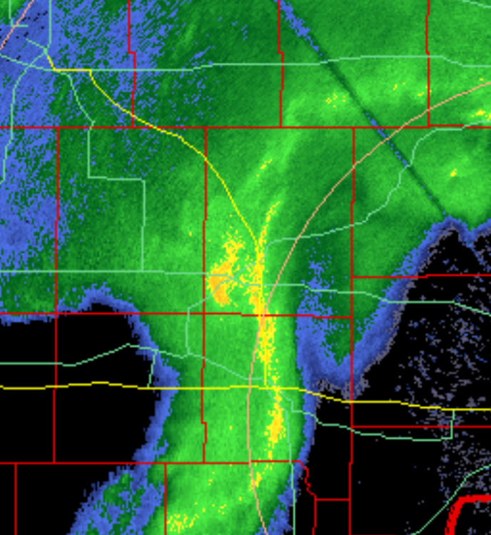
It's already snowing pretty good here, but there is what looks to be a very heavy pocket about to move over Cedar Rapids. There is even a dot of orange on the radar. It should really rip hard.
-
2
-
-
I don't like how some of the short-term models are trending so far north with the lead wave Friday.
-
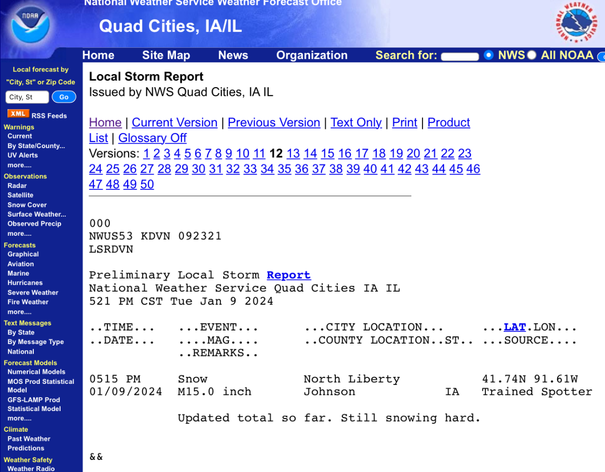
My final measurement is 11.0". There are several reports of 12-15" from Cedar Rapids to Iowa City, but I've still never measured 12". I have a nice 2-stage blower, but it still took a long time to clean. This stuff is pretty dense. It's the most wet snow I've ever received from a storm.
When the snow stopped this evening and I went out to clean, the weather improved dramatically. It was near blizzard through afternoon, but when I was out this evening it was pretty pleasant. The wind was way down and it wasn't cold at all.
-
5
-
-
Boy, this is quite the storm. It has been snowing for over 24 hours. Current radar shows one final band of snow that is strengthening as it passes through Cedar Rapids.
-
5
-
-
6 minutes ago, bud2380 said:
15” in North Liberty?? Man that’s 15 miles from me. I finished with 10.5”. It’s still snowing a little but it won’t really accumulate much more.

Once the snow starts drifting, spotter reports start diverging. Some people measure in driftier areas while some measure in blowier areas (me). Once again, I will come up short of 12".
-
2
-
-
I'm up to 10.5". There is a lot of snow. I've never seen the house totally plastered with snow like this.
-
3
-
 1
1
-
-
I am falling behind other spotters in the area due to blowing and drifting. Snow gets blown off my board, despite the fact my backyard is enclosed by a fence. I do live at the south edge of an open field, so late in these storms the north wind howls across the field and hurts my ability to measure accurately. Even though it has been ripping for the last few hours, I've only managed to accumulate one inch on my board. My total is 9.7". Other spotters are now reporting 11-12.5".
-
5
-
-
Radar still looks great. A moderate to heavy band continues to be parked over Cedar Rapids.
-
1
-
-
9.2" now. The patio actually accumulated another inch last hour, but, perhaps due to compaction, the snow board only rose another 0.6".
-
5
-
-
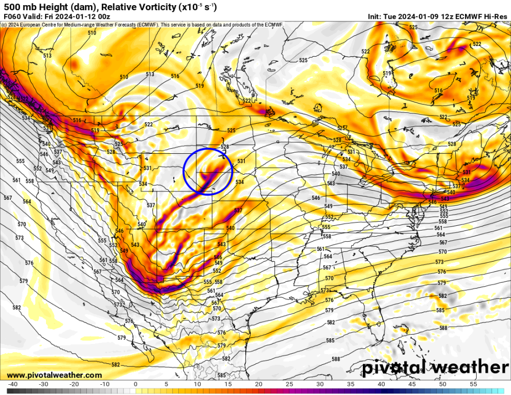
For Iowa, this piece of energy appears to be important. The main, southern, energy is going to swing east and northeast around that blue-circled energy. Plus, that energy acts to pull moisture back into Iowa. Iowa needs that energy to be stronger and hold farther west. The GFS is shooting it eastward more, so the main energy can't cut until farther east.
-
2
-
-
1 minute ago, Cfweather said:
Definitely overperformed in the Waterloo area. Warning last night was for 5-9. 11 right now and still coming down. Over a foot at my place - slightly southwest of the Waterloo airport where the official totals are from
Yeah, you did well. I was not expecting Waterloo to do nearly that well.
-
1.3" in the last hour, up to 8.6". Conditions have change dramatically over the last hour. The snow has dried a bit and the wind has risen quite a bit, really blowing now, much more like a typical winter storm.
-
1
-
1
-
-
-
I just measured 7.3". Moderate to heavy bands are expanding over the Cedar Rapids area.
-
5
-
1
-
-
The GDPS trended toward the GFS, not something I want to see.
-
1
-
-
-
11 minutes ago, bud2380 said:

I'm right in the heart of that. A heavy band is moving through Iowa City right now and heading right towards me. Fingers crossed we see 1"+/hour rates here.
Yeah, a yellow band is about to move over Homestead.
I am up to 6 inches. The snow has been a bit lighter than expected so far this morning, with too many breaks, but it's dumping now.
-
1
-
1
-


January 11-13 Major Winter Storm/Blizzard
in East of the Rockies
Posted
I'm not sure how much we'll get... probably something in the 4-8 range.