


Alex_Snakes
-
Posts
102 -
Joined
-
Last visited
Posts posted by Alex_Snakes
-
-
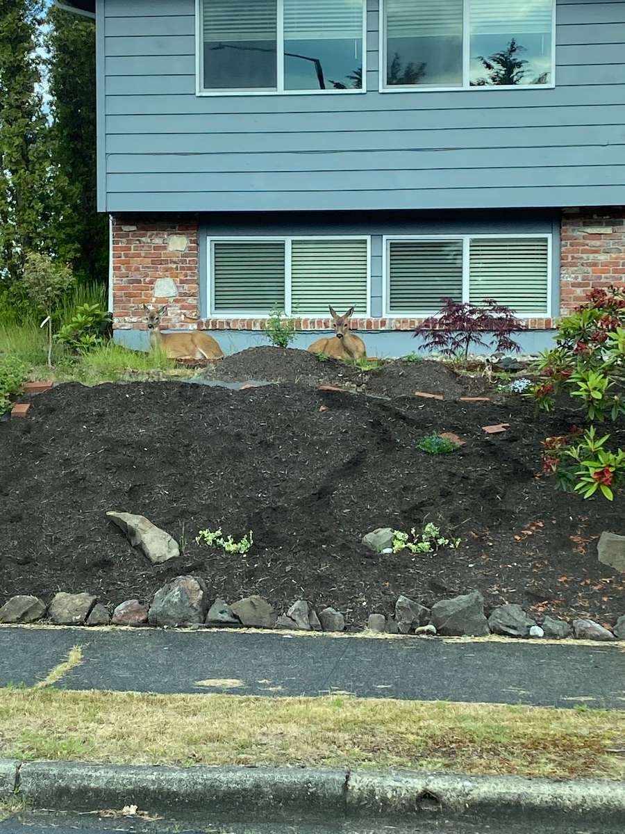
9 minutes ago, T-Town said:
We seem to have gone from friends to roommates.
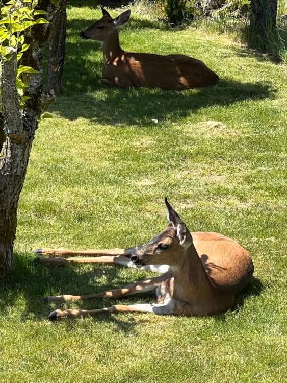
Wonder if those two were in our neighborhood last week.

-
 7
7
-
 1
1
-
-
I have been lurking on this forum since 2008, and I have never seen any maps like the ones we are seeing.
-
4
-
 1
1
-
-
-
Just read Jaya's tweets too. Something to watch with the GFS vs. Euro, etc.
-
My kids are skiing at Bluewood right now. Slope is 11 in of slush and ice, but it isn’t busy.
-
2
-
-
Lol.
I had a coworker where I worked named DJ. Lazy black guy that had an inverter in his work truck. He had a laptop and PlayStation hooked in and would show up for service calls and play video games instead. Never got anything done.
He and I partied a lot in West VIrginia until they threw him in jail for not paying child support to the 6 kids he had with 5 women. This is all a true story.
Thankfully we know he’s black or this post wouldn’t make any sense at all! :eye roll:
-
2
-
-
Woke up to a dusting of snow north of Walla Walla this morning.
-
2
-
-
Yeah... I was completely wrong with the northward shift prediction.
I am genuinely surprised to see a last minute trend south and also that it will likely stay cold all week.
And I am still cheering hard for everyone in Oregon!
Watch the Euro go north
-
It has been at least 30 years since I have seen this much snow. It is raining now and not fun to be outside. Made sure my drains are clear for the melt.
-
1
-
-
West end Tacoma heavy snow again. Crazy.
-
2
-
-
Snowing hard in west Tacoma and staying steady at 33 degrees. How long can it continue!?
Yep, west Tacoma here too. Dumping snow right now.
-
-
Jesus the BLI-YWL gradient looks to be 30-32 mb.
This would be nuts if verified.
-
3/6 Any of you old timers that still live here remember the 1989 and 1990 arctic blasts. These are the record holders for strongest gradient YWL-BLI. 1990 had a whooping 25mb gradient, 1989 was at about 24mb. These were truly intense events.
4/6 Both of these events sent crippling snow/wind into the Puget Sound and have been the hallmark of arctic invasions at least in the last 60 years or so.
5/6 This much talked about setup on Friday/Saturday is showing the potential for gradients OVER 26mb. Also, Model agreement is as good as I can remember seeing.
1989 was amazing. Only time I remember my dad telling me to go outside and check out the weather. I remember going to bed and it was raining, and to wake up with blowing snow and high wind. I will never forget it.
If we get a pressure gradient higher than those two events, we are in for something pretty amazing.
-
noon Saturday to 6 am Sunday snow for Seattle... crazy run. Druncle knows how to party
-
Rain
Probably. 18z does what 18z does.
-
Now I want to see what the 18z GFS is going to do for Friday/Saturday.
-
Seems like it only goes up right now.
True. Is there anyway to see what the BLI gradient will be Friday through Saturday? Yesterday's AFD had it at -29. Did that change?
-
Crazy run though. PNW would grind to a halt if this was to verify.
-
This won't verify. But I am going to savor this moment.
Agree. Model riding will be ups and downs the next few days.
-
Let's hope the GFS flops back to a colder solution for Friday night/Saturday.
I like how the Euro is starting things off on Friday too.
-
FV3 looks like rain or freezing rain south of Seattle as well for Saturday. Dumps north of Seattle though.
Models are going to flop around a bit so hopefully they will swing back.
-
GFS for Saturday is rain south of Seattle.
-
Seattle AFD regarding the weekend system:
"The hounds of winter still have Western Washington in their sights."
-
2
-


 Michael Snyder
PNW December 2022, winter might be coming; but mostly canceled.
in West of the Rockies
Posted
It’s not “f’n fours” for nothin’. Hang in there.